Upgrade to Pro — share decks privately, control downloads, hide ads and more …

GAFFTA Visualizing and Mapping Data, Day Two

migurski
February 10, 2012

GAFFTA Visualizing and Mapping Data, Day Two

migurski

February 10, 2012
Tweet

More Decks by migurski

Other Decks in Education

Transcript

  1. Visualizing and Mapping Data Michal Migurski & Shawn Allen, Stamen

    Design GAFFTA February 2012 http://sta.mn/zr3
  2. Data is Choices “Accepting data shaped by someone else’s choices

    is a tacit acceptance of their view of the world, their notion of what is interesting or important or valid. … if we are going to work intelligently with data we must remember that it can always be constructed some other way.” —Mitchell Whitelaw http://sta.mn/gb
  3. Problems vs. Messes “Systems above a certain level of complexity,

    and life is definitely one of them, do not present us with problems. They present us with messes. Problems have solutions, but messes can only be managed.” —Donella Meadows by way of Adam Greenfield
  4. Comma/Tab Separated Values • Ubiquitous format • Used with every

    spreadsheet application, ever • Super easy to parse (though you often have to do this yourself, which is a hassle) • Text editors are often completely sufficient for preparing and handling this form of data
  5. Shapefiles • Store vectors: points, lines, polygons • Also store

    data attributes for vectors, like a spreadsheet • Once a proprietary format, now common language for most GIS software • QGIS is a useful-though-annoying free program for dealing with shapefiles
  6. Shape “files” are four files • .shp for geometry •

    .dbf for data, like a spreadsheet • .prj for projection (sometimes) • .shx for geometry index
  7. Geo + JSON = GeoJSON { "type": "FeatureCollection", "features": [

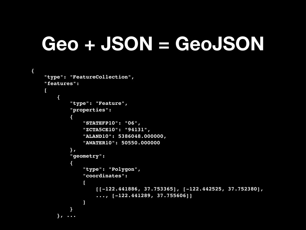
    { "type": "Feature", "properties": { "STATEFP10": "06", "ZCTA5CE10": "94131", "ALAND10": 5386048.000000, "AWATER10": 50550.000000 }, "geometry": { "type": "Polygon", "coordinates": [ [[-122.441886, 37.753365], [-122.442525, 37.752380], ..., [-122.441289, 37.755606]] ] } }, ...
  8. JSON (“Object Notation”) • Minimal syntax, tiny language. • Valid

    Javascript, valid Python = copy/paste • Used by essentially all web services, replacing XML over recent years • QGIS can convert shapefiles to GeoJSON for use in browser applications