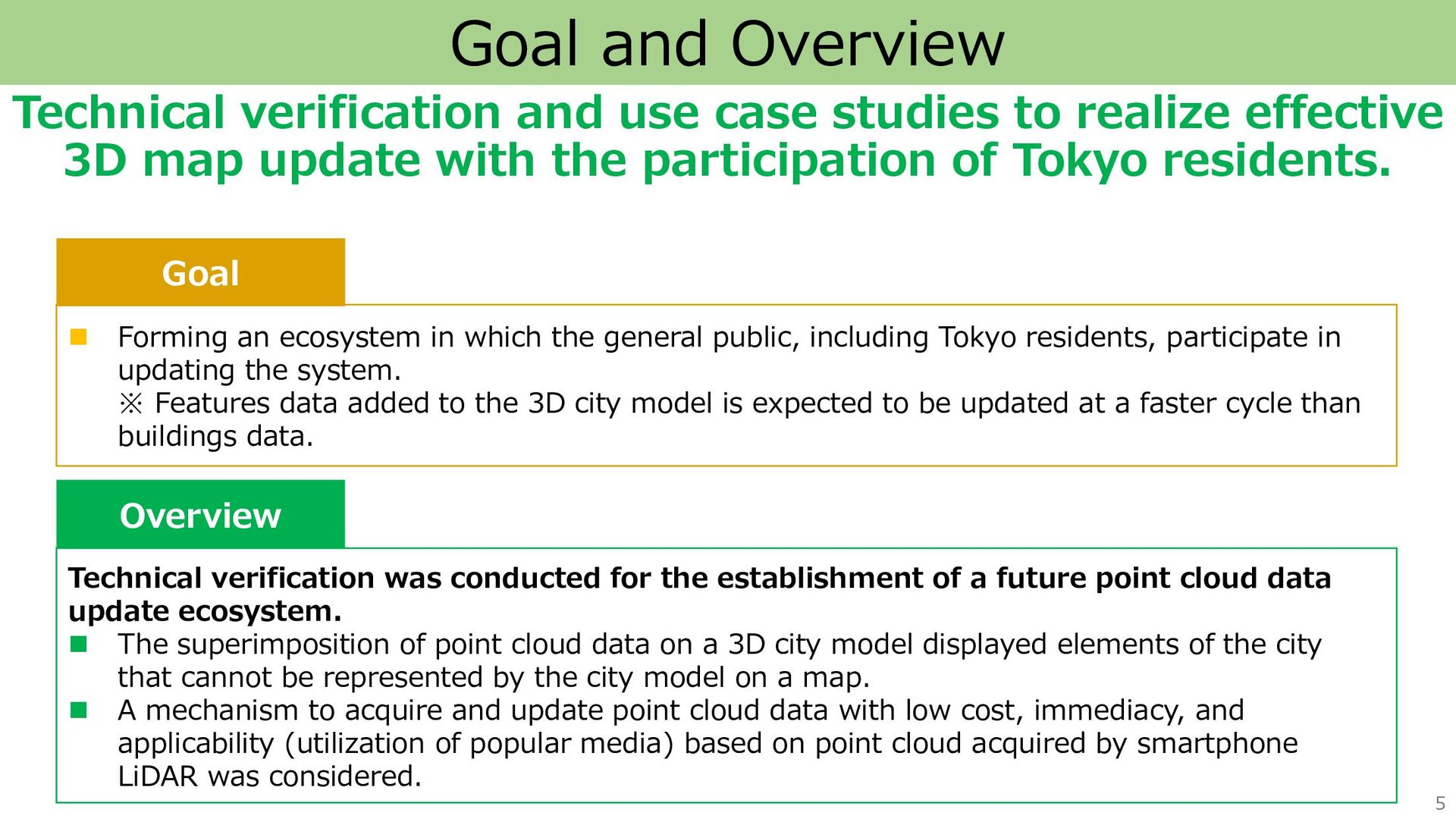
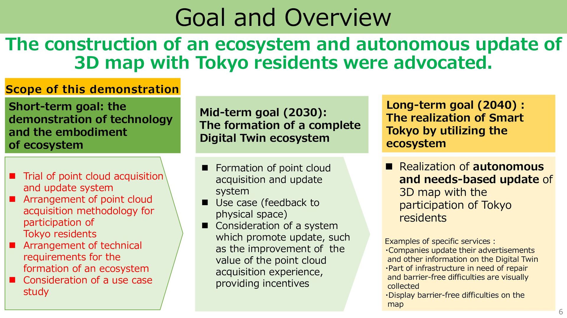
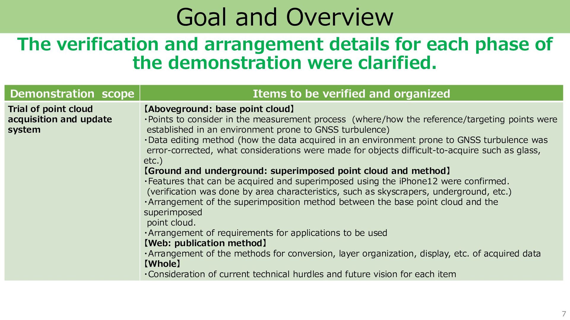
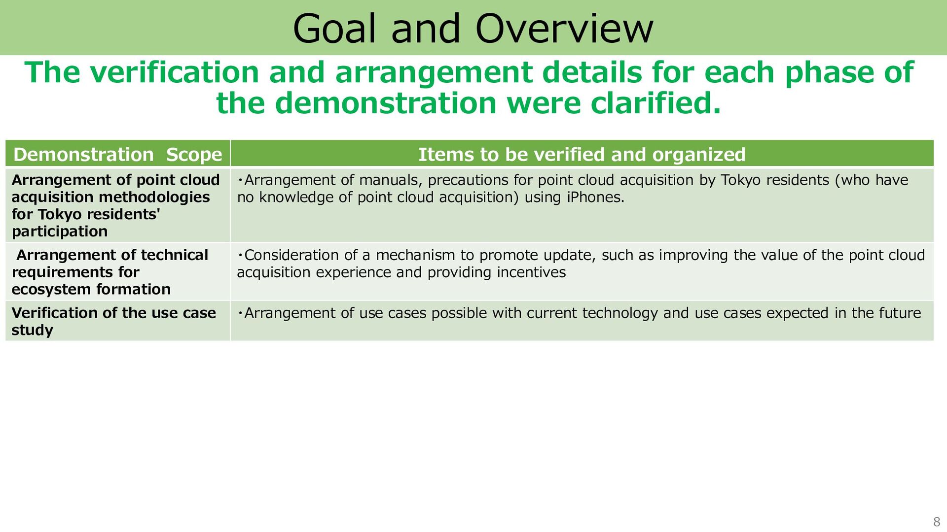
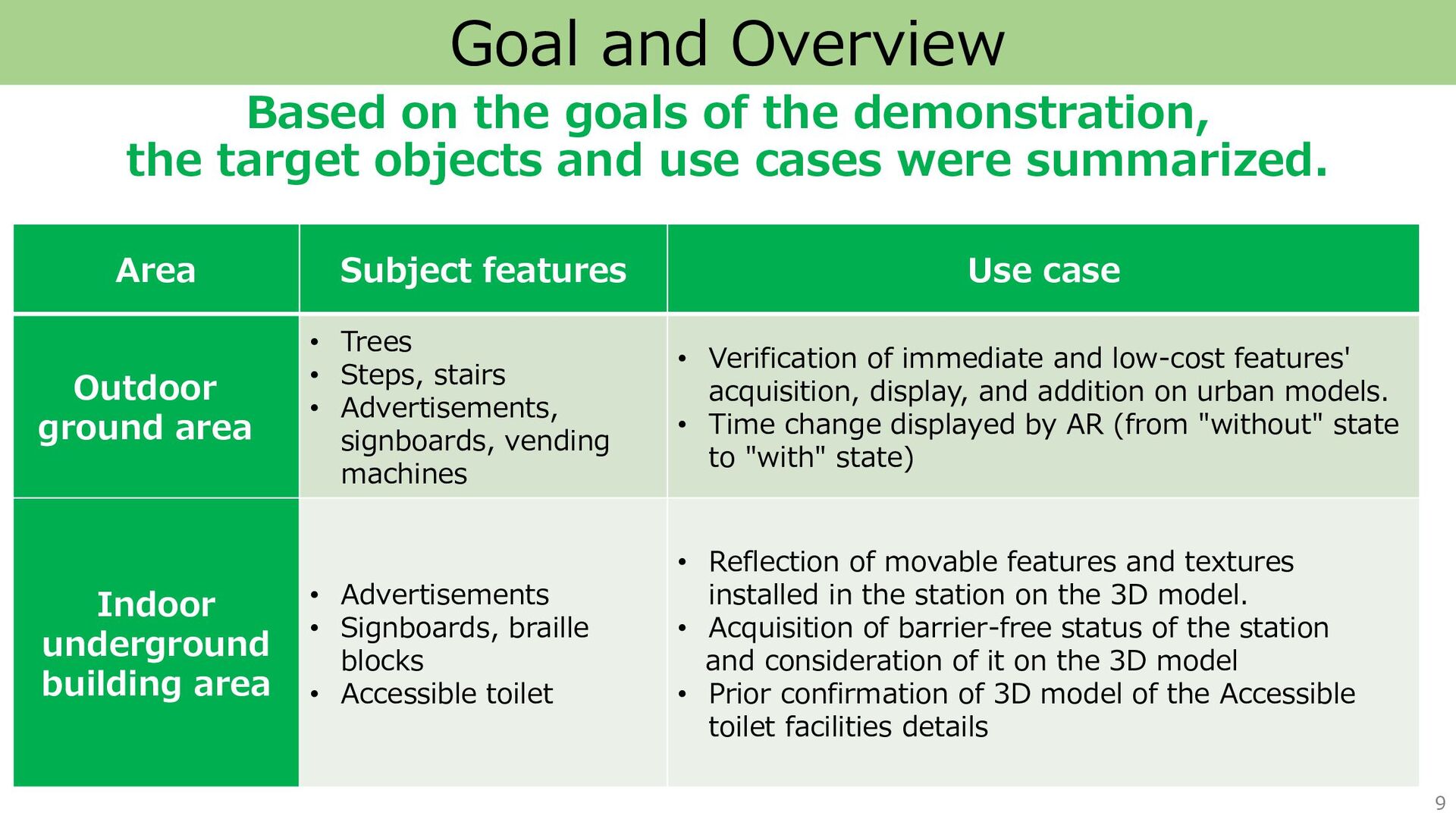
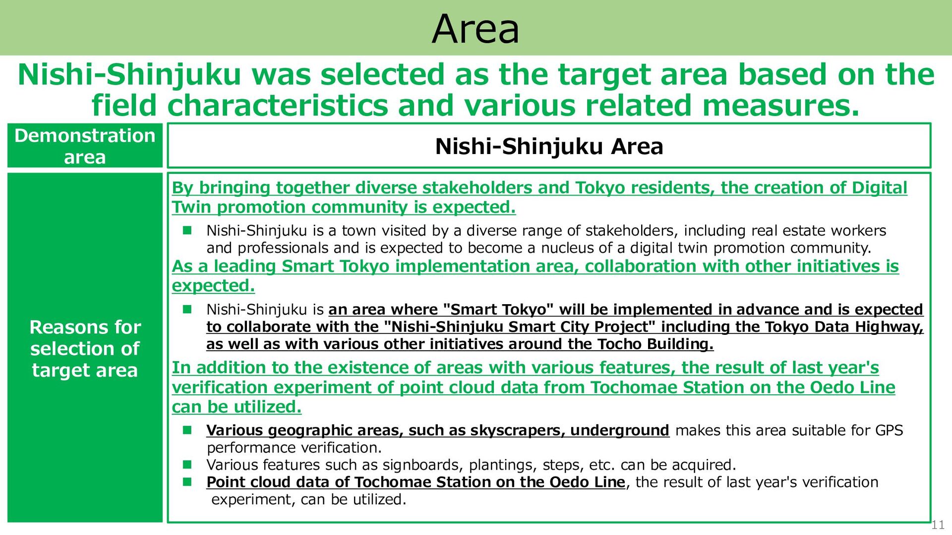
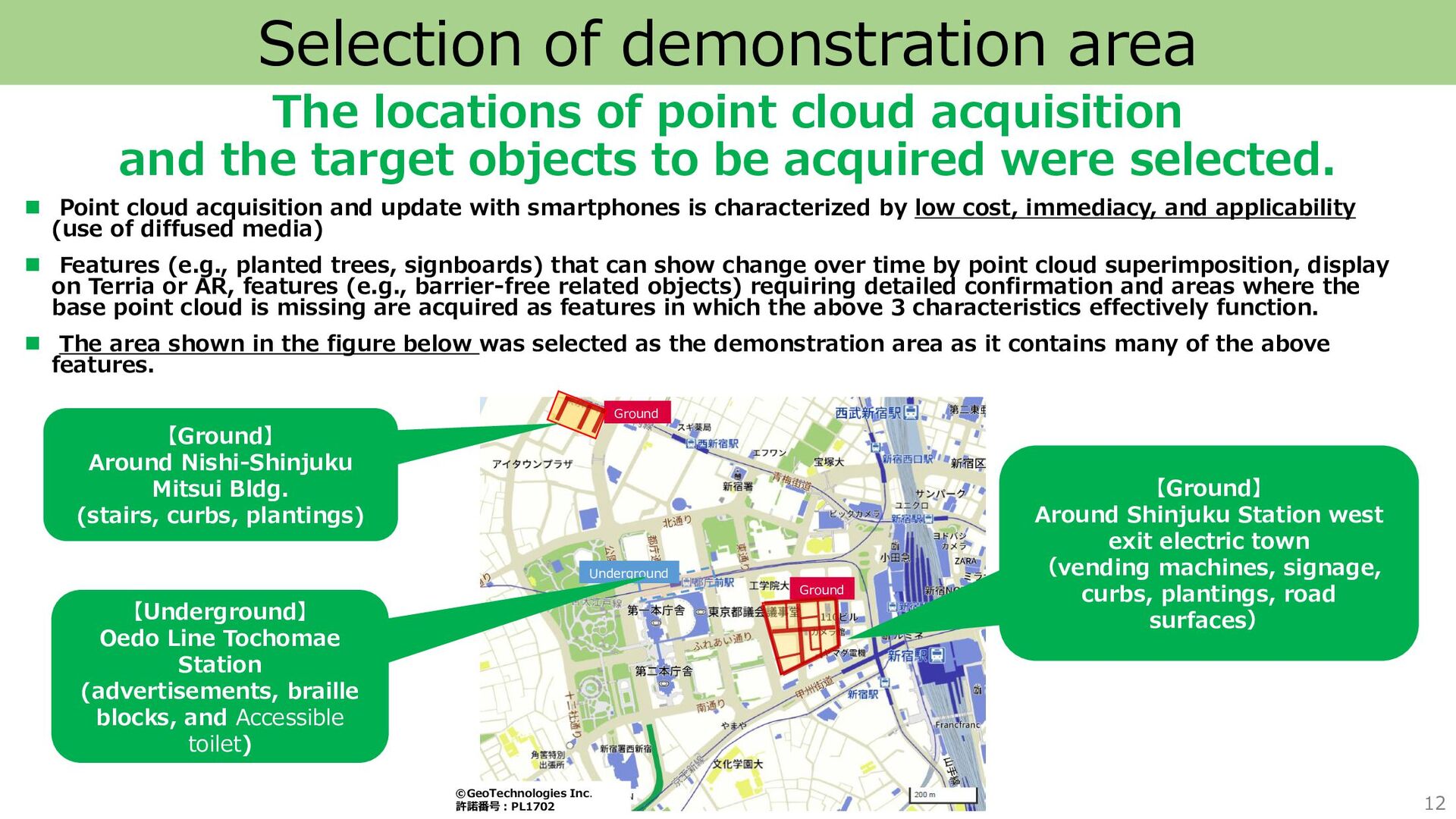
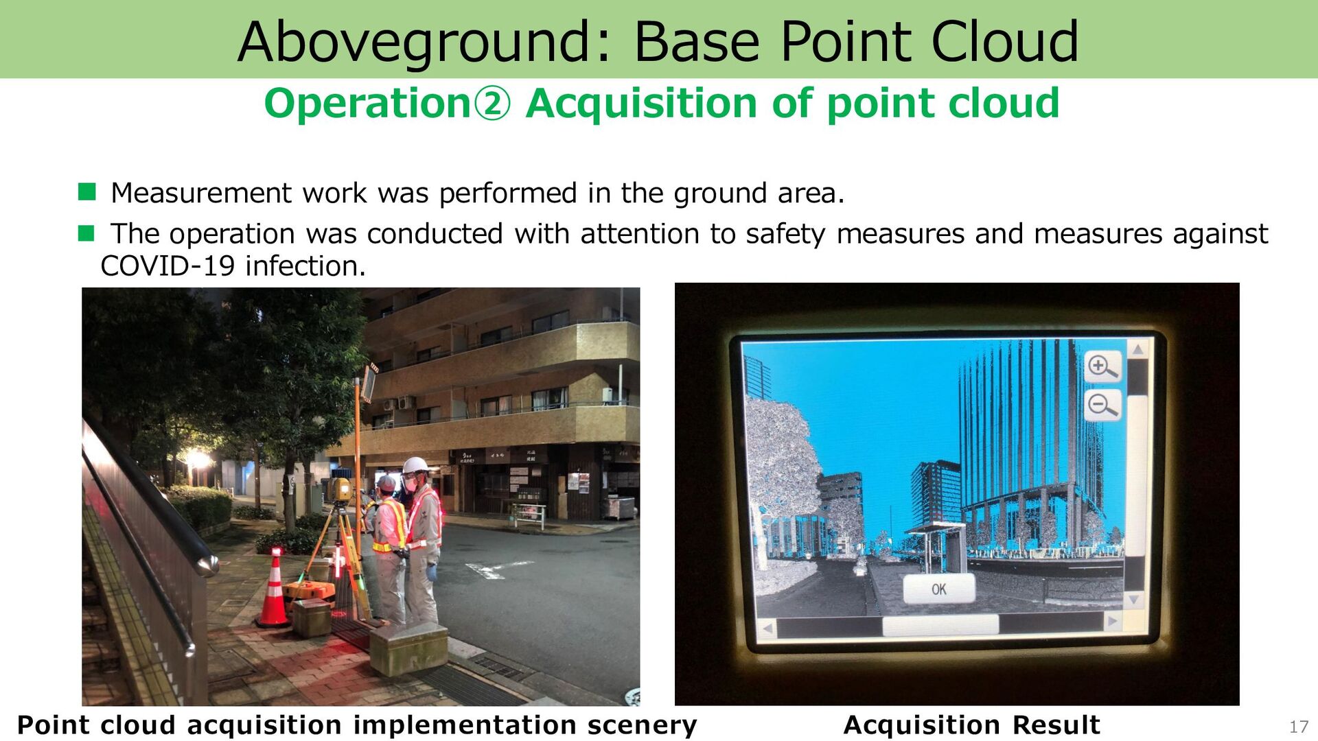
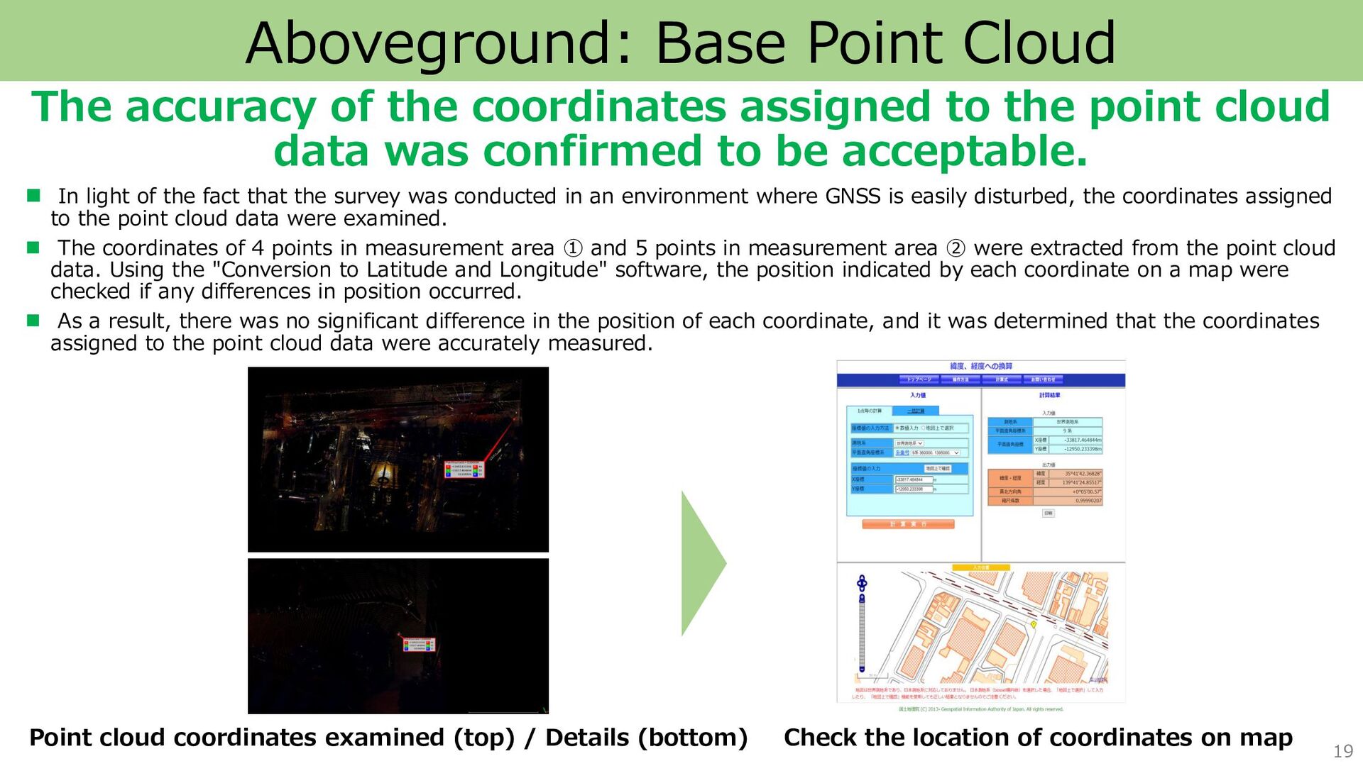
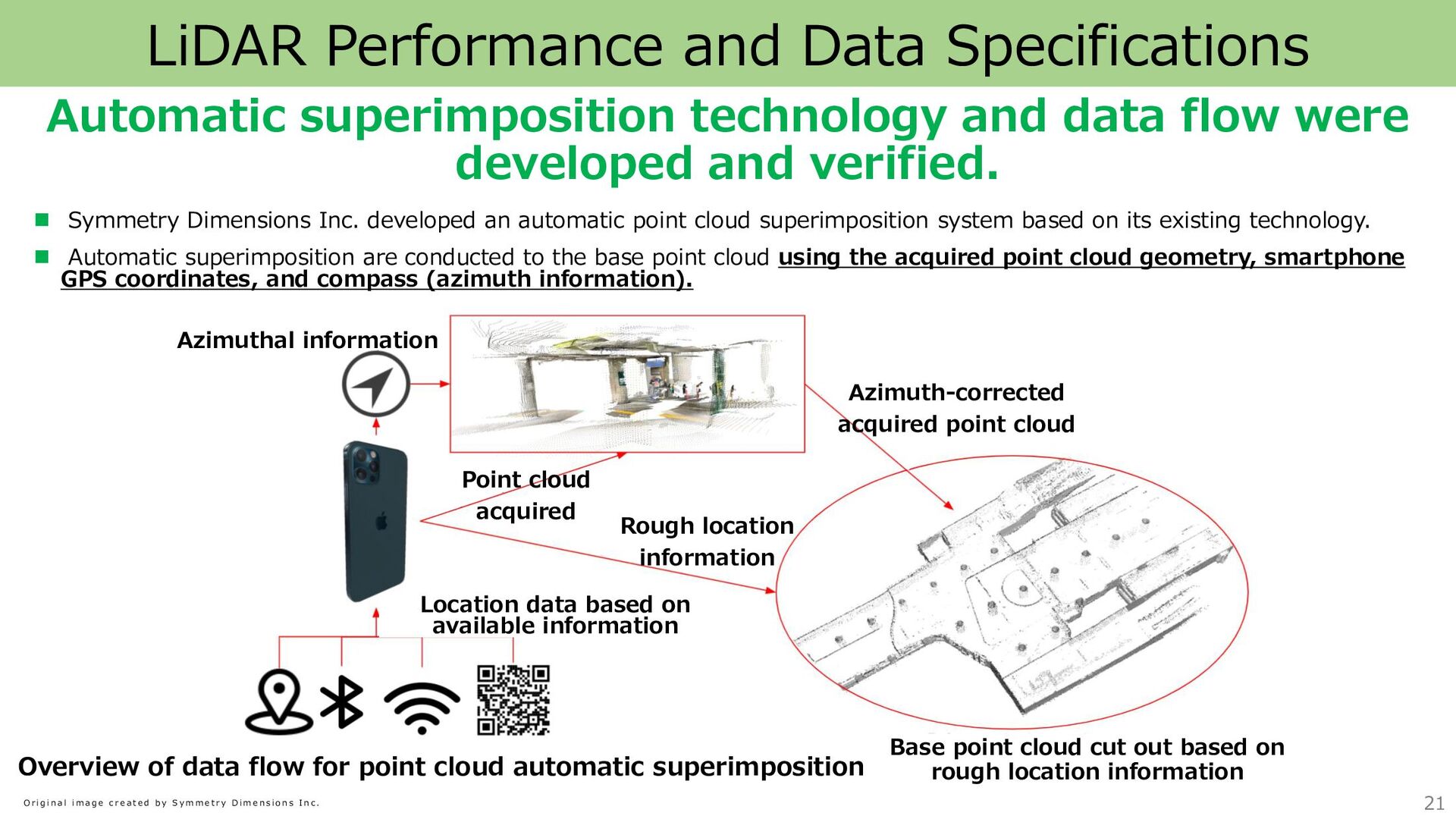
verified among the measurement methods. ◼ In light of the fact that point cloud acquisition was conducted in an environment where GNSS is easily disturbed, the data and its accuracy were carefully examined as follows: ◼ In implementing the reference point measurement, "measurement by the VRS method of the network RTK method (VRS-RTK measurement) " was implemented as a comparison to the "measurement method using a total station to measure a new point from the city district reference point (MLIT) and assign coordinates to the new point", and the results confirmed that the VRS-RTK measurement is not suitable as an implementation method. ◼ Then, to check the accuracy of the coordinates (X and Y coordinates) assigned to the point cloud data by the measurement method using a total station, the values of the coordinates (plane rectangular coordinates) were input into the Geospatial Information Authority of Japan's "Conversion to Latitude and Longitude" software, and it was confirmed that no differences occurred in the displayed locations (= no accuracy problems). - 【Measurement results using the VRS method of the networked RTK method】 - Ten points were measured around the Nishi-Shinjuku Mitsui building, and 13 points were measured around the Shinjuku Station west exit electric town. In consideration of multi-paths and other factors, each measurement took at least 3 minutes to complete (the RTK method is inherently extremely short, 10 seconds for completion). In addition, two measurements were taken at each location for inspection. - As a result, fix solution was obtained at one point in each measurement area, and at the other points, only the coordinates of the float solution were obtained. In addition, the "3D CQ" value of the coordinates of the float solution (a smaller value indicates a smaller error in the coordinates) are large, indicating that the accuracy as coordinates is low. Based on the above results, we confirmed that VRS-RTK measurement is not suitable for reference point measurement in an area with a high concentration of skyscrapers, as in this case. 18 Aboveground: Base Point Cloud