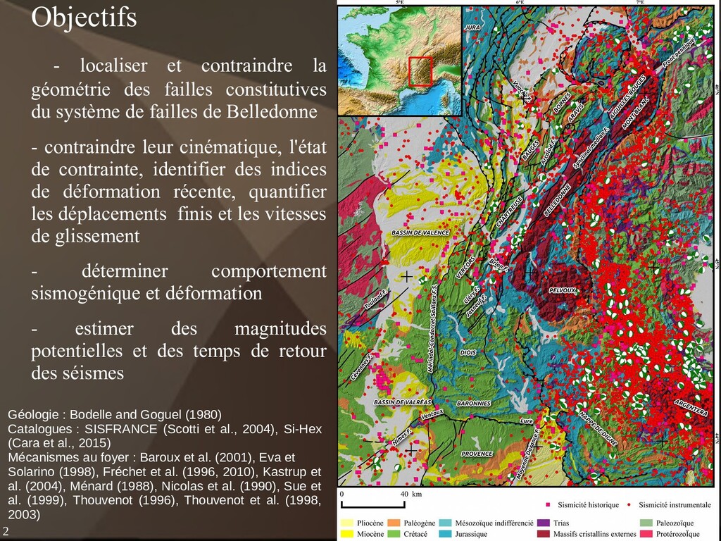
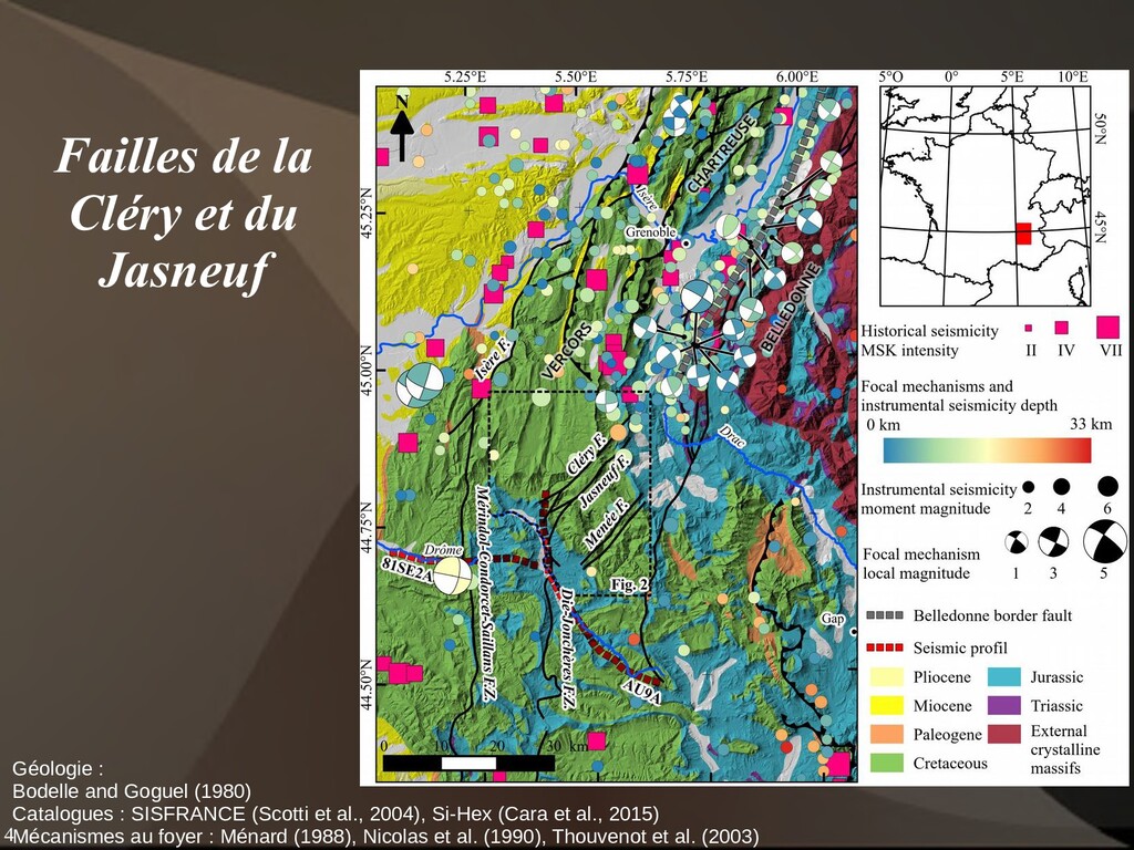
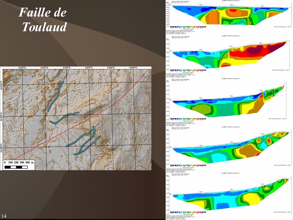
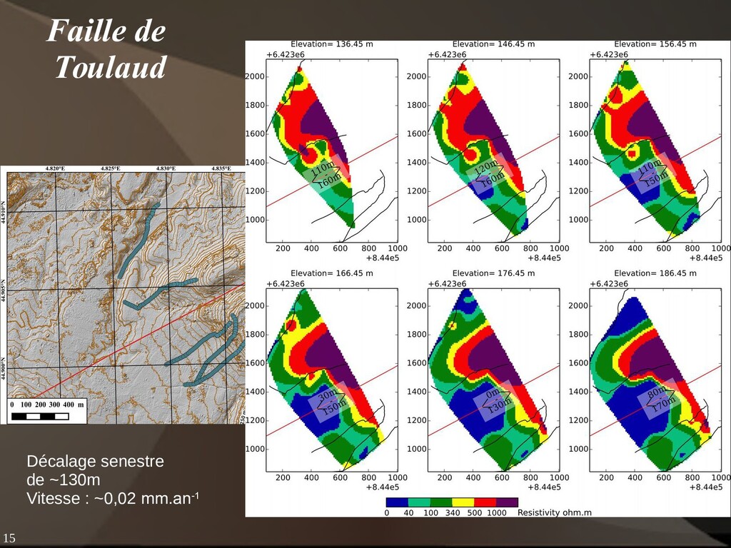
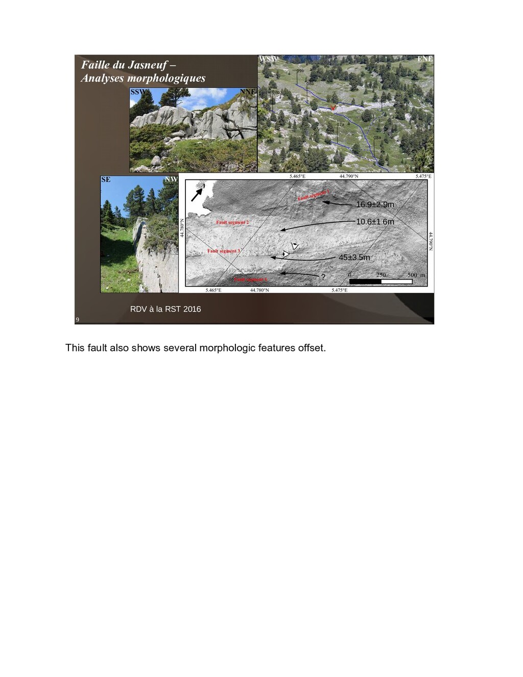
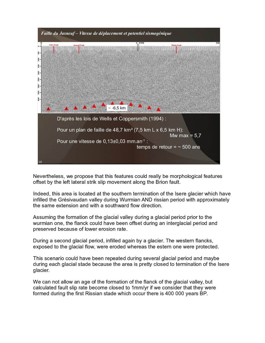
(Scotti et al., 2004), Si-Hex (Cara et al., 2015) Mécanismes au foyer : Baroux et al. (2001), Eva et Solarino (1998), Fréchet et al. (1996, 2010), Kastrup et al. (2004), Ménard (1988), Nicolas et al. (1990), Sue et al. (1999), Thouvenot (1996), Thouvenot et al. (1998, 2003) Objectifs - localiser et contraindre la géométrie des failles constitutives du système de failles de Belledonne - contraindre leur cinématique, l'état de contrainte, identifier des indices de déformation récente, quantifier les déplacements finis et les vitesses de glissement - déterminer comportement sismogénique et déformation - estimer des magnitudes potentielles et des temps de retour des séismes This study is focused on a NE trending faulting system in the western Alps. MC, rhone, southern Jura, Penninic frontal thrust, external crystalline massif and the subalpine massif This fault system that we called the Belledonne fault system extent from the Aiguilles rouges and Mont-Blanc massif north-eastward to the Vercors massif to the south westward. Alps shows two major seismic regions delimited by the external crystalline massif. The first one, eastward of the penninic front, show extension regim sub-perpendicular to the relief. The second one, westward of the external crystalline massif, show a most diffuse seismicity, but mainly with strike slip faulting and thrusting. This second area correspond to the subalpine massif which are composed of the mesozoic to cenozoic cover deformed as fold and thusth belt during the late miocene. At the limit between the external crystalline massif and the subalpine massif, a higher density seismic alignement is apparent as you can see on the iso denity seismic contours. It correspond to the BBF, identified as a crustal dextral strike slip fault by Thouvenot et al thanks to a microseismic survey. Most of the earthquakes in this area occurs in the first ten kilometers depth and don't exceed a local magnitude of four. But the region also knows several stronger earthquakes with local magnitude close to five like the Vallorcine and Grand-bornand earthquakes or the 7.5 MSK intensity Emosson earthquake.