New approaches in the kinematic imaging of global large earthquakes
Présentation d'Ana MG Ferreira (University College London) aux 2èmes Rencontres Scientifiques et Techniques Résif | 12-14 octobre 2015, La Grande Motte
Ana M G Ferreira1, Jennie Weston2, Jose-Angel Comino3, Gareth Funning4, Daniel Stich3, John Woodhouse5 1 University College London, UK 2 Arizona State University, USA 3 University of Granada, Spain 4 University of California Riverside, USA 5 University of Oxford, UK
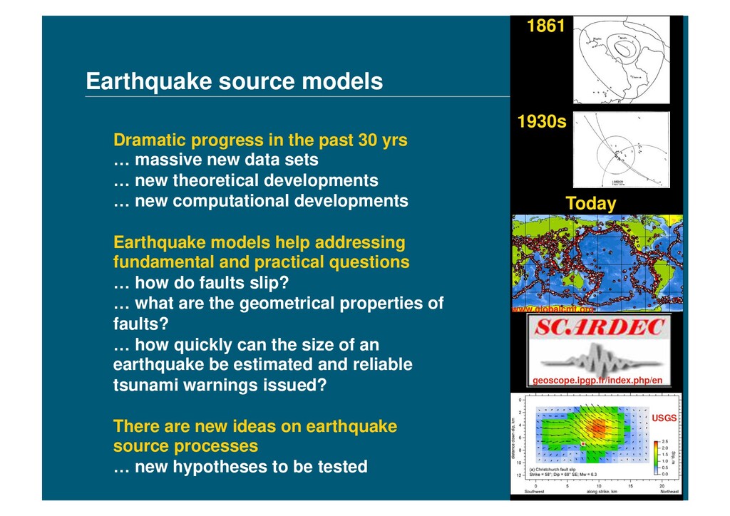
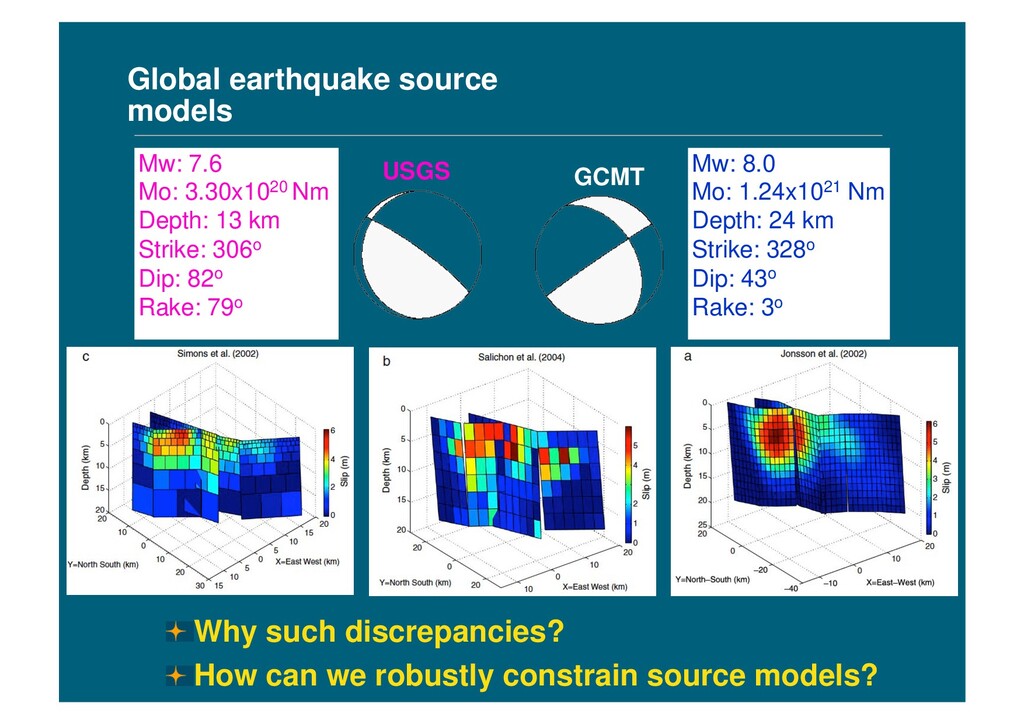
data sets … new theoretical developments … new computational developments Earthquake models help addressing fundamental and practical questions … how do faults slip? … what are the geometrical properties of faults? … how quickly can the size of an earthquake be estimated and reliable tsunami warnings issued? There are new ideas on earthquake source processes … new hypotheses to be tested Earthquake source models 1861 1930s Today www.globalcmt.org USGS geoscope.ipgp.fr/index.php/en
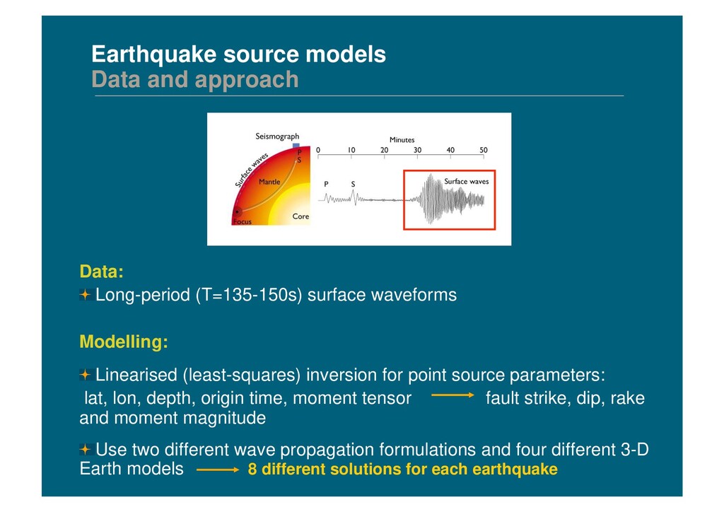
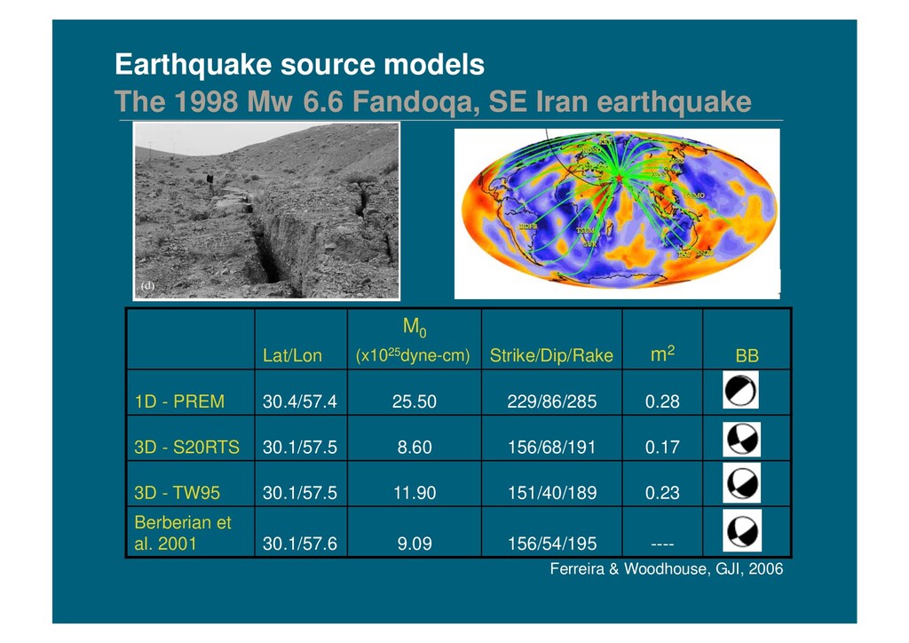
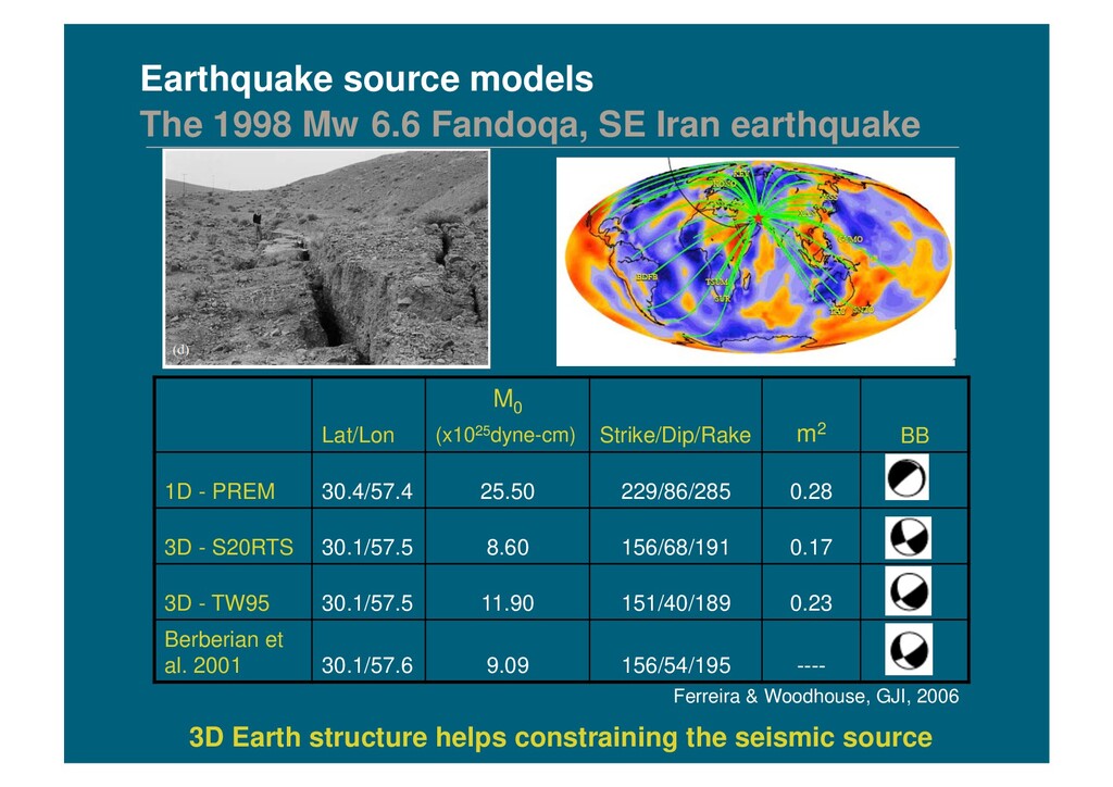
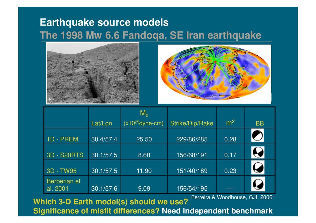
surface waveforms Modelling: ! Linearised (least-squares) inversion for point source parameters: lat, lon, depth, origin time, moment tensor fault strike, dip, rake and moment magnitude ! Use two different wave propagation formulations and four different 3-D Earth models 8 different solutions for each earthquake
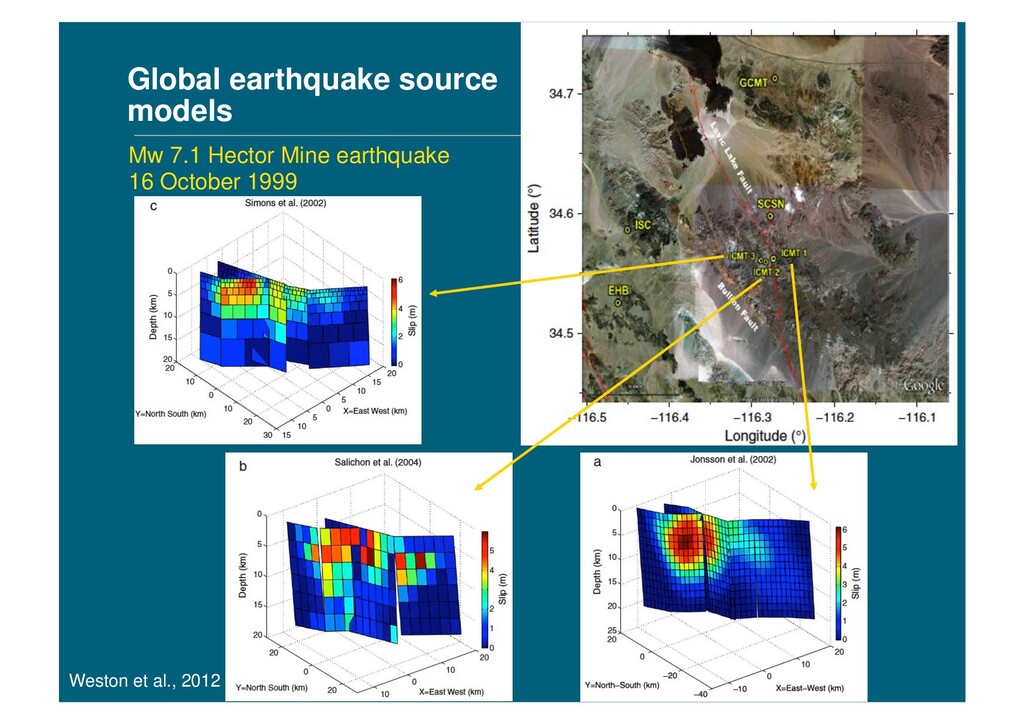
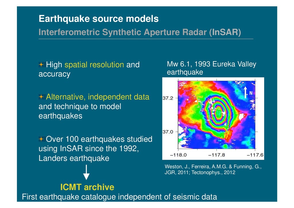
1993 Eureka Valley earthquake ! High spatial resolution and accuracy ! Alternative, independent data and technique to model earthquakes ! Over 100 earthquakes studied using InSAR since the 1992, Landers earthquake Weston, J., Ferreira, A.M.G. & Funning, G., JGR, 2011; Tectonophys., 2012 ICMT archive First earthquake catalogue independent of seismic data
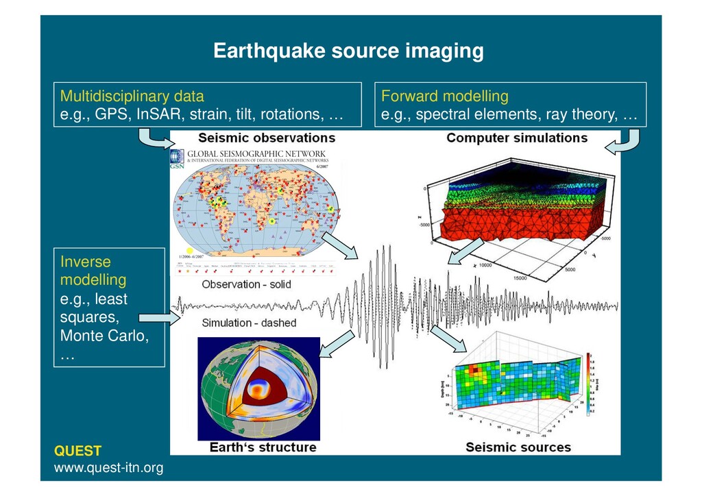
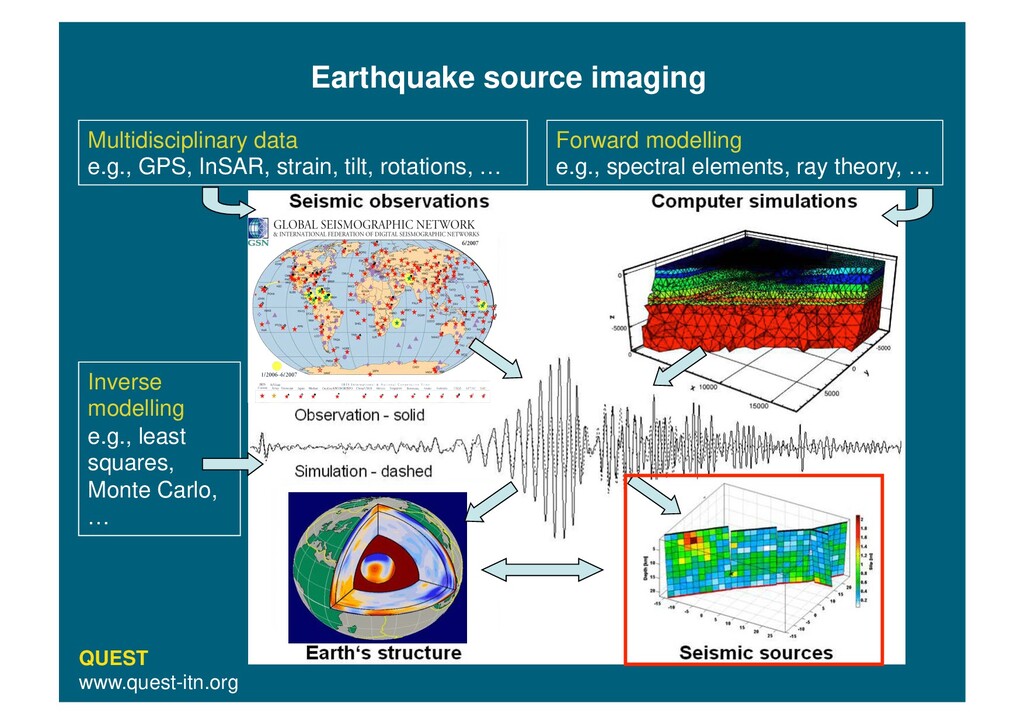
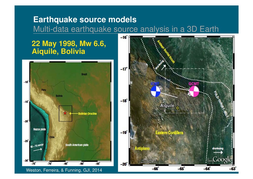
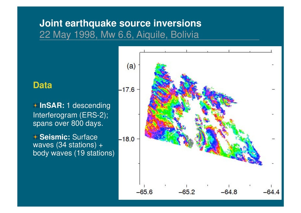
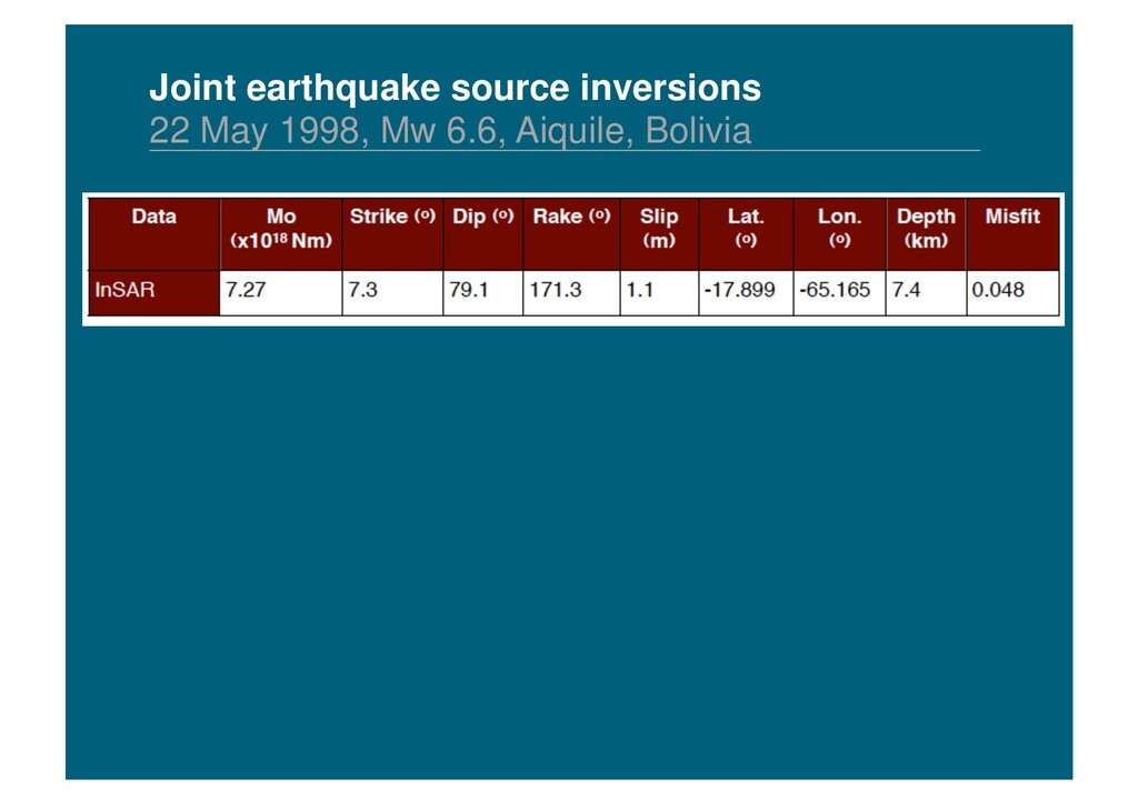
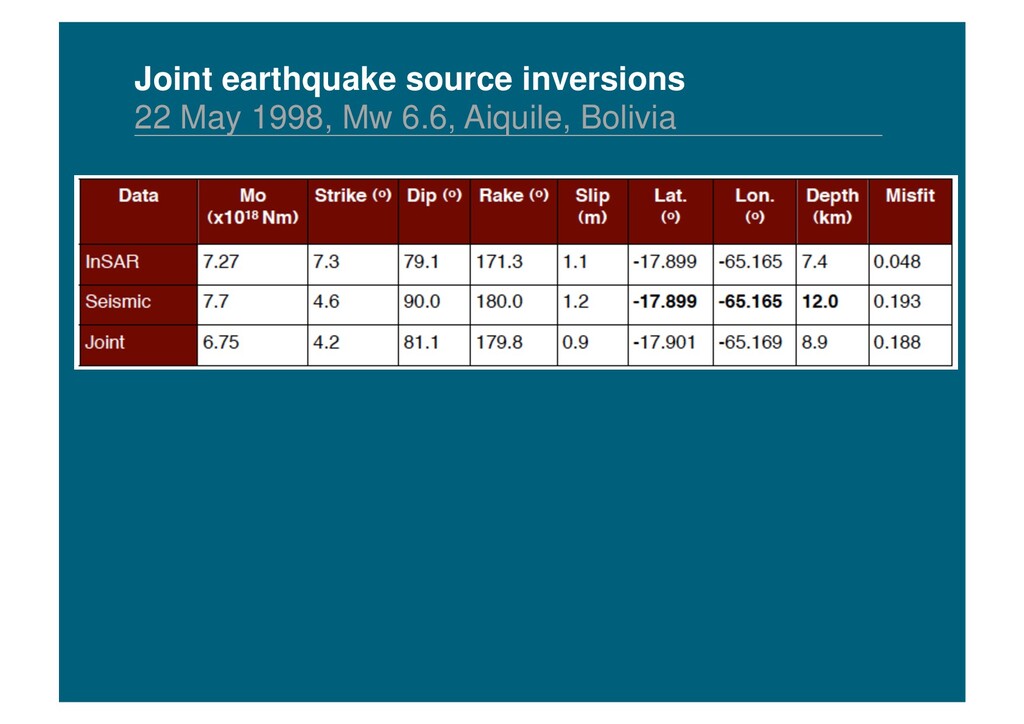
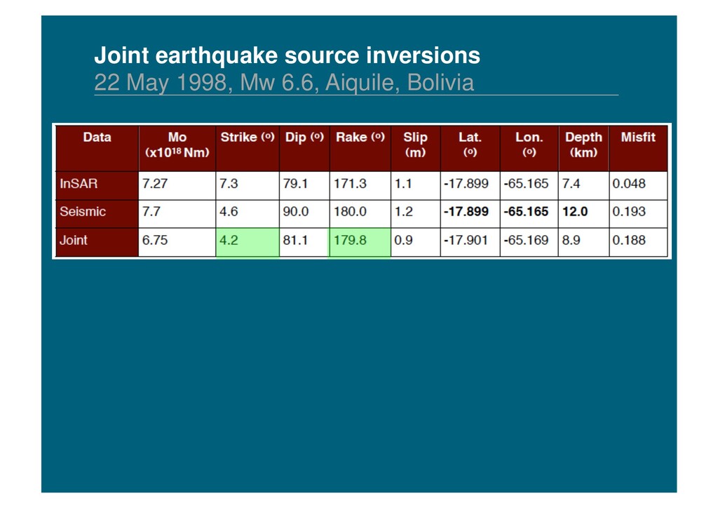
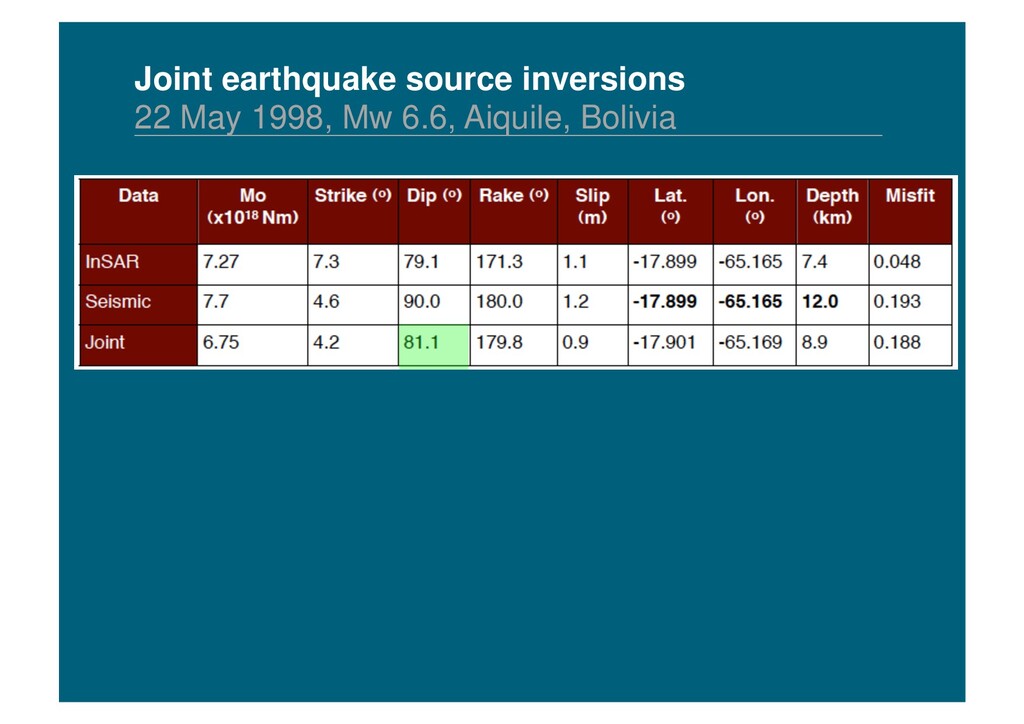
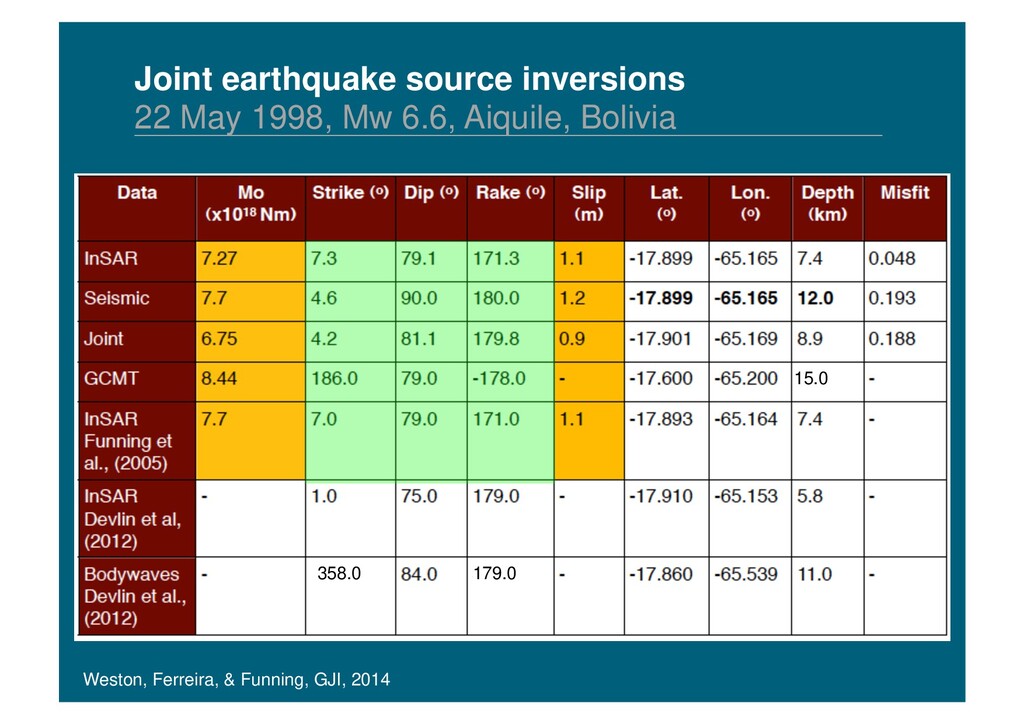
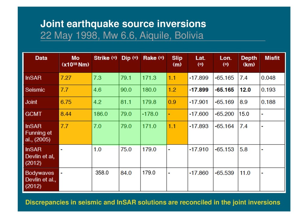
Earth Weston, Ferreira, & Funning, GJI, 2014 Data ! SAR images are processed to produce unwrapped interferograms ! Three-component long period surface (T~150 s) and body (T~30 s) waveforms
Earth Data ! SAR images are processed to produce unwrapped interferograms ! Three-component long period surface (T~150 s) and body (T~30 s) waveforms Inversion scheme ! Fix the earthquake location to the InSAR estimate ! Model the InSAR data using a forward elastic dislocation model ! Model seismic data using the SEM for the 3D mantle model S20RTS + CRUST2.0 ! Use a Monte Carlo method to find the global minimum misfit Weston, Ferreira, & Funning, GJI, 2014
Earth Inversion scheme ! Fix the earthquake location to the InSAR estimate ! Model the InSAR data using a forward elastic dislocation model ! Model seismic data using the SEM for the 3D mantle model S20RTS + CRUST2.0 ! Use a Monte Carlo method to find the global minimum misfit Estimate moment, strike, dip, rake, average slip, fault length, width Data ! SAR images are processed to produce unwrapped interferograms ! Three-component long period surface (T~150 s) and body (T~30 s) waveforms
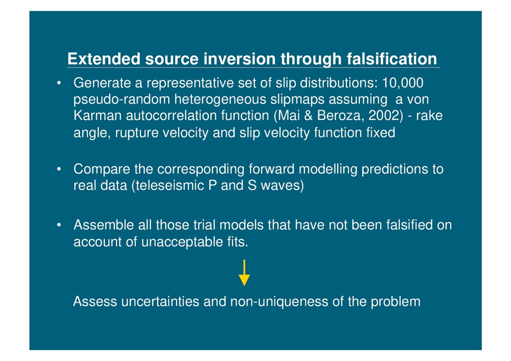
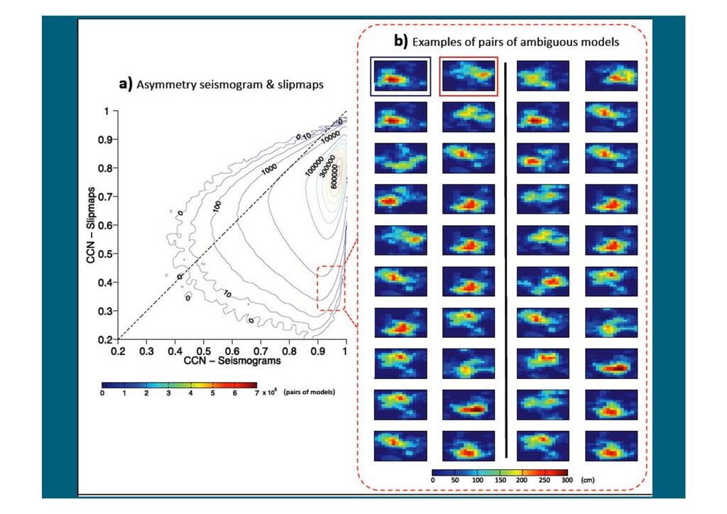
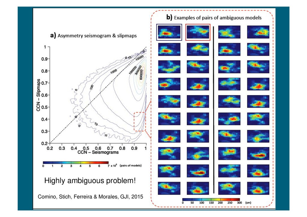
of slip distributions: 10,000 pseudo-random heterogeneous slipmaps assuming a von Karman autocorrelation function (Mai & Beroza, 2002) - rake angle, rupture velocity and slip velocity function fixed • Compare the corresponding forward modelling predictions to real data (teleseismic P and S waves) • Assemble all those trial models that have not been falsified on account of unacceptable fits. Assess uncertainties and non-uniqueness of the problem
it is important to use the full spectra of seismic and geodetic (e.g., InSAR) data along with sophisticated forward and inverse modelling • 3-D Earth structure effects need to be properly taken into account, particularly when using surface wave and normal mode data • Combining InSAR and seismic data helps resolving previous inconsistencies in source models (e.g., location) and better constraining source parameters (e.g., strike, dip and rake) • Teleseismic variable slip inversions are highly ambiguous - inversions through falsification are useful to assess uncertainties and non-uniqueness of the problem (apply to other data types)