• EuroSDR – research association of European National Mapping and Cadastral Agencies (NMCAs) • Project Aim: • To develop coherent/uniform view on GeoBIM integration • What are the benefits and challenges for uptake • From and international and multi-stakeholders’ perspective • Develop initial solutions for better integration • Develop best practice for Geo-data in BIM processes and software and best practice for BIM data in Geo-data processes and software
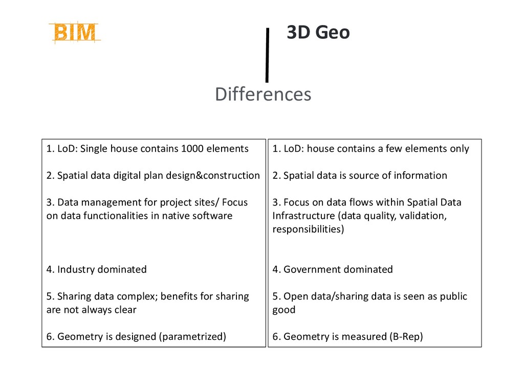
digital plan design&construction 3. Data management for project sites/ Focus on data functionalities in native software 4. Industry dominated 5. Sharing data complex; benefits for sharing are not always clear 6. Geometry is designed (parametrized) 3D Geo Differences 1. LoD: house contains a few elements only 2. Spatial data is source of information 3. Focus on data flows within Spatial Data Infrastructure (data quality, validation, responsibilities) 4. Government dominated 5. Open data/sharing data is seen as public good 6. Geometry is measured (B-Rep)
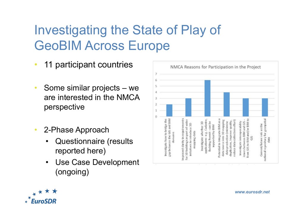
• 11 participant countries • Some similar projects – we are interested in the NMCA perspective • 2-Phase Approach • Questionnaire (results reported here) • Use Case Development (ongoing)
regional/national level National level strategic activity Questionnaire – Current Status, Awareness and Activities Fragmented picture in terms of activities – very little centralised GeoBIM integration strategy work at national level More work being done at project/company level • Mixed picture in terms of awareness • Most countries see added value of linking Geo-BIM (research or governmental programmes)
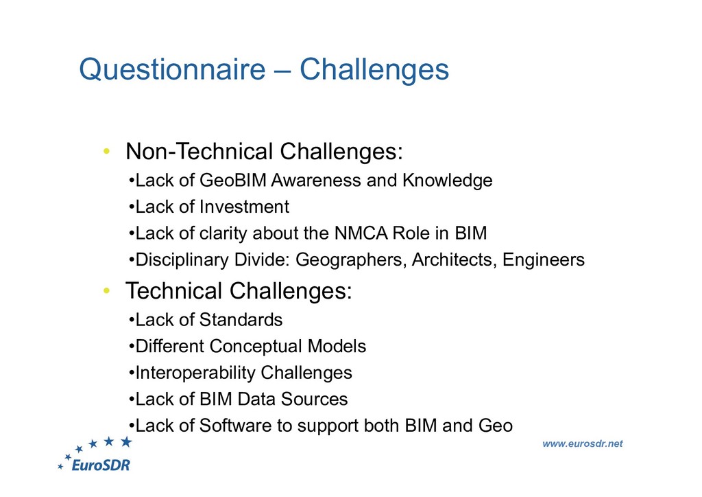
Awareness and Knowledge •Lack of Investment •Lack of clarity about the NMCA Role in BIM •Disciplinary Divide: Geographers, Architects, Engineers • Technical Challenges: •Lack of Standards •Different Conceptual Models •Interoperability Challenges •Lack of BIM Data Sources •Lack of Software to support both BIM and Geo
issues and potential benefits) is seen as number one challenge by the questionnaire respondents, to better align BIM and Geo processes” • Lack of awareness of what happens ‘the other side of the fence’ Additionally • How can NMCA data be better utilized? • How can NMCAs benefit from BIM data?
• Swisstopo, Switzerland • Ordnance Survey Ireland • Kadaster, Netherlands • ICGC, Catalunya • Agency for Data Supply and Efficiency, Denmark • GUGiK, Poland • IGN, France • Lantmateriet, Sweden • National Land Survey, Finland • Kartverket, Norway Other active partners: • Lund University • University College London • College of Engineering and Built Environment, Ireland • TU Delft Building Information Modeling and 3D GIS Integration: From the Theoretical to the Practical