EuroSDR GeoBIM project: a study in Europe on how to use the potentials of BIM and Geodata in practice
Common workflow harmonising the national experiences of the participating Countries to the EuroSDR GeoBIM project, towards the use of integrated geoinformation with BIMs.
Presented at the 14th 3D Geoinfo Conference 2019 in Singapore
Data in Practice • EuroSDR – research association of European National Mapping and Cadastral Agencies (NMCAs) • Project Aim: • Develop coherent/uniform view on GeoBIM integration • Develop initial solutions for better integration • Develop best practice for Geo- data in BIM processes and software and best practice for BIM data in Geo-data processes and software •2-Phase Approach • Questionnaire • Use Case Development (ongoing)
lack of knowledge (both of issues and potential benefits) is seen as number one challenge by the questionnaire respondents, to better align BIM and Geo processes” • Lack of awareness of what happens ‘the other side of the fence’ Additionally • How can NMCA data be better utilized? • How can NMCAs benefit from BIM data?
review of the potential applications from Phase 1 • Ongoing review of GeoBIM Status at National Level • Less formal, via our networks • Use Case #1 – Planning Permits (reported here) • Use Case #2 – Asset and Facilities Management (still at a relatively early stage)
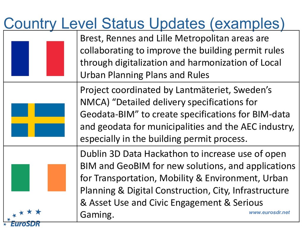
Metropolitan areas are collaborating to improve the building permit rules through digitalization and harmonization of Local Urban Planning Plans and Rules Project coordinated by Lantmäteriet, Sweden’s NMCA) “Detailed delivery specifications for Geodata-BIM” to create specifications for BIM-data and geodata for municipalities and the AEC industry, especially in the building permit process. Dublin 3D Data Hackathon to increase use of open BIM and GeoBIM for new solutions, and applications for Transportation, Mobility & Environment, Urban Planning & Digital Construction, City, Infrastructure & Asset Use and Civic Engagement & Serious Gaming.
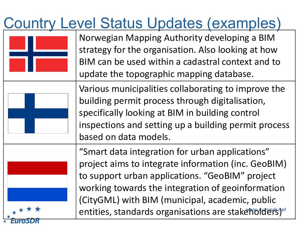
a BIM strategy for the organisation. Also looking at how BIM can be used within a cadastral context and to update the topographic mapping database. Various municipalities collaborating to improve the building permit process through digitalisation, specifically looking at BIM in building control inspections and setting up a building permit process based on data models. “Smart data integration for urban applications” project aims to integrate information (inc. GeoBIM) to support urban applications. “GeoBIM” project working towards the integration of geoinformation (CityGML) with BIM (municipal, academic, public entities, standards organisations are stakeholders)
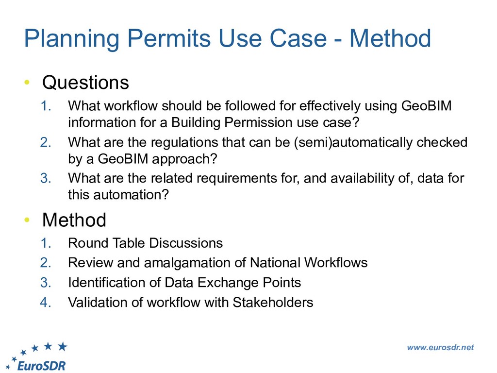
What workflow should be followed for effectively using GeoBIM information for a Building Permission use case? 2. What are the regulations that can be (semi)automatically checked by a GeoBIM approach? 3. What are the related requirements for, and availability of, data for this automation? • Method 1. Round Table Discussions 2. Review and amalgamation of National Workflows 3. Identification of Data Exchange Points 4. Validation of workflow with Stakeholders
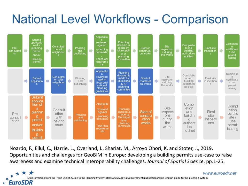
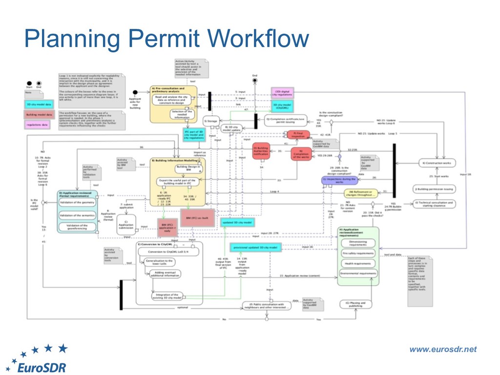
applicatio n of a planning permit and/or Building permit Consultati on wit neighbour s Phasing and publishing Applicatio n reviewed against - planning demands; - Technical requireme nts Planning decision is made by Municipali ty or planning committee Start of constructi on works Site inspection s during the works Completio n and building authorities notified Final site inspection s Completio n certificate / use permit issuing Submit applicatio n Consultati on with neighbour s Phasing and publishing Applicatio n reviewed against local and national planning guidelines Planning decision is made by Municipali ty or planning committee Start of constructi on works Site inspection s during the works Completio n and building authorities notified Final site inspection s Completio n certificate / use permit issuing Pre- consult ation Submit applica tion of a plannin g permit and/or Buildin g permit Consult ation with neighb orurs Phasing and publishing Applicatio n reviewed against - planning demands; - Technical requireme nts Planning decision is made by Municipali ty or planning committee Start of constru ction works Site inspecti ons during the works Compl etion and buildin g authorit ies notified Final site inspecti ons Compl etion certific ate / use permit issuing (UK information from the ‘Plain English Guide to the Planning System’ https://www.gov.uk/government/publications/plain-english-guide-to-the-planning-system Noardo, F., Ellul, C., Harrie, L., Overland, I., Shariat, M., Arroyo Ohori, K. and Stoter, J., 2019. Opportunities and challenges for GeoBIM in Europe: developing a building permits use-case to raise awareness and examine technical interoperability challenges. Journal of Spatial Science, pp.1-25.
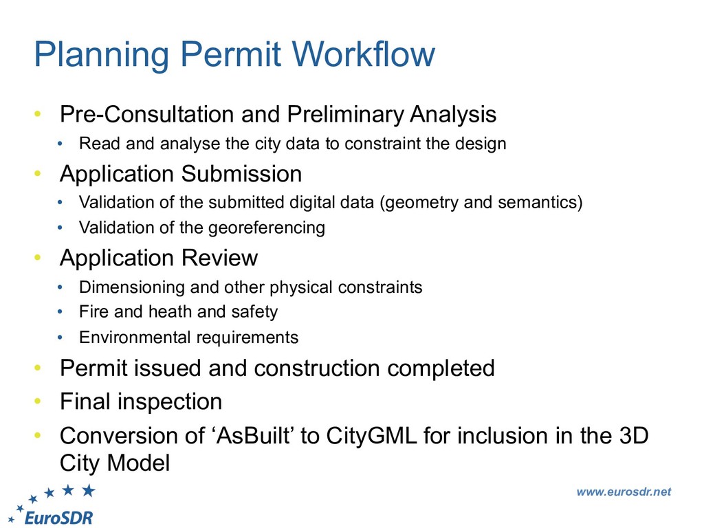
Read and analyse the city data to constraint the design • Application Submission • Validation of the submitted digital data (geometry and semantics) • Validation of the georeferencing • Application Review • Dimensioning and other physical constraints • Fire and heath and safety • Environmental requirements • Permit issued and construction completed • Final inspection • Conversion of ‘AsBuilt’ to CityGML for inclusion in the 3D City Model
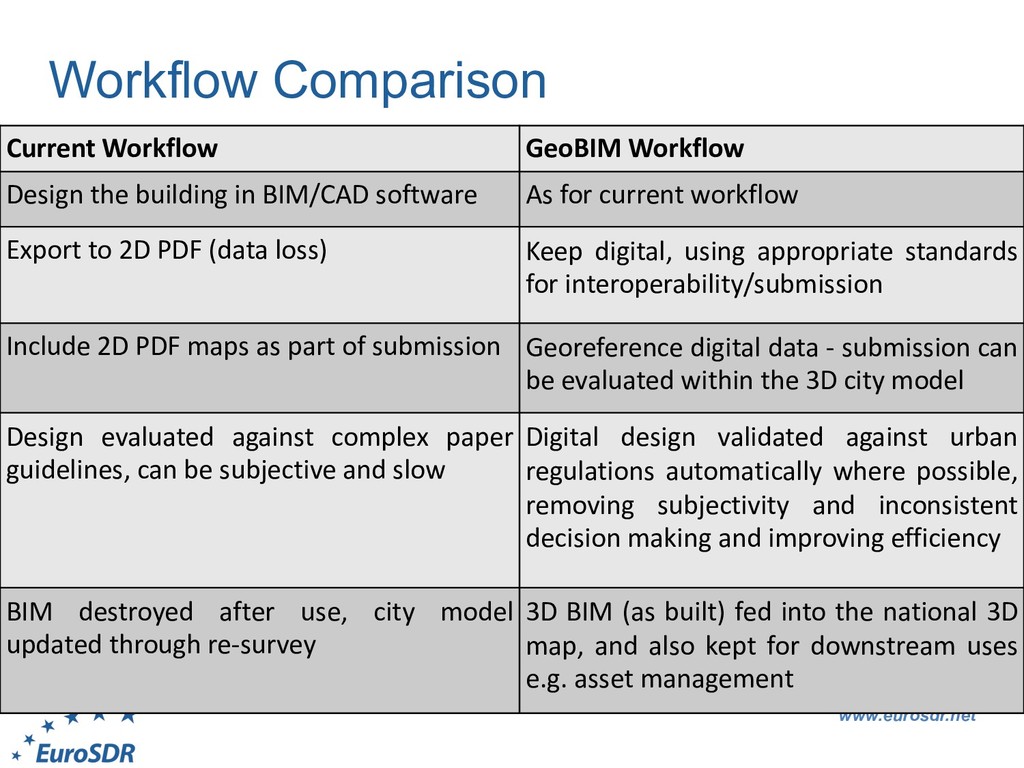
in BIM/CAD software As for current workflow Export to 2D PDF (data loss) Keep digital, using appropriate standards for interoperability/submission Include 2D PDF maps as part of submission Georeference digital data - submission can be evaluated within the 3D city model Design evaluated against complex paper guidelines, can be subjective and slow Digital design validated against urban regulations automatically where possible, removing subjectivity and inconsistent decision making and improving efficiency BIM destroyed after use, city model updated through re-survey 3D BIM (as built) fed into the national 3D map, and also kept for downstream uses e.g. asset management
• Swisstopo, Switzerland • Ordnance Survey Ireland • Kadaster, Netherlands • ICGC, Catalunya • Agency for Data Supply and Efficiency, Denmark • GUGiK, Poland • IGN, France • Lantmateriet, Sweden • National Land Survey, Finland • Kartverket, Norway • Surveying and Mapping Authority of the Republic of Slovenia Other active partners: • TU Delft • Lund University • University College London • College of Engineering and Built Environment, Ireland • University of Ljubljana Building Information Modeling and 3D GIS Integration: From the Theoretical to the Practical