Upgrade to Pro
— share decks privately, control downloads, hide ads and more …
Speaker Deck
Features
Speaker Deck
PRO
Sign in
Sign up for free
Search
Search
NACIS 2013: Cartography for a Changing Map
Search
Sponsored
·
Your Podcast. Everywhere. Effortlessly.
Share. Educate. Inspire. Entertain. You do you. We'll handle the rest.
→
mapbox
October 11, 2013
230
2
Share
Embed
Copy iframe code
Copy JS code
Copy link
Start on current slide
NACIS 2013: Cartography for a Changing Map
Presented at NACIS 2013 in Greenville, SC.
mapbox
October 11, 2013
More Decks by mapbox
See All by mapbox
Global Vector Terrain
mapbox
1
410
How to use iD for easily updating OSM
mapbox
1
160
Cartography with TileMill, PostGIS, and OpenStreetMap
mapbox
4
340
Featured
See All Featured
GraphQLとの向き合い方2022年版
quramy
50
15k
How to Align SEO within the Product Triangle To Get Buy-In & Support - #RIMC
aleyda
2
1.7k
Responsive Adventures: Dirty Tricks From The Dark Corners of Front-End
smashingmag
254
22k
Become a Pro
speakerdeck
PRO
31
6k
職位にかかわらず全員がリーダーシップを発揮するチーム作り / Building a team where everyone can demonstrate leadership regardless of position
madoxten
64
56k
<Decoding/> the Language of Devs - We Love SEO 2024
nikkihalliwell
1
280
The Anti-SEO Checklist Checklist. Pubcon Cyber Week
ryanjones
0
190
Making Projects Easy
brettharned
120
6.7k
Gemini Prompt Engineering: Practical Techniques for Tangible AI Outcomes
mfonobong
2
470
Game over? The fight for quality and originality in the time of robots
wayneb77
1
230
Neural Spatial Audio Processing for Sound Field Analysis and Control
skoyamalab
0
380
We Analyzed 250 Million AI Search Results: Here's What I Found
joshbly
1
1.6k
Transcript
Cartography for a Changing Map AJ Ashton, MapBox
None
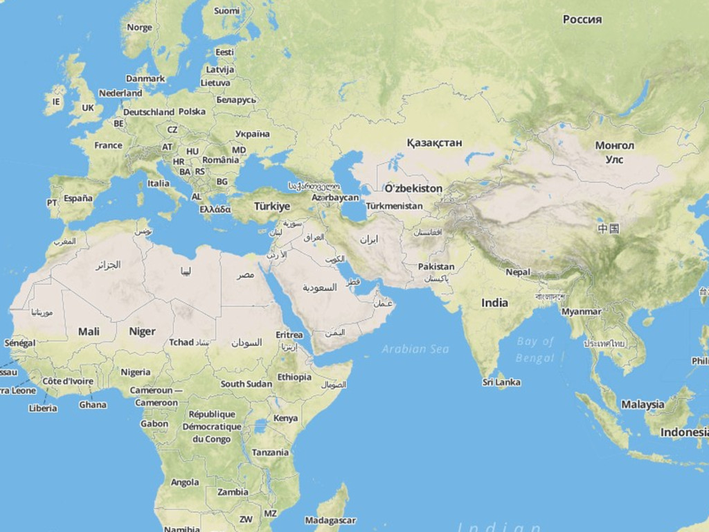
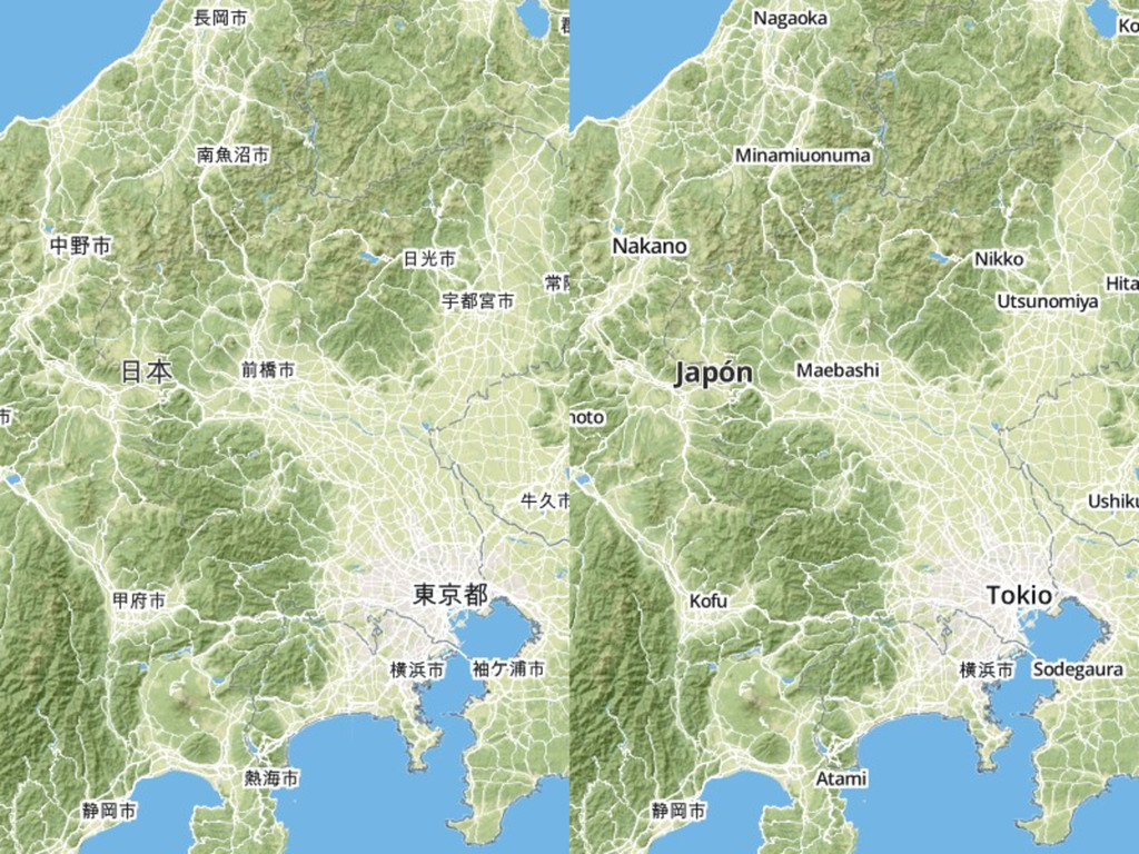
Global • All the data OpenStreetMap has to offer, and
more • Multiscale: 20+ Web Mercator zoom levels • Multiple label language options
None
Scalable • Cloud servers that get added and dropped constantly
can’t be too “heavy” • Tiles should load just as fast with 10 users as with 10,000 users • Apply different styles to the same underlying data
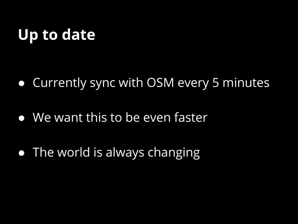
None
Up to date • Currently sync with OSM every 5
minutes • We want this to be even faster • The world is always changing
None
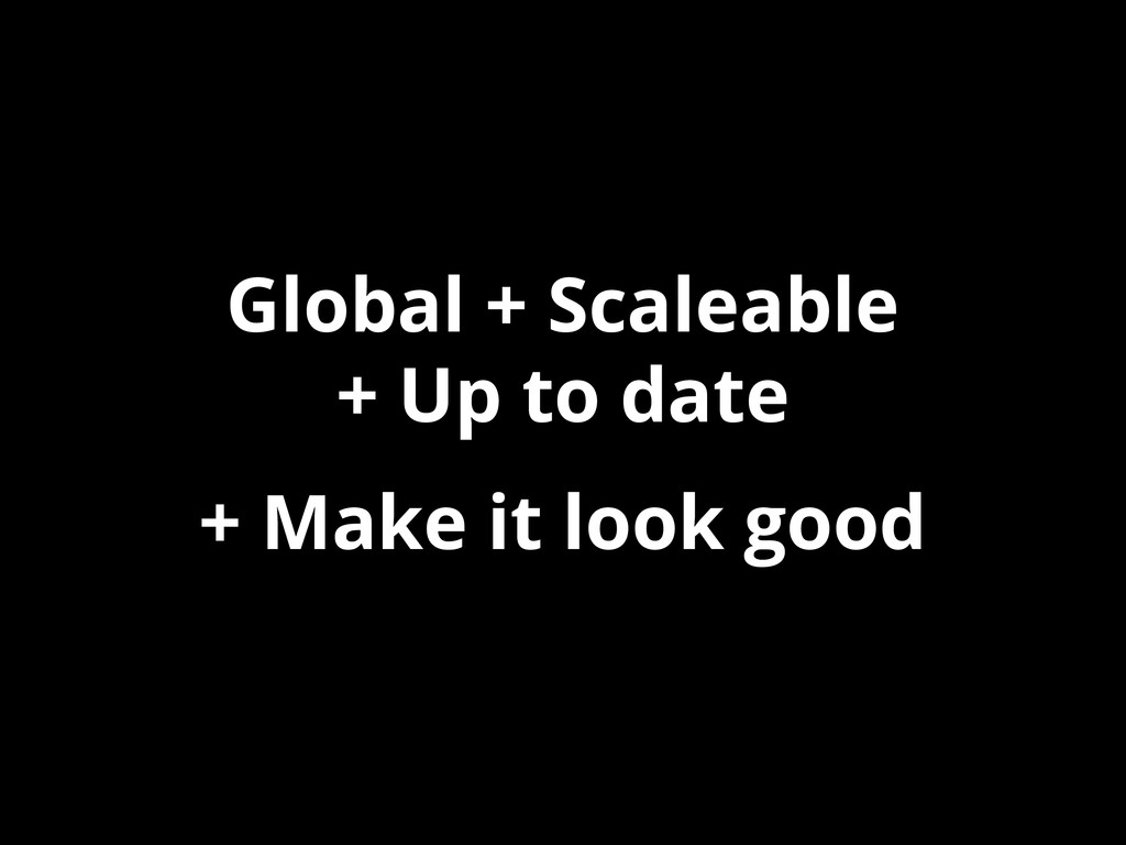
Global + Scaleable + Up to date A challenging combination
Global + Scaleable + Up to date + Make it
look good
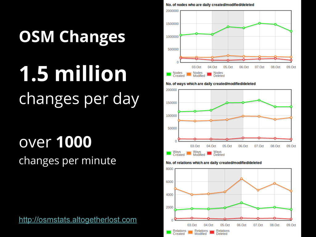
Keeping up with OSM
OSM Changes 1.5 million changes per day over 1000 changes
per minute http://osmstats.altogetherlost.com
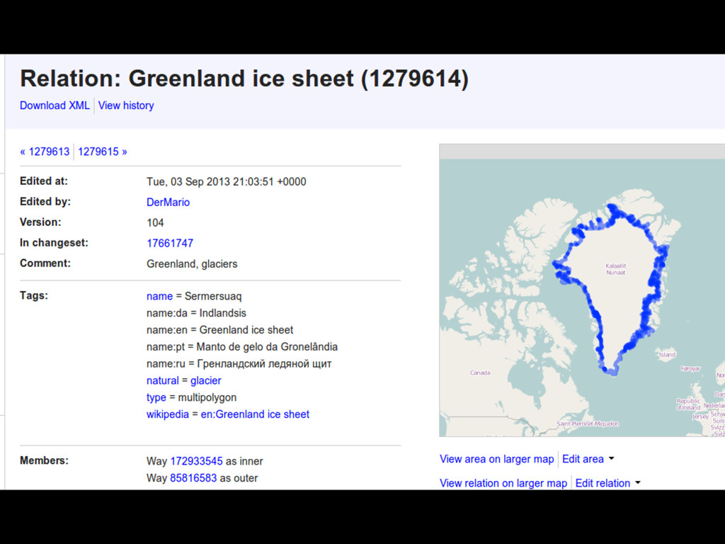
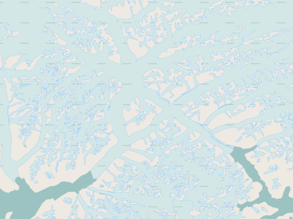
Most changes are small, but some have big consequences
None
None
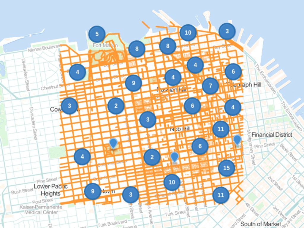
Cartography for a changing map: Simple things
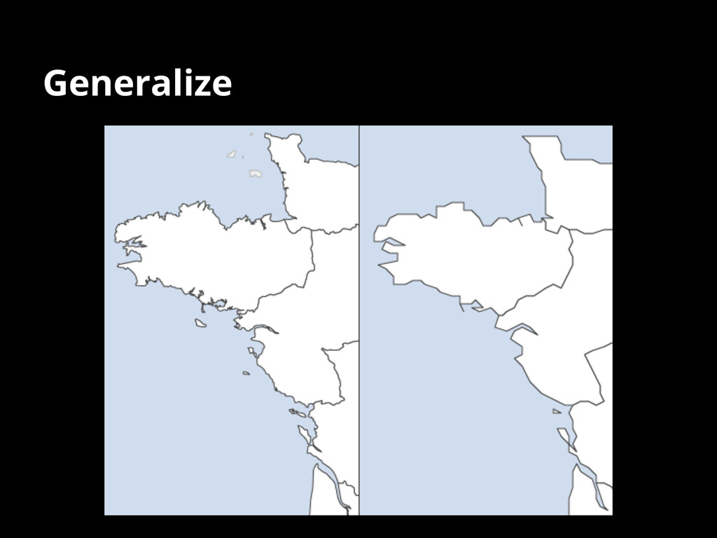
Generalize
Normalization Cleaning OSM data for consistency
Cartography for a changing map: Not-so simple things
aka. Automatic manual tweaks
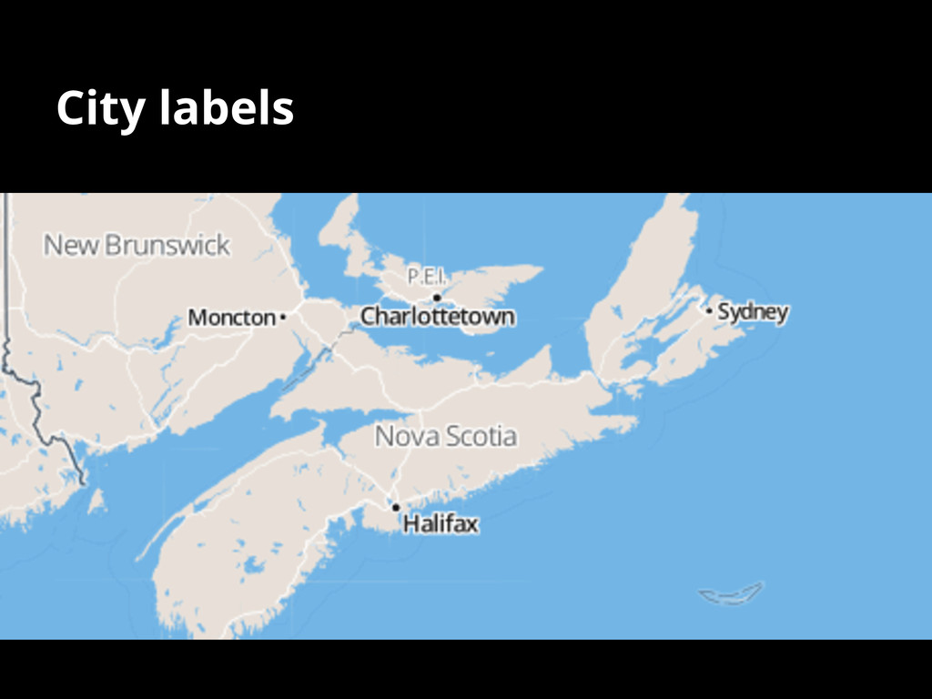
City labels
City labels • Custom list of scaleranks (based on Natural
Earth) and label direction hints • Fuzzy spatial & fuzzy text join function between incoming OSM data + our list
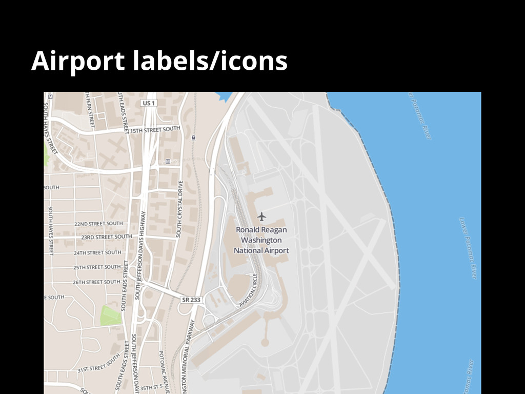
Airport labels/icons
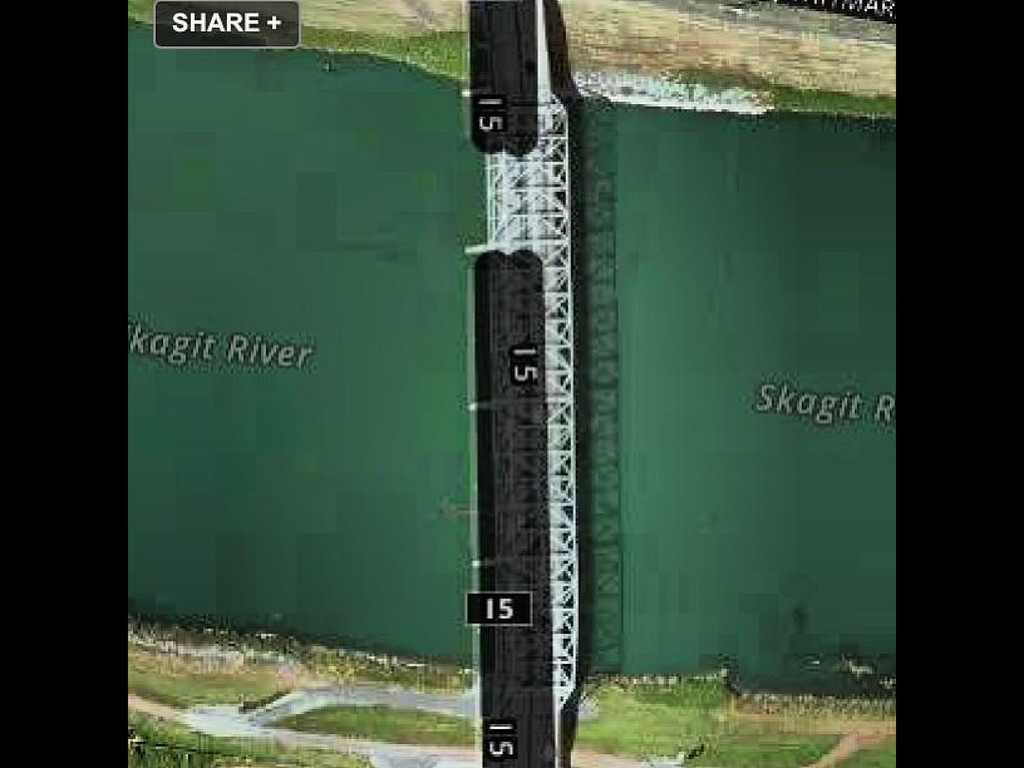
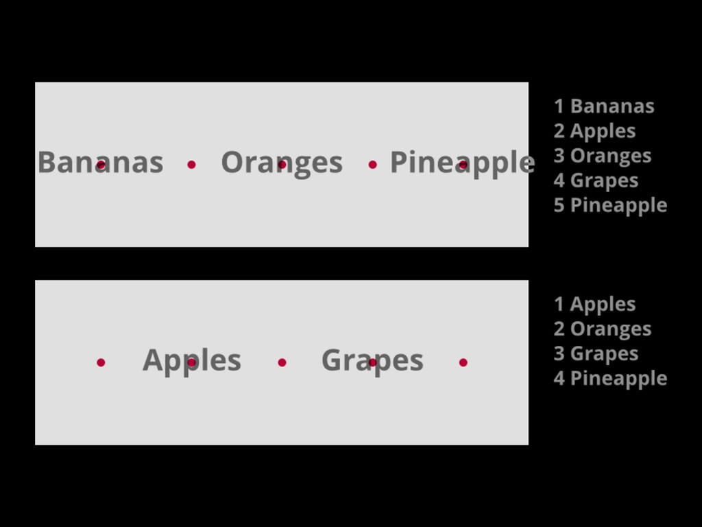
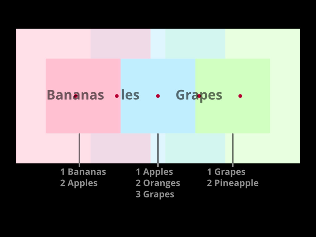
Cartography for a changing map: Working with tiles
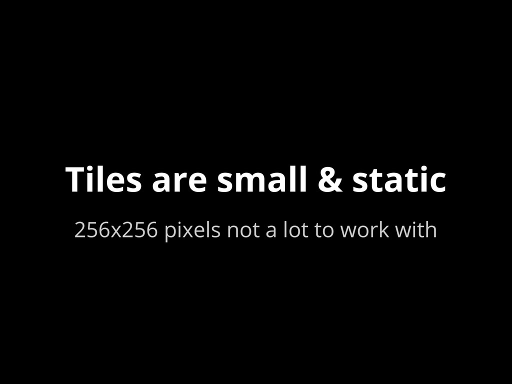
Tiles are small & static 256x256 pixels not a lot
to work with
None
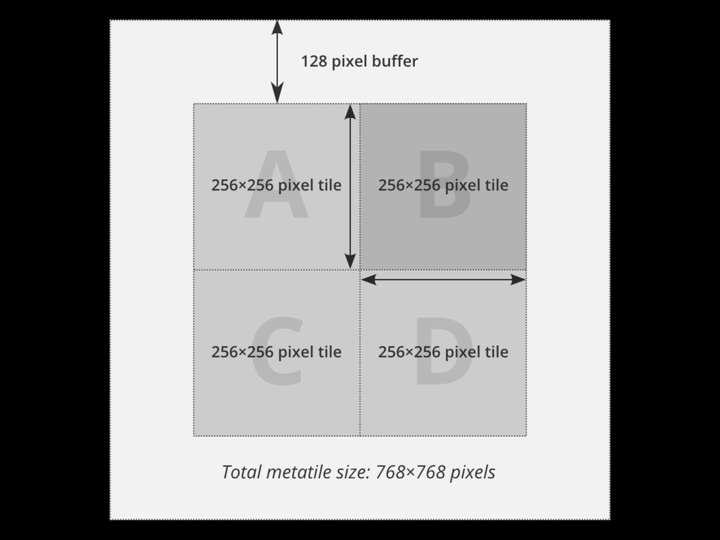
Tiles don’t know about other tiles
None
None
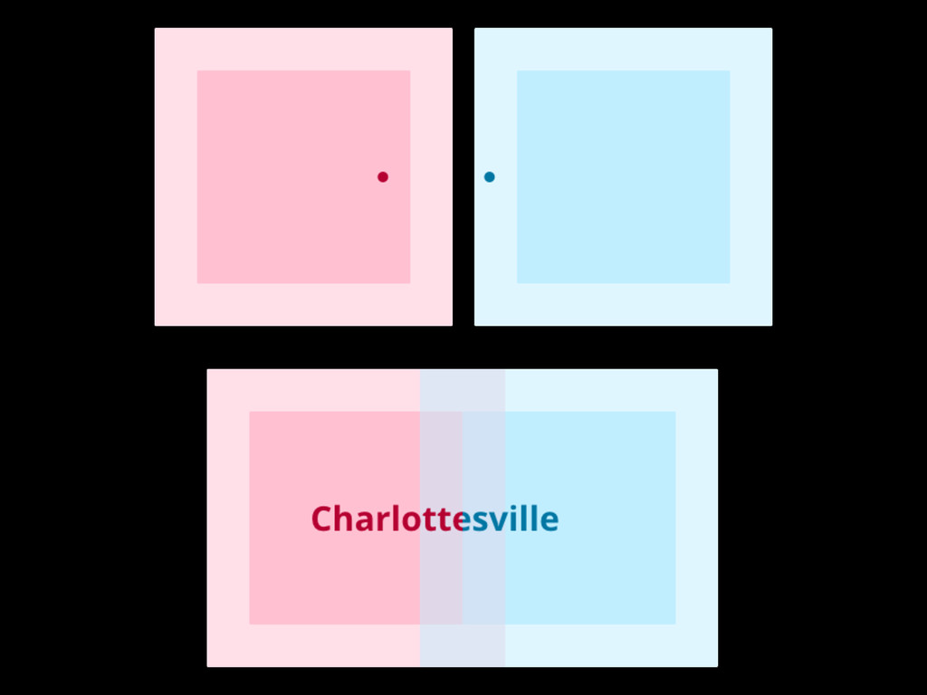
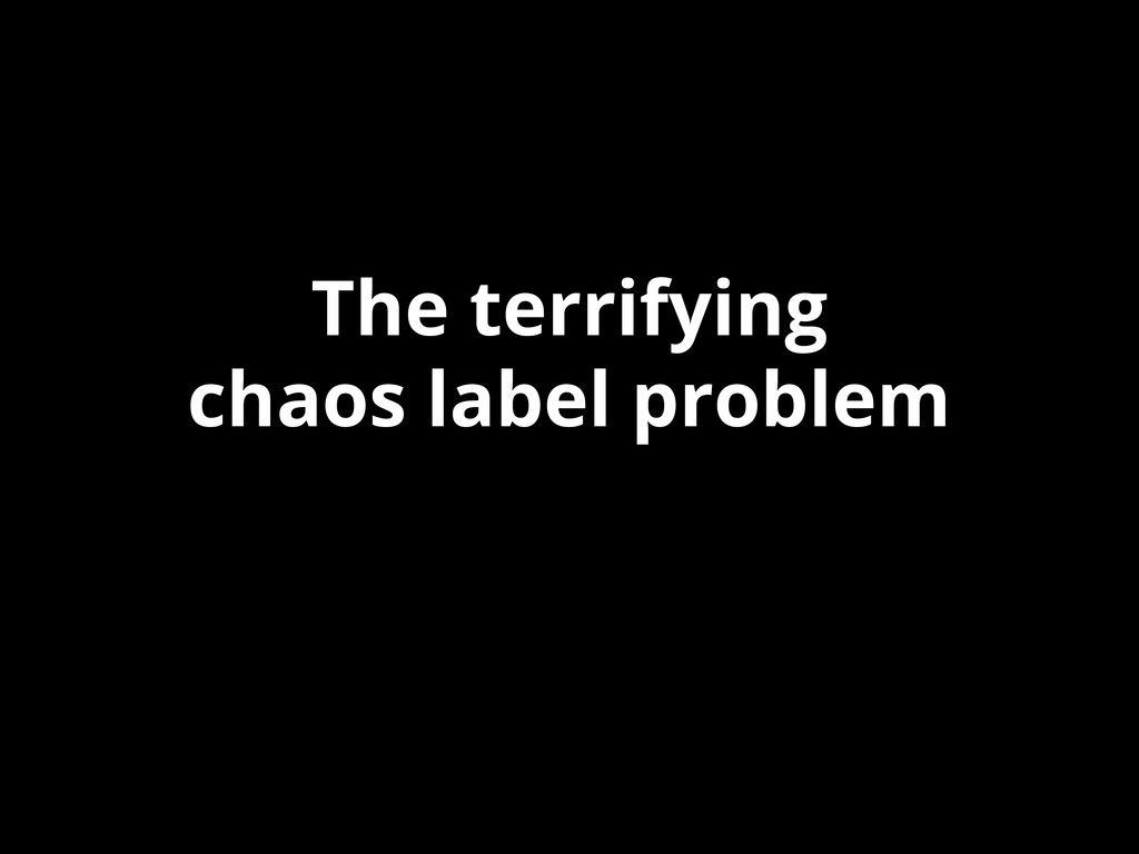
The terrifying chaos label problem
None
None
None
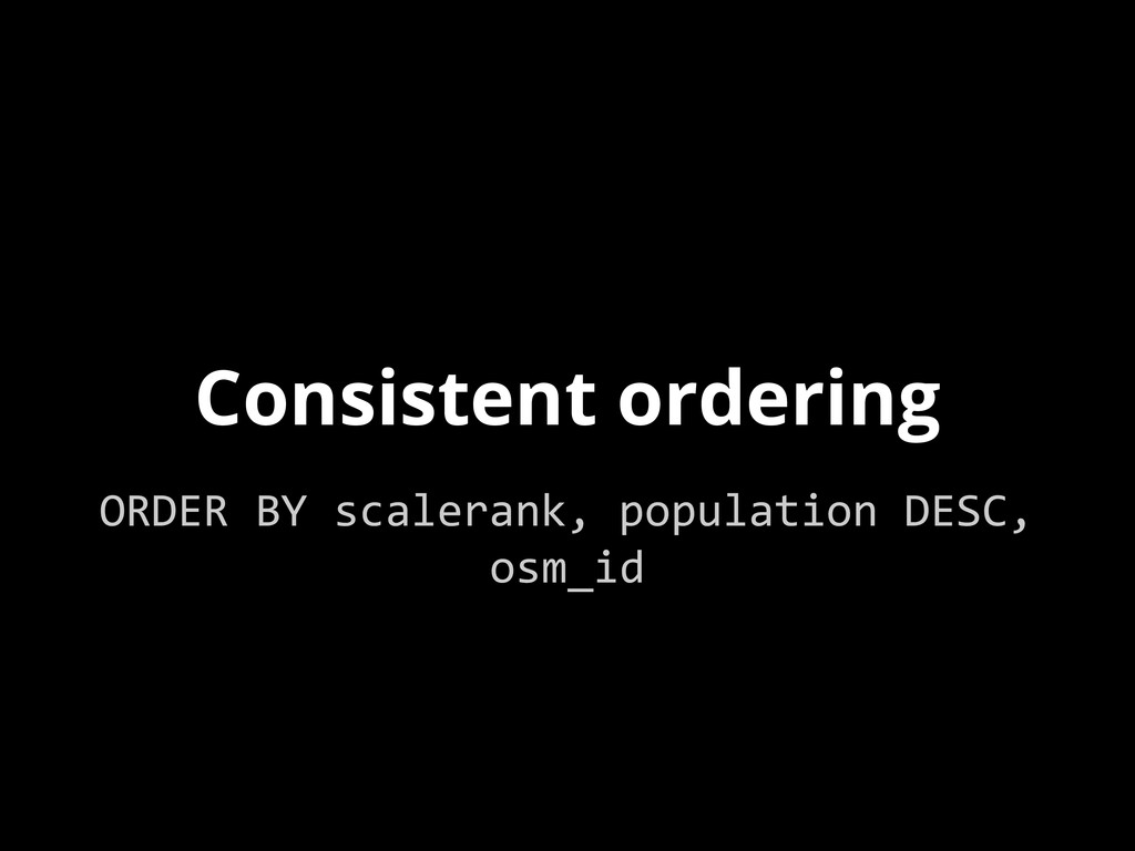
No perfect solutions Only mitigation strategies
Consistent ordering ORDER BY scalerank, population DESC, osm_id
De-duplicate at the data level GROUP BY ST_SnapToGrid(geom)
None