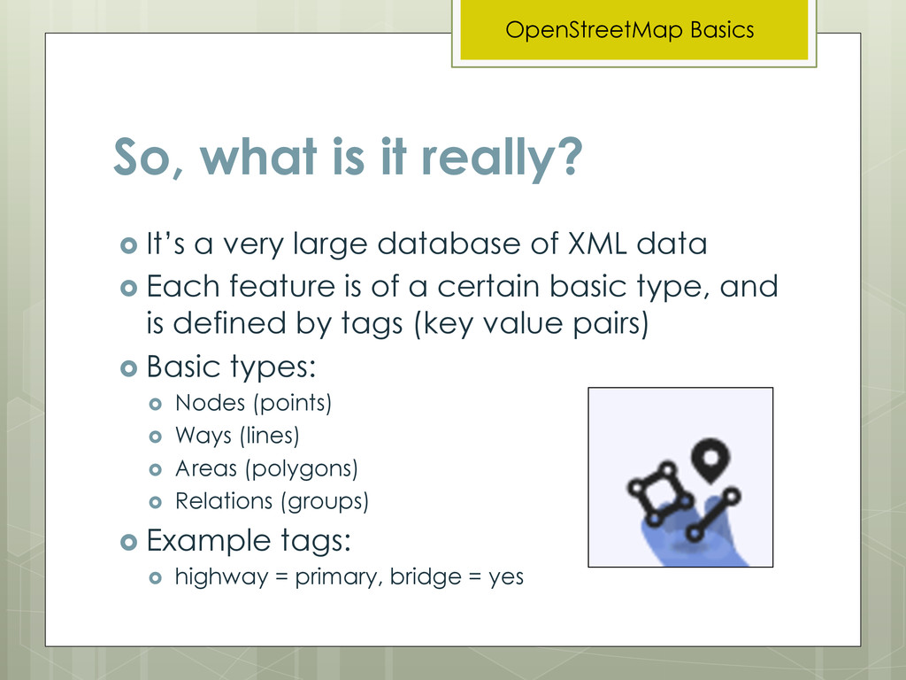
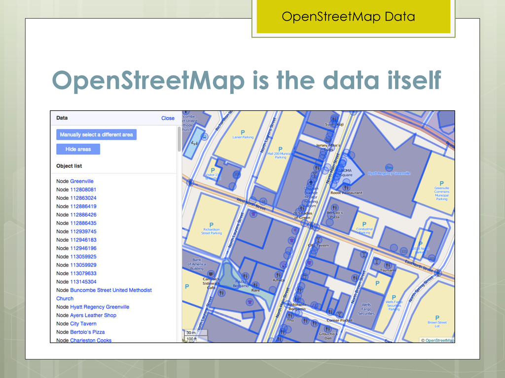
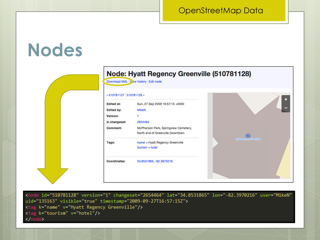
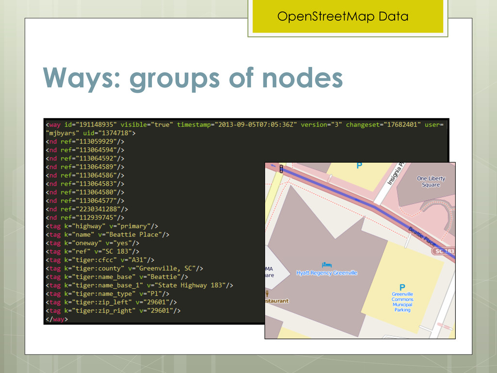
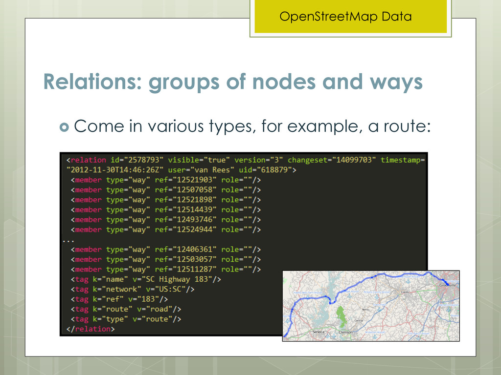
very large database of XML data ! Each feature is of a certain basic type, and is defined by tags (key value pairs) ! Basic types: ! Nodes (points) ! Ways (lines) ! Areas (polygons) ! Relations (groups) ! Example tags: ! highway = primary, bridge = yes
that uses particular cartography, whether for web or paper. ! Proprietary—anyone can use it for free as long as they provide proper credit ! Something static—it changes and grows all the time ! Controlled by an authority—it is driven and maintained by a large community of contributors and data consumers
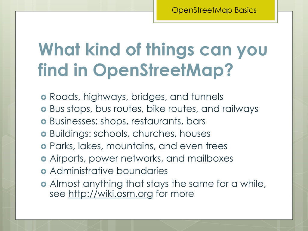
Basics ! Roads, highways, bridges, and tunnels ! Bus stops, bus routes, bike routes, and railways ! Businesses: shops, restaurants, bars ! Buildings: schools, churches, houses ! Parks, lakes, mountains, and even trees ! Airports, power networks, and mailboxes ! Administrative boundaries ! Almost anything that stays the same for a while, see http://wiki.osm.org for more
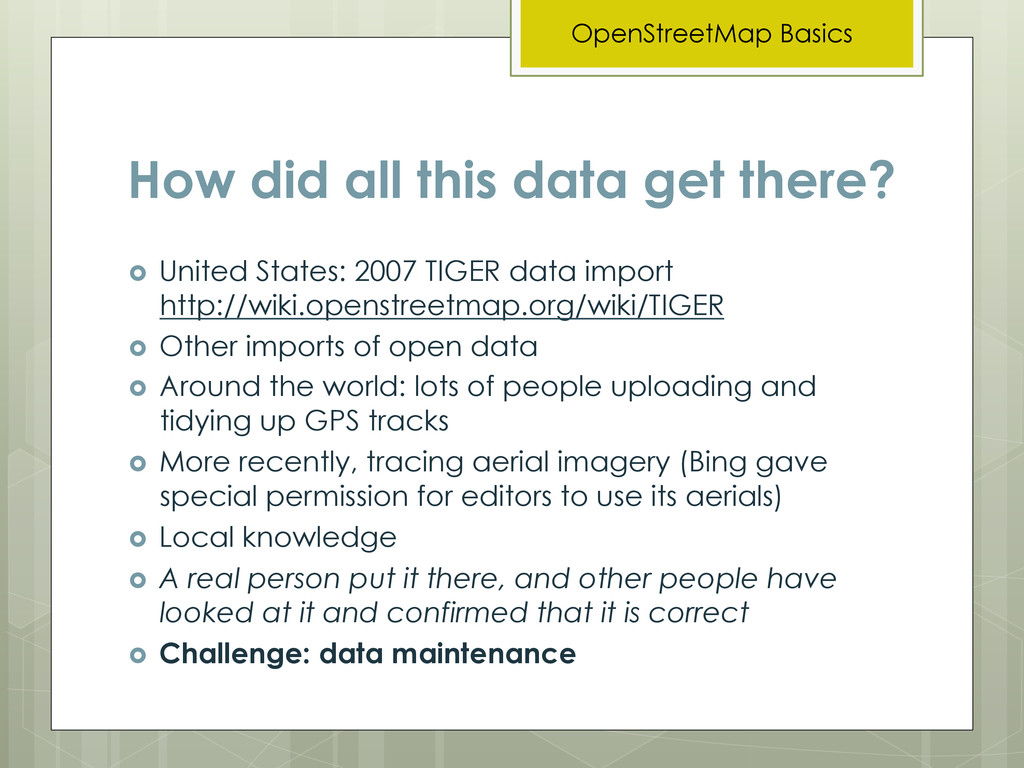
2007 TIGER data import http://wiki.openstreetmap.org/wiki/TIGER ! Other imports of open data ! Around the world: lots of people uploading and tidying up GPS tracks ! More recently, tracing aerial imagery (Bing gave special permission for editors to use its aerials) ! Local knowledge ! A real person put it there, and other people have looked at it and confirmed that it is correct ! Challenge: data maintenance OpenStreetMap Basics
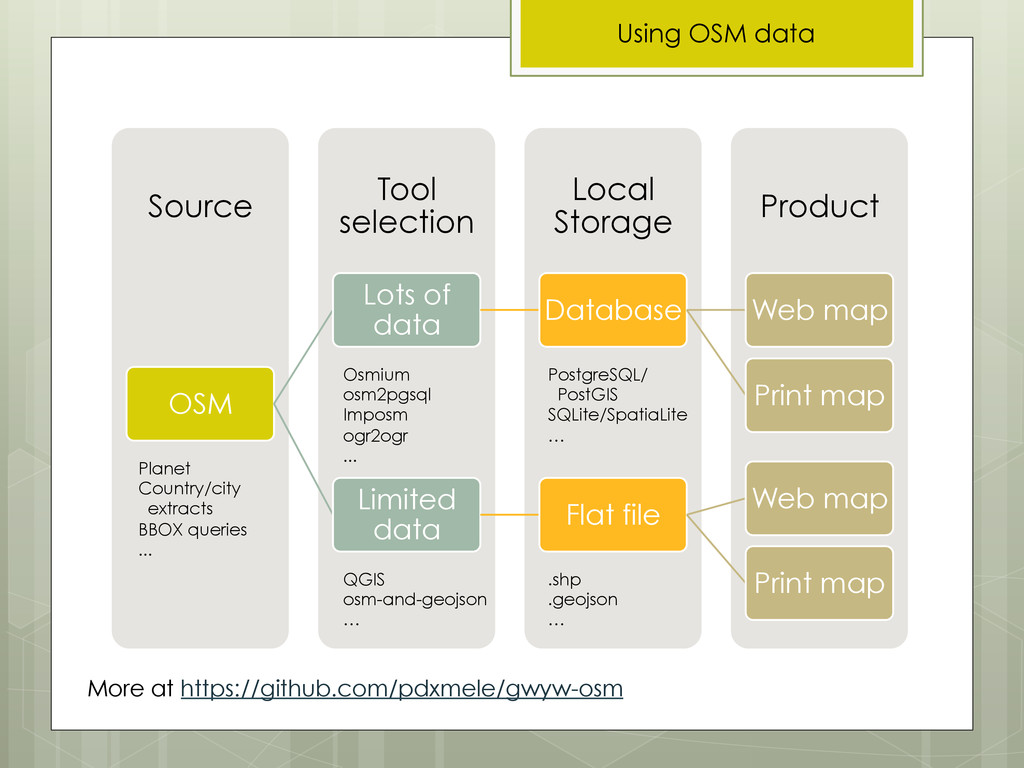
! Let’s assume we want to use OSM data for cartography ! What are you making? A web map? A print map? ! What software do you want to use to make it? ! What formats can that software use? Do you prefer to work with certain data formats? ! What is your geographic extent? ! Which features do you want to show? Everything? Only the highways? Only the coffee shops? Only a few select features? ! How often do you want to update your map? Using OSM data
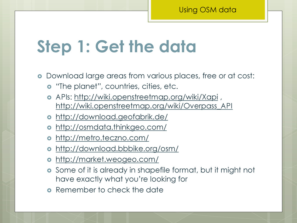
various places, free or at cost: ! “The planet”, countries, cities, etc. ! APIs: http://wiki.openstreetmap.org/wiki/Xapi , http://wiki.openstreetmap.org/wiki/Overpass_API ! http://download.geofabrik.de/ ! http://osmdata.thinkgeo.com/ ! http://metro.teczno.com/ ! http://download.bbbike.org/osm/ ! http://market.weogeo.com/ ! Some of it is already in shapefile format, but it might not have exactly what you’re looking for ! Remember to check the date Using OSM data
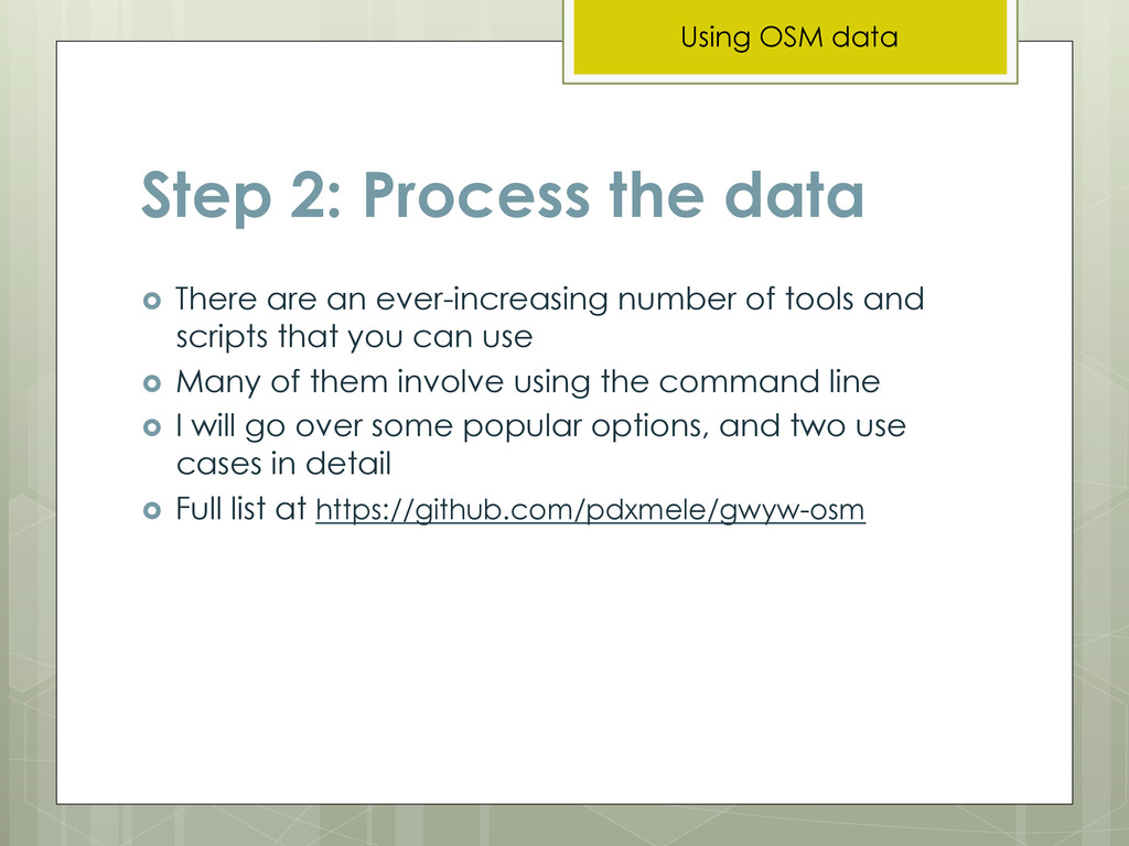
number of tools and scripts that you can use ! Many of them involve using the command line ! I will go over some popular options, and two use cases in detail ! Full list at https://github.com/pdxmele/gwyw-osm Using OSM data
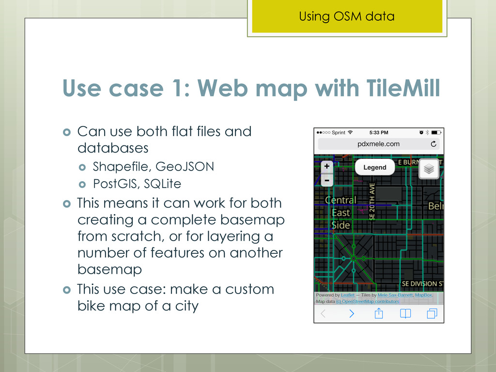
both flat files and databases ! Shapefile, GeoJSON ! PostGIS, SQLite ! This means it can work for both creating a complete basemap from scratch, or for layering a number of features on another basemap ! This use case: make a custom bike map of a city Using OSM data
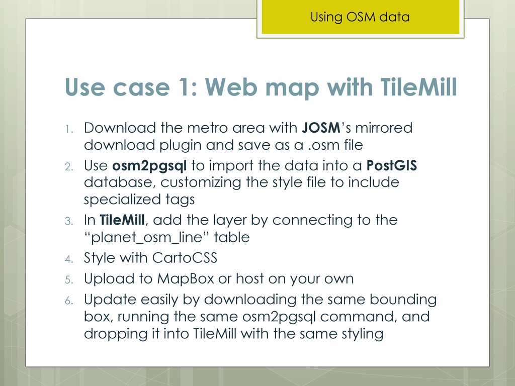
metro area with JOSM’s mirrored download plugin and save as a .osm file 2. Use osm2pgsql to import the data into a PostGIS database, customizing the style file to include specialized tags 3. In TileMill, add the layer by connecting to the “planet_osm_line” table 4. Style with CartoCSS 5. Upload to MapBox or host on your own 6. Update easily by downloading the same bounding box, running the same osm2pgsql command, and dropping it into TileMill with the same styling Using OSM data
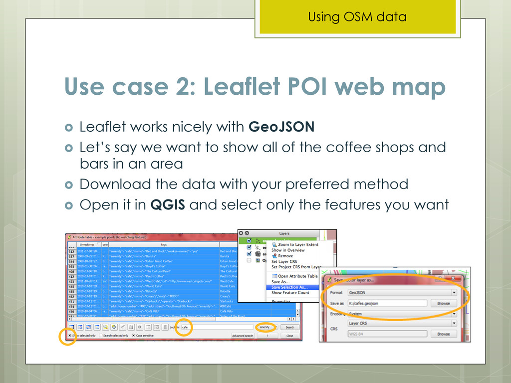
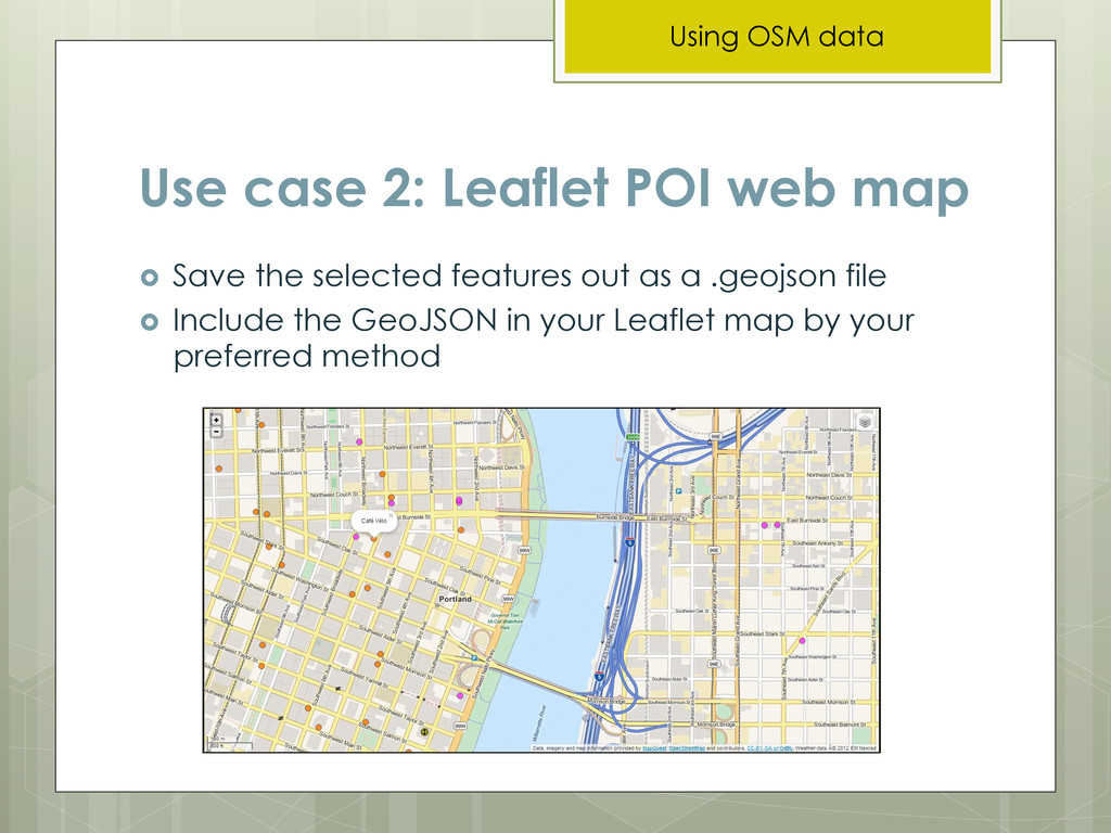
nicely with GeoJSON ! Let’s say we want to show all of the coffee shops and bars in an area ! Download the data with your preferred method ! Open it in QGIS and select only the features you want Using OSM data
Pack your patience – it can easily take months to find the method that works for you, fiddle with settings, and get all of the resources you will need ready ! Ask for help from the mailing lists and OSM/GIS help sites when you need it ! http://help.osm.org ! https://lists.openstreetmap.org/listinfo ! https://lists.openstreetmap.org/listinfo/newbies ! https://lists.openstreetmap.org/listinfo/dev ! http://gis.stackexchange.com/ Using OSM data
for OSM tags (how to filter the data) is http://wiki.osm.org ! I’ve also made a list of common tag keys for you at https://github.com/pdxmele/gwyw-osm ! Please remember to credit the OSM contributors: http://www.openstreetmap.org/copyright ! Questions? Twitter @pdxmele / saxbarm at gmail.com Go for it!
to fit the entire world on a single USB stick” ! http://www.mapbox.com/blog/vector-tiles/ ! https://github.com/mapbox/tm2 ! OSM vector tiles ! Mapnik vector tiles: http://openstreetmap.us/~migurski/vector-datasource/ The Future