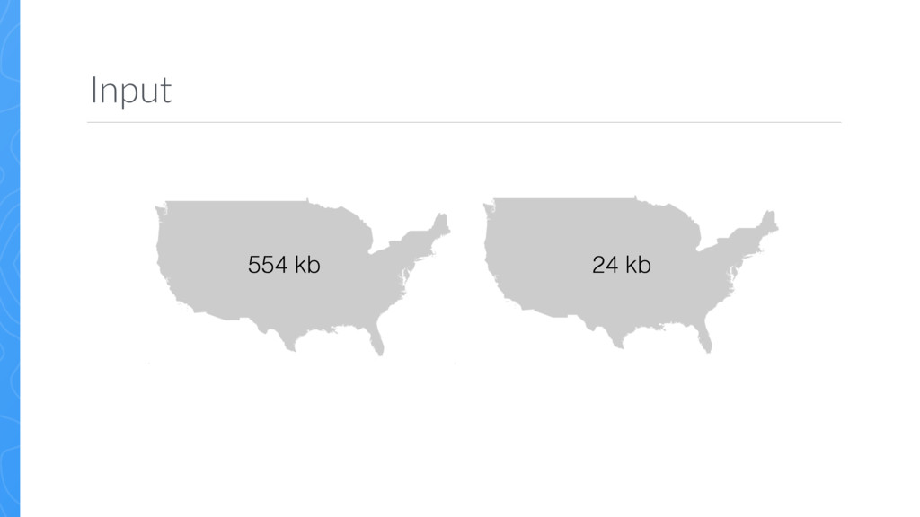
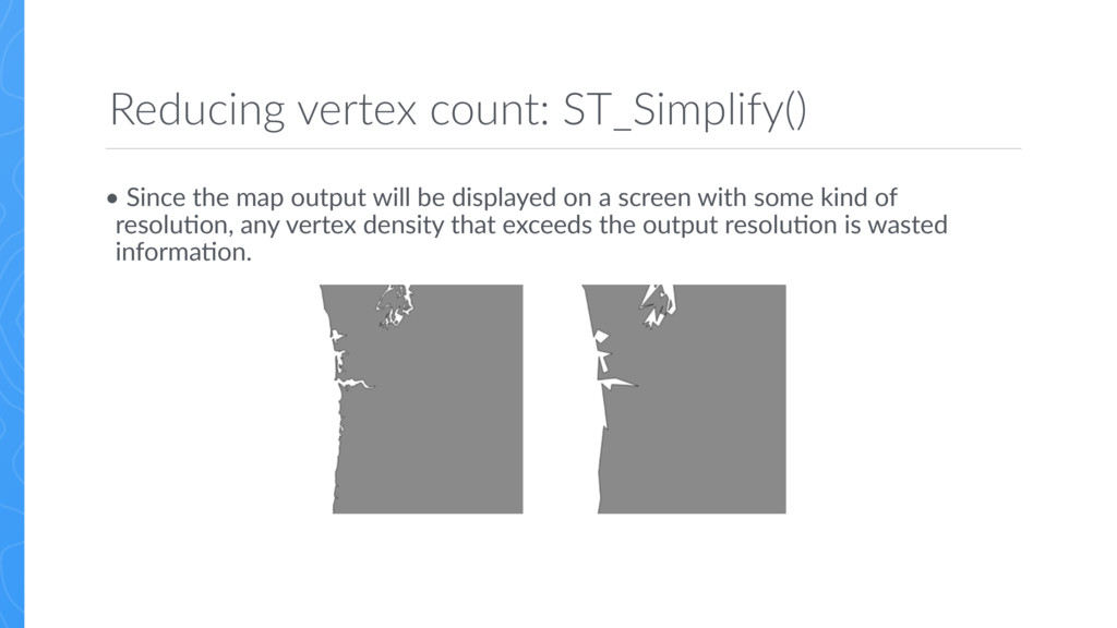
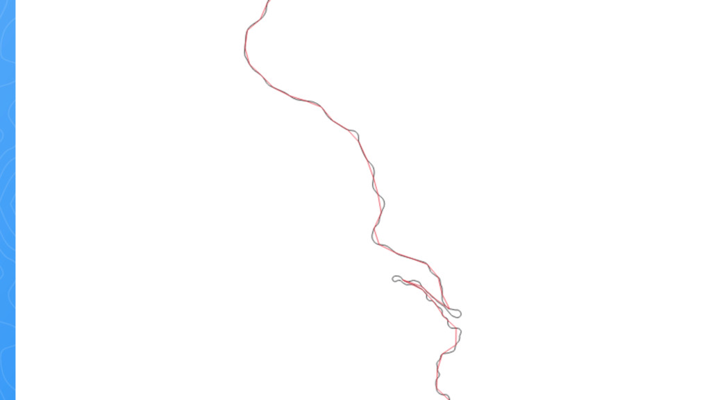
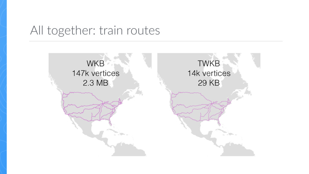
next vertex in a shape usually only takes 1 or 2 bytes, because the points aren’t very far apart • There is a big space savings available in using “delta” coordinates rather than “absolute” coordinates • Niklas Aven was working on “Tiny well-‐known binary”, a representaAon that retains the logical structure of WKB (simple feature geometry types) but packs them into the minimum possible size using delta encoding and variable length integers • All this calculaAng of deltas and minimum sized integers takes a fair amount of CPU Ame, but in our applicaAon the trade-‐off is worth it
![Node.js C++ modules demo • Source code: h]ps:/ /github.com/rochoa/codemoAon-‐2015-‐demo](https://files.speakerdeck.com/presentations/1226d833a51149b8bb7f6404739a36de/slide_20.jpg)
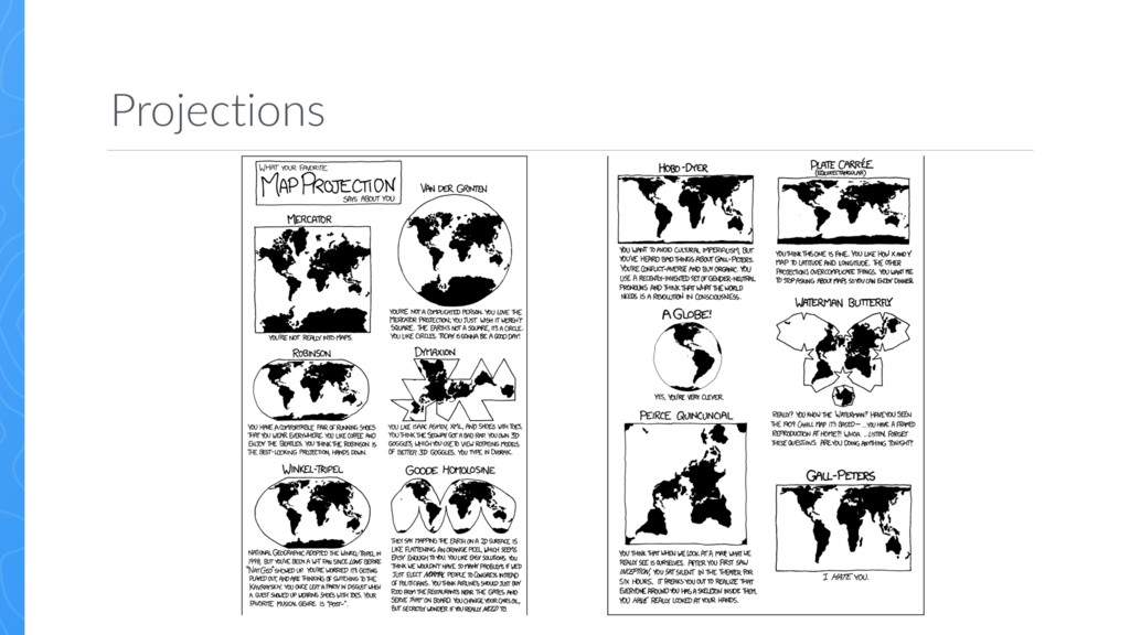
![• h]p:/ /mapAmeboston.github.io/web-‐maps-‐101/ • h]ps:/ /xkcd.com/977/ •](https://files.speakerdeck.com/presentations/1226d833a51149b8bb7f6404739a36de/slide_41.jpg)