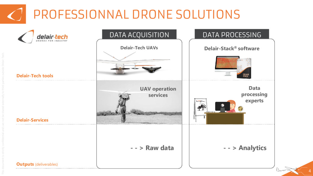
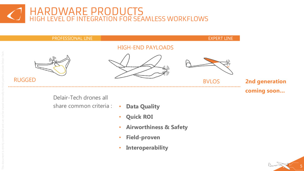
externally to third parties outside Delair-Tech. 5 HARDWARE PRODUCTS HIGH LEVEL OF INTEGRATION FOR SEAMLESS WORKFLOWS Delair-Tech drones all share common criteria : EXPERT LINE PROFESSIONAL LINE 2nd generation coming soon… BVLOS RUGGED HIGH-END PAYLOADS • Data Quality • Quick ROI • Airworthiness & Safety • Field-proven • Interoperability
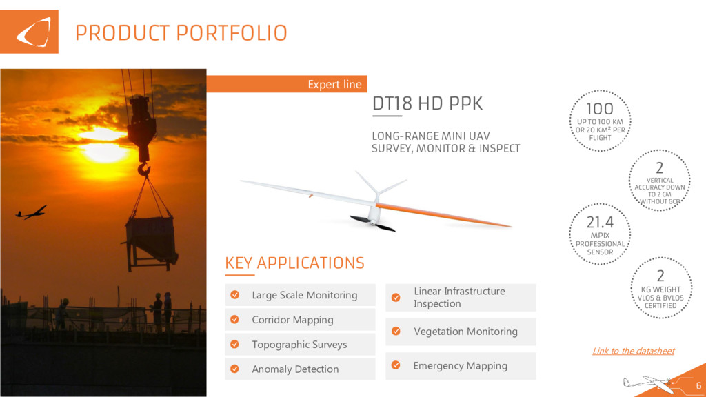
externally to third parties outside Delair-Tech. Expert line 6 DT18 HD PPK LONG-RANGE MINI UAV SURVEY, MONITOR & INSPECT 100 UP TO 100 KM OR 20 KM² PER FLIGHT 2 VERTICAL ACCURACY DOWN TO 2 CM WITHOUT GCP 21.4 MPIX PROFESSIONAL SENSOR 2 KG WEIGHT VLOS & BVLOS CERTIFIED KEY APPLICATIONS Large Scale Monitoring Linear Infrastructure Inspection Vegetation Monitoring Emergency Mapping Link to the datasheet Corridor Mapping Topographic Surveys Anomaly Detection PRODUCT PORTFOLIO
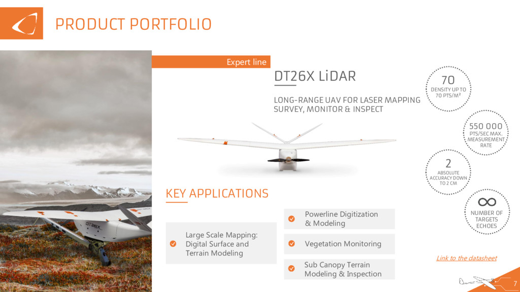
externally to third parties outside Delair-Tech. PRODUCT PORTFOLIO 7 Expert line DT26X LiDAR LONG-RANGE UAV FOR LASER MAPPING SURVEY, MONITOR & INSPECT 70 DENSITY UP TO 70 PTS/M² 550 000 PTS/SEC MAX. MEASUREMENT RATE 2 ABSOLUTE ACCURACY DOWN TO 2 CM KEY APPLICATIONS Large Scale Mapping: Digital Surface and Terrain Modeling Powerline Digitization & Modeling Vegetation Monitoring Sub Canopy Terrain Modeling & Inspection Link to the datasheet 2 NUMBER OF TARGETS ECHOES
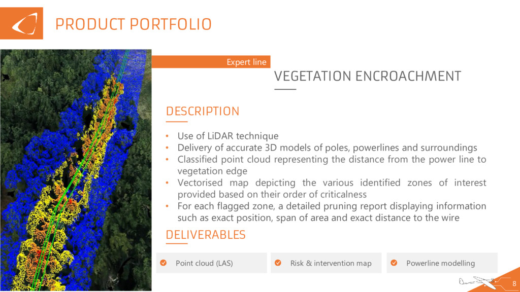
externally to third parties outside Delair-Tech. PRODUCT PORTFOLIO 8 Expert line VEGETATION ENCROACHMENT DELIVERABLES • Use of LiDAR technique • Delivery of accurate 3D models of poles, powerlines and surroundings • Classified point cloud representing the distance from the power line to vegetation edge • Vectorised map depicting the various identified zones of interest provided based on their order of criticalness • For each flagged zone, a detailed pruning report displaying information such as exact position, span of area and exact distance to the wire Point cloud (LAS) DESCRIPTION Risk & intervention map Powerline modelling
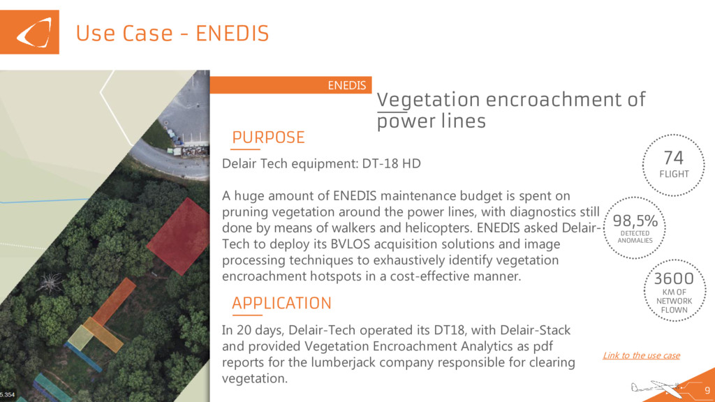
externally to third parties outside Delair-Tech. Use Case - ENEDIS 9 ENEDIS Vegetation encroachment of power lines 74 FLIGHT 98,5% DETECTED ANOMALIES APPLICATION Link to the use case 3600 KM OF NETWORK FLOWN PURPOSE Delair Tech equipment: DT-18 HD A huge amount of ENEDIS maintenance budget is spent on pruning vegetation around the power lines, with diagnostics still done by means of walkers and helicopters. ENEDIS asked Delair- Tech to deploy its BVLOS acquisition solutions and image processing techniques to exhaustively identify vegetation encroachment hotspots in a cost-effective manner. In 20 days, Delair-Tech operated its DT18, with Delair-Stack and provided Vegetation Encroachment Analytics as pdf reports for the lumberjack company responsible for clearing vegetation.
externally to third parties outside Delair-Tech. Use Case – ENEDIS – Lessons learnt for scale-up 10 ENEDIS ROI improvement on Data processing Satisfying results More anomalies than the one that have been detected by manned helicopters and walking observers Need for more data to improve the algorithms but those 300ml have already shown improvements ROI improvement: Acquisition costs too high Need for a larger network of operators to reduce the costs of data acquisition Mathematical model to improve the efficiency of the network of pilots Absolute need for BVLOS (3G connectivity with RTE)
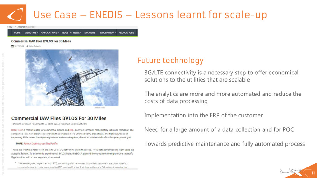
externally to third parties outside Delair-Tech. Use Case – ENEDIS – Lessons learnt for scale-up 11 Future technology 3G/LTE connectivity is a necessary step to offer economical solutions to the utilities that are scalable The analytics are more and more automated and reduce the costs of data processing Implementation into the ERP of the customer Need for a large amount of a data collection and for POC Towards predictive maintenance and fully automated process
externally to third parties outside Delair-Tech. Use Case – ENEDIS – The business model 12 Cost breakdown What the end user wants In the 100 countries where we work, we have been able to observe different strategies among the utilities for data acquisition, data processing and hardware (internal or external cooperation). -> Utilities need to be work with drone companies that can offer the full end-to-end solution. Pricing Need to be twice as cheap as conventional solutions to convince utilities to use drones The cost of the hardware and the acquisition are still the biggest in the equation Hardware will be reduced due to competition and technological improvements Data processing costs will be drastically reduced to automatisation Operating services will have to be reduced but this is a challenge that most of the companies are not addressing
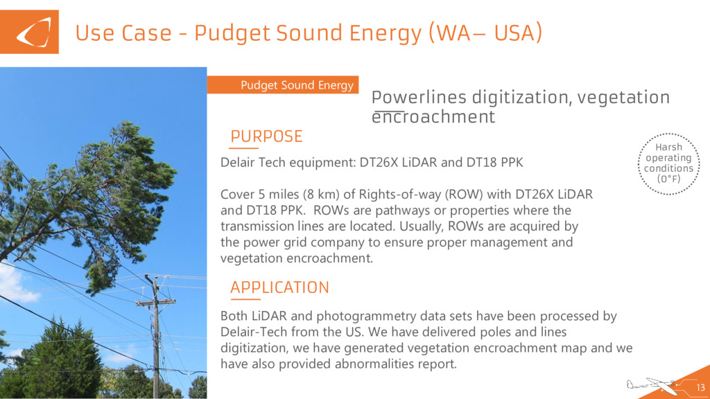
externally to third parties outside Delair-Tech. Use Case - Pudget Sound Energy (WA– USA) 13 Pudget Sound Energy Powerlines digitization, vegetation encroachment Harsh operating conditions (0°F) APPLICATION PURPOSE Delair Tech equipment: DT26X LiDAR and DT18 PPK Cover 5 miles (8 km) of Rights-of-way (ROW) with DT26X LiDAR and DT18 PPK. ROWs are pathways or properties where the transmission lines are located. Usually, ROWs are acquired by the power grid company to ensure proper management and vegetation encroachment. Both LiDAR and photogrammetry data sets have been processed by Delair-Tech from the US. We have delivered poles and lines digitization, we have generated vegetation encroachment map and we have also provided abnormalities report.
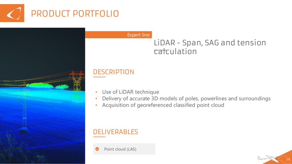
externally to third parties outside Delair-Tech. PRODUCT PORTFOLIO 14 Expert line LiDAR - Span, SAG and tension calculation DELIVERABLES • Use of LiDAR technique • Delivery of accurate 3D models of poles, powerlines and surroundings • Acquisition of georeferenced classified point cloud Point cloud (LAS) DESCRIPTION
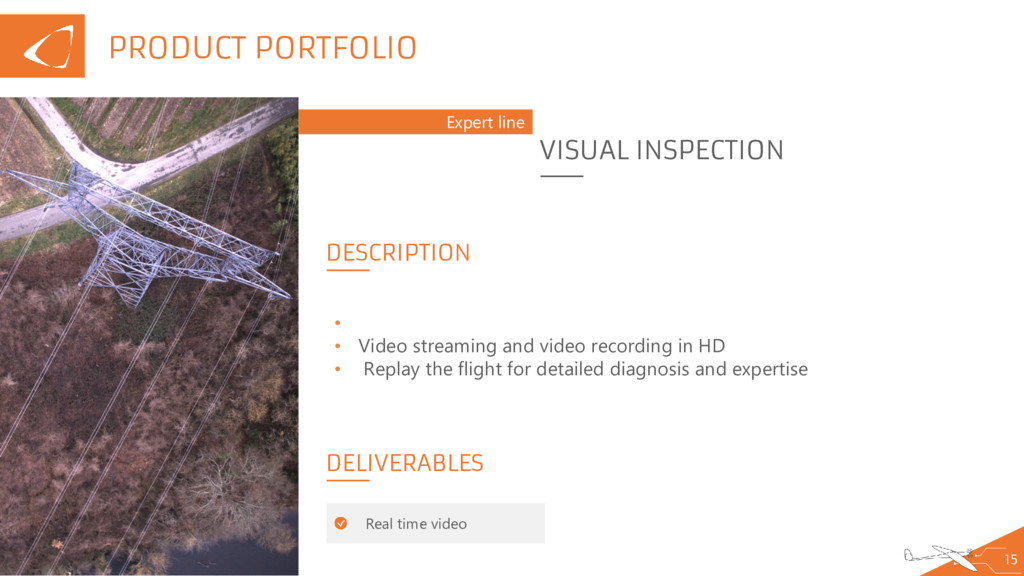
externally to third parties outside Delair-Tech. PRODUCT PORTFOLIO 15 Expert line VISUAL INSPECTION DELIVERABLES • • Video streaming and video recording in HD • Replay the flight for detailed diagnosis and expertise Real time video DESCRIPTION
externally to third parties outside Delair-Tech. PRODUCT PORTFOLIO 16 Expert line 3D TERRAIN MODEL DESIGN DELIVERABLES • High accuracy photogrammetry or LiDAR model • Valid solution for overhead line construction or underground route • DEM generation • Point cloud (LAS) DESCRIPTION
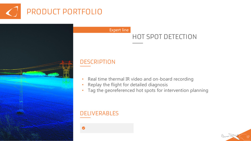
externally to third parties outside Delair-Tech. PRODUCT PORTFOLIO 17 Expert line HOT SPOT DETECTION DELIVERABLES • Real time thermal IR video and on-board recording • Replay the flight for detailed diagnosis • Tag the georeferenced hot spots for intervention planning DESCRIPTION
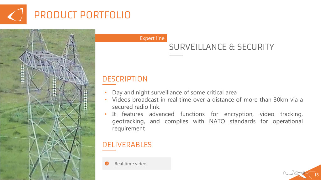
externally to third parties outside Delair-Tech. PRODUCT PORTFOLIO 18 Expert line SURVEILLANCE & SECURITY DELIVERABLES • Day and night surveillance of some critical area • Videos broadcast in real time over a distance of more than 30km via a secured radio link. • It features advanced functions for encryption, video tracking, geotracking, and complies with NATO standards for operational requirement Real time video DESCRIPTION
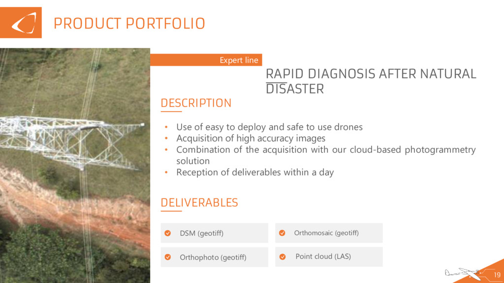
externally to third parties outside Delair-Tech. PRODUCT PORTFOLIO 19 Expert line RAPID DIAGNOSIS AFTER NATURAL DISASTER DELIVERABLES Point cloud (LAS) • Use of easy to deploy and safe to use drones • Acquisition of high accuracy images • Combination of the acquisition with our cloud-based photogrammetry solution • Reception of deliverables within a day DSM (geotiff) Orthophoto (geotiff) Orthomosaic (geotiff) DESCRIPTION
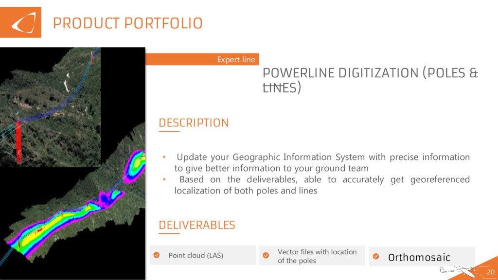
externally to third parties outside Delair-Tech. PRODUCT PORTFOLIO 20 Expert line POWERLINE DIGITIZATION (POLES & LINES) DELIVERABLES • Update your Geographic Information System with precise information to give better information to your ground team • Based on the deliverables, able to accurately get georeferenced localization of both poles and lines Point cloud (LAS) DESCRIPTION Vector files with location of the poles Orthomosaic
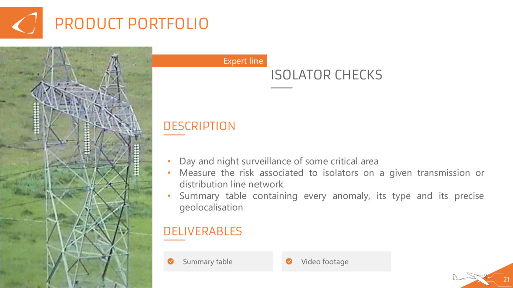
externally to third parties outside Delair-Tech. PRODUCT PORTFOLIO 21 Expert line ISOLATOR CHECKS DELIVERABLES • Day and night surveillance of some critical area • Measure the risk associated to isolators on a given transmission or distribution line network • Summary table containing every anomaly, its type and its precise geolocalisation Summary table DESCRIPTION Video footage
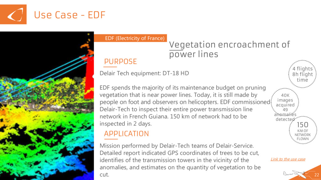
externally to third parties outside Delair-Tech. Use Case - EDF 22 EDF (Electricity of France) Vegetation encroachment of power lines 4 flights 8h flight time 40K images acquired 49 anomalies detected APPLICATION Link to the use case 150 KM OF NETWORK FLOWN PURPOSE Delair Tech equipment: DT-18 HD EDF spends the majority of its maintenance budget on pruning vegetation that is near power lines. Today, it is still made by people on foot and observers on helicopters. EDF commissioned Delair-Tech to inspect their entire power transmission line network in French Guiana. 150 km of network had to be inspected in 2 days. Mission performed by Delair-Tech teams of Delair-Service. Detailed report indicated GPS coordinates of trees to be cut, identifies of the transmission towers in the vicinity of the anomalies, and estimates on the quantity of vegetation to be cut.