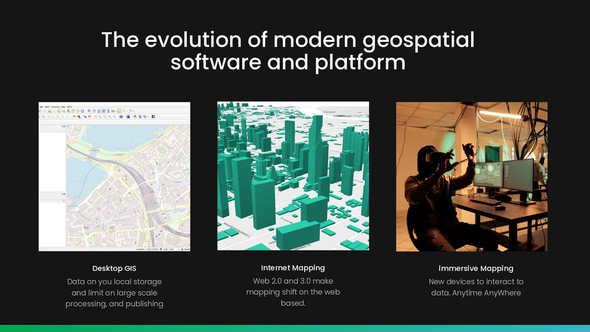
Data on you local storage and limit on large scale processing, and publishing Internet Mapping Web 2.0 and 3.0 make mapping shift on the web based. immersive Mapping New devices to interact to data. Anytime AnyWhere
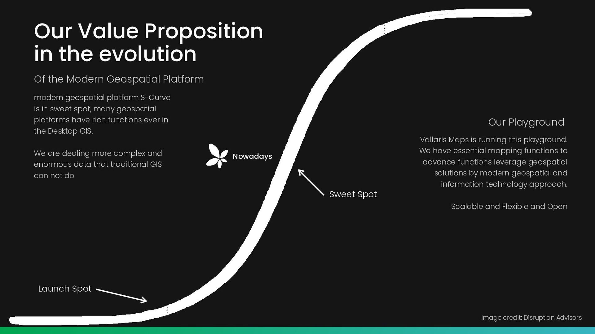
Platform Nowadays Vallaris Maps is running this playground. We have essential mapping functions to advance functions leverage geospatial solutions by modern geospatial and information technology approach. Scalable and Flexible and Open modern geospatial platform S-Curve is in sweet spot, many geospatial platforms have rich functions ever in the Desktop GIS. We are dealing more complex and enormous data that traditional GIS can not do Sweet Spot Launch Spot Image credit: Disruption Advisors Our Playground
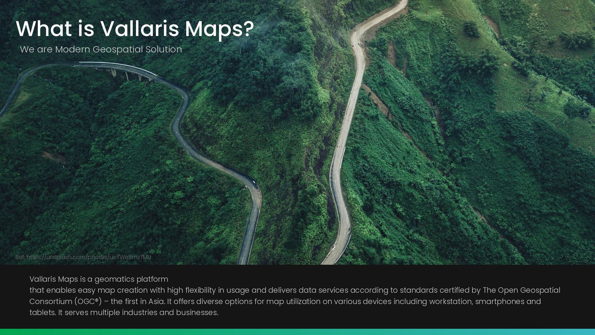
https://unsplash.com/photos/ucYWe5mzTMU Vallaris Maps is a geomatics platform that enables easy map creation with high flexibility in usage and delivers data services according to standards certified by The Open Geospatial Consortium (OGC®) – the first in Asia. It offers diverse options for map utilization on various devices including workstation, smartphones and tablets. It serves multiple industries and businesses.
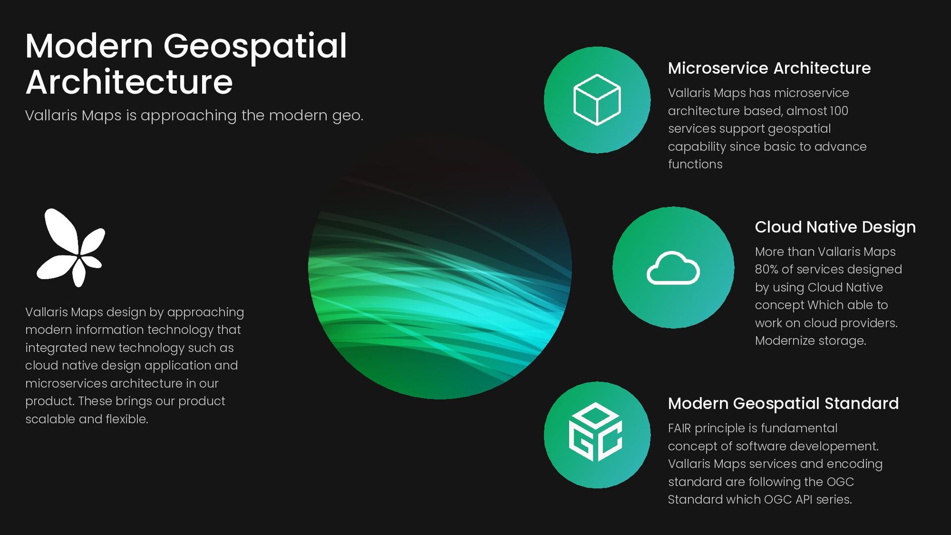
services support geospatial capability since basic to advance functions Modern Geospatial Standard FAIR principle is fundamental concept of software developement. Vallaris Maps services and encoding standard are following the OGC Standard which OGC API series. Cloud Native Design More than Vallaris Maps 80% of services designed by using Cloud Native concept Which able to work on cloud providers. Modernize storage. Vallaris Maps design by approaching modern information technology that integrated new technology such as cloud native design application and microservices architecture in our product. These brings our product scalable and flexible. Modern Geospatial Architecture Vallaris Maps is approaching the modern geo.
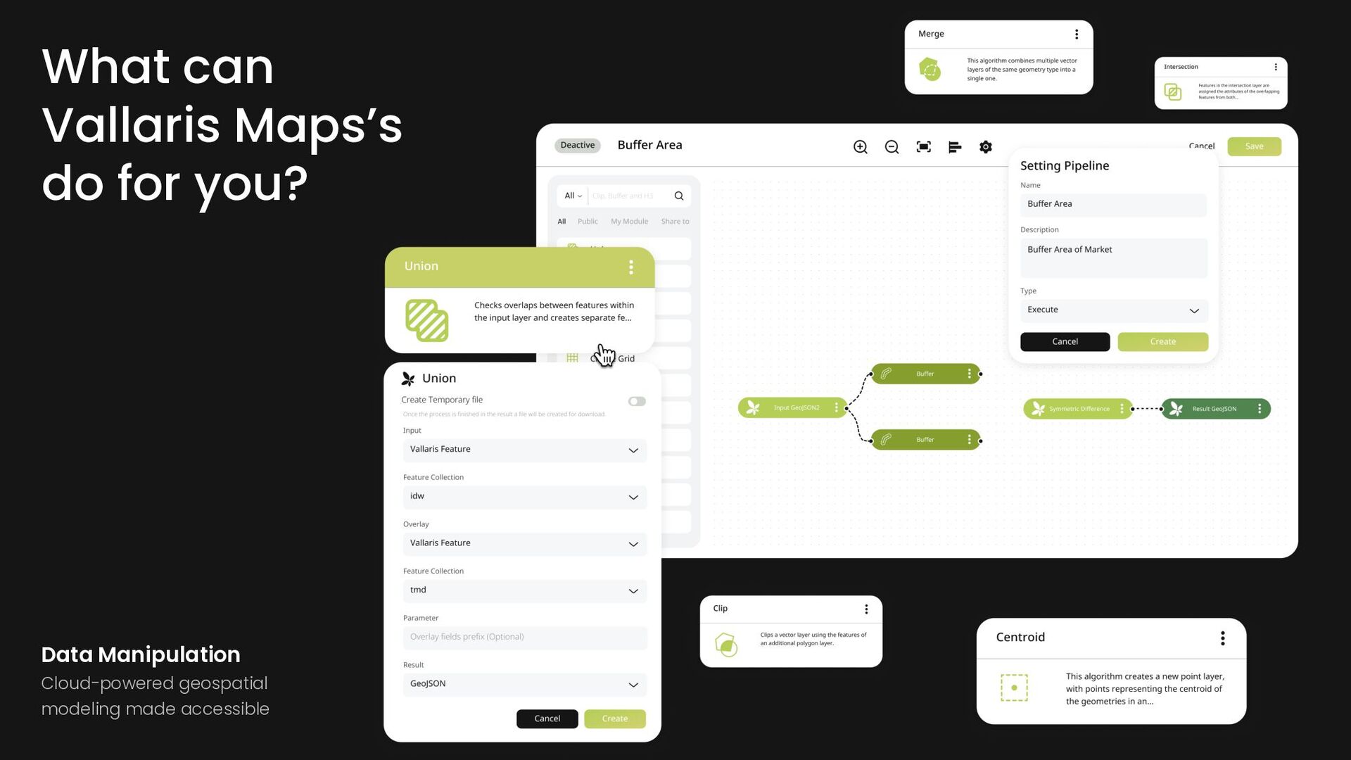
sensor data from multiple sensors may have multiple system to handle but Vallaris Streaming provide channels support multiple sources to single standard services. What can Vallaris Maps’s do for you?
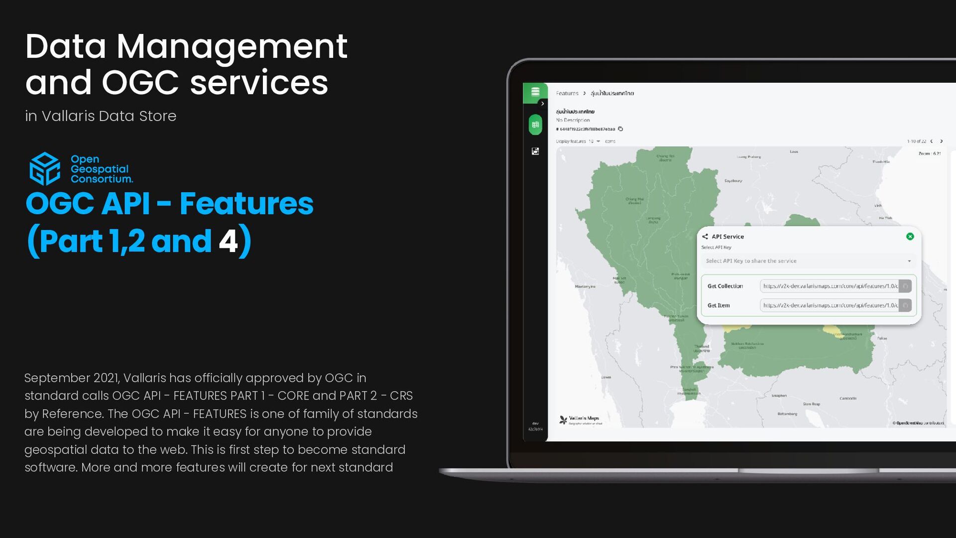
calls OGC API - FEATURES PART 1 - CORE and PART 2 - CRS by Reference. The OGC API - FEATURES is one of family of standards are being developed to make it easy for anyone to provide geospatial data to the web. This is first step to become standard software. More and more features will create for next standard Data Management and OGC services in Vallaris Data Store OGC API - Features (Part 1,2 and 4)
trying follow the OGC API - Coverages specification. On this released Vallaris is able to provide API services in coverage json encoding and which linked to resource. Data Management and OGC services in Vallaris Data Store OGC API - Coverages Service in CovJSON Stored in COG and thumbnail
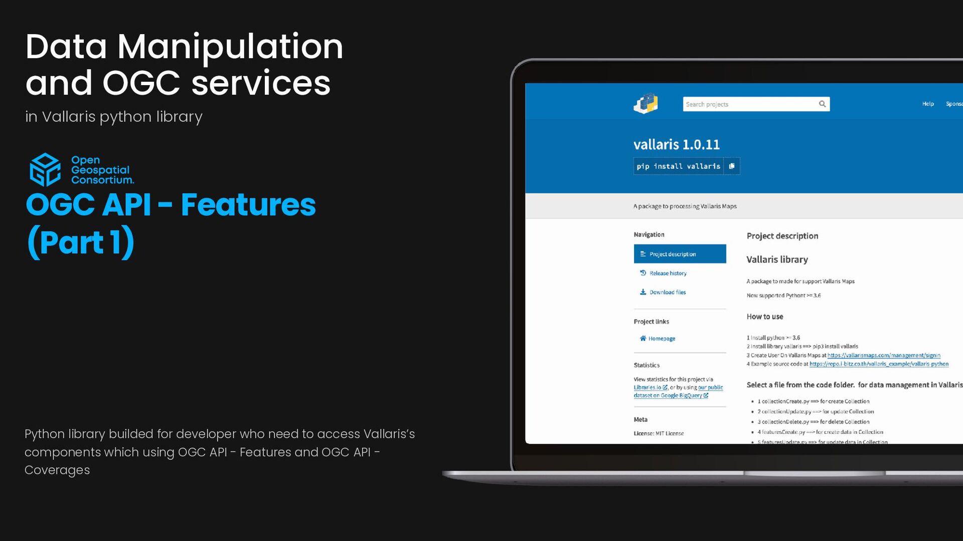
API - Features (Part 1) Python library builded for developer who need to access Vallaris’s components which using OGC API - Features and OGC API - Coverages
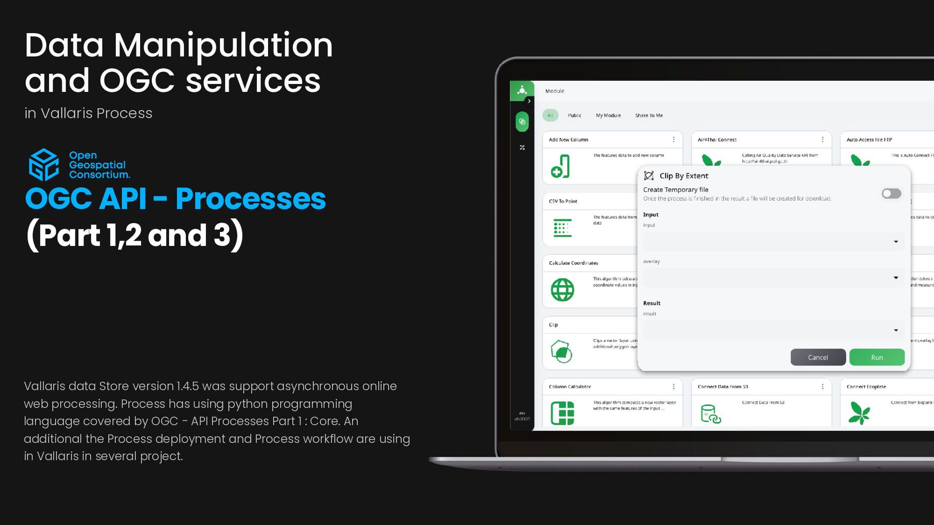
processing. Process has using python programming language covered by OGC - API Processes Part 1 : Core. An additional the Process deployment and Process workflow are using in Vallaris in several project. Data Manipulation and OGC services in Vallaris Process OGC API - Processes (Part 1,2 and 3)
- Processes (Part 1,2 and 3) Vallaris data Store version 1.4.5 was support asynchronous online web processing. Process has using python programming language covered by OGC - API Processes Part 1 : Core. An additional the Process deployment and Process workflow are using in Vallaris in several project.
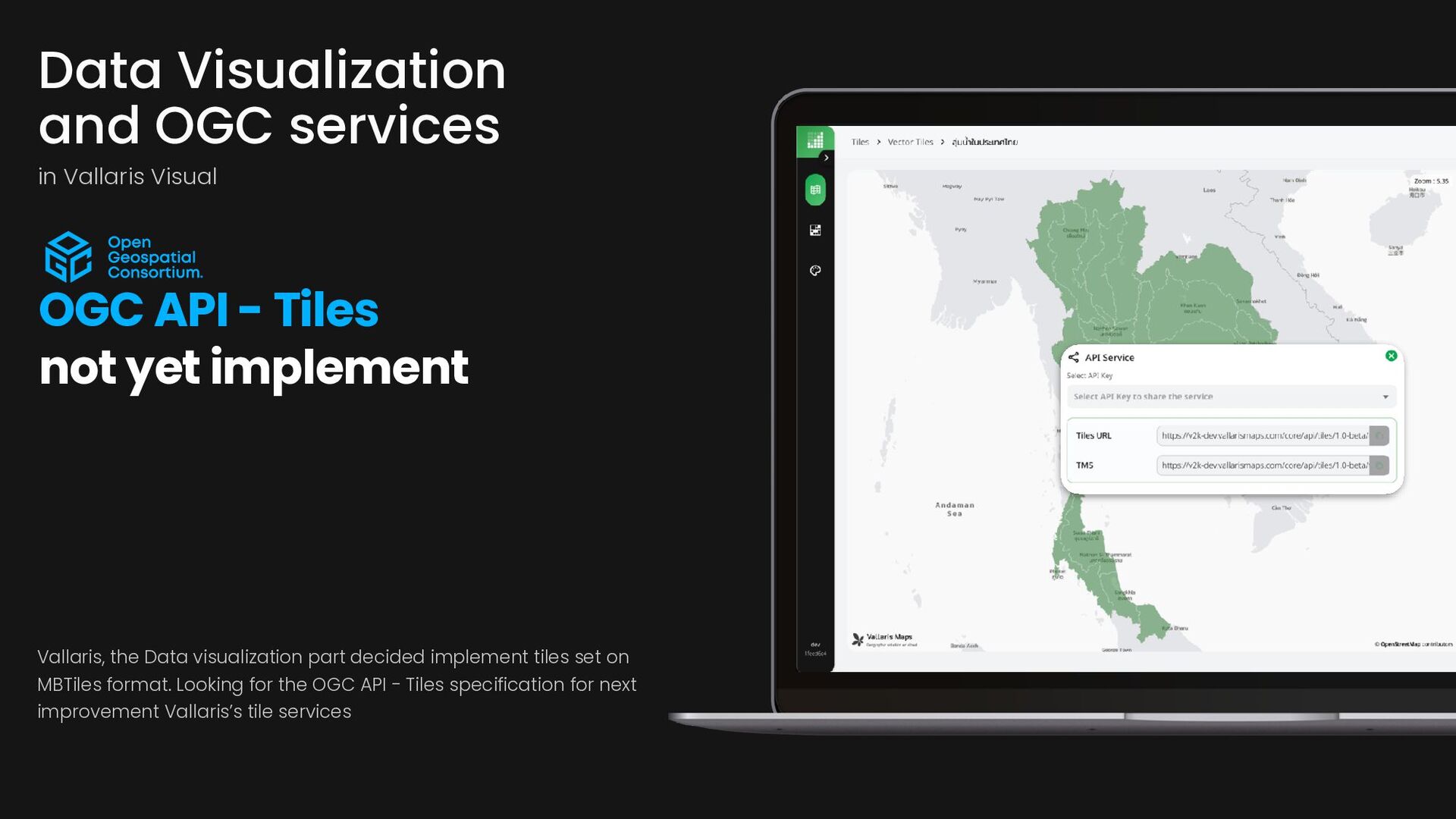
MBTiles format. Looking for the OGC API - Tiles specification for next improvement Vallaris’s tile services Data Visualization and OGC services in Vallaris Visual OGC API - Tiles not yet implement
- Tiles not yet implement Vallaris, the Data visualization part decided implement tiles set on MBTiles format. Looking for the OGC API - Tiles specification for next improvement Vallaris’s tile services
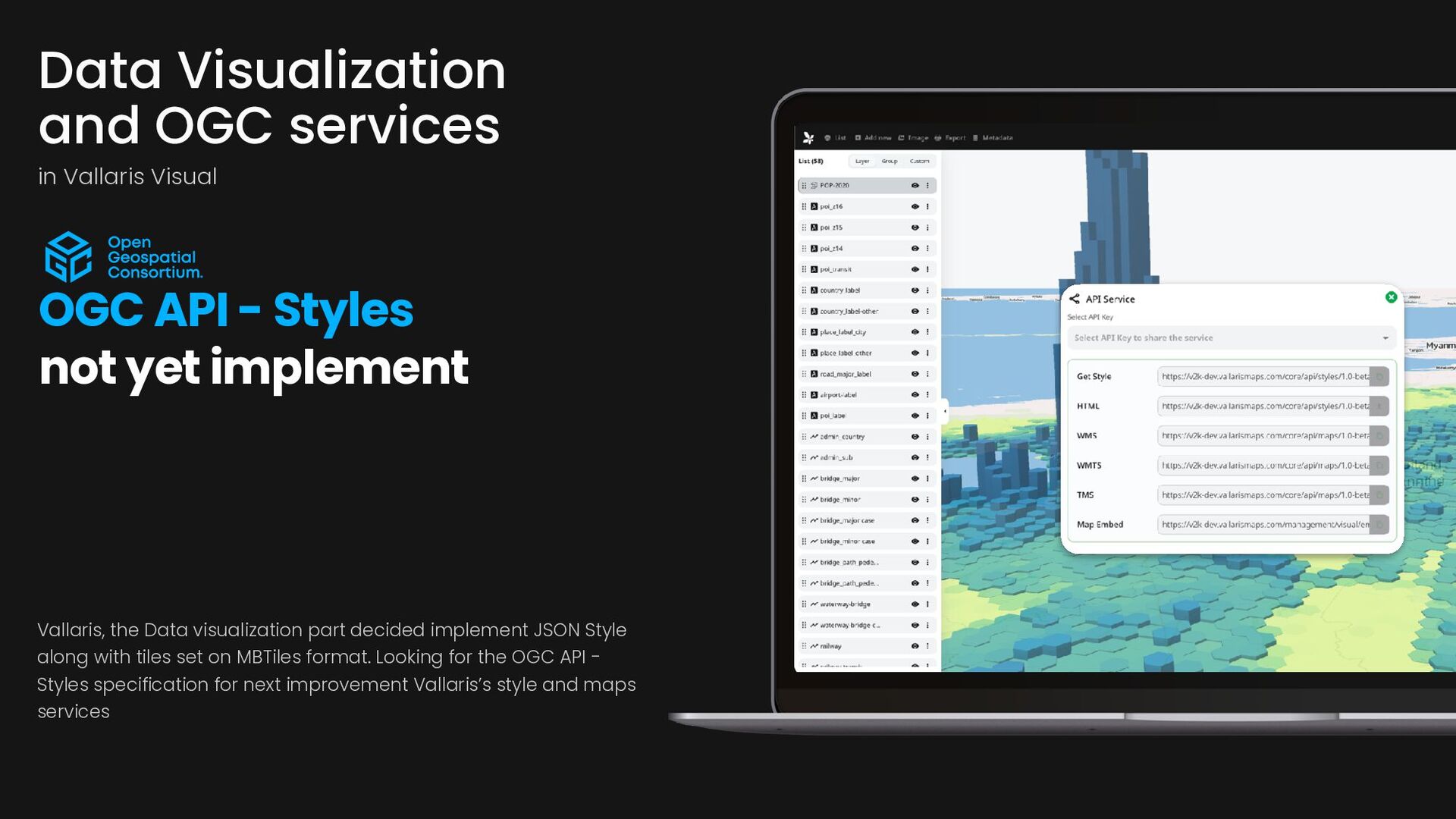
- Styles not yet implement Vallaris, the Data visualization part decided implement JSON Style along with tiles set on MBTiles format. Looking for the OGC API - Styles specification for next improvement Vallaris’s style and maps services
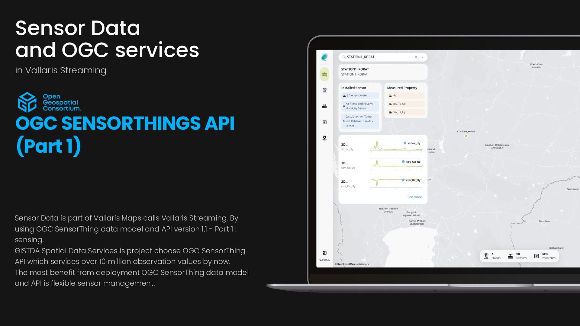
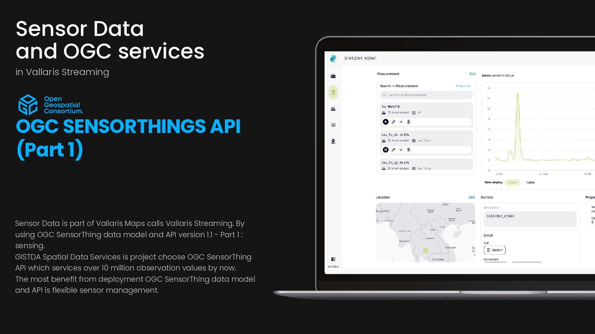
By using OGC SensorThing data model and API version 1.1 - Part 1 : sensing. GISTDA Spatial Data Services is project choose OGC SensorThing API which services over 10 million observation values by now. The most benefit from deployment OGC SensorThing data model and API is flexible sensor management. Sensor Data and OGC services in Vallaris Streaming OGC SENSORTHINGS API (Part 1)
API (Part 1) Sensor Data is part of Vallaris Maps calls Vallaris Streaming. By using OGC SensorThing data model and API version 1.1 - Part 1 : sensing. GISTDA Spatial Data Services is project choose OGC SensorThing API which services over 10 million observation values by now. The most benefit from deployment OGC SensorThing data model and API is flexible sensor management.
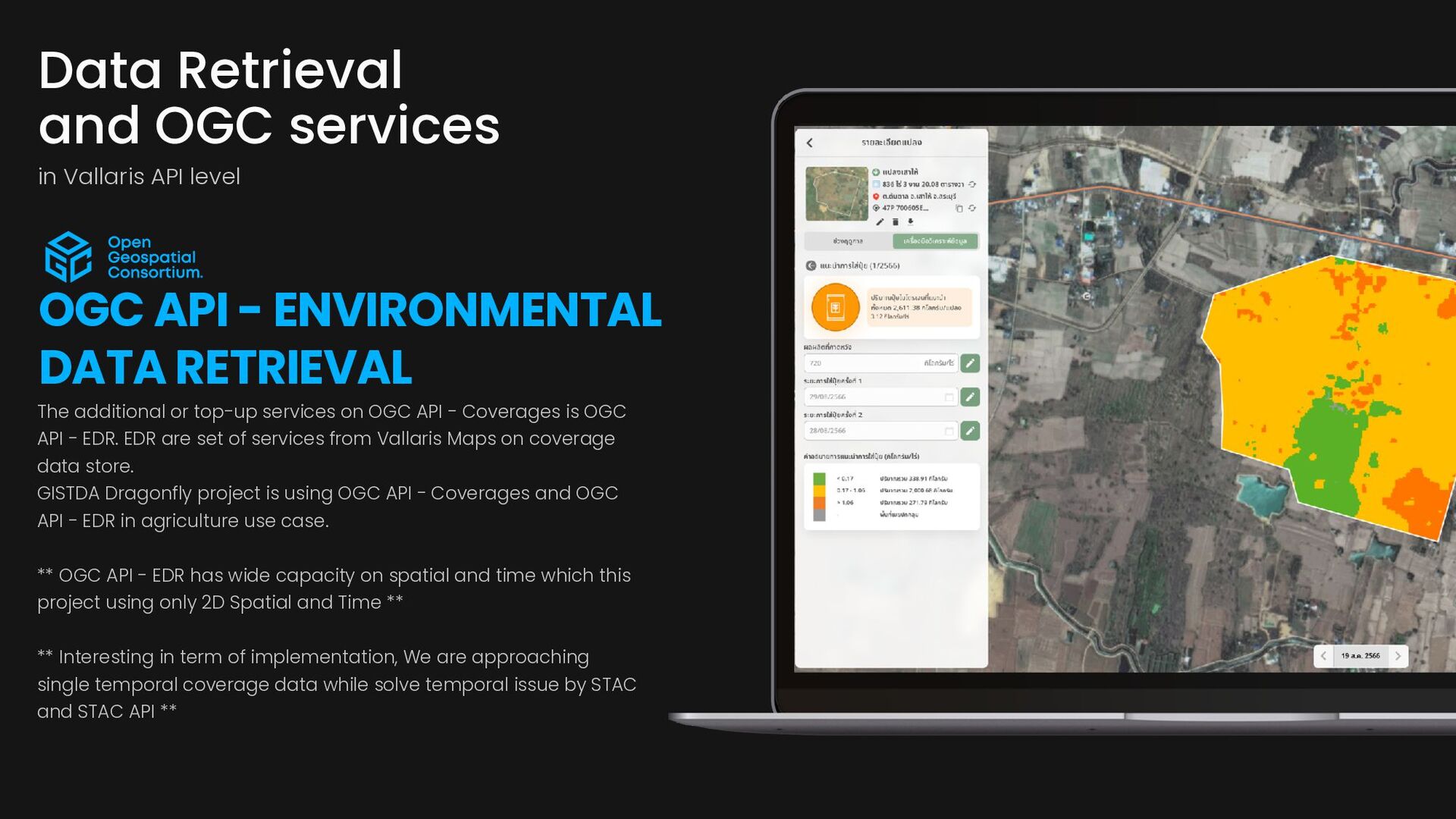
is OGC API - EDR. EDR are set of services from Vallaris Maps on coverage data store. GISTDA Dragonfly project is using OGC API - Coverages and OGC API - EDR in agriculture use case. ** OGC API - EDR has wide capacity on spatial and time which this project using only 2D Spatial and Time ** ** Interesting in term of implementation, We are approaching single temporal coverage data while solve temporal issue by STAC and STAC API ** Data Retrieval and OGC services in Vallaris API level OGC API - ENVIRONMENTAL DATA RETRIEVAL
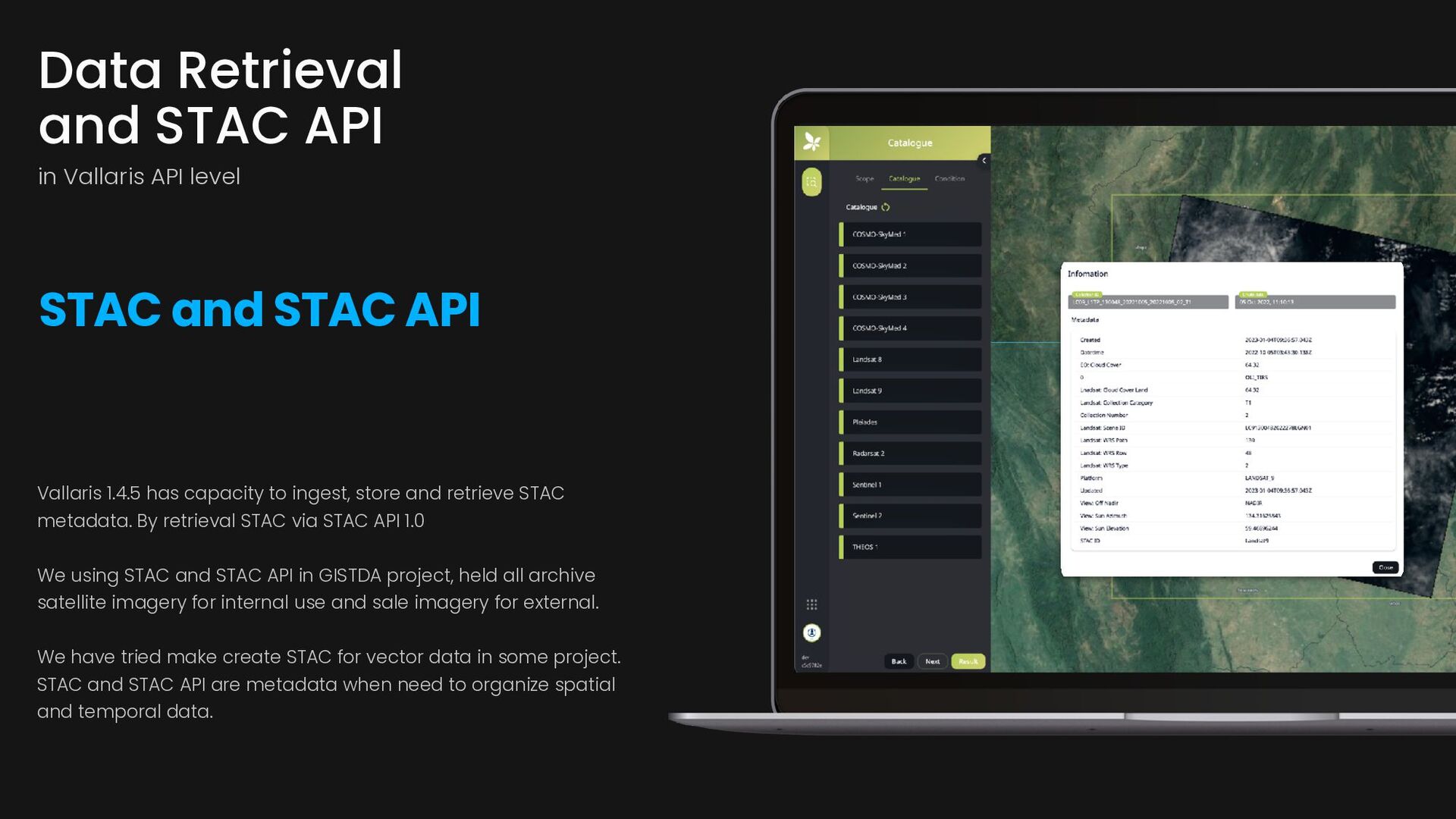
metadata. By retrieval STAC via STAC API 1.0 We using STAC and STAC API in GISTDA project, held all archive satellite imagery for internal use and sale imagery for external. We have tried make create STAC for vector data in some project. STAC and STAC API are metadata when need to organize spatial and temporal data. Data Retrieval and STAC API in Vallaris API level STAC and STAC API
any time on (phone cell) or contact us by (email). We will get back to you as soon as we can I-bitz company limited 56/3 Soi Bunyu, Dindang rd. Phayathai Bangkok, Thailand 10400 Office Hours Monday-Friday 09.00-17.00 Get In Touch (+66) 2278 7913 More Information www.i-bitz.co.th [email protected] Contact Us Geo Connect Asia 2024, 6-7 March 2024, Singapore