Upgrade to Pro — share decks privately, control downloads, hide ads and more …

Current status and challenges of FOSS4G's Japan...

Sponsored · SiteGround - Reliable hosting with speed, security, and support you can count on.
Avatar for Kayama Yoichi Kayama Yoichi
September 02, 2026

Current status and challenges of FOSS4G's Japanese localization.

FOSS4G software often has an international user base.Therefore, many FOSS4G software programs include internationalization features when they are created. These internationalization features are used to localize the software for various languages. This presentation will discuss the history, current status, and challenges of Japanese localization.

Avatar for Kayama Yoichi

Kayama Yoichi

September 02, 2026

More Decks by Kayama Yoichi

Other Decks in Technology

Transcript

  1. Self introduction Yoichi Kayama member of IT DART Programmer (IT

    Disaster Assistance and Response Team) OSGeo.JP member OSGeo.org Charter member member of GIS Association of Japan Coordinator of QGIS Japanese translation team Lecturer, Aoyama Gakuin University X ID @GsgeekO Facebook https://www.facebook.com/yoichi.kayama LinkedIn https://www.linkedin.com/in/yoichikayama/ FOSS4G 2026 Hiroshima 2 / 34
  2. The significance of software localization in Japan Many Japanese people

    are not good at English (myself included) Much of Japan's technology and culture consists of things that were imported and localized FOSS4G 2026 Hiroshima 3 / 34
  3. Many Japanese people are not good at English Japan is

    an island nation, and there was once a period when contact with foreign countries was very limited Japanese and English differ in their language structure English contains sounds that do not exist in Japanese In the past there were very few opportunities to do things together with foreigners Within FOSS4G, many people in Japan use QGIS. However, for the other FOSS4G projects listed on the OSGeo.org site, Japanese-language information is very scarce FOSS4G 2026 Hiroshima 4 / 34
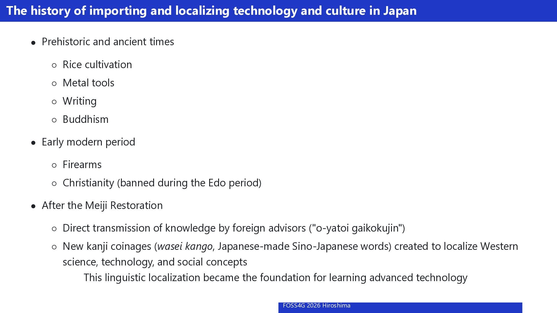
  4. The history of importing and localizing technology and culture in

    Japan Prehistoric and ancient times Rice cultivation Metal tools Writing Buddhism Early modern period Firearms Christianity (banned during the Edo period) After the Meiji Restoration Direct transmission of knowledge by foreign advisors ("o-yatoi gaikokujin") New kanji coinages (wasei kango, Japanese-made Sino-Japanese words) created to localize Western science, technology, and social concepts This linguistic localization became the foundation for learning advanced technology FOSS4G 2026 Hiroshima 5 / 34
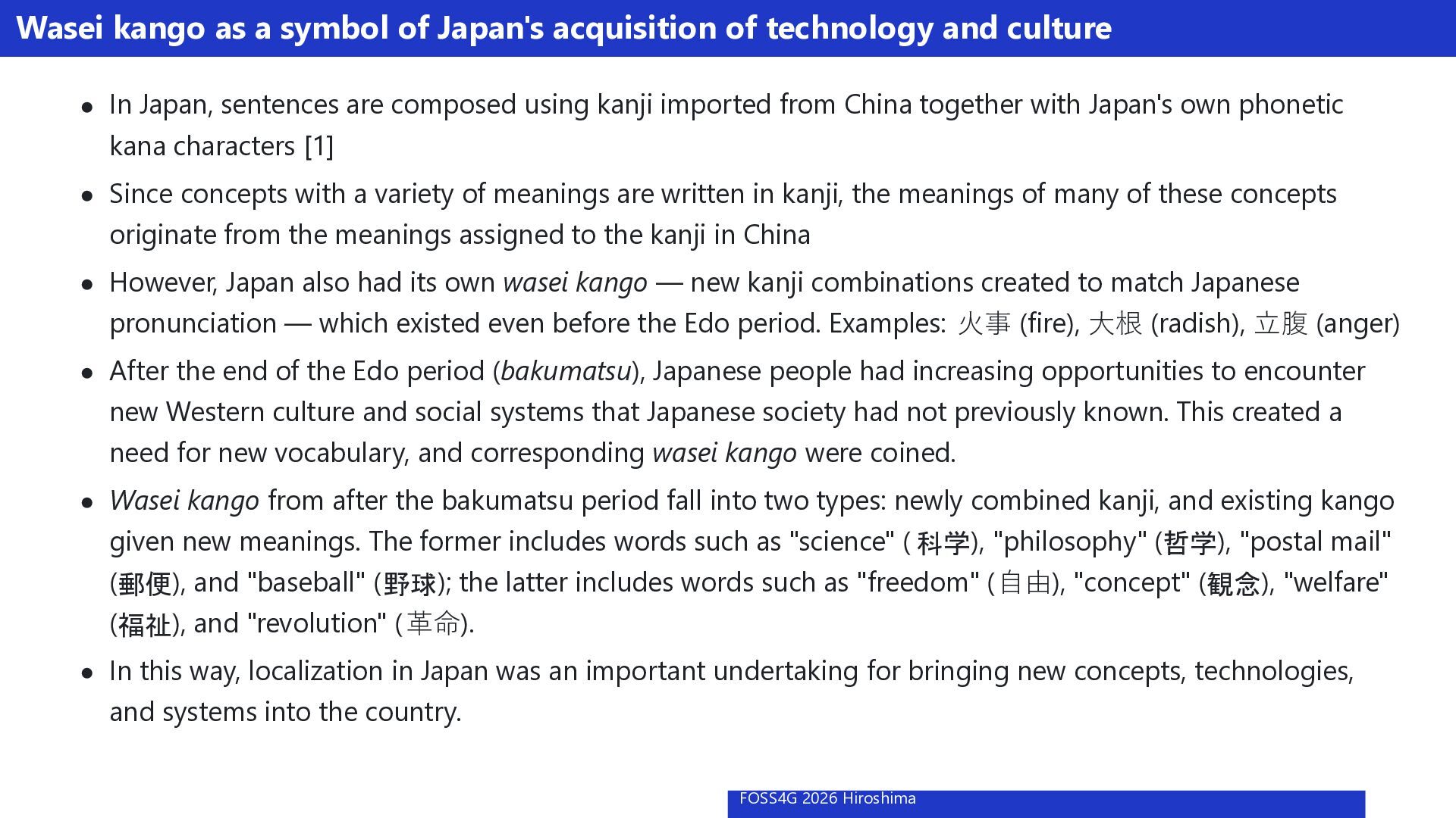
  5. Wasei kango as a symbol of Japan's acquisition of technology

    and culture In Japan, sentences are composed using kanji imported from China together with Japan's own phonetic kana characters [1] Since concepts with a variety of meanings are written in kanji, the meanings of many of these concepts originate from the meanings assigned to the kanji in China However, Japan also had its own wasei kango — new kanji combinations created to match Japanese pronunciation — which existed even before the Edo period. Examples: ⽕事 (fire), ⼤根 (radish), ⽴腹 (anger) After the end of the Edo period (bakumatsu), Japanese people had increasing opportunities to encounter new Western culture and social systems that Japanese society had not previously known. This created a need for new vocabulary, and corresponding wasei kango were coined. Wasei kango from after the bakumatsu period fall into two types: newly combined kanji, and existing kango given new meanings. The former includes words such as "science" ( 科学), "philosophy" (哲学), "postal mail" (郵便), and "baseball" ( 野球); the latter includes words such as "freedom" ( ⾃由), "concept" (観念), "welfare" (福祉), and "revolution" ( ⾰命). In this way, localization in Japan was an important undertaking for bringing new concepts, technologies, and systems into the country. FOSS4G 2026 Hiroshima 6 / 34
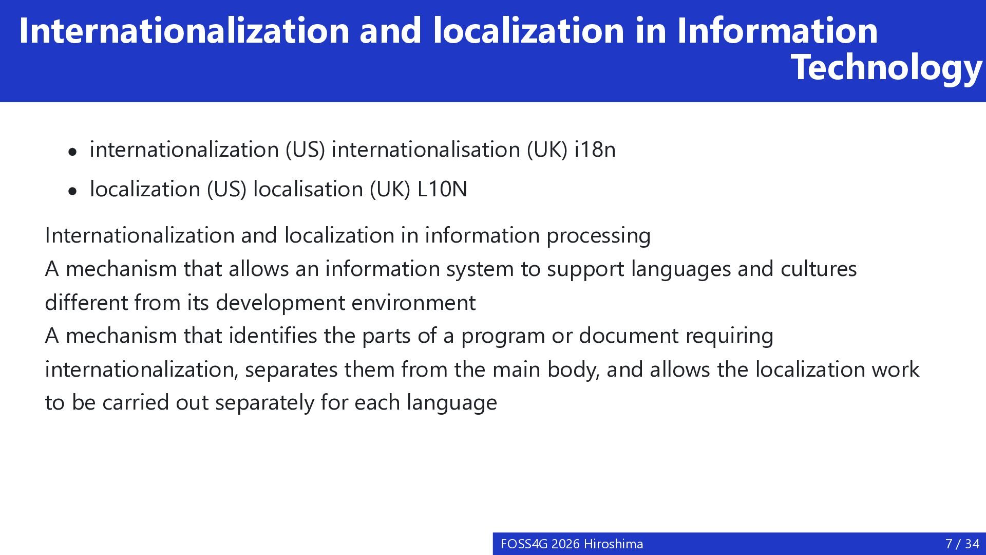
  6. Internationalization and localization in Information Technology internationalization (US) internationalisation (UK)

    i18n localization (US) localisation (UK) L10N Internationalization and localization in information processing A mechanism that allows an information system to support languages and cultures different from its development environment A mechanism that identifies the parts of a program or document requiring internationalization, separates them from the main body, and allows the localization work to be carried out separately for each language FOSS4G 2026 Hiroshima 7 / 34
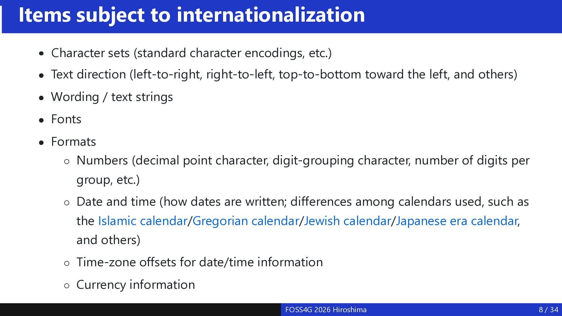
  7. Items subject to internationalization Character sets (standard character encodings, etc.)

    Text direction (left-to-right, right-to-left, top-to-bottom toward the left, and others) Wording / text strings Fonts Formats Numbers (decimal point character, digit-grouping character, number of digits per group, etc.) Date and time (how dates are written; differences among calendars used, such as the Islamic calendar/Gregorian calendar/Jewish calendar/Japanese era calendar, and others) Time-zone offsets for date/time information Currency information FOSS4G 2026 Hiroshima 8 / 34
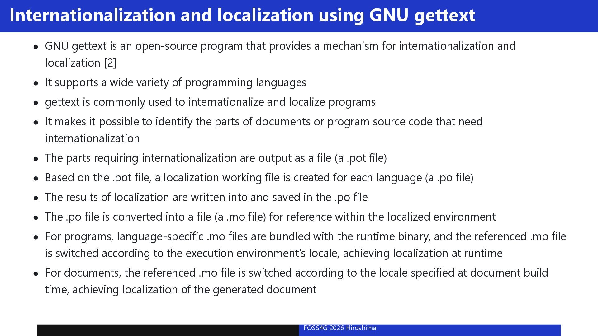
  8. Internationalization and localization using GNU gettext GNU gettext is an

    open-source program that provides a mechanism for internationalization and localization [2] It supports a wide variety of programming languages gettext is commonly used to internationalize and localize programs It makes it possible to identify the parts of documents or program source code that need internationalization The parts requiring internationalization are output as a file (a .pot file) Based on the .pot file, a localization working file is created for each language (a .po file) The results of localization are written into and saved in the .po file The .po file is converted into a file (a .mo file) for reference within the localized environment For programs, language-specific .mo files are bundled with the runtime binary, and the referenced .mo file is switched according to the execution environment's locale, achieving localization at runtime For documents, the referenced .mo file is switched according to the locale specified at document build time, achieving localization of the generated document FOSS4G 2026 Hiroshima 9 / 34
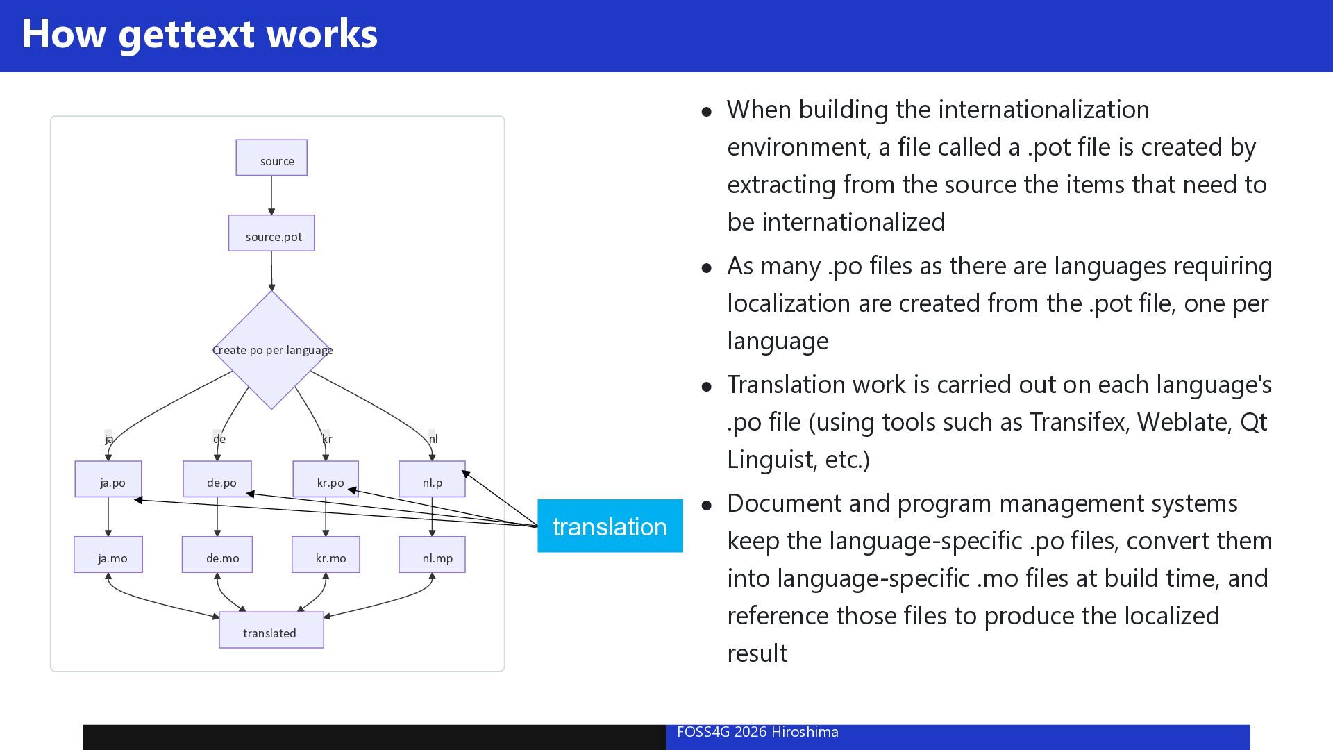
  9. How gettext works When building the internationalization environment, a file

    called a .pot file is created by extracting from the source the items that need to be internationalized source source.pot As many .po files as there are languages requiring localization are created from the .pot file, one per language Create po per language ja de kr nl ja.po de.po kr.po nl.p Translation work is carried out on each language's .po file (using tools such as Transifex, Weblate, Qt Linguist, etc.) translation ja.mo de.mo kr.mo translated nl.mp Document and program management systems keep the language-specific .po files, convert them into language-specific .mo files at build time, and reference those files to produce the localized result FOSS4G 2026 Hiroshima 10 / 34
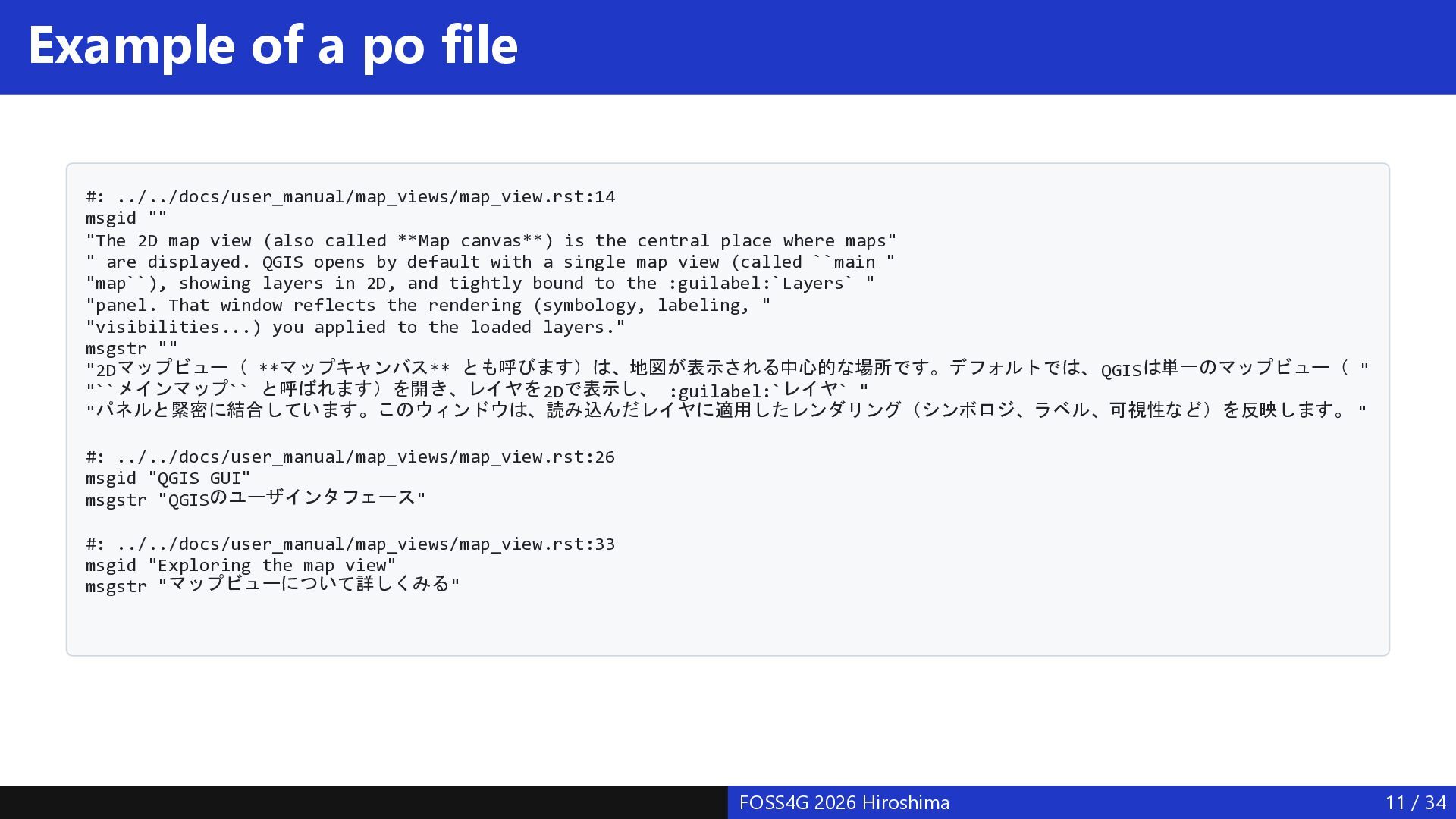
  10. Example of a po file #: ../../docs/user_manual/map_views/map_view.rst:14 msgid "" "The

    2D map view (also called **Map canvas**) is the central place where maps" " are displayed. QGIS opens by default with a single map view (called ``main " "map``), showing layers in 2D, and tightly bound to the :guilabel:`Layers` " "panel. That window reflects the rendering (symbology, labeling, " "visibilities...) you applied to the loaded layers." msgstr "" "2Dマップビュー( **マップキャンバス** とも呼びます)は、地図が表示される中心的な場所です。デフォルトでは、 QGISは単一のマップビュー( " "``メインマップ`` と呼ばれます)を開き、レイヤを 2Dで表示し、 :guilabel:`レイヤ` " "パネルと緊密に結合しています。このウィンドウは、読み込んだレイヤに適用したレンダリング(シンボロジ、ラベル、可視性など)を反映します。 " #: ../../docs/user_manual/map_views/map_view.rst:26 msgid "QGIS GUI" msgstr "QGISのユーザインタフェース " #: ../../docs/user_manual/map_views/map_view.rst:33 msgid "Exploring the map view" msgstr "マップビューについて詳しくみる " FOSS4G 2026 Hiroshima 11 / 34
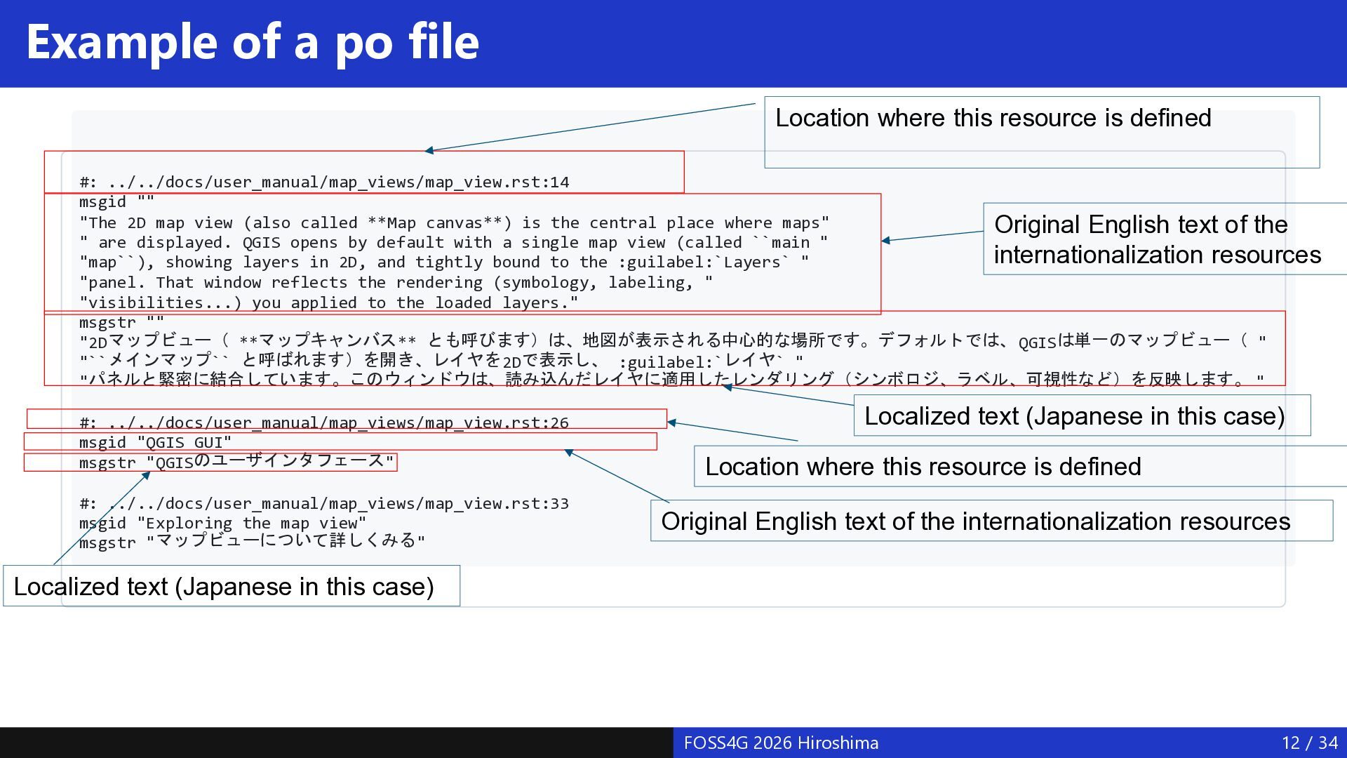
  11. Example of a po file Location where this resource is

    defined #: ../../docs/user_manual/map_views/map_view.rst:14 msgid "" "The 2D map view (also called **Map canvas**) is the central place where maps" Original English text of the " are displayed. QGIS opens by default with a single map view (called ``main " internationalization resources "map``), showing layers in 2D, and tightly bound to the :guilabel:`Layers` " "panel. That window reflects the rendering (symbology, labeling, " "visibilities...) you applied to the loaded layers." msgstr "" "2Dマップビュー( **マップキャンバス** とも呼びます)は、地図が表示される中心的な場所です。デフォルトでは、 QGISは単一のマップビュー( " "``メインマップ`` と呼ばれます)を開き、レイヤを 2Dで表示し、 :guilabel:`レイヤ` " "パネルと緊密に結合しています。このウィンドウは、読み込んだレイヤに適用したレンダリング(シンボロジ、ラベル、可視性など)を反映します。 " #: ../../docs/user_manual/map_views/map_view.rst:26 msgid "QGIS GUI" msgstr "QGISのユーザインタフェース " #: ../../docs/user_manual/map_views/map_view.rst:33 msgid "Exploring the map view" msgstr "マップビューについて詳しくみる " Localized text (Japanese in this case) Location where this resource is defined Original English text of the internationalization resources Localized text (Japanese in this case) FOSS4G 2026 Hiroshima 12 / 34
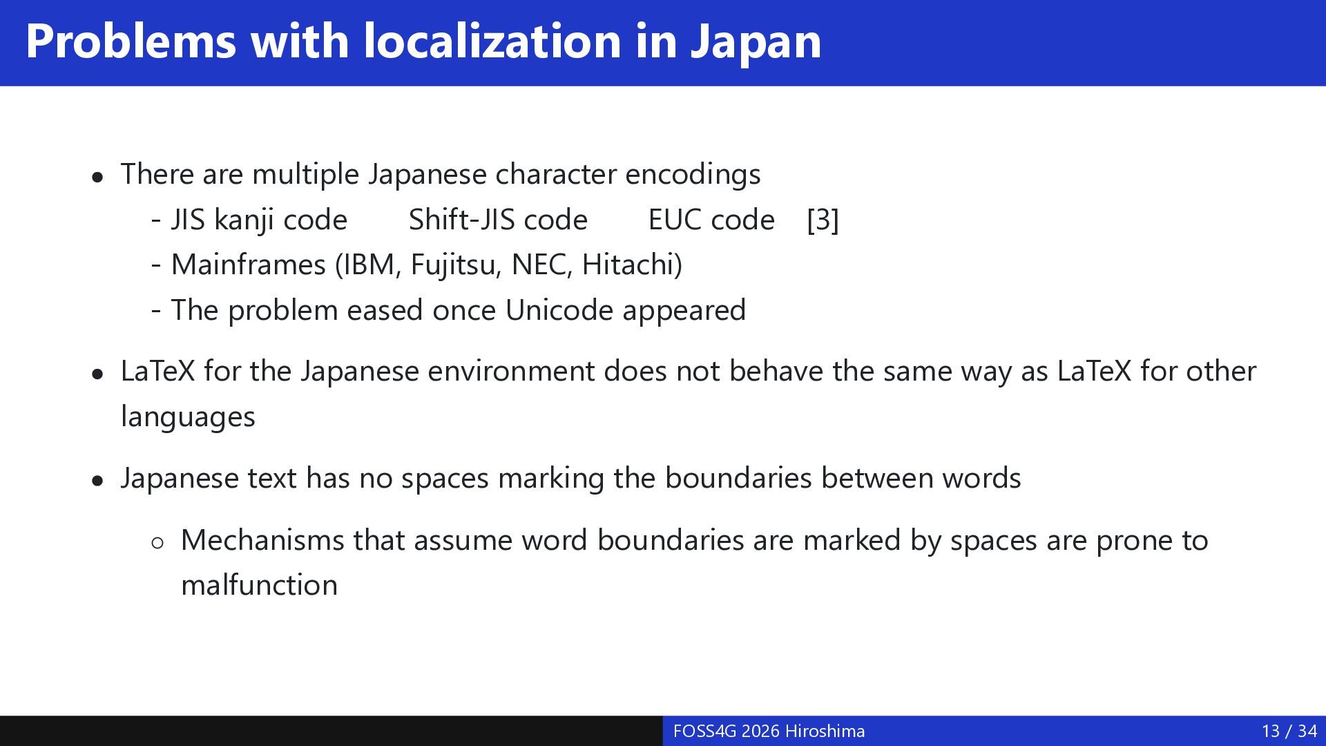
  12. Problems with localization in Japan There are multiple Japanese character

    encodings - JIS kanji code Shift-JIS code EUC code - Mainframes (IBM, Fujitsu, NEC, Hitachi) [3] - The problem eased once Unicode appeared LaTeX for the Japanese environment does not behave the same way as LaTeX for other languages Japanese text has no spaces marking the boundaries between words Mechanisms that assume word boundaries are marked by spaces are prone to malfunction FOSS4G 2026 Hiroshima 13 / 34
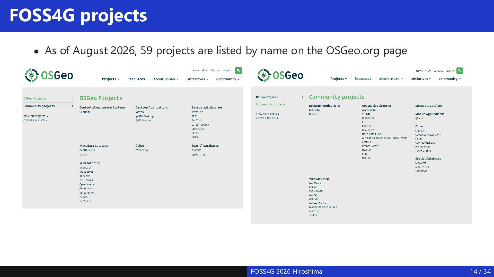
  13. FOSS4G projects As of August 2026, 59 projects are listed

    by name on the OSGeo.org page FOSS4G 2026 Hiroshima 14 / 34
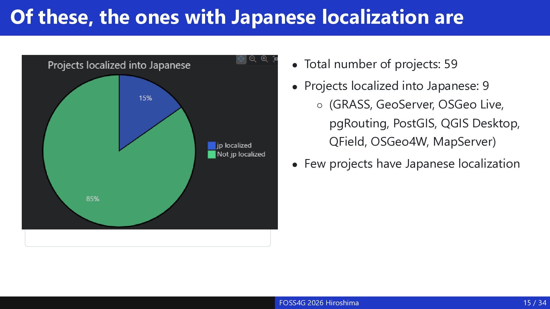
  14. Of these, the ones with Japanese localization are Total number

    of projects: 59 Projects localized into Japanese: 9 (GRASS, GeoServer, OSGeo Live, pgRouting, PostGIS, QGIS Desktop, QField, OSGeo4W, MapServer) jp localized Few projects have Japanese localization FOSS4G 2026 Hiroshima 15 / 34
  15. Japanese localization of FOSS4G software As shown in the graph

    on the previous page, only a small proportion of FOSS4G projects on OSGeo.org have Japanese localization. For systems without Japanese localization, actual usage within Japan is likely limited. I would like to introduce the Japanese localization work done for a few of these products. FOSS4G 2026 Hiroshima 16 / 34
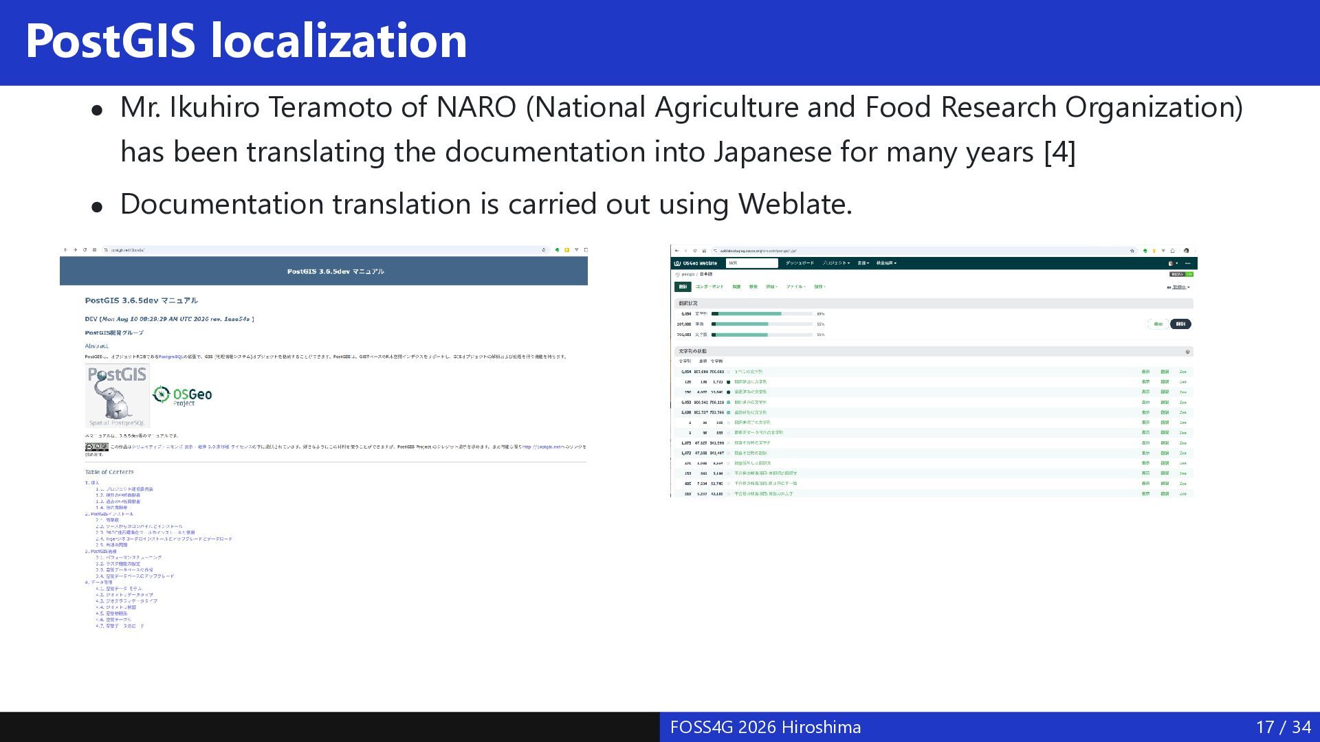
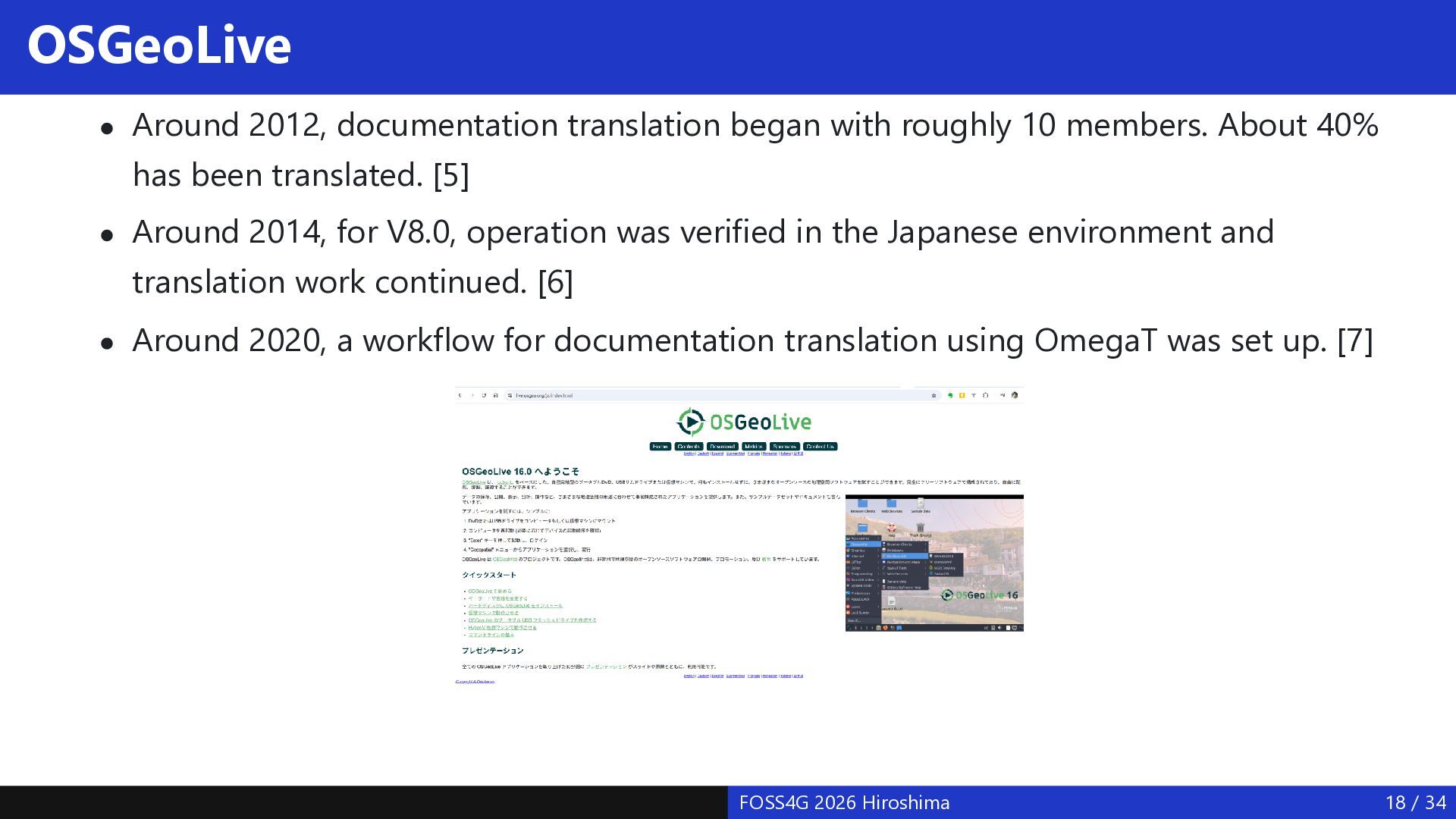
  16. PostGIS localization Mr. Ikuhiro Teramoto of NARO (National Agriculture and

    Food Research Organization) has been translating the documentation into Japanese for many years [4] Documentation translation is carried out using Weblate. FOSS4G 2026 Hiroshima 17 / 34
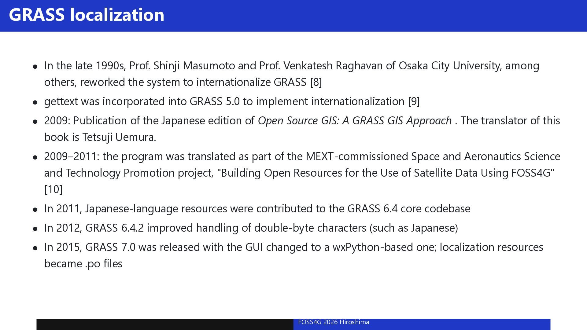
  17. OSGeoLive Around 2012, documentation translation began with roughly 10 members.

    About 40% has been translated. [5] Around 2014, for V8.0, operation was verified in the Japanese environment and translation work continued. [6] Around 2020, a workflow for documentation translation using OmegaT was set up. [7] FOSS4G 2026 Hiroshima 18 / 34
  18. GRASS localization In the late 1990s, Prof. Shinji Masumoto and

    Prof. Venkatesh Raghavan of Osaka City University, among others, reworked the system to internationalize GRASS [8] gettext was incorporated into GRASS 5.0 to implement internationalization [9] 2009: Publication of the Japanese edition of Open Source GIS: A GRASS GIS Approach . The translator of this book is Tetsuji Uemura. 2009–2011: the program was translated as part of the MEXT-commissioned Space and Aeronautics Science and Technology Promotion project, "Building Open Resources for the Use of Satellite Data Using FOSS4G" [10] In 2011, Japanese-language resources were contributed to the GRASS 6.4 core codebase In 2012, GRASS 6.4.2 improved handling of double-byte characters (such as Japanese) In 2015, GRASS 7.0 was released with the GUI changed to a wxPython-based one; localization resources became .po files FOSS4G 2026 Hiroshima 19 / 34
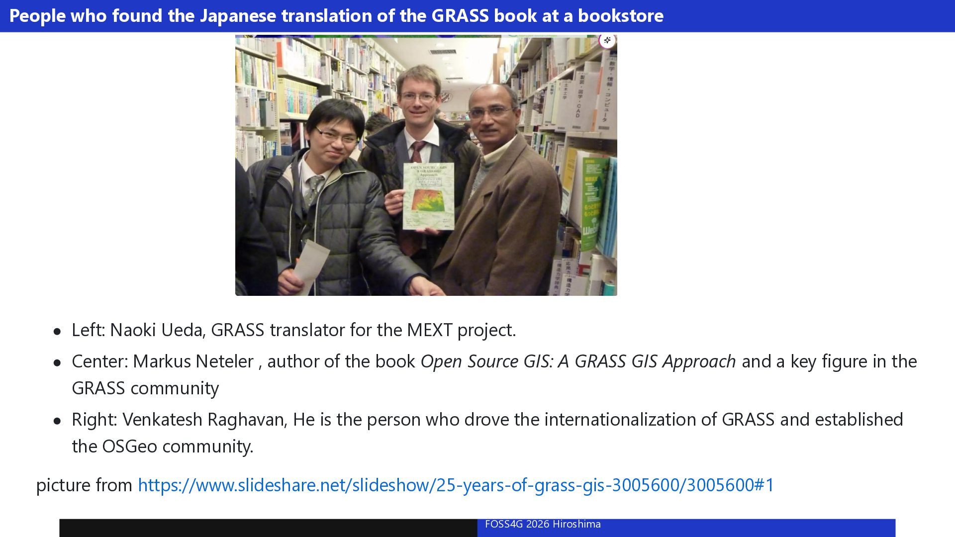
  19. People who found the Japanese translation of the GRASS book

    at a bookstore Left: Naoki Ueda, GRASS translator for the MEXT project. Center: Markus Neteler , author of the book Open Source GIS: A GRASS GIS Approach and a key figure in the GRASS community Right: Venkatesh Raghavan, He is the person who drove the internationalization of GRASS and established the OSGeo community. picture from https://www.slideshare.net/slideshow/25-years-of-grass-gis-3005600/3005600#1 FOSS4G 2026 Hiroshima 20 / 34
  20. QGIS Japanese localization Localization work possible within QGIS [11] Localization

    of the desktop program's menus and messages; localization of behavior Localization of documentation Localization of the website FOSS4G 2026 Hiroshima 21 / 34
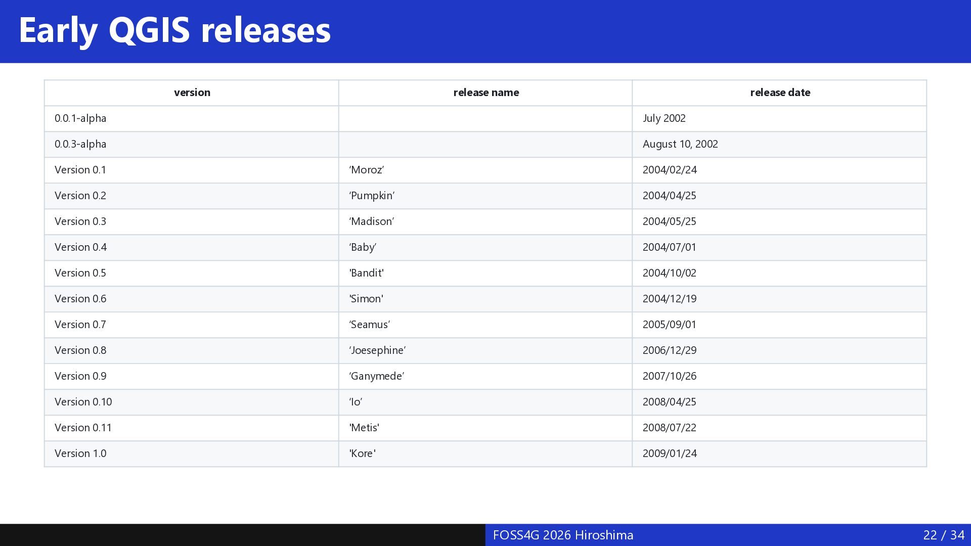
  21. Early QGIS releases version release name release date 0.0.1-alpha July

    2002 0.0.3-alpha August 10, 2002 Version 0.1 ‘Moroz’ 2004/02/24 Version 0.2 ‘Pumpkin’ 2004/04/25 Version 0.3 ‘Madison’ 2004/05/25 Version 0.4 ‘Baby’ 2004/07/01 Version 0.5 'Bandit' 2004/10/02 Version 0.6 'Simon' 2004/12/19 Version 0.7 ‘Seamus’ 2005/09/01 Version 0.8 ‘Joesephine’ 2006/12/29 Version 0.9 ‘Ganymede’ 2007/10/26 Version 0.10 ‘Io’ 2008/04/25 Version 0.11 'Metis' 2008/07/22 Version 1.0 'Kore' 2009/01/24 FOSS4G 2026 Hiroshima 22 / 34
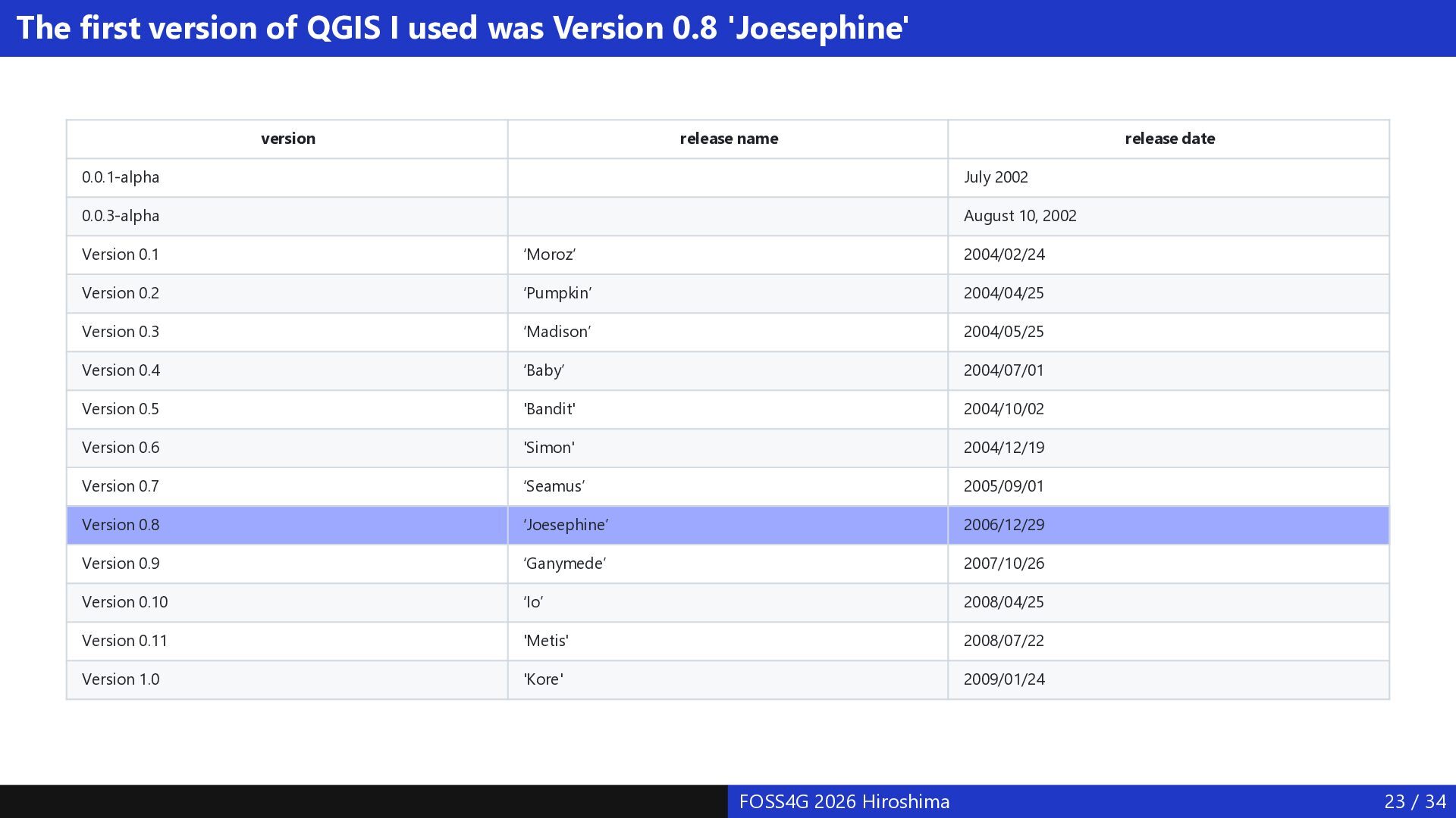
  22. The first version of QGIS I used was Version 0.8

    'Joesephine' version release name release date 0.0.1-alpha July 2002 0.0.3-alpha August 10, 2002 Version 0.1 ‘Moroz’ 2004/02/24 Version 0.2 ‘Pumpkin’ 2004/04/25 Version 0.3 ‘Madison’ 2004/05/25 Version 0.4 ‘Baby’ 2004/07/01 Version 0.5 'Bandit' 2004/10/02 Version 0.6 'Simon' 2004/12/19 Version 0.7 ‘Seamus’ 2005/09/01 Version 0.8 ‘Joesephine’ 2006/12/29 Version 0.9 ‘Ganymede’ 2007/10/26 Version 0.10 ‘Io’ 2008/04/25 Version 0.11 'Metis' 2008/07/22 Version 1.0 'Kore' 2009/01/24 FOSS4G 2026 Hiroshima 23 / 34
  23. QGIS around this time In the desktop program, about half

    of the menus were displayed in Japanese The software was unstable, and it often crashed when data file names contained Japanese characters FOSS4G 2026 Hiroshima 24 / 34
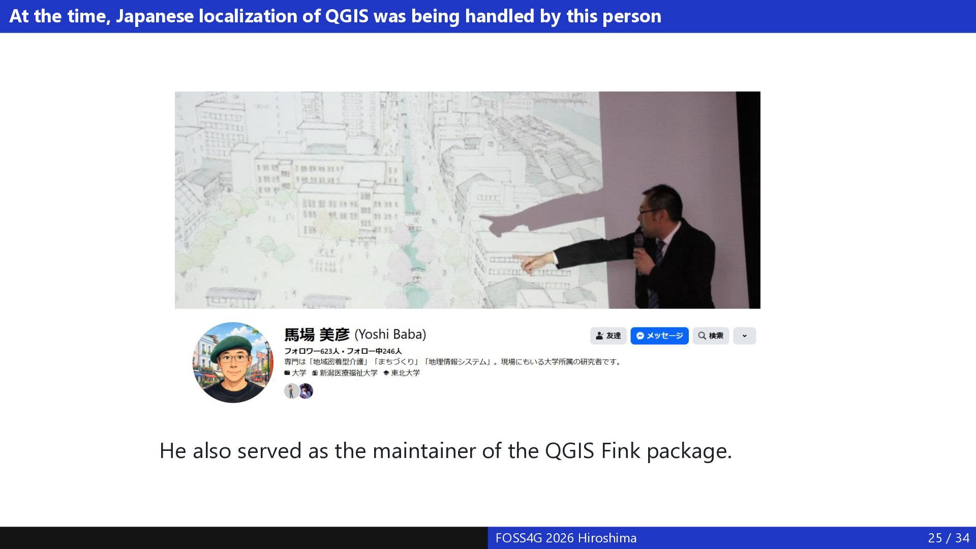
  24. At the time, Japanese localization of QGIS was being handled

    by this person He also served as the maintainer of the QGIS Fink package. FOSS4G 2026 Hiroshima 25 / 34
  25. QGIS Desktop localization work at the time From the summer

    of 2008, I began working on the Japanese localization of QGIS Desktop Desktop program localization procedure Create a .ts file (a language-specific XML file containing Qt translation resources) from the source files Translate the .ts file using Qt Linguist Convert the .ts file into a .qm file When the .qm file is loaded at program binary startup, that language becomes available The online help was written in HTML, so the HTML was translated as well Initially, a Japan-specific .qm file was created, and a custom QGIS installer built around it was produced Starting with V1.4, the Japanese .ts file began being contributed to the main QGIS repository (Subversion) I also found several places that produced errors when file or folder names contained Japanese characters, and created issues in the issue tracker and fixed the program accordingly FOSS4G 2026 Hiroshima 26 / 34
  26. QGIS Japanese localization under a MEXT-commissioned project 2009–2011: MEXT (Ministry

    of Education, Culture, Sports, Science and Technology)-commissioned Space and Aeronautics Science and Technology Promotion project, "Building Open Resources for the Use of Satellite Data Using FOSS4G" [10] Members gathered around OSGeo.JP took on this MEXT-commissioned project, and included localization of the QGIS program and documentation as part of the work For three years I was able to carry out QGIS localization work as part of my job at the company I belonged to at the time Carried out Japanese localization of the QGIS 1.6 User Guide and Developers Guide At the time, the documentation was written in LaTeX. Even when Japanese text was inserted into the English LaTeX source, functions such as table-of-contents generation did not work correctly — but Mr. Nuimura (then at Nagoya University) adjusted LaTeX so that PDF and HTML could be generated properly The LaTeX improvements made here were also used for compiling the Korean and Tamil QGIS documentation Many organizations took part in this MEXT project, and the evaluation after its completion was rated "S" (top rating) FOSS4G 2026 Hiroshima 27 / 34
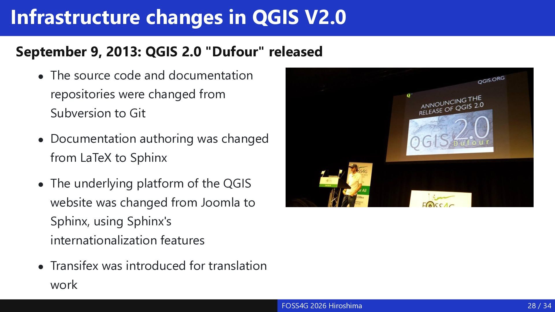
  27. Infrastructure changes in QGIS V2.0 September 9, 2013: QGIS 2.0

    "Dufour" released The source code and documentation repositories were changed from Subversion to Git Documentation authoring was changed from LaTeX to Sphinx The underlying platform of the QGIS website was changed from Joomla to Sphinx, using Sphinx's internationalization features Transifex was introduced for translation work FOSS4G 2026 Hiroshima 28 / 34
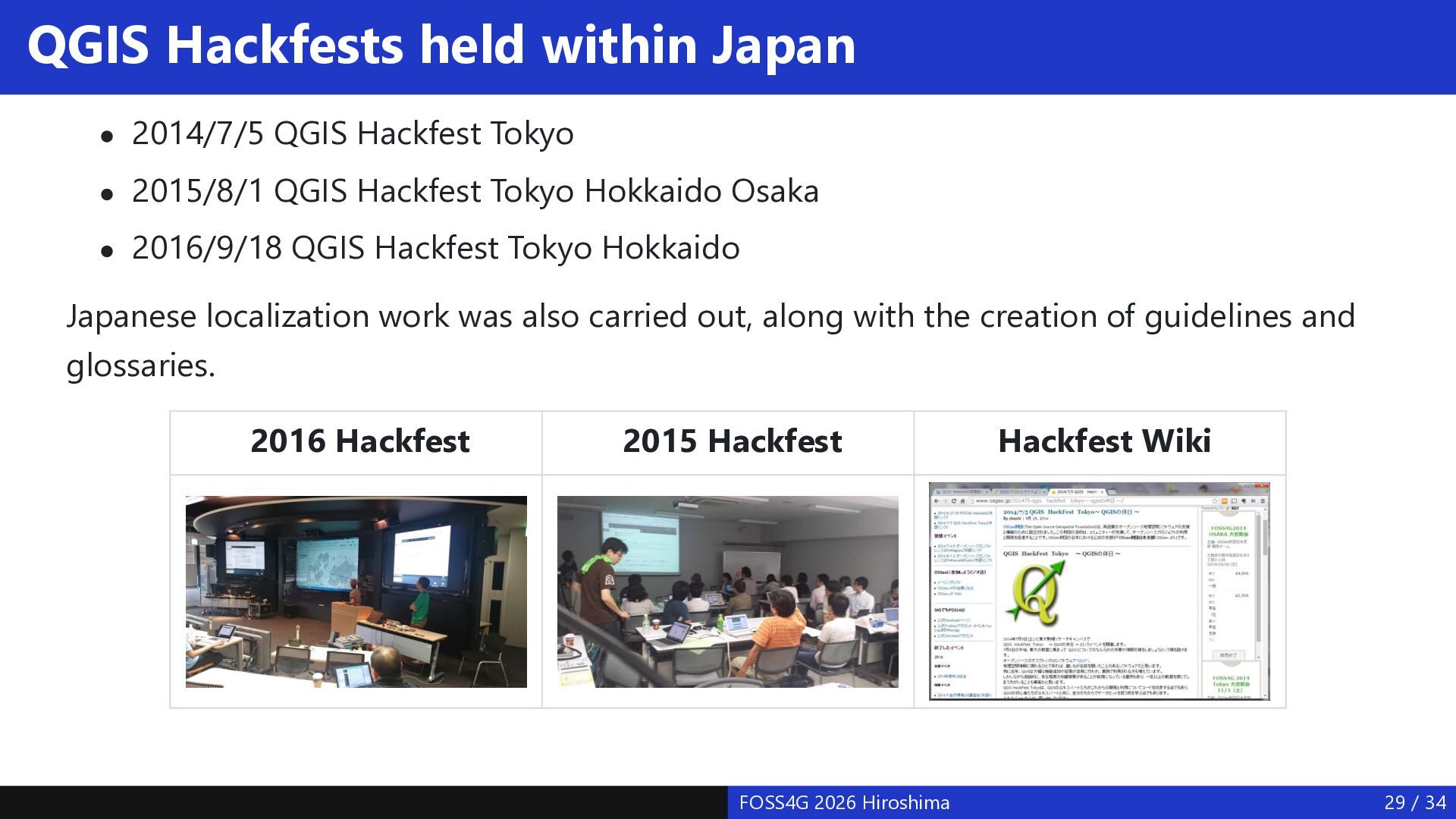
  28. QGIS Hackfests held within Japan 2014/7/5 QGIS Hackfest Tokyo 2015/8/1

    QGIS Hackfest Tokyo Hokkaido Osaka 2016/9/18 QGIS Hackfest Tokyo Hokkaido Japanese localization work was also carried out, along with the creation of guidelines and glossaries. 2016 Hackfest 2015 Hackfest FOSS4G 2026 Hiroshima Hackfest Wiki 29 / 34
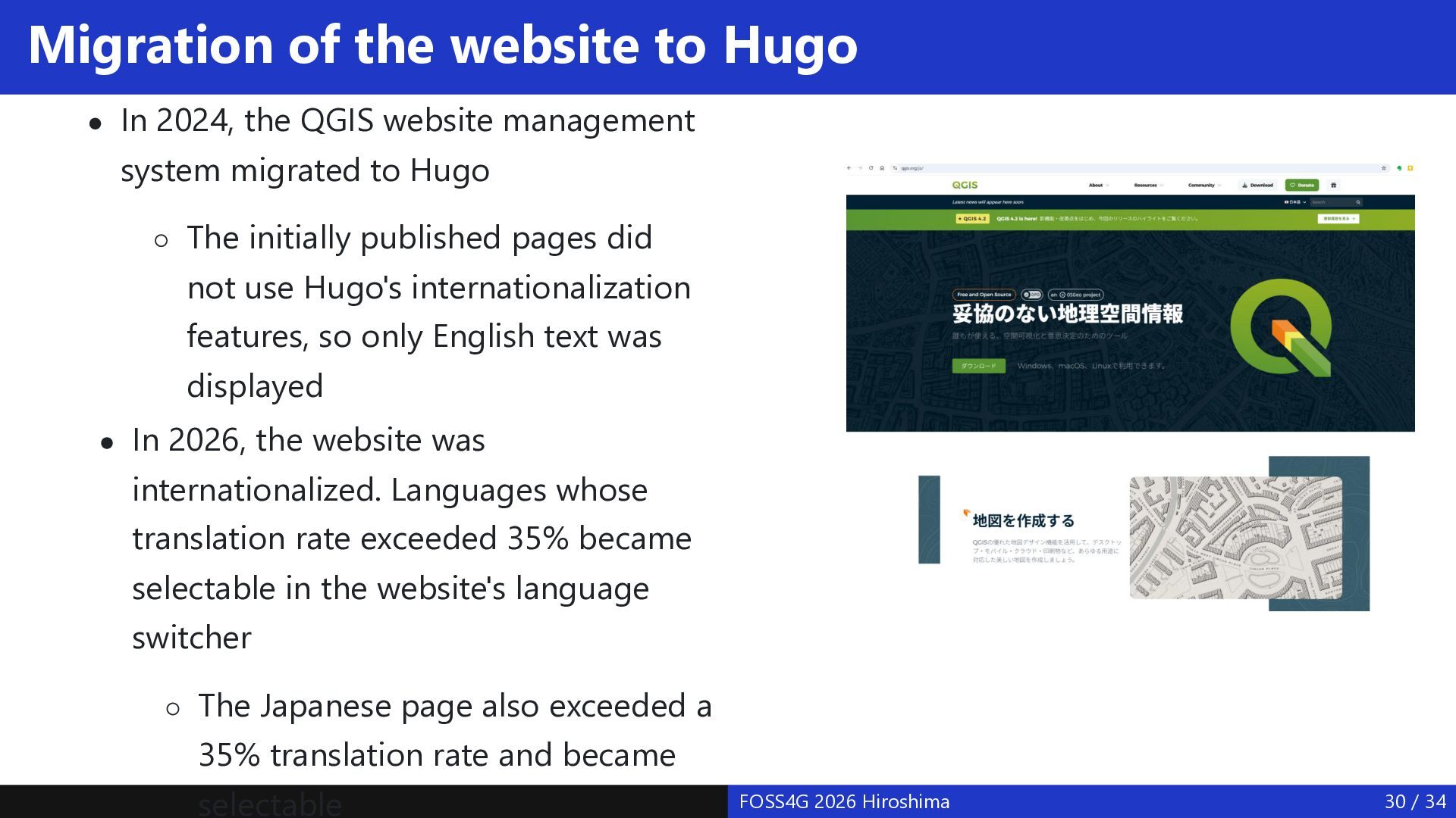
  29. Migration of the website to Hugo In 2024, the QGIS

    website management system migrated to Hugo The initially published pages did not use Hugo's internationalization features, so only English text was displayed In 2026, the website was internationalized. Languages whose translation rate exceeded 35% became selectable in the website's language switcher The Japanese page also exceeded a 35% translation rate and became selectable FOSS4G 2026 Hiroshima 30 / 34
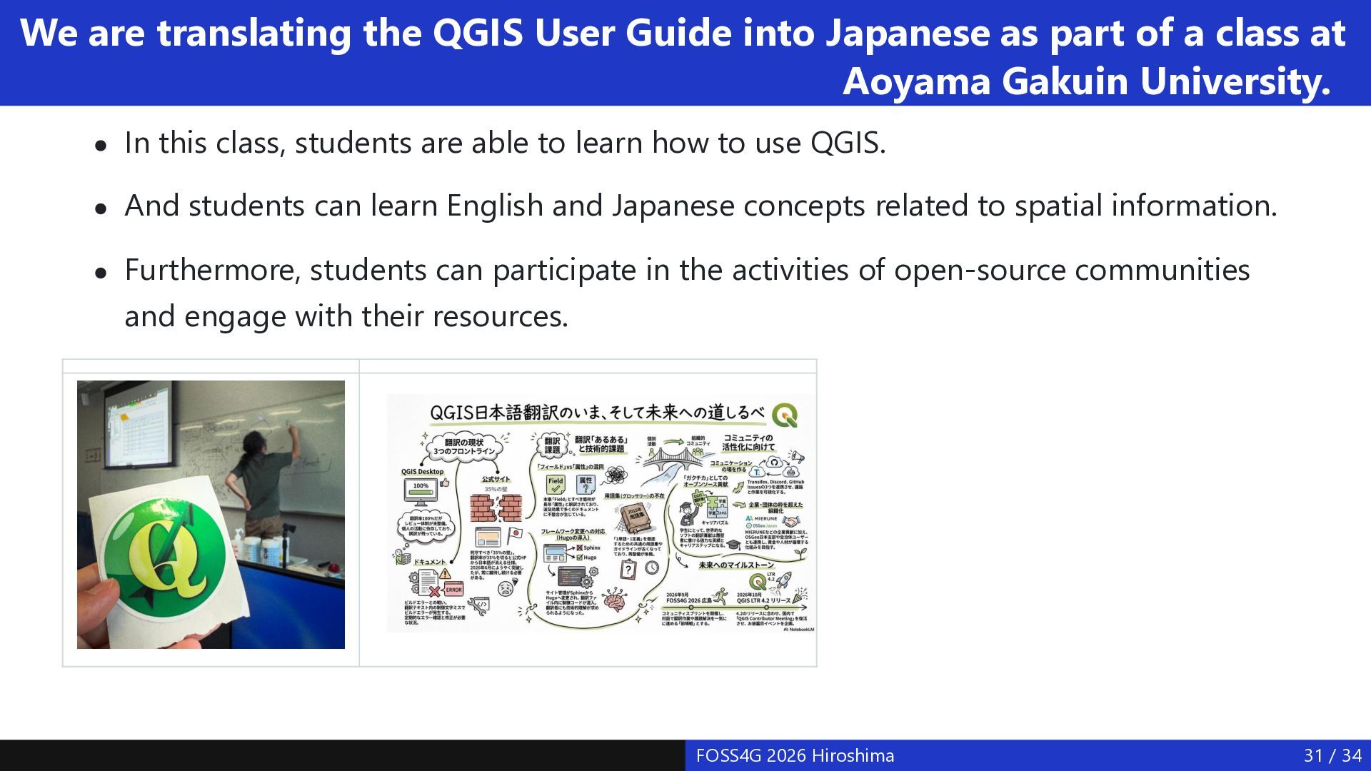
  30. We are translating the QGIS User Guide into Japanese as

    part of a class at Aoyama Gakuin University. In this class, students are able to learn how to use QGIS. And students can learn English and Japanese concepts related to spatial information. Furthermore, students can participate in the activities of open-source communities and engage with their resources. FOSS4G 2026 Hiroshima 31 / 34
  31. Current status and challenges of FOSS4G Japanese localization In the

    past, there were many character encodings to support and multiple kinds of translation resource formats, but with the spread of Unicode and of the gettext -> .po file format, localization work itself now has a standardized approach Some localization efforts have ended up being carried out by a single person, and it might be better for these to become group efforts QGIS has many localization contributors. However, since the work has become individualized, a venue is needed for reviewing and discussing localization content QGIS Desktop JP translation team: 2 coordinators, 4 reviewers, 75 translators QGIS Docs and Website JP translation team: 6 coordinators, 2 reviewers, 103 translators A venue for review and discussion is also needed for the localization of projects other than QGIS It would be fine if people could understand information in a given field in English, but I believe localization is necessary for fullscale adoption within Japan Perhaps FOSS4G product localization is needed in order to create wasei kango for the geospatial information field In particular, no localization work has been done for foundational software such as GDAL, PDAL, and PROJ. Perhaps wasei kango are needed in this area too. FOSS4G 2026 Hiroshima 32 / 34
  32. References [1] WaseiKango, https://en.wikipedia.org/wiki/Wasei-kango [2] gettext, https://en.wikipedia.org/wiki/Gettext [3] Japanese text

    encoding, http://lfw.org/text/jp.html [4] PostGIS 3.7.0dev Manual, https://postgis.net/docs/manual-dev/ja/ [5] Toshikazu Seto, Development and localization of OSGeo-Live for dissemination and utilization of FOSS4G, 2012, https://www.gisa-japan.org/content/files/conferences/proceedings/2012cd//papers/B-2-1.pdf [6] Kentaro Hatori, Japanese localization of OSGeo-Live 8.0, 2014, https://youtu.be/TpDXNA7Bjac?si=cj3lfoq_44WSGZIn [7] Ko Nagase, On OSGeoLive documentation translation using OmegaT, 2020, https://qiita.com/sanak/items/4ca1f7a6677056269f7d [8] Shinji Masumoto et al , Multi-Language Support and Localization of GRASS GIS, 2004, https://neteler.org/wpcontent/uploads/2024/12/masumoto2005_multi_language_support_grass_gis.pdf [9] Shinji Masumoto et al, Present Status of GRASS Internationalization Project , 2004, https://foss4g.asia/2004/Full Paper_PDF/Present Status of GRASS Internationalization Project.pdf [10] Building Open Resources for the Use of Satellite Data Utilizing FOSS4G, 2011, http://www.osgeo.jp/foss4g-mext/ [11] Yoichi KAYAMA, Current Status and Issues of QGIS Japanese localization, 2014, https://www.gisajapan.org/content/files/conferences/proceedings/2014cd/papers/D-4-1.pdf FOSS4G 2026 Hiroshima 34 / 34