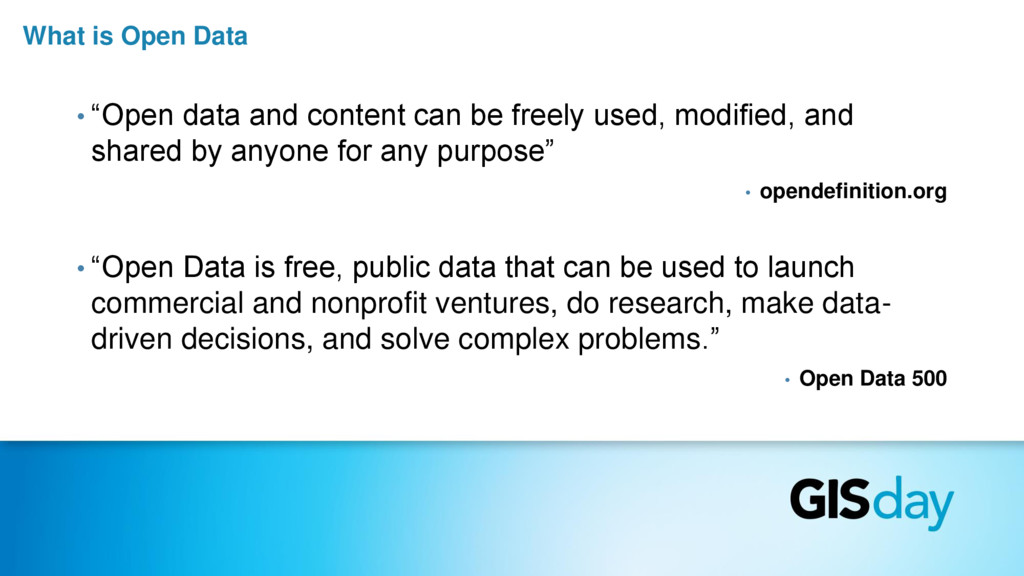
be freely used, modified, and shared by anyone for any purpose” • opendefinition.org • “Open Data is free, public data that can be used to launch commercial and nonprofit ventures, do research, make data- driven decisions, and solve complex problems.” • Open Data 500
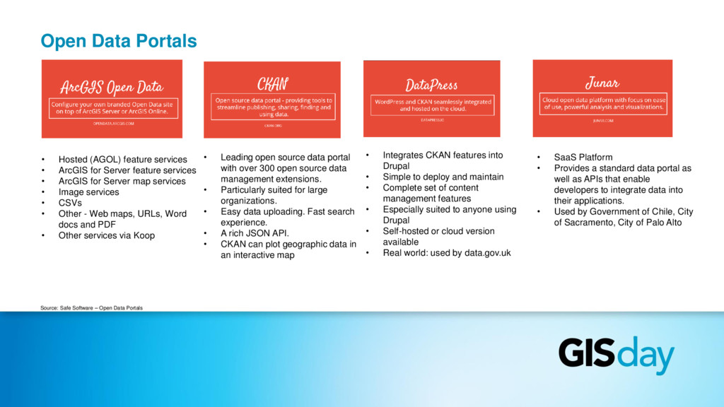
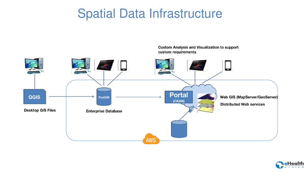
for Server feature services • ArcGIS for Server map services • Image services • CSVs • Other - Web maps, URLs, Word docs and PDF • Other services via Koop Source: Safe Software – Open Data Portals • Leading open source data portal with over 300 open source data management extensions. • Particularly suited for large organizations. • Easy data uploading. Fast search experience. • A rich JSON API. • CKAN can plot geographic data in an interactive map • Integrates CKAN features into Drupal • Simple to deploy and maintain • Complete set of content management features • Especially suited to anyone using Drupal • Self-hosted or cloud version available • Real world: used by data.gov.uk • SaaS Platform • Provides a standard data portal as well as APIs that enable developers to integrate data into their applications. • Used by Government of Chile, City of Sacramento, City of Palo Alto
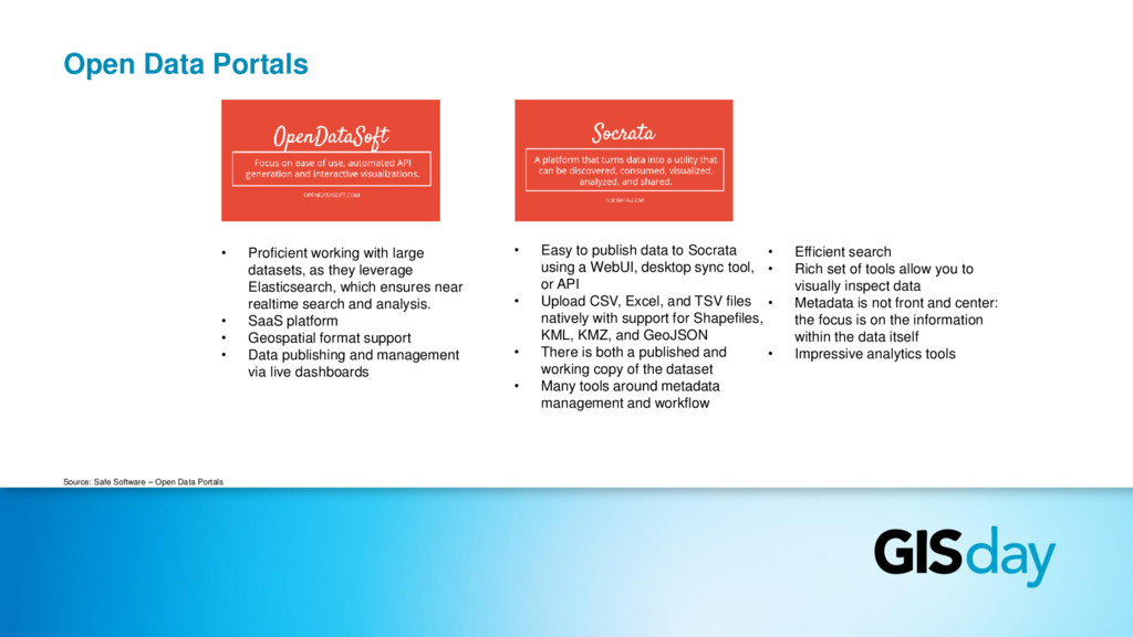
they leverage Elasticsearch, which ensures near realtime search and analysis. • SaaS platform • Geospatial format support • Data publishing and management via live dashboards Source: Safe Software – Open Data Portals • Easy to publish data to Socrata using a WebUI, desktop sync tool, or API • Upload CSV, Excel, and TSV files natively with support for Shapefiles, KML, KMZ, and GeoJSON • There is both a published and working copy of the dataset • Many tools around metadata management and workflow • Efficient search • Rich set of tools allow you to visually inspect data • Metadata is not front and center: the focus is on the information within the data itself • Impressive analytics tools
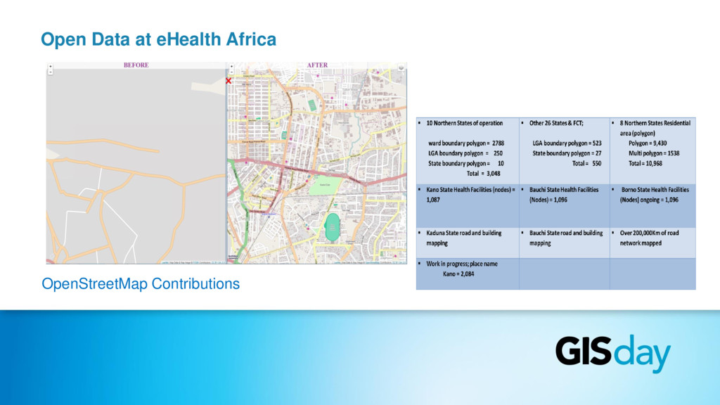
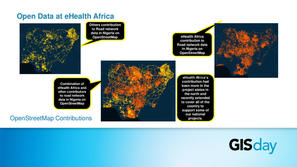
Road network data in Nigeria on OpenStreetMap eHealth Africa contribution to Road network data in Nigeria on OpenStreetMap Combination of eHealth Africa and other contributors to road network data in Nigeria on OpenStreetMap eHealth Africa’s contribution had been more in the project states in the north and recently extended to cover all of the country to support some of our national projects.