UN 2.0 Agenda • Introduction • UN Open GIS Initiative DWG 7 Smart Maps • Overview of UN Vector Tile Toolkit • What is Vector Tile? • Overview of our work • Added Value • Summary 2
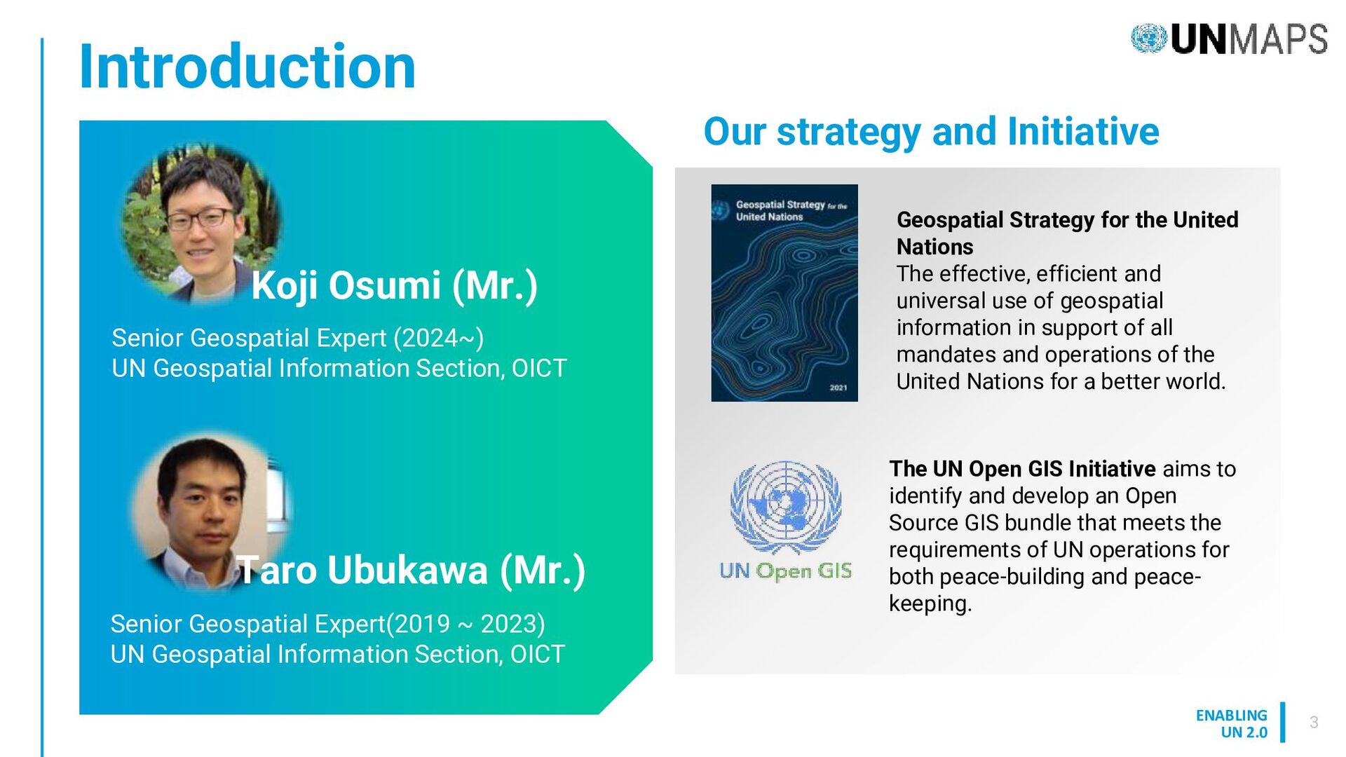
effective, efficient and universal use of geospatial information in support of all mandates and operations of the United Nations for a better world. Our strategy and Initiative Introduction 3 The UN Open GIS Initiative aims to identify and develop an Open Source GIS bundle that meets the requirements of UN operations for both peace-building and peace- keeping. Senior Geospatial Expert (2024~) UN Geospatial Information Section, OICT Senior Geospatial Expert(2019 ~ 2023) UN Geospatial Information Section, OICT Koji Osumi (Mr.) Taro Ubukawa (Mr.)
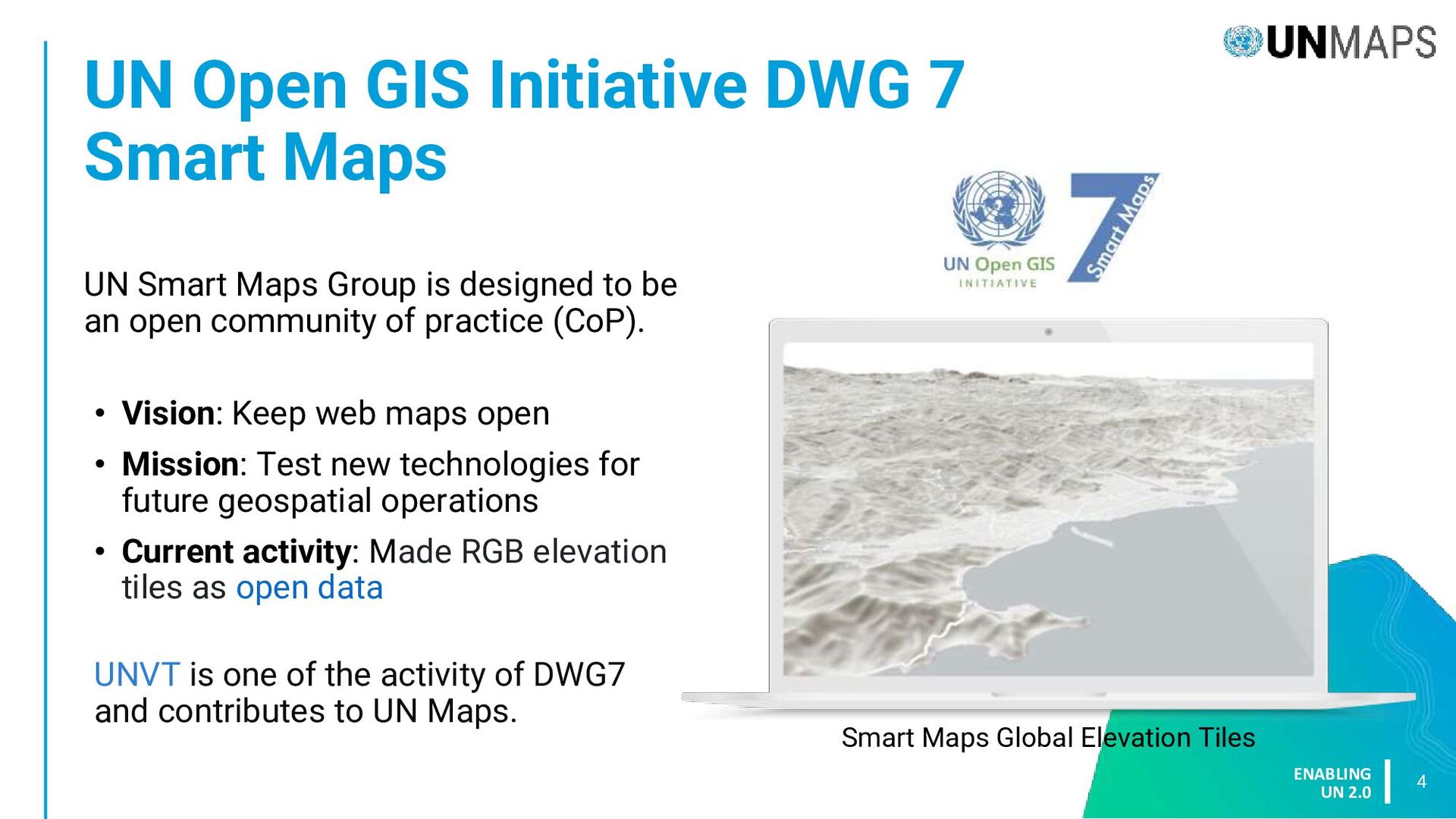
Maps 4 UN Smart Maps Group is designed to be an open community of practice (CoP). • Vision: Keep web maps open • Mission: Test new technologies for future geospatial operations • Current activity: Made RGB elevation tiles as open data UNVT is one of the activity of DWG7 and contributes to UN Maps. Smart Maps Global Elevation Tiles
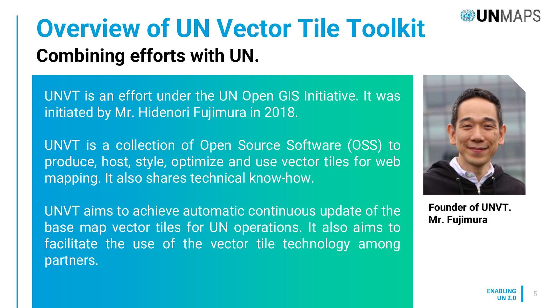
UNVT is an effort under the UN Open GIS Initiative. It was initiated by Mr. Hidenori Fujimura in 2018. UNVT is a collection of Open Source Software (OSS) to produce, host, style, optimize and use vector tiles for web mapping. It also shares technical know-how. UNVT aims to achieve automatic continuous update of the base map vector tiles for UN operations. It also aims to facilitate the use of the vector tile technology among partners. Combining efforts with UN. Founder of UNVT. Mr. Fujimura
for efficient web mapping – tile based on certain rules (z/x/y). It’s not an image but vector, which is machine readable. Vector tile format is getting to be mainstream of web mapping. Map data is divided into tiles Image from Fujimura(2019) Smaller data size in general Map style is needed Image Tile Vector Tile
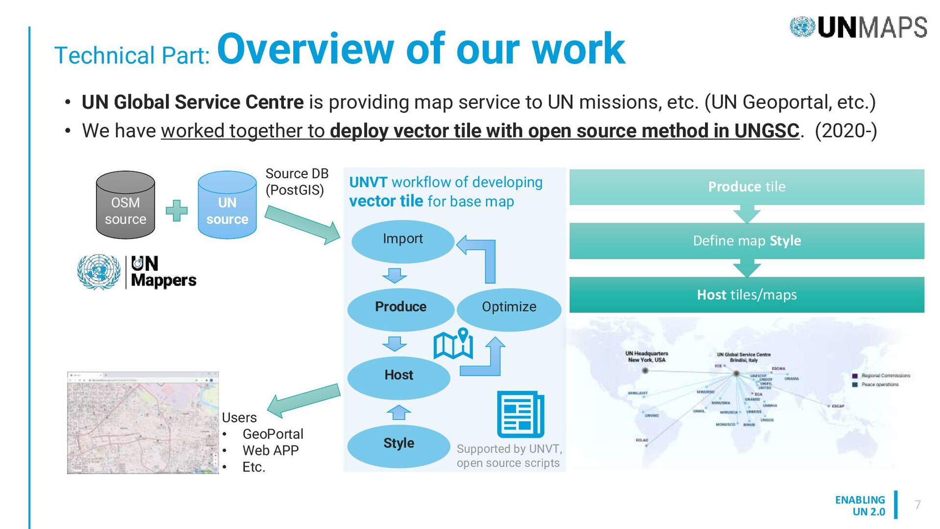
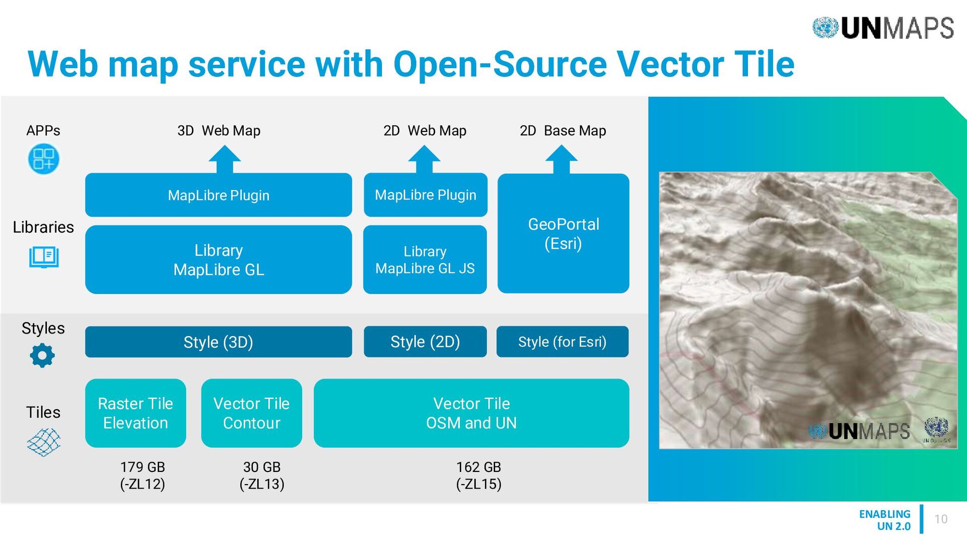
OSM source UN source Supported by UNVT, open source scripts Produce Host Style Optimize Import UNVT workflow of developing vector tile for base map Source DB (PostGIS) Users • GeoPortal • Web APP • Etc. Host tiles/maps Define map Style Produce tile • UN Global Service Centre is providing map service to UN missions, etc. (UN Geoportal, etc.) • We have worked together to deploy vector tile with open source method in UNGSC. (2020-)
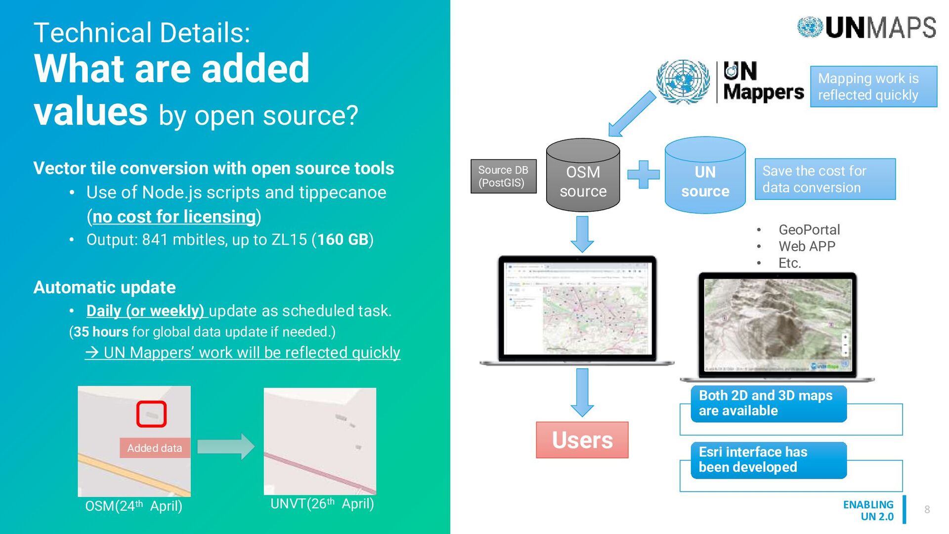
by open source? Vector tile conversion with open source tools • Use of Node.js scripts and tippecanoe (no cost for licensing) • Output: 841 mbitles, up to ZL15 (160 GB) Automatic update • Daily (or weekly) update as scheduled task. (35 hours for global data update if needed.) → UN Mappers’ work will be reflected quickly OSM source UN source Source DB (PostGIS) • GeoPortal • Web APP • Etc. Users Mapping work is reflected quickly Save the cost for data conversion Both 2D and 3D maps are available Esri interface has been developed OSM(24th April) UNVT(26th April) Added data
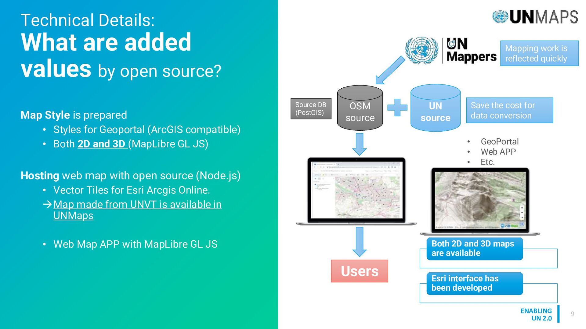
by open source? OSM source UN source Source DB (PostGIS) • GeoPortal • Web APP • Etc. Users Mapping work is reflected quickly Save the cost for data conversion Both 2D and 3D maps are available Esri interface has been developed Map Style is prepared • Styles for Geoportal (ArcGIS compatible) • Both 2D and 3D (MapLibre GL JS) Hosting web map with open source (Node.js) • Vector Tiles for Esri Arcgis Online. →Map made from UNVT is available in UNMaps • Web Map APP with MapLibre GL JS
Tile Toolkit is a collection of Open Source Software (OSS) for web mapping, developed under the UN Open GIS Initiative DWG 7, Smart Maps. UN Vector Tile Toolkit has been deployed in UN Maps Basemap system to provide Daily (or weekly) automatic update as scheduled task, ensuring that UN Mappers' work is promptly reflected. Working with the partners, we will continue improving our maps delivery and application to support UN operations.
![ENABLING UN 2.0 Thank you Koji Osumi [email protected] Taro Ubukawa](https://files.speakerdeck.com/presentations/cd6643e2b69f4b56a07fc403013d965c/slide_11.jpg)