Upgrade to Pro
— share decks privately, control downloads, hide ads and more …
Speaker Deck
Features
Speaker Deck
PRO
Sign in
Sign up for free
Search
Search
空間情報システム入門
Search
Sponsored
·
Your Podcast. Everywhere. Effortlessly.
Share. Educate. Inspire. Entertain. You do you. We'll handle the rest.
→
Mami Narahara
June 16, 2016
0
70
空間情報システム入門
Mami Narahara
June 16, 2016
Tweet
Share
More Decks by Mami Narahara
See All by Mami Narahara
プレゼンテーション1.pdf
mamiwachan
0
23
How to make a map
mamiwachan
0
23
How to make a map
mamiwachan
0
47
プレゼンテーション1改定.pdf
mamiwachan
0
130
Featured
See All Featured
Tips & Tricks on How to Get Your First Job In Tech
honzajavorek
0
440
Embracing the Ebb and Flow
colly
88
5k
Visualization
eitanlees
150
17k
Visualizing Your Data: Incorporating Mongo into Loggly Infrastructure
mongodb
49
9.9k
Marketing Yourself as an Engineer | Alaka | Gurzu
gurzu
0
130
Evolving SEO for Evolving Search Engines
ryanjones
0
130
The Psychology of Web Performance [Beyond Tellerrand 2023]
tammyeverts
49
3.3k
The Limits of Empathy - UXLibs8
cassininazir
1
220
Crafting Experiences
bethany
1
52
WENDY [Excerpt]
tessaabrams
9
36k
Navigating the moral maze — ethical principles for Al-driven product design
skipperchong
2
250
The Success of Rails: Ensuring Growth for the Next 100 Years
eileencodes
47
7.9k
Transcript
建物マニュアルのマッピング
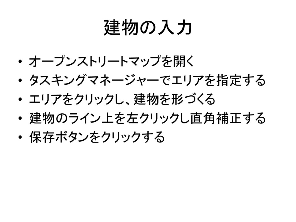
建物の入力 • オープンストリートマップを開く • タスキングマネージャーでエリアを指定する • エリアをクリックし、建物を形づくる • 建物のライン上を左クリックし直角補正する •
保存ボタンをクリックする
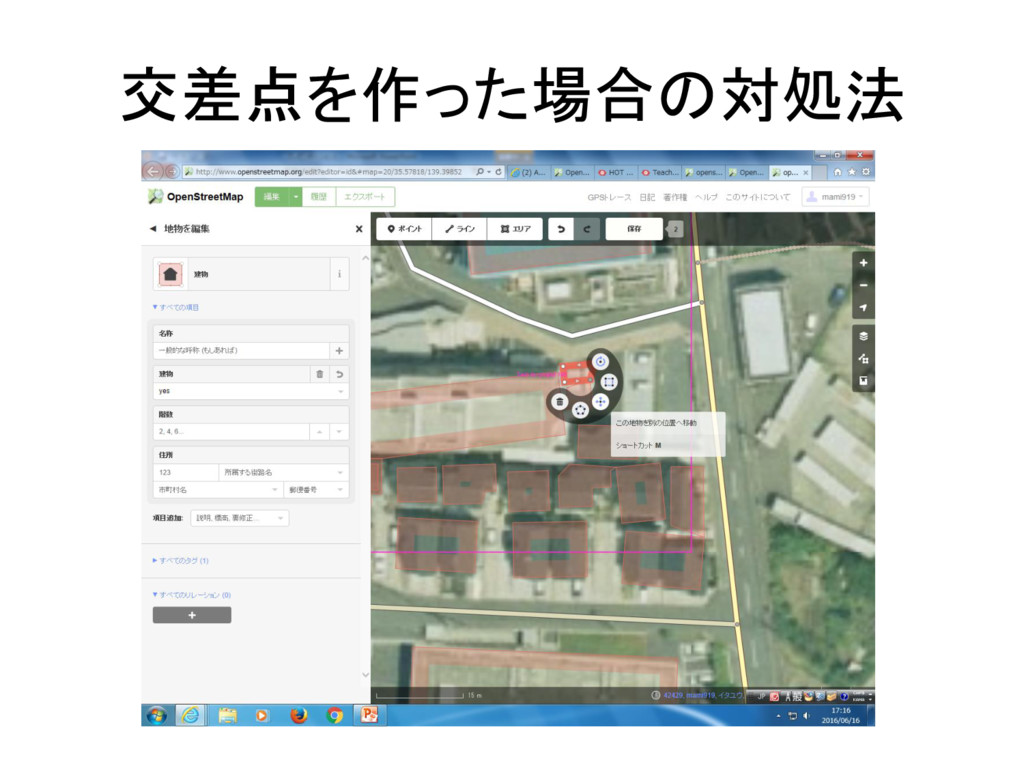
交差点を作った場合の対処法
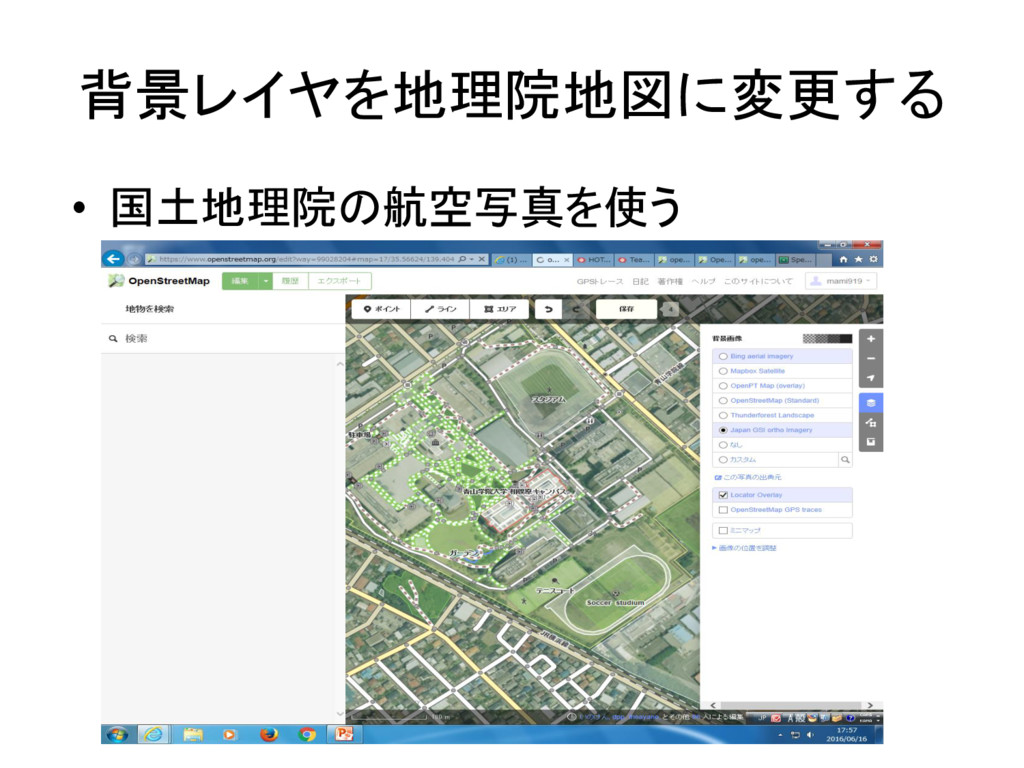
背景レイヤを地理院地図に変更する • 国土地理院の航空写真を使う
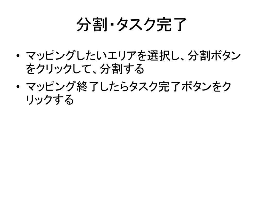
分割・タスク完了 • マッピングしたいエリアを選択し、分割ボタン をクリックして、分割する • マッピング終了したらタスク完了ボタンをク リックする