Upgrade to Pro — share decks privately, control downloads, hide ads and more …

State of GeoNode 2.10

State of GeoNode 2.10

Simone Giannecchini

August 28, 2019
Tweet

More Decks by Simone Giannecchini

Other Decks in Technology

Transcript

  1. This presentation is brought to you by Francesco Bartoli francbartoli

    Security and spatial IT geek with an opinionated mind to openness. Hugely addicted to rock and mountain climbing. GeoNode PSC member. Simone Dalmasso simod Technical project officer at European Commission JRC in charge of the Copernicus EMS Rapid Mapping. Father of 1.5 children, former chef and GeoNode PSC member. Co-founder and Senior SW Engineer @GeoSolutions, involved on GIS related Open Source projects since 2004. PSC member of GeoServer, PSC and OSGEO Project Officer of GeoNode.
  2. GeoNode at a Glance A web framework based on Python

    and Django to allow people to upload, describe, share and use their geospatial data. We usually define GeoNode as a geospatial-CMS. Core Components • Django • SQLite/PotsgreSQL-PostGIS • GeoServer/QGIS Server • GeoWebCache • pycsw / GeoNetwork • (MapStore)
  3. Capabilities o Upload geospatial datasets (by default shapefiles and GeoTIFFs)

    o User with appropriate permissions can edit layer metadata, which are exposed by OGC CSW and REST, to provide search/discovery capability o Create thematic maps accessible to general public o Users with appropriate permissions can edit layer styles and features (for vector layers) o Granular permission systems: viewing, downloading, metadata editing, styles and feature editing for a layer can be restricted to users or groups o GeoNode exposes a number of standards for each layer: OGC (WMS, WMS-C, WFS, WFS-T, WCS, CSW) and mass market search standards (OAI-PMH, SRU, OpenSearch)
  4. Release History o June 2019, GeoNode 2.10 (Django 1.11.20, GeoServer

    2.14, pycsw 2.2.0) o April 2018, GeoNode 2.8 (Django 1.8.19, GeoServer 2.12.2, pycsw 2.0.2, group moderation and resources publication workflow, SLD upload, metadata wizard) o May 2017, GeoNode 2.6 (Django 1.8.7, GeoServer 2.9, pycsw 2.0.2, React client, QGIS server backend, ansible and docker setup, Ubuntu 16.04 support) o November 2015, GeoNode 2.4 (Django 1.6.11, GeoServer 2.7, pycsw 1.10.5, django- guardian, groups, remote services, responsive template, Ubuntu 14.04 support) o April 2014, GeoNode 2.0 (Django 1.5.5, GeoServer 2.5, pycsw 1.8.6, django- polymorphic, bootstrap, Ubuntu 12.04 support) o October 2012, GeoNode 1.2 (Django 1.4, GeoServer 2.3, South migrations, django- taggit, social features, comments and ratings, find/add layers widget) o May 2012, GeoNode 1.1.1 (Ubuntu 10.04 and 11.04 installer) o December 2010, GeoNode 1.0, with major contributions from OpenGeo, the World Bank, GFDRR, UNISDR, and GEM o August 2010, GeoNode 1.0-beta
  5. Summits and code sprints o GeoNode Summit 2019: Viareggio, Italy

    (hosted by GeoSolutions) o GeoNode Summit 2018: Turin, Italy (hosted by ITHACA) o GeoNode Code Sprint 2016: Bonn, Germany and New Orleans, LA, USA o GeoNode Summit 2016: Rome, Italy (hosted by UN WFP) o GeoNode Code Sprint 2015: New Orleans, LA, USA and Turin, Italy o GeoNode Summit 2012: Cambridge, MA, USA (hosted by Harvard University) o GeoNode Summit 2011: Washington DC (hosted by World Bank)
  6. Community growth and adoption The World Bank, OpenGeo, Australia Indonesia

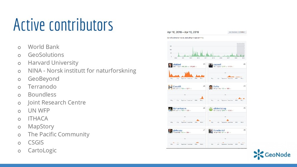
    Facility for Disaster Reduction (AIFDR), MapStory, Global Earthquake Model (GEM) Foundation, Harvard WorldMap, ROGUE (US Army Corps of Engineers), South Pacific Applied Geoscience Commission (SOPAC), SERVIR (US National Aeronautics and Space Administration / NASA), Regional Centre for Mapping of Resources for Development (RCMRD, Kenya), Information Technology for Humanitarian Assistance Cooperation and Action (ITHACA, Italy), UN World Food Programme (WFP), Comision Permanente de Contingencias (COPECO, Honduras), Humanitarian Information Unit (HIU, US State Department), Marine Civil Information Management System (MARCIMS, US Marine Corps), National Geospatial-Intelligence Agency (US NGA), Office of Secretary of Defense (US), Pacific Disaster Center, Central Asian Institute for Applied Geosciences (CAIAG, Kyrgyzstan), National Research Council, Institute of Marine Sciences (Italy), European Commission Joint Research Centre (JRC), World Agroforestry Centre (ICRAF), Massachusetts Institute of Technology (MIT, US), National Oceanic and Atmospheric Administration Center for Weather and Climate Prediction (NOAA NCWCP, US Department of Commerce), Politecnico di Milano (Italy), Humanitarian Data Exchange (HDX, United Nations Office for the Coordination of Humanitarian Affairs), Agency for International Development (US AID), HABAKA Innovation Hub (Madagascar), GESP (Gestione Elaborazione Studio Pianificazione, Italy), Zhejiang University (China), Ritsumeika University (Japan), Intergovernmental Authority on Development (IGAD), (MapStand Ltd), (UNESCO IHP-WINS), Consiglio Nazionale delle Ricerche (CNR Italy), Uganda Bureau of Statistics – Uganda Boureau Of Statistics (UBOS), Istituto Superiore per la Protezione e la Ricerca Ambientale - (ISPRA Italy), Skeena Knowledge Trust - (SKT Canada) …
  7. Community and infrastructure o Official PSC elected by the community

    and composed today by 5 members o ~20 active core committers across several organizations o ~500 members on the users list o ~120 members on the developers list o Mailing list traffic growing steadily o Successfully onboarding new developers and contributing organizations o ~350 Pull Requests Merged in the last year o Continuous Integration + Automated Builds o Working toward a regular release cycle
  8. Active contributors o World Bank o GeoSolutions o Harvard University

    o NINA - Norsk institutt for naturforskning o GeoBeyond o Terranodo o Boundless o Joint Research Centre o UN WFP o ITHACA o MapStory o The Pacific Community o CSGIS o CartoLogic
  9. Releases covered by this presentation September 2017 2.6.x 2.8.x 2.10.x

    2.10.1 May 2019 June 2019 3.0.x development stable maintenance Python 2 Django==1.8.7 GeoServer 2.9 Python 2 Django==1.8.19 GeoServer 2.13 Python 2 Django>=1.11.23 GeoServer 2.14.3/2.15.2 Python 3 Django 2 YOU ARE HERE Sept 2019 2020
  10. Are you using a older version? Upgrade! o User/Developer lists

    and Gitter tipically covers only supported versions o Today it means 2.8.x and 2.10.x o From June it will mean 2.10.x and 3.0.x o Security fixes and installation support on new Oss being added to supported versions only! o Moving data from old versions will be much harder if not impossible o Web interfaces and GIS clients will be much different. No one will be able to backport fixes or improvements to the old ones. o Please upgrade your GeoNode installations!!!
  11. Upgrade? What’s in it for me? o Let’s check what’s

    new in 2.10 upcoming release o Check the bottom of each slide to see who sponsored a certain feature, who implemented it, and what version contains it Sponsor Author Version
  12. Upgrade to GeoServer 2.14.3 o Important Security and performance fixes

    o Updated versions of community modules: ✓ Backup & Restore ✓ OAuth2 ✓ GeoFence ✓ GeoWebCache Community GeoSolutions GeoSolutions 2.8.2 - 2.10 o Support for more styles and improved compatibility with QGIS SLD export o Almost ready to support 2.15.x and 2.16.x
  13. Remote Services Improvements IGAD UNESCO GeoSolutions 2.8.2 - 2.10 o

    Improved stability on harvesting o Support for more endpoints, WMS, ArcGIS REST, GeoNode OWS APIs o Import Legends and as much as metadata fields as possible o Allows remote resource filtering and exposure to the catalogue
  14. Improvements to Uploaders and data formats UNESCO GeoSolutions GeoSolutions 2.8.2

    - 2.10 o SLDs and metadata XML can be included directly on a ZIP file o Supports: CSV, KML, KMZ (Ground Overlays), JSON
  15. SLD Export and Upload UNESCO WB GeoSolutions 2.8.2 - 2.10

    o Direct download of available styles and original dataset o Still needs work and improvements; for the moment supports well only simple styles
  16. GeoNode GIS-Client Hooksets MapStand Ltd GeoSolutions GeoSolutions 2.10 o GIS

    Clients (maps and layer details) can be plugged in as external libraries thanks to the CLIENT HOOKSETS o You can add your ones
  17. GeoNode and GeoFence Performance Optimizations HARVARD UNIVERSITY GeoSolutions 2.10 o

    Performance improvements and hardening to support a huge number of resources and maps, 10k+ layers! o The possibility to activate DELAYED SECURITY signals in order to allow GeoNode and GeoFence align asynchronously
  18. Docker Improvements / SPCgeonode Compose GeoBeyond SPC GeoBeyond SPC 2.10

    o Docker Compose installation has been simplified a lot, both on GeoNode core and GeoNode- Project o SPCgeonode is a setup for Geonode deployment at SPC. It makes it easy to deploy a production ready Geonode. The setup aims for simplicity over flexibility, so that it will only apply for typical small scale Geonode installations. o The setup is also usable for Geonode development or customization. o https://github.com/GeoNode/geonode/tree/master/scripts/spcgeonode
  19. Security and Hardening - MIDDLEWAREs Community Community 2.10 o GeoNode

    2.10 is based on Django framework v.1.11. The framework offers a strong and battle- tested security mechanism inherited and extended by GeoNode’s own security layer and integrations. The general security features of Django are well described in its own documents: https://docs.djangoproject.com/en/1.11/topics/security ✓ LockDown Middleware (GeoNode) a Middleware class which forces authentication for every non-authorized URL ✓ SessionControl Middleware (GeoNode) a Middleware class looking for Token expiration and session validity. Accordingly to the settings, it will either force the user to log in again or refresh/extend the token validity. ✓ Cors Middleware A Django App that adds CORS (Cross-Origin Resource Sharing) headers to responses. Although JSON-P is useful, it is strictly limited to GET requests. CORS builds on top of XmlHttpRequest to allow developers to make cross-domain requests, similar to same-domain requests. http://www.html5rocks.com/en/tutorials/cors ✓ CsrfView Middleware ref. https://docs.djangoproject.com/en/2.2/ref/csrf ✓ XFrameOptions Middleware ref. https://docs.djangoproject.com/en/2.2/ref/clickjacking ✓ Security Middleware ref. https://django-secure.readthedocs.io/en/latest/middleware.html ✓ OAuth2Token Middleware ref. https://django-oauth-toolkit.readthedocs.io/en/latest/tutorial/tutorial_03.html
  20. Security and Hardening – OWS Internal Proxy Community Community 2.10

    o Fixed users dangerous privileges escalation; internally requests to the backend were always done as “ADMIN” o GeoNode Proxied OWS Endpoints ✓ The proxy automatically searches for the user OAUth2 Token and injects the correct BEARER AUTH Headers transparently ✓ /gs/ows Accepts BASIC AUTH headers but still allows anonymous users to fetch OWS documents ✓ /gs/w*s Forces the users to perform BASIC AUTH first
  21. Fixes and Improvements Community Community 2.10 o Well known 2.6

    issues: ✓ Thumbnails generation ✓ Wrong BBOX coordinates on Download Links ✓ Wrong BBOX coordinates for projections different from WGS84 or EPSG:3857 ✓ Glitches on Map Zoom levels ✓ Errors on Metadata Editor, especially after updating an existing resource ✓ Upload Encoding errors on input data ✓ Misbehavior on GeoServer data-store creation ✓ Filtering errors on Vectorial Data Download ✓ and many more…
  22. Contrib Apps Promotion Community Community 2.10 o Most of the

    “contrib apps” have been ported to core o “contribs” have now their onw repository with dedicated docs https://github.com/GeoNode/contribs
  23. Test Frameworks and Code-coverage Community NINA NINA GeoSolutions 2.10 o

    Test framework on Travis has been completely refactored o Thanks to NINA we have now also support for “Selenium” tests
  24. Internationalization and Documentation Community CSGIS CSGIS GeoSolutions 2.10 o Internationalization

    has been improved, we have almost 90% coverage for 5 main languages o Completely revised and updated Documentation, preview at http://docs.geonode.org/en/new-docs/ o Help is very welcome here from the community. To participate jump into the following threads https://github.com/GeoNode/geonode/issues/4394 Docs: Rework TOC Docs: Replace Transifex with manual build Instructions https://github.com/GeoNode/geonode/issues/4387
  25. User Lists Participation o Answering users questions relies on a

    low number of people o We lack “testers”; this kind of project would need also a lot of manual testing for all its functionalities on a regular basis o Developers are very few and Pull Requests often do not respect the contribution policies. In particular: ✓ There’s no GitHub issue describing the problem linked to the Pull Request ✓ GitHub issues are plain requests often without a good description of the use case and how to reproduce it ✓ Lack of test cases and documentation ✓ History of commits is usually messed up
  26. Steps to get in touch with developers 1. If you

    need for clarification first of all try to describe the issue as well as possible through the official mailing lists; IMPORTANT: always specify ✓ Which versions of GeoNode and GeoServer you are using ✓ Which Operative System and hardware you are using ✓ How you installed the framework 2. If you need to get in touch directly with developers, consider using the official “gitter” chat https://gitter.im/GeoNode/general 3. If the issue has been confirmed and there’s no easy or immediate resolution, open a ticket on GitHub https://github.com/GeoNode/geonode/issues with steps on how to reproduce the problem and labels
  27. In case you stumble into a vulnerability: Responsible Disclosure o

    Keep exploit details out of issue report. o Mark the issue as a vulnerability. o Be prepared to work with Project Steering Committee (PSC) on a solution. o Keep in mind PSC members are volunteers and an extensive fix may require fundraising / resources. If you are not in position to communicate in public please consider commercial support, contacting a PSC member, or reaching us via the Open Source Geospatial Foundation at [email protected]