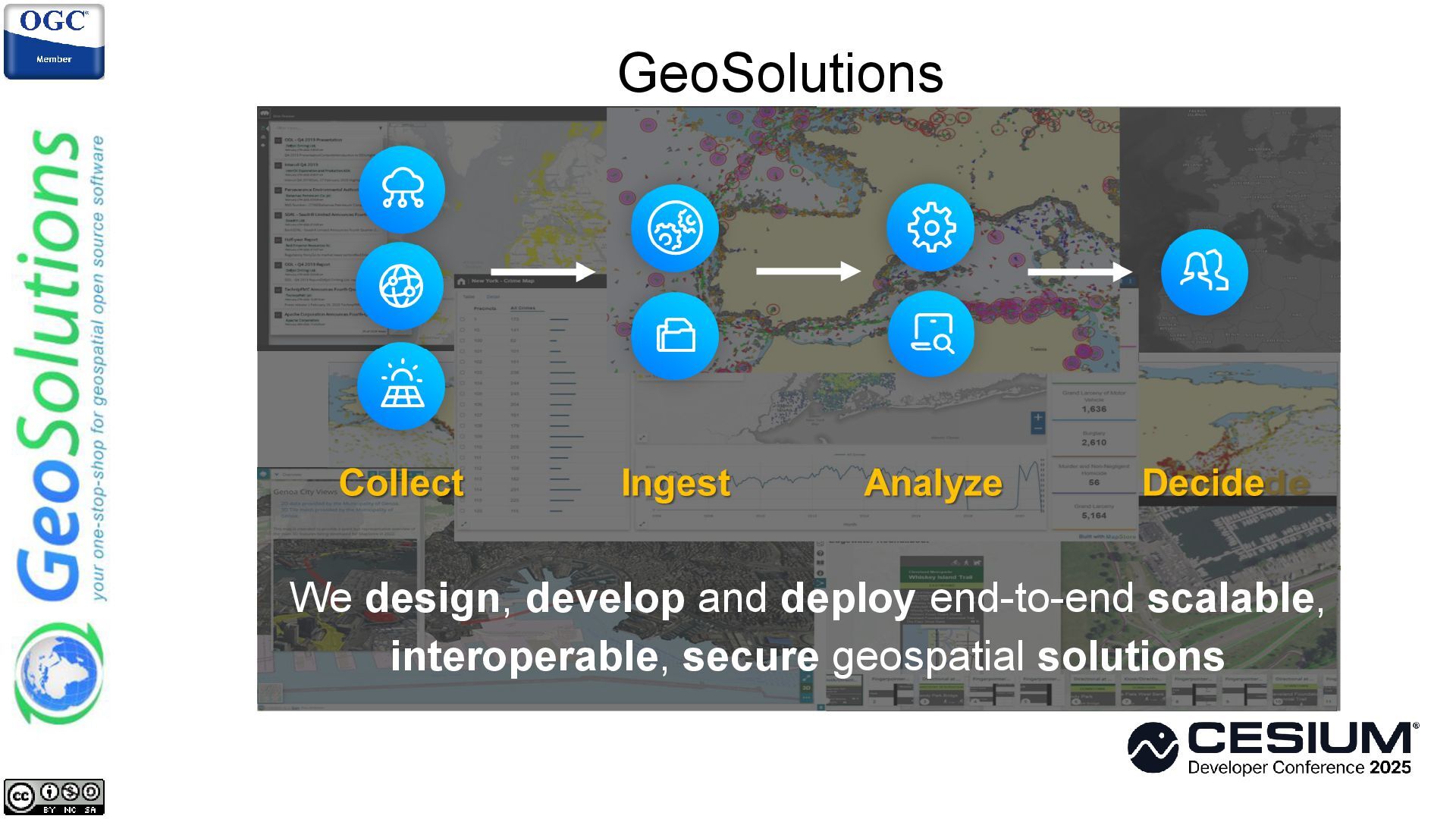
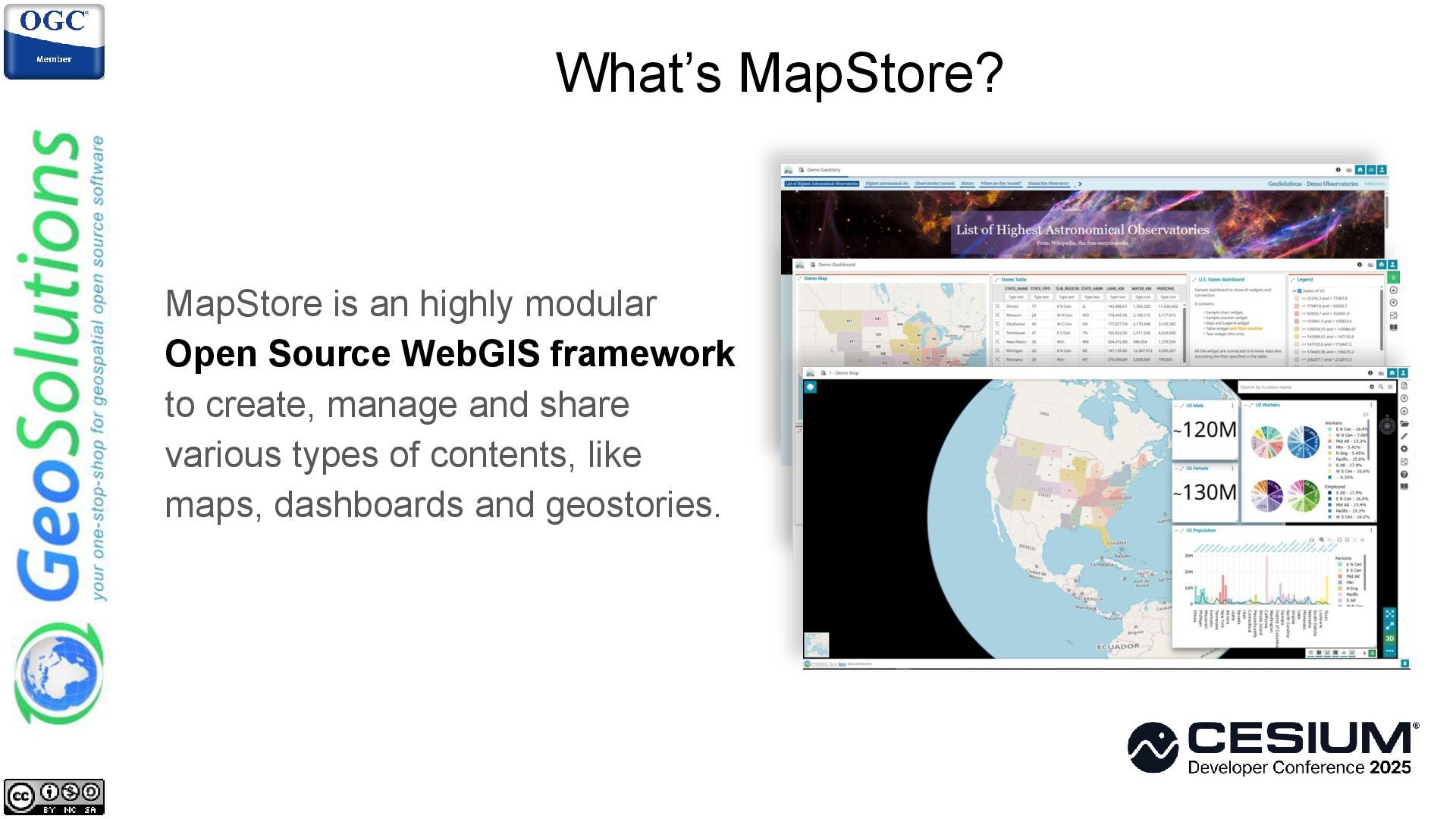
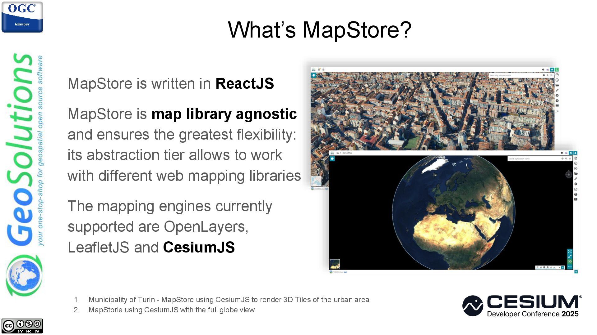
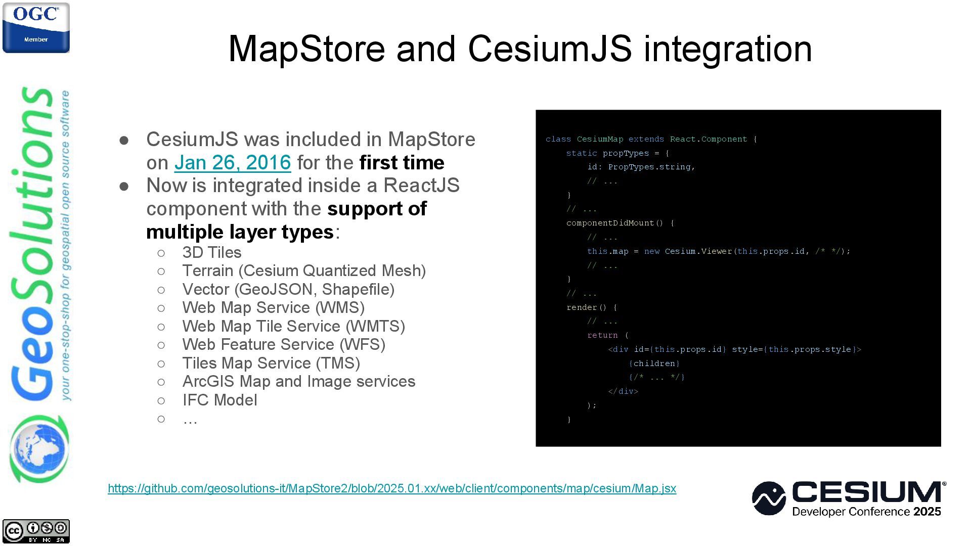
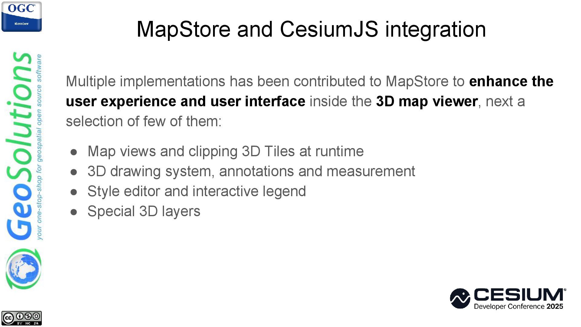
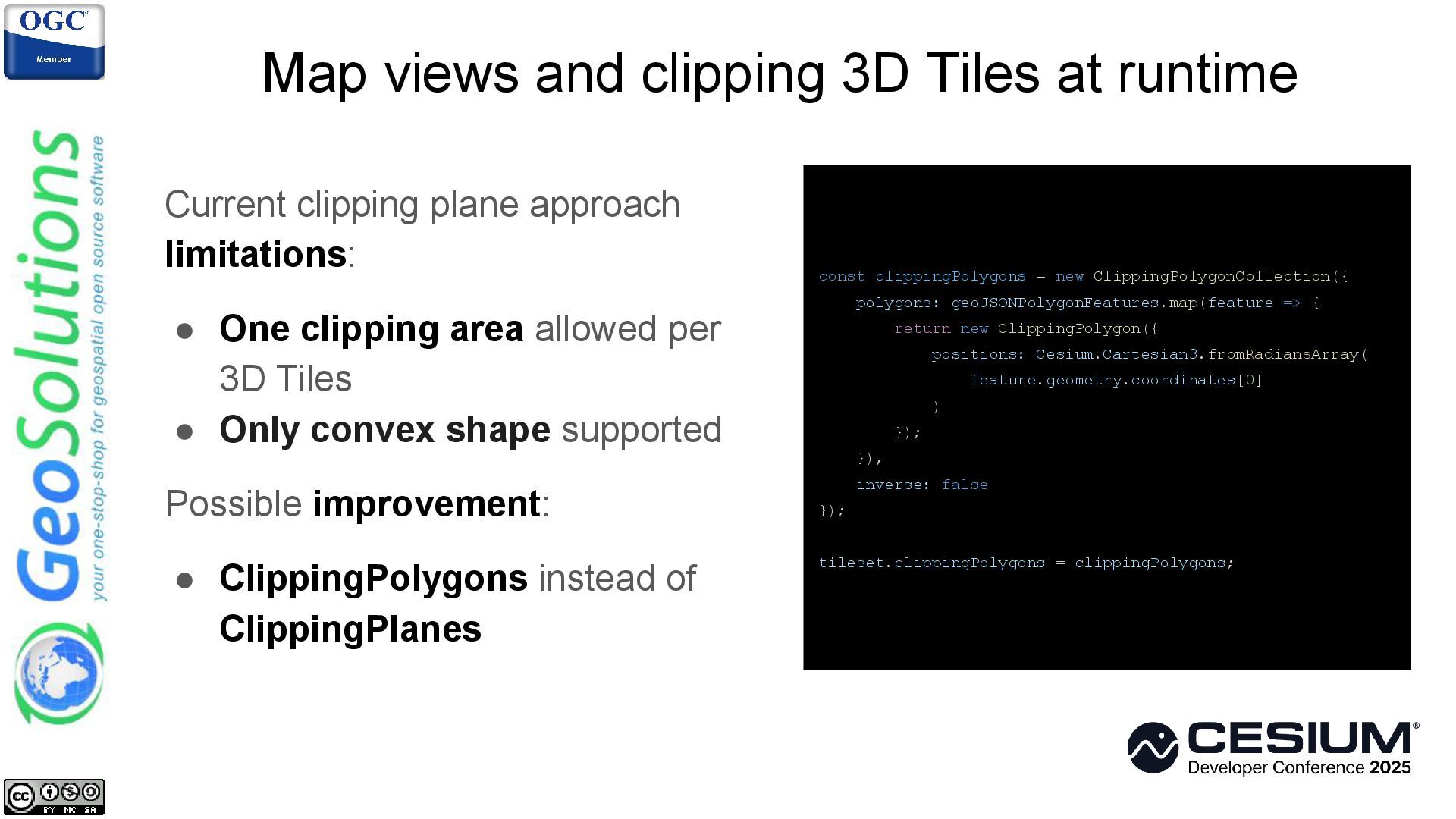
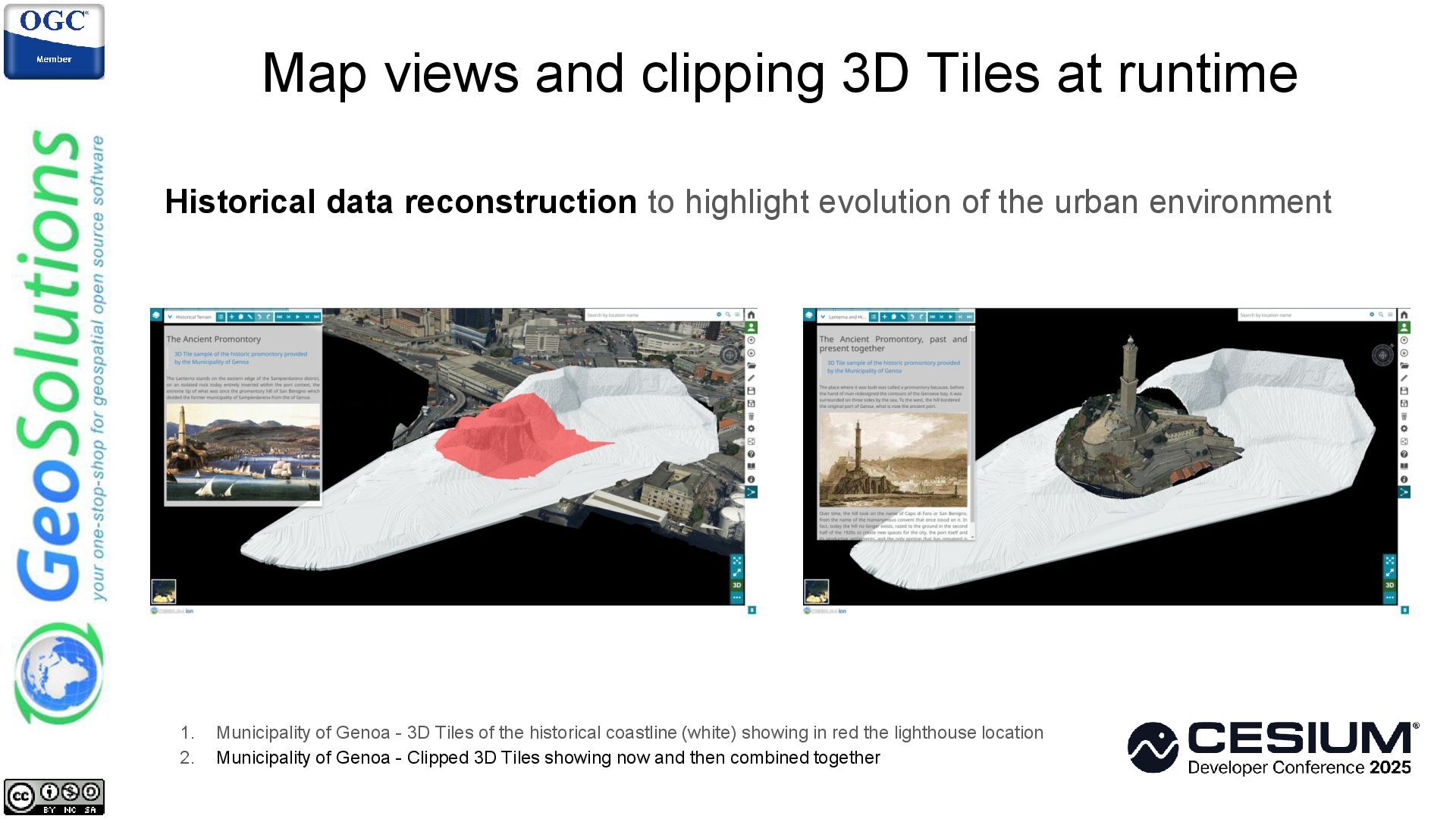
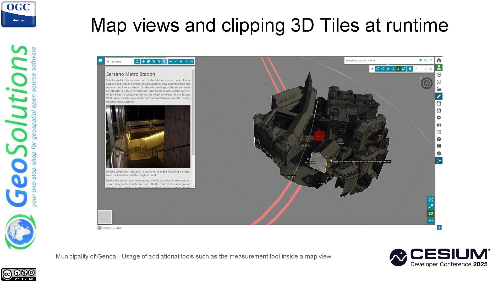
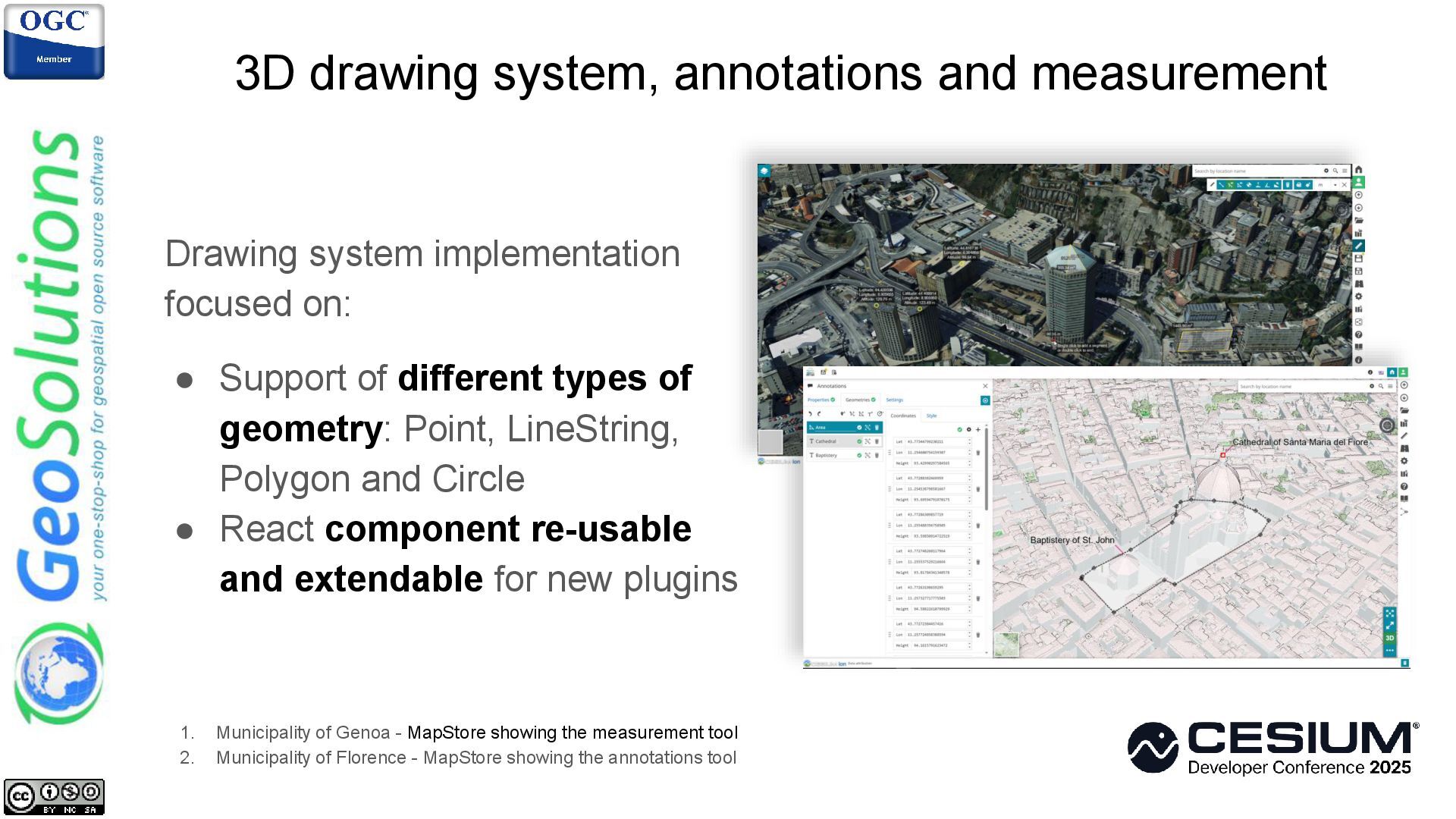
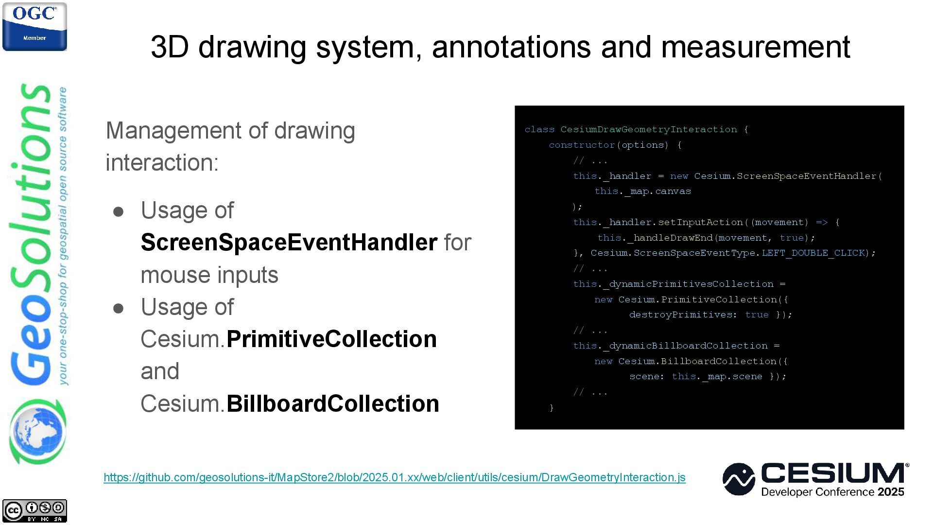
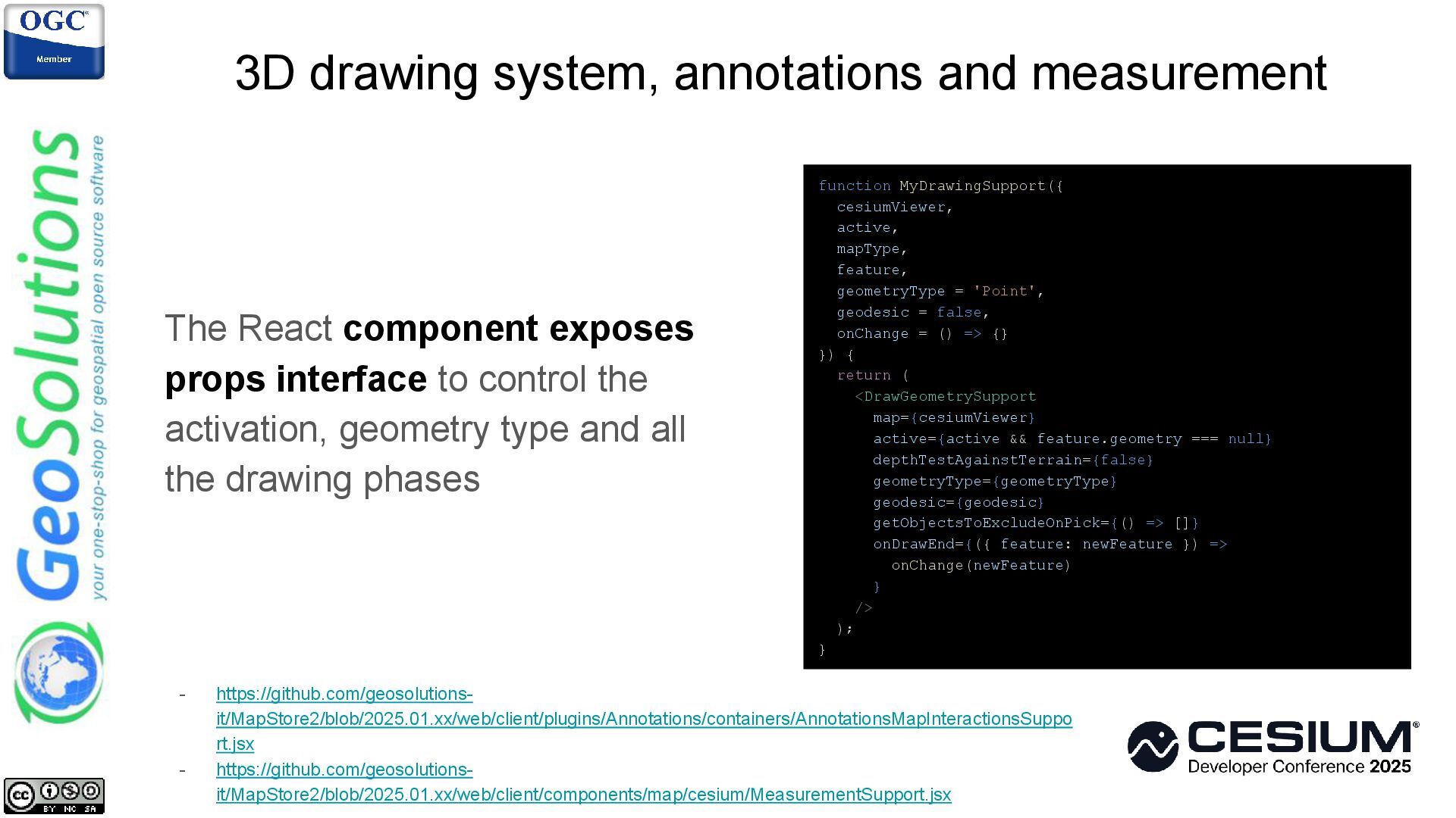
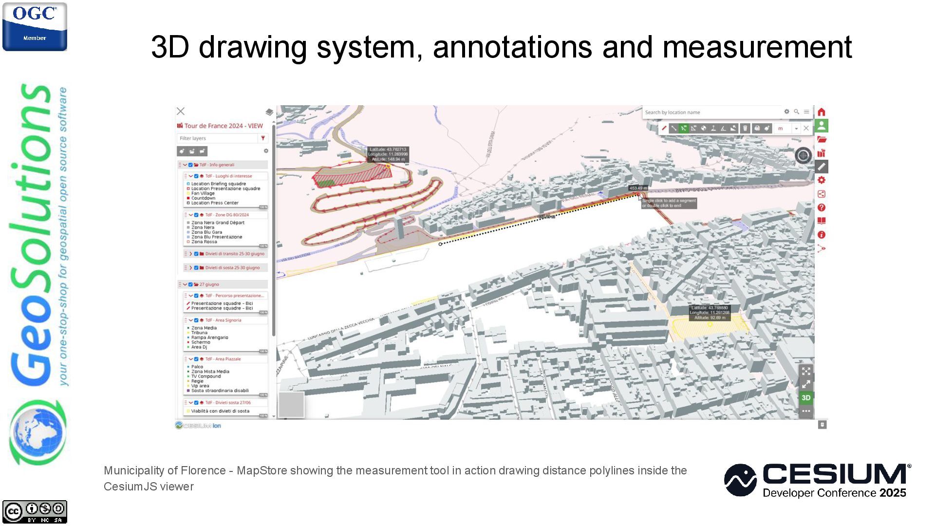
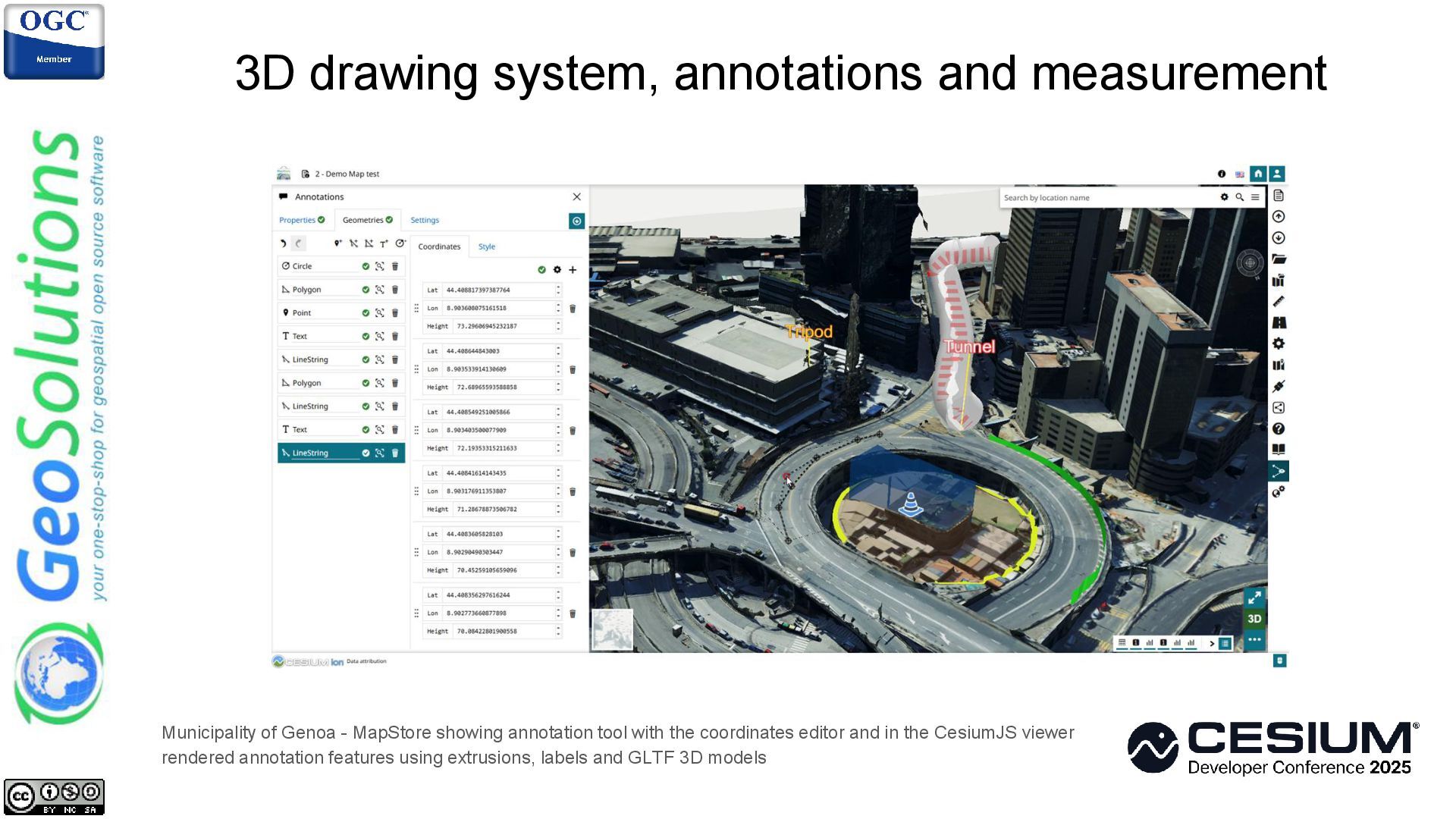
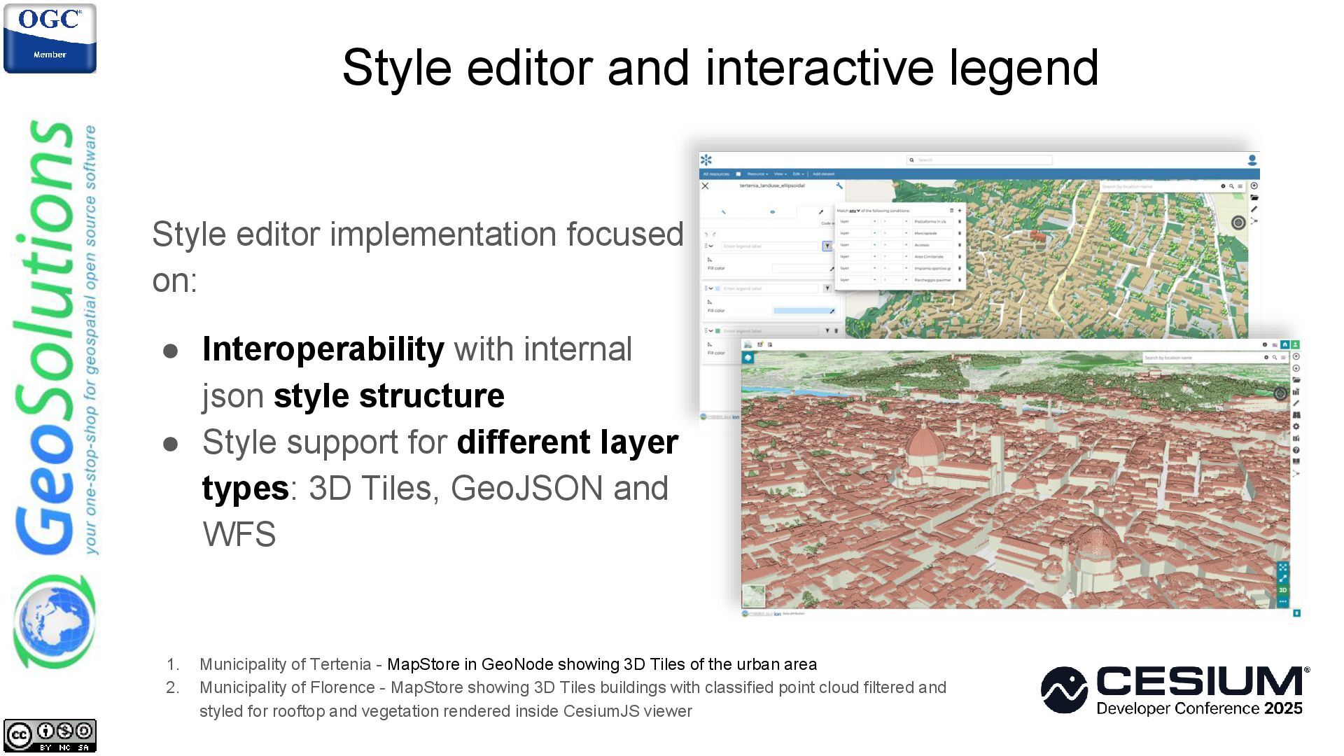
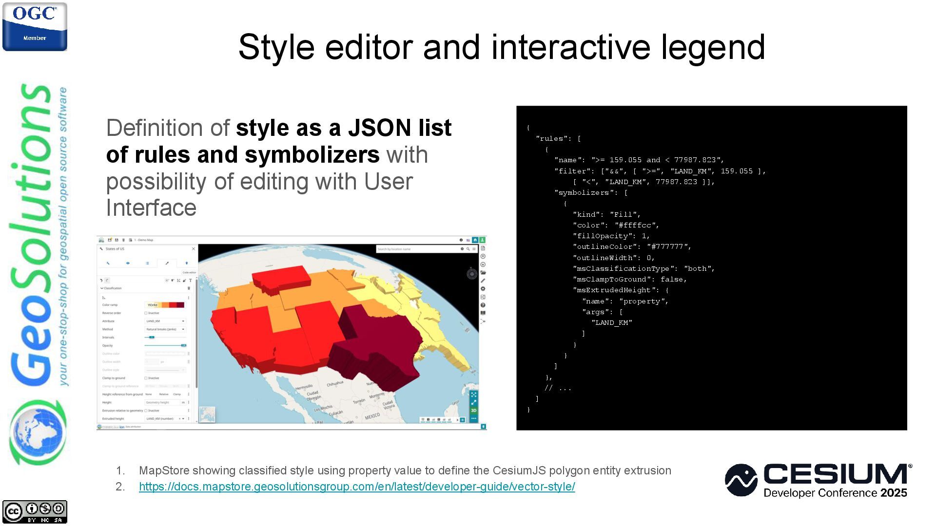
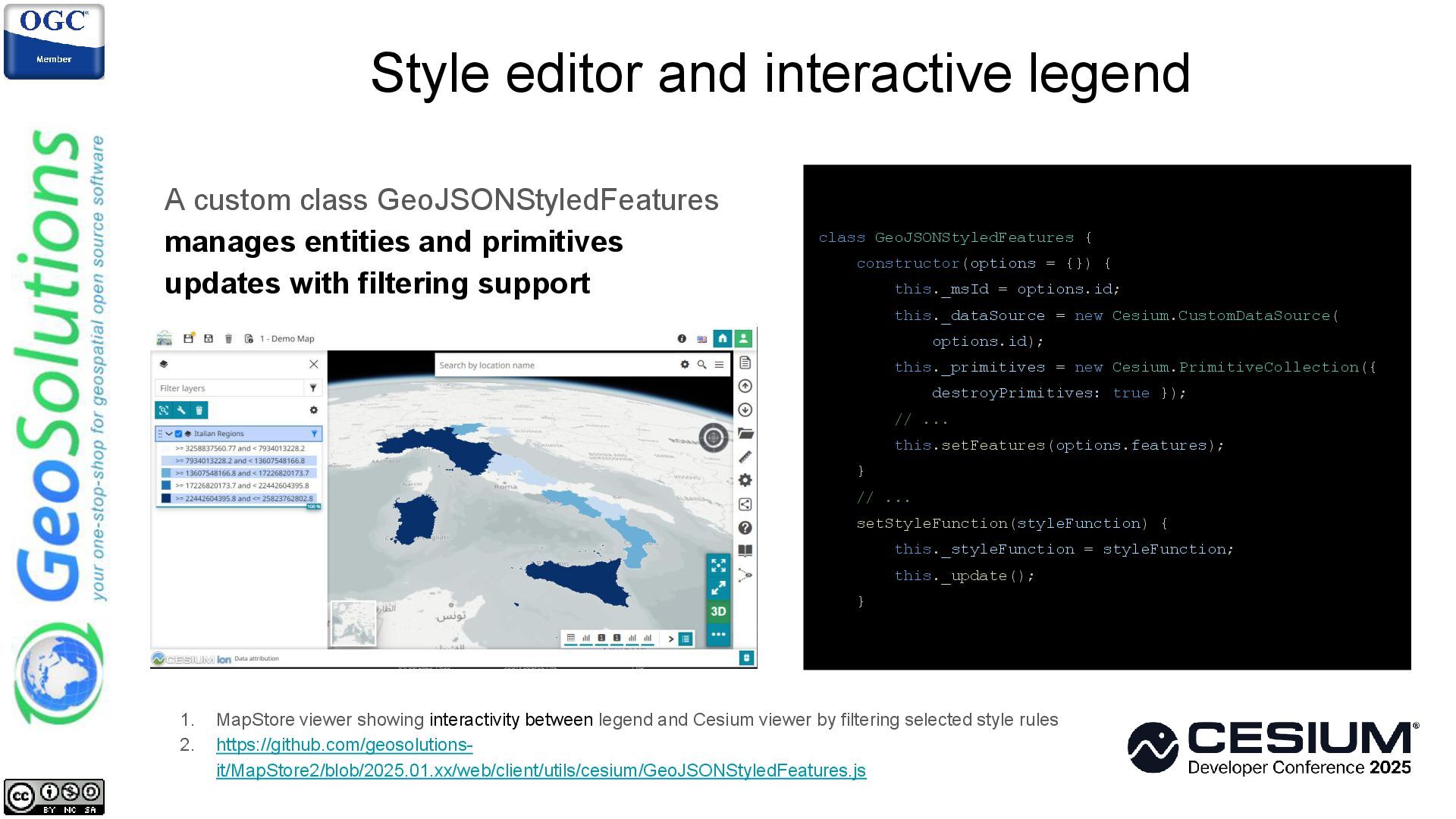
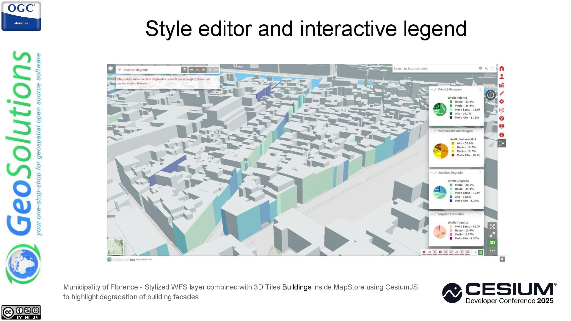
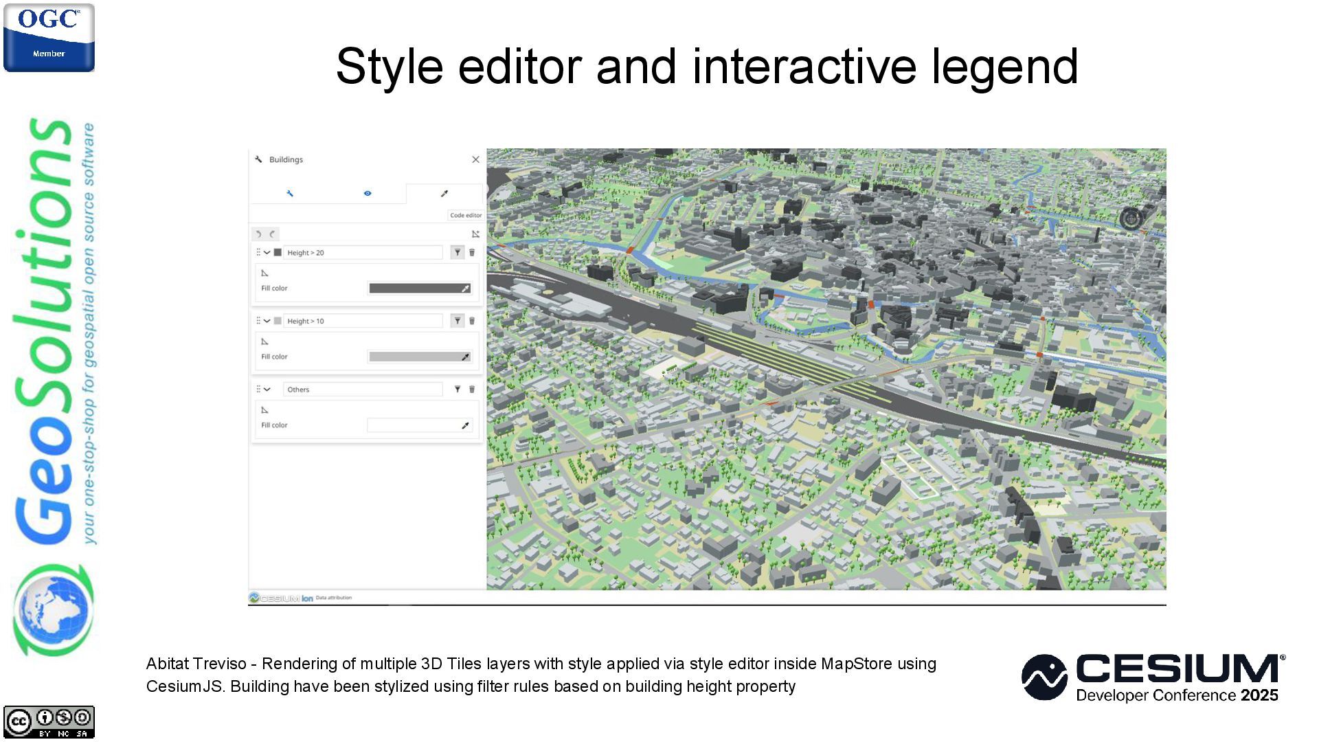
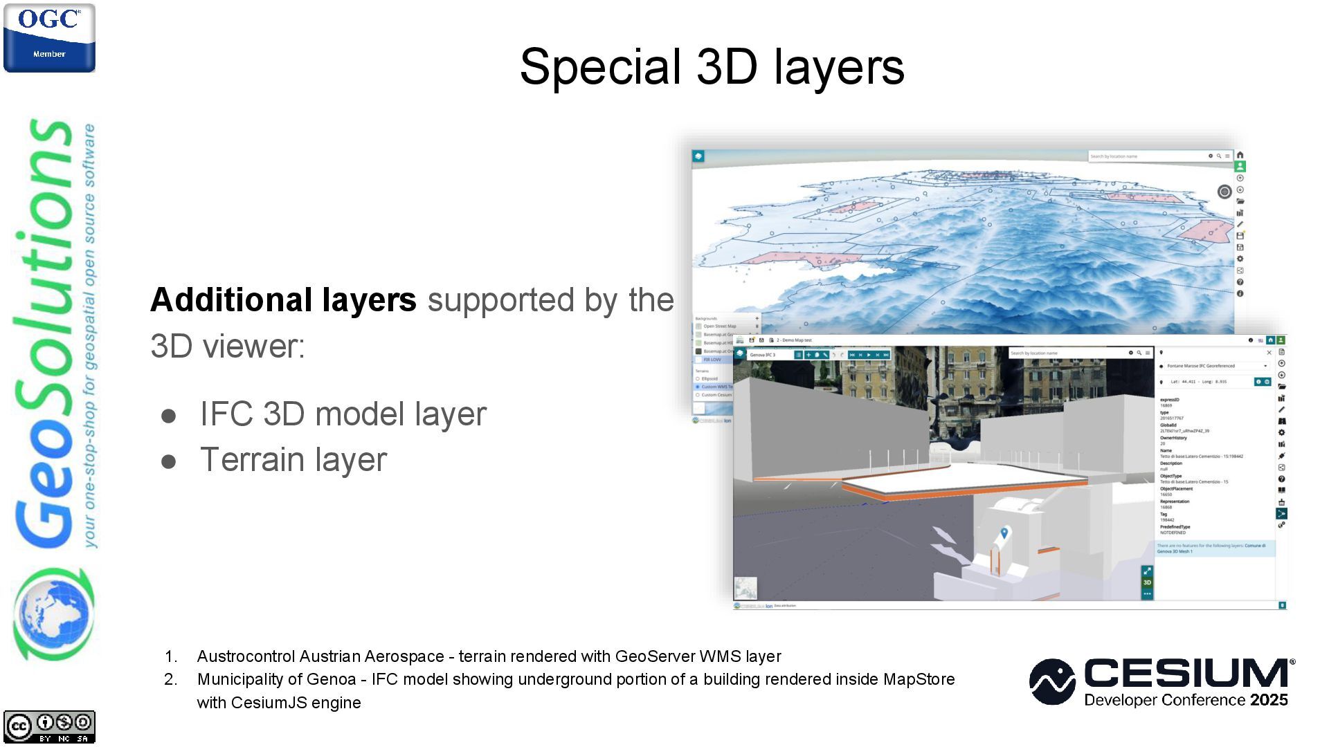
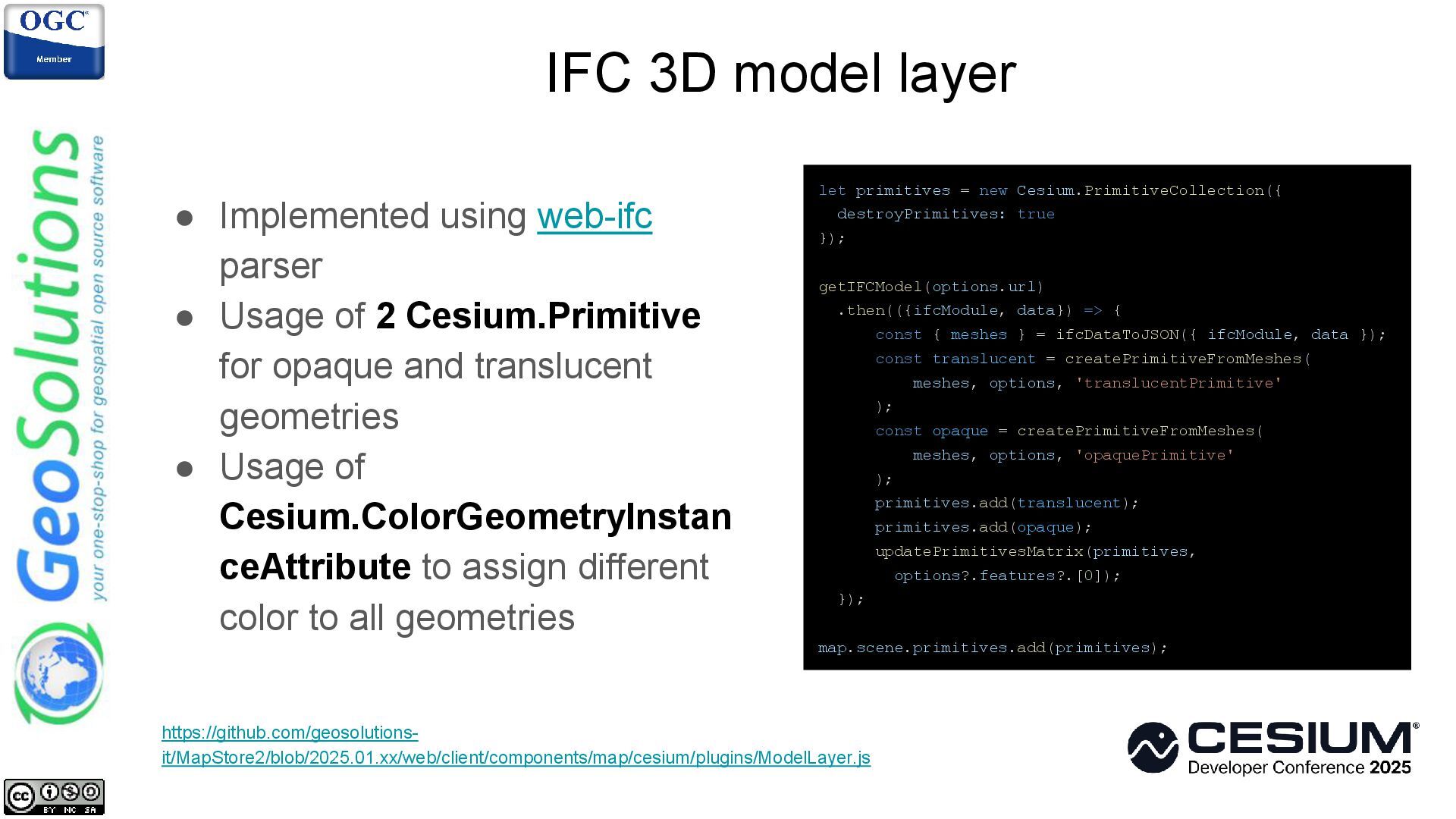
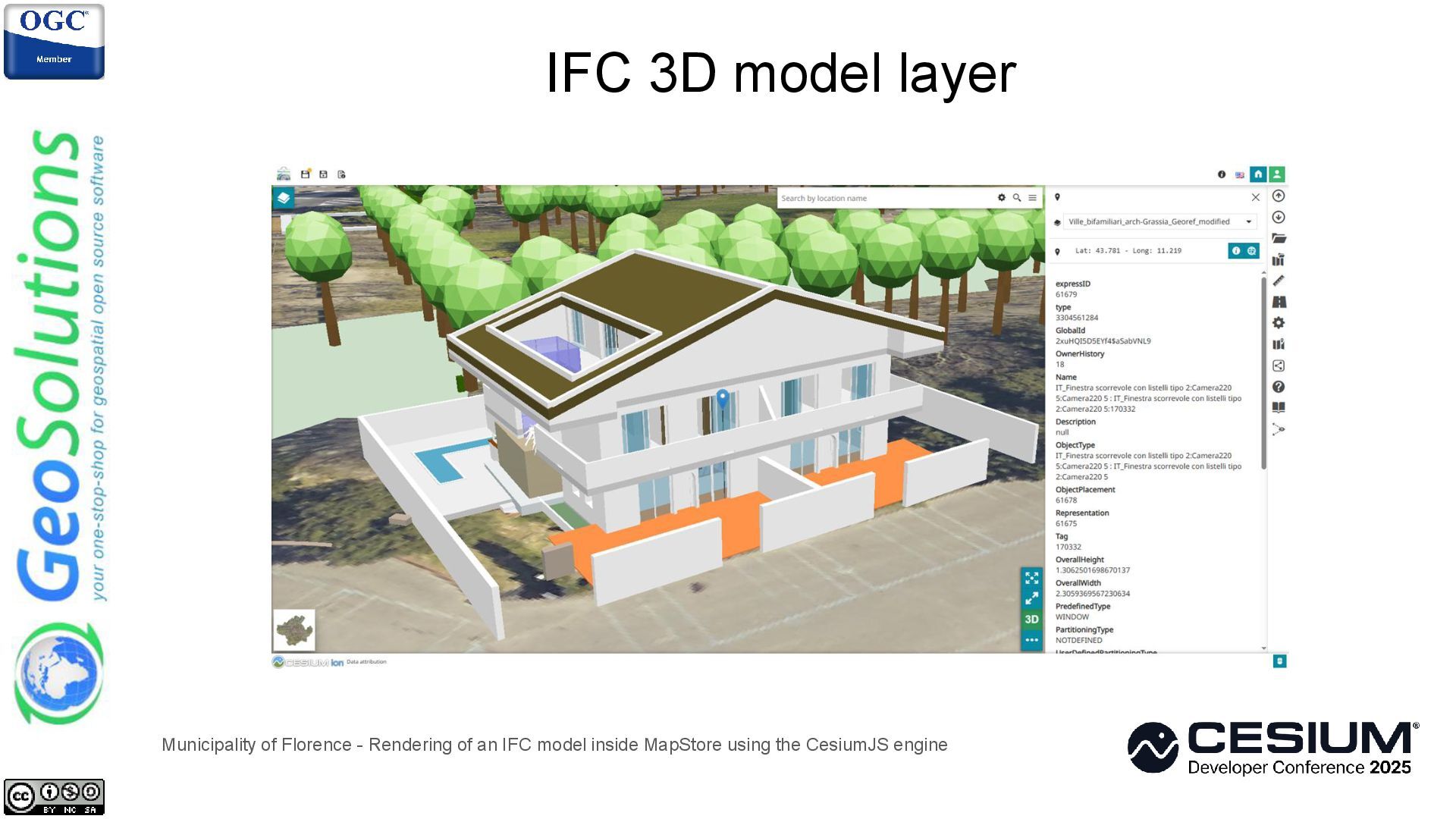
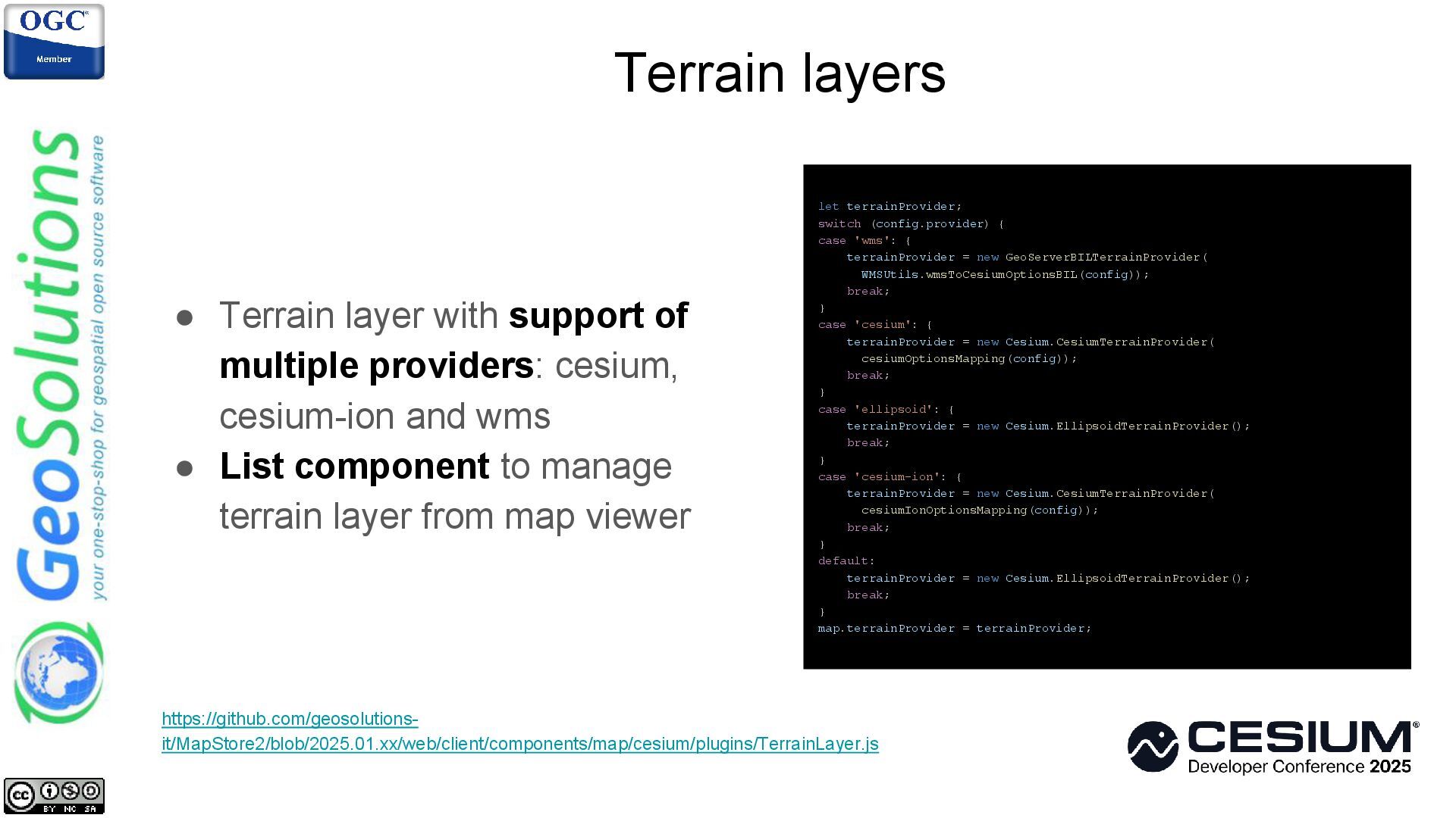
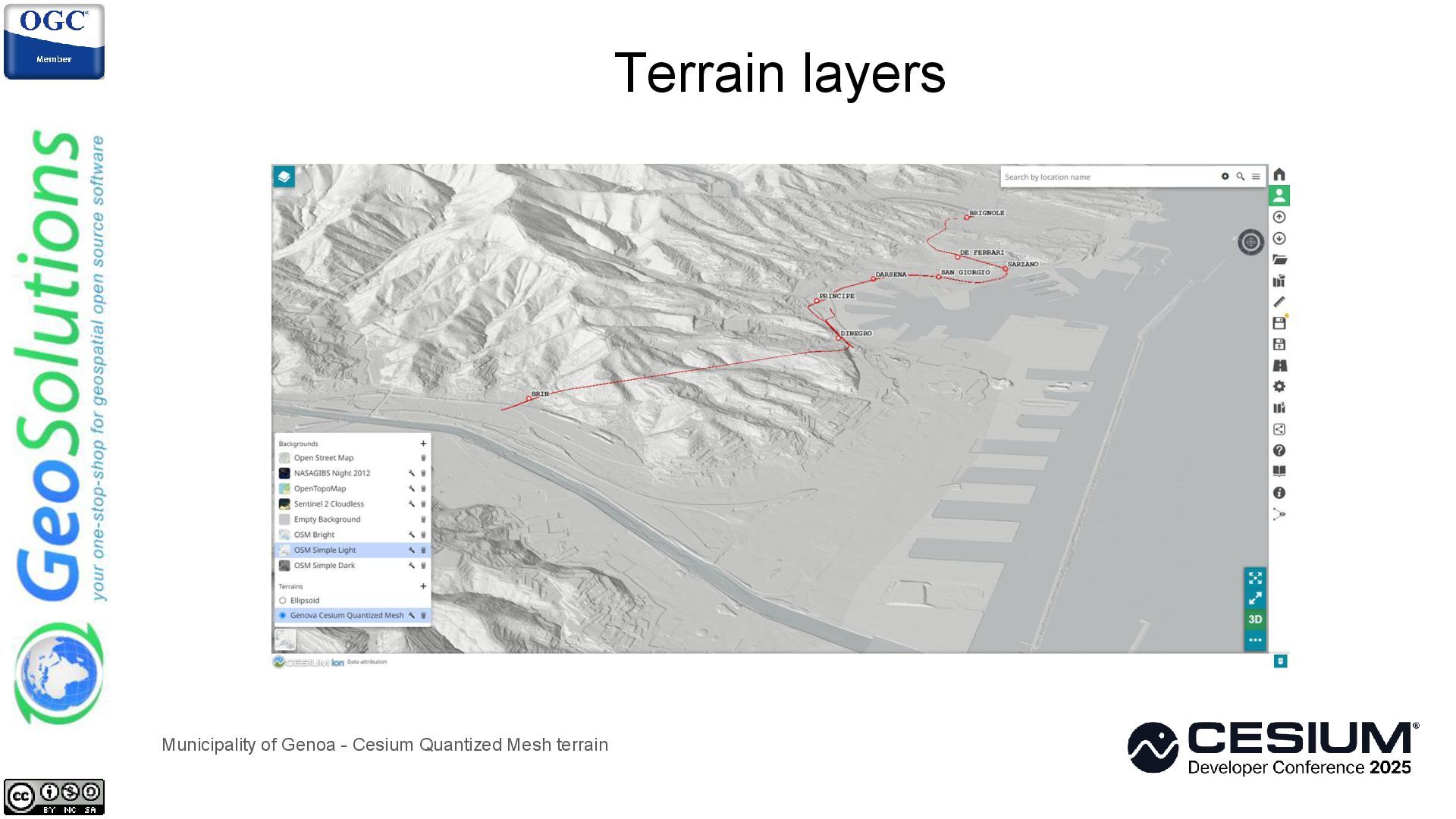
MapStore is an open-source WebGIS application designed for cross-platform compatibility, functioning seamlessly across various web browsers and mobile devices. Its user-friendly interface empowers users to effortlessly create, customize, and share a wide range of interactive geospatial content, including dynamic maps, insightful dashboards, informative charts, and compelling geostories. Users can integrate and visualize diverse geospatial data and design engaging presentations that effectively communicate spatial information and insights on top of OGC community standards. MapStore’s nature fosters collaboration and community-driven development, allowing users to contribute to the project, extend its functionality, and tailor it to their specific needs. This presentation outlines the open-source tools that the author and his team implemented in MapStore to enrich its 3D capabilities. The presenter will showcase the most relevant 3D tools implemented on top of CesiumJS as a result of many contributions coming from Italian Public Administrations such as the municipalities of Florence and Genoa as well as the Austrocontrol Austrian Aerospace and many others organizations worldwide. The presentation also focuses on specific code implementation of such tools, to highlight the potential of the framework's capabilities in managing functionalities like: 3D measurements, 3D annotations, styling, 3D Tiles and 3D models support, Map Views and Terrain layers.
![[email protected] [email protected]](https://files.speakerdeck.com/presentations/1911b898a7c54c229ffe9331f1b3f79f/slide_33.jpg)