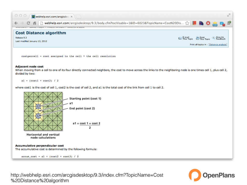
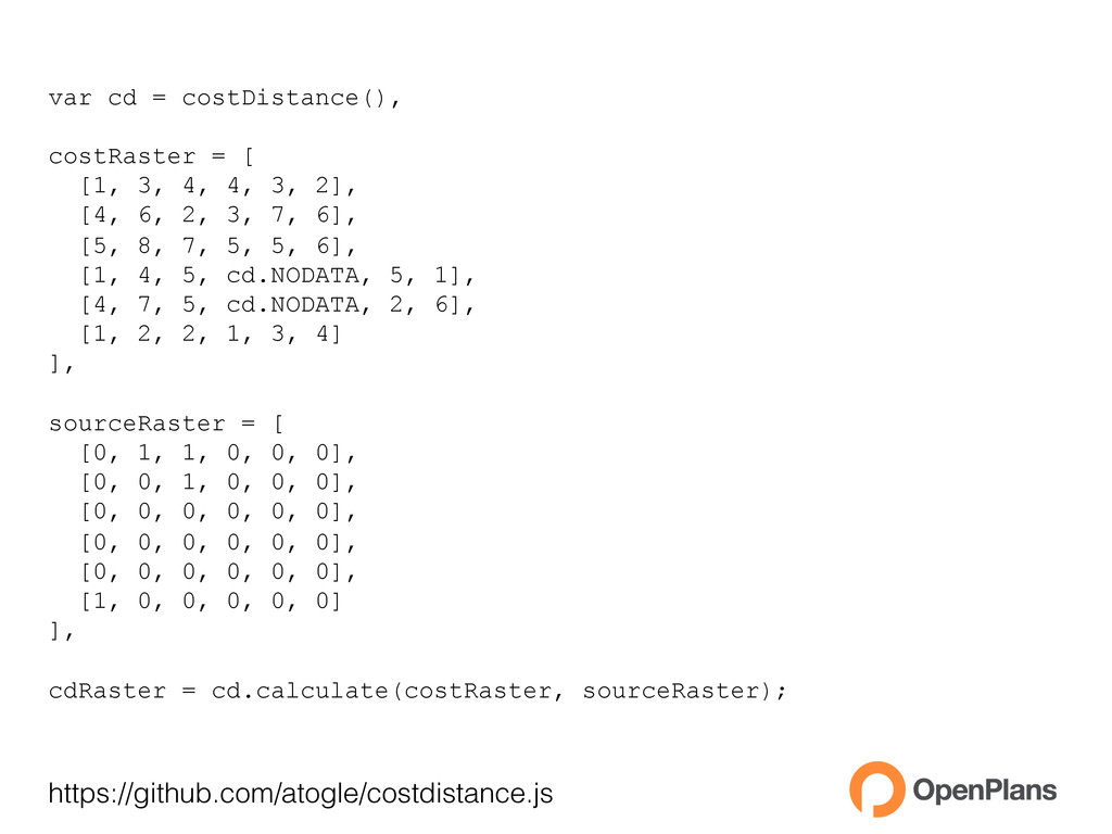
4, 4, 3, 2], [4, 6, 2, 3, 7, 6], [5, 8, 7, 5, 5, 6], [1, 4, 5, cd.NODATA, 5, 1], [4, 7, 5, cd.NODATA, 2, 6], [1, 2, 2, 1, 3, 4] ], sourceRaster = [ [0, 1, 1, 0, 0, 0], [0, 0, 1, 0, 0, 0], [0, 0, 0, 0, 0, 0], [0, 0, 0, 0, 0, 0], [0, 0, 0, 0, 0, 0], [1, 0, 0, 0, 0, 0] ], cdRaster = cd.calculate(costRaster, sourceRaster);