Upgrade to Pro — share decks privately, control downloads, hide ads and more …

Prototype a Mapping application

Prototype a Mapping application

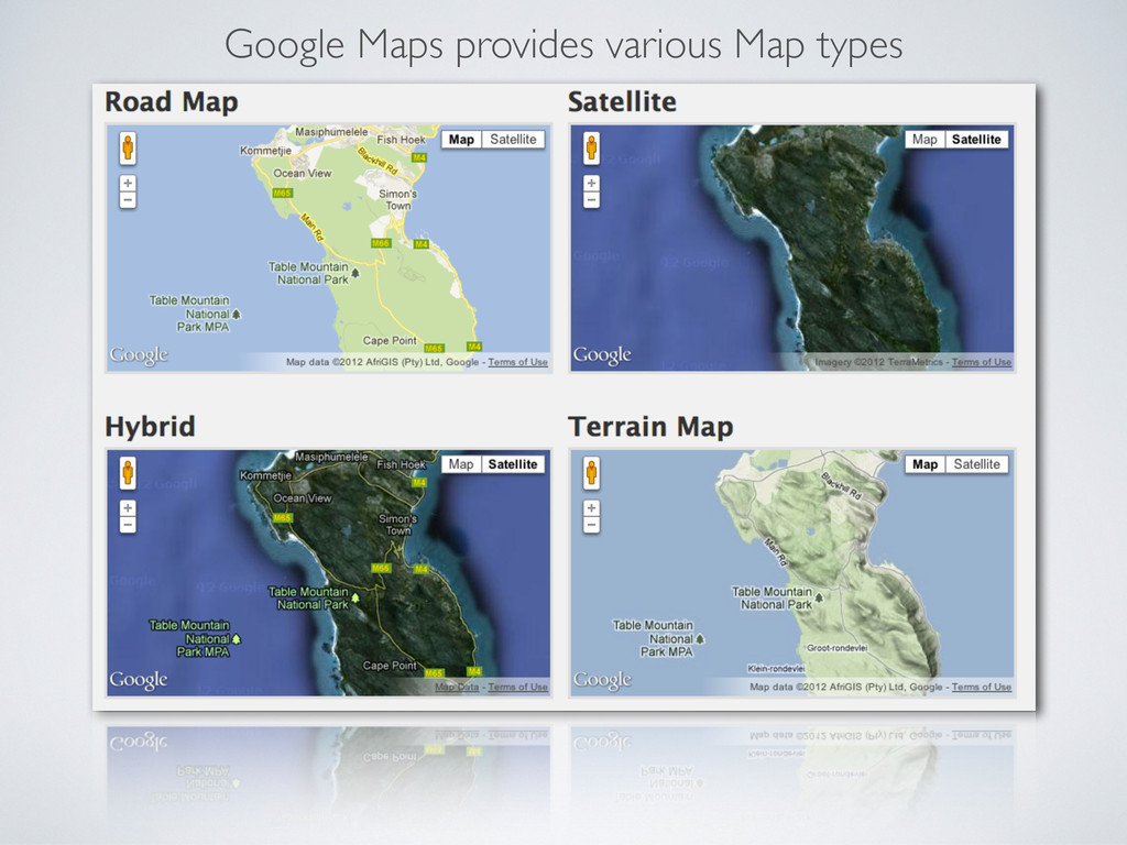
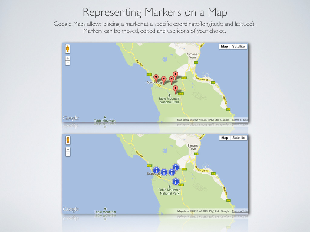
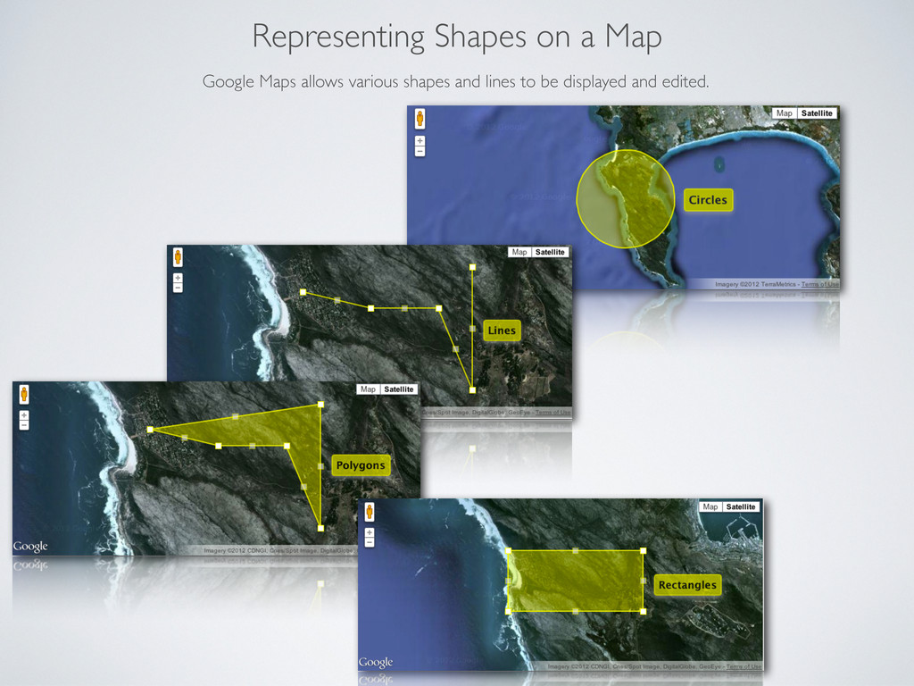
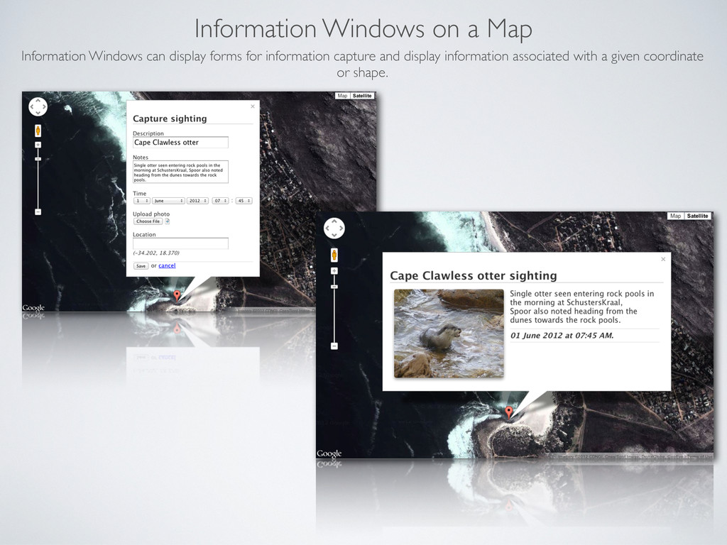
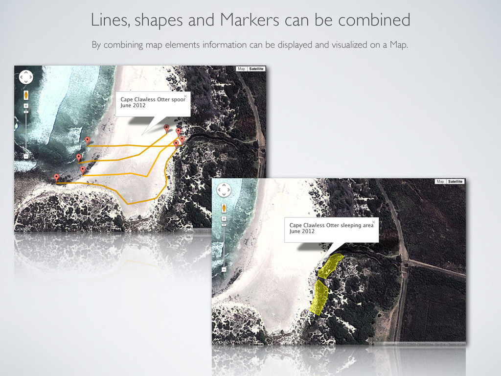
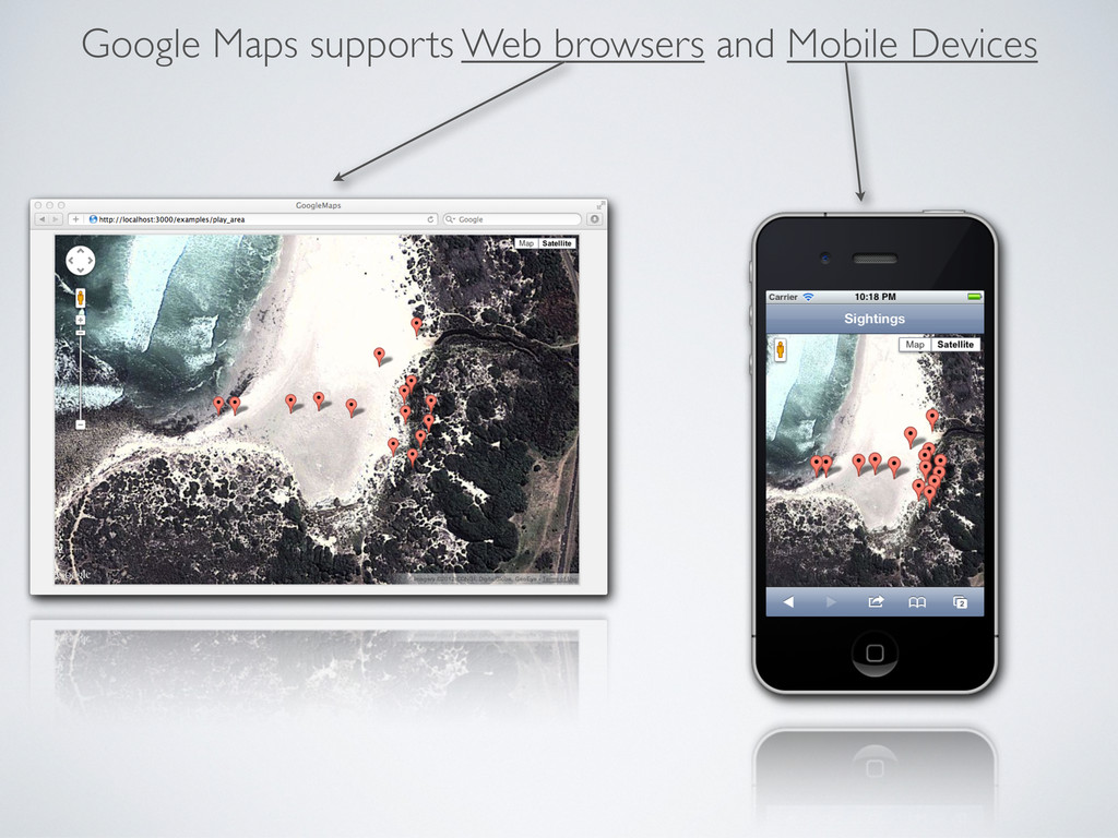
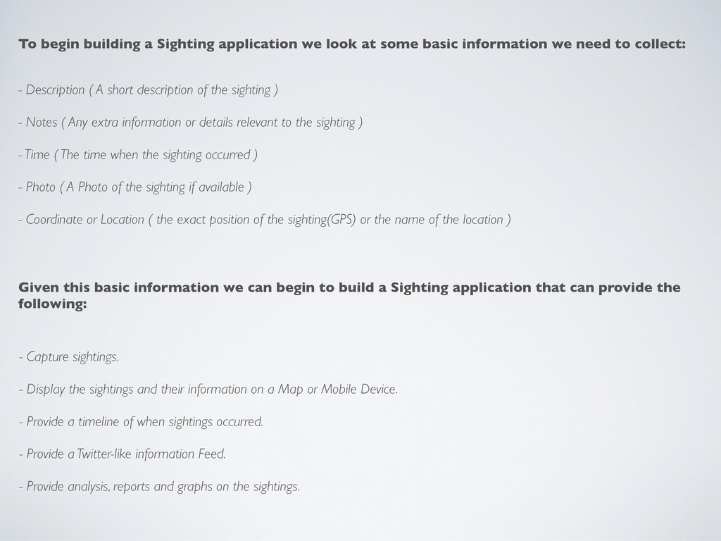
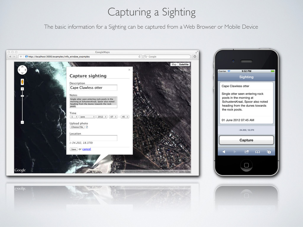
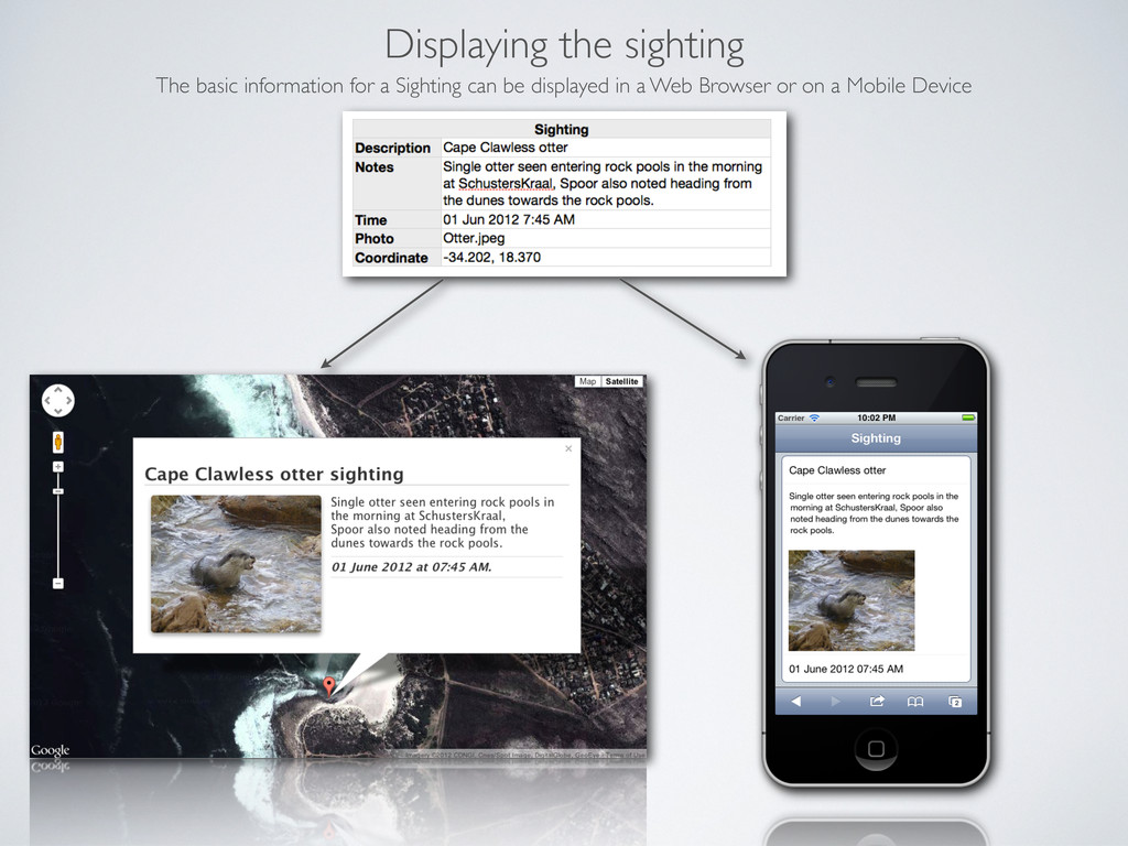
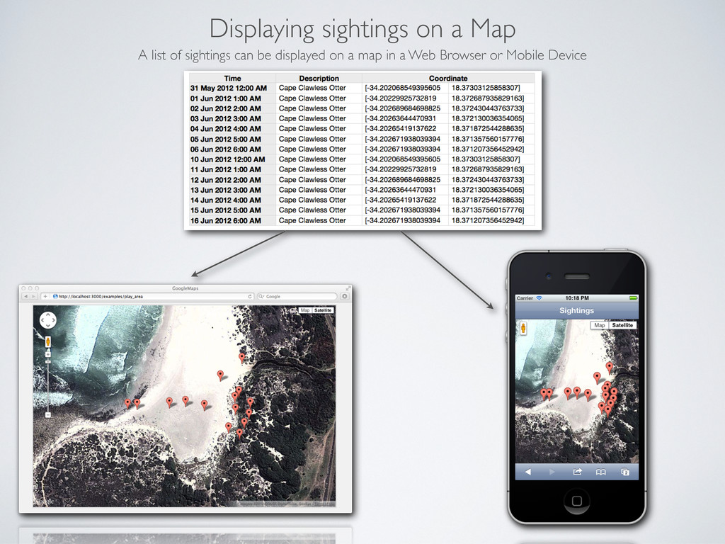
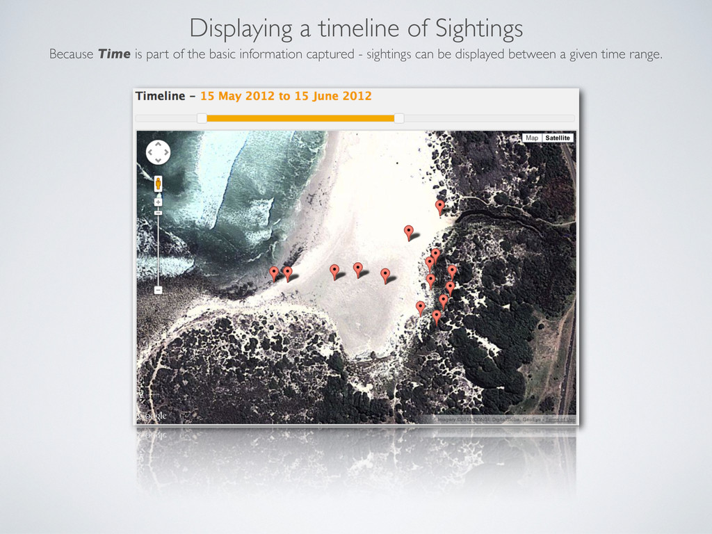
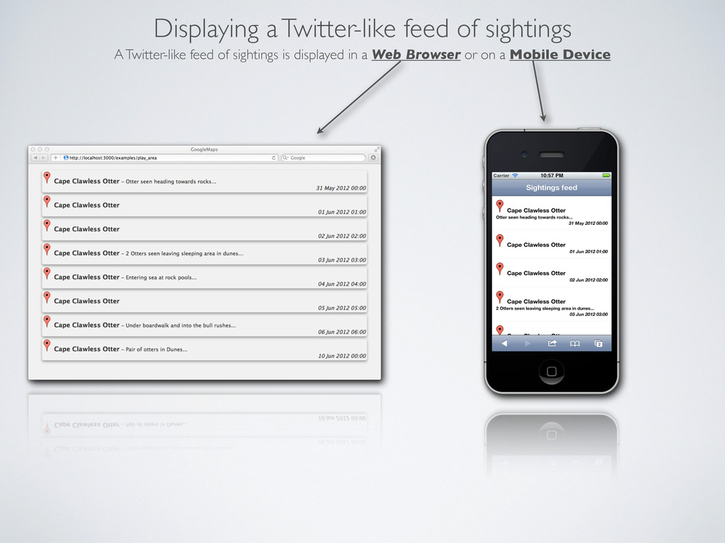
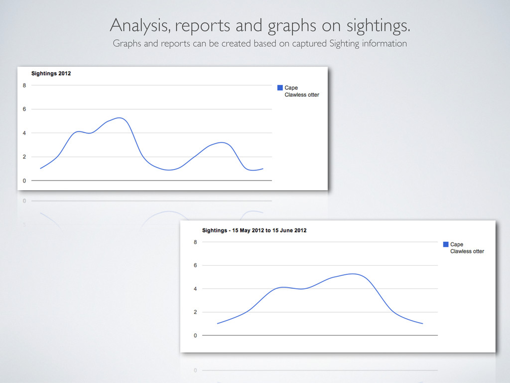
The following presentation shows the capabilities of Google Maps V3 as a mapping platform and touches on building a basic "Sightings" mapping application - that captures and displayed sightings at a given location and time.

The presentations purpose is to briefly convey the possibilities for a prototype mapping application.

ghostsamurai

June 01, 2012
Tweet

More Decks by ghostsamurai

Other Decks in Technology

Transcript

  1. Representing Markers on a Map Google Maps allows placing a

    marker at a specific coordinate(longitude and latitude). Markers can be moved, edited and use icons of your choice.
  2. Information Windows on a Map Information Windows can display forms

    for information capture and display information associated with a given coordinate or shape.
  3. Lines, shapes and Markers can be combined By combining map

    elements information can be displayed and visualized on a Map.
  4. - Description ( A short description of the sighting )

    - Notes ( Any extra information or details relevant to the sighting ) - Time ( The time when the sighting occurred ) - Photo ( A Photo of the sighting if available ) - Coordinate or Location ( the exact position of the sighting(GPS) or the name of the location ) To begin building a Sighting application we look at some basic information we need to collect: Given this basic information we can begin to build a Sighting application that can provide the following: - Capture sightings. - Display the sightings and their information on a Map or Mobile Device. - Provide a timeline of when sightings occurred. - Provide a Twitter-like information Feed. - Provide analysis, reports and graphs on the sightings.
  5. Capturing a Sighting The basic information for a Sighting can

    be captured from a Web Browser or Mobile Device
  6. Displaying the sighting The basic information for a Sighting can

    be displayed in a Web Browser or on a Mobile Device
  7. Displaying sightings on a Map A list of sightings can

    be displayed on a map in a Web Browser or Mobile Device
  8. Displaying a timeline of Sightings Because Time is part of

    the basic information captured - sightings can be displayed between a given time range.
  9. Displaying a Twitter-like feed of sightings A Twitter-like feed of

    sightings is displayed in a Web Browser or on a Mobile Device
  10. Analysis, reports and graphs on sightings. Graphs and reports can

    be created based on captured Sighting information