a tool to solve global scale problems •Steered by ISCGM (International Steering Committee for global mapping) •Participated by National Geospatial Info. Authorities. Global Map: Digital geospatial info. at a scale of 1:1 million National/Regional version: Vector (Boundary, Transport, Drainage, Population centers), Raster (Elevation, Land use, Land cover, Vegetation) Global version: Elevation, Land cover, Vegetation 4
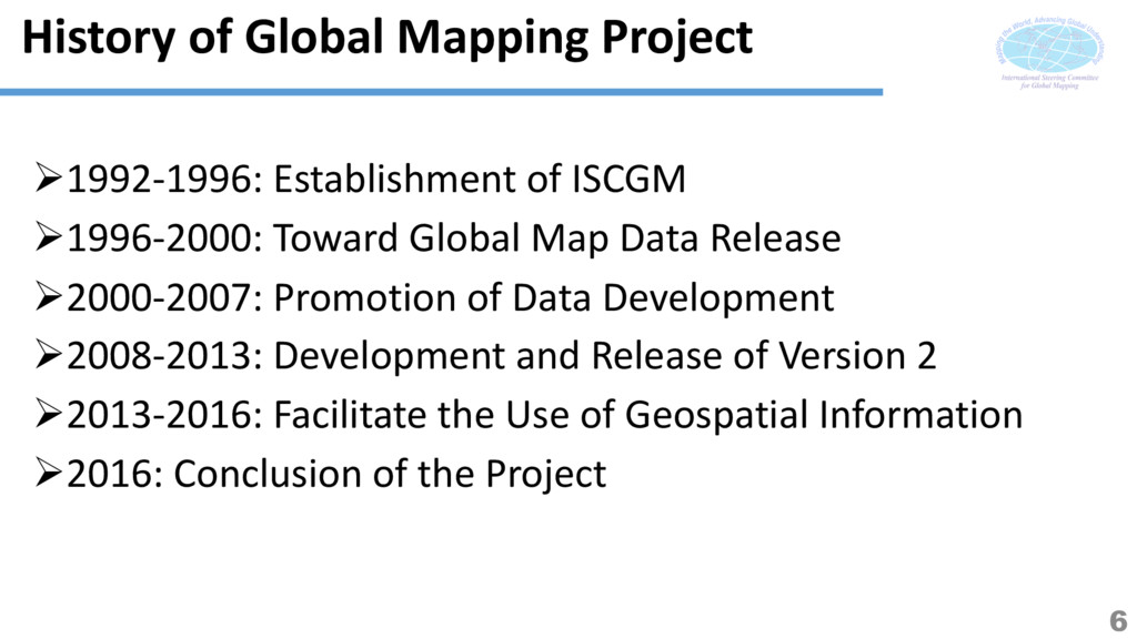
Toward Global Map Data Release Ø2000-2007: Promotion of Data Development Ø2008-2013: Development and Release of Version 2 Ø2013-2016: Facilitate the Use of Geospatial Information Ø2016: Conclusion of the Project 6
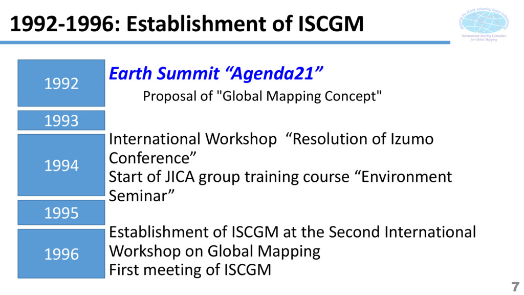
"Global Mapping Concept" International Workshop “Resolution of Izumo Conference” Start of JICA group training course “Environment Seminar” Establishment of ISCGM at the Second International Workshop on Global Mapping First meeting of ISCGM 1992-1996: Establishment of ISCGM 7
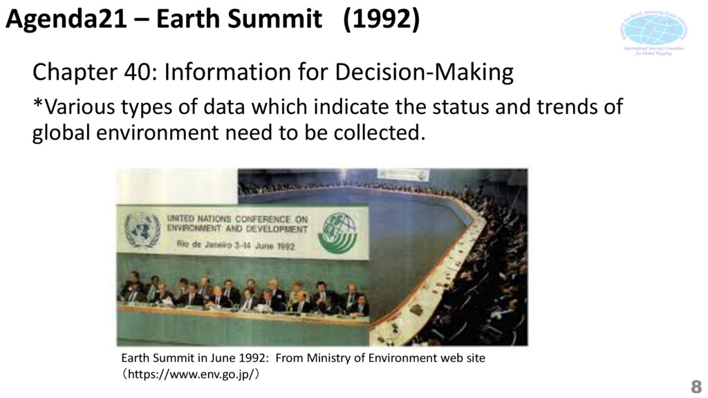
From Ministry of Environment web site (https://www.env.go.jp/) Chapter 40: Information for Decision-Making *Various types of data which indicate the status and trends of global environment need to be collected. 8
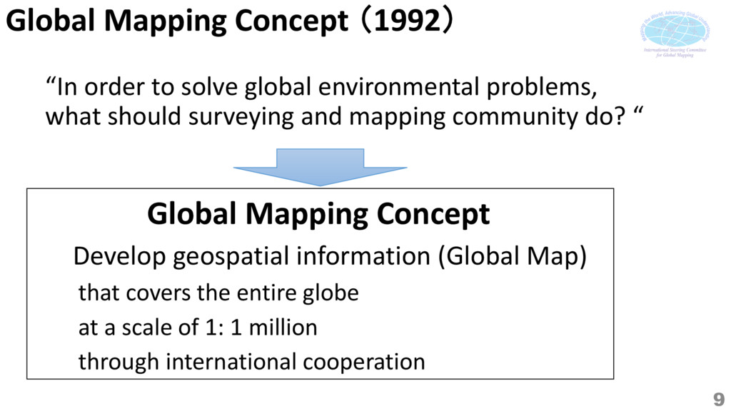
problems, what should surveying and mapping community do? “ 9 Develop geospatial information (Global Map) that covers the entire globe at a scale of 1: 1 million through international cooperation Global Mapping Concept
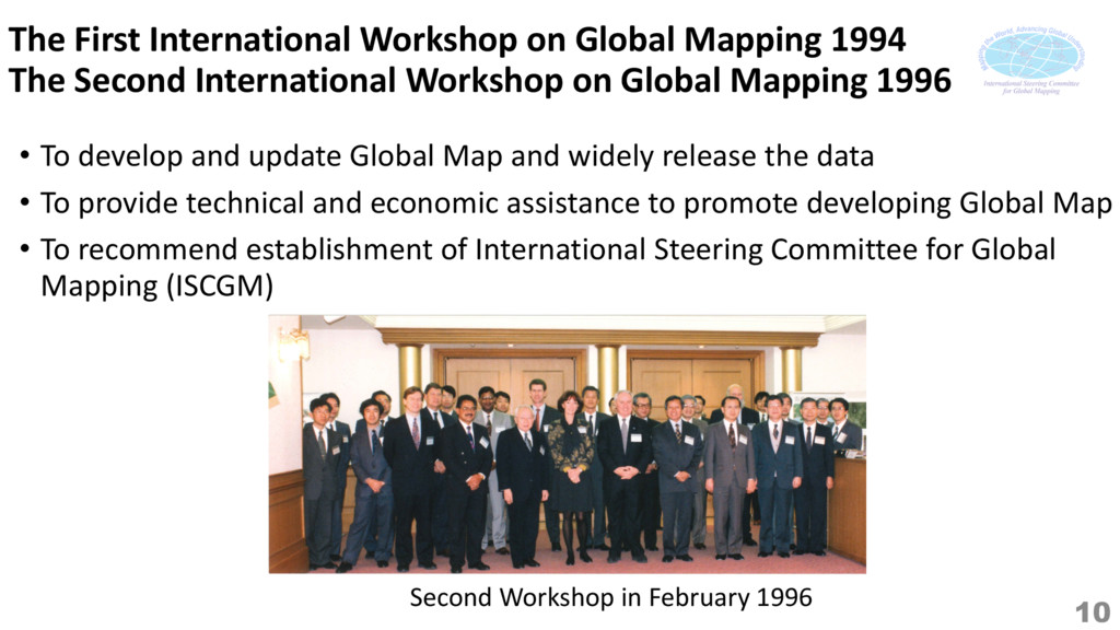
the data • To provide technical and economic assistance to promote developing Global Map • To recommend establishment of International Steering Committee for Global Mapping (ISCGM) The First International Workshop on Global Mapping 1994 The Second International Workshop on Global Mapping 1996 Second Workshop in February 1996 10
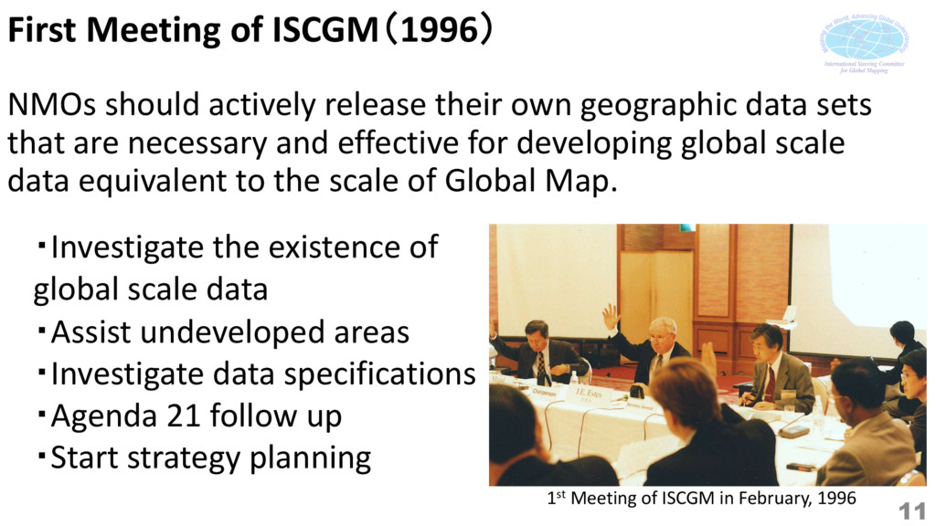
geographic data sets that are necessary and effective for developing global scale data equivalent to the scale of Global Map. ・Investigate the existence of global scale data ・Assist undeveloped areas ・Investigate data specifications ・Agenda 21 follow up ・Start strategy planning 1st Meeting of ISCGM in February, 1996 11
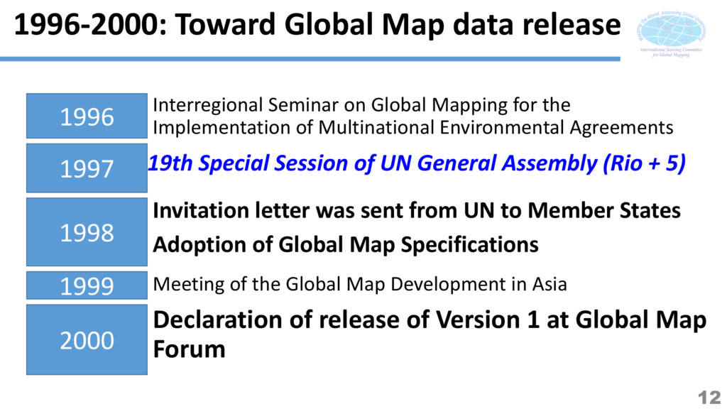
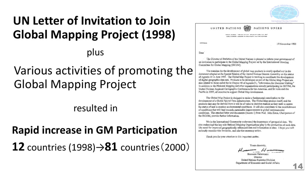
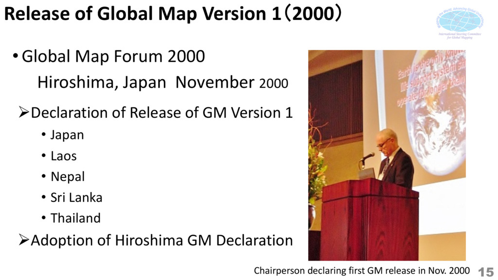
UN General Assembly (Rio + 5) Invitation letter was sent from UN to Member States Adoption of Global Map Specifications Declaration of release of Version 1 at Global Map Forum 1997 1998 1999 2000 1996 Interregional Seminar on Global Mapping for the Implementation of Multinational Environmental Agreements Meeting of the Global Map Development in Asia 12
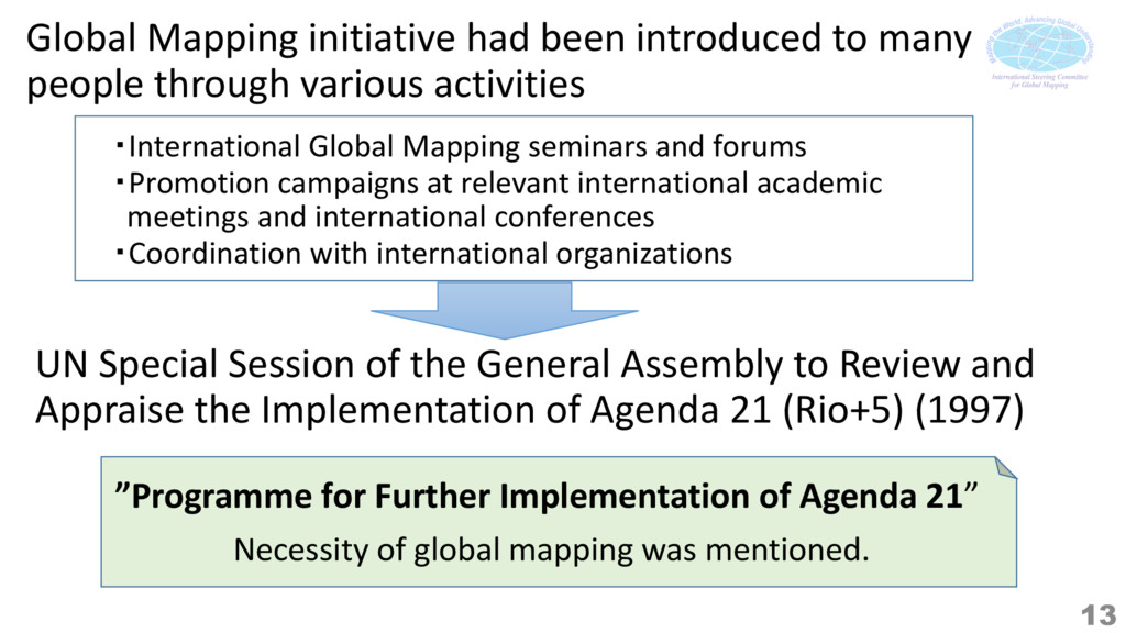
Appraise the Implementation of Agenda 21 (Rio+5) (1997) Necessity of global mapping was mentioned. ・International Global Mapping seminars and forums ・Promotion campaigns at relevant international academic meetings and international conferences ・Coordination with international organizations ”Programme for Further Implementation of Agenda 21” Global Mapping initiative had been introduced to many people through various activities 13
Rapid increase in GM Participation 12 countries (1998)→81 countries(2000) Various activities of promoting the Global Mapping Project 14 plus resulted in
GM Version 1 • Japan • Laos • Nepal • Sri Lanka • Thailand ØAdoption of Hiroshima GM Declaration • Global Map Forum 2000 Hiroshima, Japan November 2000 Chairperson declaring first GM release in Nov. 2000 15
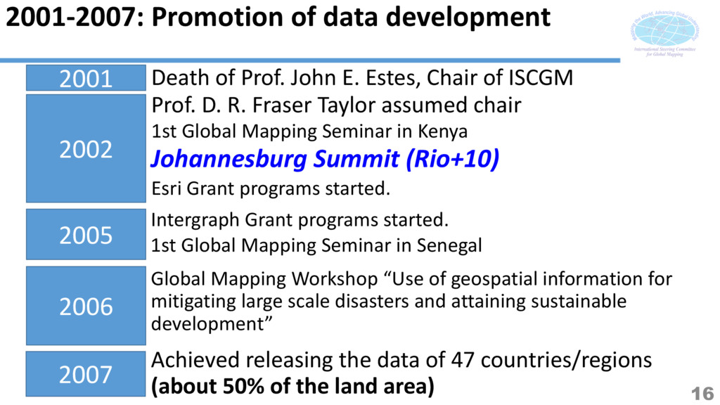
assumed chair 2001 2002 Death of Prof. John E. Estes, Chair of ISCGM 1st Global Mapping Seminar in Kenya Johannesburg Summit (Rio+10) Esri Grant programs started. Intergraph Grant programs started. Global Mapping Workshop “Use of geospatial information for mitigating large scale disasters and attaining sustainable development” 2005 2006 2007 Achieved releasing the data of 47 countries/regions (about 50% of the land area) 1st Global Mapping Seminar in Senegal 16
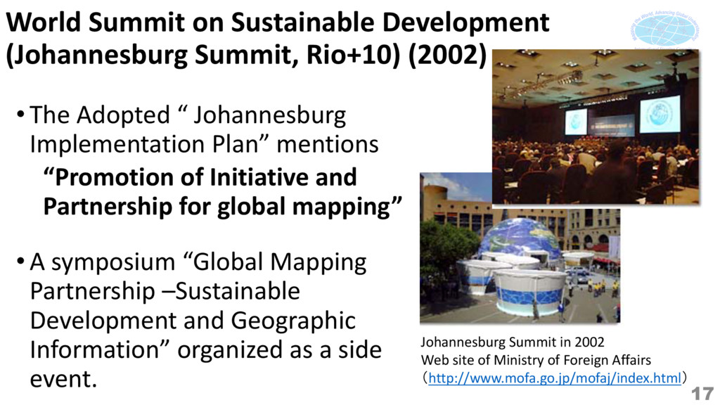
Adopted “ Johannesburg Implementation Plan” mentions “Promotion of Initiative and Partnership for global mapping” Johannesburg Summit in 2002 Web site of Ministry of Foreign Affairs (http://www.mofa.go.jp/mofaj/index.html) 17 •A symposium “Global Mapping Partnership –Sustainable Development and Geographic Information” organized as a side event.
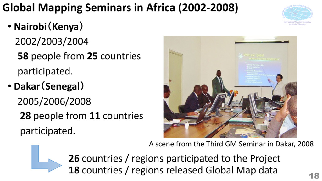
people from 25 countries participated. • Dakar(Senegal) 2005/2006/2008 28 people from 11 countries participated. A scene from the Third GM Seminar in Dakar, 2008 26 countries / regions participated to the Project 18 countries / regions released Global Map data 18
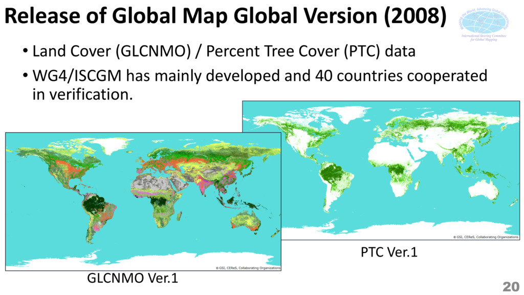
Development (Rio+20) 2009 2010 2011 2012 2008 Global Mapping Forum 2008/Global Map Tokyo Declaration "Global Map Global Version"ver.1 was released. 2013 First release of Global Map ver. 2 (national / regional). 1st UNCE-GGIM "Global Map Global Version"ver.2 was released. 2008-2013: Development and Release of version 2 19
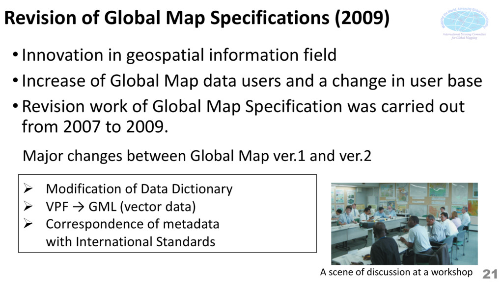
information field • Increase of Global Map data users and a change in user base • Revision work of Global Map Specification was carried out from 2007 to 2009. Ø Modification of Data Dictionary Ø VPF → GML (vector data) Ø Correspondence of metadata with International Standards Major changes between Global Map ver.1 and ver.2 21 A scene of discussion at a workshop
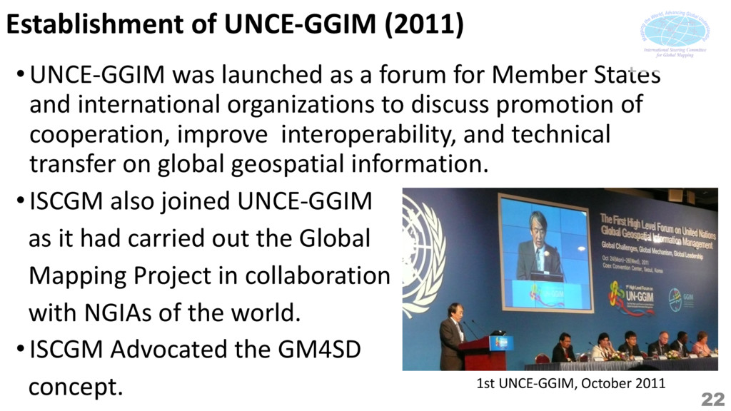
forum for Member States and international organizations to discuss promotion of cooperation, improve interoperability, and technical transfer on global geospatial information. • ISCGM also joined UNCE-GGIM as it had carried out the Global Mapping Project in collaboration with NGIAs of the world. • ISCGM Advocated the GM4SD concept. 1st UNCE-GGIM, October 2011 22
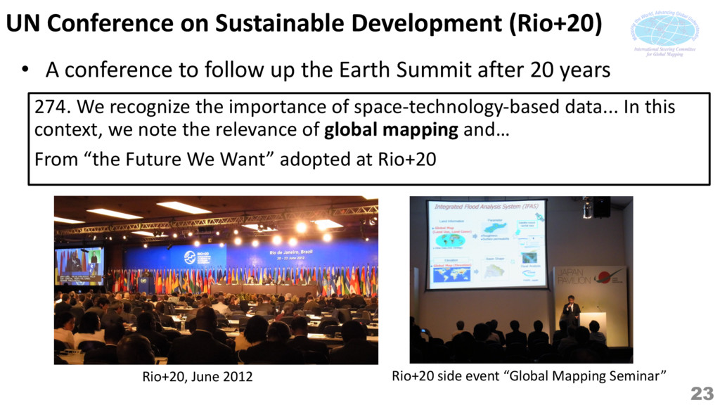
follow up the Earth Summit after 20 years Rio+20, June 2012 Rio+20 side event “Global Mapping Seminar” 274. We recognize the importance of space-technology-based data... In this context, we note the relevance of global mapping and… From “the Future We Want” adopted at Rio+20 23
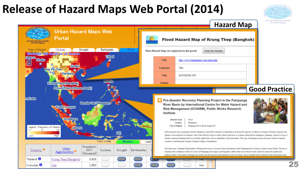
Disaster Management“ Hazard Maps Web Portal site and Catalogue Service were released. 2014 2015 2013 Over the 30 countries released Global Map data as EuroGlobalMap became OpenData. Professor Paul Cheung assumed new Chair 2013-2016: Facilitate the use of geospatial information 23rd Meeting of ISCGM / Data transfer ceremony 2016 Global Land Cover NMO Version ver.3 was released. 24
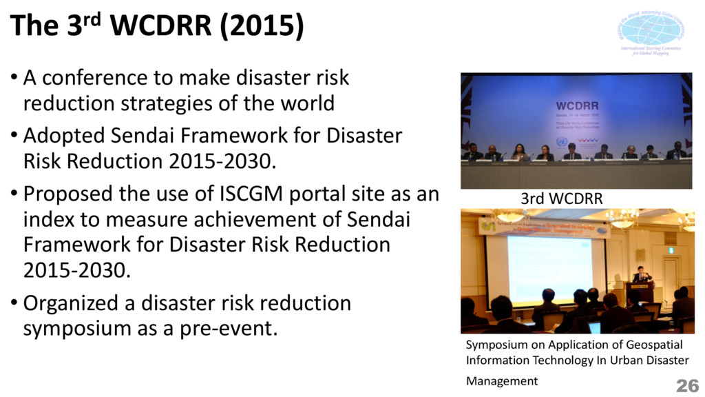
risk reduction strategies of the world • Adopted Sendai Framework for Disaster Risk Reduction 2015-2030. • Proposed the use of ISCGM portal site as an index to measure achievement of Sendai Framework for Disaster Risk Reduction 2015-2030. • Organized a disaster risk reduction symposium as a pre-event. 3rd WCDRR Symposium on Application of Geospatial Information Technology In Urban Disaster Management 26
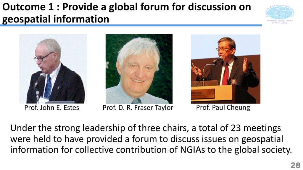
23 meetings were held to have provided a forum to discuss issues on geospatial information for collective contribution of NGIAs to the global society. Prof. John E. Estes Prof. D. R. Fraser Taylor Prof. Paul Cheung Outcome 1 : Provide a global forum for discussion on geospatial information 28
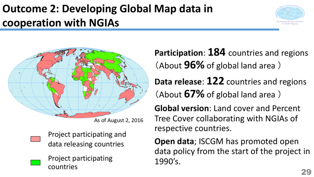
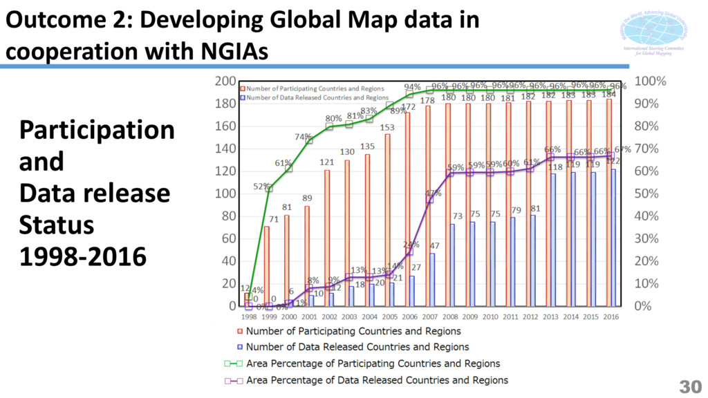
2: Developing Global Map data in cooperation with NGIAs Participation: 184 countries and regions (About 96% of global land area ) Data release: 122 countries and regions (About 67% of global land area ) Global version: Land cover and Percent Tree Cover collaborating with NGIAs of respective countries. Open data; ISCGM has promoted open data policy from the start of the project in 1990’s. Project participating and data releasing countries
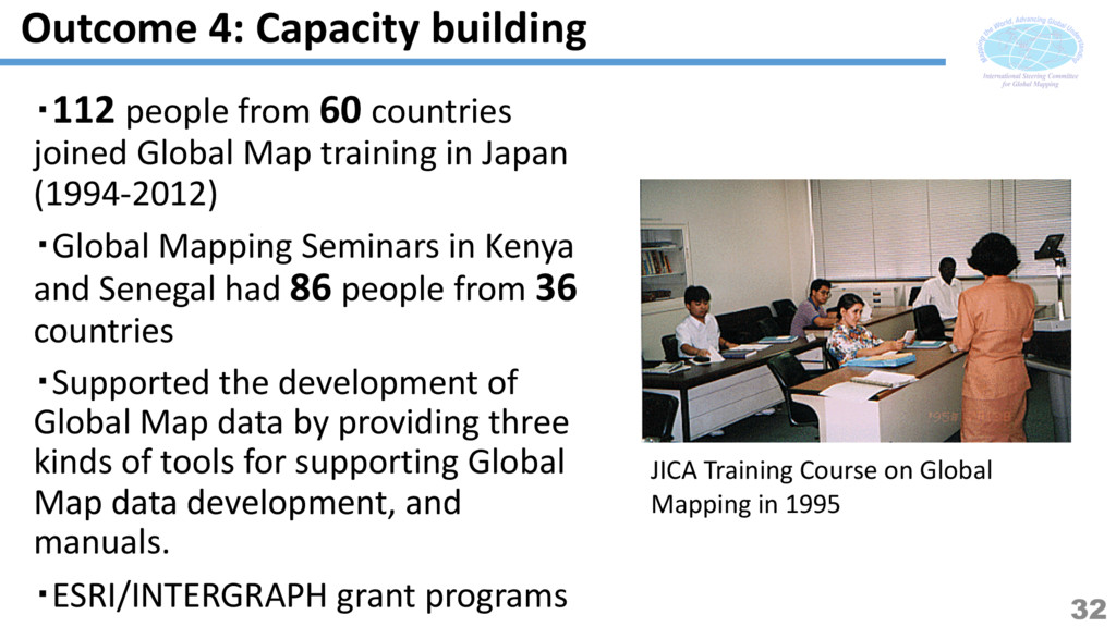
Japan (1994-2012) ・Global Mapping Seminars in Kenya and Senegal had 86 people from 36 countries ・Supported the development of Global Map data by providing three kinds of tools for supporting Global Map data development, and manuals. ・ESRI/INTERGRAPH grant programs JICA Training Course on Global Mapping in 1995 Outcome 4: Capacity building 32
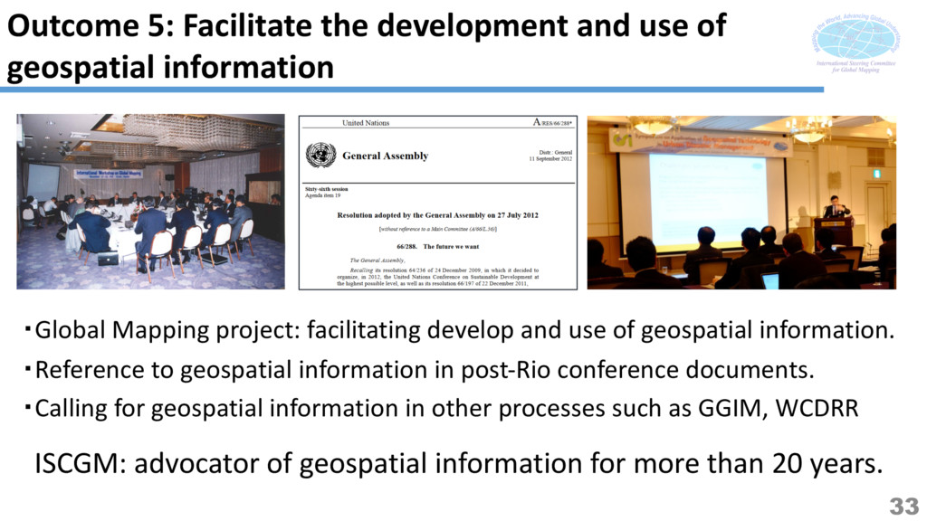
・Reference to geospatial information in post-Rio conference documents. ・Calling for geospatial information in other processes such as GGIM, WCDRR ISCGM: advocator of geospatial information for more than 20 years. 33 Outcome 5: Facilitate the development and use of geospatial information
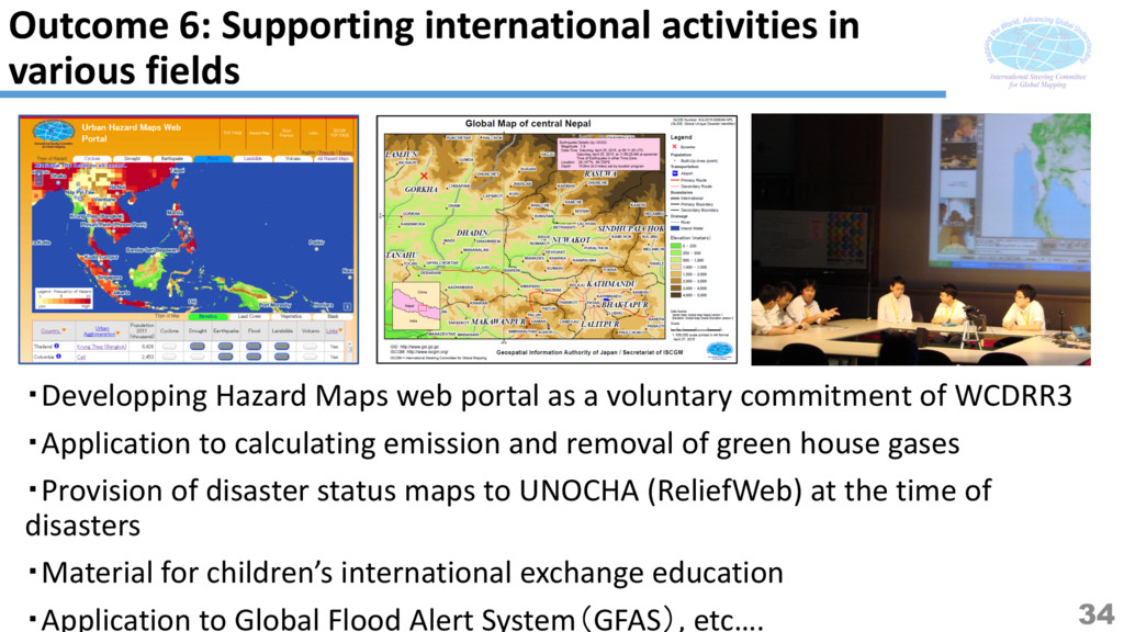
WCDRR3 ・Application to calculating emission and removal of green house gases ・Provision of disaster status maps to UNOCHA (ReliefWeb) at the time of disasters ・Material for children’s international exchange education ・Application to Global Flood Alert System(GFAS), etc…. Outcome 6: Supporting international activities in various fields 34
Earth Summit, which triggered starting the Global Mapping Project, and Twenty years have passed since the establishment of ISCGM. ・ 122 countries and regions, covering 67% of whole land areas released Global Map data as well as Global version data. ・ISCGM contributed to building capacity of digital mapping technology of NGIAs, particularly in developing world. ・ISCGM and all the participating members contributed to the world through promoting geospatial information including Global Map data. 35
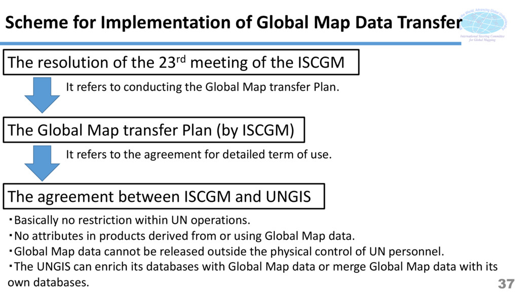
of the 23rd meeting of the ISCGM The Global Map transfer Plan (by ISCGM) The agreement between ISCGM and UNGIS It refers to conducting the Global Map transfer Plan. It refers to the agreement for detailed term of use. ・Basically no restriction within UN operations. ・No attributes in products derived from or using Global Map data. ・Global Map data cannot be released outside the physical control of UN personnel. ・The UNGIS can enrich its databases with Global Map data or merge Global Map data with its own databases. 37
the understanding that the Global Mapping project is going to conclude in the end of March 2017, ISCGM agrees not to gather anymore after the 23rd meeting. 2. ISCGM acknowledges the Global Map transfer Plan and instructs the secretariat to conduct it. 3. ISCGM instructs the secretariat to register the contents of the Urban Hazard Maps Web Portal to the Knowledge Base of UNCE-GGIM. ISCGM Secretariat will keep its minimum function until Mar. 2017 for carrying out the Global Map transfer Plan, not continuing the following. a) Update of the Internet site except the matters related to the report of the 23rd meeting. b) Administrating works related to the participation to the project, developing and updating Global Map data, and so on. Urban Hazard Maps Web Portal will be closed after completion of registering to Knowledge Base. 38
the Global Map data to UNGIS on behalf of the organization. 2. Global Map data can be used within the United Nations System without any restriction including mandatory attribution. The detailed terms of use are described in the agreement titled “Dissemination and handling in the use of the Global Map data provided from the International Steering Committee for Global Mapping (ISCGM) to the United Nations Geospatial Information Section (UNGIS) in support of the United Nations operations.” 3. In order to ensure availability of Global Map data on the Web, the secretariat will work to provide the availability of the data if they are not yet released from the participating organization. In this case, any user authentication or access logging are not provided. This plan is ’opt-in’: this plan is applied according to the agreement by respective participating organizations. Otherwise the Global Map data of the organization stays its own. ISCGM Secretariat will carry out the actual transfer of Global Map data no later than Mar. 2016. 39
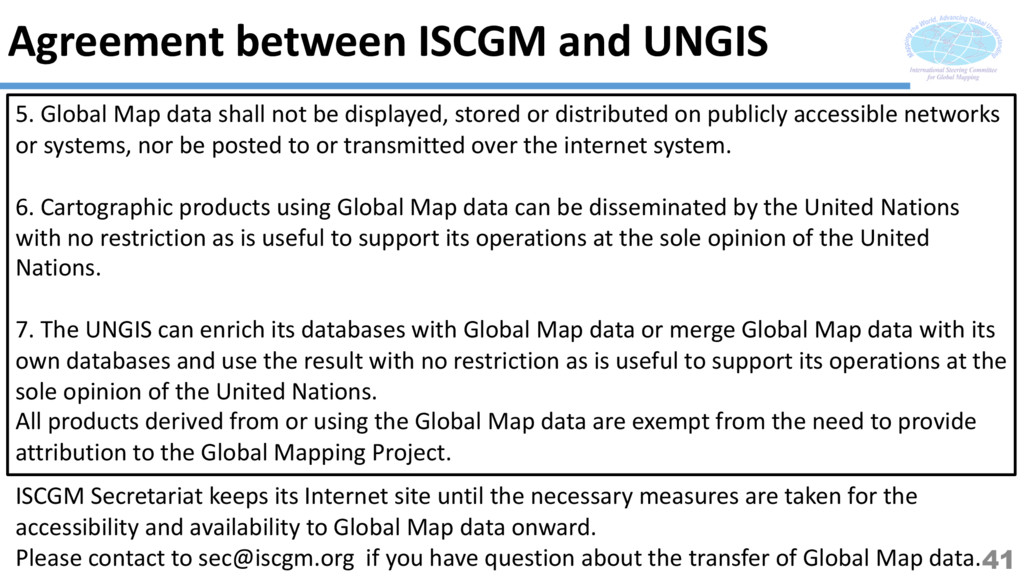
for Global Mapping (ISCGM), representing all its participating members, provides a copy of its Global Map data to the United Nations Geospatial Information Section (UNGIS), free of charge, and authorises perpetually its use in support of the United Nations operations without any restriction except the ones enumerated below. 2. The Chief of the Geospatial Information Section, Department of Field Support, United Nations (UNGIS) will act as the central repository and dissemination point for all Global Map data for its use in support of the United Nations operations and will assure that users are fully aware of the dissemination, handling and use condition of the Global Map data. 3. Global Map data shall only be used for the official purpose of supporting United Nations operations. Any other use beyond the scope of this official purpose is not authorized. 4. Global Map data cannot be released outside the physical control of United Nations personnel directly involved in supporting United Nations operations. 40
distributed on publicly accessible networks or systems, nor be posted to or transmitted over the internet system. 6. Cartographic products using Global Map data can be disseminated by the United Nations with no restriction as is useful to support its operations at the sole opinion of the United Nations. 7. The UNGIS can enrich its databases with Global Map data or merge Global Map data with its own databases and use the result with no restriction as is useful to support its operations at the sole opinion of the United Nations. All products derived from or using the Global Map data are exempt from the need to provide attribution to the Global Mapping Project. Agreement between ISCGM and UNGIS ISCGM Secretariat keeps its Internet site until the necessary measures are taken for the accessibility and availability to Global Map data onward. Please contact to [email protected] if you have question about the transfer of Global Map data.41