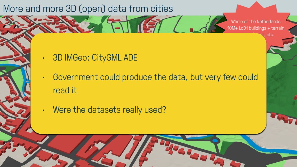
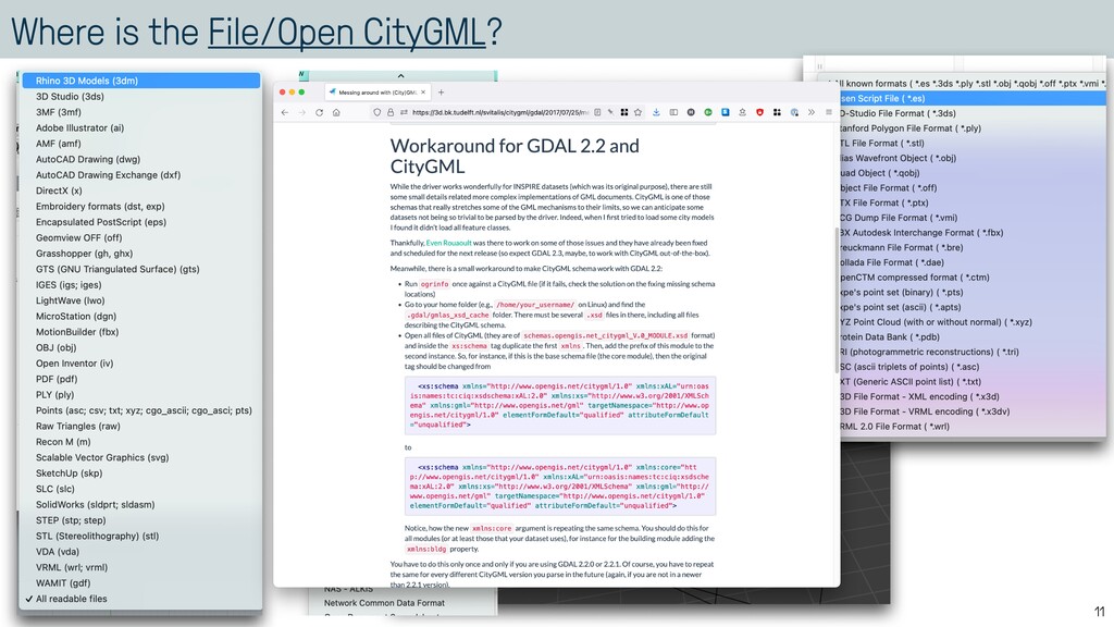
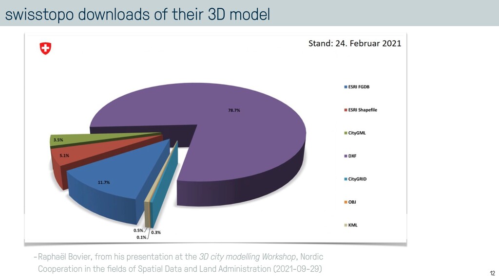
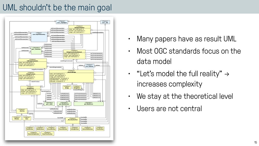
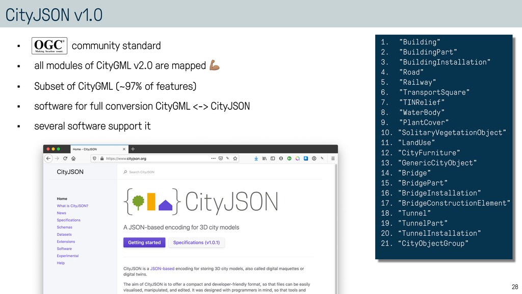
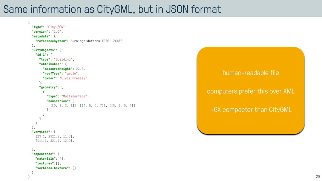
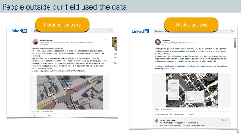
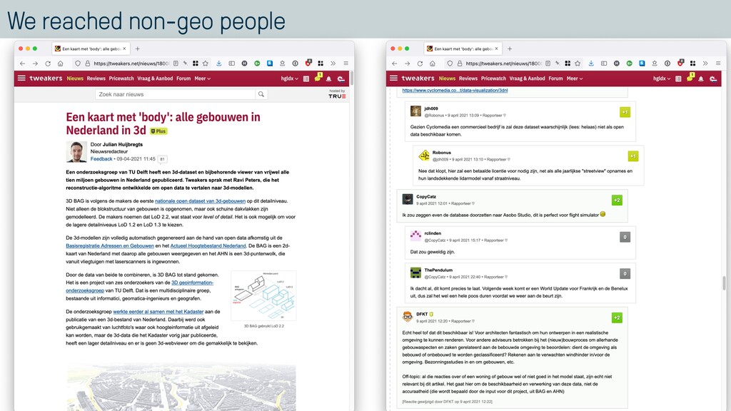
"type": “CityJSON", "version": “1.0”, "metadata": { "referenceSystem": "urn:ogc:def:crs:EPSG::7415", }, "CityObjects": { "id-1": { "type": "Building", "attributes": { "measuredHeight": 22.3, "roofType": "gable", "owner": “Elvis Presley" }, "geometry": [ { "type": "MultiSurface", "boundaries": [ [[0, 3, 2, 1]], [[4, 5, 6, 7]], [[0, 1, 5, 4]] ] } ] } }, "vertices": [ [23.1, 2321.2, 11.0], [111.1, 321.1, 12.0], ... ], "appearance": { "materials": [], "textures":[], "vertices-texture": [] } } human-readable file computers prefer this over XML ~6X compacter than CityGML
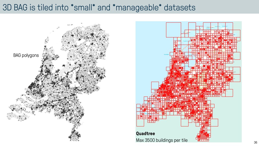
![thank you. [email protected] 3d.bk.tudelft.nl/hledoux Hugo Ledoux https://cityjson.org https://3dbag.nl](https://files.speakerdeck.com/presentations/fdb357b46f4f4a52a48d599f0f0bc35e/slide_41.jpg)