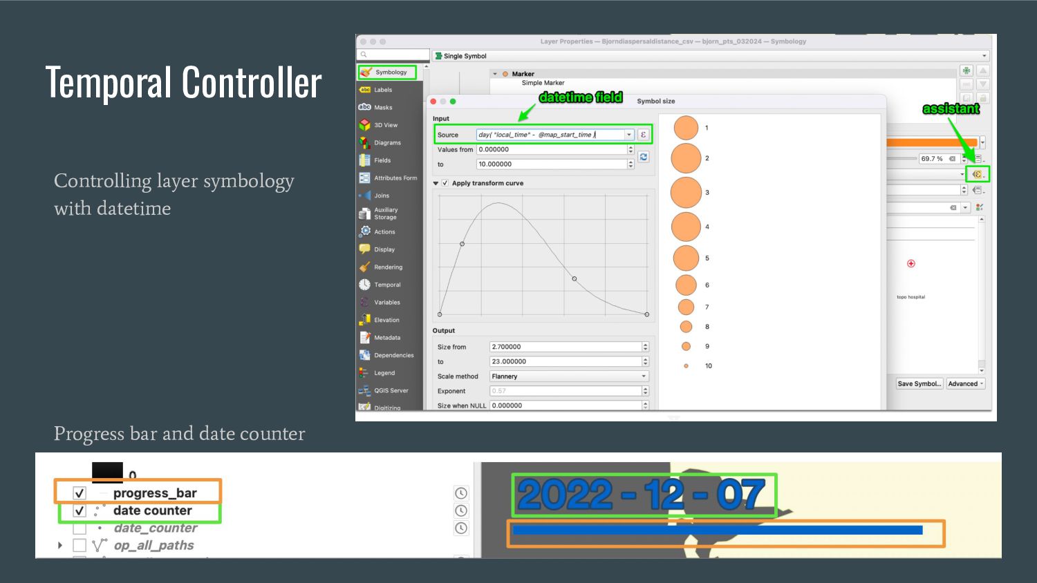
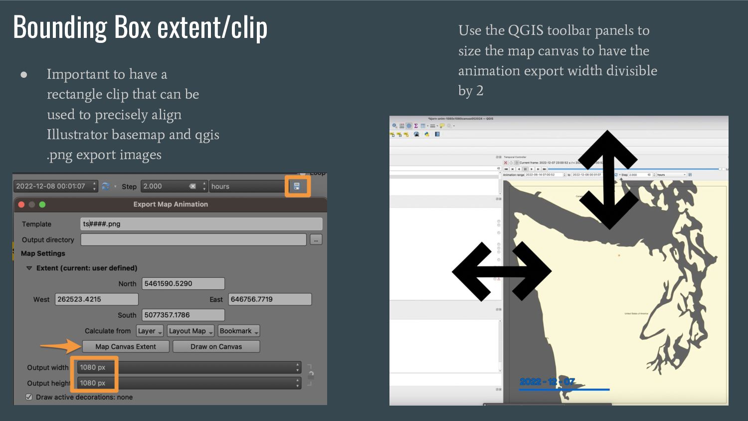
that can be used to precisely align Illustrator basemap and qgis .png export images • Use the QGIS toolbar panels to size the map canvas to have the animation export width divisible by 2 Use the QGIS toolbar panels to size the map canvas to have the animation export width divisible by 2
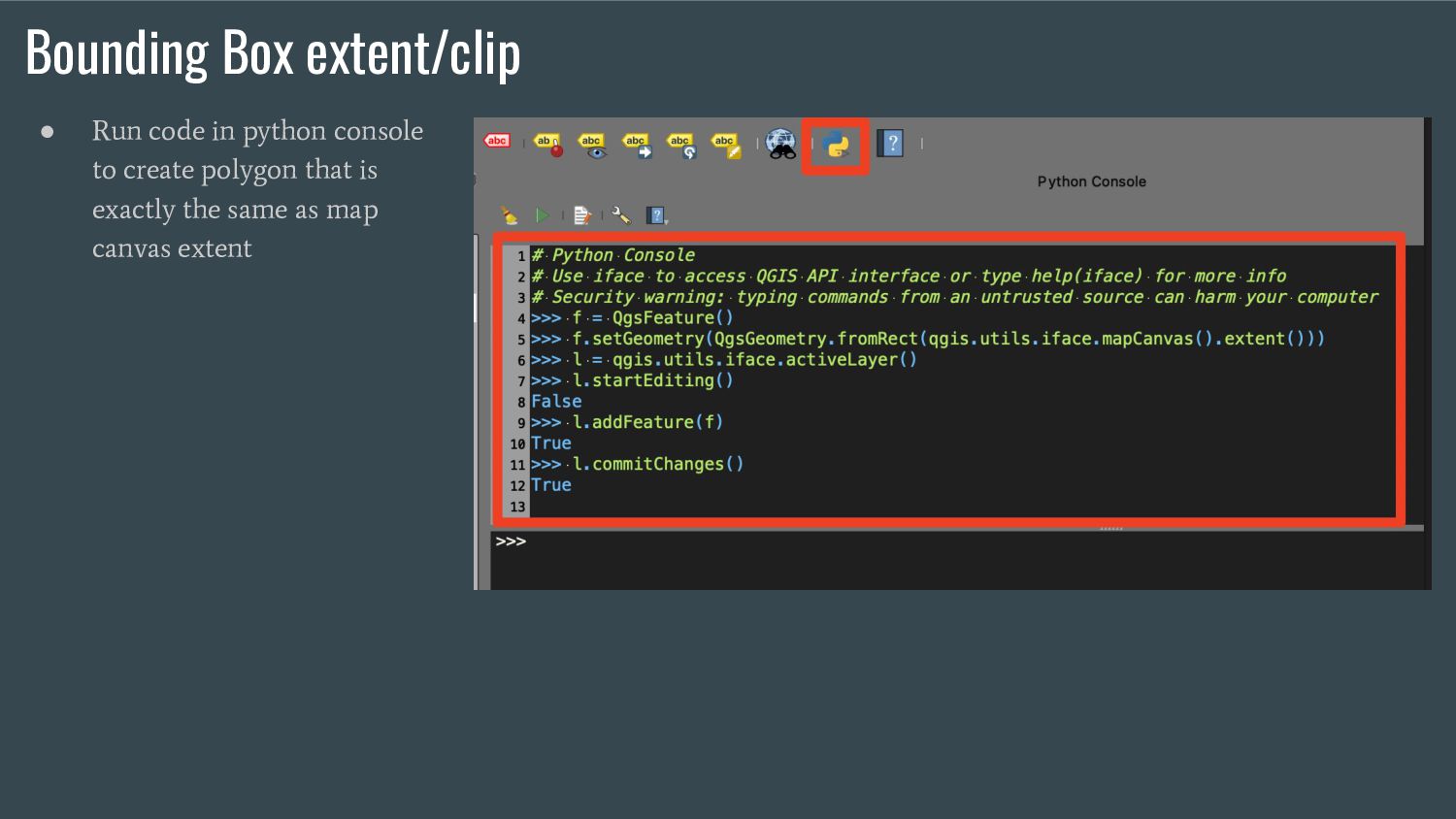
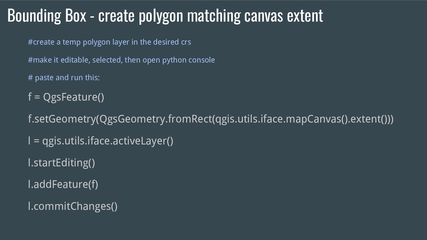
temp polygon layer in the desired crs #make it editable, selected, then open python console # paste and run this: f = QgsFeature() f.setGeometry(QgsGeometry.fromRect(qgis.utils.iface.mapCanvas().extent())) l = qgis.utils.iface.activeLayer() l.startEditing() l.addFeature(f) l.commitChanges()
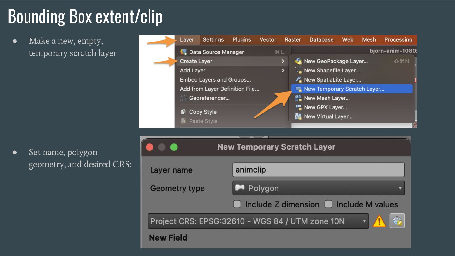
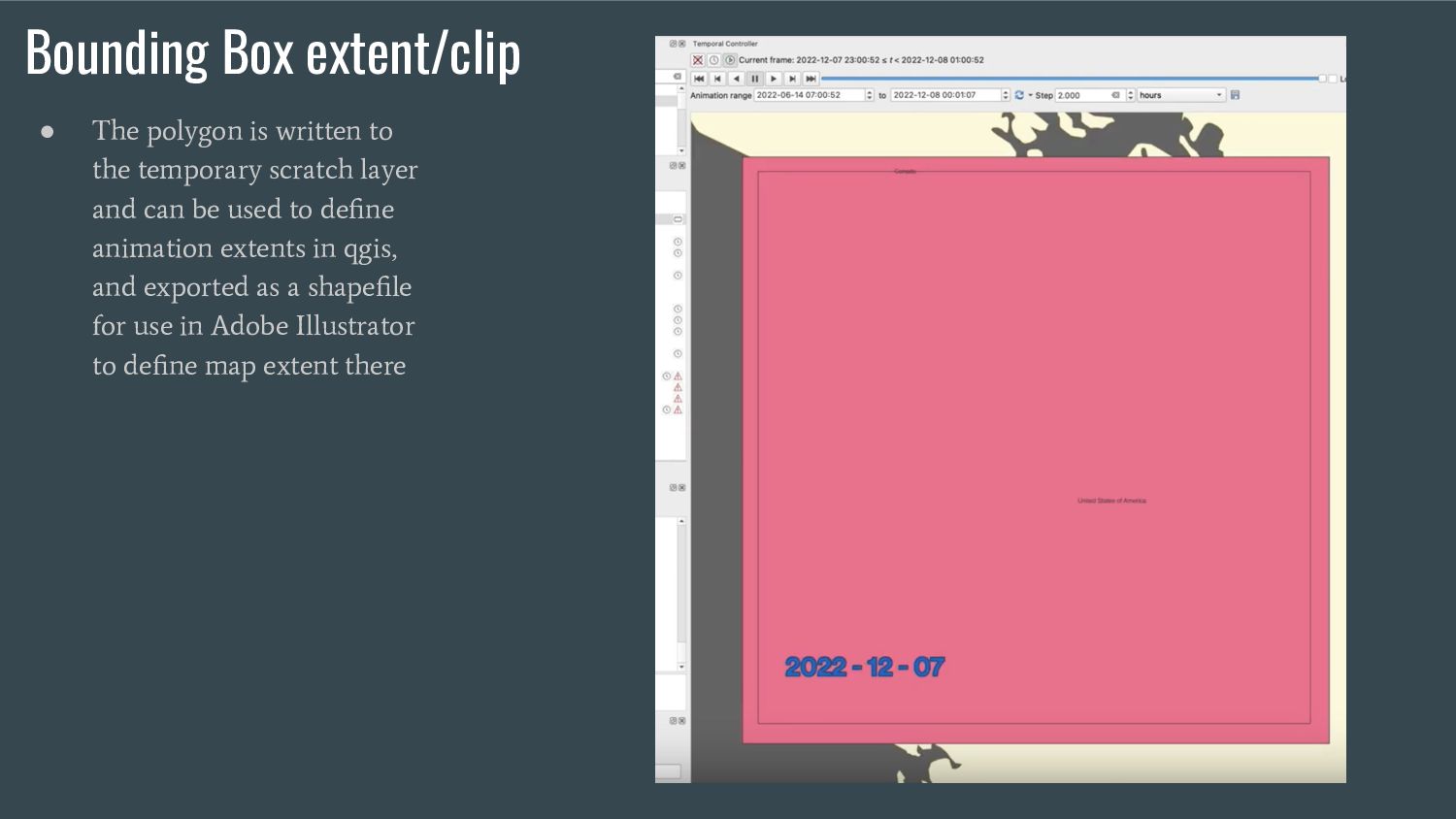
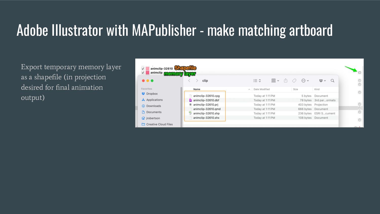
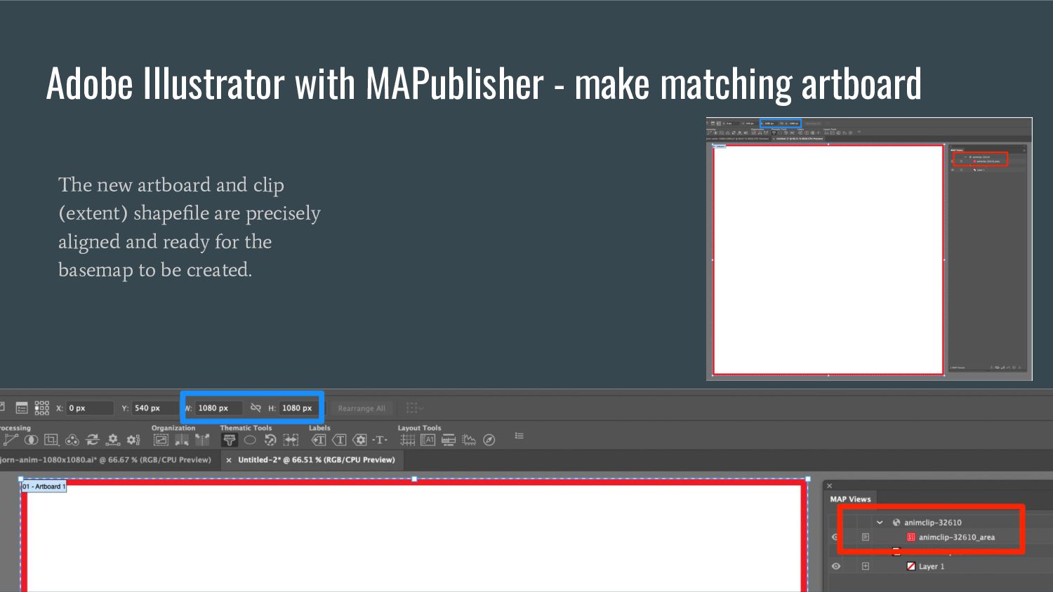
temporary scratch layer and can be used to define animation extents in qgis, and exported as a shapefile for use in Adobe Illustrator to define map extent there
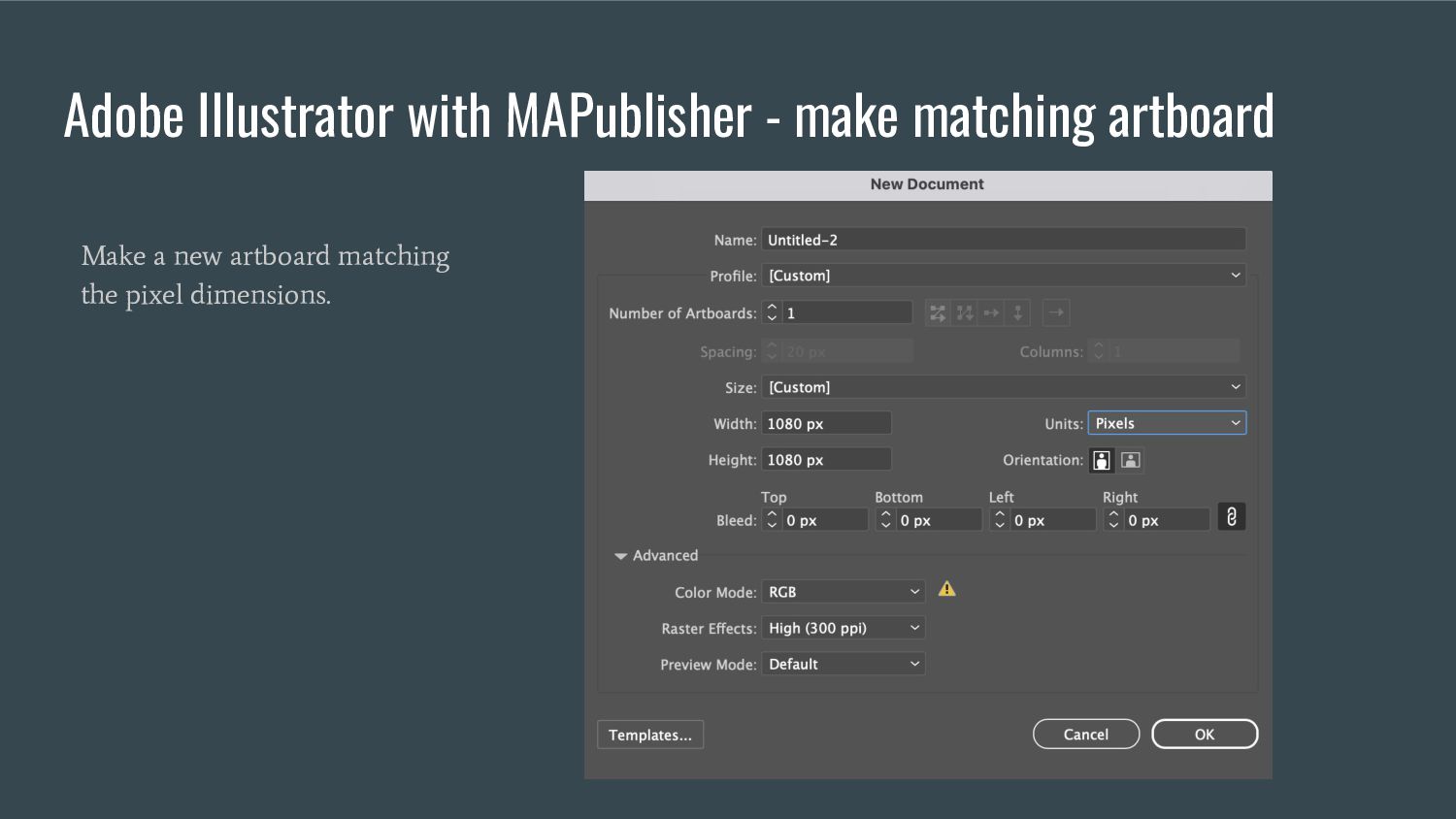
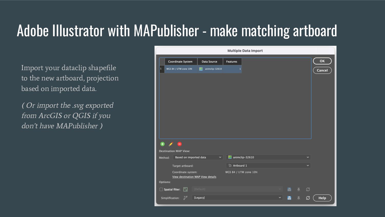
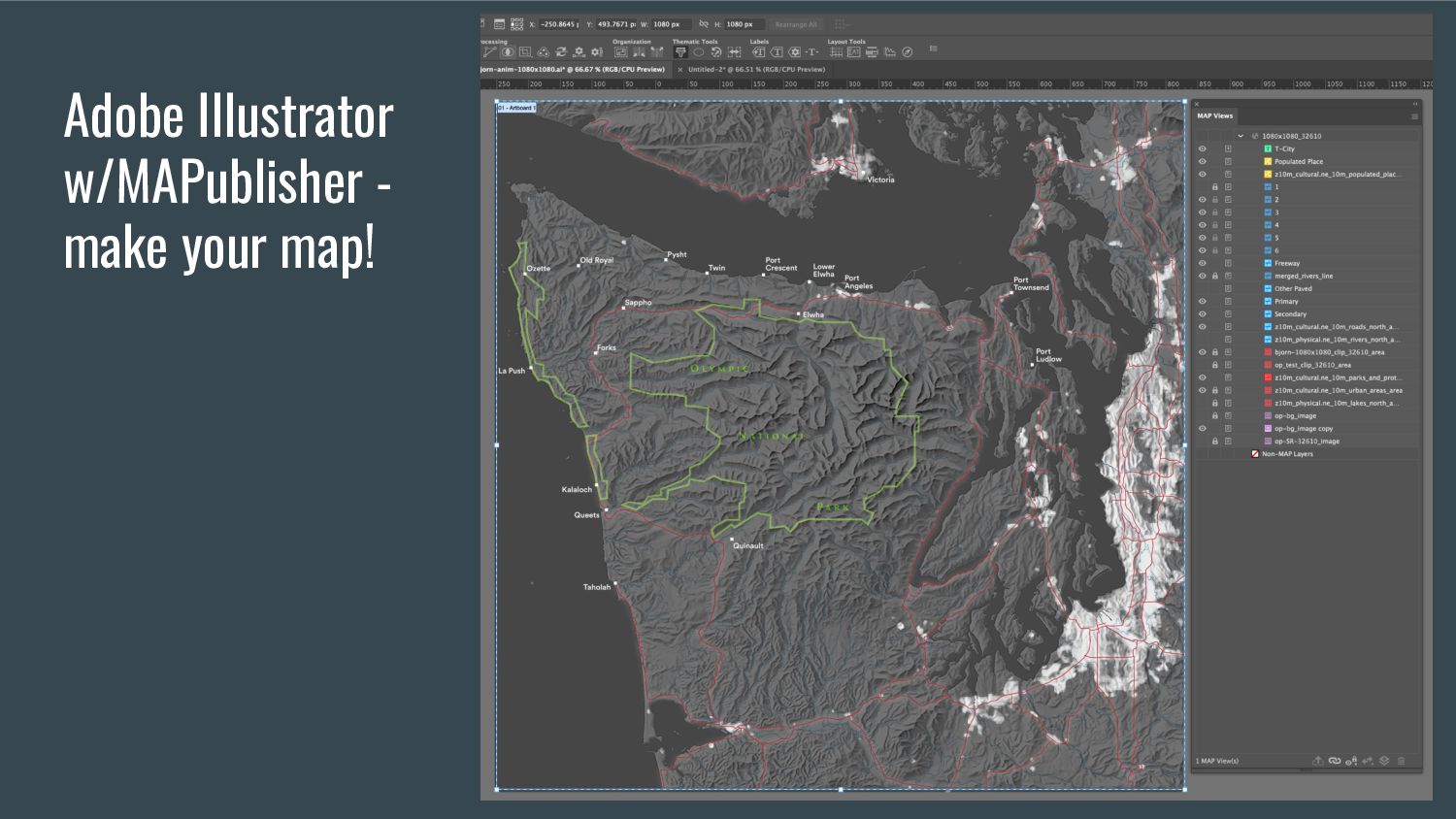
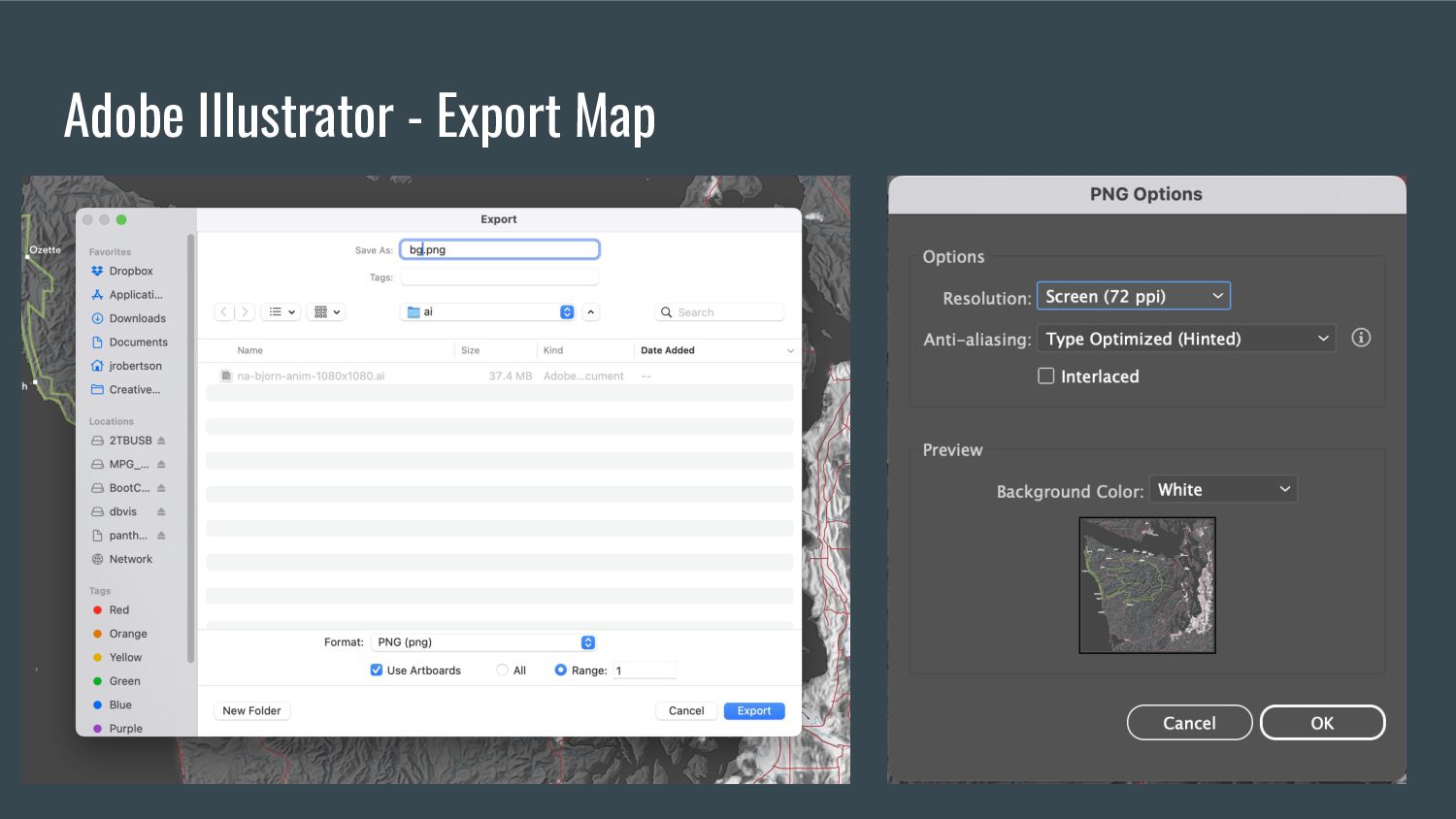
dataclip shapefile to the new artboard, projection based on imported data. ( Or import the .svg exported from ArcGIS or QGIS if you don’t have MAPublisher )
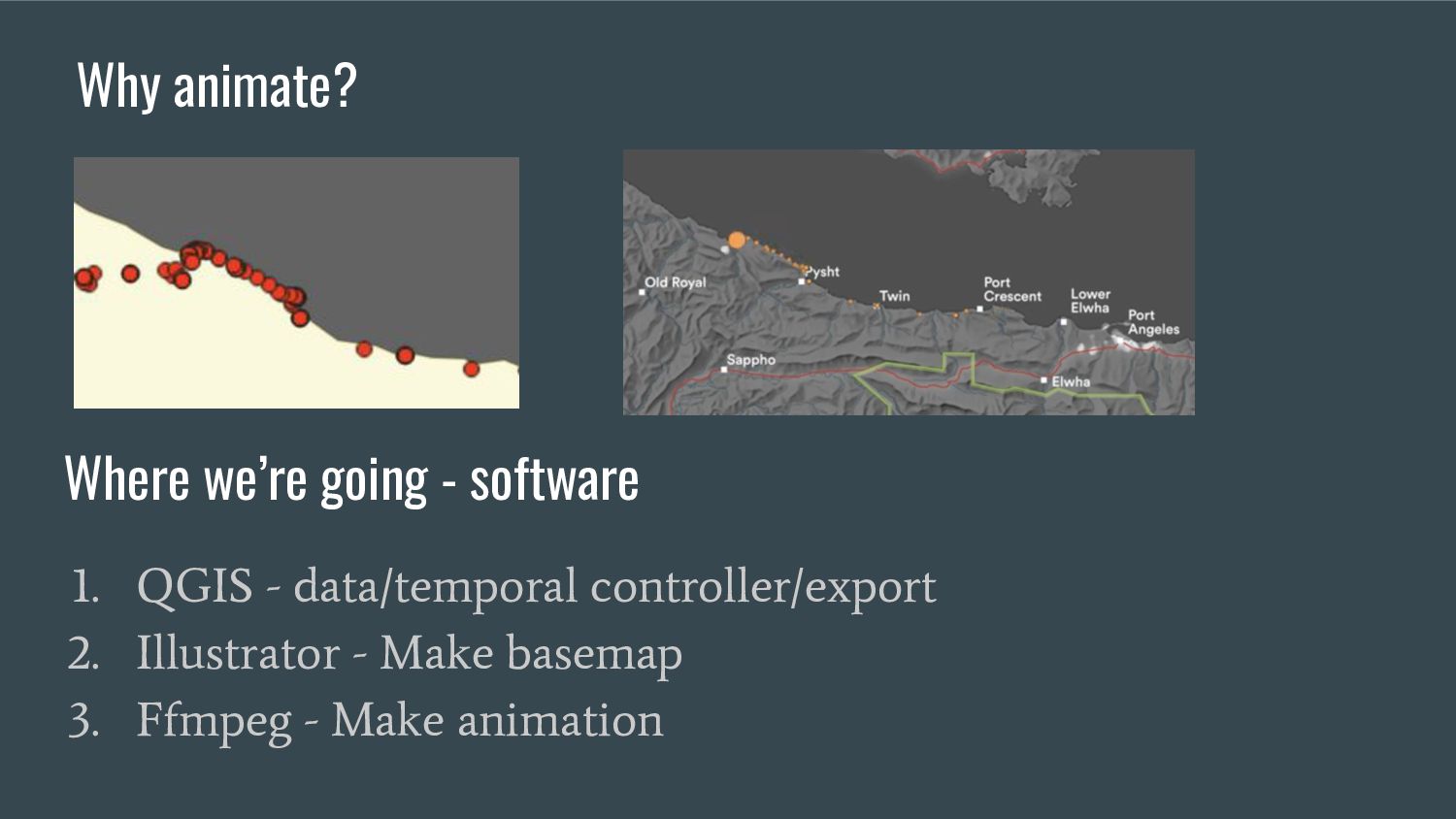
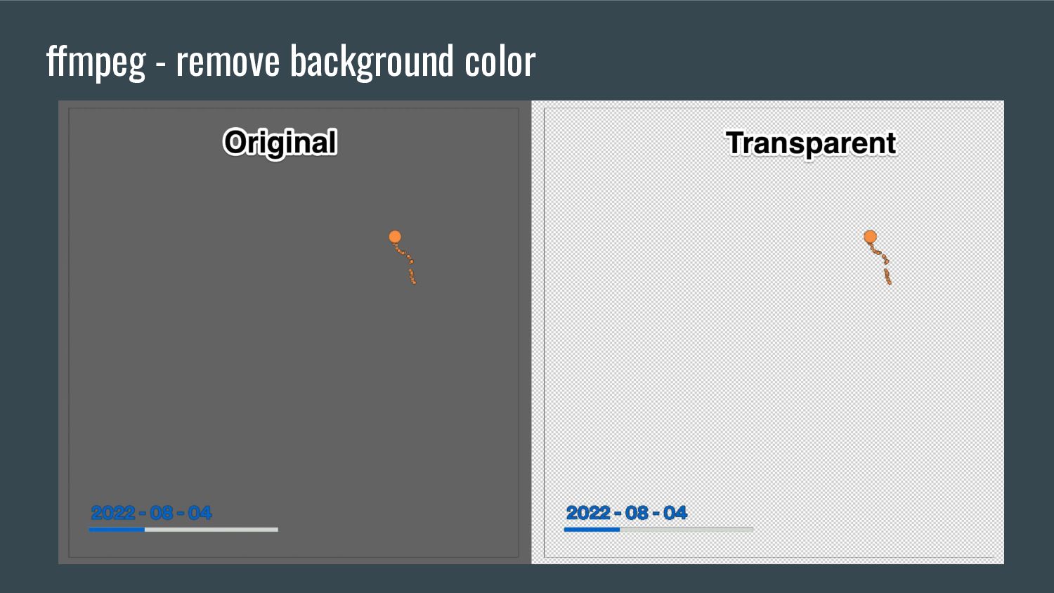
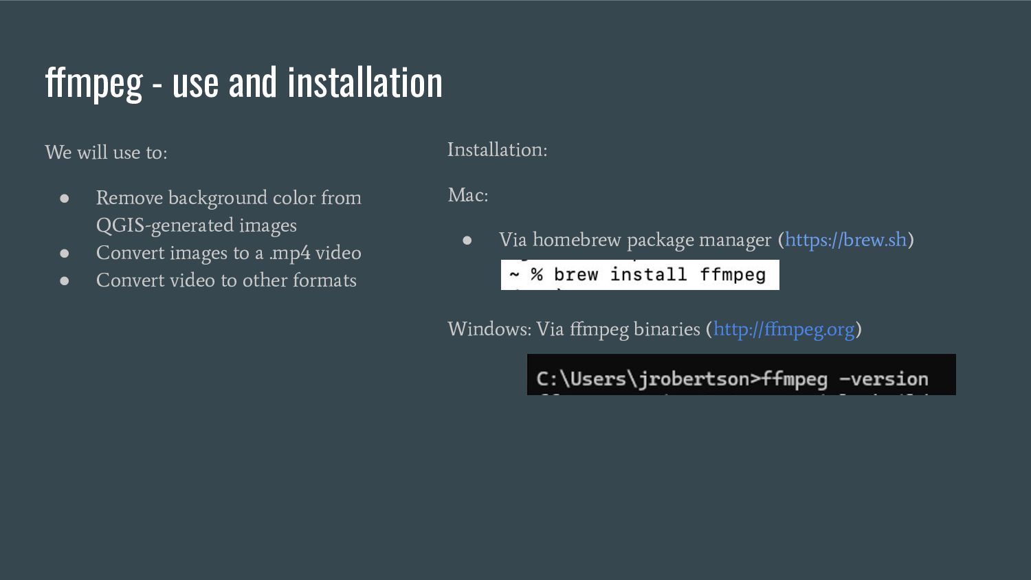
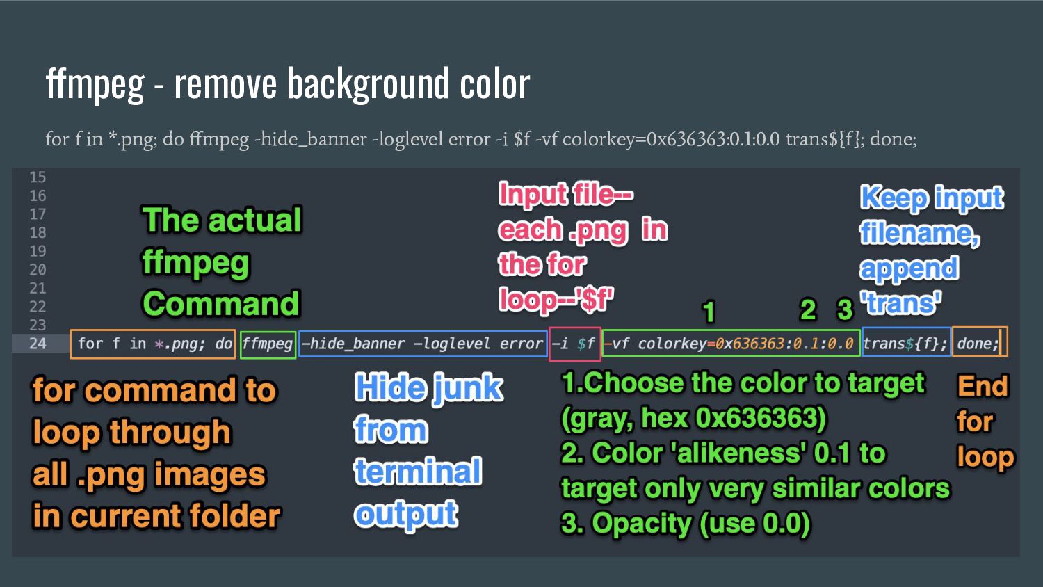
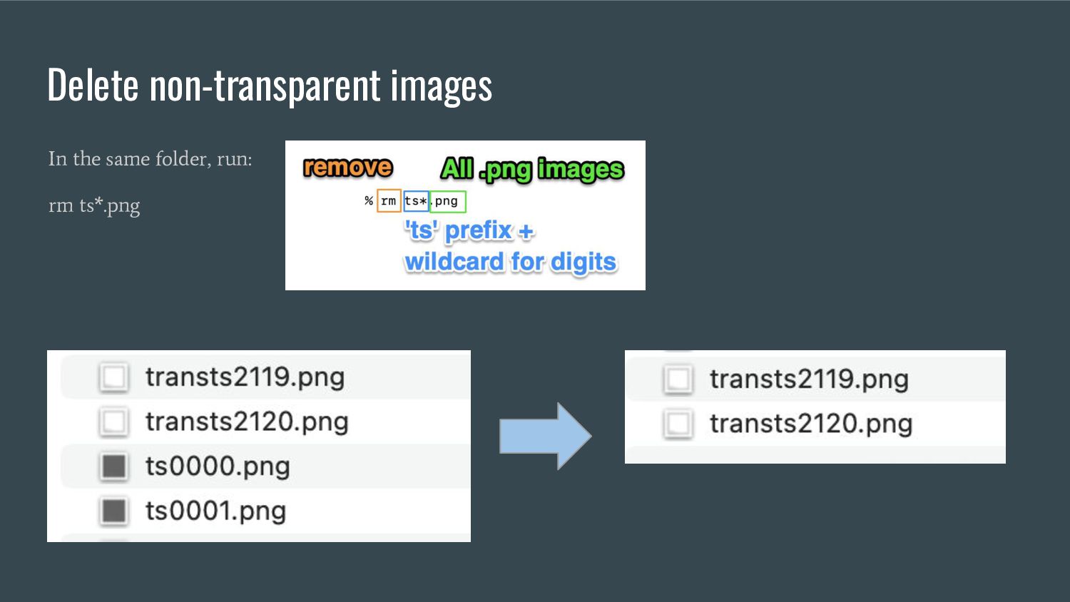
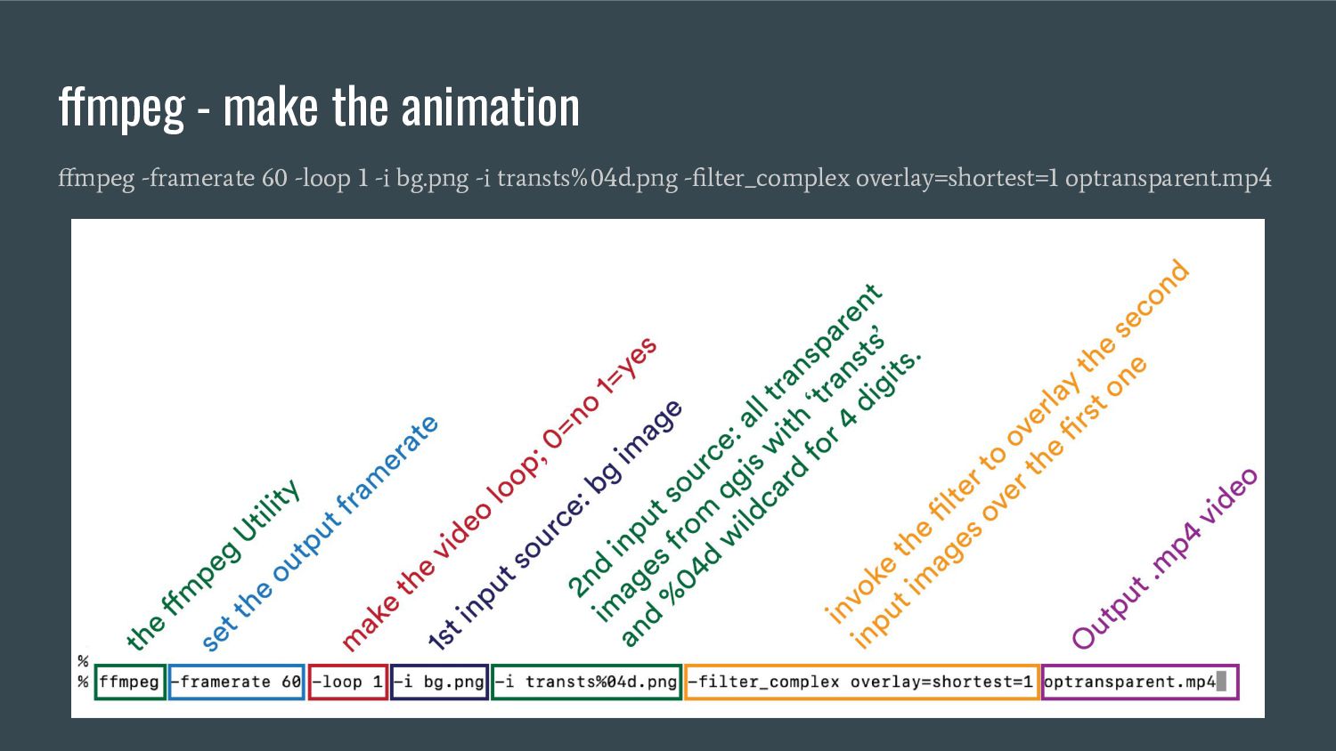
Remove background color from QGIS-generated images • Convert images to a .mp4 video • Convert video to other formats Installation: Mac: • Via homebrew package manager (https://brew.sh) Windows: Via ffmpeg binaries (http://ffmpeg.org)
![cairn.pw/nacis [slides & resources] • Illustrator scripts and shortcuts (still](https://files.speakerdeck.com/presentations/16b31c7d16d540e5b1bfc46358f7ef42/slide_1.jpg)