Upgrade to Pro — share decks privately, control downloads, hide ads and more …

Real life interoperability - Increasing the use of Earth Observation data

Jérôme Gasperi
June 04, 2012
80

Real life interoperability - Increasing the use of Earth Observation data

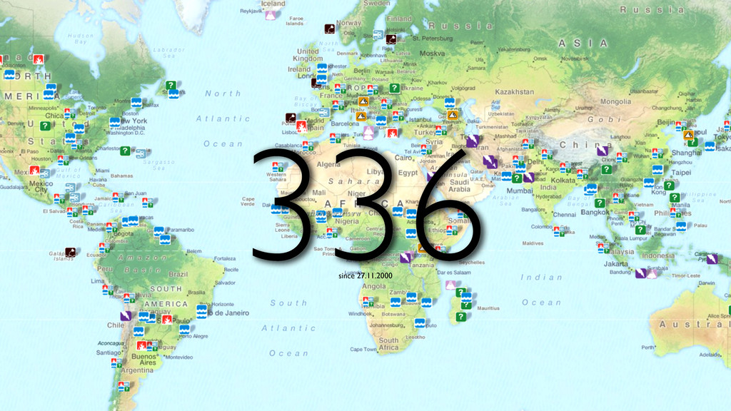
4S Symposium - Portorož - June 4th 2012

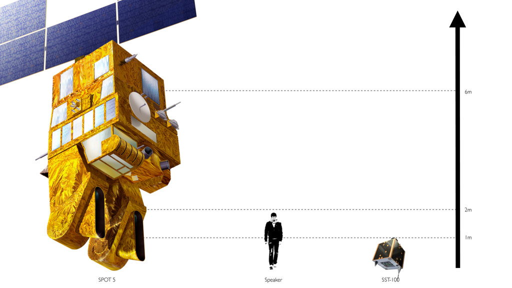
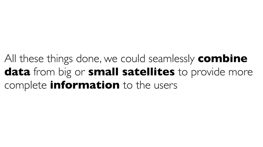
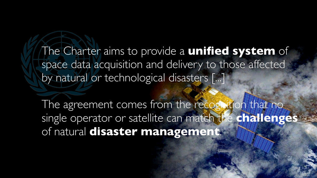
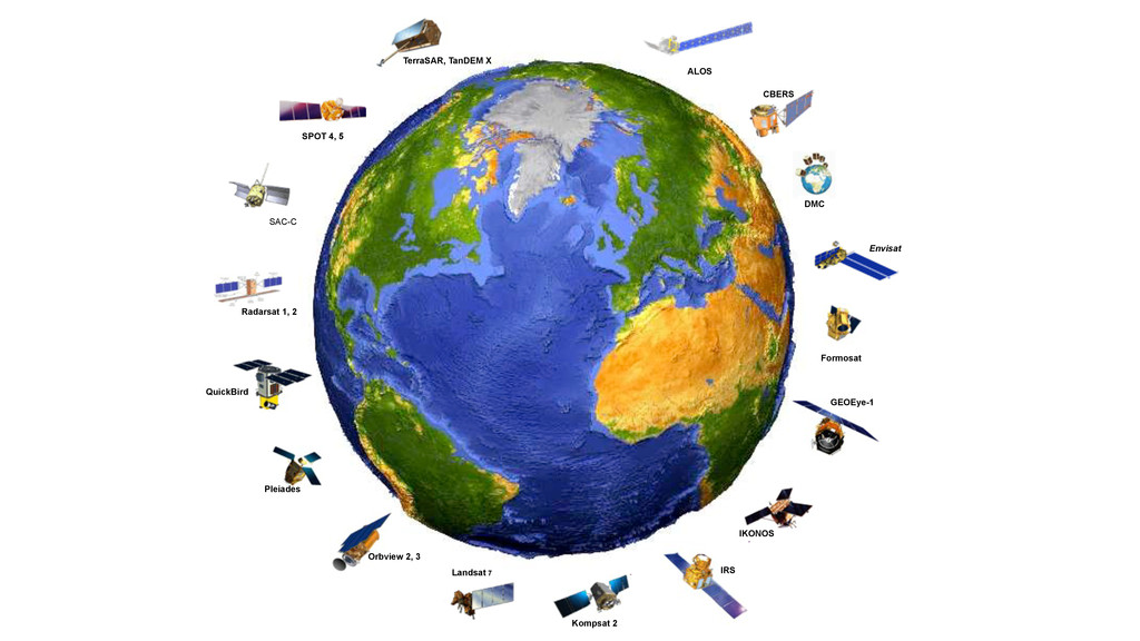
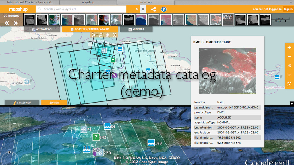
In the last decades, use of Earth Observation satellites data has grown considerably. In this context, Geospatial web services technology has provided a new means to provide easy and interoperable access to Earth Observation data. Open Geospatial Consortium (OGC) services have been widely adopted in the Geosciences community, and particularly in the remote sensing community. These services bring seamless integration of heterogeneous ressources from small and big satellites and make Earth Observation data available to a wider range of public users than ever before. Focused on natural disasters management, this presentation will show how an innovative and efficient web application can take advantage of the power of interoperability to provide more complete data to the users

Jérôme Gasperi

June 04, 2012
Tweet

Transcript

  1. Jérôme GASPERI 4S Symposium - Portorož - June 4th, 2012

    REAL LIFE INTEROPERABILITY Increasing the use of Earth Observation data
  2. format | describe | access files metadata services A readable

    one ! (e.g. JPG, TIF, HDF, etc.) A structured (e.g. XML) and standardized (e.g. HMA) description OGC Web Services W*S INTEROPERABILITY
  3. Share maps WMS Share vectors WFS Share data WCS Search

    metadata CSW Geospatial Web Services
  4. All these things done, we could seamlessly combine data from

    big or small satellites to provide more complete information to the users
  5. A concrete use case International Charter "Space and Major Disasters"

    metadata catalog http://www.disasterschartercatalog.org
  6. The Charter aims to provide a unified system of space

    data acquisition and delivery to those affected by natural or technological disasters [...] The agreement comes from the recognition that no single operator or satellite can match the challenges of natural disaster management.
  7. SPOT 4, 5 Orbview 2, 3 SAC-C Formosat IRS Pleiades

    IKONOS QuickBird Envisat Landsat 7 Radarsat 1, 2 DMC CBERS TerraSAR, TanDEM X Kompsat 2 GEOEye-1 ALOS