Toulouse, France - 2013.05.30
Centre de Compétences Techniques "Cloud Computing et Big Data"
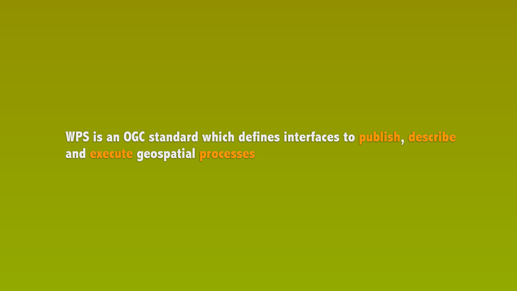
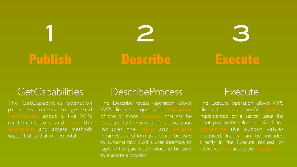
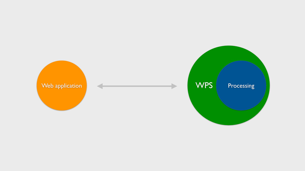
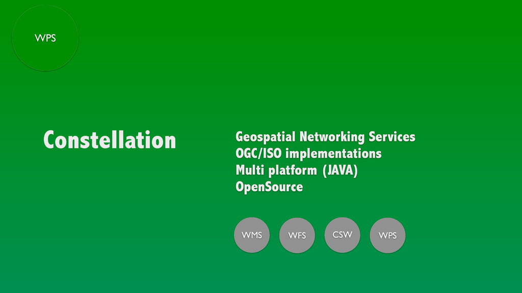
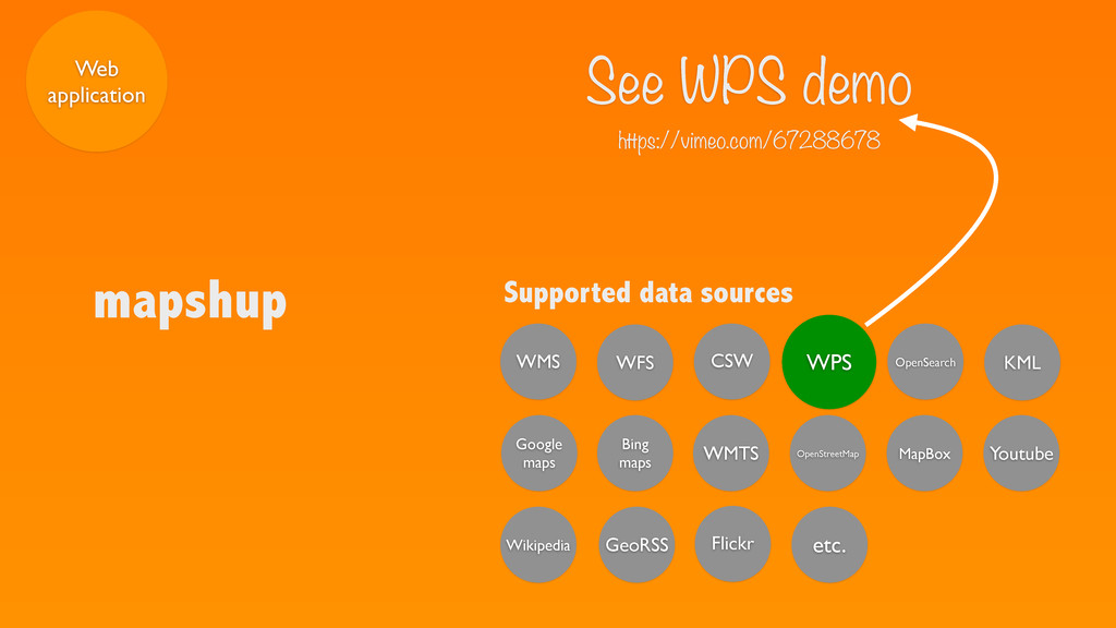
WPS is an OGC standard which defines interfaces to publish, describe and execute geospatial processes
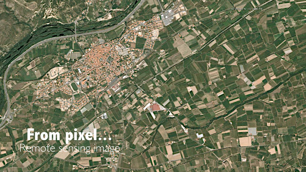
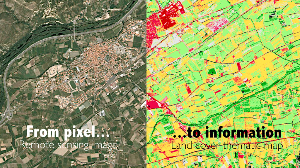
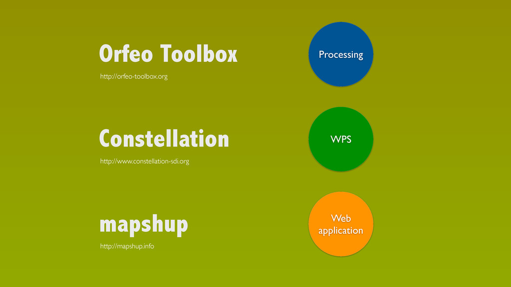
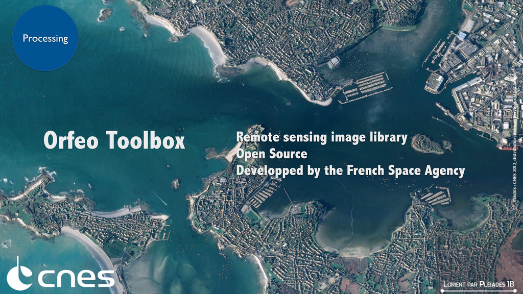
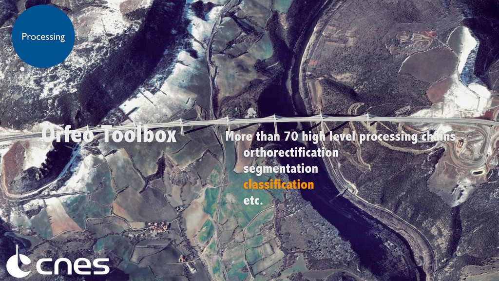
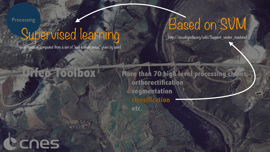
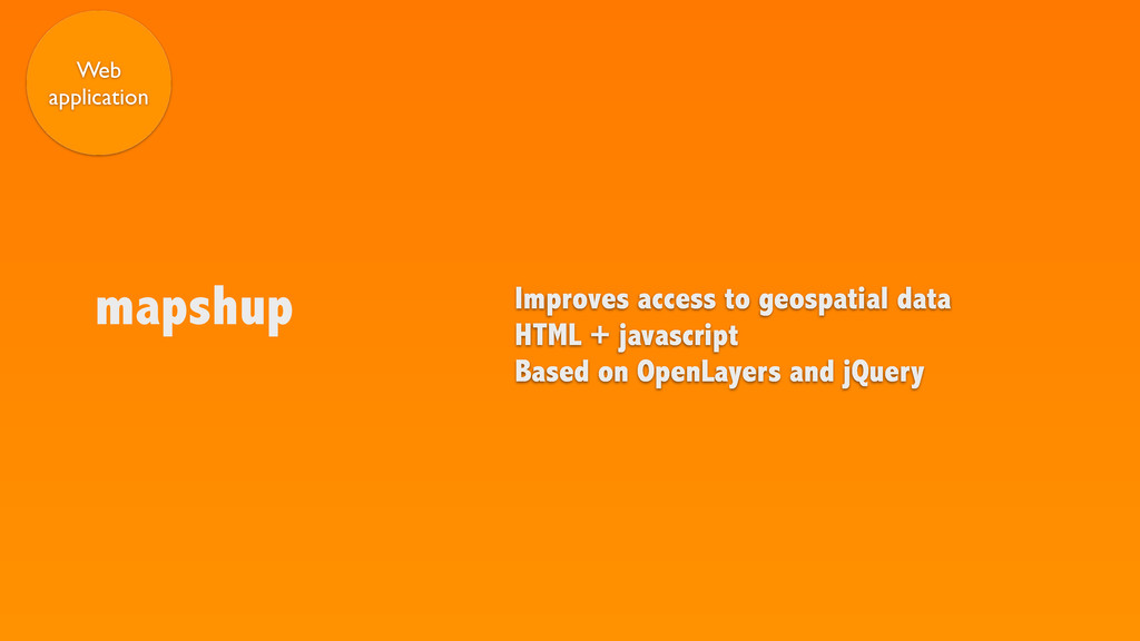
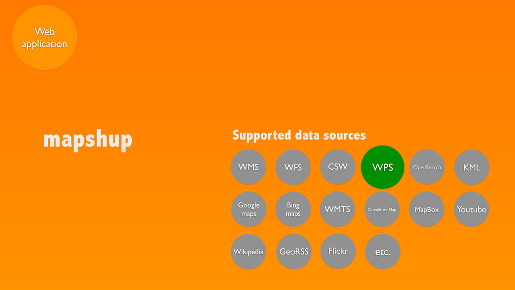
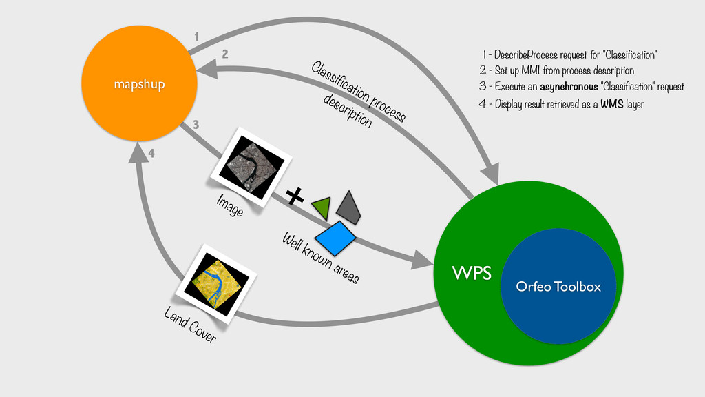
The Orfeo Toolbox (OTB - http://www.orfeo-toolbox.org/) is an Open Source Remote Sensing Image Processing software library developed by CNES. The aim of the toolbox is to gather a large number of state of the art algo- rithms for building processing chains for satellite images. Using the constellation server (http://www.constellation-sdi.org/), we exposed the main OTB processing chains as Web Processing Services (WPS). The WPS provides rules for standardizing inputs and outputs for invoking geospatial processing services. These services are managed from a web browser using the mapshup web client (http://mapshup.info). mapshup supports both synchronous and asynchronous processes and offers direct visualisation of results. The whole system provides user a complete and comprehensive image processing chain to produce land cover classification from satellite orthoimagery.
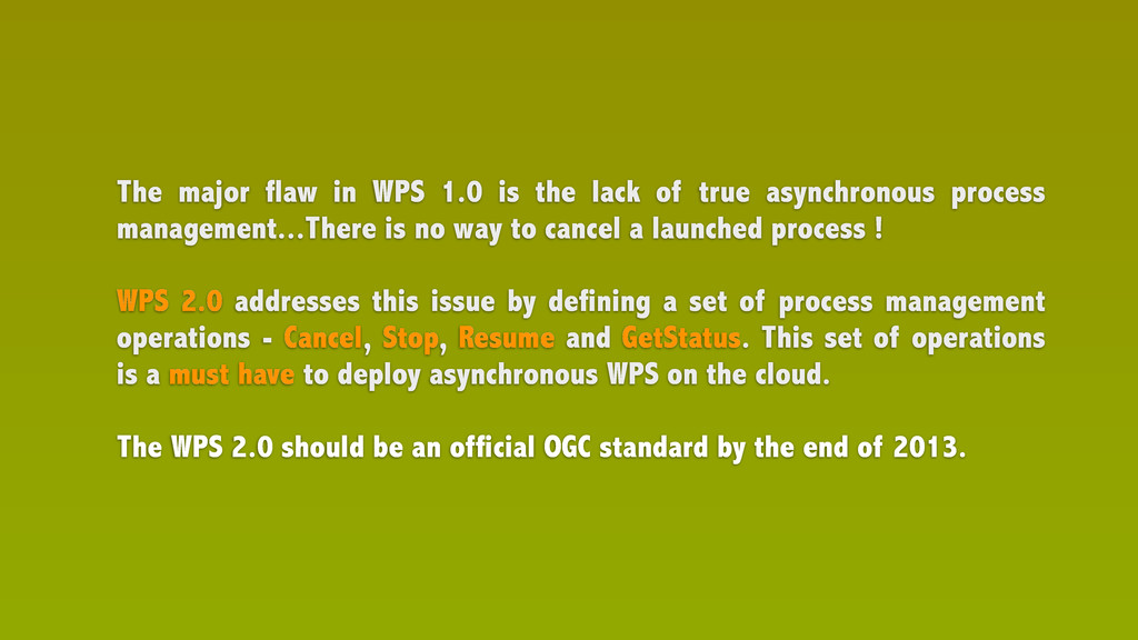
With an update to WPS 2.0, this chain should fit well to a Cloud architecture
![https://speakerdeck.com/jjrom/web-processing-service [email protected]](https://files.speakerdeck.com/presentations/0162f4c0aacc013081ce7672e1edf9ec/slide_27.jpg)