ACRE Pacific presentation at ICSHMO'12 - Andrew Lorrey (NIWA)
Presentation detailing the ACRE Pacific initiative, related projects, and current work being undertaken on Pacific Island data rescue with the support of the French Pacific Fund.
Andrew LORREY1, Penehuro LEFALE2, Howard DIAMOND3, Juerg LUTEBACHER4, Petra CHAPPELL1, Philip MALSALE5, Rob ALLAN6 and Pacific Island Meteorological Services 1 Na@onal Ins@tute of Water and Atmospheric Research, Auckland, New Zealand 2 MetService, Kelburn, Wellington, New Zealand 3 Na@onal Oceanic and Atmospheric Administra@on, Global Climate Observing Program, USA 4 Department of Geography, Justus-‐Liebig University, Giessen, Germany 5 Vanuatu Meteorological Service, Port Vila, Vanuatu 6 UK Met Office, Hadley Centre, Exeter, UK Special thanks to our funders (above), Davina Ashford, Philip Brohan, Gil Compo, Joelle Gergis and Clive Wilkinson
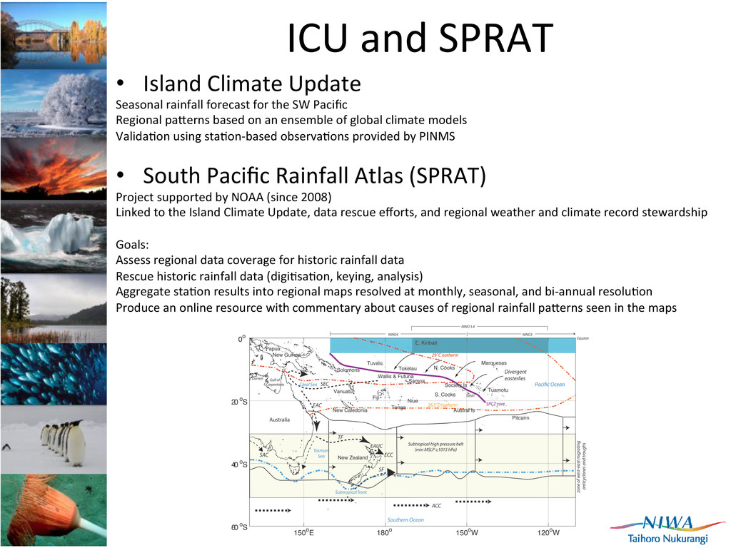
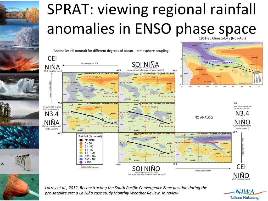
rainfall forecast for the SW Pacific Regional pa[erns based on an ensemble of global climate models Valida]on using sta]on-‐based observa]ons provided by PINMS • South Pacific Rainfall Atlas (SPRAT) Project supported by NOAA (since 2008) Linked to the Island Climate Update, data rescue efforts, and regional weather and climate record stewardship Goals: Assess regional data coverage for historic rainfall data Rescue historic rainfall data (digi]sa]on, keying, analysis) Aggregate sta]on results into regional maps resolved at monthly, seasonal, and bi-‐annual resolu]on Produce an online resource with commentary about causes of regional rainfall pa[erns seen in the maps
the SW Pacific region 2. Hundreds of thousands of monthly rainfall entries, but many sta]ons have less than 10 years data 3. Fewer sta]ons for smaller island na]ons 4. Significant coverage decrease prior to the early 1950s, and during WWI and WWII. 5. Good spa]o-‐temporal coverage during the mid-‐1950s to 1960s 6. There is incomplete temporal coverage for some sta]ons that cover 1951-‐2009 7. Government transi]ons and emergence to independent na]on status ofen see data gaps 8. Manual to automated observa]on changes ofen see gaps 9. Splicing may be possible 10. Common period of overlap and most complete period of coverage is 1961-‐1990.
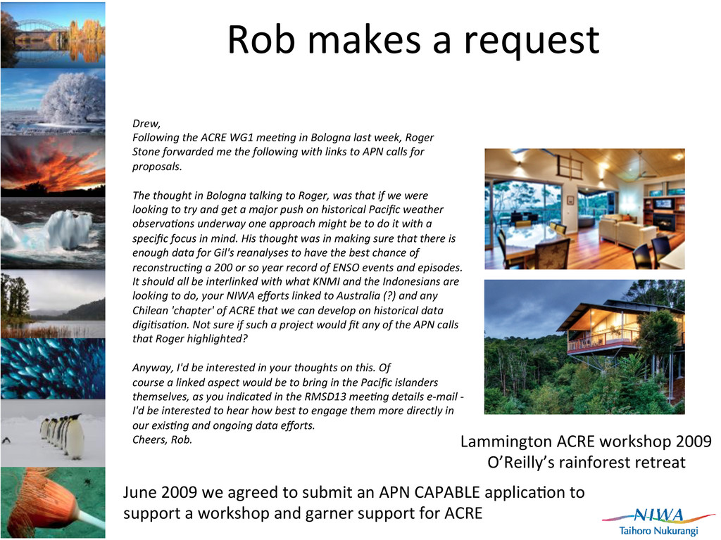
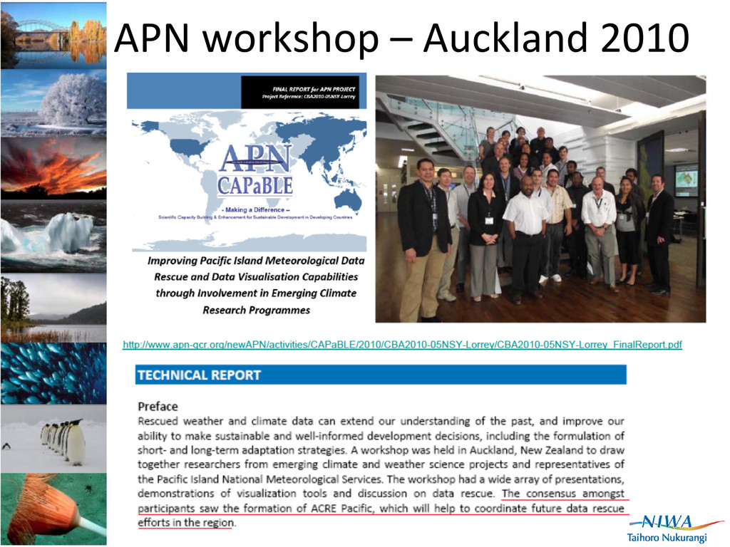
WG1 meeGng in Bologna last week, Roger Stone forwarded me the following with links to APN calls for proposals. The thought in Bologna talking to Roger, was that if we were looking to try and get a major push on historical Pacific weather observaGons underway one approach might be to do it with a specific focus in mind. His thought was in making sure that there is enough data for Gil's reanalyses to have the best chance of reconstrucGng a 200 or so year record of ENSO events and episodes. It should all be interlinked with what KNMI and the Indonesians are looking to do, your NIWA efforts linked to Australia (?) and any Chilean 'chapter' of ACRE that we can develop on historical data digiGsaGon. Not sure if such a project would fit any of the APN calls that Roger highlighted? Anyway, I'd be interested in your thoughts on this. Of course a linked aspect would be to bring in the Pacific islanders themselves, as you indicated in the RMSD13 meeGng details e-‐mail -‐ I'd be interested to hear how best to engage them more directly in our exisGng and ongoing data efforts. Cheers, Rob. Lammington ACRE workshop 2009 O’Reilly’s rainforest retreat June 2009 we agreed to submit an APN CAPABLE applica]on to support a workshop and garner support for ACRE
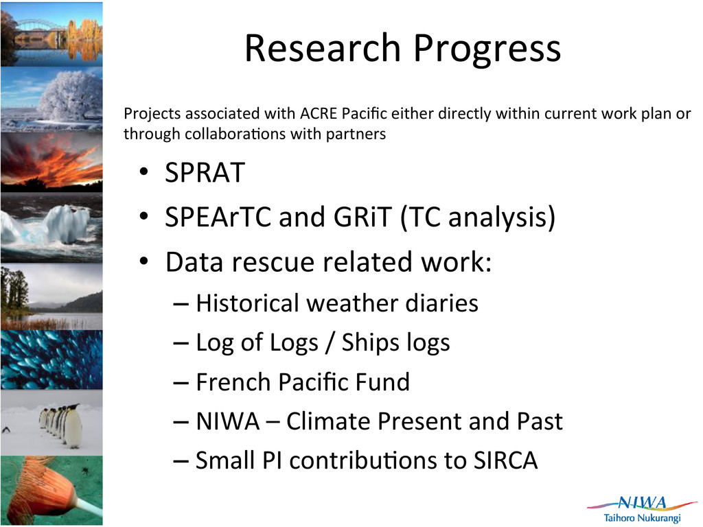
(TC analysis) • Data rescue related work: – Historical weather diaries – Log of Logs / Ships logs – French Pacific Fund – NIWA – Climate Present and Past – Small PI contribu]ons to SIRCA Projects associated with ACRE Pacific either directly within current work plan or through collabora]ons with partners
in Google Earth (now in version 3) for use by PINMS (visual valida]on of ICU forecasts) and climate researchers (ENSO pa[erns) Reveal coherent areas of enhanced & suppressed rainfall (possibly ENSO-‐related) • Add value to our understanding of atmospheric circula]on anomalies and impacts in the region • Regional reference material in atlas format that can be accessed by PINMS • Addi]onal version for non-‐specialists
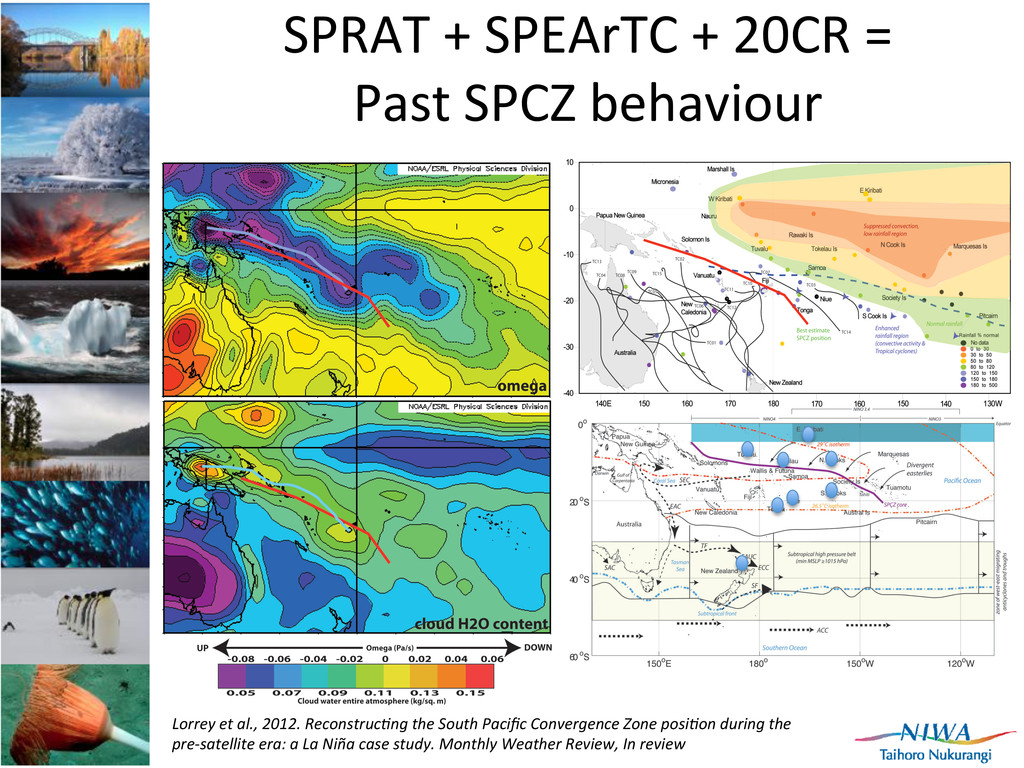
Lorrey et al., 2012. ReconstrucGng the South Pacific Convergence Zone posiGon during the pre-‐satellite era: a La Niña case study Monthly Weather Review, In review 1961-‐90 Climatology (Nov-‐Apr) Anomalies (% normal) for different degrees of ocean – atmosphere coupling
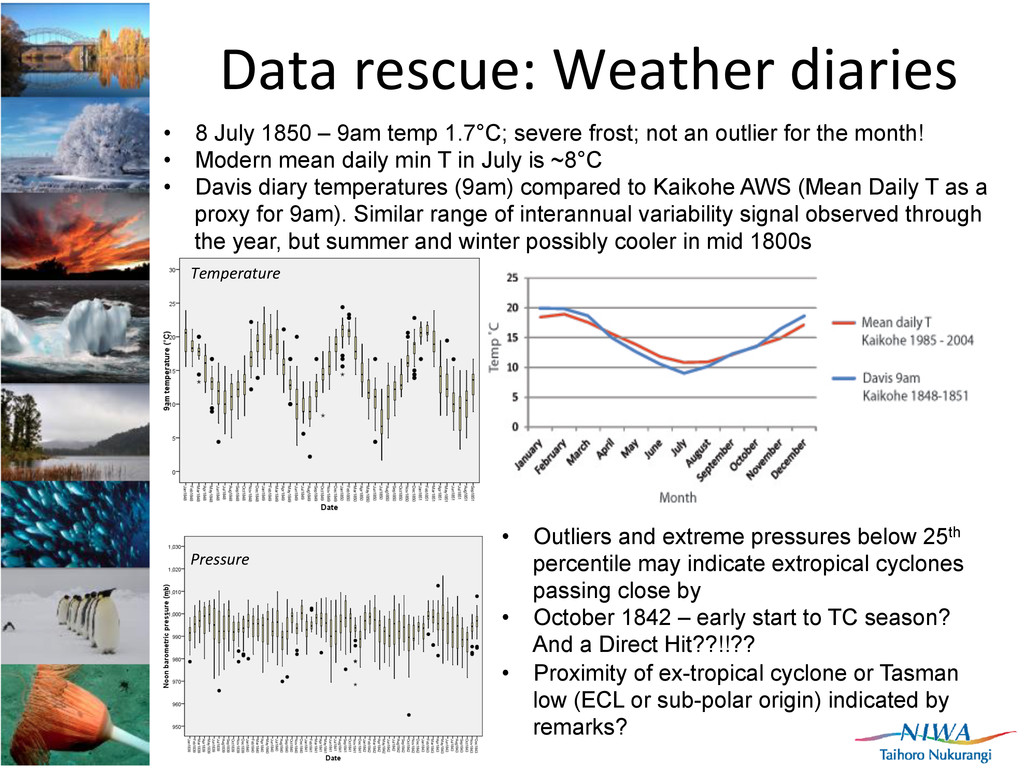
not an outlier for the month! • Modern mean daily min T in July is ~8°C • Davis diary temperatures (9am) compared to Kaikohe AWS (Mean Daily T as a proxy for 9am). Similar range of interannual variability signal observed through the year, but summer and winter possibly cooler in mid 1800s Data rescue: Weather diaries • Outliers and extreme pressures below 25th percentile may indicate extropical cyclones passing close by • October 1842 – early start to TC season? And a Direct Hit??!!?? • Proximity of ex-tropical cyclone or Tasman low (ECL or sub-polar origin) indicated by remarks? Temperature Pressure
CHARLES CROCKER, Stourton Caundle." "July 30, 1849.—The hills were covered with snow, the first ever seen by the naGves inhabiGng this part of New Zealand. The Putahi was also covered.” “July 31.—This morning the hills were again white with snow.” Davis weather diary notes ICE ¼ inch thick on the surface of a duck pond on the property in Waimate North, 15 July 1839 (close to Kaikohe). Temp readings at 9AM were as low as 4.4°C on that day. (Also note it was as low as 1.7°C in 1850 at Kaikohe) Excerpt from Coleman, J.N. 1865. • Frost (1985-2004) climatology at Kaikohe • Max days occurrence of ground frost = 2 days; Max days occurrence of screen frost = 1 day; None in last two years • Davis diary 1848-1851: 82 days where comment of ‘frost’ occurs Data rescue: Weather diaries
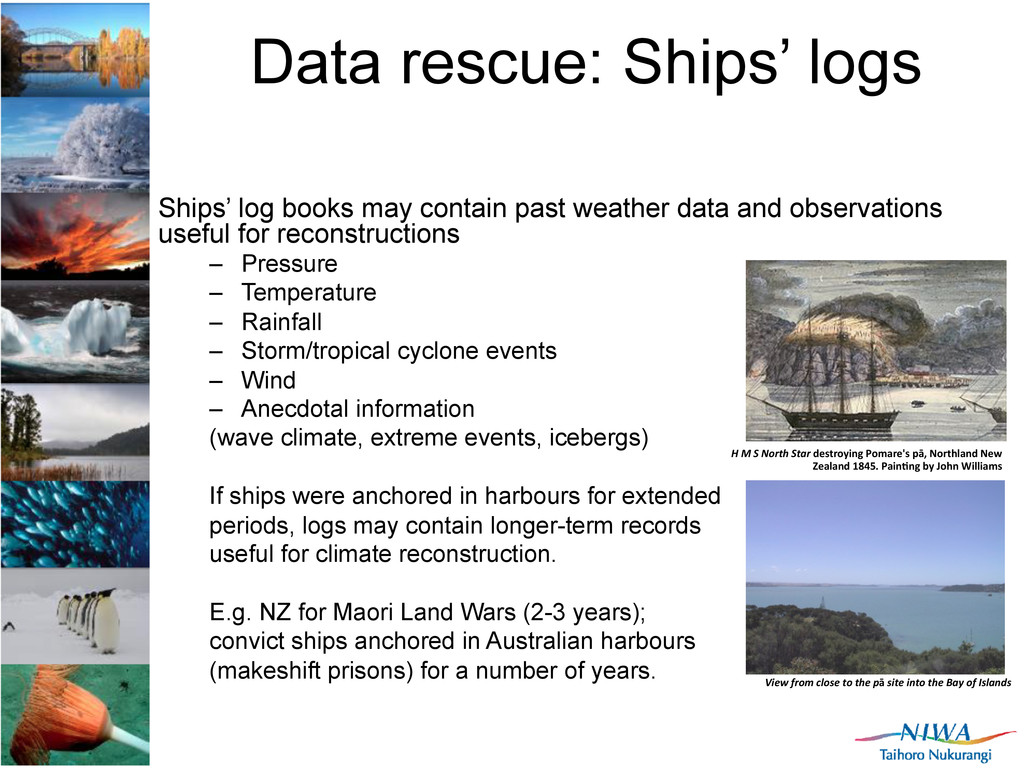
weather data and observations useful for reconstructions – Pressure – Temperature – Rainfall – Storm/tropical cyclone events – Wind – Anecdotal information (wave climate, extreme events, icebergs) If ships were anchored in harbours for extended periods, logs may contain longer-term records useful for climate reconstruction. E.g. NZ for Maori Land Wars (2-3 years); convict ships anchored in Australian harbours (makeshift prisons) for a number of years. H M S North Star destroying Pomare's pā, Northland New Zealand 1845. Pain@ng by John Williams View from close to the pā site into the Bay of Islands
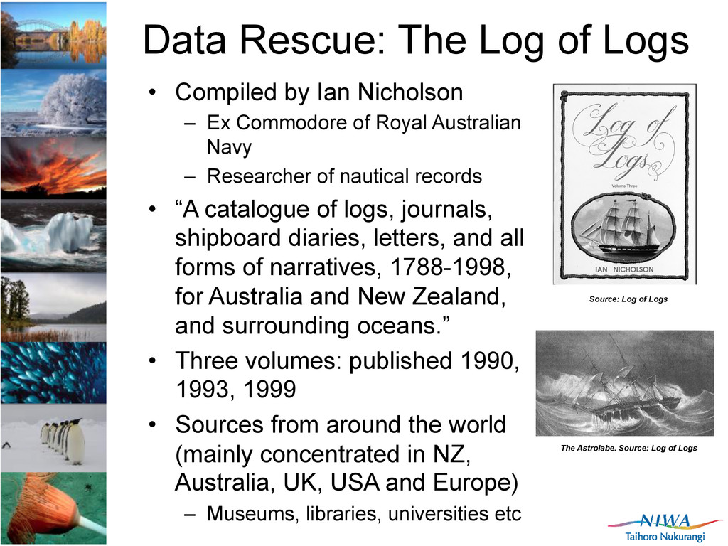
Nicholson – Ex Commodore of Royal Australian Navy – Researcher of nautical records • “A catalogue of logs, journals, shipboard diaries, letters, and all forms of narratives, 1788-1998, for Australia and New Zealand, and surrounding oceans.” • Three volumes: published 1990, 1993, 1999 • Sources from around the world (mainly concentrated in NZ, Australia, UK, USA and Europe) – Museums, libraries, universities etc The Astrolabe. Source: Log of Logs Source: Log of Logs
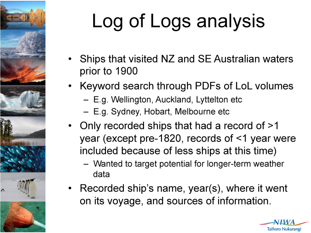
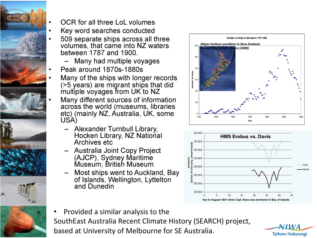
SE Australian waters prior to 1900 • Keyword search through PDFs of LoL volumes – E.g. Wellington, Auckland, Lyttelton etc – E.g. Sydney, Hobart, Melbourne etc • Only recorded ships that had a record of >1 year (except pre-1820, records of <1 year were included because of less ships at this time) – Wanted to target potential for longer-term weather data • Recorded ship’s name, year(s), where it went on its voyage, and sources of information.
searches conducted • 509 separate ships across all three volumes, that came into NZ waters between 1787 and 1900. – Many had multiple voyages • Peak around 1870s-1880s • Many of the ships with longer records (>5 years) are migrant ships that did multiple voyages from UK to NZ • Many different sources of information across the world (museums, libraries etc) (mainly NZ, Australia, UK, some USA) – Alexander Turnbull Library, Hocken Library, NZ National Archives etc – Australia Joint Copy Project (AJCP), Sydney Maritime Museum, British Museum – Most ships went to Auckland, Bay of Islands, Wellington, Lyttelton and Dunedin Number of ships in NZ waters 1787-1900 0 20 40 60 80 100 120 1780 1800 1820 1840 1860 1880 1900 Year Number of ships • Provided a similar analysis to the SouthEast Australia Recent Climate History (SEARCH) project, based at University of Melbourne for SE Australia. Major harbour posi?ons in New Zealand. Source: World Port Source (2009)
New Caledonia and French Polynesia Louis Le Breton (Paris, 1818-‐1866) L’Astrolabe and La Zelee in the Torres Strait, 1843 Peabody Essex Museum, Massachuse[s USA Examples of culturally significant items gathered from different SW Pacific islands on early voyages Peabody Essex Museum, Massachuse[s USA 0 5 10 15 20 25 30 35 40 45 50 1780 1800 1820 1840 1860 1880 1900 All of SW Pacific 0 5 10 15 20 1780 1800 1820 1840 1860 1880 1900 French Polynesia & New Caledonia combined
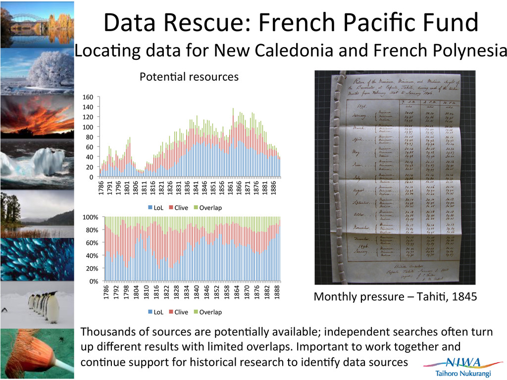
100 120 140 160 1786 1791 1796 1801 1806 1811 1816 1821 1826 1831 1836 1841 1846 1851 1856 1861 1866 1871 1876 1881 1886 LoL Clive Overlap 0% 20% 40% 60% 80% 100% 1786 1792 1798 1804 1810 1816 1822 1828 1834 1840 1846 1852 1858 1864 1870 1876 1882 1888 LoL Clive Overlap Poten]al resources Data Rescue: French Pacific Fund Loca]ng data for New Caledonia and French Polynesia Monthly pressure – Tahi], 1845 Thousands of sources are poten]ally available; independent searches ofen turn up different results with limited overlaps. Important to work together and con]nue support for historical research to iden]fy data sources
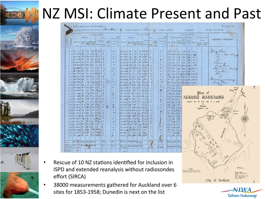
10 NZ sta]ons iden]fied for inclusion in ISPD and extended reanalysis without radiosondes effort (SIRCA) • 38000 measurements gathered for Auckland over 6 sites for 1853-‐1958; Dunedin is next on the list
Pacific • Improving spa]al and temporal density of surface pressure for the Southwest Pacific back into the 1800s • Cook Islands Meteorological Service (4 sta]ons, 2 NCI/2 SCI back to early 1900s) • Niue (Alofi sta]on, back to early 1900s) 2005-2009: 800+ station years digitised with support from NOAA and the Ministry for the Environment, NZ - Cook Islands (Rarotonga, Penryhn) - Kiribati (Christmas Is, Tarawa) -Tuvalu (Funafuti) - Tokelau - Samoa (Apia) - Niue (Alofi)
Lorrey et al., 2012. ReconstrucGng the South Pacific Convergence Zone posiGon during the pre-‐satellite era: a La Niña case study. Monthly Weather Review, In review
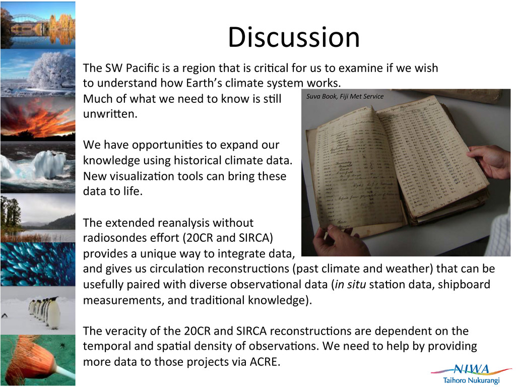
cri]cal for us to examine if we wish to understand how Earth’s climate system works. Much of what we need to know is s]ll unwri[en. We have opportuni]es to expand our knowledge using historical climate data. New visualiza]on tools can bring these data to life. The extended reanalysis without radiosondes effort (20CR and SIRCA) provides a unique way to integrate data, and gives us circula]on reconstruc]ons (past climate and weather) that can be usefully paired with diverse observa]onal data (in situ sta]on data, shipboard measurements, and tradi]onal knowledge). The veracity of the 20CR and SIRCA reconstruc]ons are dependent on the temporal and spa]al density of observa]ons. We need to help by providing more data to those projects via ACRE. Suva Book, Fiji Met Service
![ICSHMO9 findings for SPRAT 1. 100s of sta]ons in](https://files.speakerdeck.com/presentations/8df7cdc02c8501300ec622000a1e8010/slide_3.jpg)
![South Pacific Rainfall Atlas (SPRAT) Plohng of sta]on rainfall anomalies](https://files.speakerdeck.com/presentations/8df7cdc02c8501300ec622000a1e8010/slide_7.jpg)
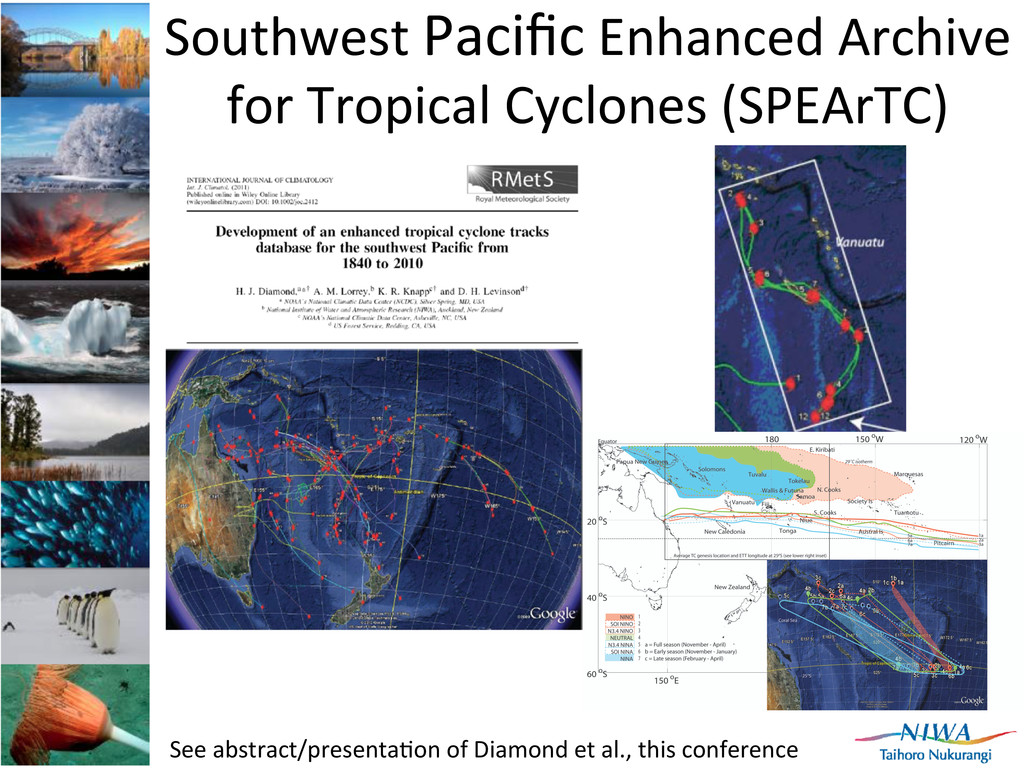
![SPEArTC: GrIT analysis of TC sinuosity rela]ve to ENSO](https://files.speakerdeck.com/presentations/8df7cdc02c8501300ec622000a1e8010/slide_10.jpg)
![Data Rescue: French Pacific Fund Loca]ng data for](https://files.speakerdeck.com/presentations/8df7cdc02c8501300ec622000a1e8010/slide_18.jpg)
![Small island contribu]ons to the extended reanalysis via ACRE](https://files.speakerdeck.com/presentations/8df7cdc02c8501300ec622000a1e8010/slide_21.jpg)