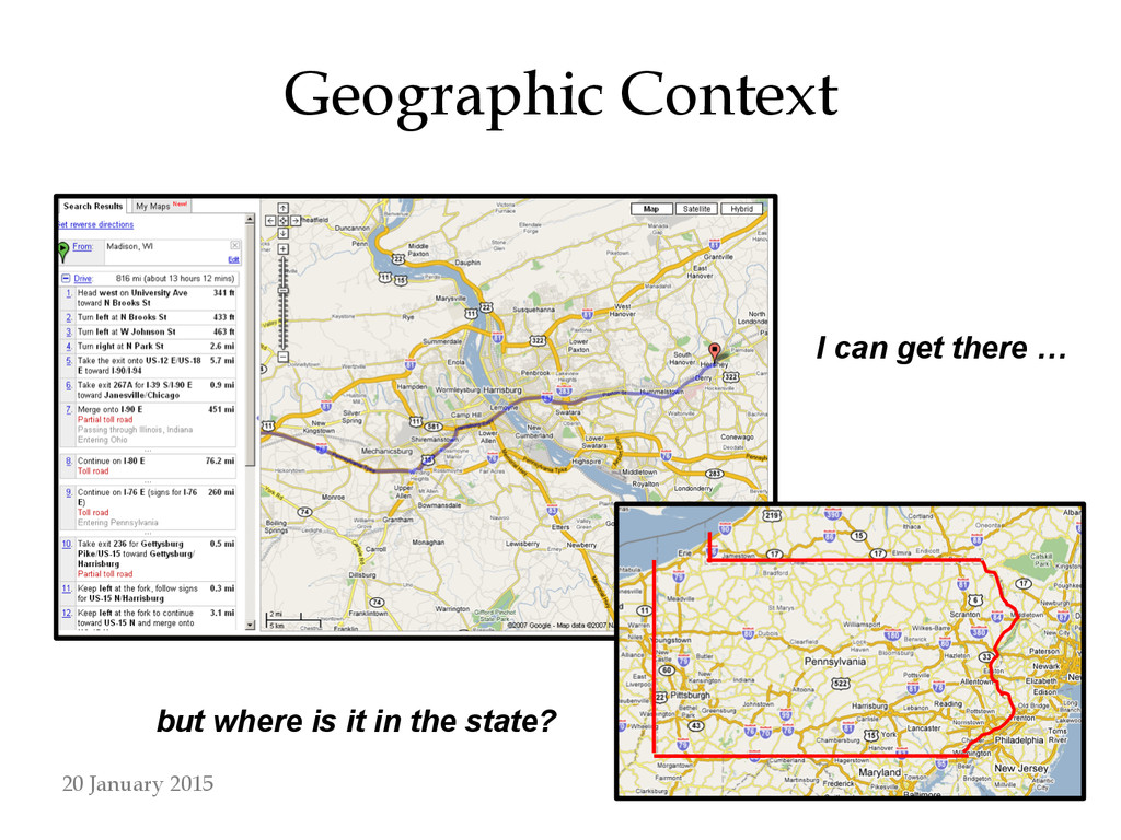
online and interactive maps has led to novel methods of accessing geographic information ! • How do navigational tools in these interfaces affect a user’s concept of the area? ! • Hypothesis: people recall more geographic context through using a static paper map than an interactive map 20 January 2015
literature available on constructing cognitive maps with environmental experience ! • Far fewer works on learning from maps alone – Most plausible experimental design for this research is based on least documented concepts ! • Big gap in literature regarding interactive map user experience 20 January 2015
of geographic knowledge (Lobben 2004) – Route vs survey knowledge ! • Learning (MacEachren 1992) – Path-based vs landmark-based ! • Hierarchical knowledge structures (MacEachren 1992) – Relationships between regions and objects within a given region are relatively easy to process • Objects in different regions are hard to relate 20 January 2015
Learning theory (MacEachren 1992) – Areas learned from (static) maps are “picture-like,” can be mentally scanned for information ! • Kinds of spatial knowledge (MacEachren 1991) – Declarative: objects & places – Procedural: routes – Configurational: relationships and patterns ! • Encoding cartographic representation data (Lloyd 1989) – Spatial relationships from maps encoded more accurately in less time than physical exposure to environment--survey knowledge 20 January 2015
interfaces (Harrower & Sheesley 2005) – Success of an interactive map depends on interface, which defines map’s functionality – More efficient panning and zooming tools introduces higher potential for “navigational trauma” – All maps exist to answer geographic questions of varying levels of specificity • Interactive maps are very good for answering precise questions, but are not necessarily as useful for “fuzzy” tasks 20 January 2015
hypothesis, 41 subjects were given paper and interactive maps and instructed to perform basic map reading tasks, such as finding named buildings ! • Subjects were then asked questions probing their ability to recall the geographic context surrounding the task areas ! • Difference in accuracy and confidence of answers between paper and interactive maps would suggest a difference in the extent to which each interface allows the acquisition of contextual knowledge 20 January 2015
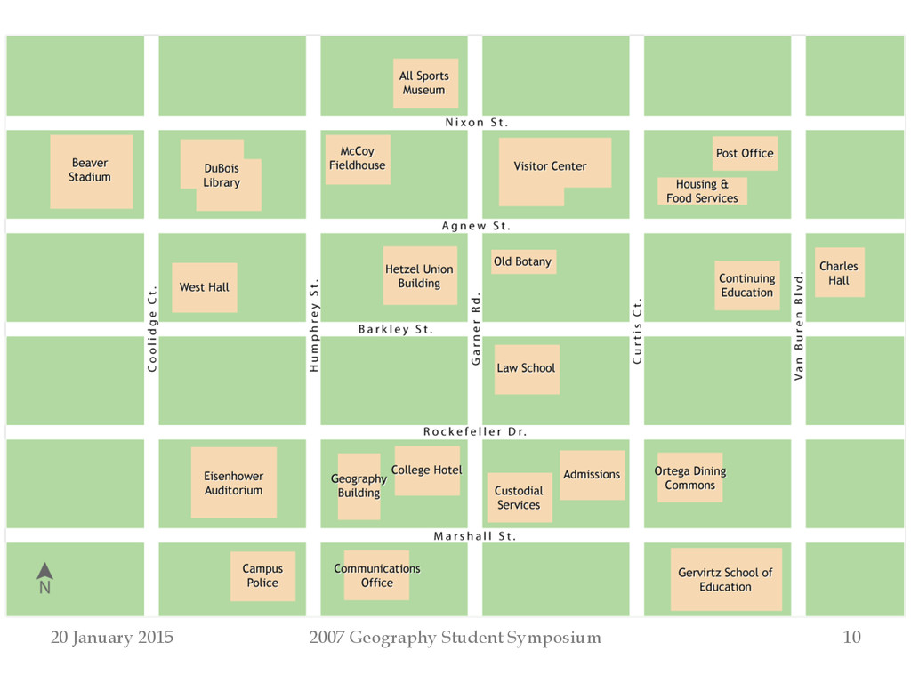
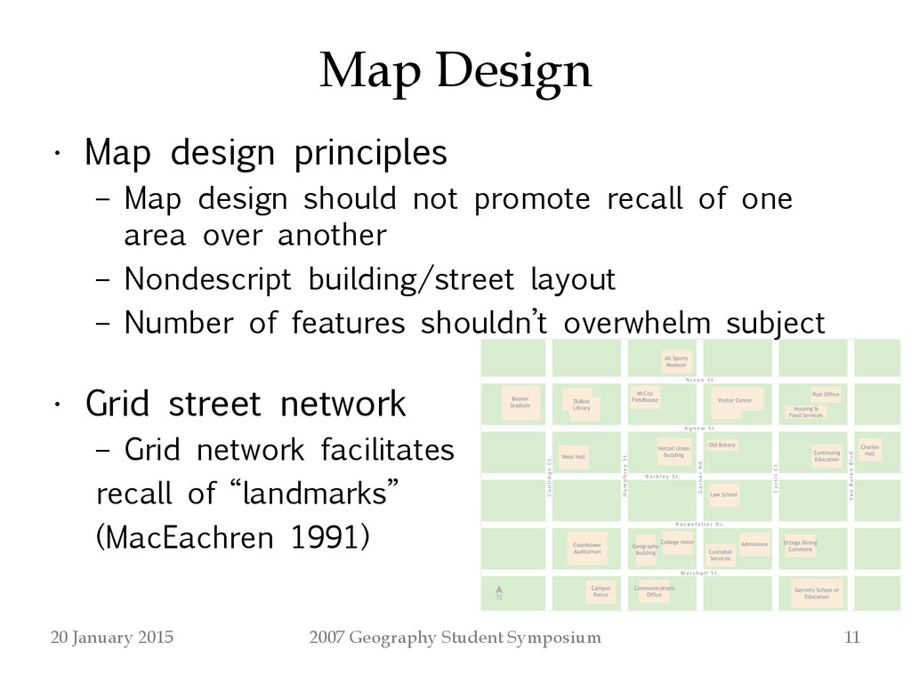
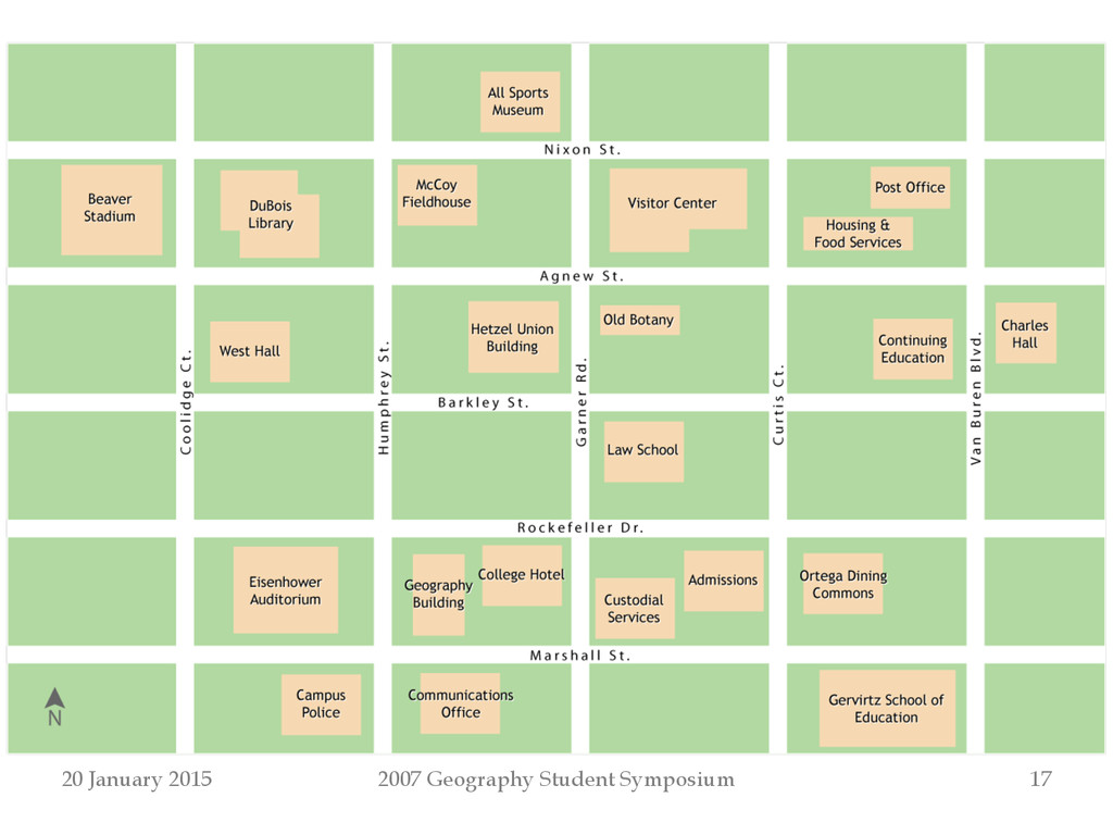
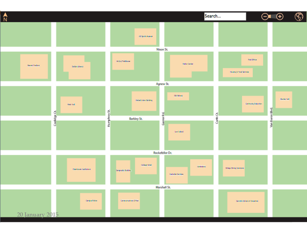
principles – Map design should not promote recall of one area over another – Nondescript building/street layout – Number of features shouldn’t overwhelm subject ! • Grid street network – Grid network facilitates recall of “landmarks” (MacEachren 1991) 20 January 2015
testing showed that an overabundance of buildings made geographic context recall nearly impossible – 111 and 53 buildings in first and second versions, respectively; final version has 22 buildings ! • In earlier map versions, areas with distinctive street design promoted recall of that specific area ! • Building shape and size not reported to effect a difference in recall 20 January 2015
into three sections: – Background information on subject’s familiarity with and use of paper and interactive maps – Map reading/recall questions with paper map – Map reading/recall questions with interactive map ! • Subject group included experts and non-experts – Kulhavy and Stock (1996) showed there should be no difference between experts and non-experts in ability to recall map information 20 January 2015
background information is collected, subjects are asked to perform four map reading tasks using either a paper or interactive version of the map – Half of subjects use paper map first, half use interactive first ! • Map reading tasks direct a subject’s attention to specific buildings and street intersections by asking them to find the objects on the map ! • Subjects are asked not to memorize the entire map, but rather to focus on locations of specified buildings and street intersections ! • Four minutes are given for map reading tasks 20 January 2015
map is taken away upon conclusion of map reading tasks and subject is presented with seven map recall questions dealing with geographic context of map reading locations ! • Map recall questions deal with locations from map reading tasks, but focus on features between the map reading locations, along the map periphery, and general map knowledge 20 January 2015
map recall question can be categorized as assessing knowledge of one of the following: – Map periphery – Relative linear distance • Ordinal • Ratio – Street network distance – Overall map context – Overall extent – Medial features 20 January 2015
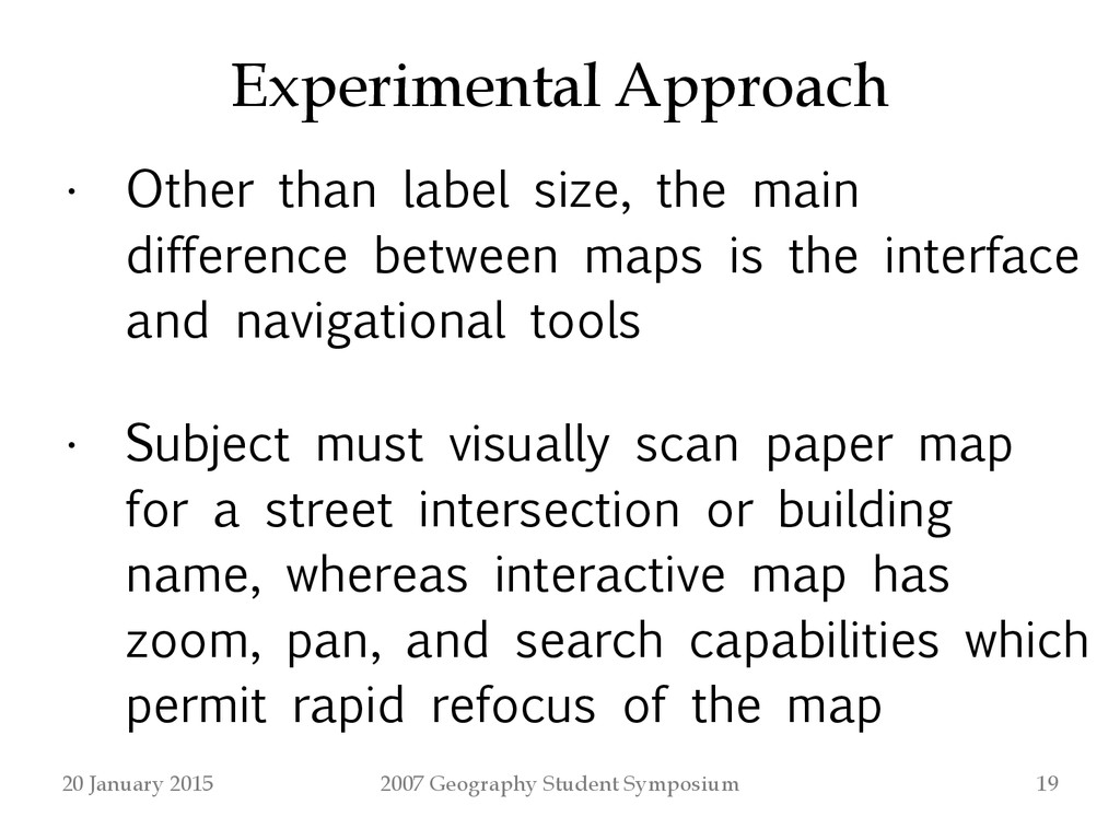
label size, the main difference between maps is the interface and navigational tools ! • Subject must visually scan paper map for a street intersection or building name, whereas interactive map has zoom, pan, and search capabilities which permit rapid refocus of the map 20 January 2015
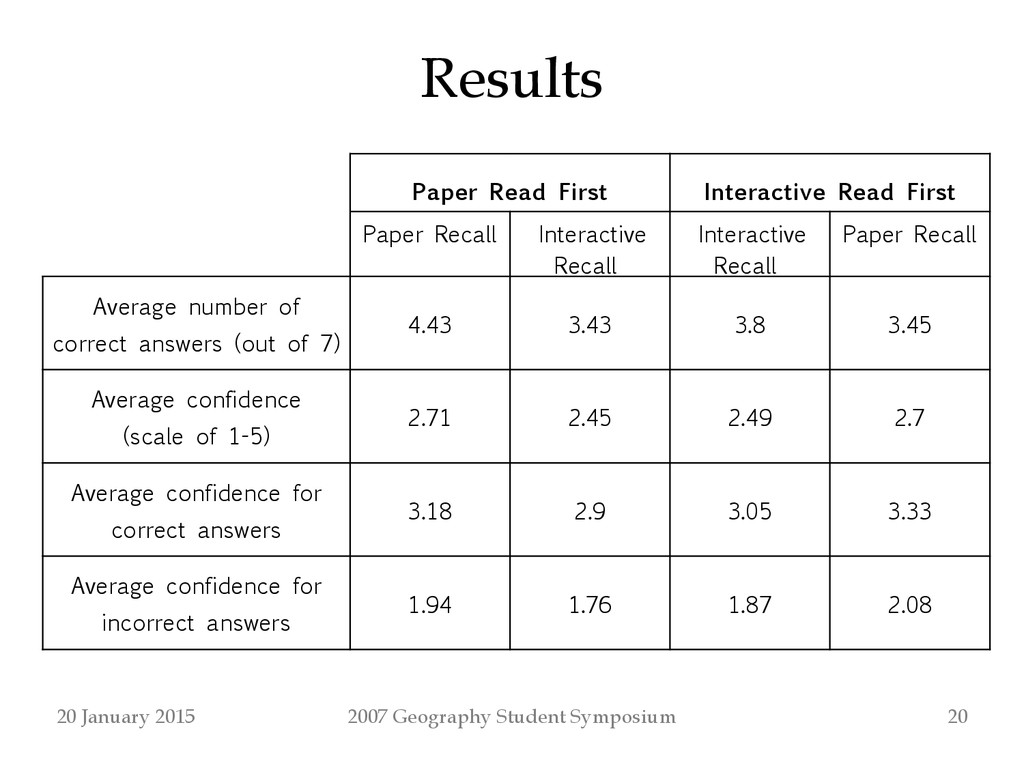
Read First Paper Recall Interactive Recall Interactive Recall Paper Recall Average number of correct answers (out of 7) 4.43 3.43 3.8 3.45 Average confidence (scale of 1-5) 2.71 2.45 2.49 2.7 Average confidence for correct answers 3.18 2.9 3.05 3.33 Average confidence for incorrect answers 1.94 1.76 1.87 2.08 20 January 2015
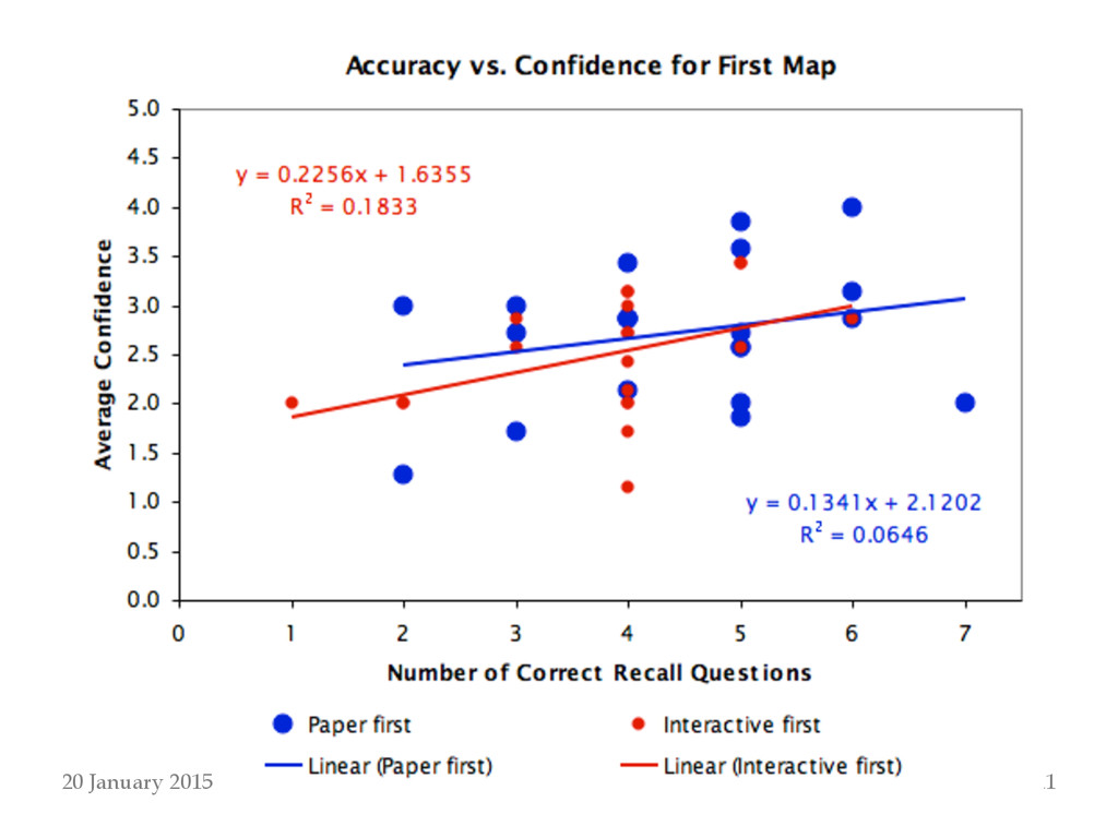
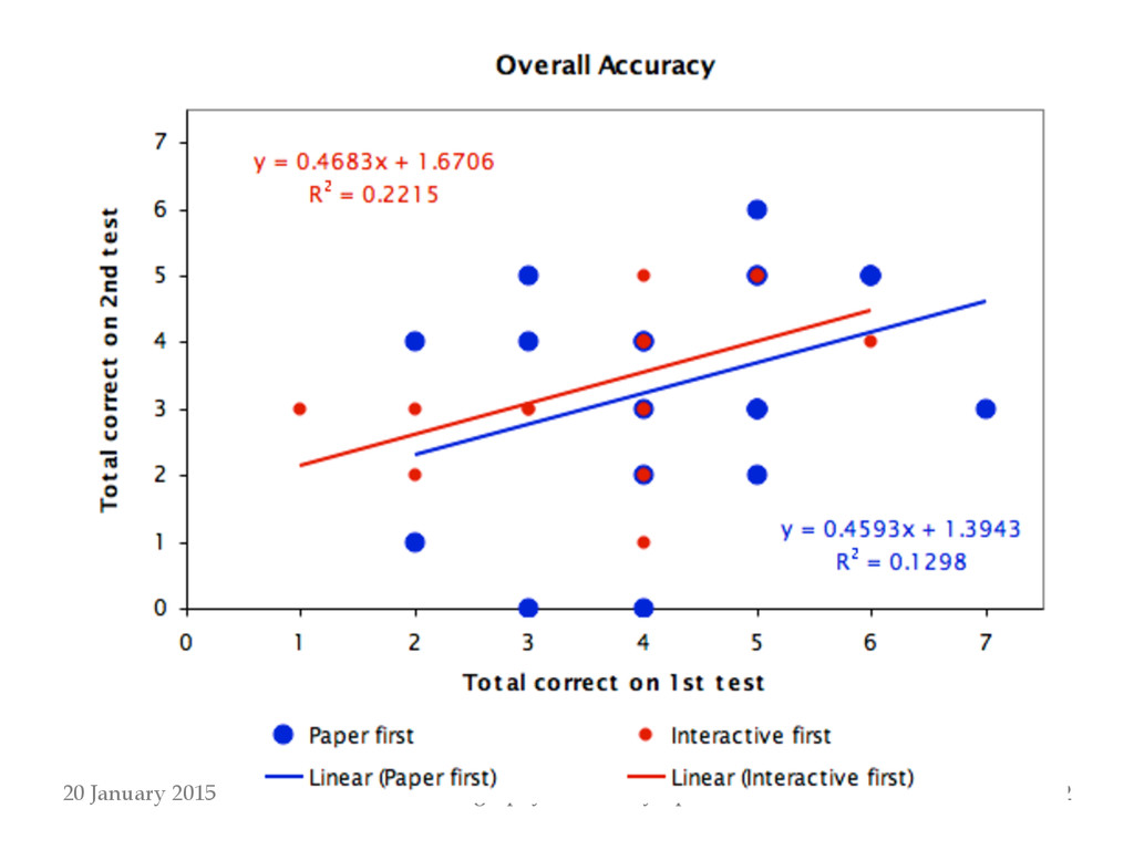
set of recall questions, use of the paper map did not result in significantly higher accuracy than the interactive map (p=0.0569) – No significant difference between the two interfaces in accuracy on the second set of questions (p=0.9625) ! • There was significantly higher accuracy with the paper map than the interactive map when the paper map was read first (p=0.0078), but not when the interactive map was read first (p=0.8994) ! • There were no significant differences in average confidence in any relevant comparisons ! • Subjects had most success with overall map context and extent questions, and least success with map periphery and medial features questions 20 January 2015
correct, but more testing is needed – Relatively weak indications that recall of geographic context is better with paper map – Confidence in recall is on average not higher with paper map – Map learning from one medium to the other does not seem to have much impact regardless of the order 20 January 2015
with real-world navigation tasks on the ground ! • Test subjects with more complex, realistic map ! • Test different geographic scales ! • Test specific interactive map navigation tools in isolation ! • If knowledge of geographic context is indeed less with interactive maps, what interface elements or tools can improve this knowledge? 20 January 2015