Upgrade to Pro — share decks privately, control downloads, hide ads and more …

3D Geoinfo pre-conference workshop: 3dfier

Stelios Vitalis
September 30, 2018
150

3D Geoinfo pre-conference workshop: 3dfier

Stelios Vitalis

September 30, 2018
Tweet

Transcript

  1. 3DTOP10NL Open data 2013 1:10.000 topo map Supercomputer: 70.000h calculation

    time (8 years) Contains inconsistencies à Lessons learned
  2. BGT ~1:500 topo map ~9x more 2D objects as TOP10NL

    Supercomputer: 80 years calculation time
  3. IMGeo 3D is optional 2D IMGeo LOD0 LOD1 3D LOD2

    BGT BAG Tree Extrusion Extrusion 2.5D
  4. Input: any 2D datasets (eg TOP10NL or BGT) 8 We

    assign each polygon to a class: 1. Building 2. Water 3. Road 4. Vegetation 5. Terrain 6. Separation 7. Bridge
  5. Lifting each polygon based on simple rules (eg avg) 11

    gaps Terrain and vegetation classes have LiDAR points added Other classes only vertices are lifted
  6. Stitching adjacent polygons with pairwise rules 13 avg of both

    vertical surfaces added volume of buildings can be preserved
  7. 15

  8. 16

  9. Opens the door to many simulations: 18 1. urban heat

    island 2. wind comfort for pedestrian at street level 3. wind loading on buildings 4. urban blast 5. crowd movement 6. urban flooding simulations
  10. 3dfier wiki on github Usage of 3dfier https://github.com/tudelft3d/3dfier/wiki/General-3dfier-tutorial-to-generate-LOD1-models Extract data

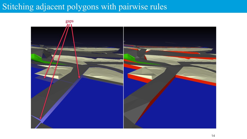
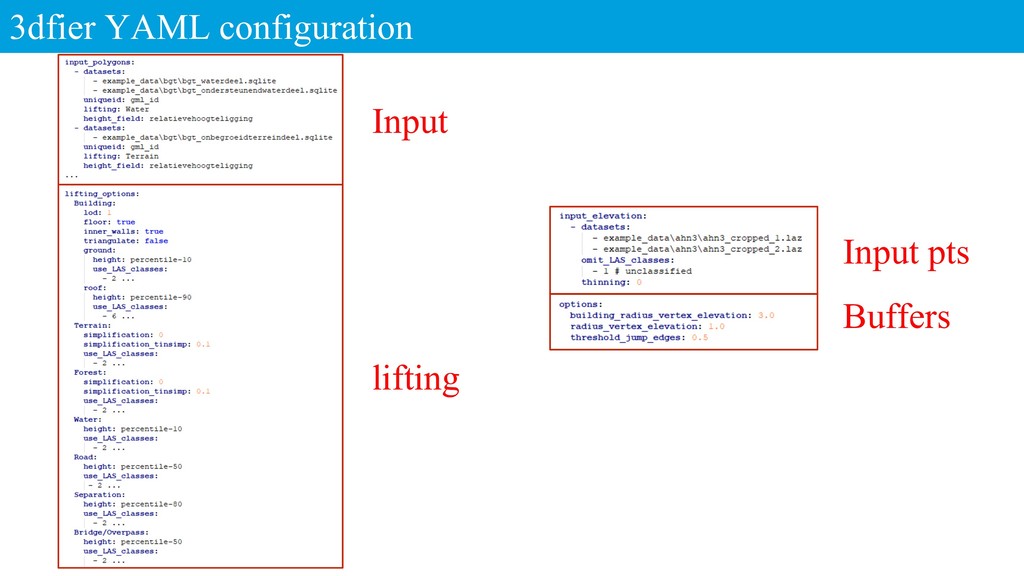
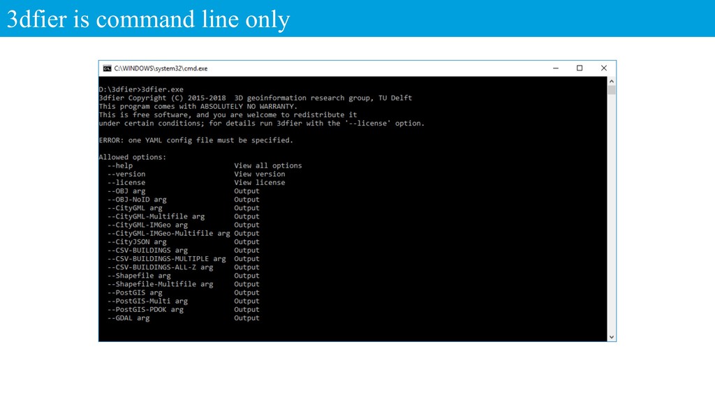
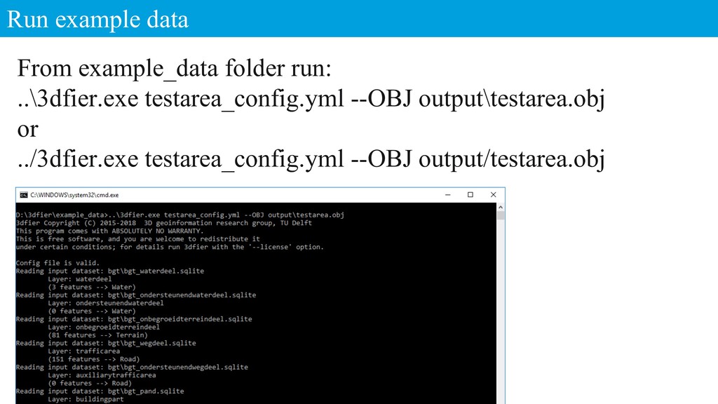
    from OSM https://github.com/tudelft3d/3dfier/wiki/Extracting-building-footprints-from-OpenStreetMap Running the precompiled binary on Windows https://github.com/tudelft3d/3dfier/wiki/Running-the-precompiled-3dfier-binary-on- Windows-64-bit-7%2C-8-or-10
  11. Run example data From example_data folder run: ..\3dfier.exe testarea_config.yml --OBJ

    output\testarea.obj or ../3dfier.exe testarea_config.yml --OBJ output/testarea.obj