Upgrade to Pro
— share decks privately, control downloads, hide ads and more …
Speaker Deck
Features
Speaker Deck
PRO
Sign in
Sign up for free
Search
Search
FOSS4G Nara/Tokyo
Search
Sponsored
·
Ship Features Fearlessly
Turn features on and off without deploys. Used by thousands of Ruby developers.
→
Mauricio Giraldo
October 30, 2016
Technology
2.1k
0
Share
Embed
Copy iframe code
Copy JS code
Copy link
Start on current slide
FOSS4G Nara/Tokyo
Presentation at Nara Women's University and Tokyo University by invitation of OSGeo Japan
Mauricio Giraldo
October 30, 2016
More Decks by Mauricio Giraldo
See All by Mauricio Giraldo
Aereo: An experimental bird’s eye view of the digital collections from the State Library of New South Wales
mgiraldo
0
380
From food to buildings and beyond: what happens when a library opens its digital collections to human-computer collaboration
mgiraldo
2
220
Aprendizajes de trabajo en bibliotecas digitales
mgiraldo
0
180
building inspector
mgiraldo
0
110
Talk at the NYU ITP Data Art class / Spring 2017
mgiraldo
0
200
Humanidades Digitales en los laboratorios de la Biblioteca Pública de New York
mgiraldo
0
130
Human-Computer Collaboration at NYPL Labs
mgiraldo
2
500
NYPL Labs @ Eyeo Festival 2015
mgiraldo
1
790
NYPL Labs Design @ MITH Digital Dialogues
mgiraldo
0
900
Other Decks in Technology
See All in Technology
LLM/Agent評価:トップ営業の発言を「正解」にする 〜暗黙的正解による評価を営業資産に変える〜
takkuhiro
1
230
知らん間に、回ってる
ming_ayami
0
640
AIと共生する開発者プラットフォーム:バクラクのモノレポ×マイクロサービス基盤
sakajunquality
2
3.6k
【Claude Code】鹿野さんに聞く 私の推しの並行開発環境 大公開 / claude-code-parallel-2026-07-15
tonkotsuboy_com
12
8.2k
実装だけじゃない! CCA-F取得エンジニアが教えるClaude Code開発プロセス活用術
diggymo
2
770
CIで使うClaude
iwatatomoya
0
280
「ちゃんとやっている」は独りよがりだった ― 不安に寄り添うインシデント対応へ / Towards incident response that addresses anxieties
chmikata
1
5.6k
大量データに対しても、生成AIを用いてリーズナブルにデータ加工をしたい!Databricksのai_queryについて調べてみた
kamoshika
1
190
SREとQA 二人三脚で進めるSLO運用/sre-qa-slo
sugitak
0
660
しくみを学んで使いこなそう GitHub Copilot app
torumakabe
2
260
AIレビューはどこまで任せられるのか?自動化と人が背負うレビューの境界
sansantech
PRO
3
930
AmplifyHostingConstructからSSRフレームワークのためのホスティング設計を考察する/amplify-hosting-construct
fossamagna
1
120
Featured
See All Featured
Testing 201, or: Great Expectations
jmmastey
46
8.2k
Money Talks: Using Revenue to Get Sh*t Done
nikkihalliwell
0
360
Game over? The fight for quality and originality in the time of robots
wayneb77
1
220
How STYLIGHT went responsive
nonsquared
100
6.2k
What's in a price? How to price your products and services
michaelherold
247
13k
From π to Pie charts
rasagy
0
230
Have SEOs Ruined the Internet? - User Awareness of SEO in 2025
akashhashmi
0
390
The SEO identity crisis: Don't let AI make you average
varn
0
510
Neural Spatial Audio Processing for Sound Field Analysis and Control
skoyamalab
0
370
Crafting Experiences
bethany
1
210
Breaking role norms: Why Content Design is so much more than writing copy - Taylor Woolridge
uxyall
0
340
Chrome DevTools: State of the Union 2024 - Debugging React & Beyond
addyosmani
10
1.3k
Transcript
͠΅Ξ͚ͪͬ͜Δͯ
buenos días
mauricio giraldo arteaga @mgiraldo
None
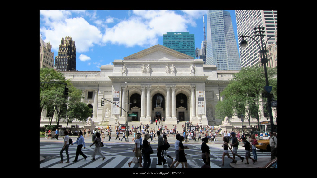
flickr.com/photos/wallyg/6133216510
None
None
None
None
None
None
None
None
None
None
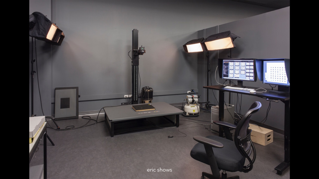
eric shows
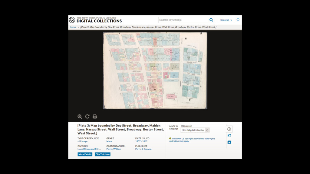
digitalcollections.nypl.org
None
None
None
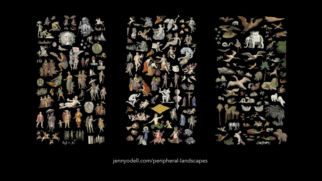
jennyodell.com/peripheral-landscapes
None
None
None
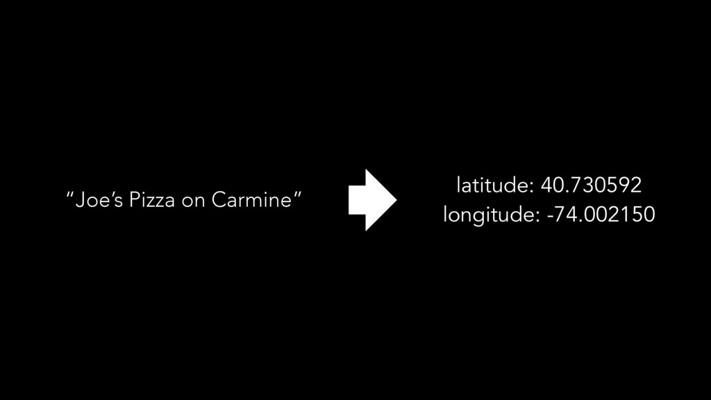
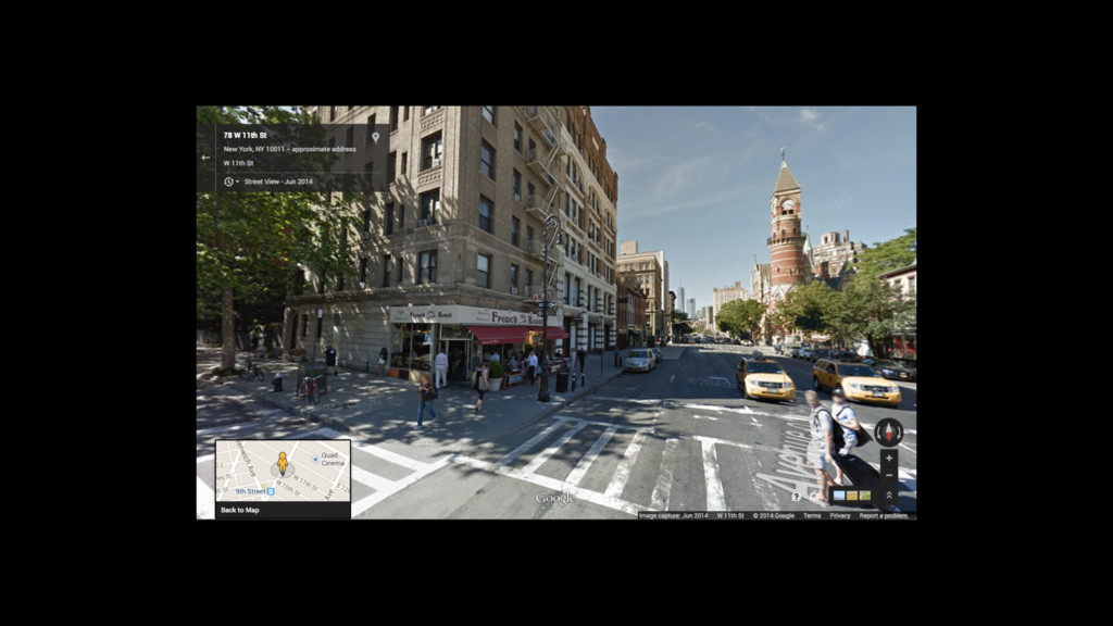
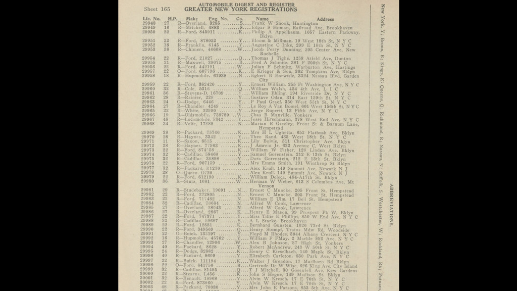
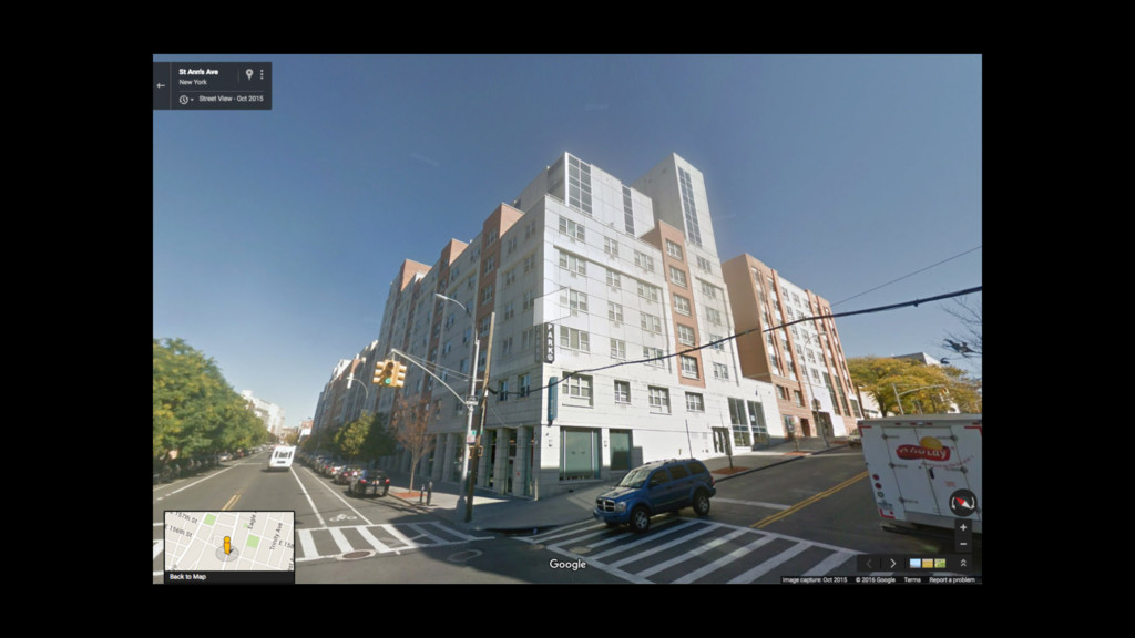
“Joe’s Pizza on Carmine” latitude: 40.730592 longitude: -74.002150
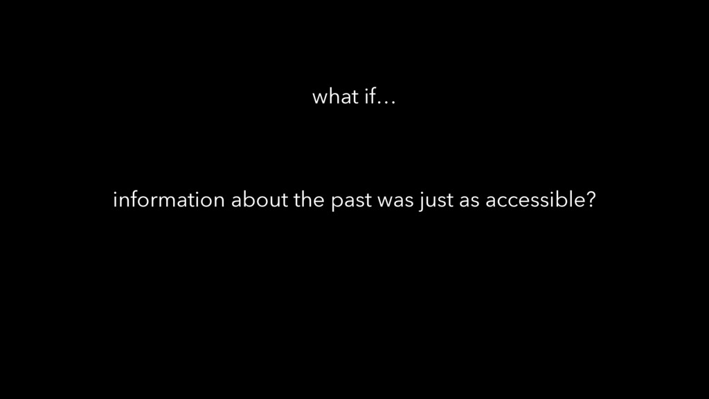
information about the past was just as accessible? what if…
None
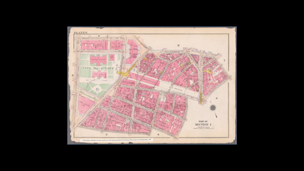
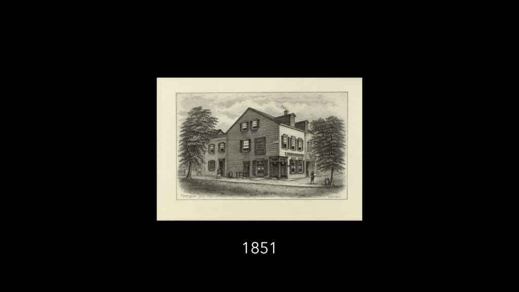
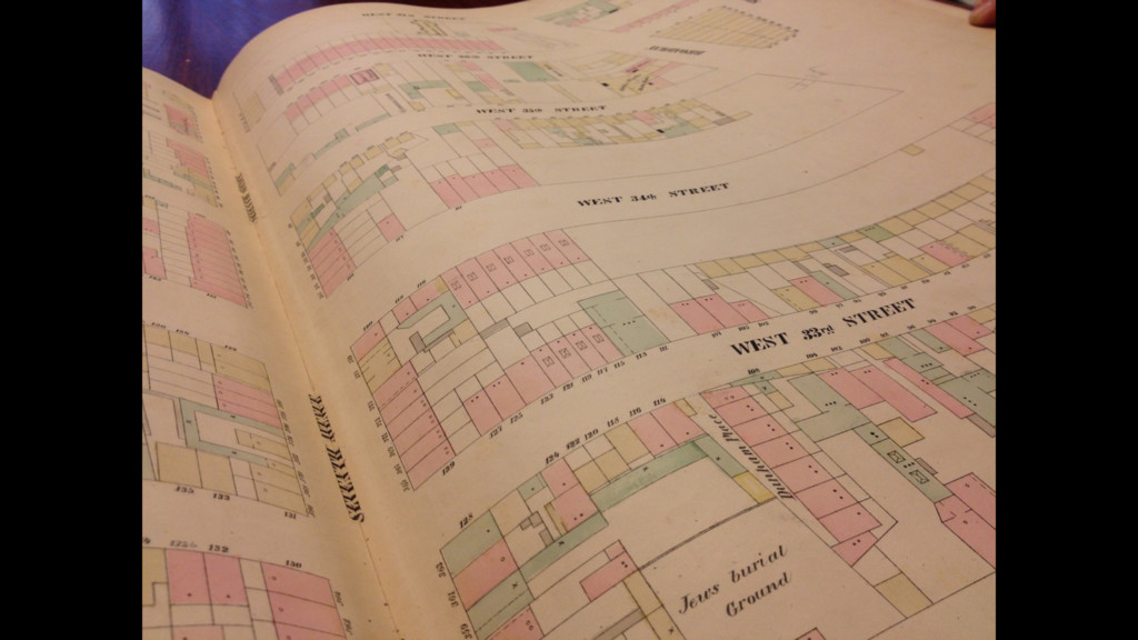
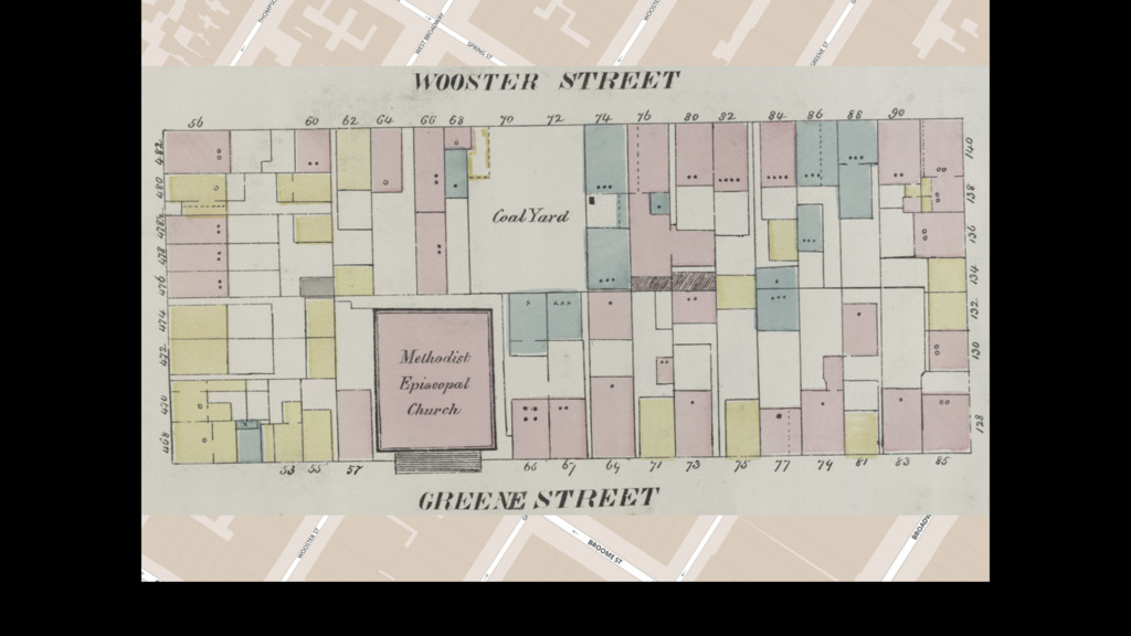
1851
None
None
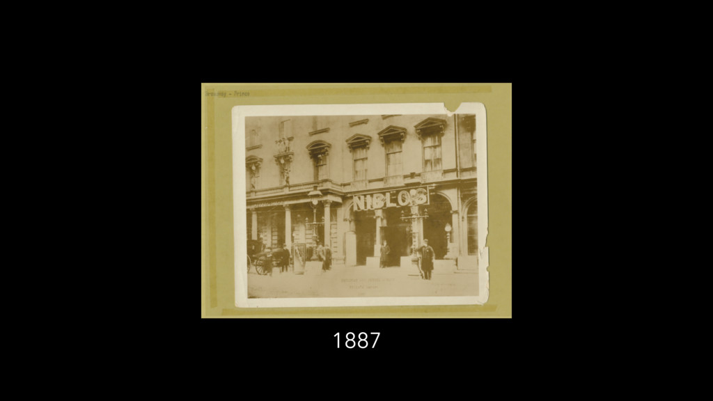
1887
None
None
1931
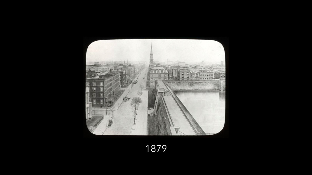
1879
None
None
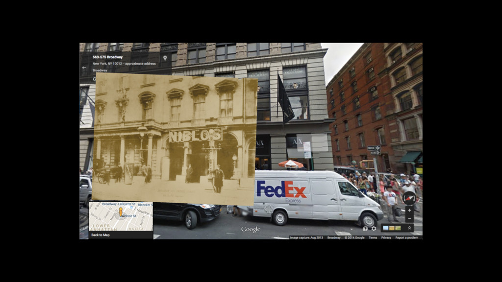
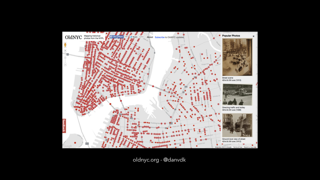
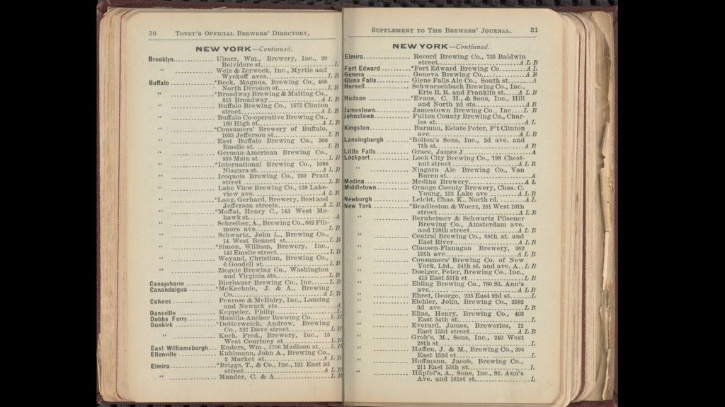
oldnyc.org - @danvdk
None
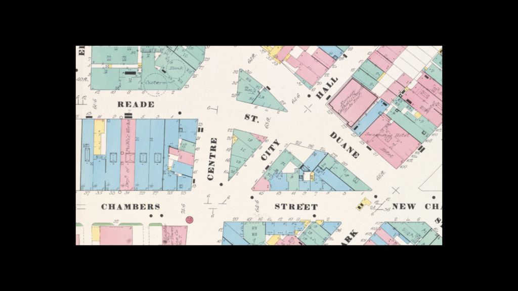
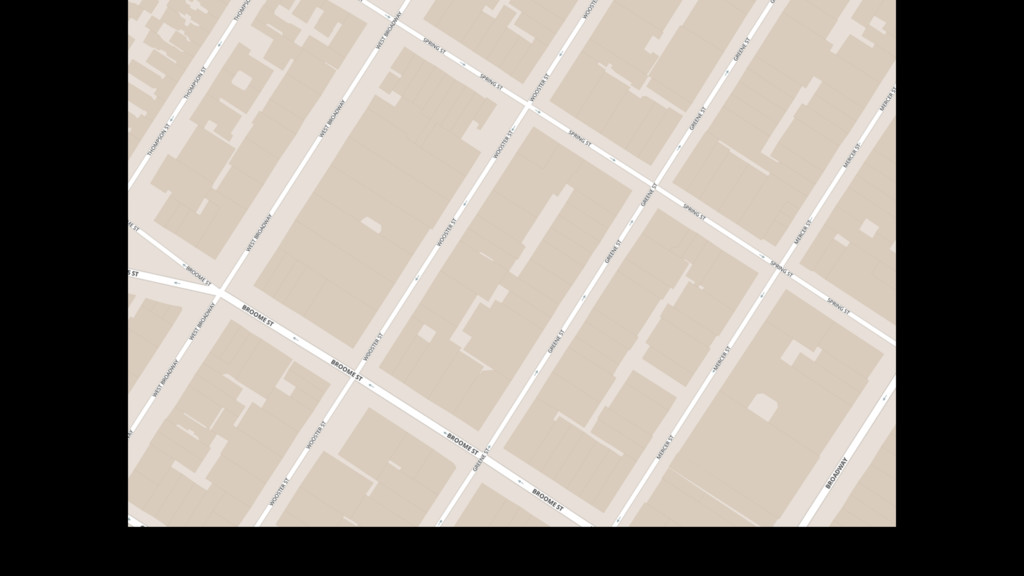
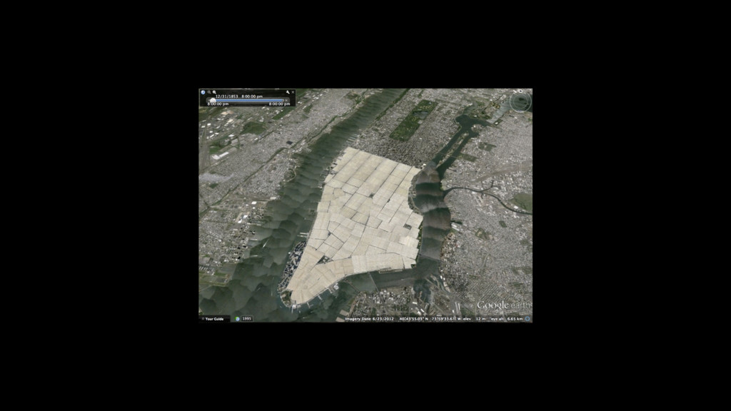
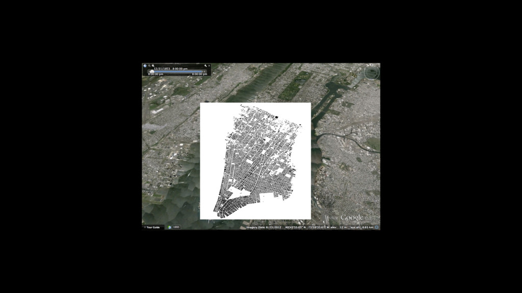
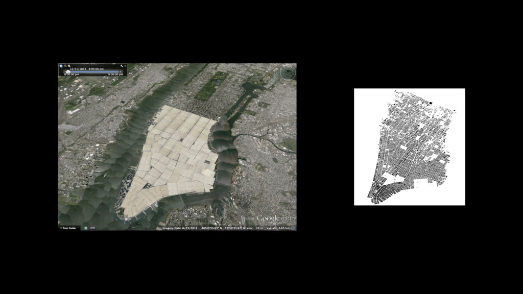
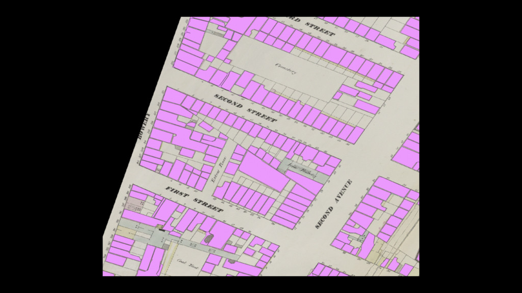
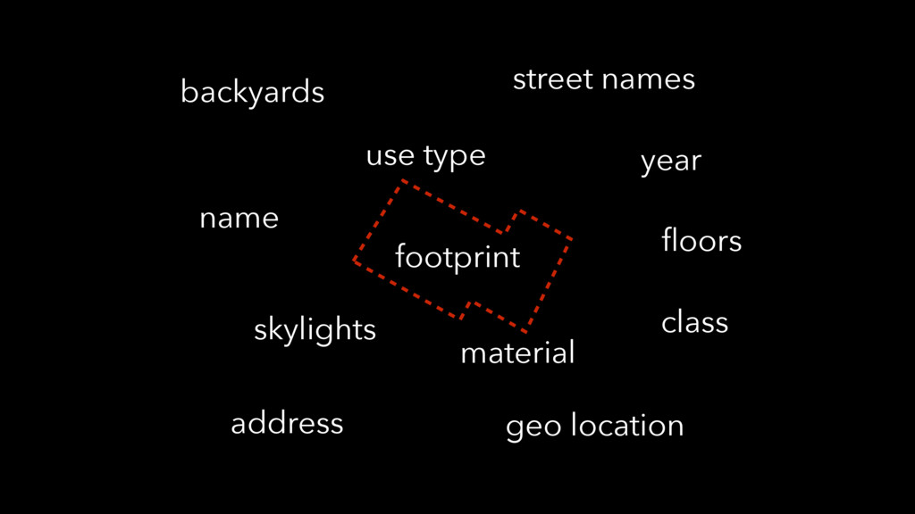
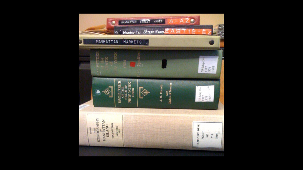
footprint material use type street names address floors name class
geo location year skylights backyards
None
None
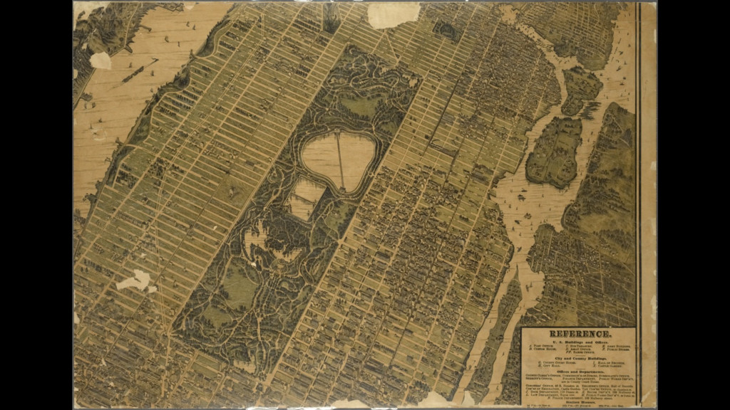
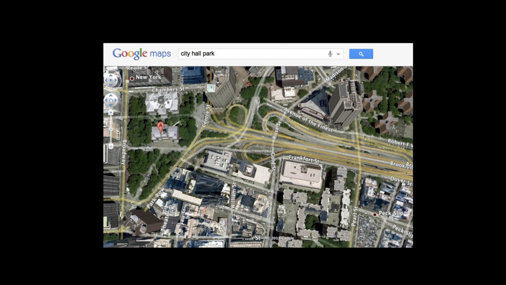
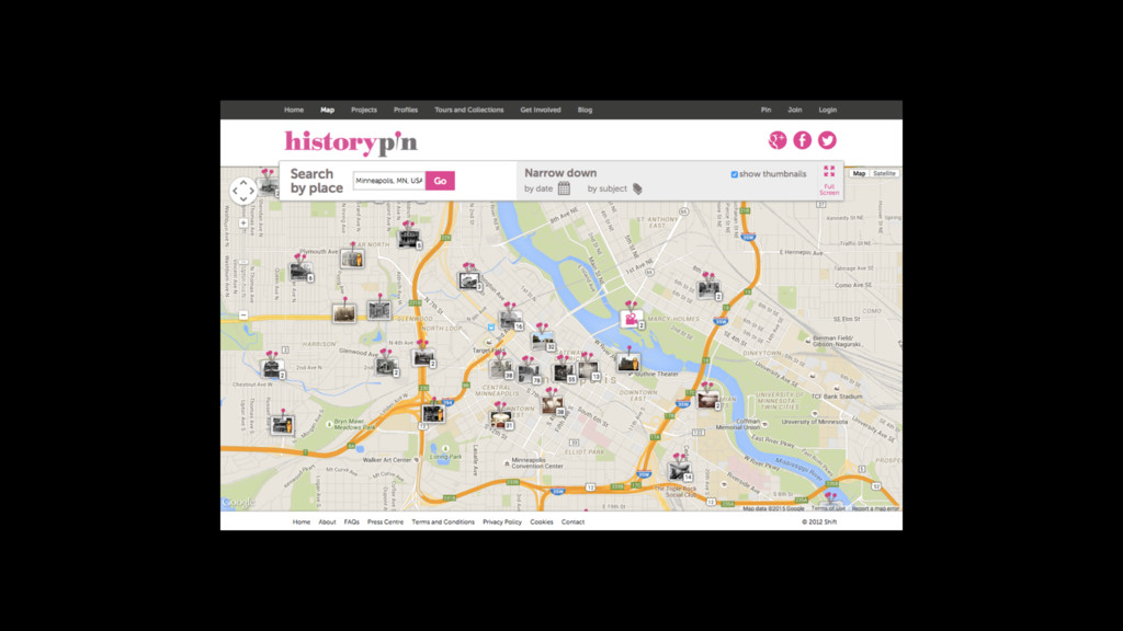
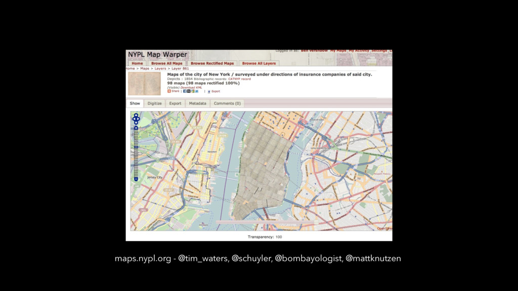
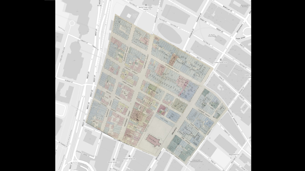
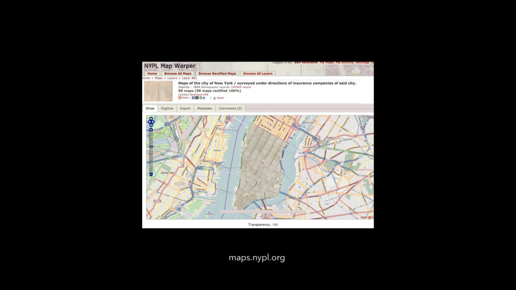
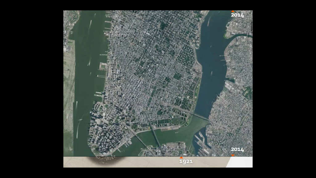
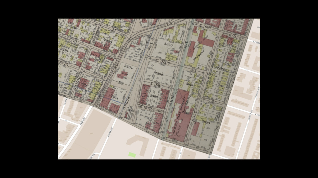
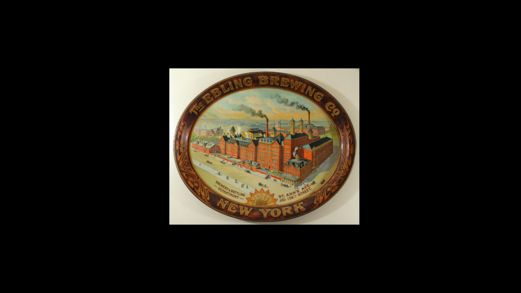
maps.nypl.org - @tim_waters, @schuyler, @bombayologist, @mattknutzen
maps.nypl.org
None
None
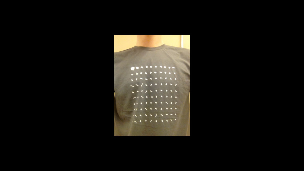
*this is a simulation. actual process is intensive. consult your
mathematician before trying
None
None
maps.nypl.org
None
None
None
None
choleramap.pulitzercenter.org — Sonia Shah
None
None
bottleneck
None
None
None
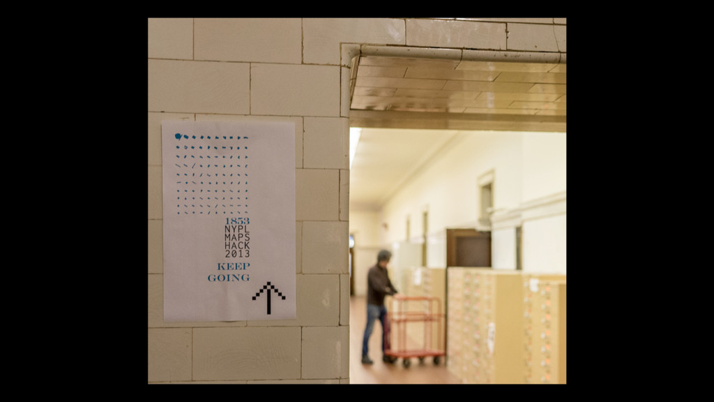
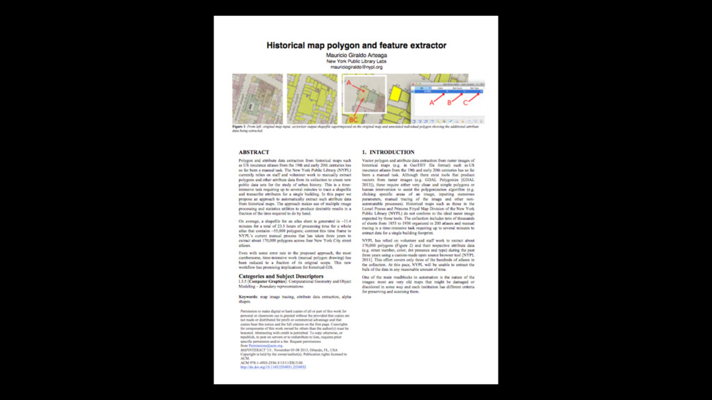
github.com/NYPL/map-vectorizer
None
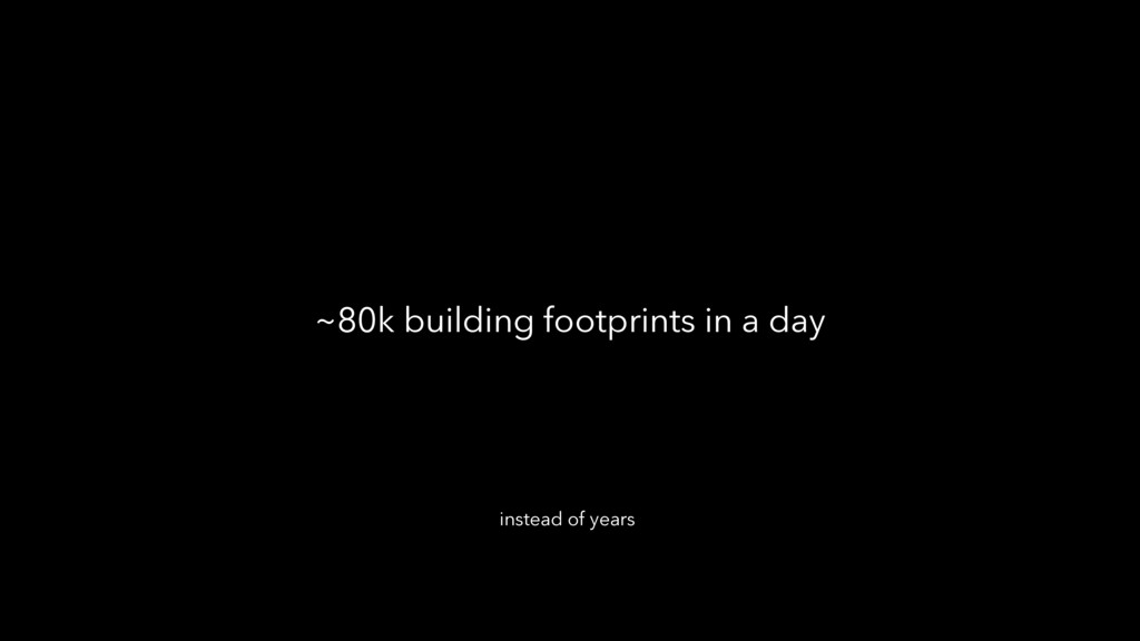
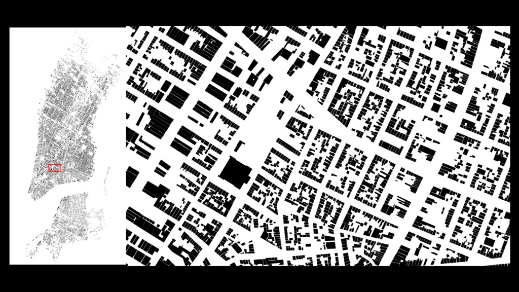
~80k building footprints in a day instead of years
None
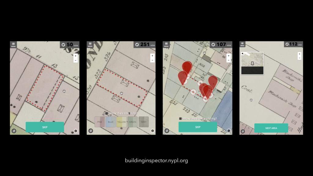
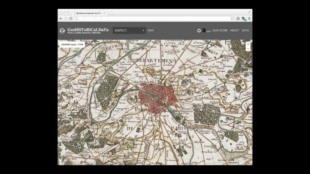
buildinginspector.nypl.org
None
None
footprint material use type street names address floors name class
geo location year skylights backyards
check YES FIX address color fix *footprints marked as “NO”
go to building heaven
buildinginspector.nypl.org
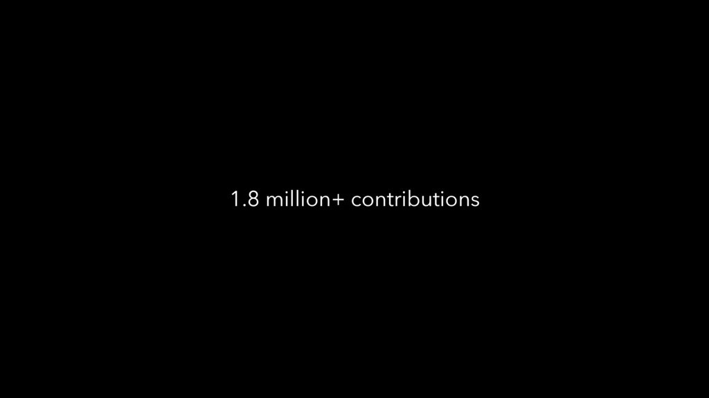
1.8 million+ contributions
None
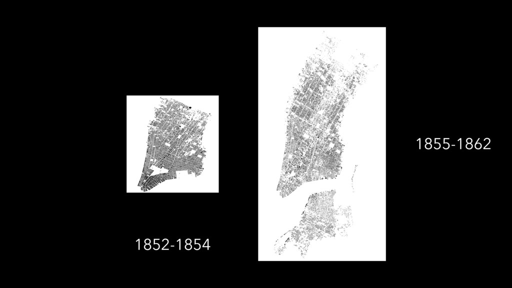
1852-1854
1855-1862 1852-1854
buildinsinspector.nypl.org
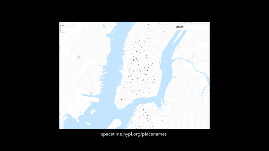
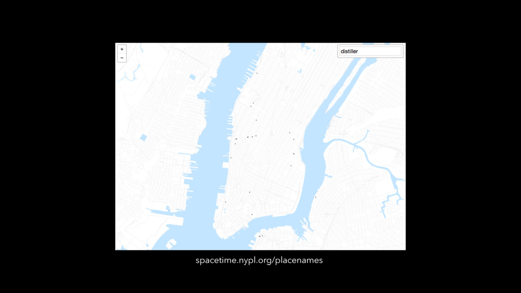
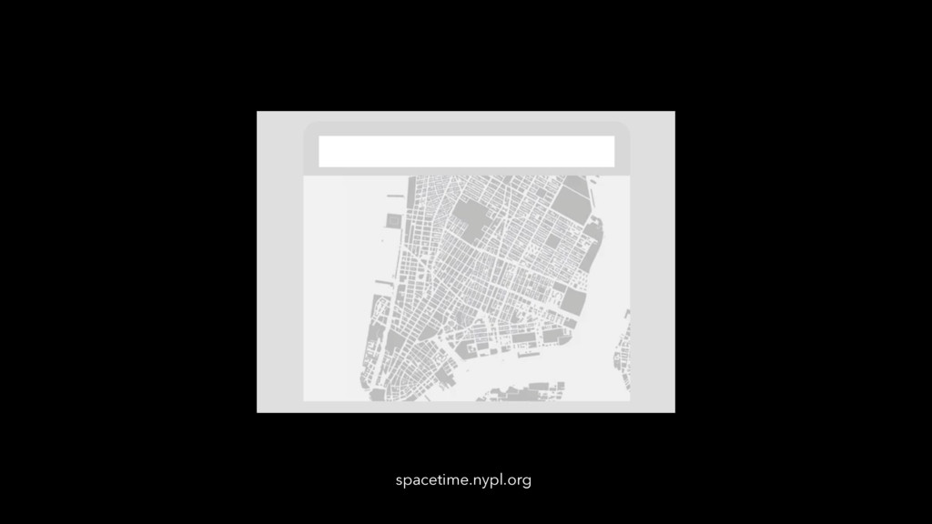
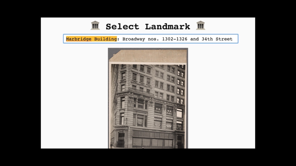
spacetime.nypl.org/placenames
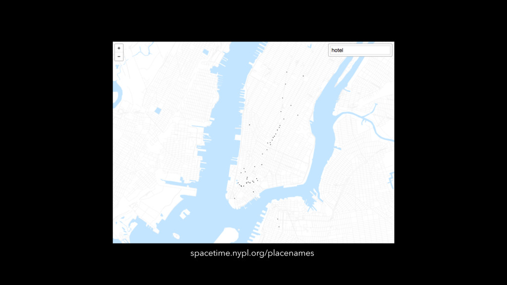
spacetime.nypl.org/placenames
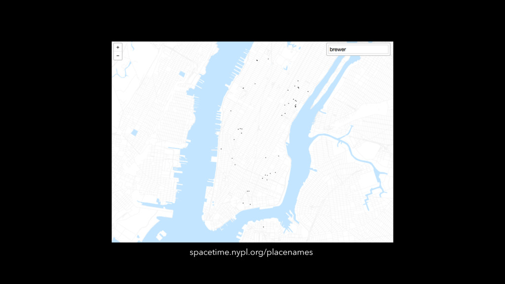
spacetime.nypl.org/placenames
spacetime.nypl.org/placenames
spacetime.nypl.org/placenames
spacetime.nypl.org/placenames
spacetime.nypl.org/placenames
None
None
None
None
None
None
None
None
None
None
None
connect all the things!
spacetime.nypl.org
spacetime.nypl.org
(still experimental…)
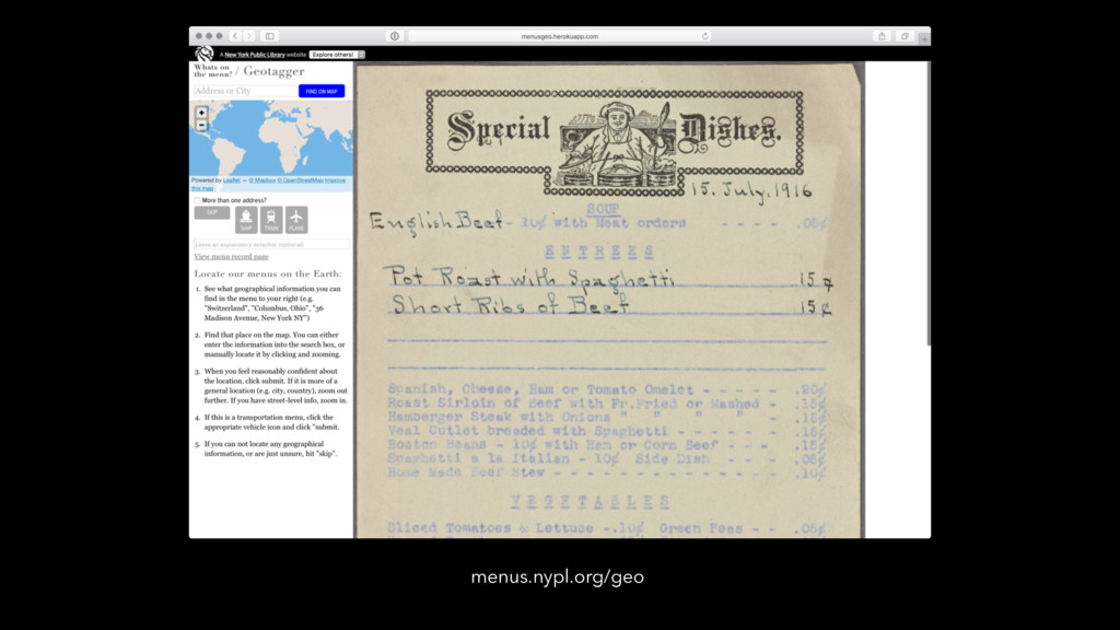
menus.nypl.org/geo
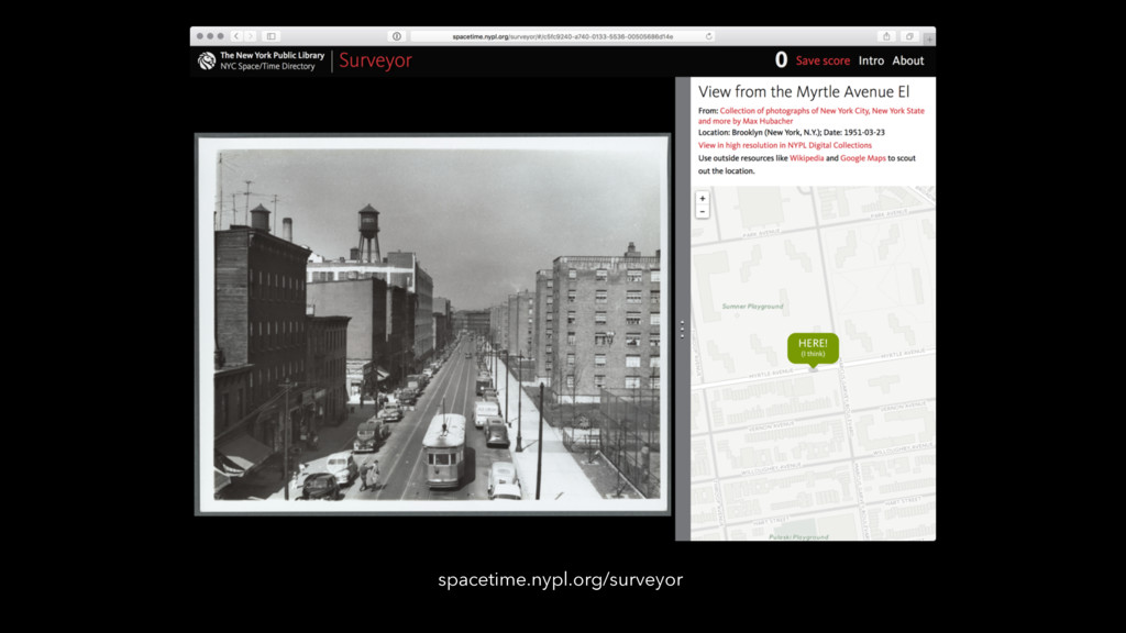
spacetime.nypl.org/surveyor
spacetime.nypl.org/tagmap
None
spacetime.nypl.org
spacetime.nypl.org
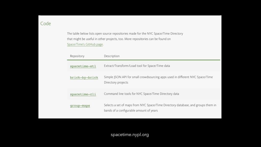
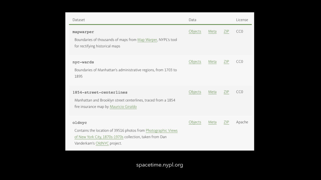
github.com/NYPL-spacetime
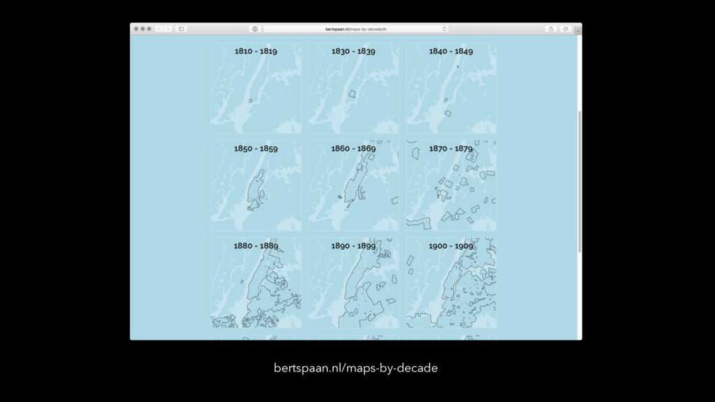
bertspaan.nl/maps-by-decade
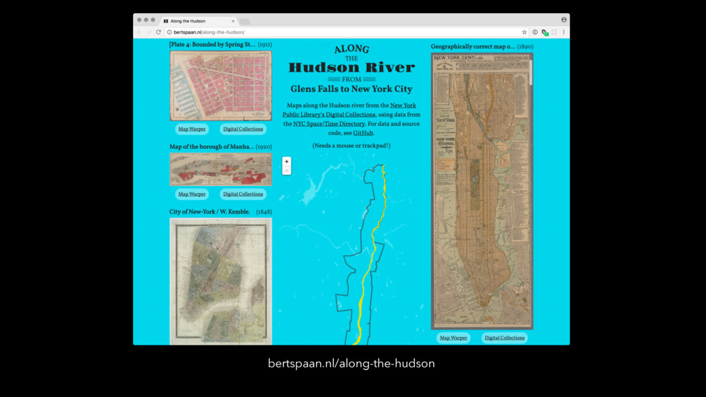
bertspaan.nl/along-the-hudson
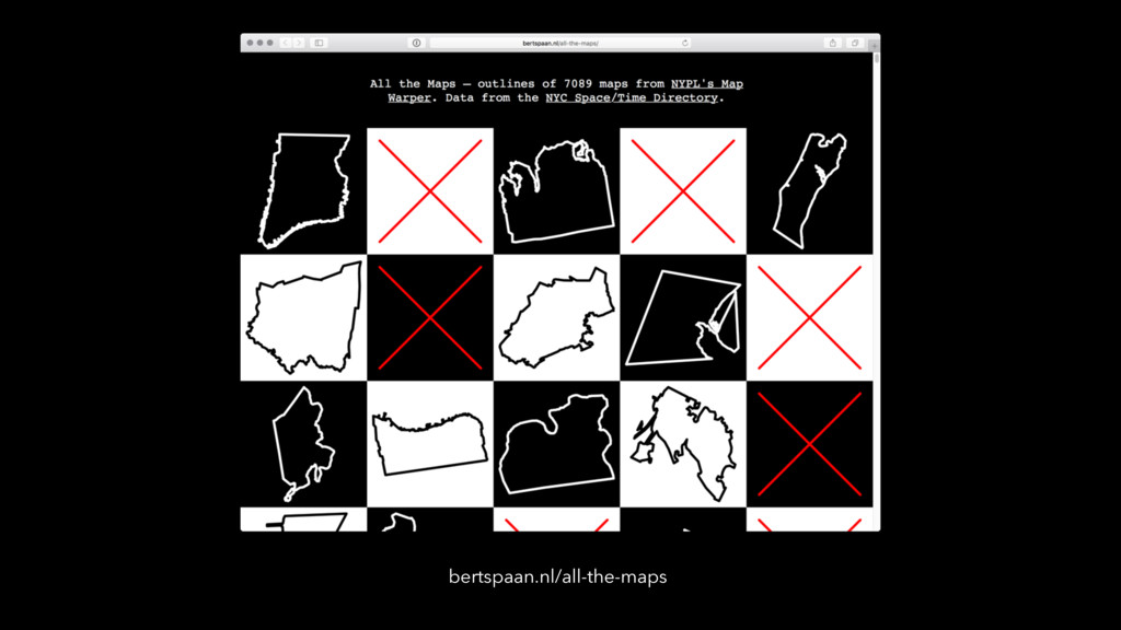
bertspaan.nl/all-the-maps
͘Π͢;͜ @mgiraldo