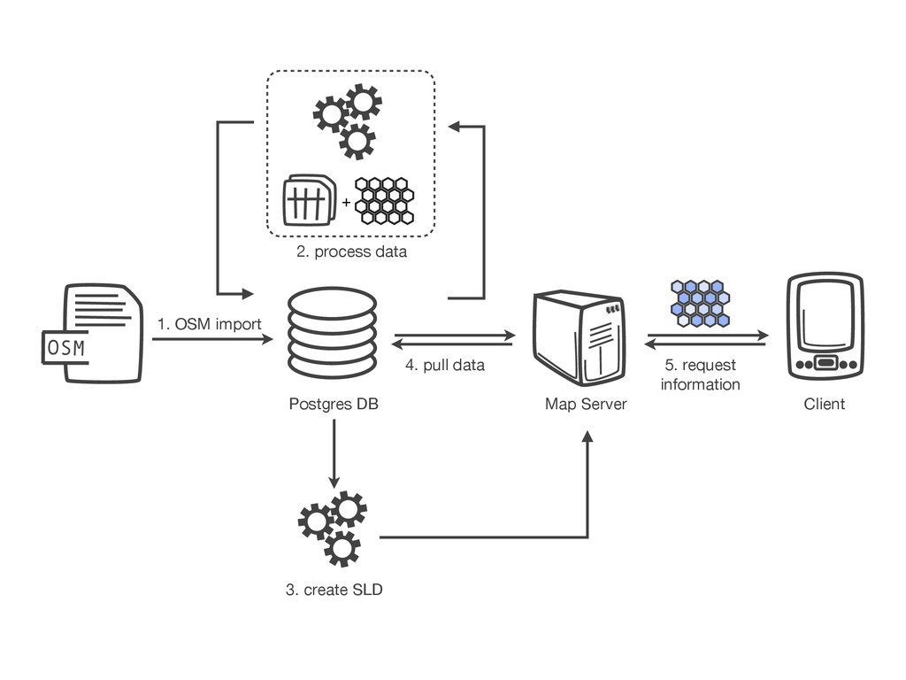
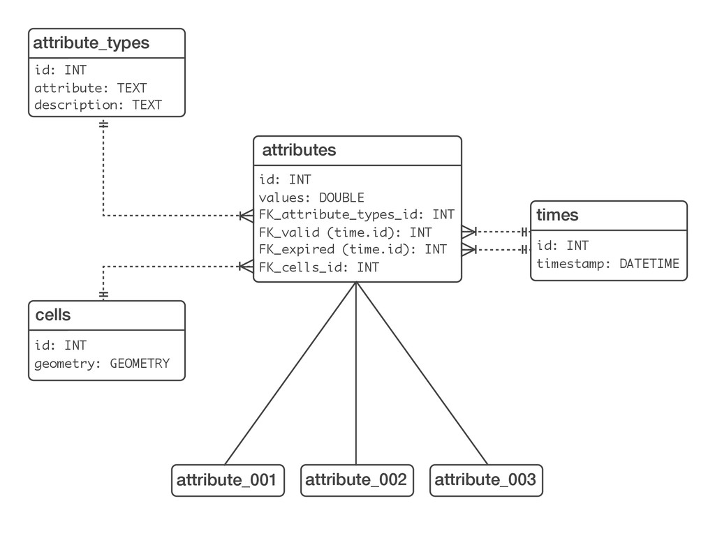
FK_expired (time.id): INT FK_cells_id: INT times id: INT timestamp: DATETIME cells id: INT geometry: GEOMETRY attribute_types id: INT attribute: TEXT description: TEXT attribute_001 attribute_002 attribute_003
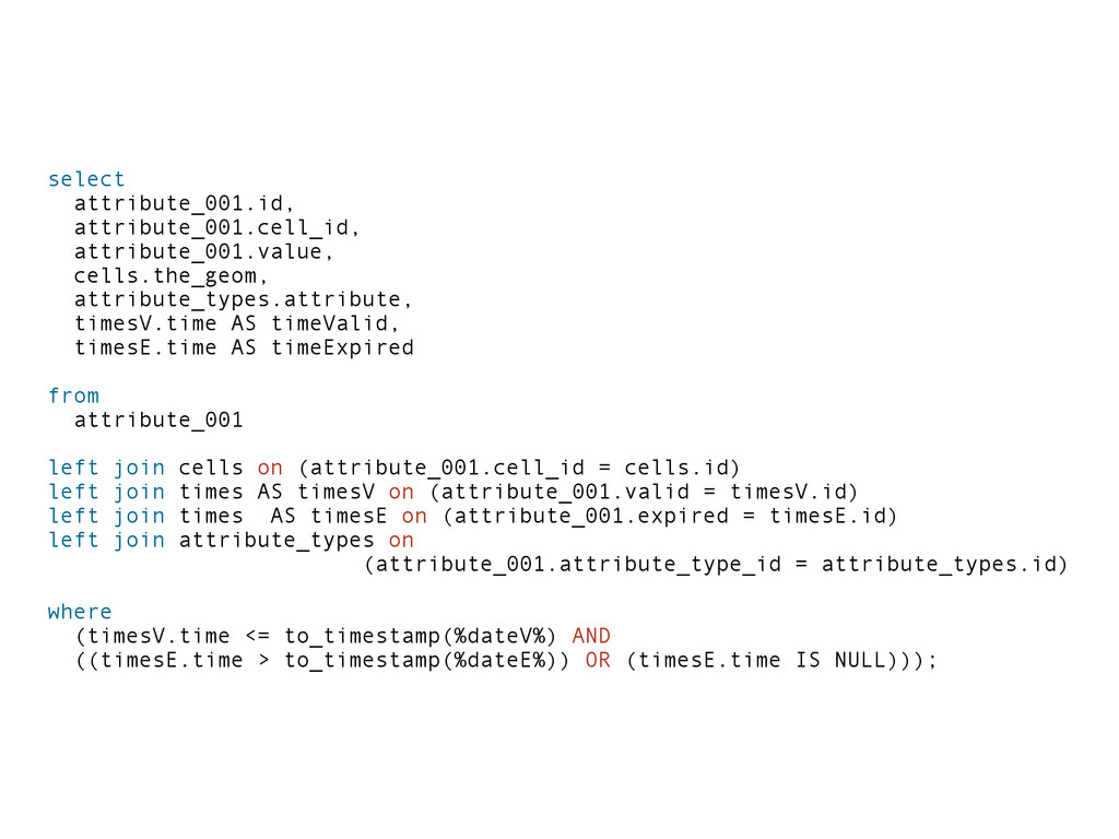
AS timeExpired from attribute_001 left join cells on (attribute_001.cell_id = cells.id) left join times AS timesV on (attribute_001.valid = timesV.id) left join times AS timesE on (attribute_001.expired = timesE.id) left join attribute_types on (attribute_001.attribute_type_id = attribute_types.id) where (timesV.time <= to_timestamp(%dateV%) AND ((timesE.time > to_timestamp(%dateE%)) OR (timesE.time IS NULL)));
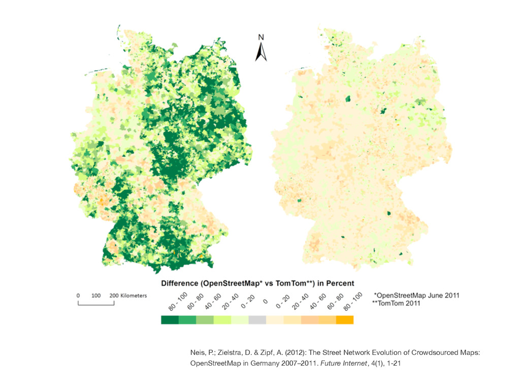
from volunteered geographic information by means of genetic algorithms and artificial neural networks. International Journal of Geographical Information Science. DOI:10.1080/13658816.2011.619501
![http://osmatrix.geoserver/wms/osmatrix/? request=getMap& layer=osmatrix:landuse_industrial& viewparams=time:1296758206 [...]](https://files.speakerdeck.com/presentations/c15e8fc0d524013195173613a192ed87/slide_16.jpg)