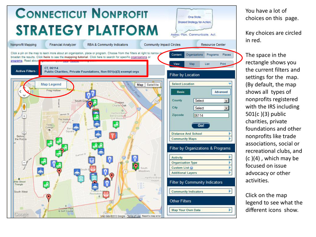
choices are circled in red. The space in the rectangle shows you the current filters and settings for the map. (By default, the map shows all types of nonprofits registered with the IRS including 501(c )(3) public charities, private foundations and other nonprofits like trade associations, social or recreational clubs, and (c )(4) , which may be focused on issue advocacy or other activities. Click on the map legend to see what the different icons show.
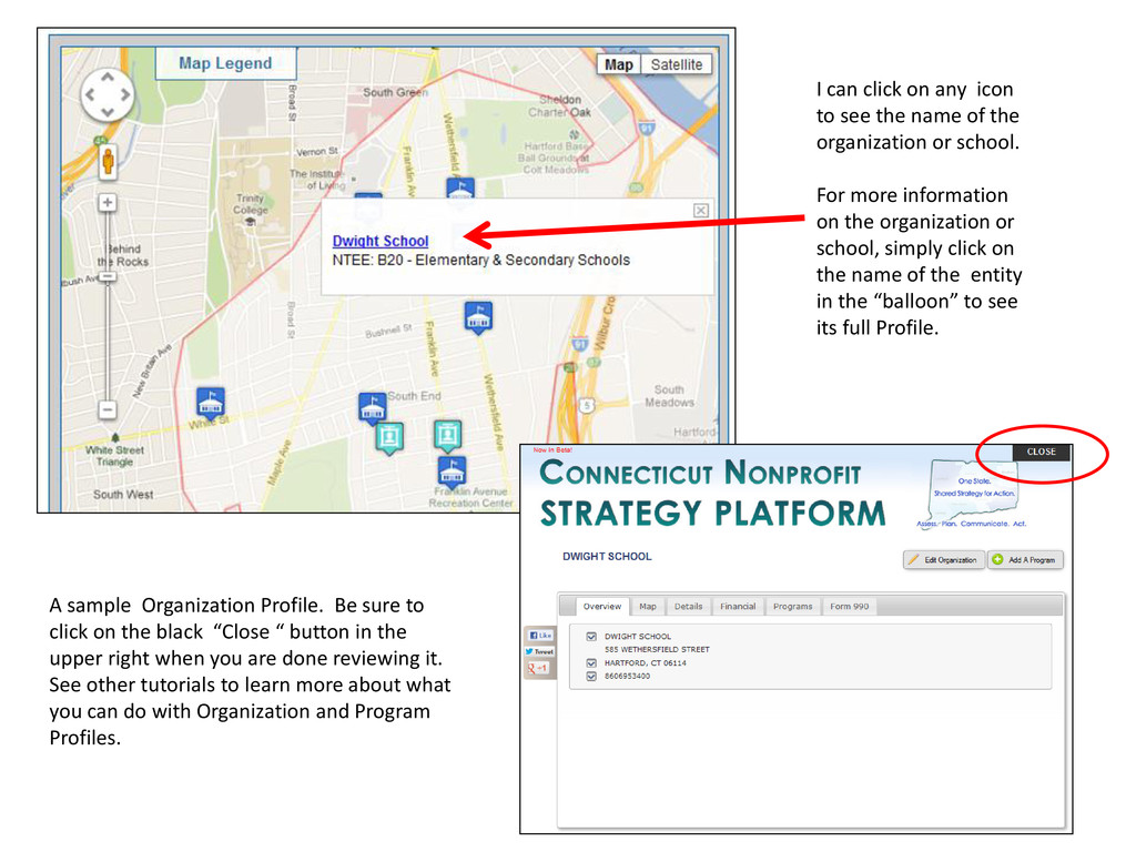
of the organization or school. For more information on the organization or school, simply click on the name of the entity in the “balloon” to see its full Profile. A sample Organization Profile. Be sure to click on the black “Close “ button in the upper right when you are done reviewing it. See other tutorials to learn more about what you can do with Organization and Program Profiles.
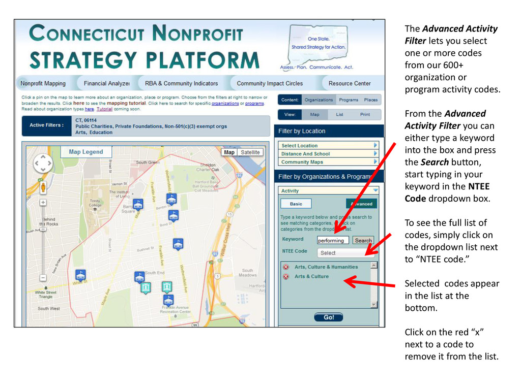
codes from our 600+ organization or program activity codes. From the Advanced Activity Filter you can either type a keyword into the box and press the Search button, start typing in your keyword in the NTEE Code dropdown box. To see the full list of codes, simply click on the dropdown list next to “NTEE code.” Selected codes appear in the list at the bottom. Click on the red “x” next to a code to remove it from the list.
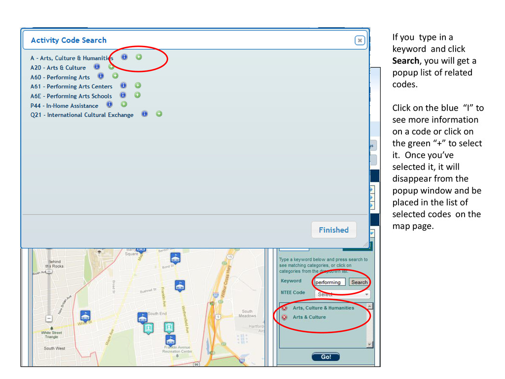
will get a popup list of related codes. Click on the blue “I” to see more information on a code or click on the green “+” to select it. Once you’ve selected it, it will disappear from the popup window and be placed in the list of selected codes on the map page.
say you want to see all the afterschool arts, sports or tutoring programs within walking distance of a school. Choose “Distance and School” under “Filter by Location,” select the school from the dropdown list or type in a specific address you get a map like this.
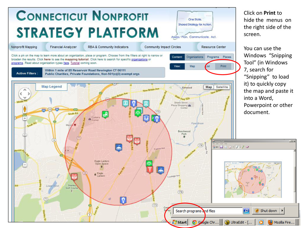
side of the screen. You can use the Windows “Snipping Tool” (in Windows 7, search for “Snipping” to load it) to quickly copy the map and paste it into a Word, Powerpoint or other document.
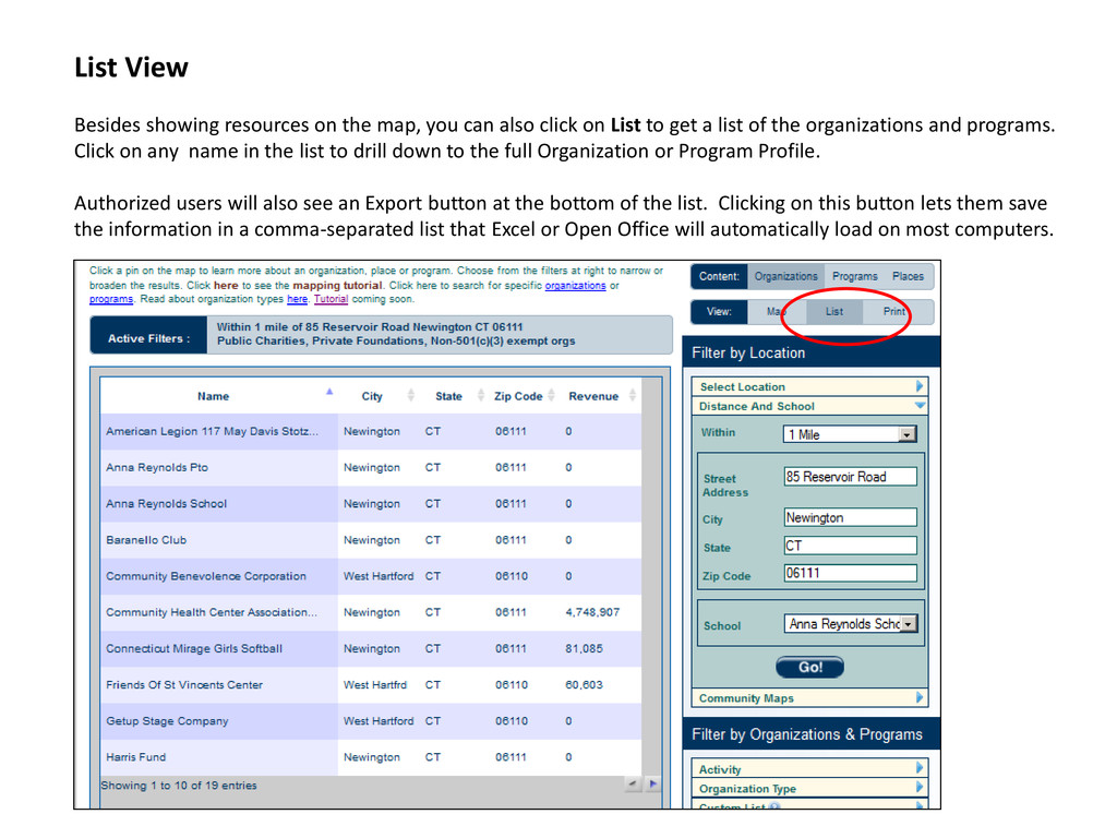
also click on List to get a list of the organizations and programs. Click on any name in the list to drill down to the full Organization or Program Profile. Authorized users will also see an Export button at the bottom of the list. Clicking on this button lets them save the information in a comma-separated list that Excel or Open Office will automatically load on most computers.
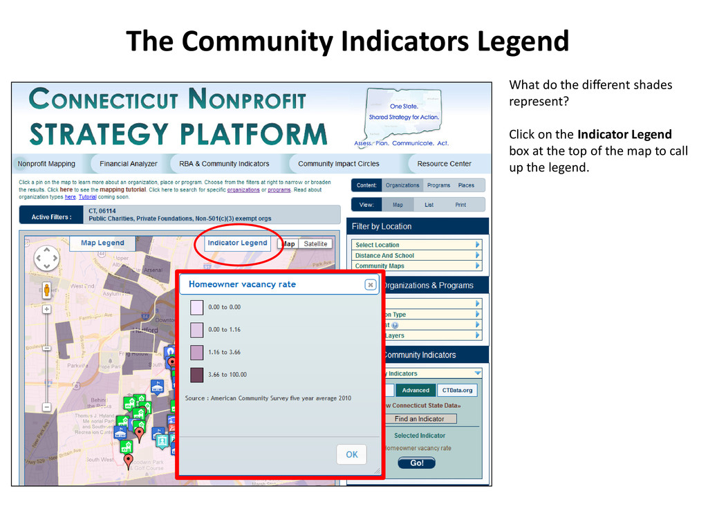
also show Community Indicators like child, elderly, or overall poverty rates or the unemployment rate, displayed on this map. You can click on any of the handful of Basic Indicators or select “Advanced” to see the list of hundreds of indicators available from the Census Bureau, other national databases and state databases compiled by the CT Data Collaborative. Click on CTData.org to jump directly to the Collaborative’s maps. Community Indicators
up the Community Indicator Search. You can type in a keyword (partial words like “hous” for houses or housing are ok) or choose Expand All to browse the full list of indicators. Community Indicators: Advanced Be sure to click “Expand All” after your search to see all the entries found or click on the small blue triangle next to a category to see the items that matched the search for that category. Click on a green plus sign to select an indicator. Your currently chosen Indicator is listed here
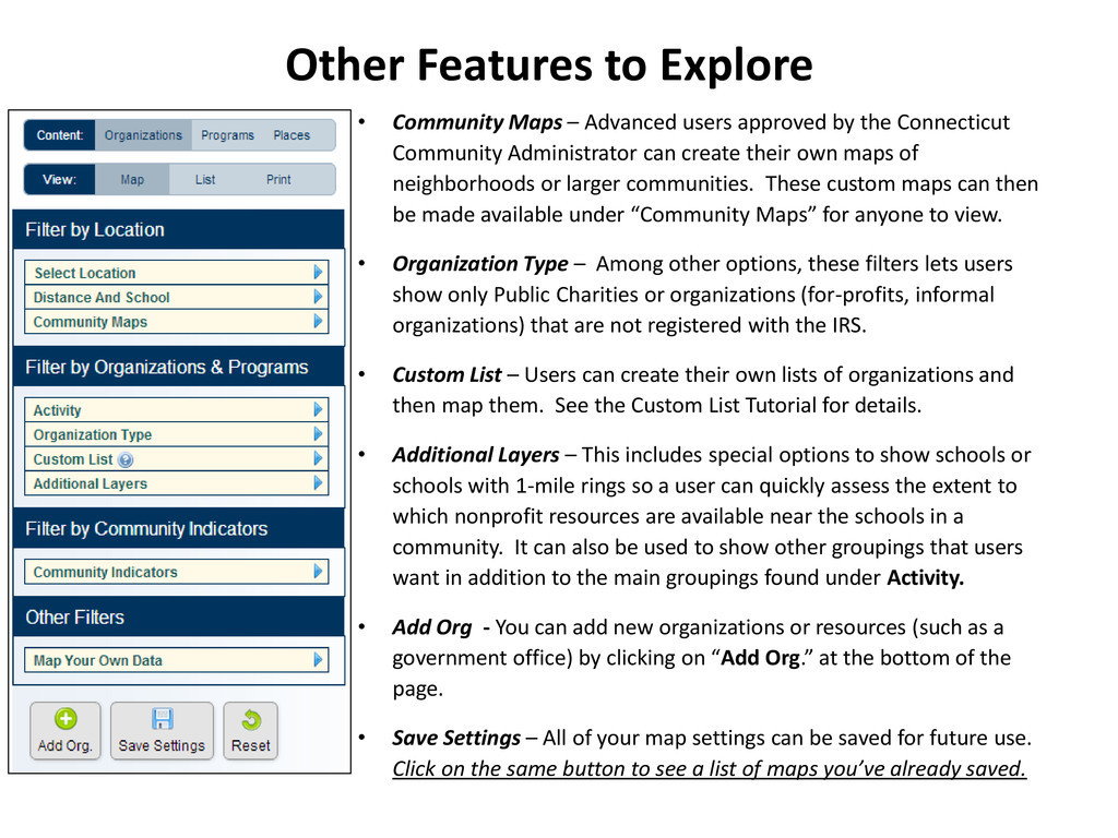
approved by the Connecticut Community Administrator can create their own maps of neighborhoods or larger communities. These custom maps can then be made available under “Community Maps” for anyone to view. • Organization Type – Among other options, these filters lets users show only Public Charities or organizations (for-profits, informal organizations) that are not registered with the IRS. • Custom List – Users can create their own lists of organizations and then map them. See the Custom List Tutorial for details. • Additional Layers – This includes special options to show schools or schools with 1-mile rings so a user can quickly assess the extent to which nonprofit resources are available near the schools in a community. It can also be used to show other groupings that users want in addition to the main groupings found under Activity. • Add Org - You can add new organizations or resources (such as a government office) by clicking on “Add Org.” at the bottom of the page. • Save Settings – All of your map settings can be saved for future use. Click on the same button to see a list of maps you’ve already saved.