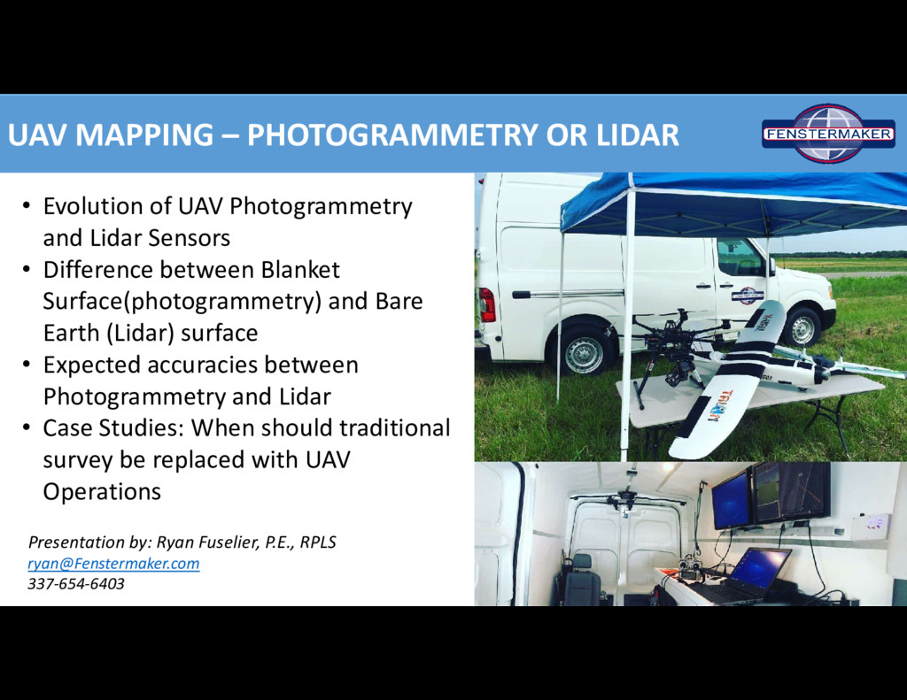
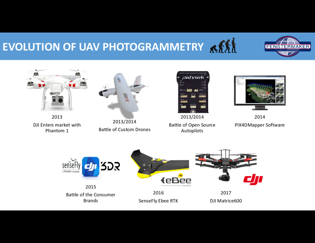
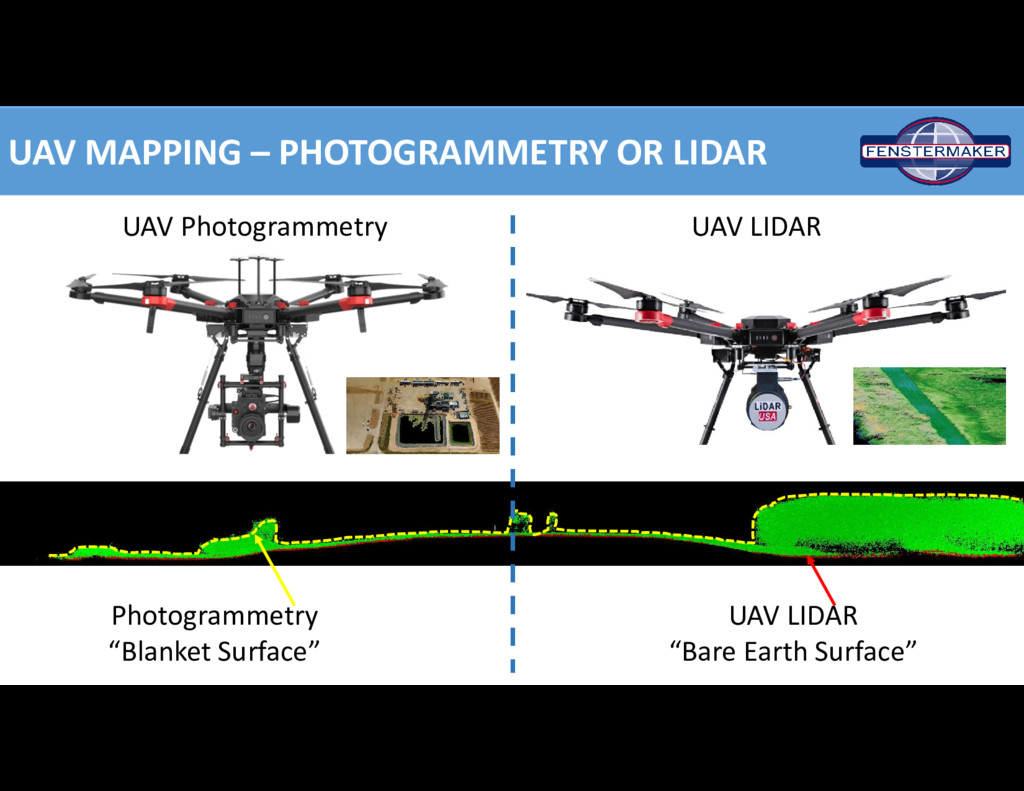
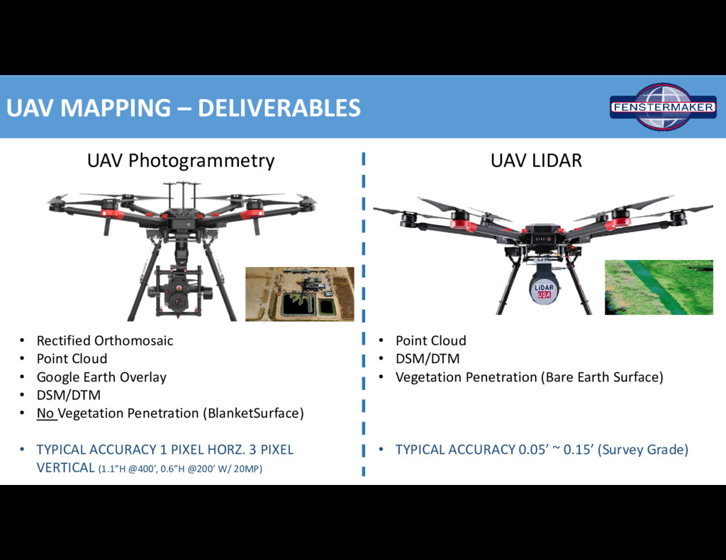
Photogrammetry and Lidar Sensors • Difference between Blanket Surface(photogrammetry) and Bare Earth (Lidar) surface • Expected accuracies between Photogrammetry and Lidar • Case Studies: When should traditional survey be replaced with UAV Operations Presentation by: Ryan Fuselier, P.E., RPLS [email protected] 337-654-6403
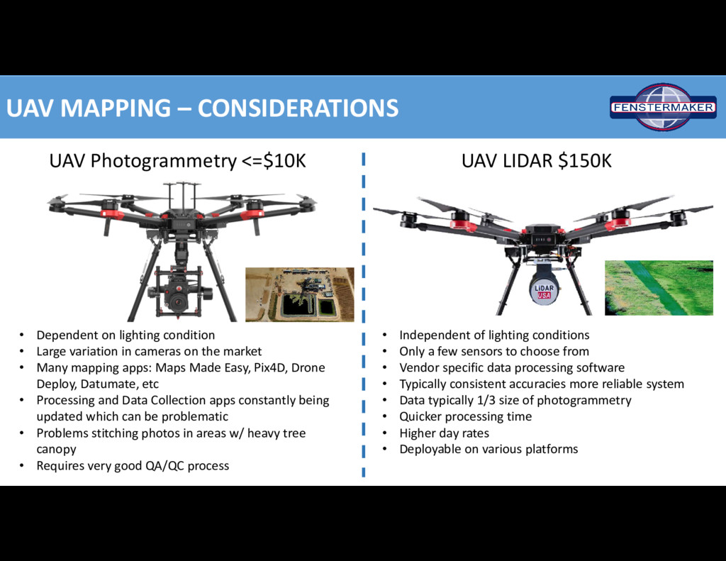
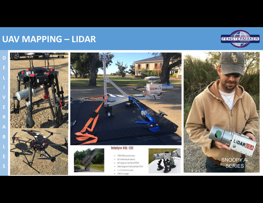
• Dependent on lighting condition • Large variation in cameras on the market • Many mapping apps: Maps Made Easy, Pix4D, Drone Deploy, Datumate, etc • Processing and Data Collection apps constantly being updated which can be problematic • Problems stitching photos in areas w/ heavy tree canopy • Requires very good QA/QC process • Independent of lighting conditions • Only a few sensors to choose from • Vendor specific data processing software • Typically consistent accuracies more reliable system • Data typically 1/3 size of photogrammetry • Quicker processing time • Higher day rates • Deployable on various platforms
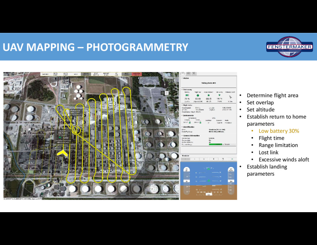
overlap • Set altitude • Establish return to home parameters • Low battery 30% • Flight time • Range limitation • Lost link • Excessive winds aloft • Establish landing parameters
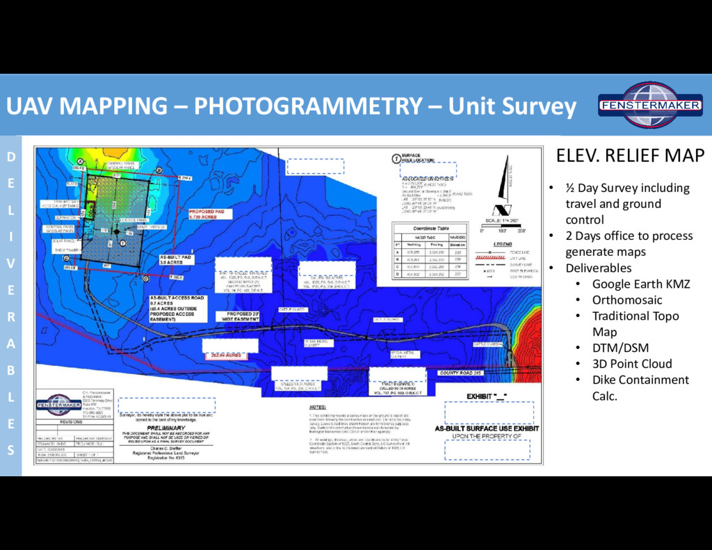
I V E R A B L E S • ½ Day Survey including travel and ground control • 2 Days office to process generate maps • Deliverables • Google Earth KMZ • Orthomosaic • Traditional Topo Map • DTM/DSM • 3D Point Cloud • Dike Containment Calc. ELEV. RELIEF MAP
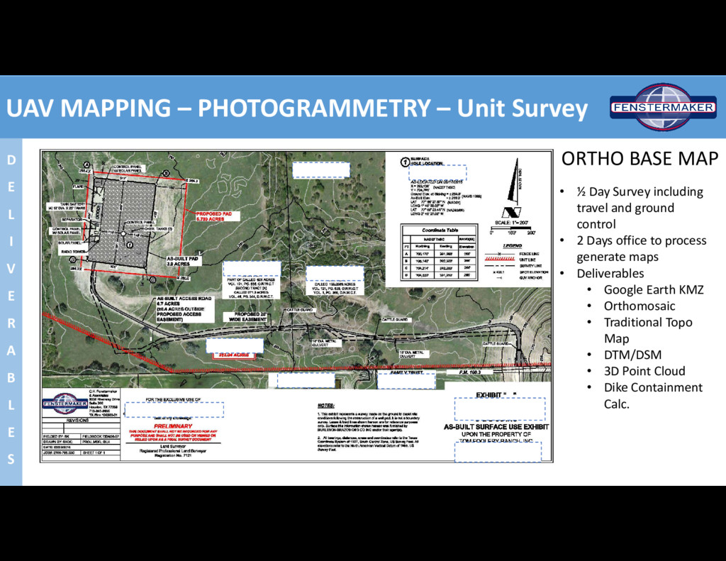
I V E R A B L E S ORTHO BASE MAP • ½ Day Survey including travel and ground control • 2 Days office to process generate maps • Deliverables • Google Earth KMZ • Orthomosaic • Traditional Topo Map • DTM/DSM • 3D Point Cloud • Dike Containment Calc.
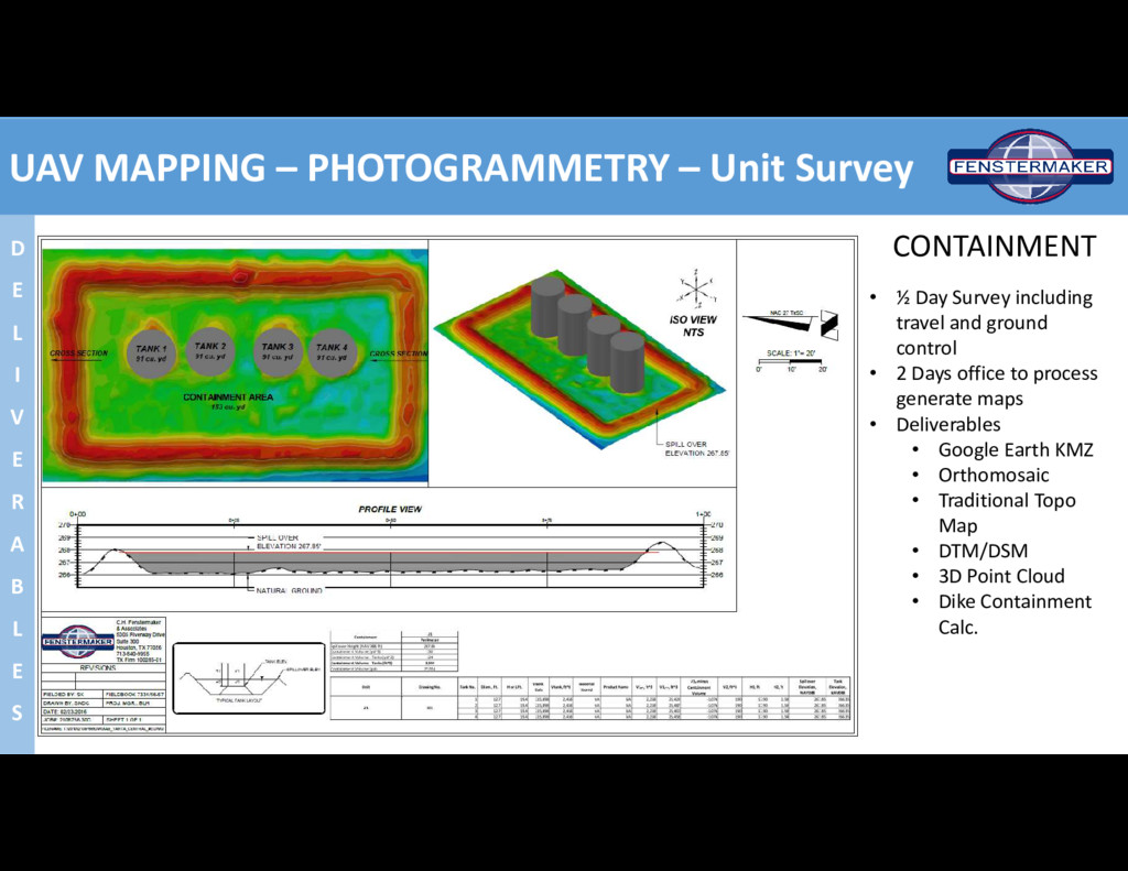
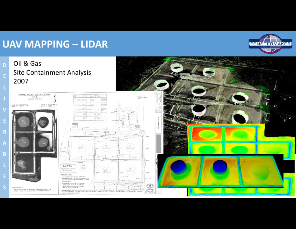
I V E R A B L E S CONTAINMENT • ½ Day Survey including travel and ground control • 2 Days office to process generate maps • Deliverables • Google Earth KMZ • Orthomosaic • Traditional Topo Map • DTM/DSM • 3D Point Cloud • Dike Containment Calc.
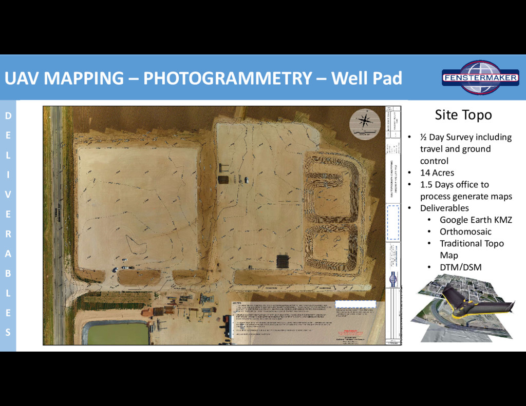
I V E R A B L E S Site Topo • ½ Day Survey including travel and ground control • 14 Acres • 1.5 Days office to process generate maps • Deliverables • Google Earth KMZ • Orthomosaic • Traditional Topo Map • DTM/DSM
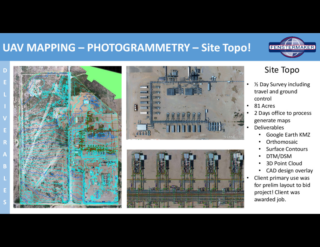
I V E R A B L E S Site Topo • ½ Day Survey including travel and ground control • 81 Acres • 2 Days office to process generate maps • Deliverables • Google Earth KMZ • Orthomosaic • Surface Contours • DTM/DSM • 3D Point Cloud • CAD design overlay • Client primary use was for prelim layout to bid project! Client was awarded job.
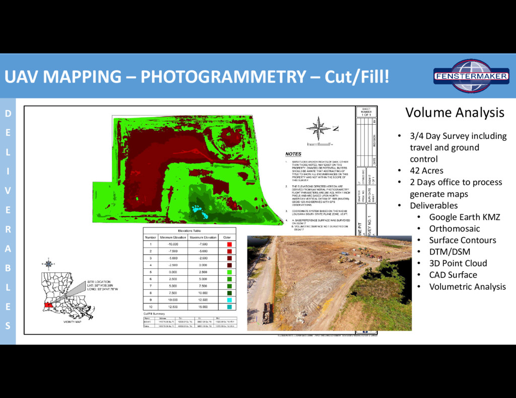
V E R A B L E S Volume Analysis • 3/4 Day Survey including travel and ground control • 42 Acres • 2 Days office to process generate maps • Deliverables • Google Earth KMZ • Orthomosaic • Surface Contours • DTM/DSM • 3D Point Cloud • CAD Surface • Volumetric Analysis
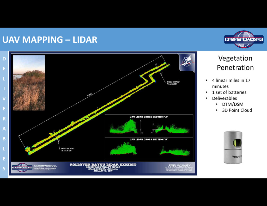
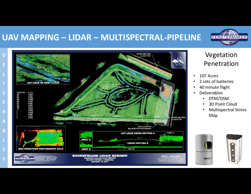
V E R A B L E S • 107 Acres • 2 sets of batteries • 40 minute flight • Deliverables • DTM/DSM • 3D Point Cloud • Multispectral Stress Map Vegetation Penetration
![THANK YOU Ryan Fuselier Operations Leader Fenstermaker 337-654-6403 [email protected] UAV](https://files.speakerdeck.com/presentations/d518ceebb49d4cc1b6356c37342d9549/slide_22.jpg)