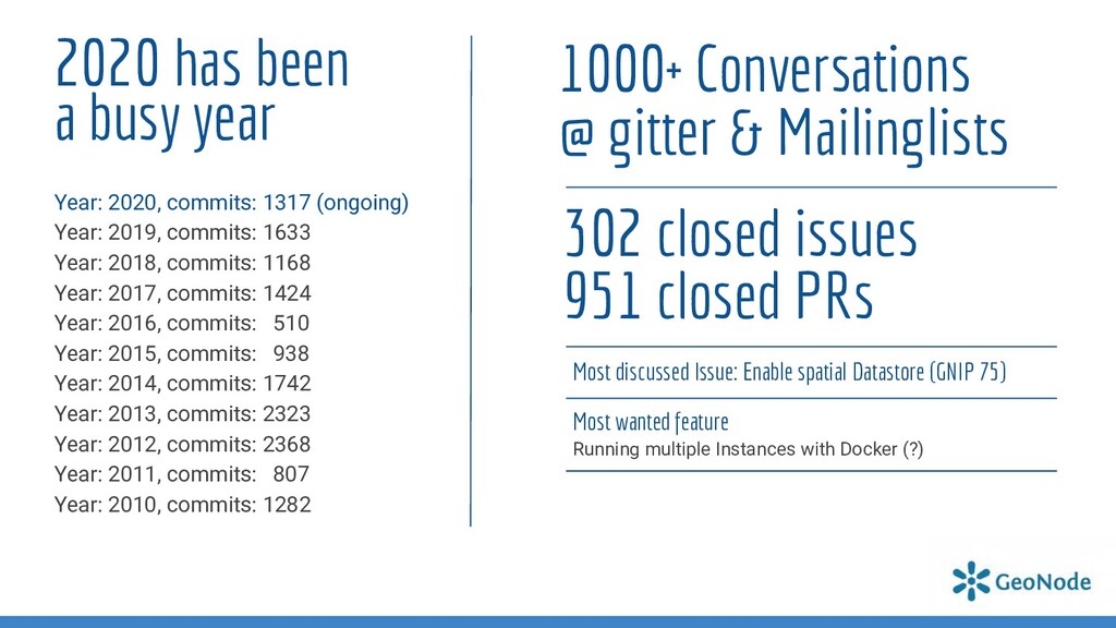
The year 2020 was special, everyone knows that. We welcome all of you and review what happened in the GeoNode community and glimpse at upcoming features.
in 3.0 and 3.1 release o Check the bottom of each slide to see who sponsored a certain feature, who implemented it, and what version contains it Sponsor Author Version
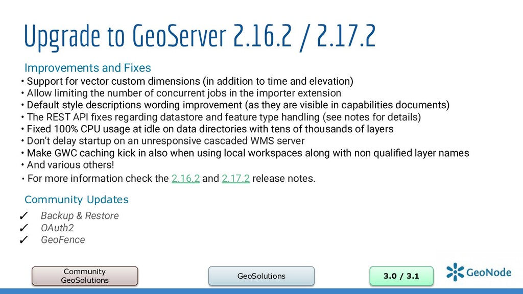
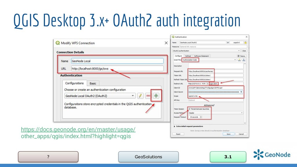
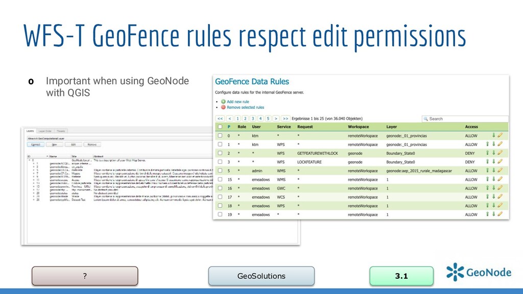
/ 3.1 Improvements and Fixes • Support for vector custom dimensions (in addition to time and elevation) • Allow limiting the number of concurrent jobs in the importer extension • Default style descriptions wording improvement (as they are visible in capabilities documents) • The REST API fixes regarding datastore and feature type handling (see notes for details) • Fixed 100% CPU usage at idle on data directories with tens of thousands of layers • Don’t delay startup on an unresponsive cascaded WMS server • Make GWC caching kick in also when using local workspaces along with non qualified layer names • And various others! • For more information check the 2.16.2 and 2.17.2 release notes. Community Updates ✓ Backup & Restore ✓ OAuth2 ✓ GeoFence
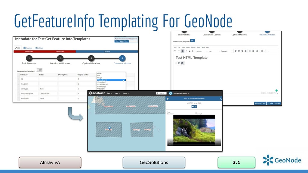
has been improved, we have almost 90% coverage for 5 main languages ✓ Added languages: Portuguese / Spanish ✓ Completely revised and updated Documentation: ➢ GetFeatureInfo Templating For GeoNode ➢ HowTo: Geonode with QGIS ➢ Improve GeoNode OpenID SP Protocol in order to be able to provide access to external clients ➢ Document the use of slide show in themes ➢ Update Advanced Installation steps to work against Ubuntu 20.04LTS ➢ Update Advanced Installation steps to work against RHEL 7.x ➢ How to setup rabbitmq, supervisor and memcached in order to fully enable async workers ➢ How to Upgrade from 2.10.x / 3.0
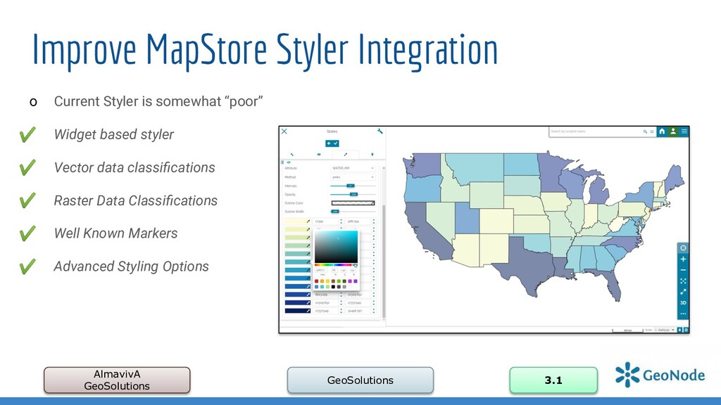
Styler is somewhat “poor” ✔ Widget based styler ✔ Vector data classifications ✔ Raster Data Classifications ✔ Well Known Markers ✔ Advanced Styling Options
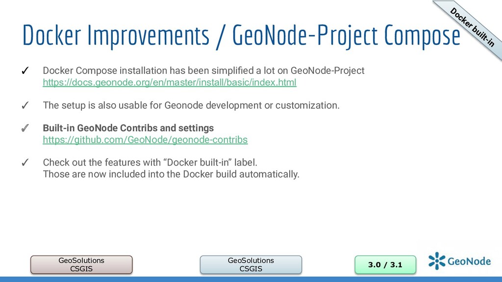
/ 3.1 ✓ Docker Compose installation has been simplified a lot on GeoNode-Project https://docs.geonode.org/en/master/install/basic/index.html ✓ The setup is also usable for Geonode development or customization. ✓ Built-in GeoNode Contribs and settings https://github.com/GeoNode/geonode-contribs ✓ Check out the features with “Docker built-in” label. Those are now included into the Docker build automatically. Docker built-in
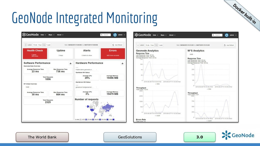
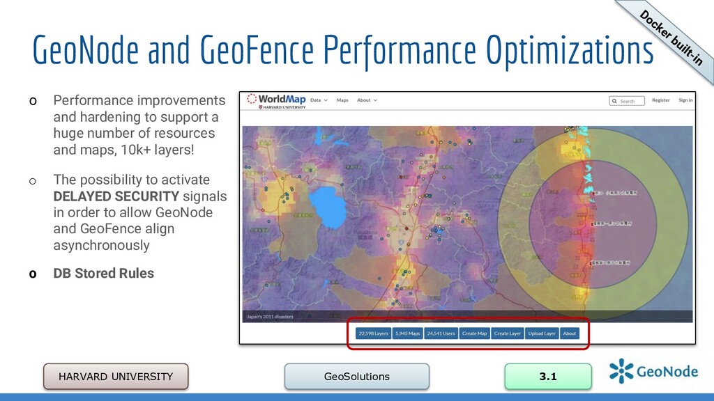
Performance improvements and hardening to support a huge number of resources and maps, 10k+ layers! o The possibility to activate DELAYED SECURITY signals in order to allow GeoNode and GeoFence align asynchronously o DB Stored Rules Docker built-in
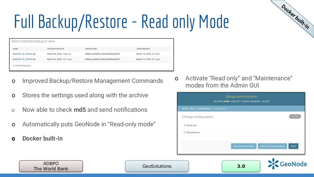
GeoSolutions 3.0 o Activate “Read only” and “Maintenance” modes from the Admin GUI o Improved Backup/Restore Management Commands o Stores the settings used along with the archive o Now able to check md5 and send notifications o Automatically puts GeoNode in “Read-only mode” o Docker built-in Docker built-in
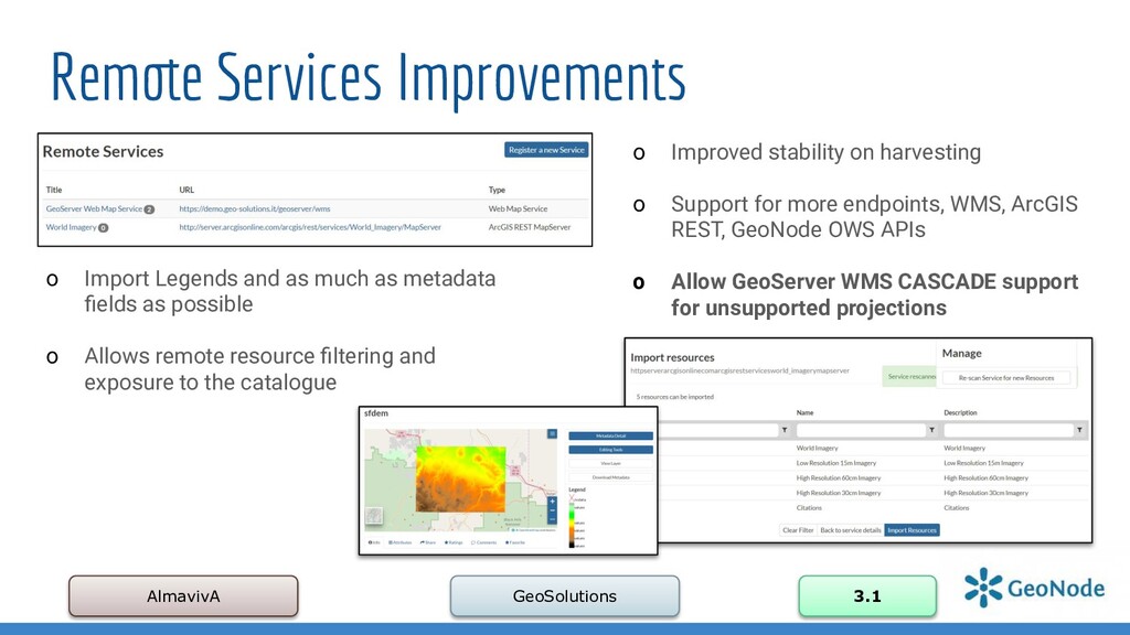
harvesting o Support for more endpoints, WMS, ArcGIS REST, GeoNode OWS APIs o Allow GeoServer WMS CASCADE support for unsupported projections o Import Legends and as much as metadata fields as possible o Allows remote resource filtering and exposure to the catalogue
will be hidden to anonymous users only. The registered users will be still able to access the resources • The “unpublished” resources will remain hidden to users if the permission will be explicitly removed • During the upload, whenever the advanced workflow is enabled, the owner’s Groups are automatically allowed to access the resource, even if the “anonymous” flag has been disabled. • During the upload, “managers” of the owner’s Groups associated to the resource, are always allowed to edit the resource, the same as they are admin for that resource • “managers” of the owner’s Groups associated to the resource are allowed to “publish” also the resources, not only to “approve” them
issues: ✓ Added "DOI" field to base metadata ✓ Extend resource search APIs with abstract and purpose fields ✓ Improved Remote Services and Metadata Fetch ✓ Improved Message Inbox and Messaging & Notification System ✓ Improved Thumbnails and Thumbnails Upload / edit before posting ✓ Improved Management Commands ✓ and many more…
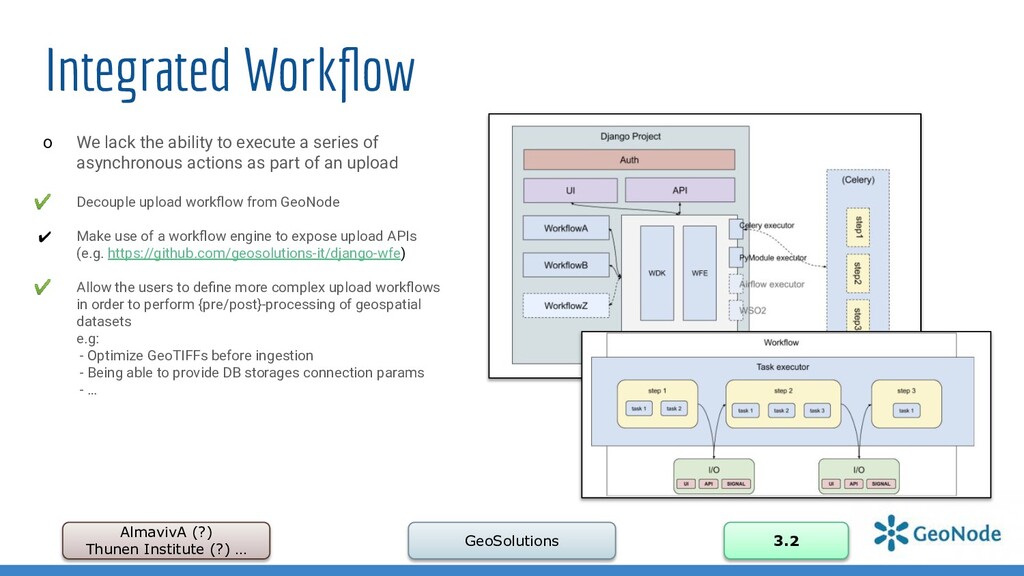
o We lack the ability to execute a series of asynchronous actions as part of an upload ✔ Decouple upload workflow from GeoNode ✔ Make use of a workflow engine to expose upload APIs (e.g. https://github.com/geosolutions-it/django-wfe) ✔ Allow the users to define more complex upload workflows in order to perform {pre/post}-processing of geospatial datasets e.g: - Optimize GeoTIFFs before ingestion - Being able to provide DB storages connection params - …
3.2 o What if I want to consume GeoNode from third party apps or a SPA client? ✔ A clean REST API for CRUD operations on GeoNode model would be nice! ✔ Cleaner Authentication support - Oauth2 but also proper API keys management ✔ OpenAPI 3.0 specification, for documentation and versioning ✔ GNIP-79: GeoNode REST APIs (v2)
✔ Manage and share "Geo Applications" similarly to the other GeoNode entities, such as Documents, Layers and Maps. ✔ Such Geo Applications could be any kind of object provided by a plugged in client library, which is not a Layer nor a Map. As an instance Dashboards, GeoStories, Charts, Geospatial Analysis and so forth. ✔ GNIP-78: GeoNode generic "Apps" model to include pluggable entities into the framework
Storytelling in GeoNode ✔ MapStore Plugin ✔ Reuse GeoNode Layers and Resources to build Story ✔ Images, Video, Maps and so on ✔ Integrated visual editor
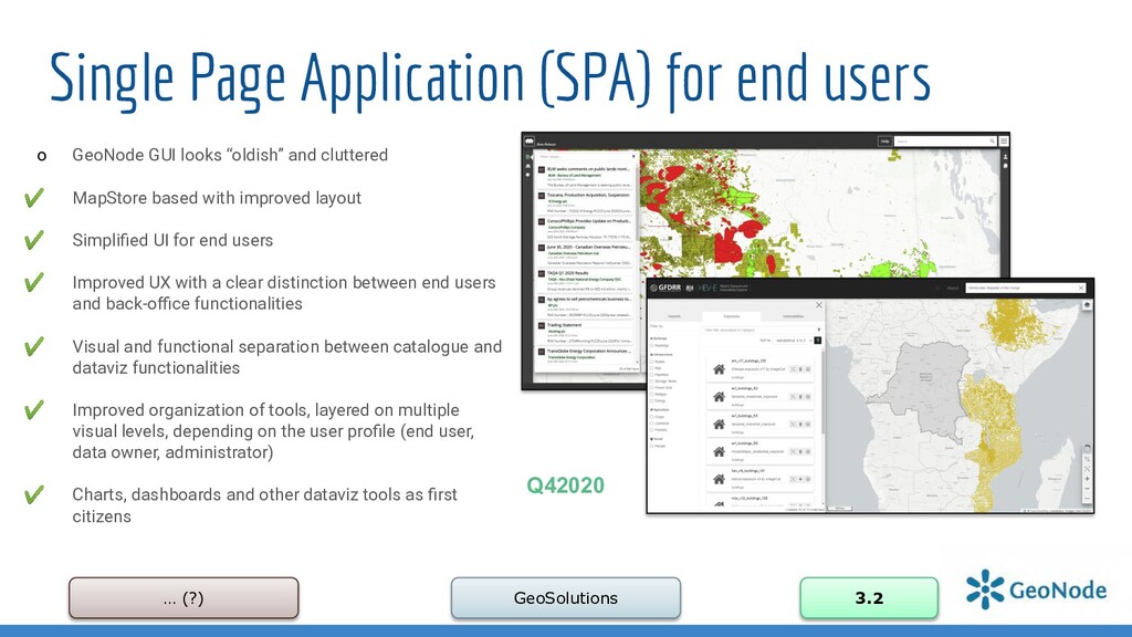
3.2 o GeoNode GUI looks “oldish” and cluttered ✔ MapStore based with improved layout ✔ Simplified UI for end users ✔ Improved UX with a clear distinction between end users and back-office functionalities ✔ Visual and functional separation between catalogue and dataviz functionalities ✔ Improved organization of tools, layered on multiple visual levels, depending on the user profile (end user, data owner, administrator) ✔ Charts, dashboards and other dataviz tools as first citizens Q42020
core • Behavior Driven Development • Fresh Start • Web UI Framework Agnostic • API First & API Gateway • Support for multiple data providers https://github.com/GeoNode/geonode-vision/blob/master/geonode-vision.md
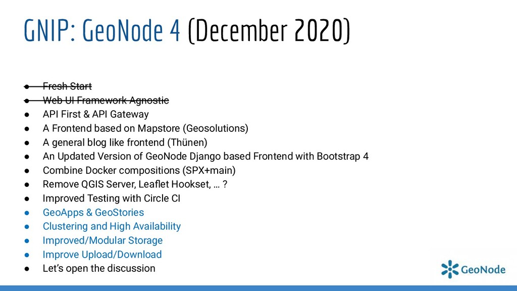
UI Framework Agnostic • API First & API Gateway • A Frontend based on Mapstore (Geosolutions) • A general blog like frontend (Thünen) • An Updated Version of GeoNode Django based Frontend with Bootstrap 4 • Combine Docker compositions (SPX+main) • Remove QGIS Server, Leaflet Hookset, … ? • Improved Testing with Circle CI • GeoApps & GeoStories • Clustering and High Availability • Improved/Modular Storage • Improve Upload/Download • Let’s open the discussion