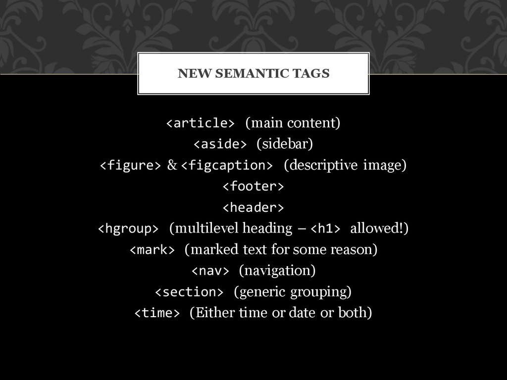
image) <footer> <header> <hgroup> (multilevel heading – <h1> allowed!) <mark> (marked text for some reason) <nav> (navigation) <section> (generic grouping) <time> (Either time or date or both) NEW SEMANTIC TAGS
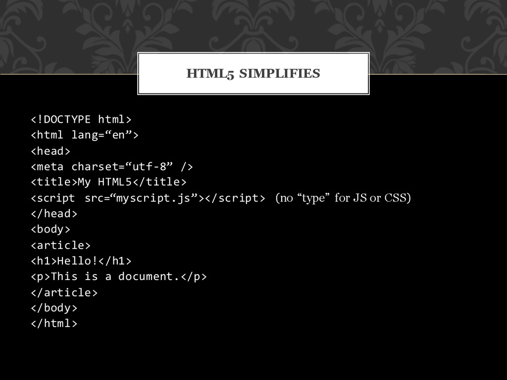
<script src=“myscript.js”></script> (no “type” for JS or CSS) </head> <body> <article> <h1>Hello!</h1> <p>This is a document.</p> </article> </body> </html> HTML5 SIMPLIFIES
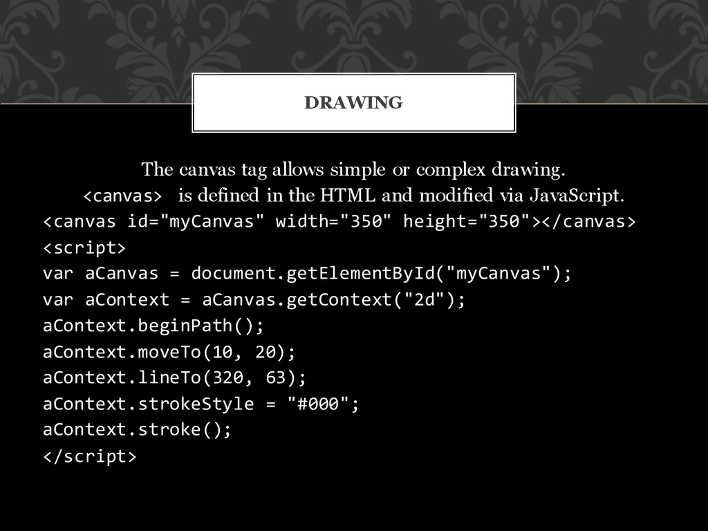
is defined in the HTML and modified via JavaScript. <canvas id="myCanvas" width="350" height="350"></canvas> <script> var aCanvas = document.getElementById("myCanvas"); var aContext = aCanvas.getContext("2d"); aContext.beginPath(); aContext.moveTo(10, 20); aContext.lineTo(320, 63); aContext.strokeStyle = "#000"; aContext.stroke(); </script> DRAWING
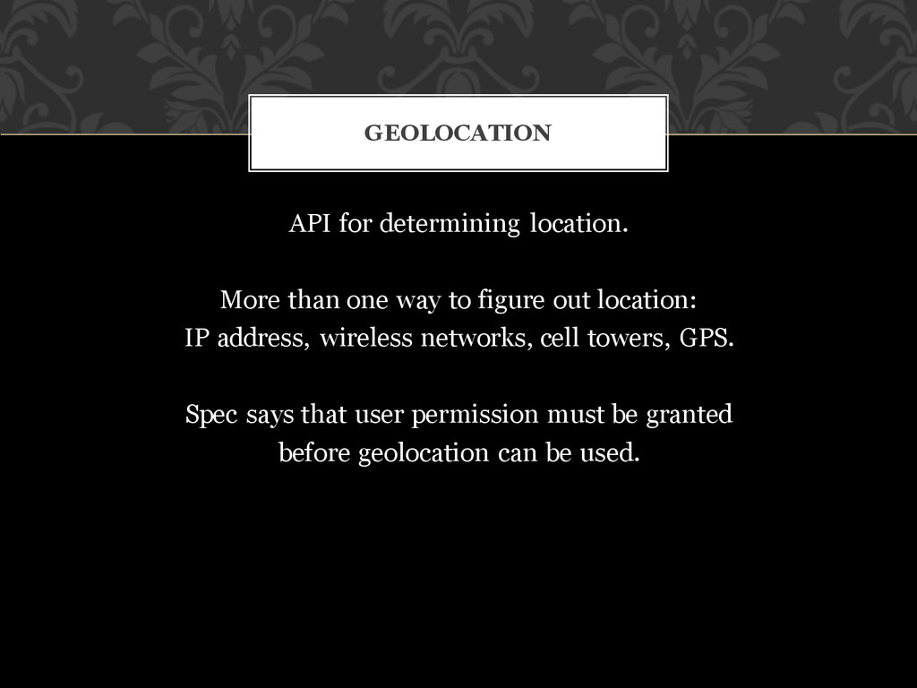
out location: IP address, wireless networks, cell towers, GPS. Spec says that user permission must be granted before geolocation can be used. GEOLOCATION
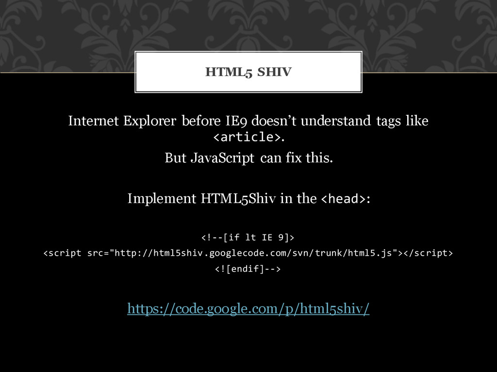
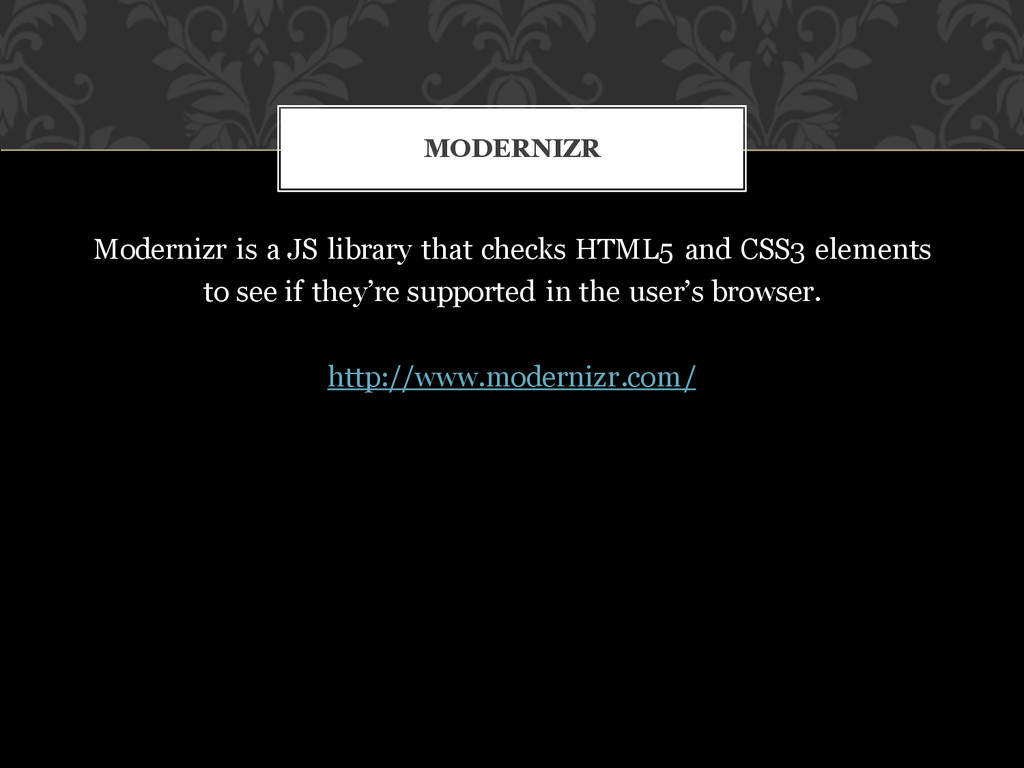