Upgrade to Pro — share decks privately, control downloads, hide ads and more …

Supporting NHS England

Health GI
May 13, 2015
90

Supporting NHS England

Supporting NHS England Area Teams

Health GI

May 13, 2015
Tweet

Transcript

  1. GIS Support for NHS England Area Teams Trevor Foster GIS

    & Primary Care Manager South, Central and West Commissioning Support
  2. South, Central & West Commissioning Support (SCWCS) GIS and Mapping

    Service • What is GIS? • About us • How GIS is used in healthcare - Example analysis and maps • Case study examples • Demonstration - HealthGIS Maps (online mapping portal) – GP Finder – BNSSSG CCGs project – MapCat (map catalogue)
  3. What is GIS? • Geographic Information System (Wikipedia): – “GIS

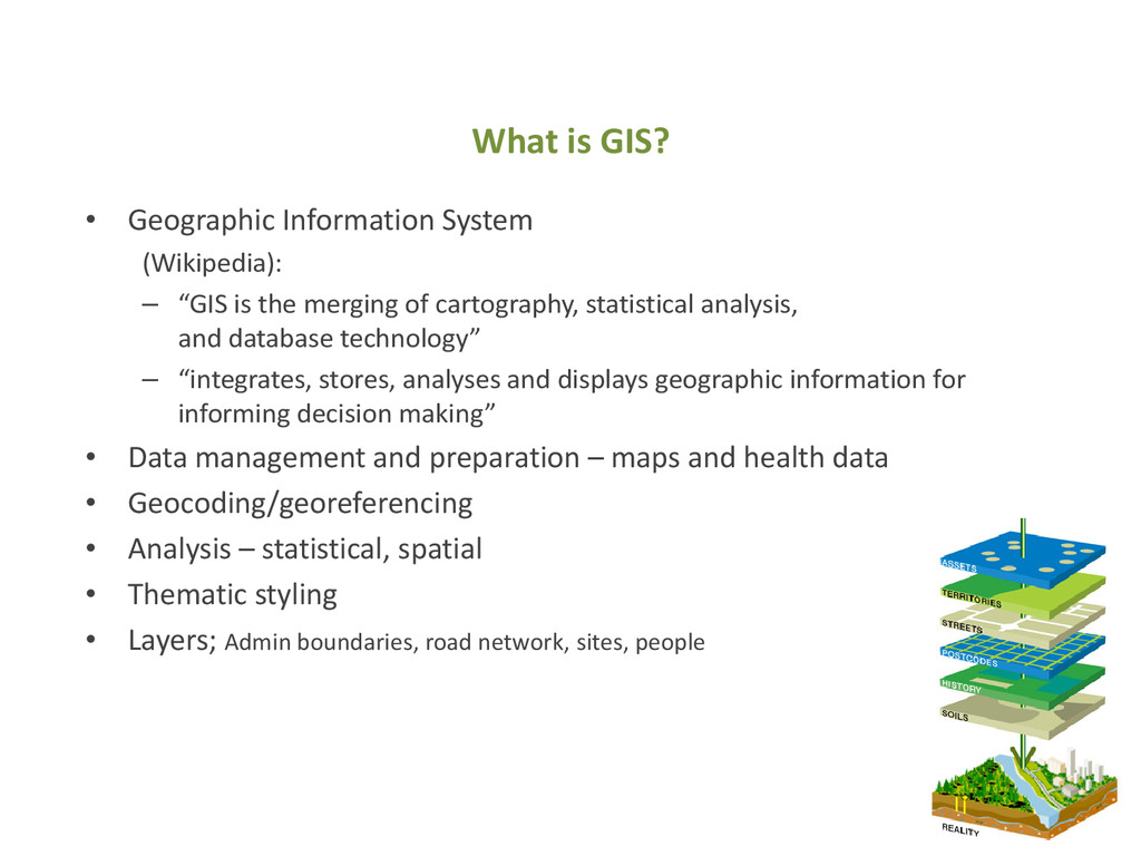
    is the merging of cartography, statistical analysis, and database technology” – “integrates, stores, analyses and displays geographic information for informing decision making” • Data management and preparation – maps and health data • Geocoding/georeferencing • Analysis – statistical, spatial • Thematic styling • Layers; Admin boundaries, road network, sites, people
  4. Helps support business decision making Support around: Using: • Contract

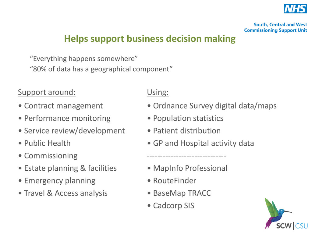
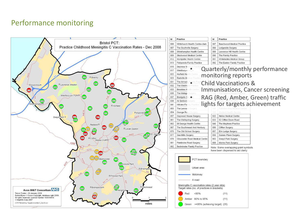
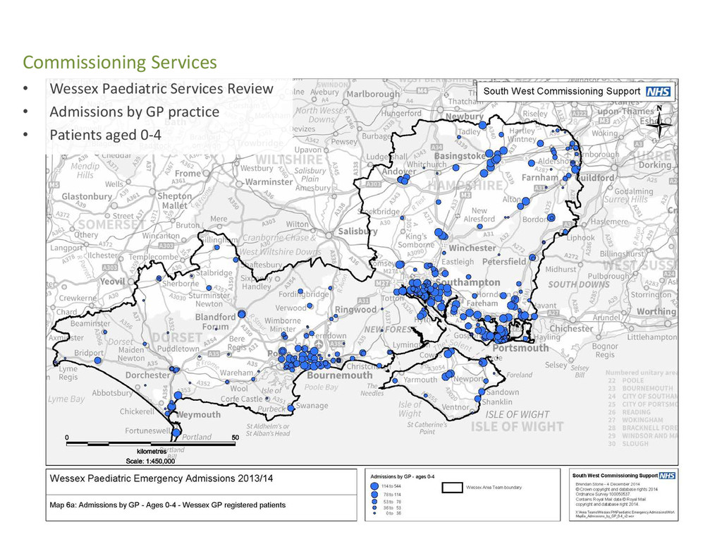
    management • Performance monitoring • Service review/development • Public Health • Commissioning • Estate planning & facilities • Emergency planning • Travel & Access analysis • Ordnance Survey digital data/maps • Population statistics • Patient distribution • GP and Hospital activity data ------------------------------ • MapInfo Professional • RouteFinder • BaseMap TRACC • Cadcorp SIS “Everything happens somewhere” “80% of data has a geographical component”
  5. SWCS - GIS and Mapping Service • Formerly Avon IM&T

    Consortium – 2013 moved to South West CSU – 2015 moved to South, Central and West CSU • Supporting HA/PCTs/CCGs and others for 20 years • Ordnance Survey licensing - OpenData & PSMA (2010/11) • OS Multi-Client Contractor License (2011) • Growth in demand from wider NHS • Developed team of specialised GIS analysts/developers • Traditional GIS analysis and mapping • HealthGIS Maps (on-line mapping portal) • Licensed partner with Ordnance Survey (2014)
  6. • Bristol, North Somerset, South Glos, Somerset CCGs • NHS

    England Area Teams – BNSSSG, East Anglia (Serco), Shropshire & Staffs, BGSW, Devon & Cornwall, Kent & Medway • Strategic Clinical Senates – South West, Wessex, Thames Valley • Public Health depts in Local Authorities – Avon, Wiltshire, Dorset • Community Health – Bristol, North Somerset, South Gloucestershire, Sirona Care & Health • PCC (Primary Care Commissioning), Soar Beyond – PNA support • NHS Property Services (BNSSSG) • Mental Health Trust (NW London) • Royal College of Midwives (National project) • Ad-hocs; Hospital Trusts, BBC Children in Need, NHS Scotland Customers
  7. Contract management • GP contract map • Where GIS started

    in Avon – mid 90’s • Patient details from ‘Exeter System’ registration database • Postcodes • Graduated symbols thematic • Options to include age/sex
  8. • 2012 DH initiative • Surgery location • Contractual area

    • Registered patients • Drive-time areas (peak-time) for (10, 15 minutes) • No. & % patients in each area GP Outer Areas
  9. • Final map • Contractual area • Registered patients •

    Outer Area boundary • Proposal by practice • No. & % patients in each area GP Outer Areas
  10. Service development (GP) • Number of overlapping practice areas across

    area • Aim is to provide choice of at least 2 practices to patients
  11. Service development (GP) • Planned housing development areas • Information

    from Local Authority • 5,700 + 2,400 houses (approx 19,000 patients) over 20 years
  12. Service development (GP) • Residential housing development • Option for

    proposed District Centre (GP surgery) • Walking access times to nearest GP surgeries
  13. Service development (GP) • Second option for proposed District Centre

    (GP surgery) • Walking access times to nearest GP surgeries • Clearly better access with this option
  14. Equality Impact Assessment • Maps and information to support assessments

    • Area and registered patients • Deprivation • Travel access (drive, walk, PT) • Practice coverage • Profile reports
  15. Pharmacy Control of Entry • Pharmacy application maps • e.g.

    Boots, Lloyds, independents • Informs CCG board • Proposed location • 1.6km buffer area • Pharmacies • GP Practices • Registered population (dispensing, non-disp) • Distance measurement • Terrain, slope gradients
  16. Pharmacy Control of Entry • Distance and time measurement between

    locations • Walking • Driving • Cycling
  17. Pharmaceutical Needs Assessment (PNA) • Mandatory HWB/CCG requirement • Annual

    refresh & publish • Supports HWB, CCG, PH planning and development • Maps – Pharmacy contractors – 1.6km buffers – Travel access; drive-times (average, peak, off-peak), public transport, walking. Population numbers by travel time zones – Opening times and availability – Demographic maps; deprivation, population density, ethnicity – Lifestyle maps; obesity (adults, children), smoking prevalence
  18. PNA

  19. Dispensing List Validation • Pharmacies and dispensing GP practices •

    1.6km exclusion zones • Plus Non-Controlled Locality areas
  20. Dispensing List Validation • Dispensing practice map • Dispensing patients

    plotted • Patient numbers and details (list) inside/outside areas
  21. Dental Monitoring Reports • All practices accepting/not accepting NHS patients

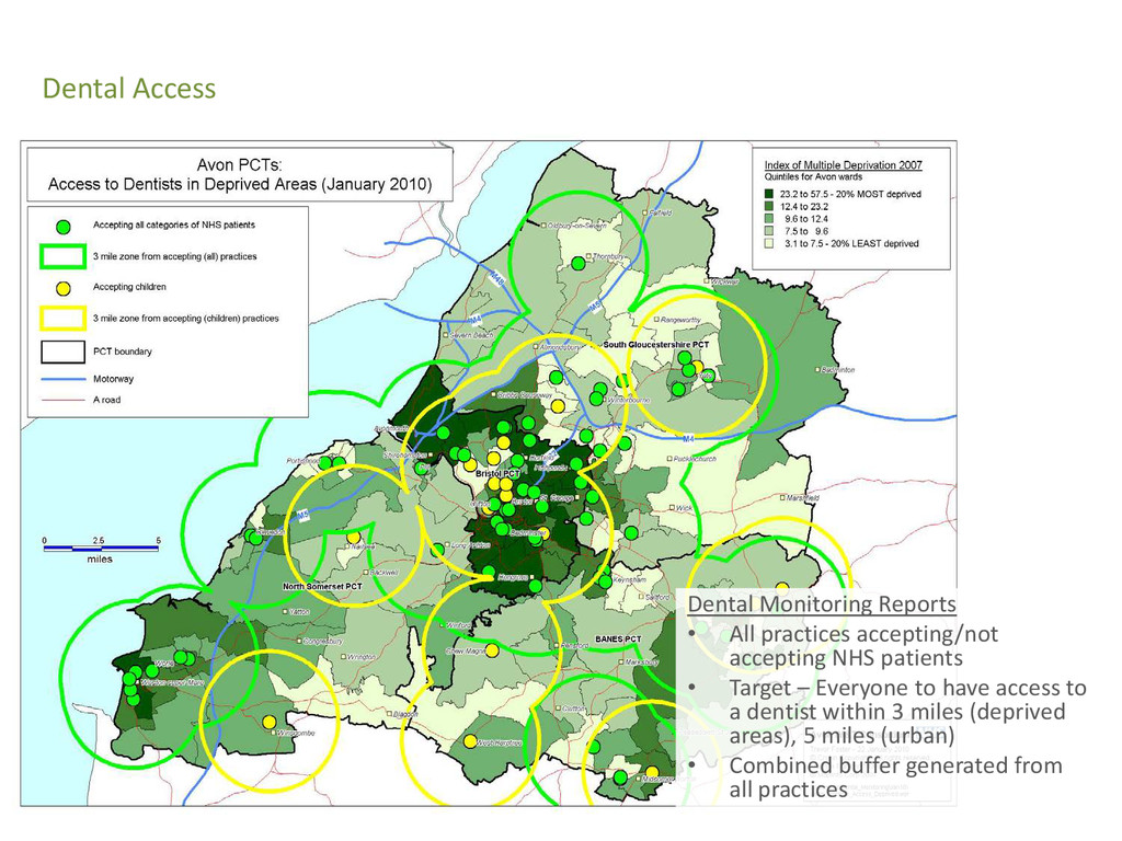
    • Target – Everyone to have access to a dentist within 3 miles (deprived areas), 5 miles (urban) • Combined buffer generated from all practices Dental Access
  22. • Quarterly/monthly performance monitoring reports • Child Vaccinations & Immunisations,

    Cancer screening • RAG (Red, Amber, Green) traffic lights for targets achievement Performance monitoring
  23. • CQUIN (Commissioning for Quality & Innovation) scheme – Equity

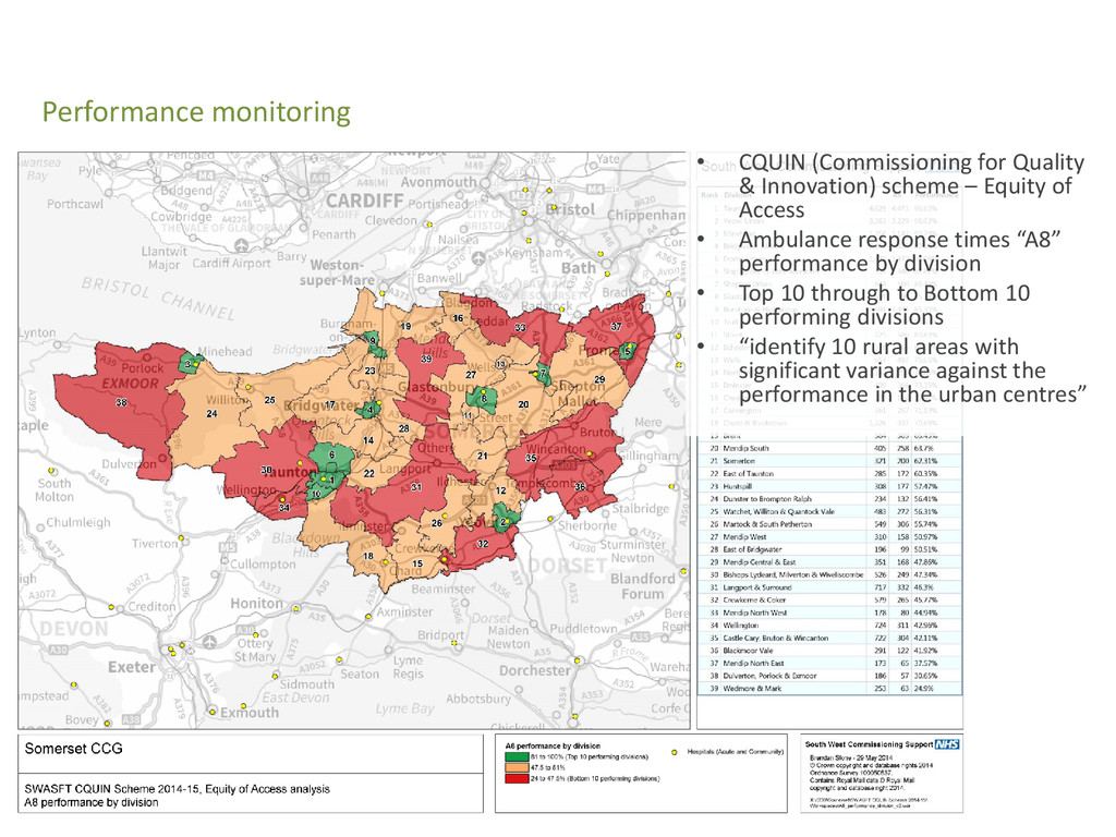
    of Access • Ambulance response times “A8” performance by division • Top 10 through to Bottom 10 performing divisions • “identify 10 rural areas with significant variance against the performance in the urban centres” Performance monitoring
  24. • Somerset GP Out of Hours • Service provider sites

    • No. calls by type • Deprivation • Population density Commissioning Services
  25. • Wessex Paediatric Services Review • Admissions by GP practice

    • Patients aged 0-4 Commissioning Services
  26. • Further information? • Contact us at - [email protected] [email protected]

    • Telephone: 0117 9002490 • Visit our website: http://www.healthgis.nhs.uk http://nww.healthgis.nhs.uk (NHS staff only)