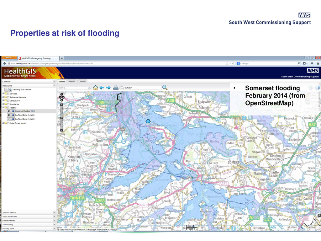
the South West, particularly the flooding on the Somerset levels during the winter • HealthGIS on-line mapping portal development, using Cadcorp Web Map Layers
Consortium - moved to South West CSU in April 2013 • Supporting NHS; Avon Health Authority – Primary Care Trusts – Clinical Commissioning Groups since 1995 • Ordnance Survey OpenData & PSMA (2010/11) • Ordnance Survey Licensed Partner – May 2014 • Growth in demand from wider NHS • Developed team of GIS analysts/developers • Development of HealthGIS Maps (on-line mapping portal)
England Area Team (Bristol, North Somerset, Somerset, South Gloucestershire) • Other Area Teams – East Anglia (Serco), Shropshire & Staffs • Strategic Clinical Network (SW) – formerly Avon, Somerset, Wilts + Peninsula, Dorset, 3 Counties (Glos) cancer networks • Public Health depts in Local Authorities – Avon, Wiltshire, Dorset • Mental Health Trust (NW London) • Community Health – Bristol, North Somerset, South Gloucestershire, Sirona Care & Health (Bath) • Primary Care Commissioning (PCC) • Ad-hocs; Hospital Trusts, BBC Children in Need, NHS Scotland Customers
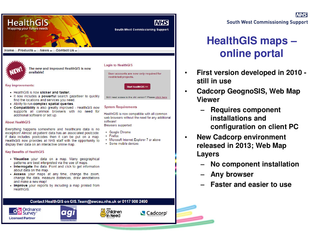
2010 - still in use • Cadcorp GeognoSIS, Web Map Viewer – Requires component installations and configuration on client PC • New Cadcorp environment released in 2013; Web Map Layers – No component installation – Any browser – Faster and easier to use
of the Web Map layers software would be less than cost of IT support for community users • Web Map Layers implemented end 2013, administrator training January 2014 • Plan to migrate existing projects during 2014 • An initial candidate for migration – “Emergency Planning” project • Initial development in January and then “tried it out” on the Emergency Planning Team. They found it so useful to support work around Somerset levels flooding, they’ve been using it since
element of the NHS response to the Somerset Floods providing a simple but efficient means of identifying flooded and at risk areas and cross checking these with vulnerable patients and health assets” Simon Steele NHS England Emergency Planning Team
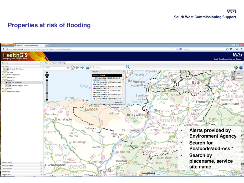
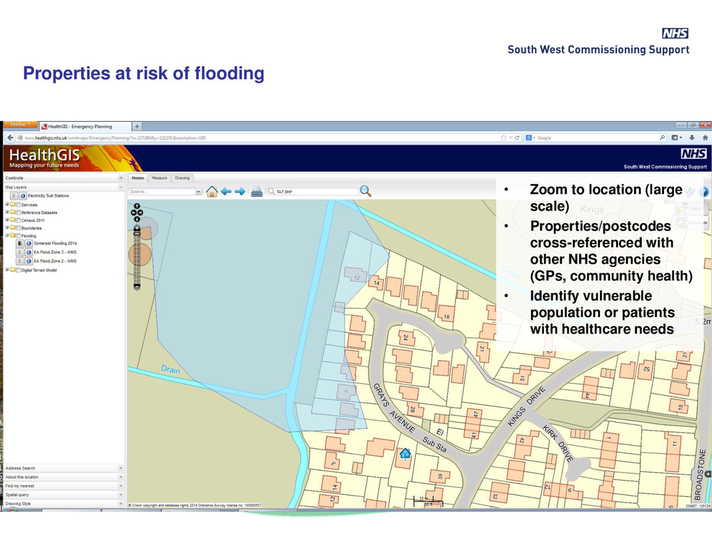
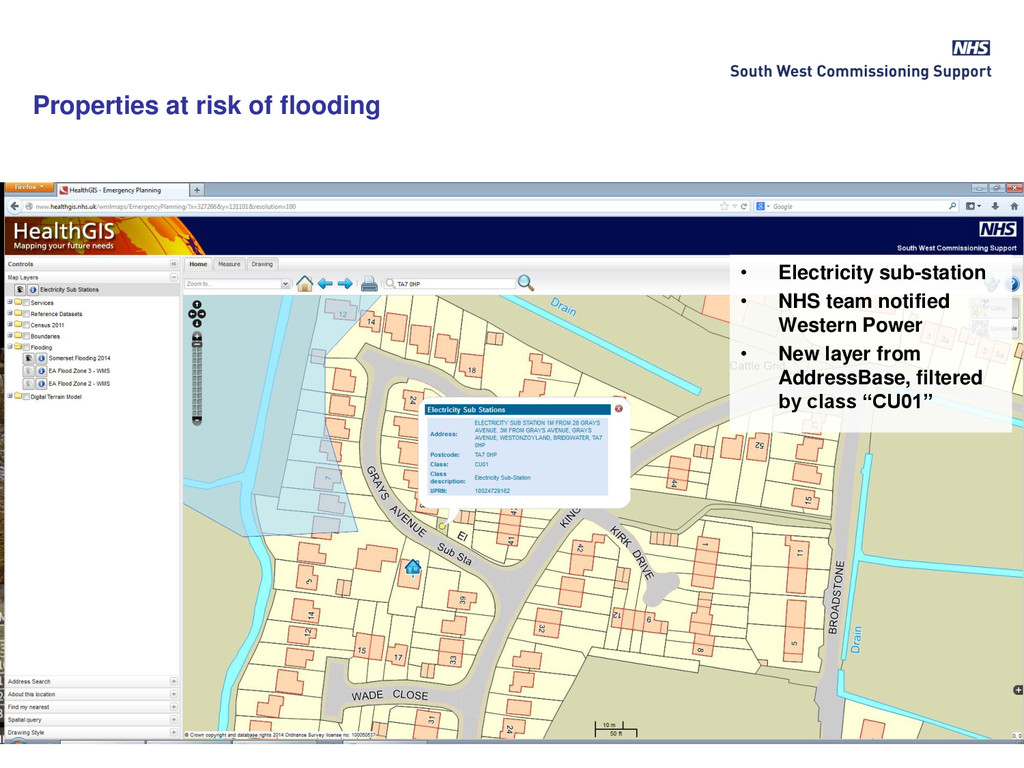
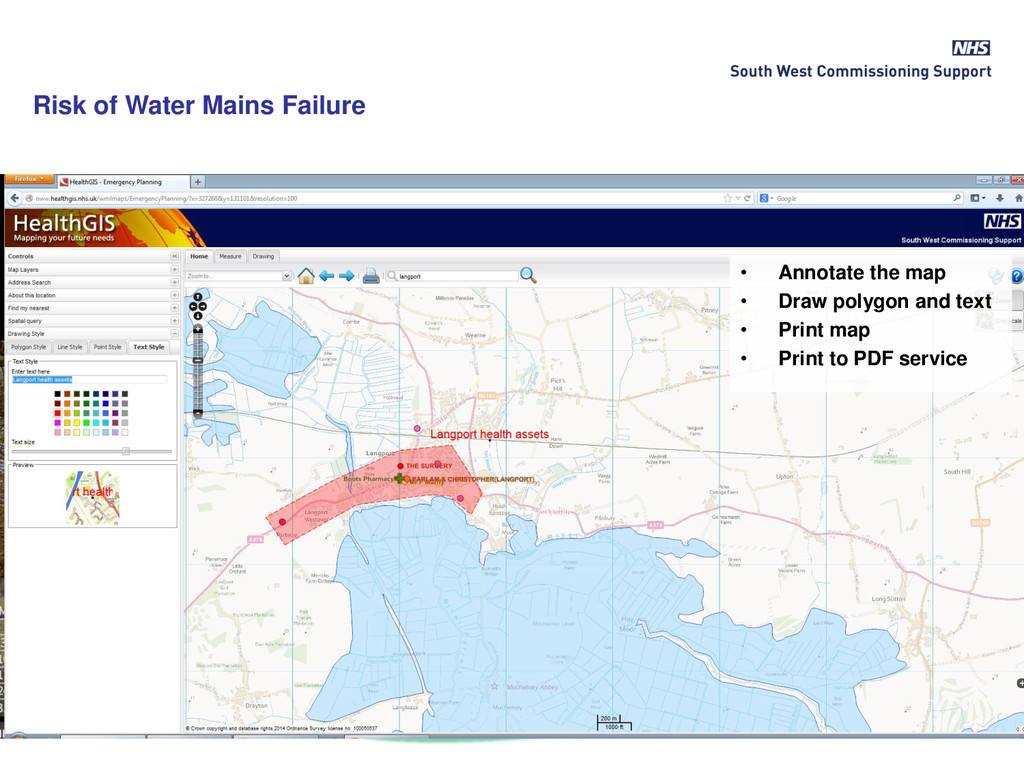
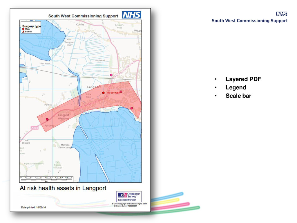
LA, NHS, Environment Agency, Red Cross, Military) • Maps of at risk postcodes shared (GPs, Somerset Community Partnership, A&E Hospital) as we were the first to produce the information • Also identified other agency assets (e.g. electricity sub stations in these areas) • Able to share data with other agencies in a visual, easy to understand format
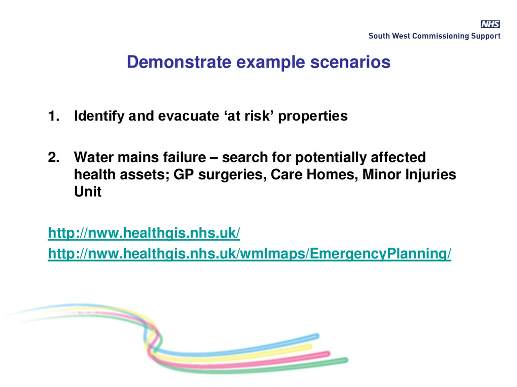
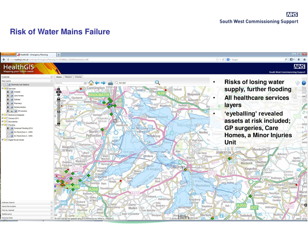
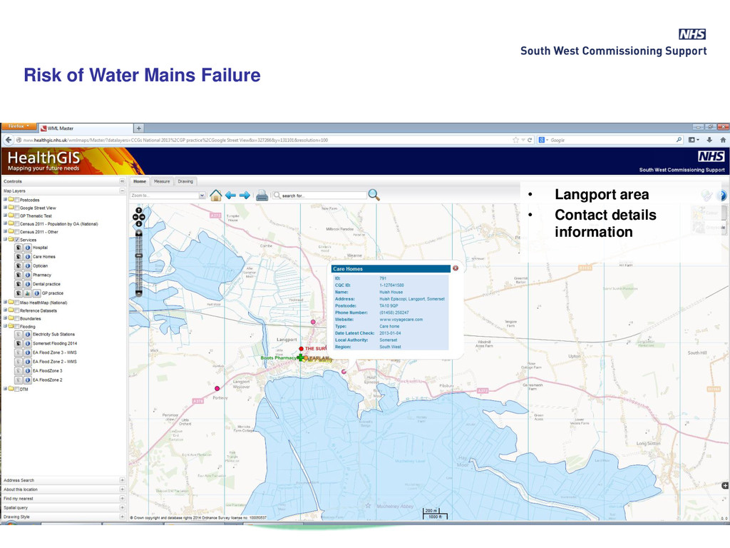
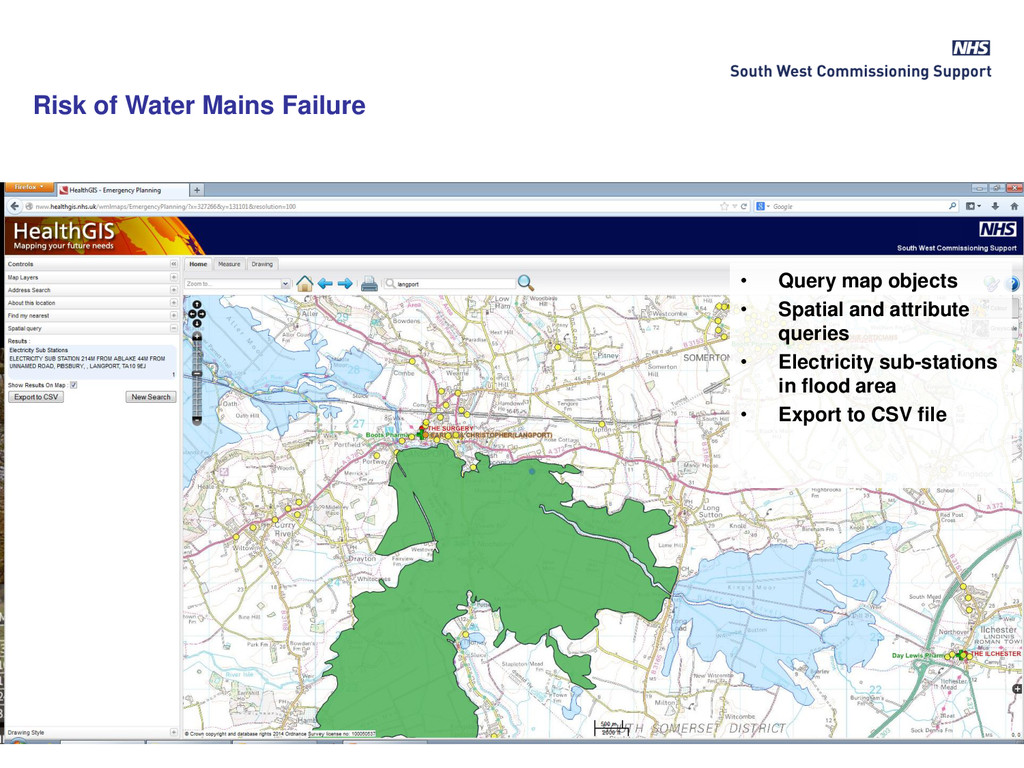
2. Water mains failure – search for potentially affected health assets; GP surgeries, Care Homes, Minor Injuries Unit http://nww.healthgis.nhs.uk/ http://nww.healthgis.nhs.uk/wmlmaps/EmergencyPlanning/
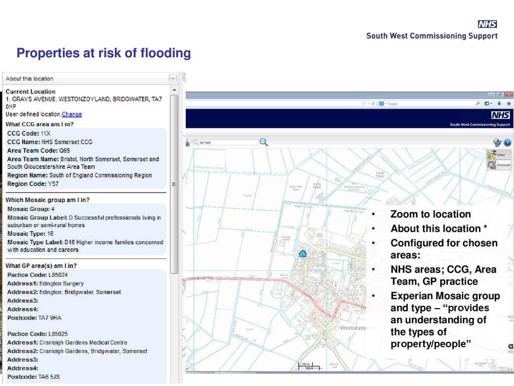
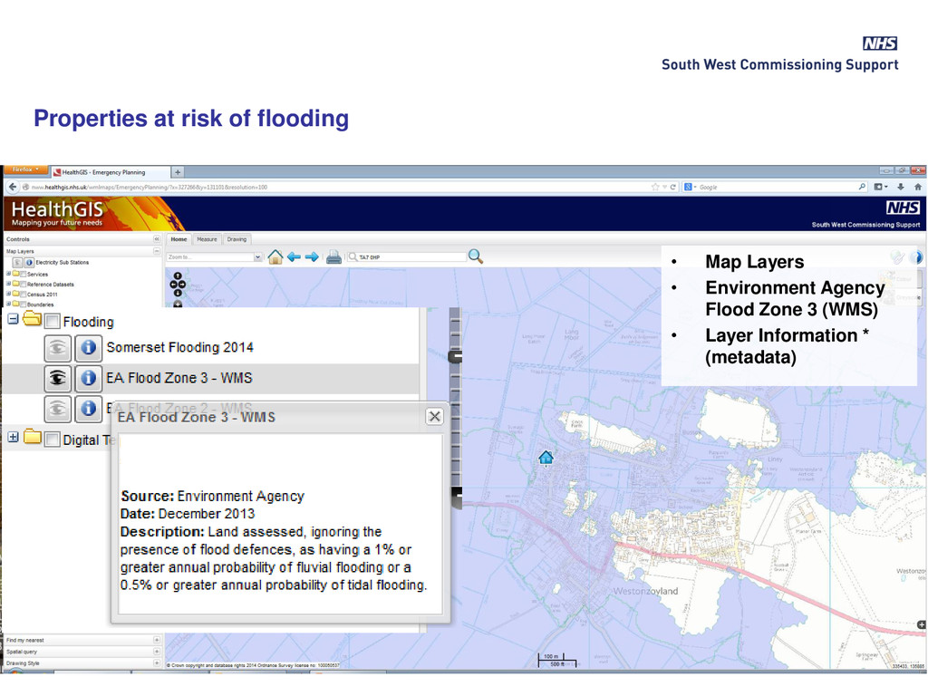
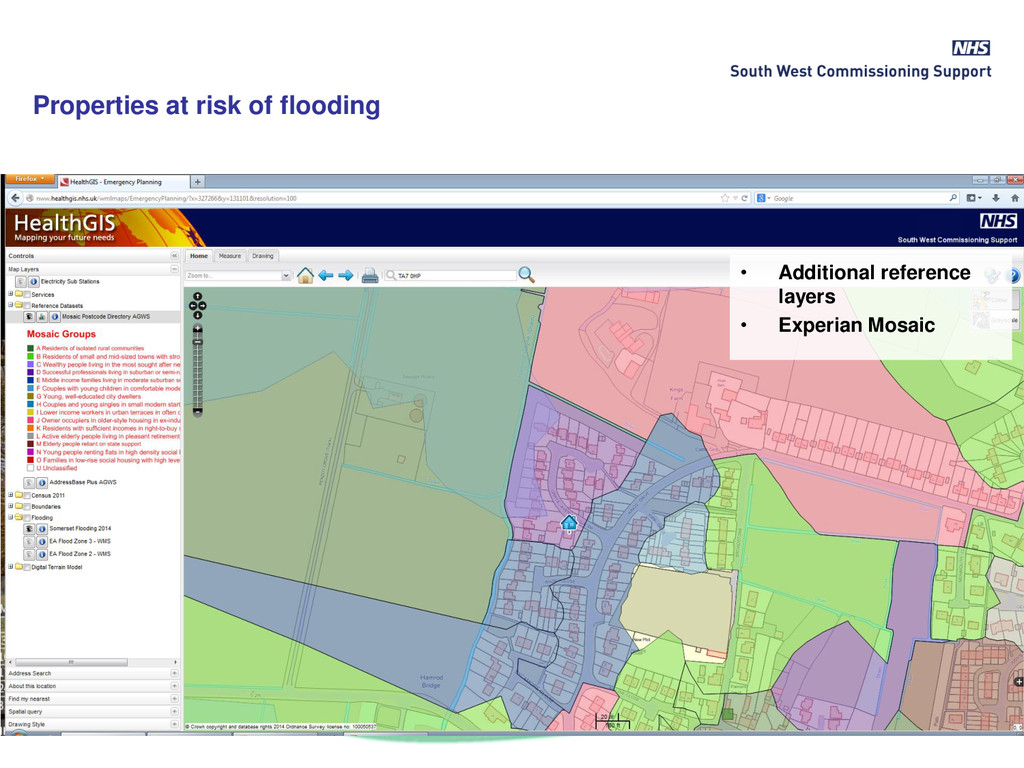
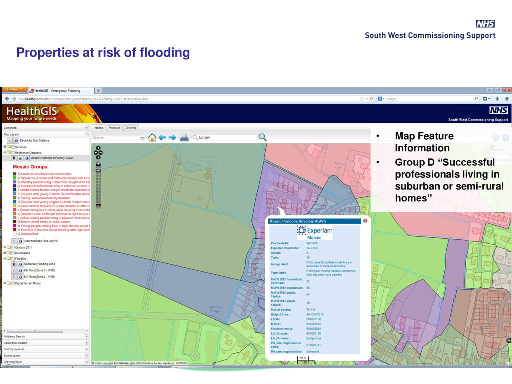
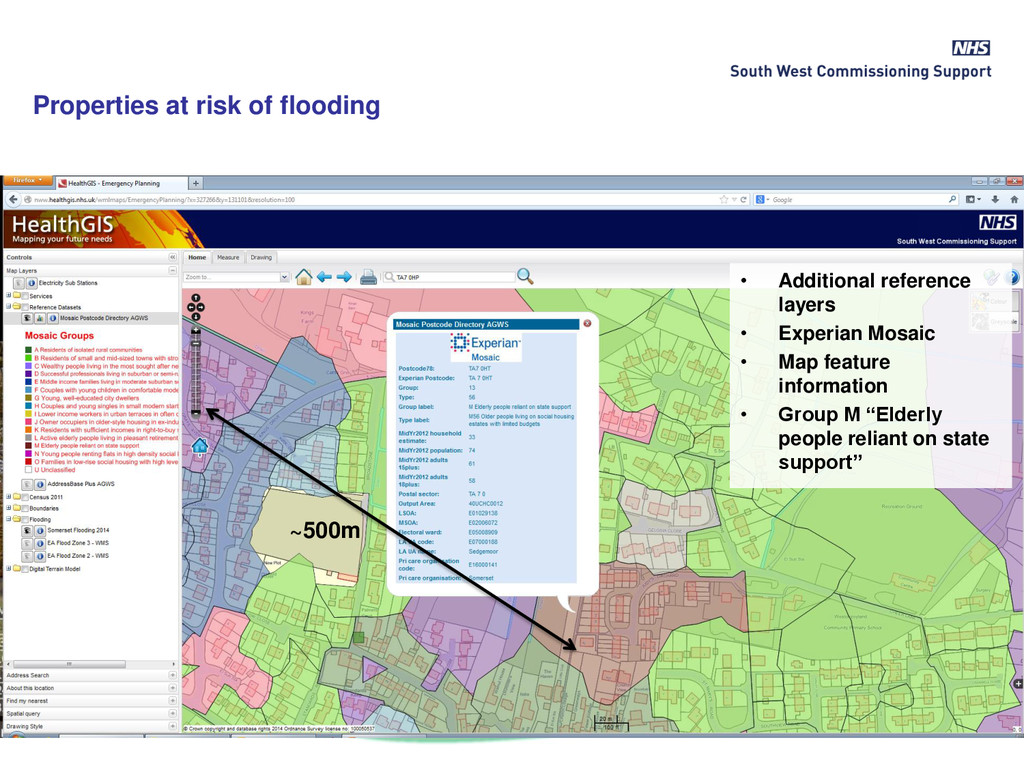
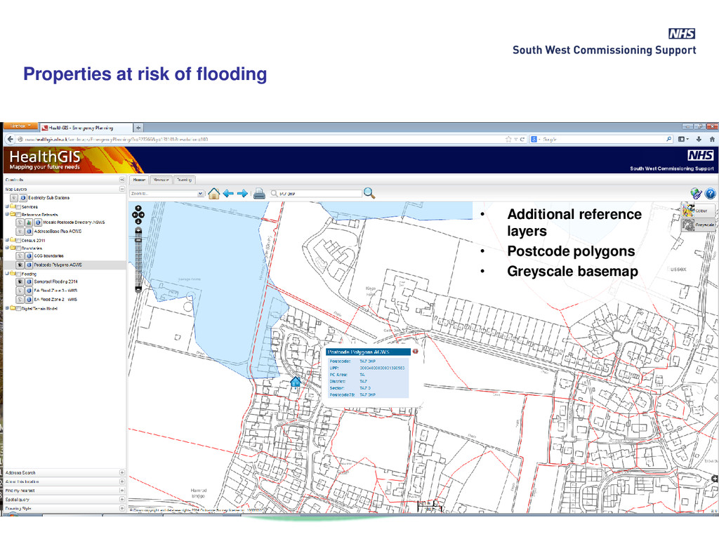
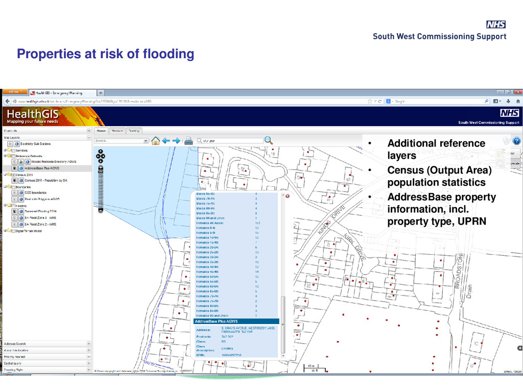
Configured for chosen areas: • NHS areas; CCG, Area Team, GP practice • Experian Mosaic group and type – “provides an understanding of the types of property/people” Properties at risk of flooding
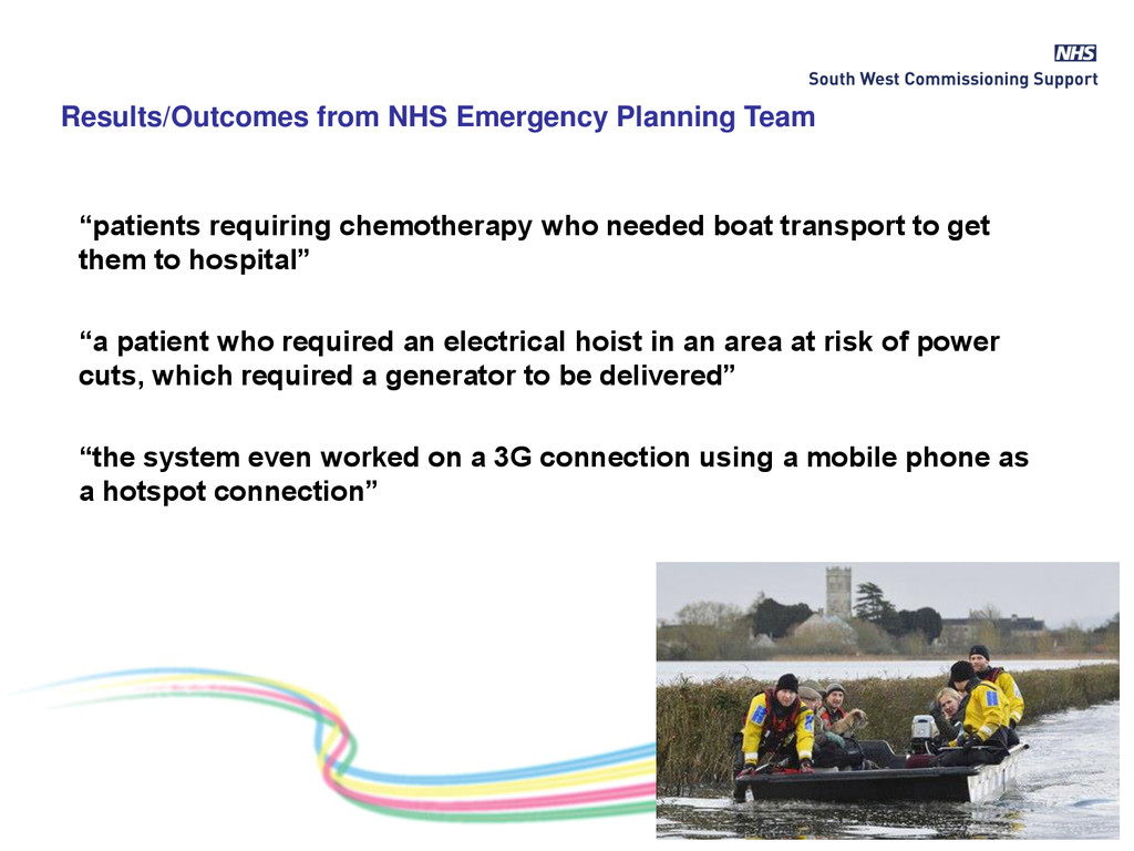
to hospital” “a patient who required an electrical hoist in an area at risk of power cuts, which required a generator to be delivered” “the system even worked on a 3G connection using a mobile phone as a hotspot connection” Results/Outcomes from NHS Emergency Planning Team
healthcare services layers • ‘eyeballing’ revealed assets at risk included; GP surgeries, Care Homes, a Minor Injuries Unit Risk of Water Mains Failure
traffic accidents, pollution, pandemic disease, UXB…) – Emergency Treatment Centres – Accessibility to all Hospitals (drive-time and blue-light travel times) – Locations of Mass Casualty Vehicles – Locations of Emergency Dressing Packs – Motorway junctions, other possible evacuation sites – Pandemic Flu Prophylaxis Centres (including using GIS analysis to identify optimum locations) – Key infrastructure (e.g. Hinkley Point nuclear power station) – Mental Health inpatient facilities • Add layer of patient locations (with appropriate security) for immediate access to relevant patient information in impacted areas, e.g. “Vulnerable people”
![• Further information? • Contact us at [email protected] or [email protected]](https://files.speakerdeck.com/presentations/30ebfe189acb43138ec16ead1e7197dc/slide_28.jpg)