is a mobile device? • What roles do maps play on mobile devices? • What kind of decisions are made using mobile maps? • How is uncertainty understood in the decision making process? • How can uncertainty be mitigated? • How do we know if mitigation strategies work? Thursday, October 10, 13
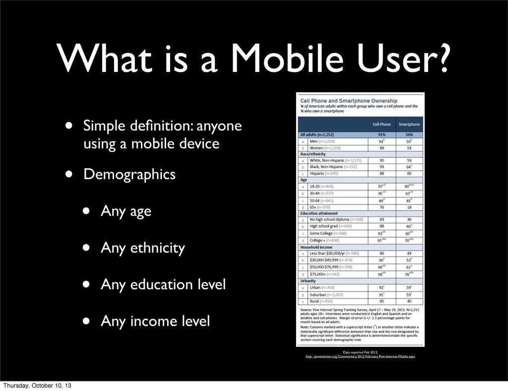
a mobile device Data reported Feb 2012. http://pewinternet.org/Commentary/2012/February/Pew-Internet-Mobile.aspx • Demographics • Any age • Any ethnicity • Any education level • Any income level Thursday, October 10, 13
Easily transported • Held in the hand • Physically small • Access to various data networks • Power to last all day • Multi-modal interaction Thursday, October 10, 13
Destination and route planning • Location sharing via social media (i.e. FourSquare, Facebook, Yelp) • Taking and viewing pictures or other geo- referenced data • All of these tasks can be related to... Thursday, October 10, 13
Where to visit/eat/stay • Which way to go • Where to tell others to go, meet, etc. • Which mode of travel to use • All decisions have some... Thursday, October 10, 13
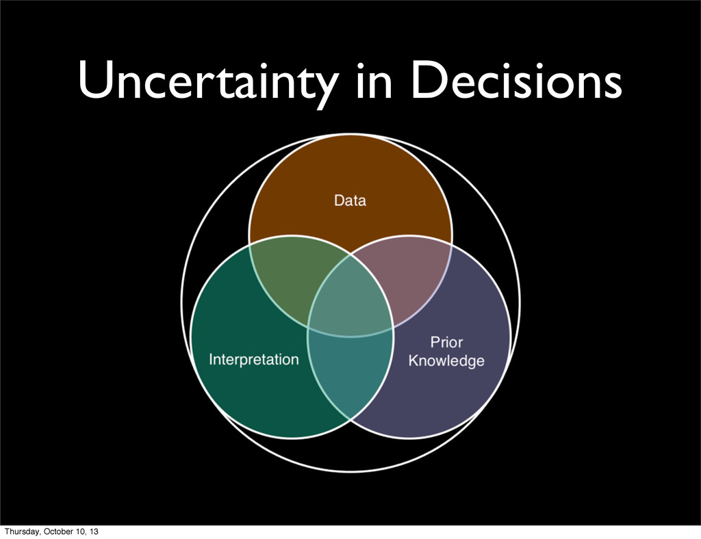
• Interpretation of visuals • Perceived meaning[3], ambiguity/vagueness, context • Prior Knowledge • Career[4], initial/prior solutions[4], subjective valuation of information[5,6] [1] MacEachren, A. M. (1992) Visualizing uncertain information. Cartographic Perspectives. 13. 10-19. [2] MacEachren, A.M. (1994) SOME truth with maps: A primer on symbolization and design. Association of American Geographers, Washington, D. C. [3] MacEachren, A.M. (1995) How Maps Work: Representation, Visualization, and Design. Guilford Press. [4] Kobus, D., S. Proctor, and Holste. S. (2001) Effects of experience and uncertainty during dynamic decision making. International Journal of Industrial Ergonomics 28. 275-290. [5] Reece, W., and Matthews, L. (1993) Evidence and uncertainty in subjective prediction: Influences on optimistic judgment. Psychological Reports 2(72). 435-439. [6] Cohen, B. L., and Wallsten, T. S. (1992) The effect of constant outcome value on judgments and decision making given linguistic probabilities. Journal of Behavioral Decision Making 1(5). 53 Thursday, October 10, 13
aspects of certainty (accuracy/precision focus) • Presenting bad aspects of uncertainty (error focus) • Design symbology to convey uncertainty[2,3] • Design interaction to provide access to uncertainty[4,5] • More work can be done here... [1] Buttenfield, B. P. (1993) Representing data quality. Cartographica (special content, Mapping Data Quality). 30(2&3). 1-7. [2] Pang, A. (2001) Visualizing uncertainty in geo-spatial data. In: Proceedings of the Workshop on the Intersections between Geospatial Information and Information Technology. National Academies Committee of the Computer Science and Telecommunications Board, Washington, D.C. [3] Wittenbrink, C.M., Saxon, E.., Furman, J.J., Pang, A., and Lodha, S. (1995) Glyphs for visualizing uncertainty in environmental vector fields. IEEE Translations on Visualization and Computer Graphics. 2(3). 266-79. [4] Fisher, P. (1993) Visualizing uncertainty in soil maps by animation. Cartographica. 30(2+3). 20-27. [5] Howard, D., and MacEachren., A.M.(1996) Interface design for geographic visualization: Tools for representing reliability. Cartography and Geographic Information Systems. 23(2). 59-77. Thursday, October 10, 13
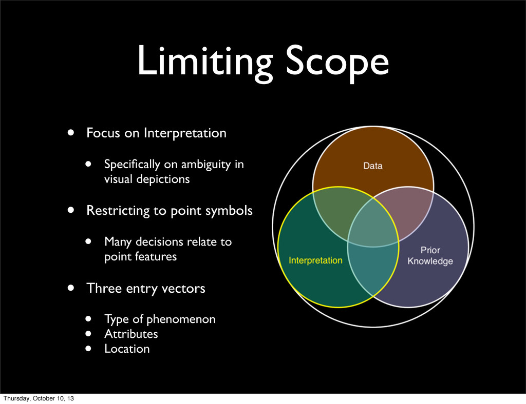
in visual depictions • Restricting to point symbols • Many decisions relate to point features • Three entry vectors • Type of phenomenon • Attributes • Location Thursday, October 10, 13
• Tourist maps[1,2] • Digital displays[3] • Application domain[4,5] • Limited evaluations on mobile devices [1] Forrest, D. and Castner, H.W. (1985) The design and perception of point symbols for tourist maps. The Cartographic Journal. 22. 11-19. [2] Clarke, L.M. (1989) An experimental investigation of the communicative efficiency of point symbols on tourist maps. The Cartographic Journal. 26. 105-110. [3] Morrison, C. and Forrest, D. (1995) A study of point symbol design for computer based large scale tourist mapping. The Cartographic Journal. 32. 126-136. [4] Akella, M.K. (2009) First Responders and Crisis Map Symbols: Clarifying Communication. Cartography and Geographic Information Science. 36. 19-28. [5] Bianchetti, R.A., Wallgrün, J.O., Yang, J., Blanford, J.I., Robinson, A.C., and Klippel, A. (2012) Free classification of Canadian and American emergency management map symbol standards. The Cartographic Journal. 49(4). 350-360. Thursday, October 10, 13
for mobile devices • Design and run user studies on mobile devices • Define user study as series of tasks • Tasks test for different interpretation problems • Record/report results to researchers/designers • Automated bias correction • Free and open source Thursday, October 10, 13
![Uncertainty in Decisions • Data • Error, accuracy, precision, etc.[1,2]](https://files.speakerdeck.com/presentations/1f1343f019170131674c7215726d6691/slide_8.jpg)
![Mitigating Uncertainty • Common, data driven, strategies[1] • Presenting good](https://files.speakerdeck.com/presentations/1f1343f019170131674c7215726d6691/slide_9.jpg)