Upgrade to Pro
— share decks privately, control downloads, hide ads and more …
Speaker Deck
Features
Speaker Deck
PRO
Sign in
Sign up for free
Search
Search
Who ARE the People in your Neighborhood? Develo...
Search
Nathaniel V. KELSO
October 20, 2016
380
2
Share
Embed
Copy iframe code
Copy JS code
Copy link
Start on current slide
Who ARE the People in your Neighborhood? Developing Mapzen’s Neighborhood Database
Nat Case, INCase LLC
[email protected]
NACIS 2016
Nathaniel V. KELSO
October 20, 2016
More Decks by Nathaniel V. KELSO
See All by Nathaniel V. KELSO
Back to the Desktop
nvkelso
2
650
Who's On First Overview
nvkelso
1
250
Who's on First: Administrative Boundaries & Localities
nvkelso
1
240
Introducing Web Mapping to Writing Studies and Journalism Classes at the University of Minnesota Duluth
nvkelso
0
150
A Jobs Panel: How to Hire or Be Hired
nvkelso
0
310
Big History, Little History: Cartography in the Twentieth Century
nvkelso
0
190
Displaying Change Data on a US Topo Map
nvkelso
0
130
UAEU Employees' Social Impact Assessment in Urban Development in Al Ain City
nvkelso
0
240
Dasymetric Tessellaton
nvkelso
0
200
Featured
See All Featured
Highjacked: Video Game Concept Design
rkendrick25
PRO
1
410
Leo the Paperboy
mayatellez
8
1.9k
Leading Effective Engineering Teams in the AI Era
addyosmani
9
2.1k
Optimizing for Happiness
mojombo
378
71k
The State of eCommerce SEO: How to Win in Today's Products SERPs - #SEOweek
aleyda
2
11k
Speed Design
sergeychernyshev
33
1.9k
Rails Girls Zürich Keynote
gr2m
96
14k
Designing Dashboards & Data Visualisations in Web Apps
destraynor
231
55k
Beyond borders and beyond the search box: How to win the global "messy middle" with AI-driven SEO
davidcarrasco
3
180
HDC tutorial
michielstock
2
740
Why Our Code Smells
bkeepers
PRO
340
58k
"I'm Feeling Lucky" - Building Great Search Experiences for Today's Users (#IAC19)
danielanewman
230
23k
Transcript
Who ARE the People in your Neighborhood? Developing Mapzen’s Neighborhood
Database Nat Case, INCase LLC
[email protected]
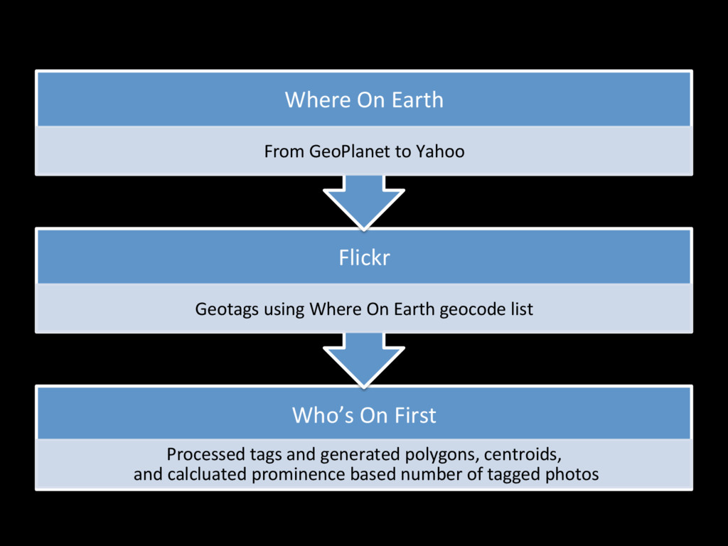
Who’s On First Processed tags and generated polygons, centroids,
and calcluated prominence based number of tagged photos Flickr Geotags using Where On Earth geocode list Where On Earth From GeoPlanet to Yahoo
Where On Earth field classifica@on (from Wikipedia)
None
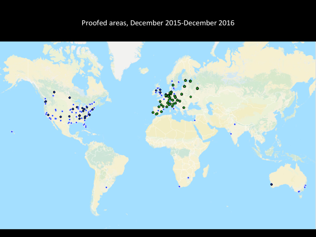
Proofed areas, December 2015-‐December 2016
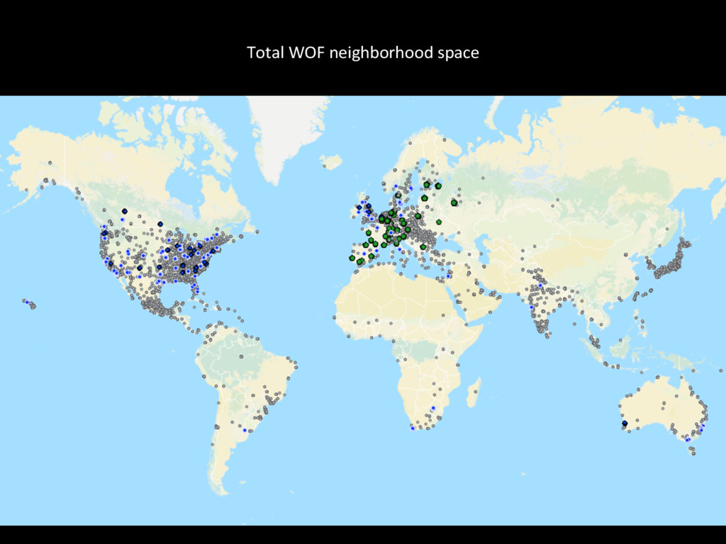
Total WOF neighborhood space
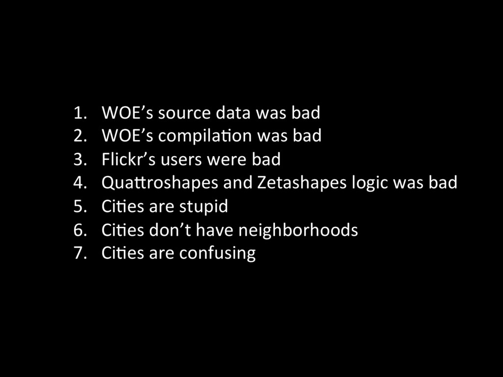
1. WOE’s source data was bad 2. WOE’s compila@on
was bad 3. Flickr’s users were bad 4. QuaProshapes and Zetashapes logic was bad 5. Ci@es are stupid 6. Ci@es don’t have neighborhoods 7. Ci@es are confusing
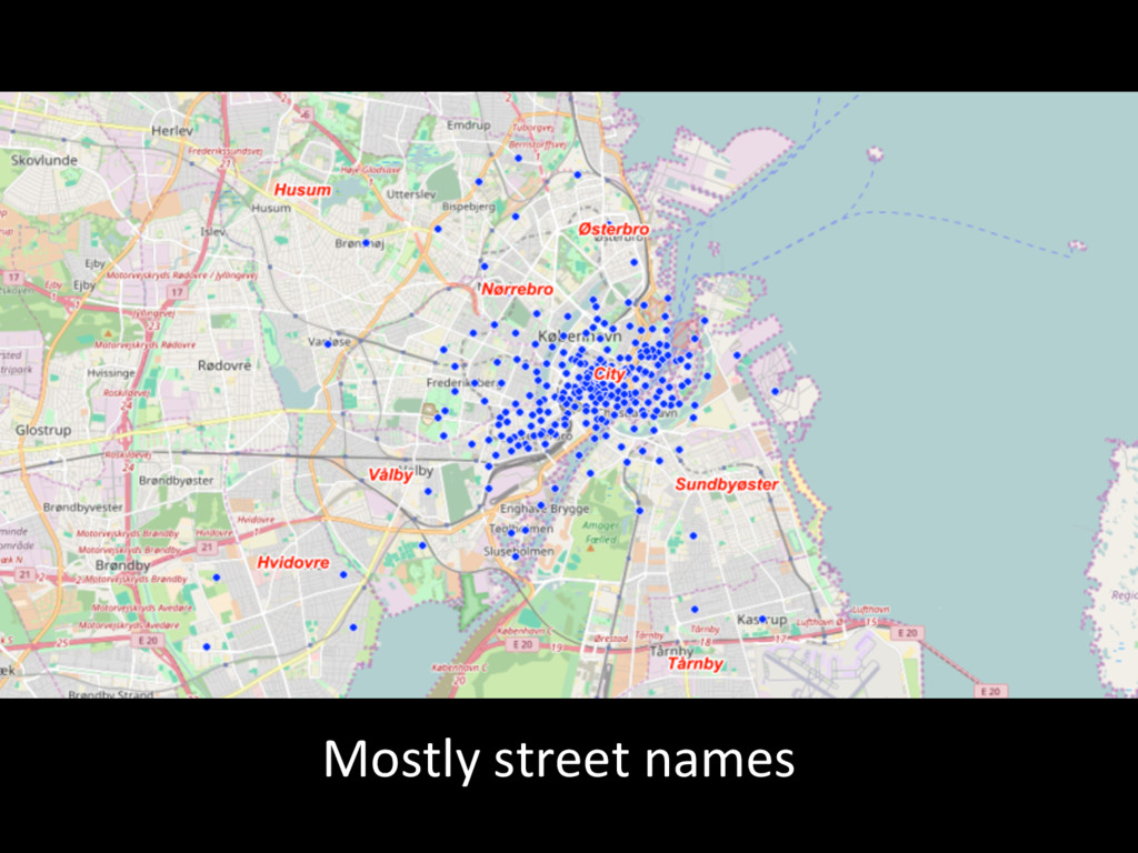
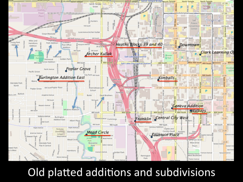
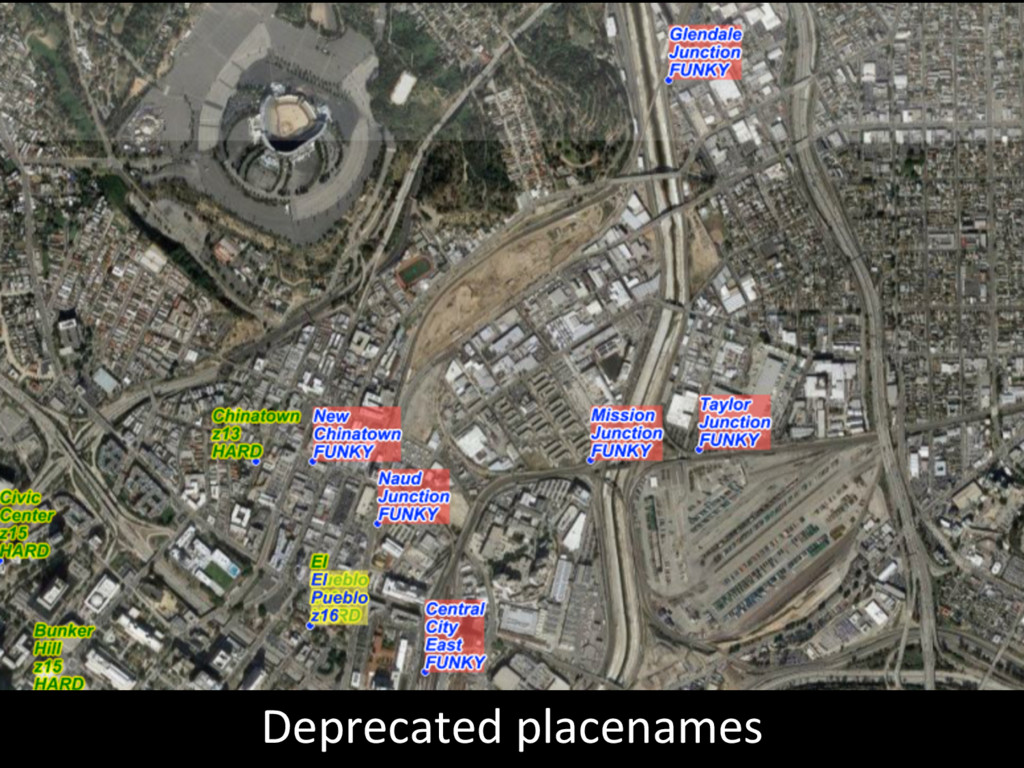
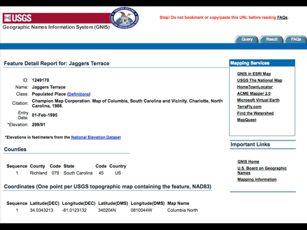
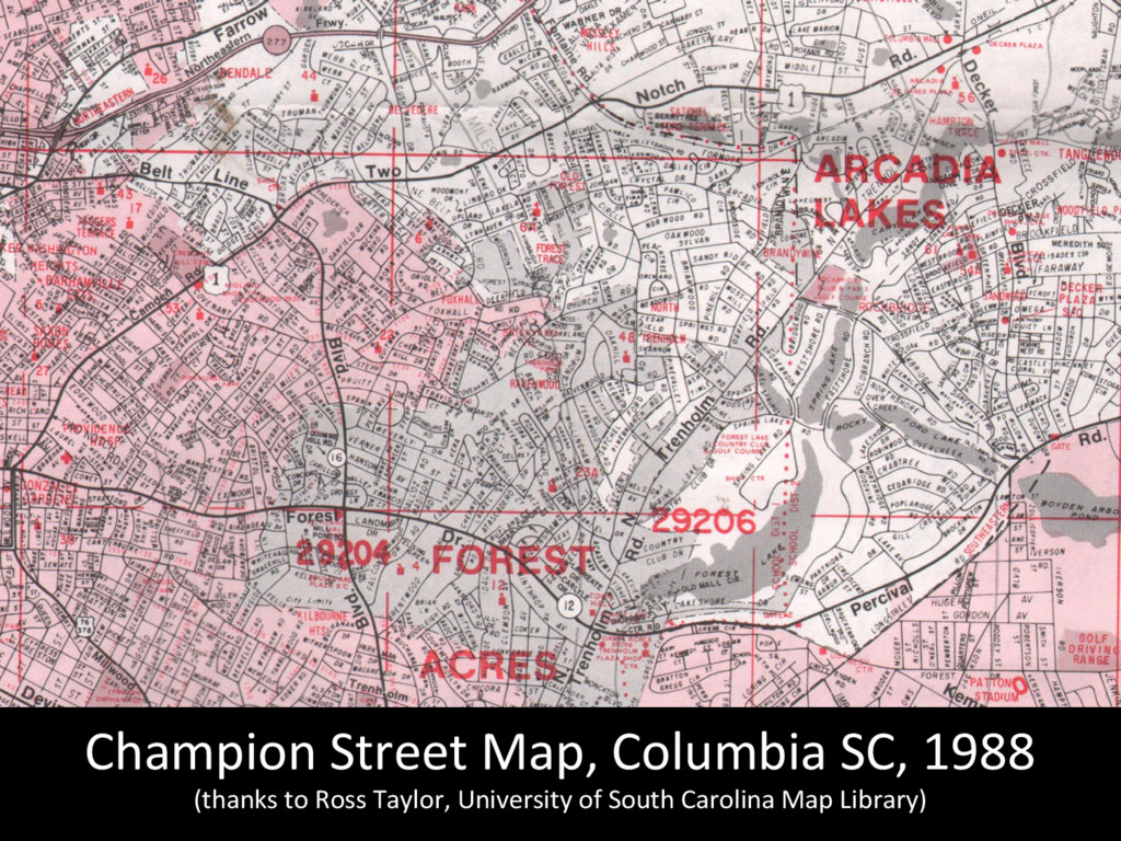
WOE source data was bad
Mostly street names
Old plaPed addi@ons and subdivisions
Deprecated placenames
None
None
Champion Street Map, Columbia SC, 1988 (thanks to Ross
Taylor, University of South Carolina Map Library)
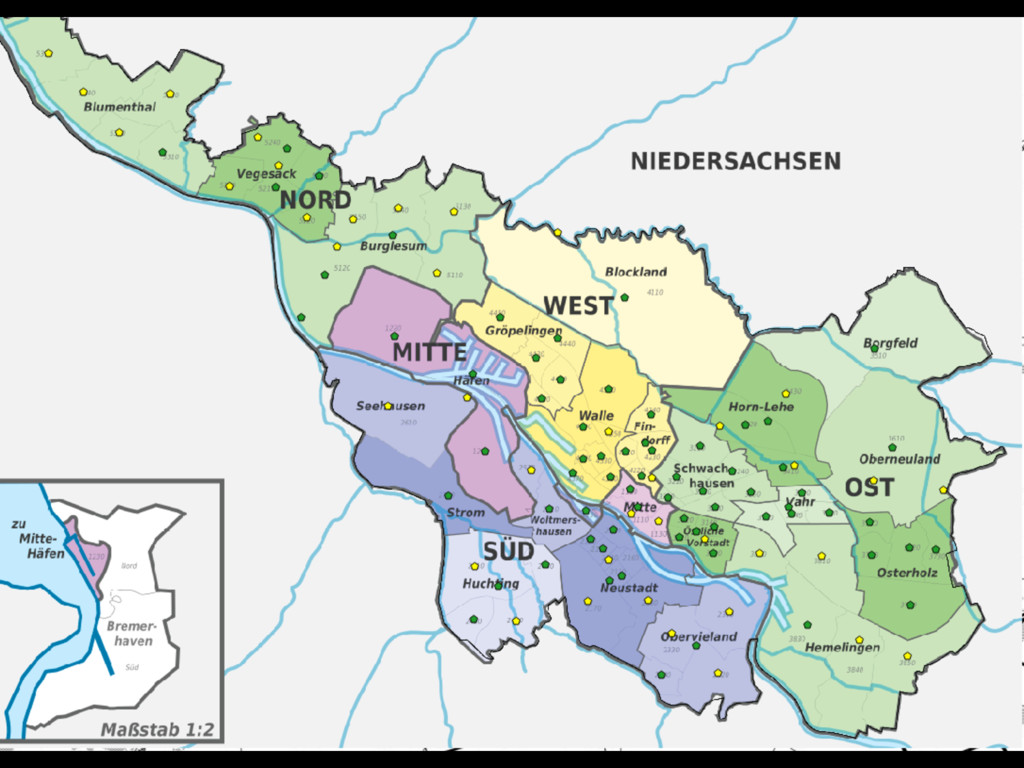
WOE compila@on was bad
Missing rioni
None
None
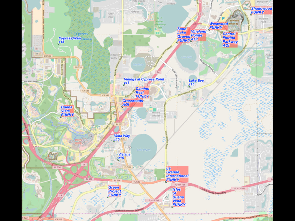
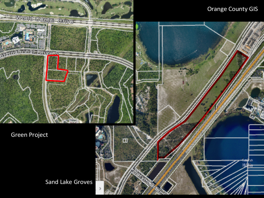
Green Project Sand Lake Groves Orange County
GIS
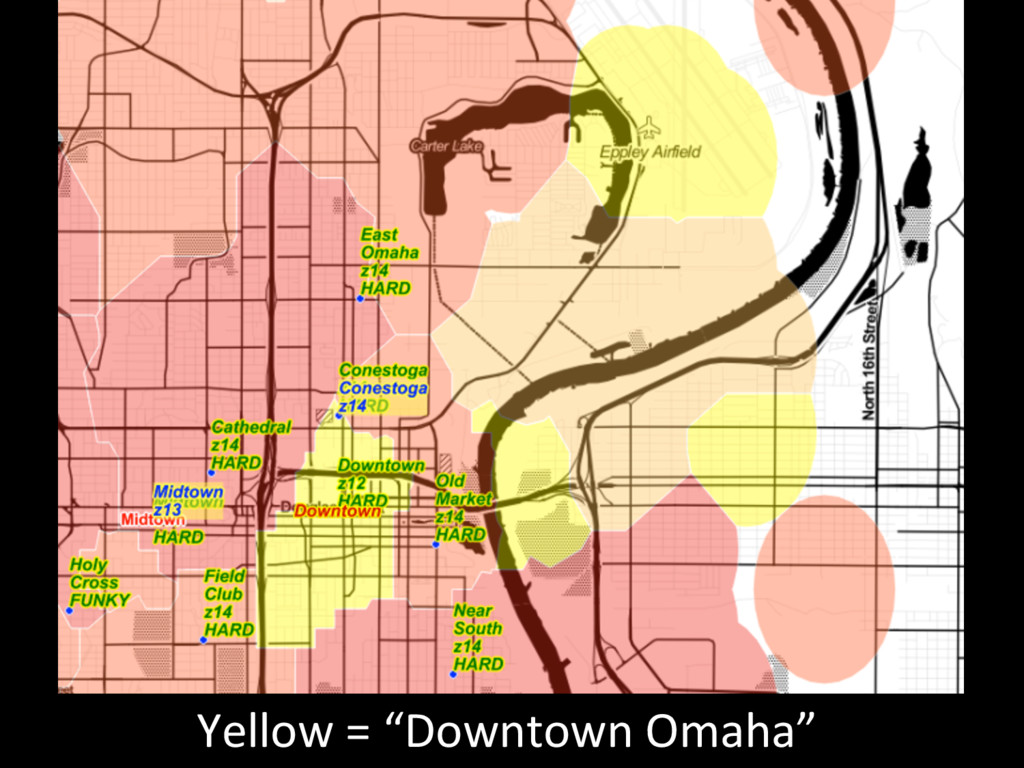
Flickr users are bad
Yellow = “Downtown Omaha”
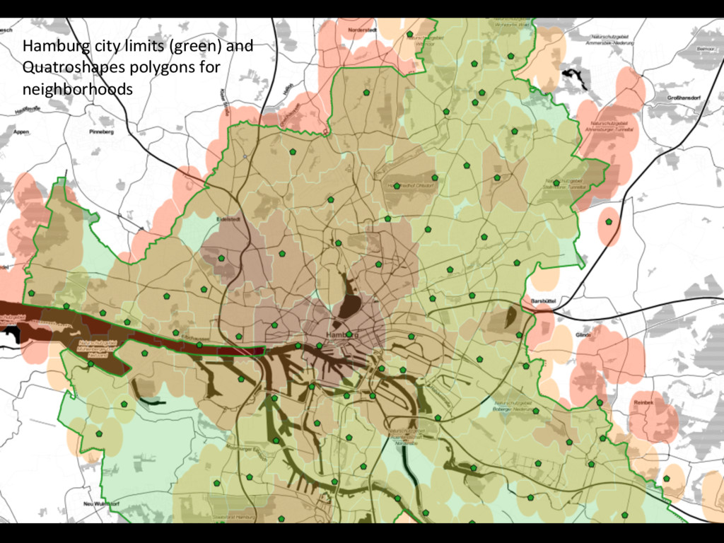
Quatroshapes and Zetashapes logic were bad
Hamburg city limits (green) and Quatroshapes polygons for
neighborhoods
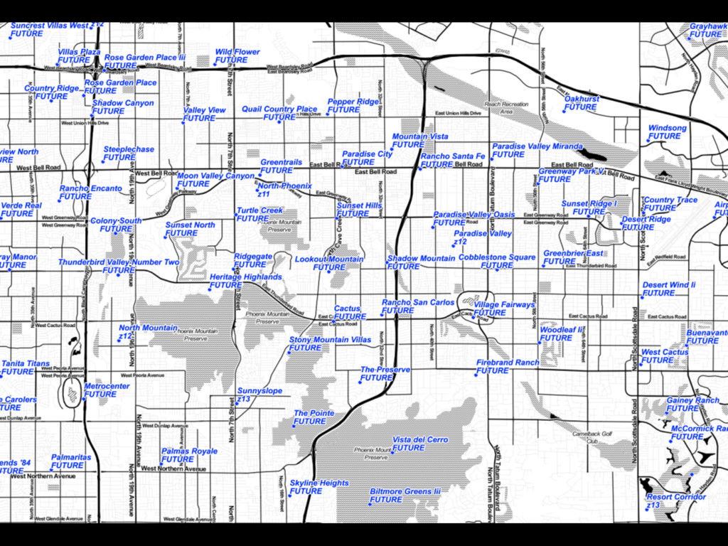
Ci@es are stupid
None
Ci@es don’t have neighborhoods
None
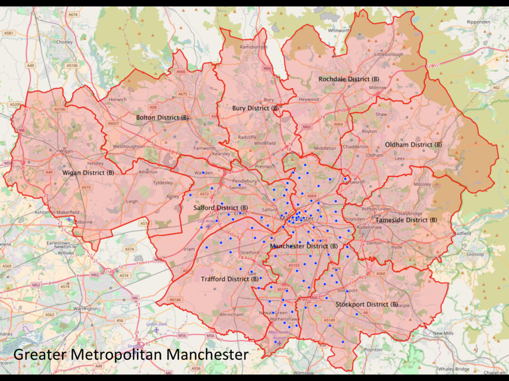
Ci@es are confusing
Greater Metropolitan Manchester
None
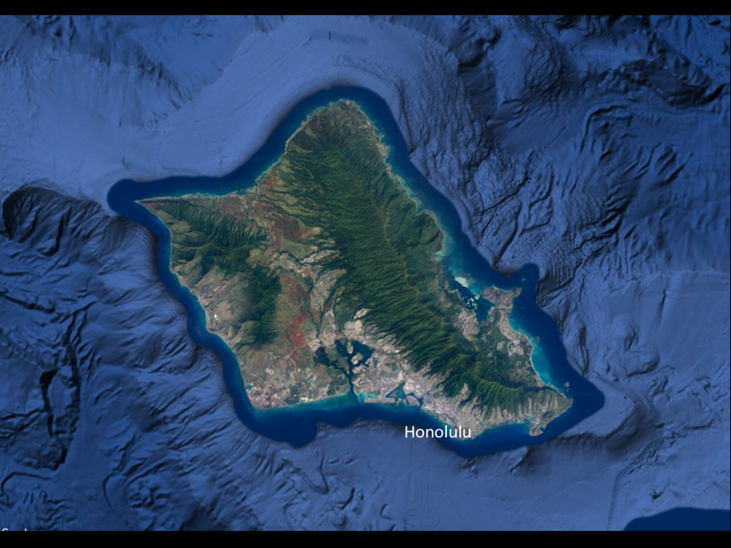
Honolulu
Honolulu
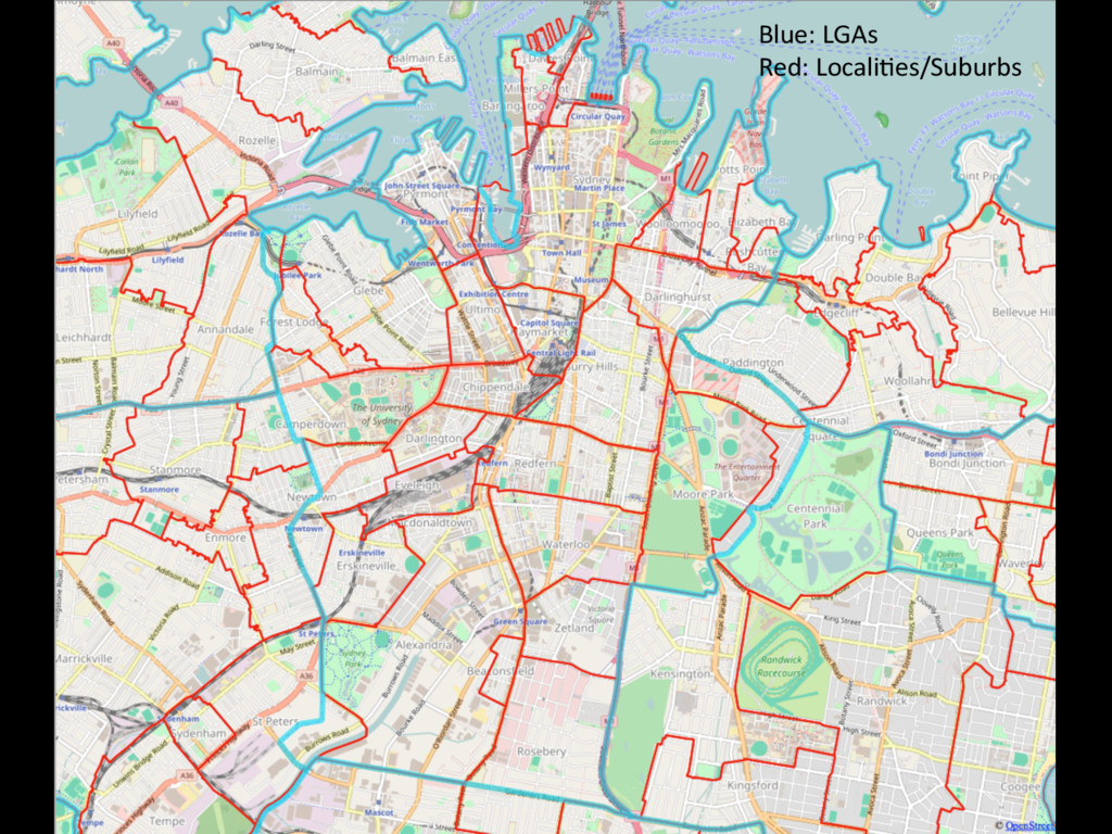
Blue: LGAs Red: Locali@es/Suburbs
LAS VEGAS North Las Vegas Henderson
None
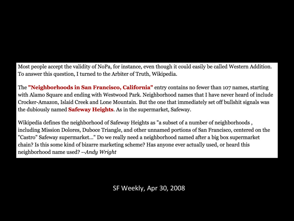
SF Weekly, Apr 30, 2008
None
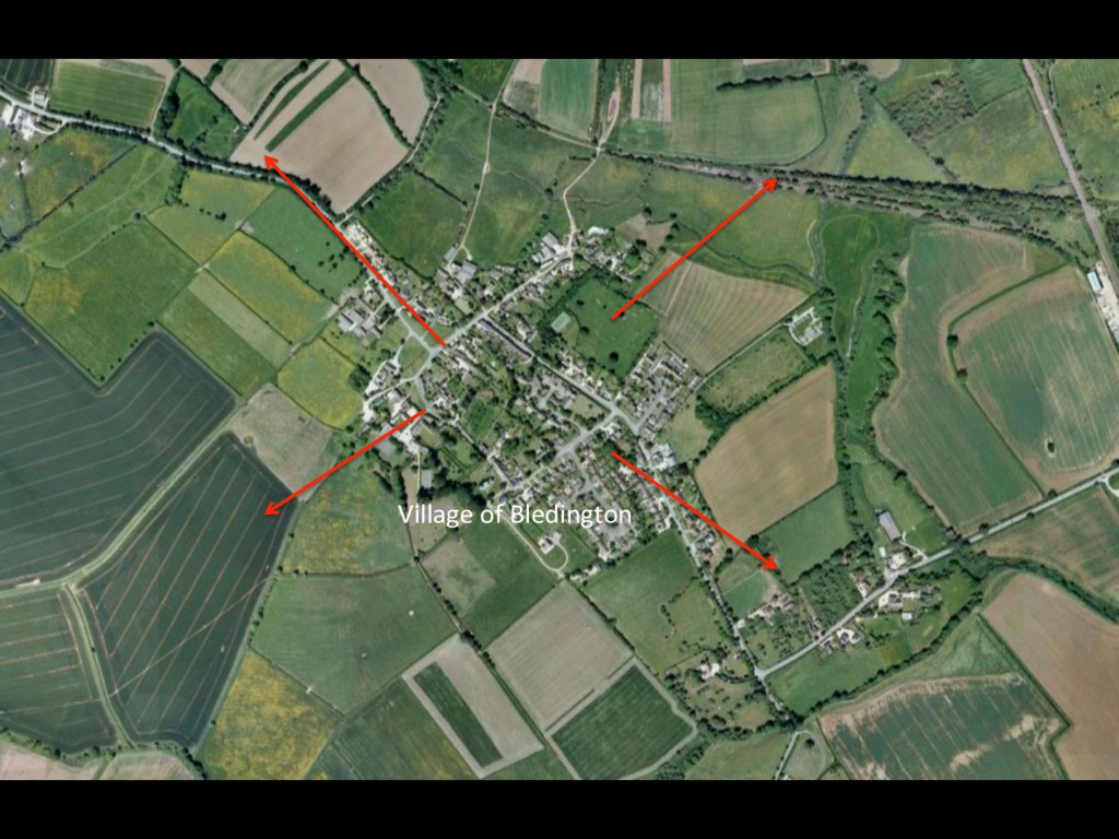
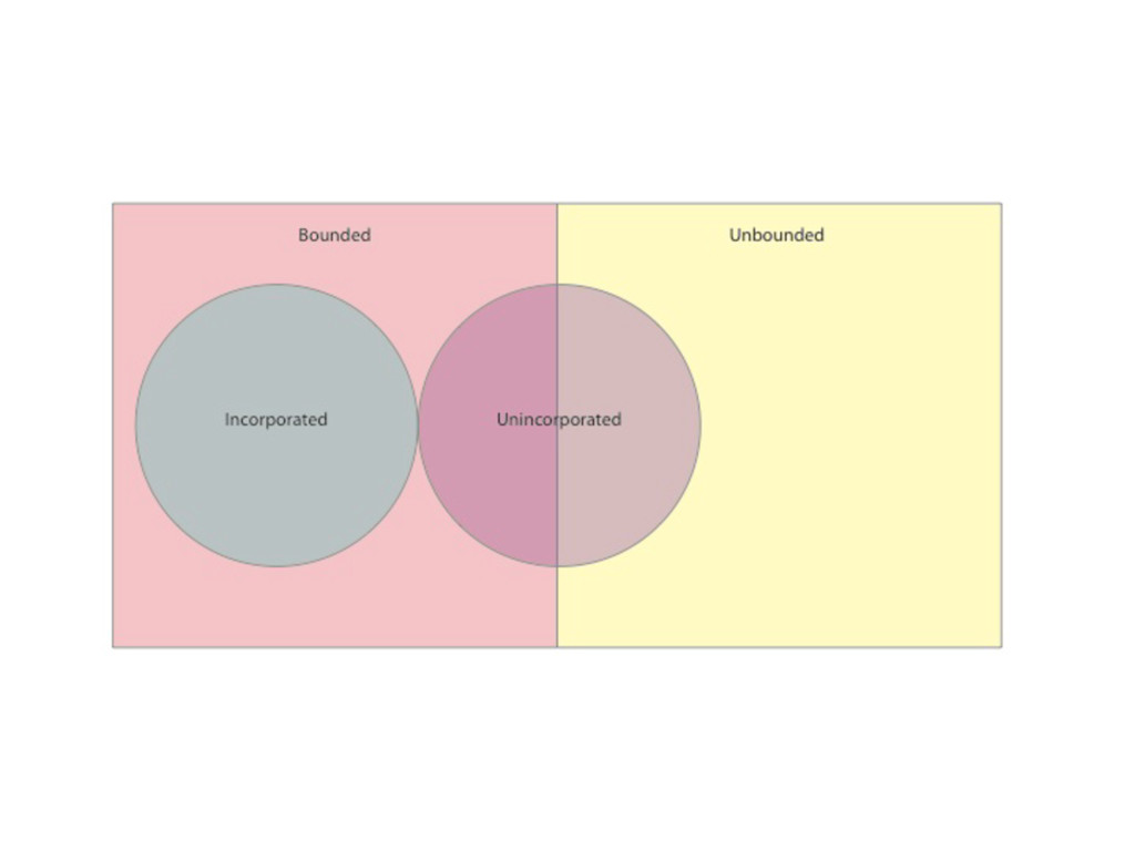
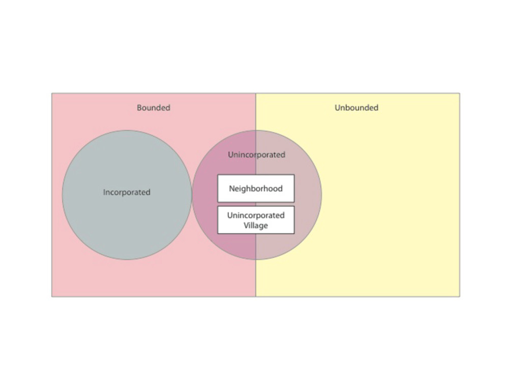
A couple ideas
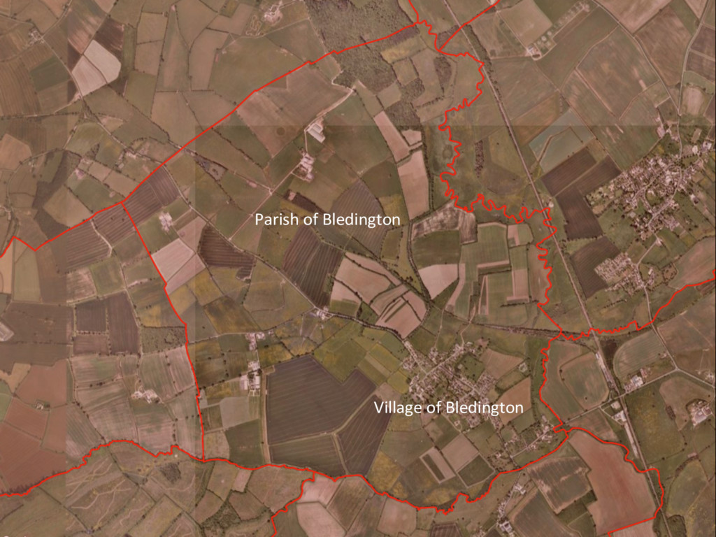
There are two basic kinds of populated place geography:
radial and bounded. Every named populated place has at least the poten@al to have both kinds of geography.
Village of Bledington
Parish of Bledington Village of Bledington
Neighborhoods are not subsets or subdivisions of ci@es,
but instead are unincorporated places.
None
None
Greater Metropolitan Manchester
None
None