Upgrade to Pro — share decks privately, control downloads, hide ads and more …

Designing Schematic Maps

Rasagy Sharma
February 04, 2022

Designing Schematic Maps

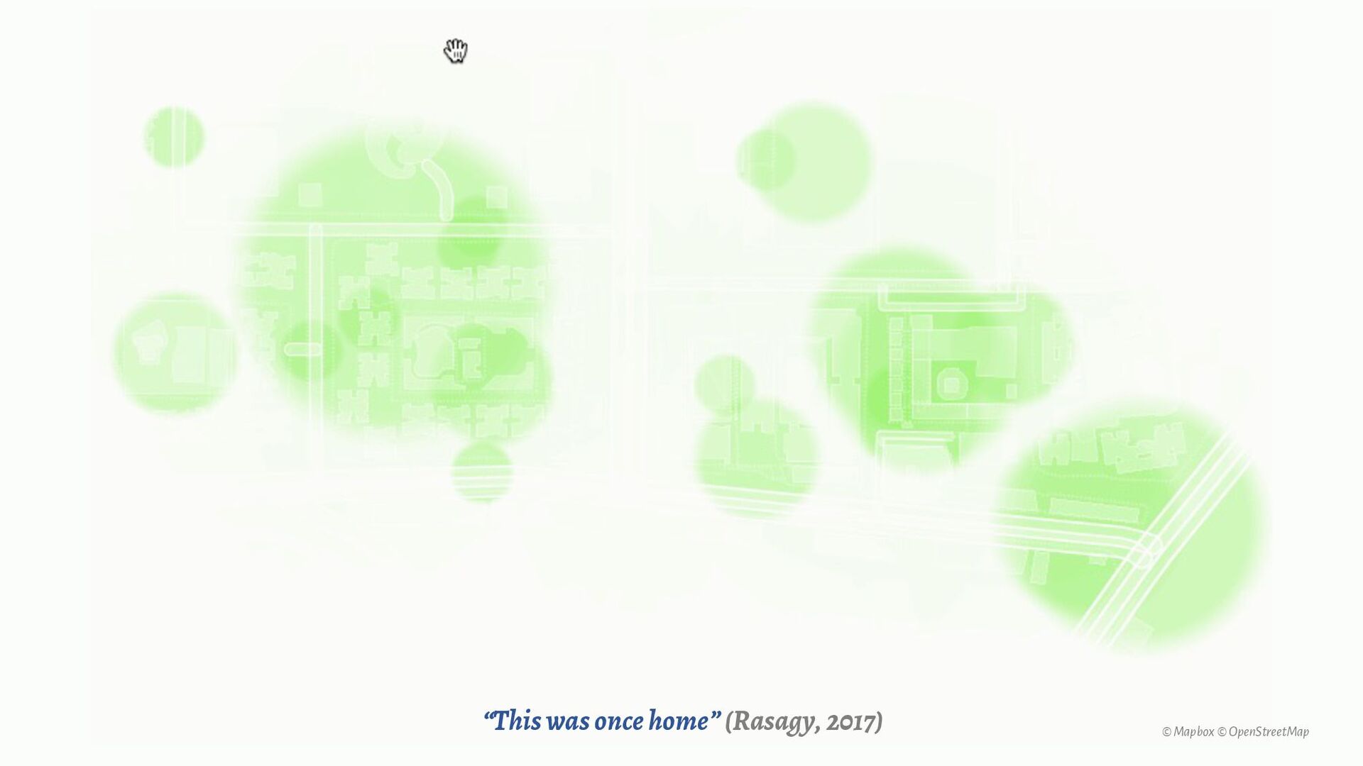
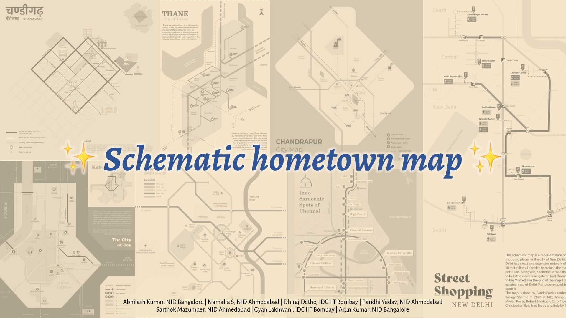
What would maps of cities look like if individuals designed maps, based on their lived experiences?
What if maps weren’t focused on being accurate & consistent, but abstract & personal?

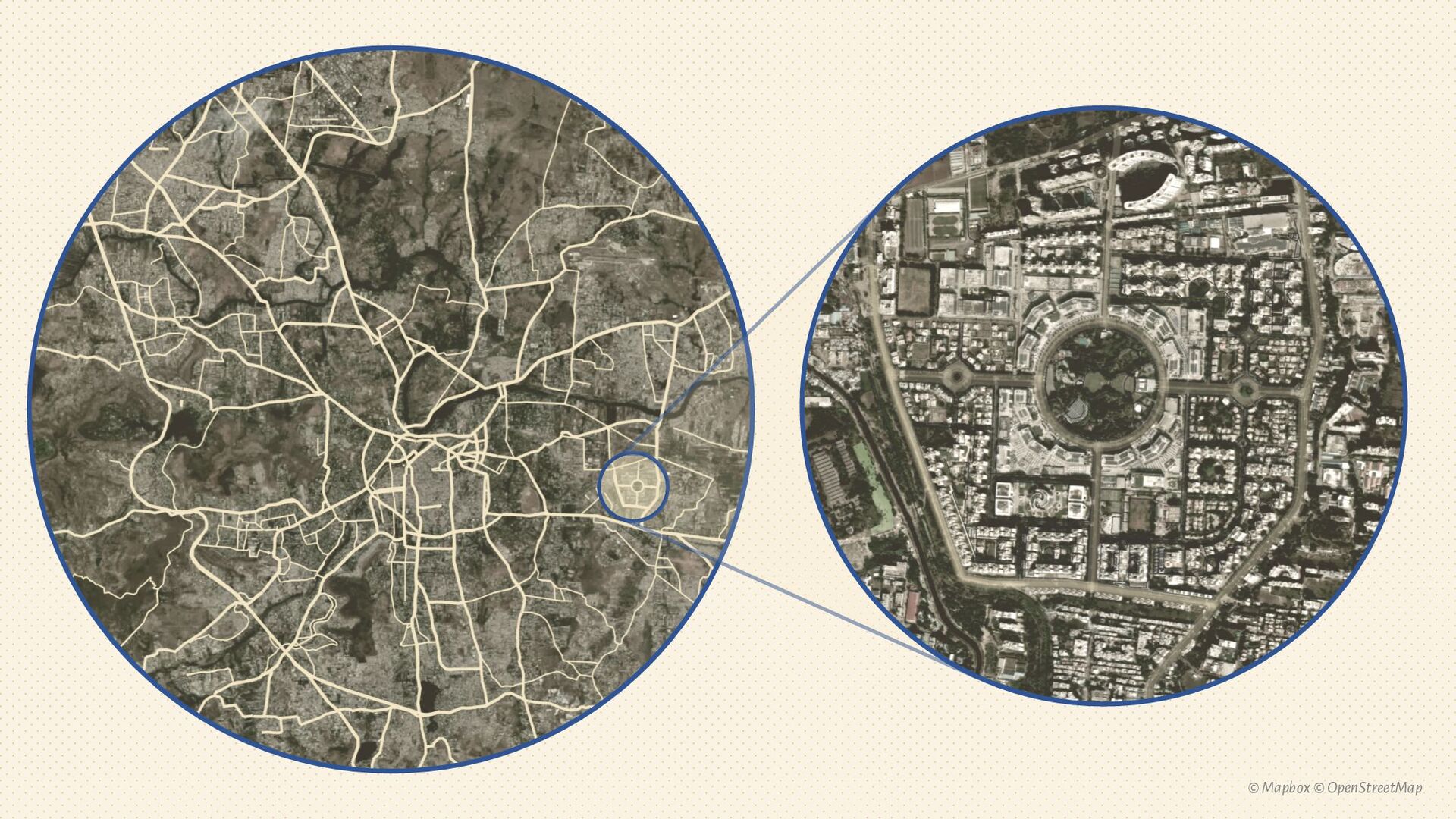
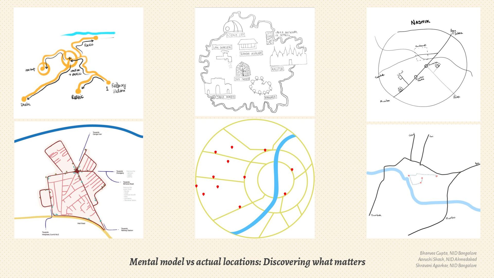
While digital mapping platforms like Google Maps or OSM have made it easy for anyone to get detailed maps of any city, I’ve often struggled to express my experience of the cities I’ve lived in. We can use the principles behind schematic maps to enable anyone to express their mental model of a city, and visualize experiences that they can curate.

This talk showcases Schematic maps of Indian cities designed by students from my Digital Cartography & Geo-Visualization modules in the past few years. It also explains common steps to create your own schematic map.

This assignment is inspired by a schematic mapping workshop I attended by Arun Ganesh, and has evolved over the years under the guidance of Prof. Venkatesh Rajamanickam (IDC, IIT Bombay) & Prof. Chakradhar Saswade (NID, Bangalore).

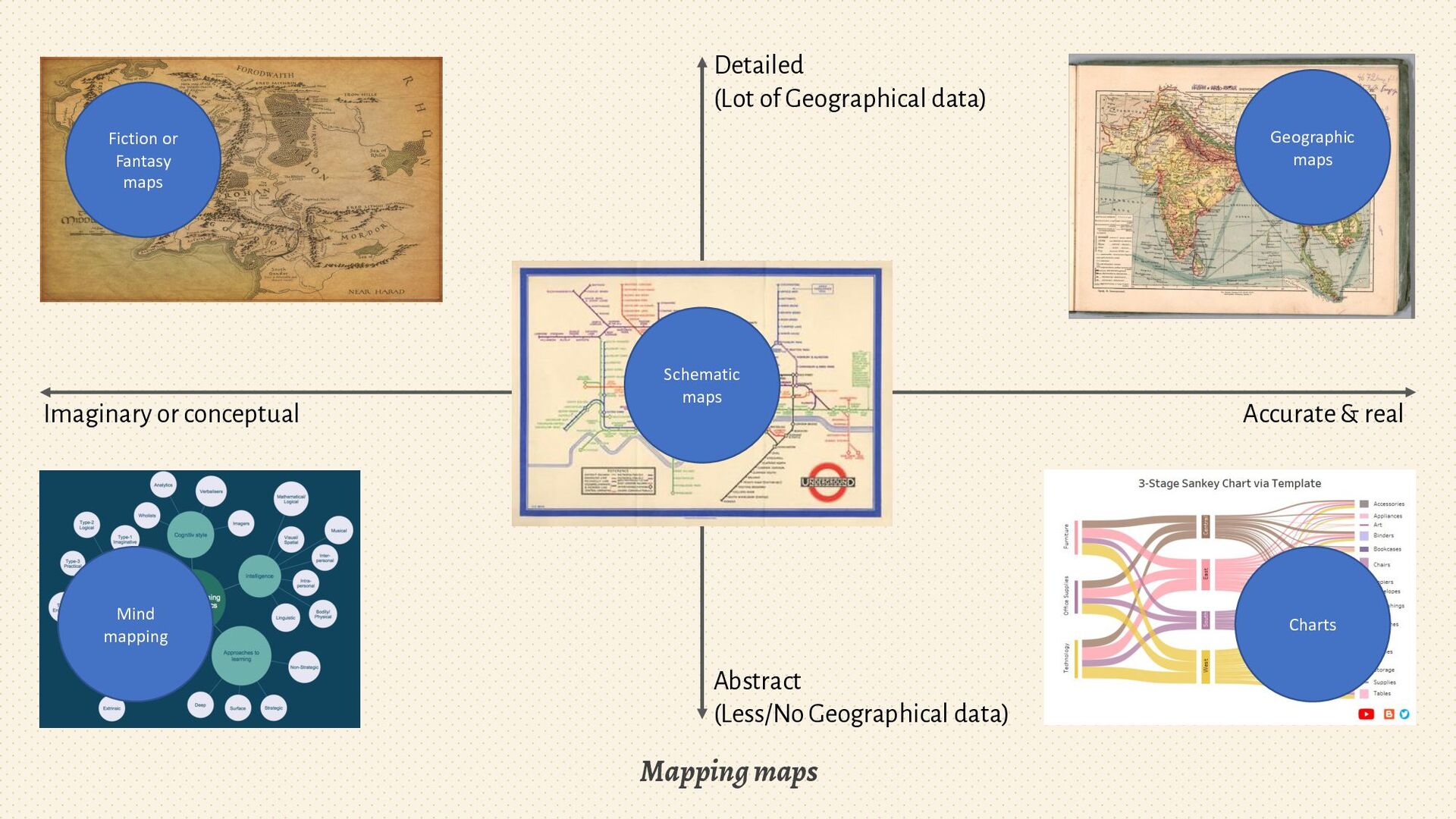
Process of curation & abstraction for creating schematic maps:
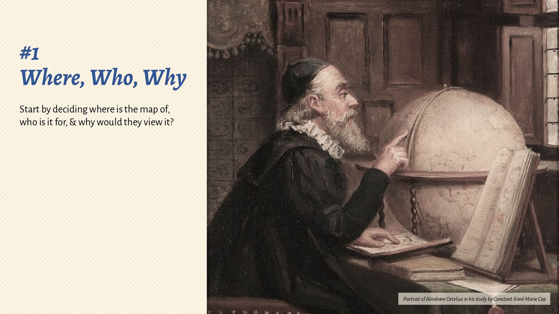
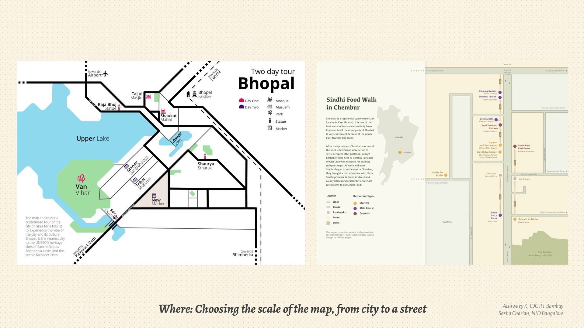
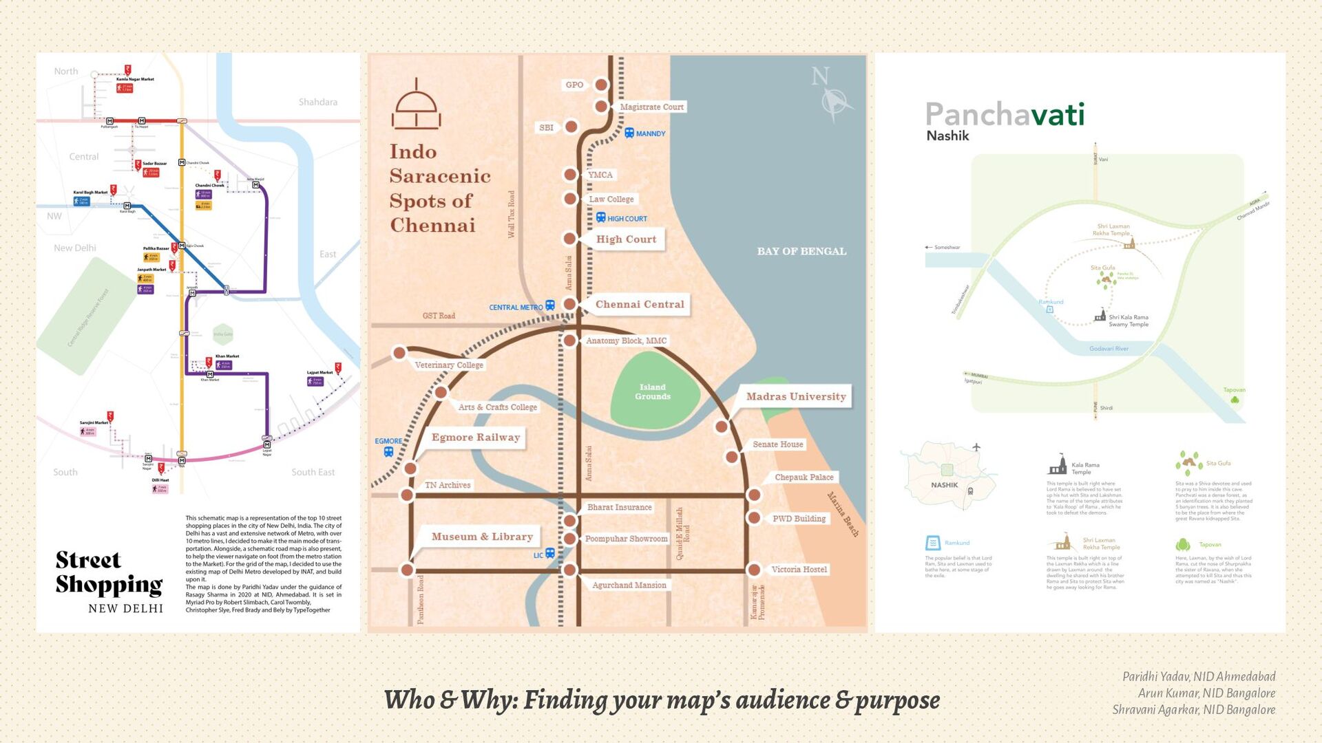
1. Define Scale, Audience & Purpose
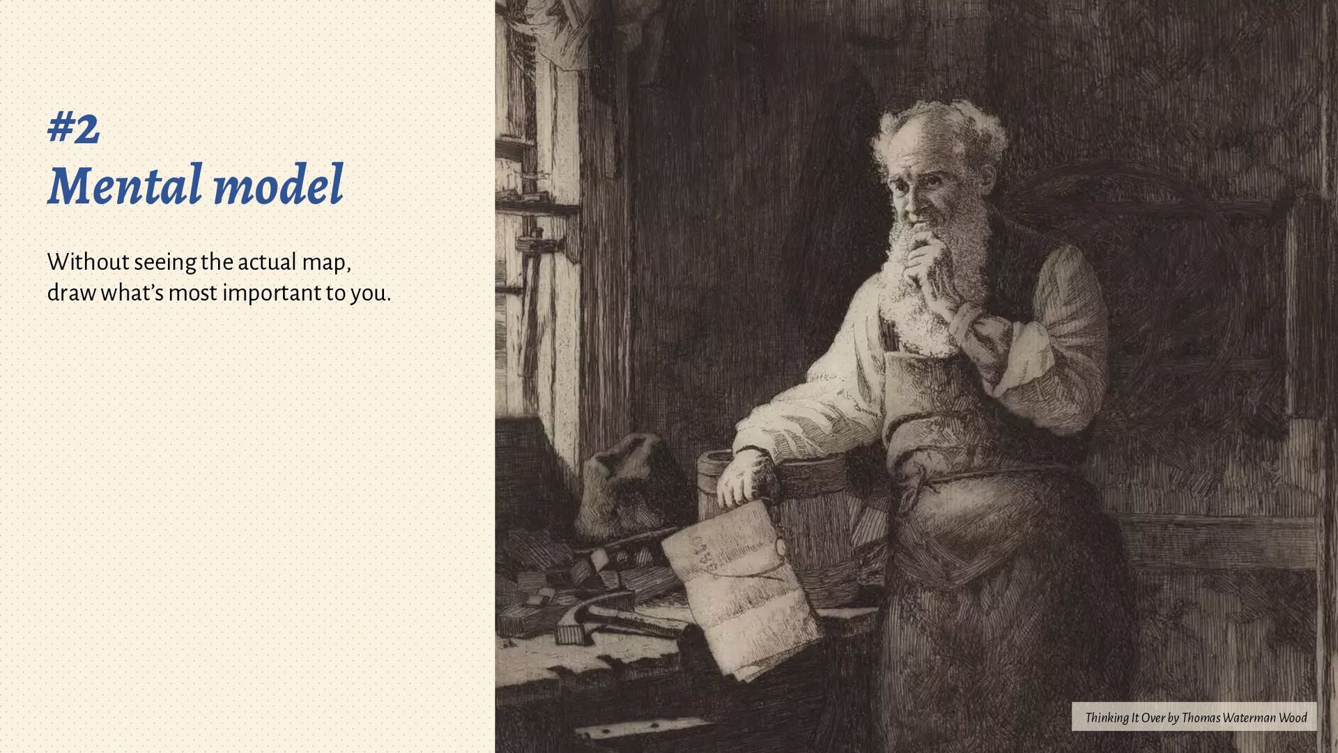
2. Sketch your mental model
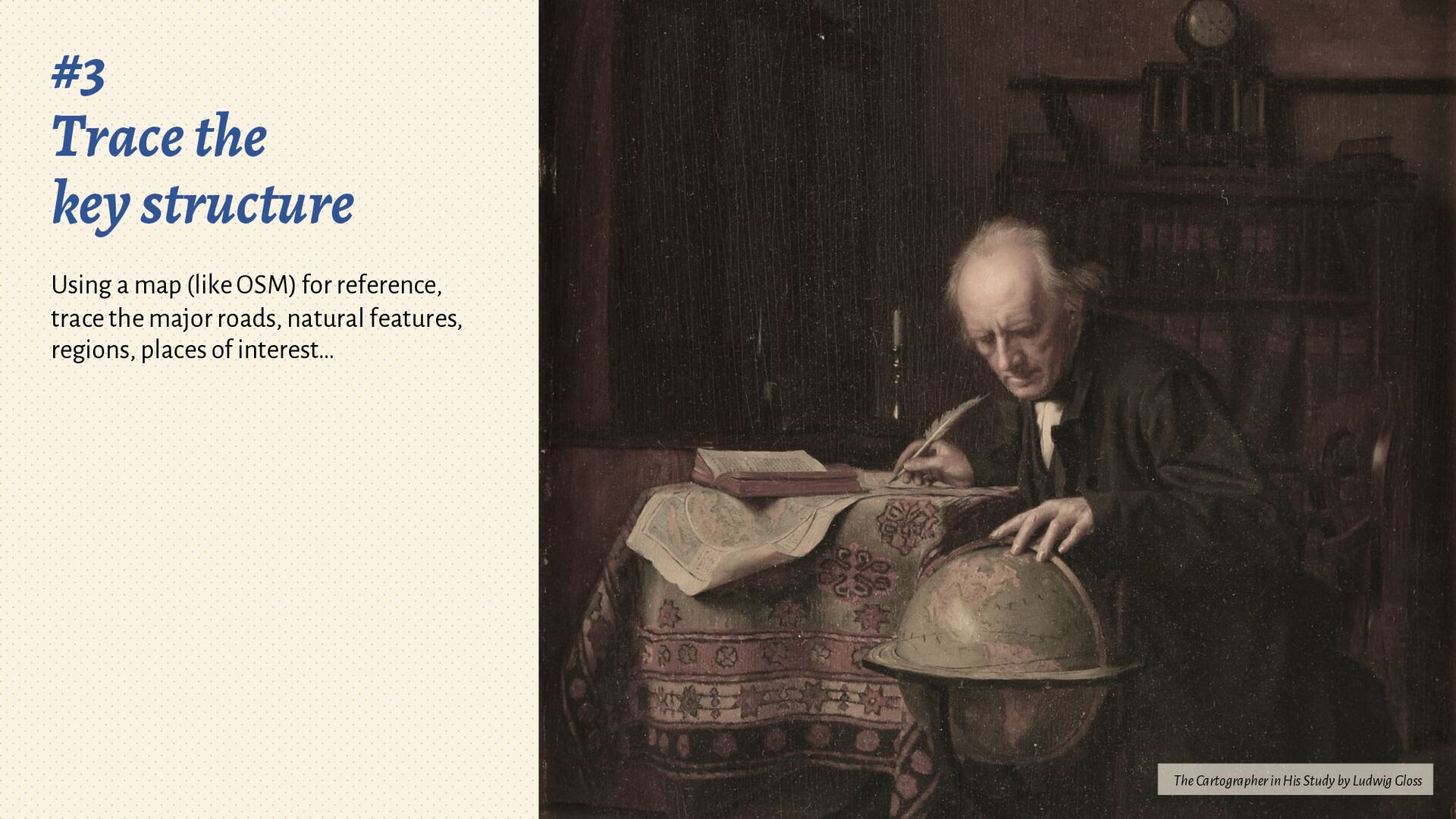
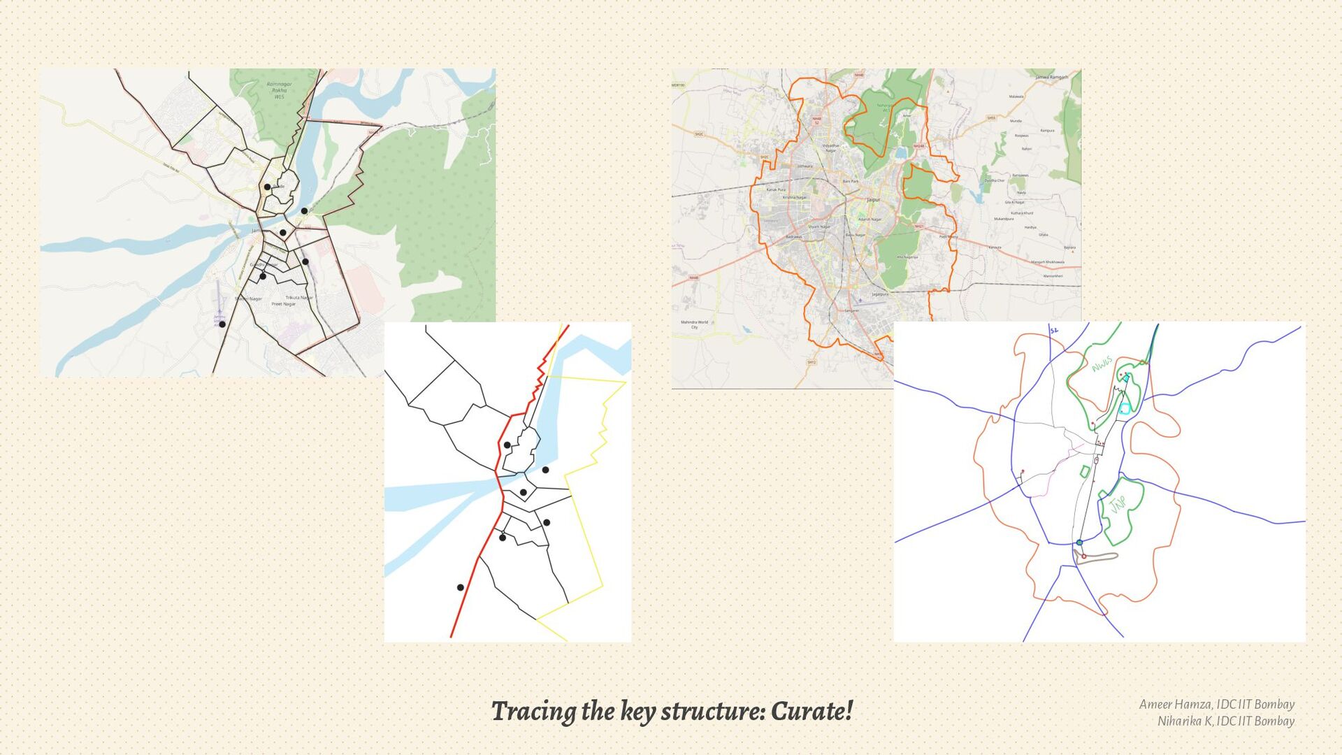
3. Trace relevant aspects
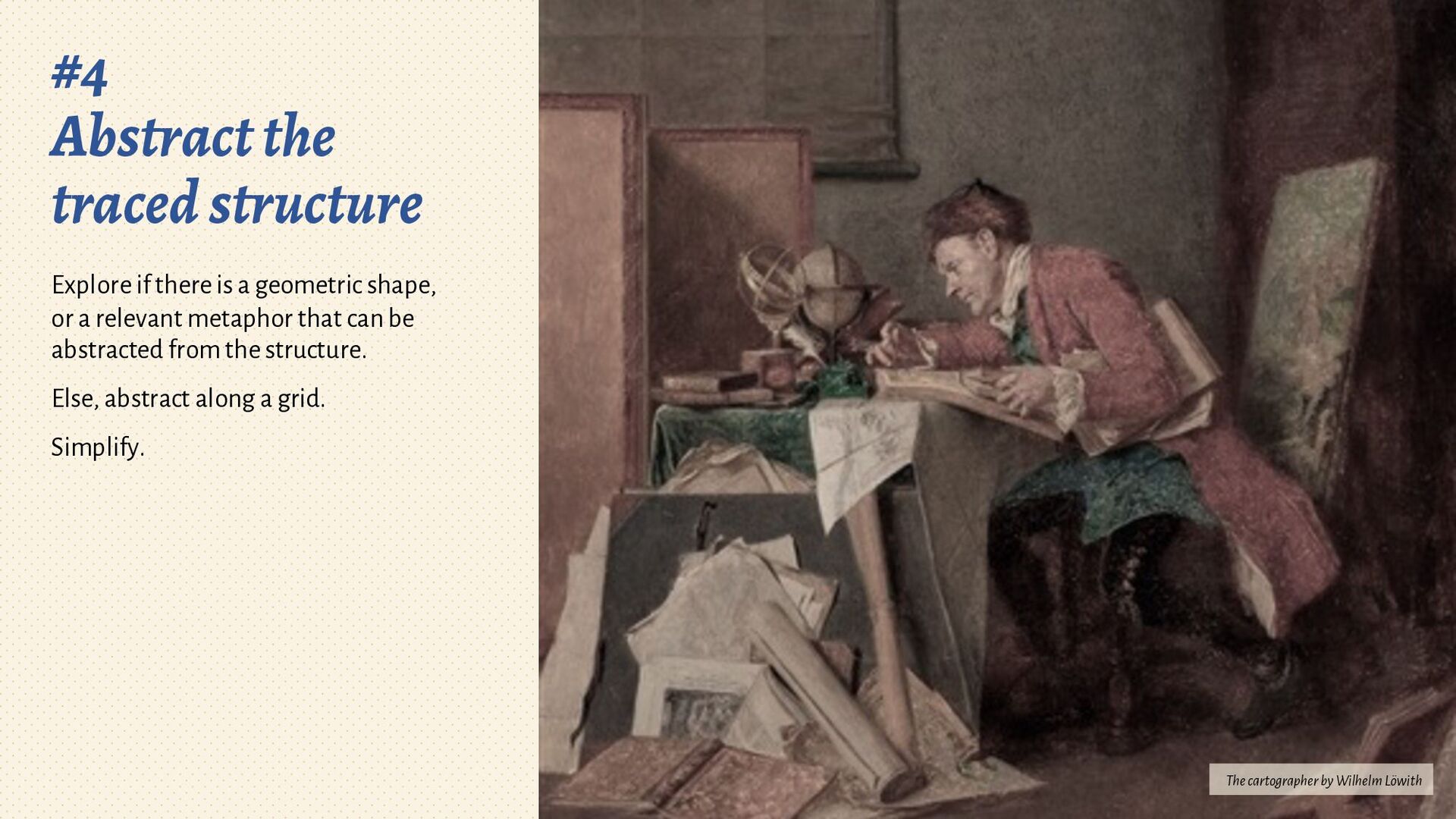
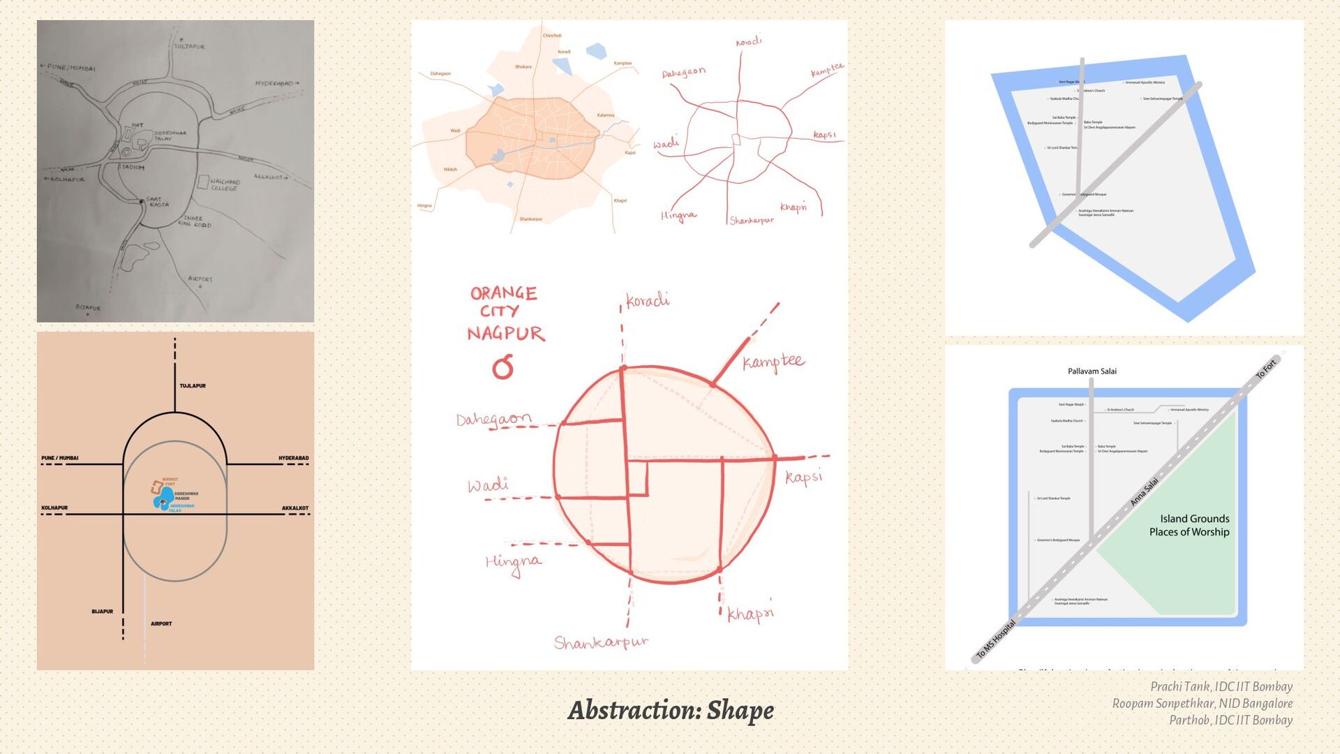
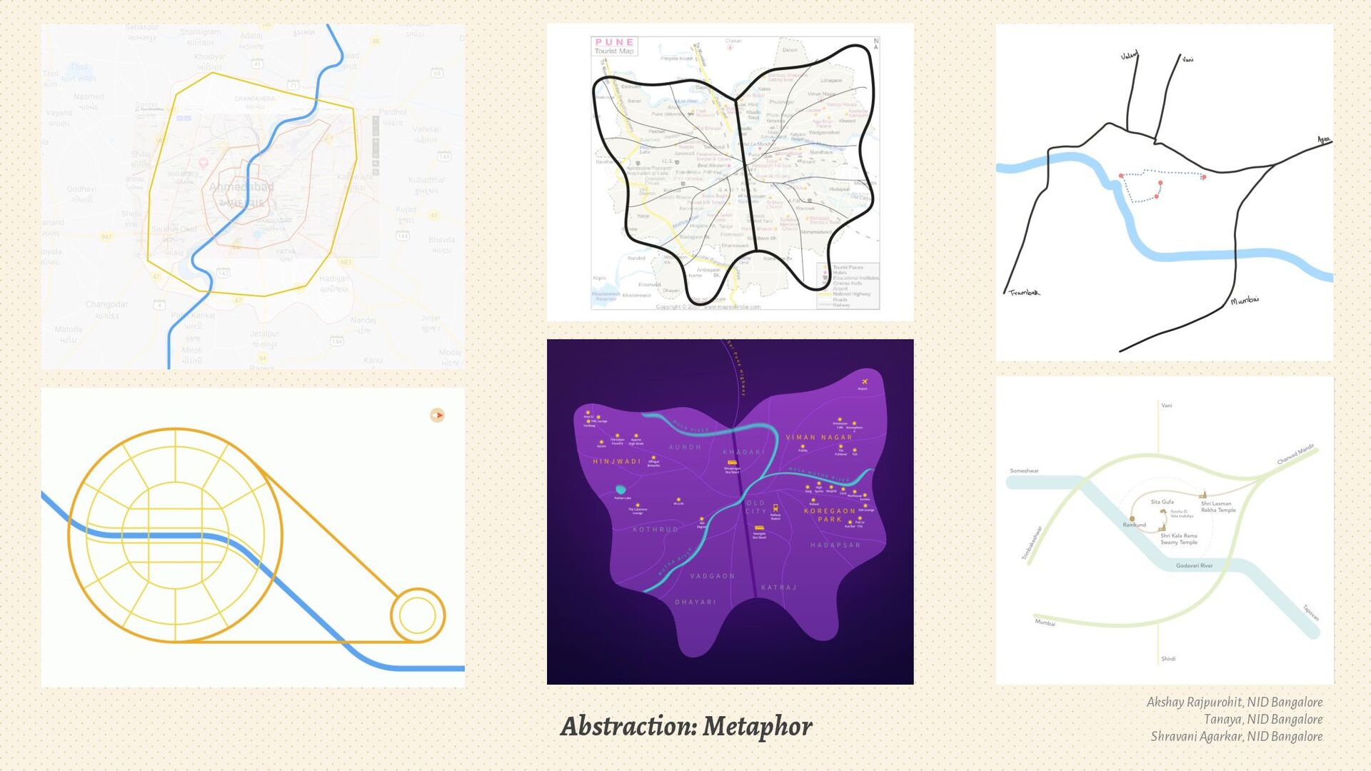
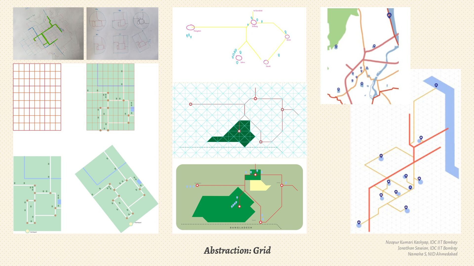
4. Abstraction: Grids, metaphors & geometric shapes
5. Simplification vs Minimal details
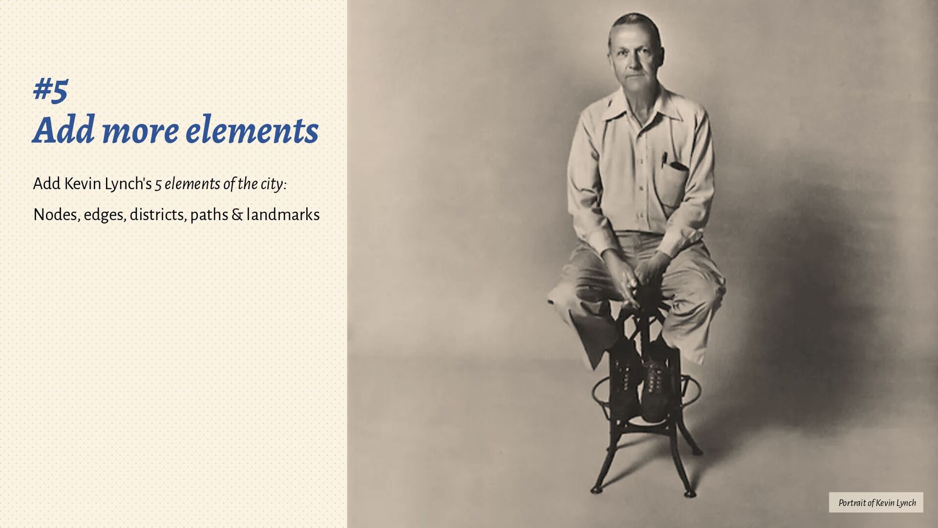
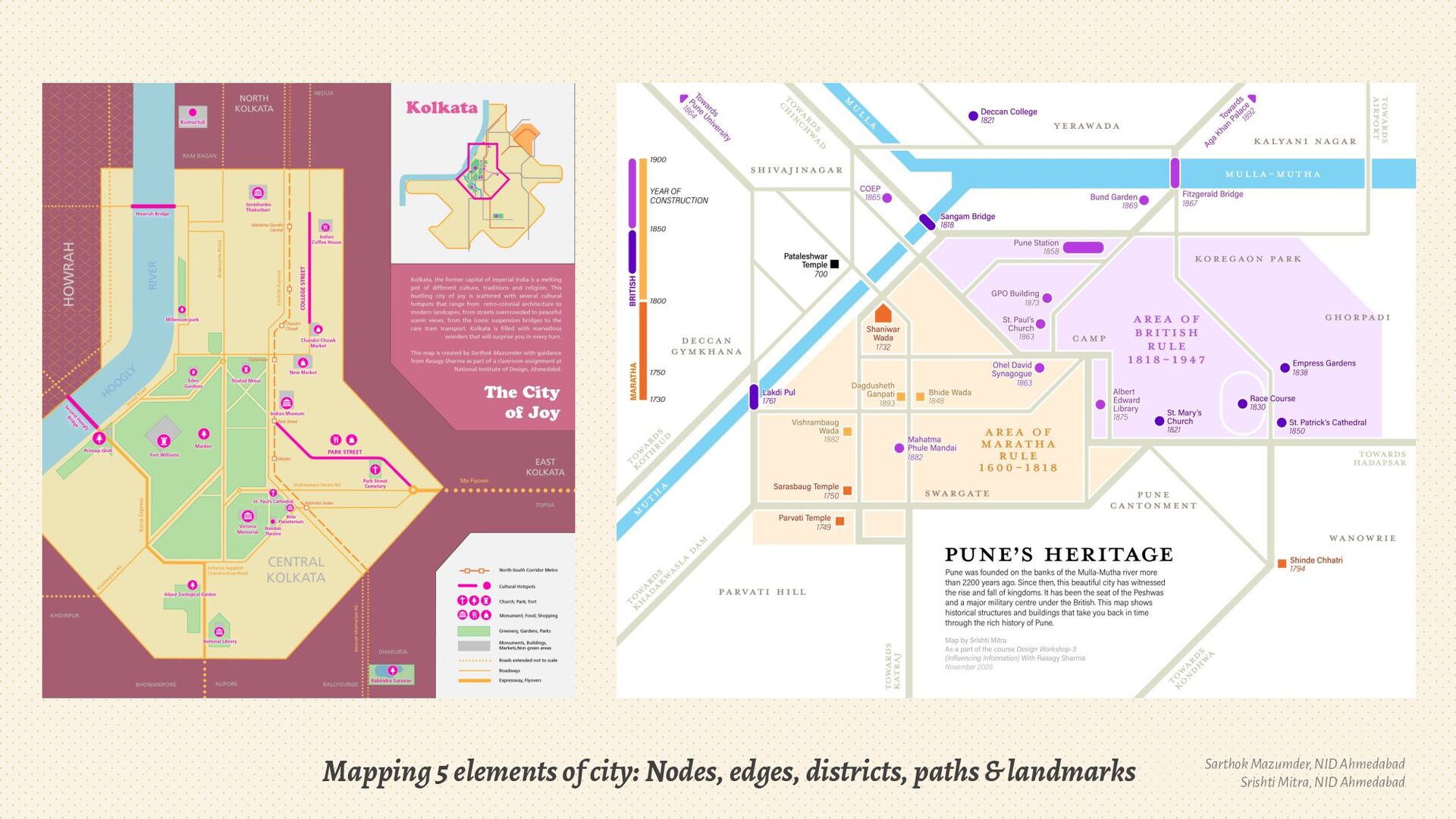
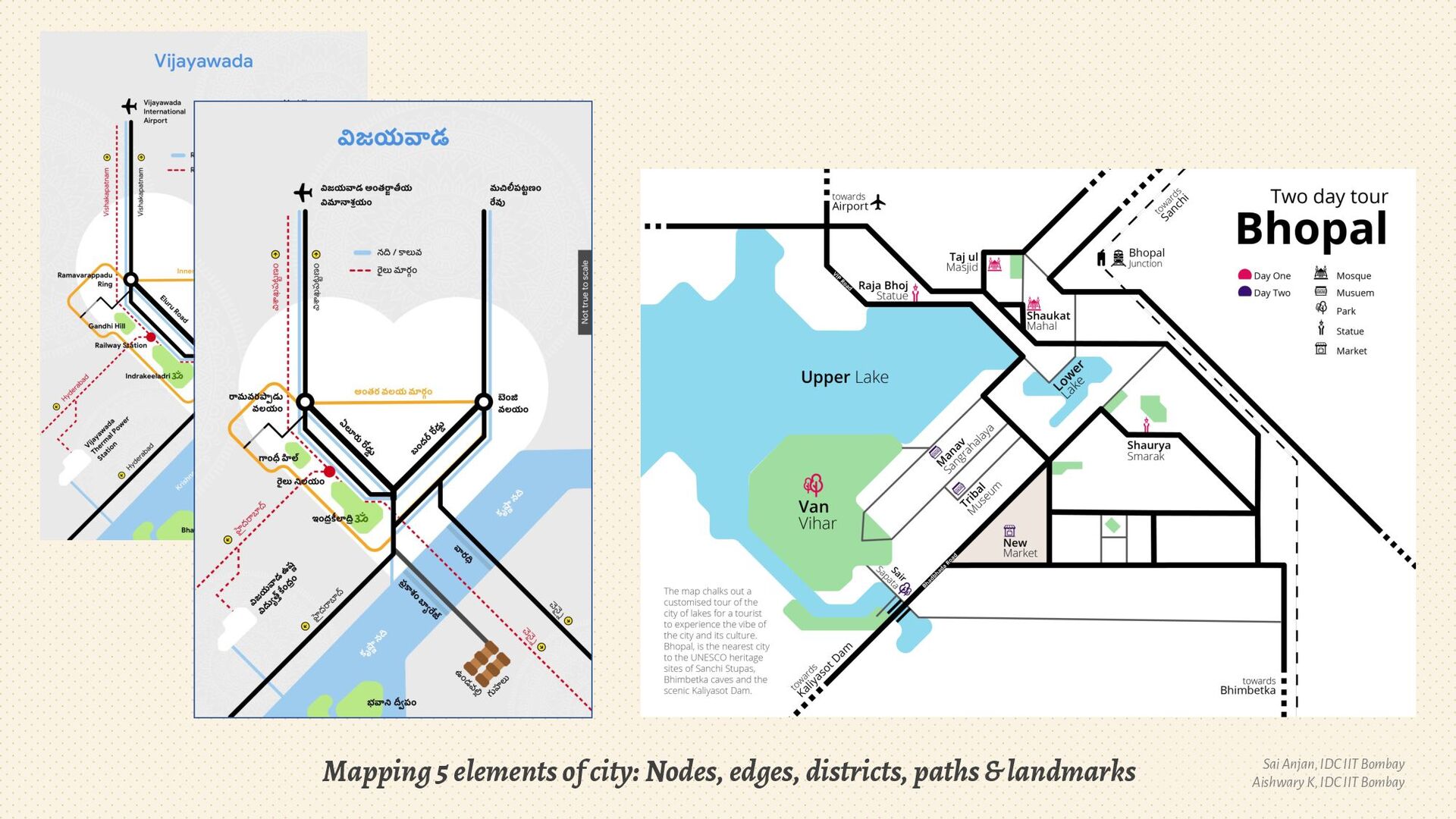
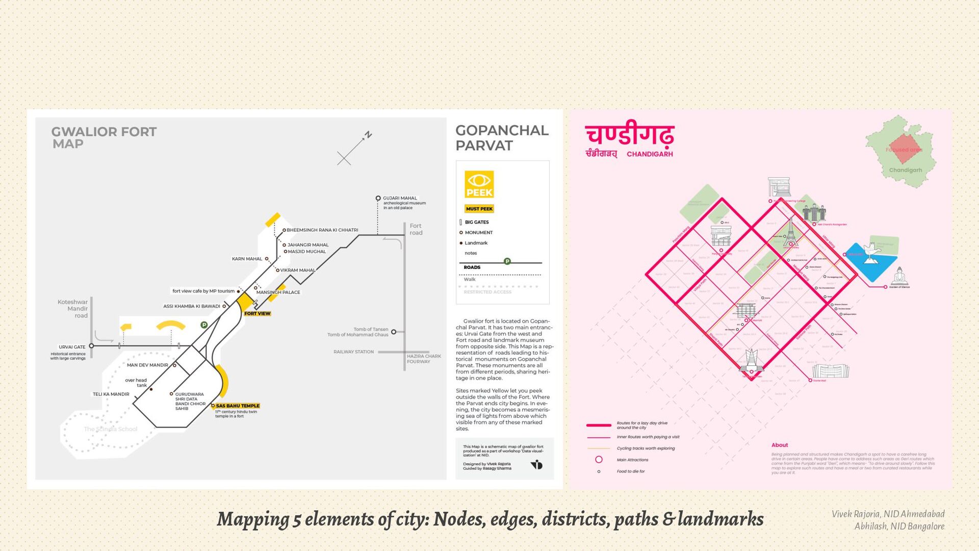
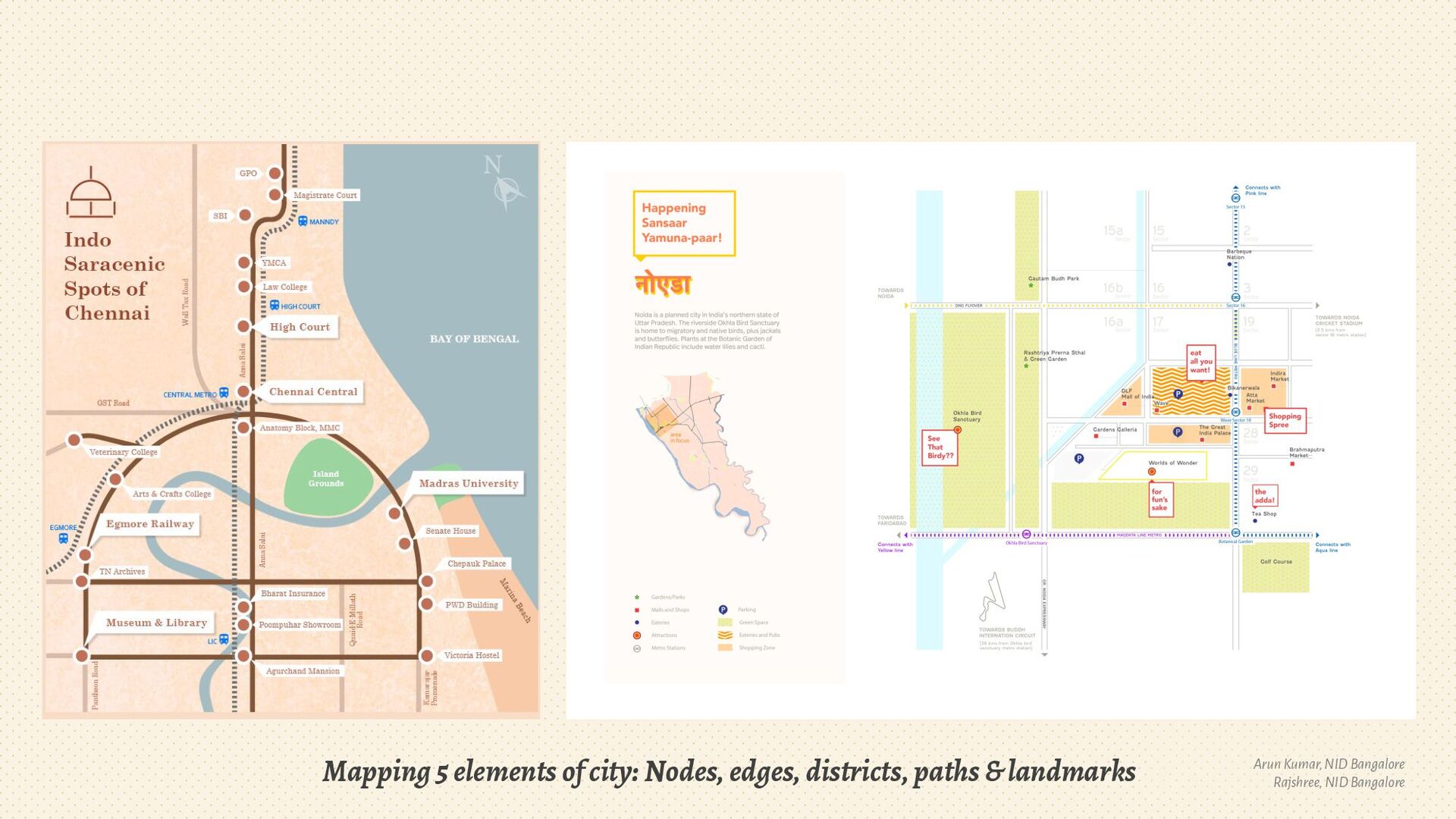
6. Elements of the city
7. Balance visual hierarchy
8. Focus on design details
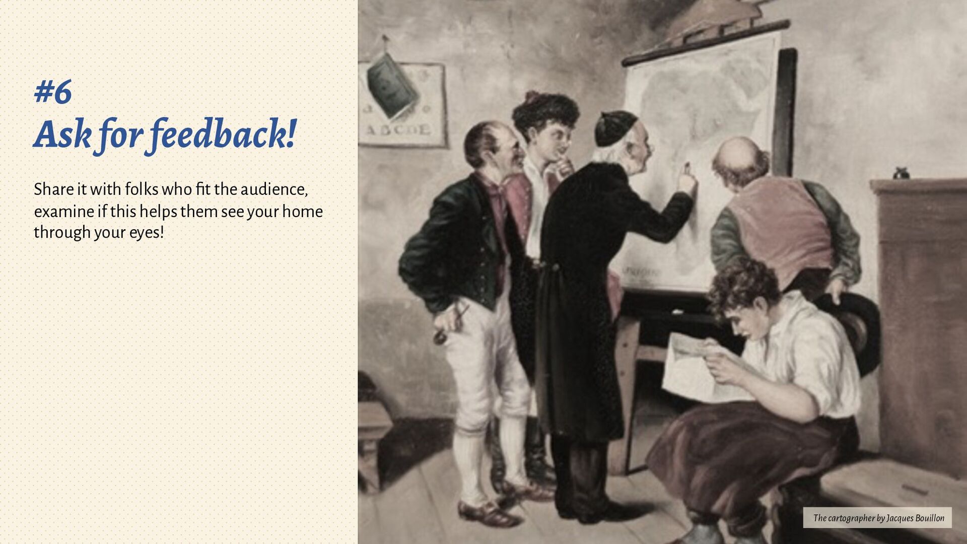
9. Share for feedback & iteration!

Rasagy Sharma

February 04, 2022
Tweet

More Decks by Rasagy Sharma

Other Decks in Design

Transcript

  1. Scheming against accurate maps Illustration from Daniel Crouch Rare Books

    Rasagy Sharma Information Designer, Data Artist & a compulsive Sketchnoter. @rasagy @data.n.coded
  2. © Mapbox © OpenStreetMap Delhi (17 yrs) Goa (4 yrs)

    Mysuru (3 mon) Bengaluru (3 yrs) Hyderabad (6 mon) Pune (1.5 yrs) Mumbai (3 mon)
  3. Delhi (17 yrs) Goa (4 yrs) Mysuru (3 mon) Hyderabad

    (6 mon) Mumbai (3 mon) Pune (1.5 yrs) © Mapbox © OpenStreetMap Bengaluru ❤ (3 yrs 8+yrs)
  4. What does the term map mean? Mapping data/information vs making

    a map: Verb vs noun As a noun: conceptual, geographic, schematic, contextual, fantasy…
  5. Mapping maps Detailed (Lot of Geographical data) Abstract (Less/No Geographical

    data) Accurate & real Imaginary or conceptual Geographic maps Schematic maps Mind mapping Charts Fiction or Fantasy maps
  6. Harry Beck’s Tube map (1931 & 1933): Straighter lines, even

    distance, diagonals Images from Wikimedia
  7. ✨ Schematic hometown map ✨ Abhilash Kumar, NID Bangalore |

    Namaha S, NID Ahmedabad | Dhiraj Dethe, IDC IIT Bombay | Paridhi Yadav, NID Ahmedabad Sarthok Mazumder, NID Ahmedabad | Gyan Lakhwani, IDC IIT Bombay | Arun Kumar, NID Bangalore
  8. #1 Where, Who, Why Start by deciding where is the

    map of, who is it for, & why would they view it? Portrait of Abraham Ortelius in his study by Constant Aimé Marie Cap
  9. Where: Choosing the scale of the map, from city to

    a street Aishwary K, IDC IIT Bombay Sasha Cherian, NID Bangalore
  10. Who & Why: Finding your map’s audience & purpose Paridhi

    Yadav, NID Ahmedabad Arun Kumar, NID Bangalore ShravaniAgarkar, NID Bangalore
  11. #2 Mental model Without seeing the actual map, draw what’s

    most important to you. Thinking It Over by Thomas Waterman Wood
  12. Mental model vs actual locations: Discovering what matters Bhanvee Gupta,

    NID Bangalore Aarushi Shash, NID Ahmedabad ShravaniAgarkar, NID Bangalore
  13. #3 Trace the key structure Using a map (like OSM)

    for reference, trace the major roads, natural features, regions, places of interest… The Cartographer in His Study by Ludwig Gloss
  14. #4 Abstract the traced structure Explore if there is a

    geometric shape, or a relevant metaphor that can be abstracted from the structure. Else, abstract along a grid. Simplify. The cartographer by Wilhelm Löwith
  15. #5 Add more elements Add Kevin Lynch's 5 elements of

    the city: Nodes, edges, districts, paths & landmarks Portrait of Kevin Lynch
  16. Mapping 5 elements of city: Nodes, edges, districts, paths &

    landmarks SarthokMazumder, NID Ahmedabad Srishti Mitra, NID Ahmedabad
  17. Mapping 5 elements of city: Nodes, edges, districts, paths &

    landmarks Sai Anjan, IDC IIT Bombay Aishwary K, IDC IIT Bombay
  18. Mapping 5 elements of city: Nodes, edges, districts, paths &

    landmarks Vivek Rajoria, NID Ahmedabad Abhilash, NID Bangalore
  19. Mapping 5 elements of city: Nodes, edges, districts, paths &

    landmarks Arun Kumar, NID Bangalore Rajshree, NID Bangalore
  20. #6 Ask for feedback! Share it with folks who fit

    the audience, examine if this helps them see your home through your eyes! The cartographer by Jacques Bouillon
  21. 🙏 Rasagy Sharma @rasagy rasagy.in @data.n.coded Thanks to Prof. Venkatesh

    Rajamanickam (IDC, IIT Bombay), Prof. Chakradhar Saswade (NID Bangalore) & Arun Ganesh (Mapbox).