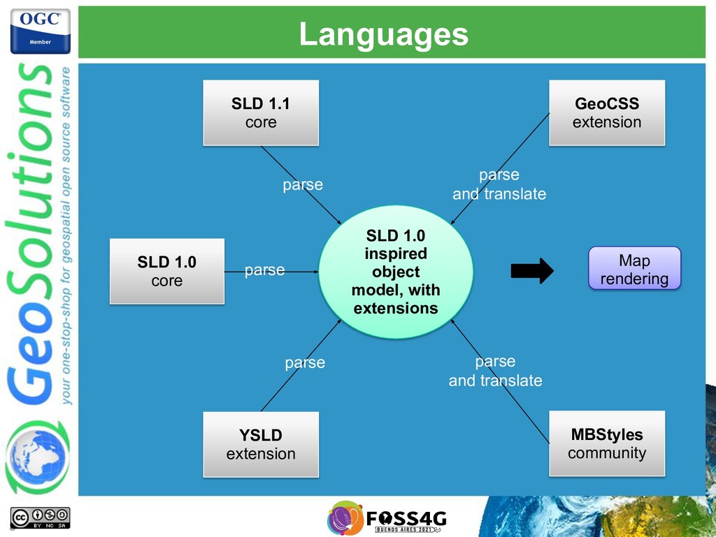
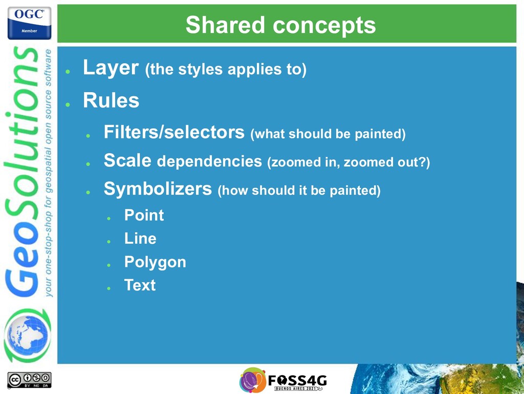
The presentation aims to provide attendees with enough information to master GeoServer styling documents and most of GeoServer extensions to generate appealing, informative, readable maps that can be quickly rendered on screen. Examples will be provided from the OSM data directory GeoSolutions shared with the community.
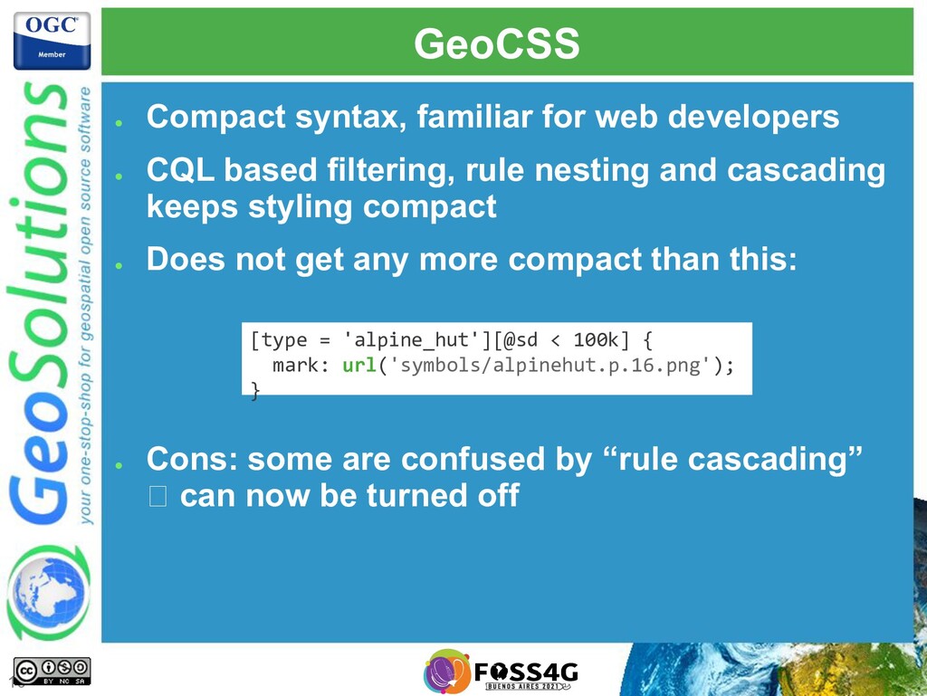
![Simple image [type = 'alpine_hut'][@sd < 100k] { mark: url('symbols/alpinehut.p.16.png');](https://files.speakerdeck.com/presentations/5ca5c7d71b024a1890e99e355ef3c6cb/slide_20.jpg)
![Marks (SVG in this case) [type = 'bank'][@sd < 6k]](https://files.speakerdeck.com/presentations/5ca5c7d71b024a1890e99e355ef3c6cb/slide_21.jpg)
![Marks composition and override [type = 'fountain’] { [@sd <](https://files.speakerdeck.com/presentations/5ca5c7d71b024a1890e99e355ef3c6cb/slide_22.jpg)
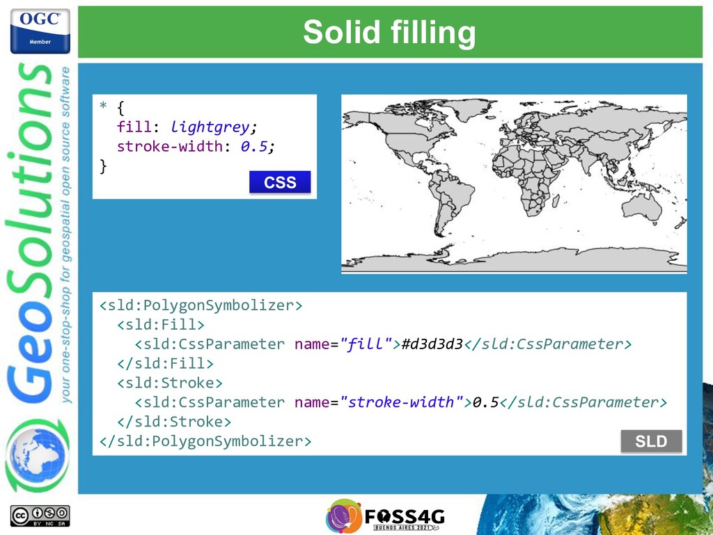
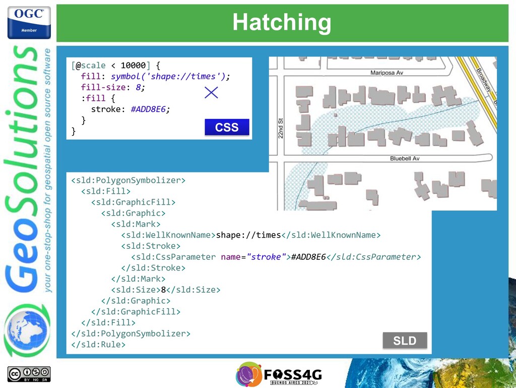
![Solid fills and repeating images fill [@sd < 800k][type in](https://files.speakerdeck.com/presentations/5ca5c7d71b024a1890e99e355ef3c6cb/slide_26.jpg)
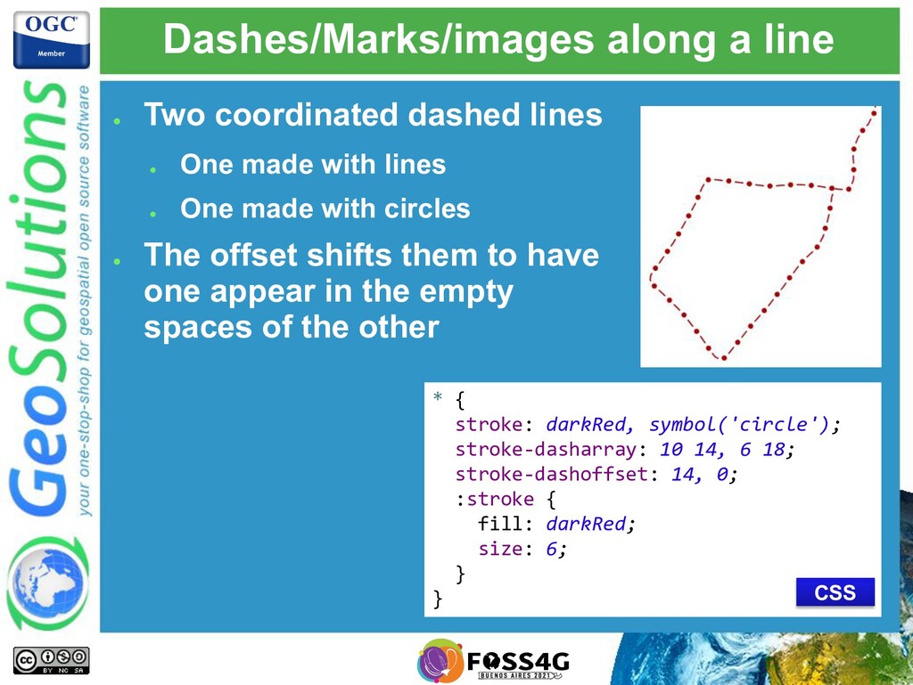
![Solid lines (OSM admin borders) [type = 'administrative'] { [admin_level](https://files.speakerdeck.com/presentations/5ca5c7d71b024a1890e99e355ef3c6cb/slide_29.jpg)
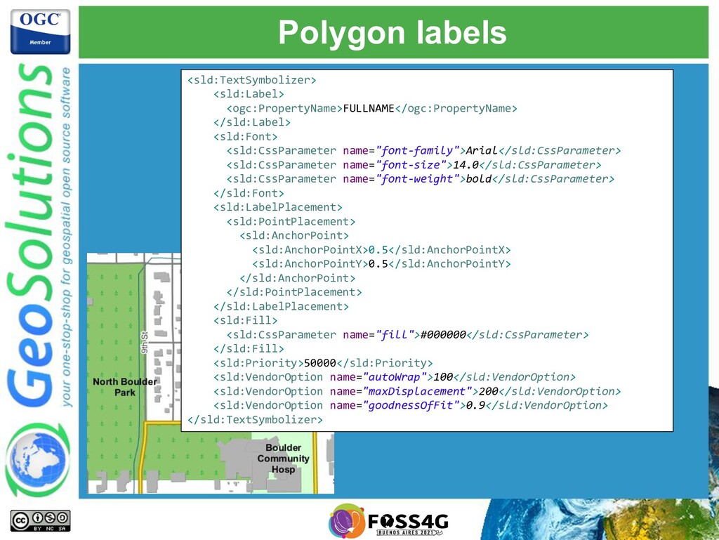
![Point labels and obstacles [@sd < 200k] { label: [FULLNAME];](https://files.speakerdeck.com/presentations/5ca5c7d71b024a1890e99e355ef3c6cb/slide_34.jpg)
![Line labels [@sd < 200k] { label: [LABEL_NAME]; font-fill: #000000;](https://files.speakerdeck.com/presentations/5ca5c7d71b024a1890e99e355ef3c6cb/slide_35.jpg)
![Z ordering http://docs.geoserver.org/latest/en/user/styling/sld- extensions/z-order/example.html [class = 'motorways'] { stroke: #990000,](https://files.speakerdeck.com/presentations/5ca5c7d71b024a1890e99e355ef3c6cb/slide_41.jpg)
![Geometry transformations [@scale < 10000] { fill-geometry: [offset(the_geom, 6, -6)];](https://files.speakerdeck.com/presentations/5ca5c7d71b024a1890e99e355ef3c6cb/slide_42.jpg)
![That’s all folks! Questions? [email protected] 51](https://files.speakerdeck.com/presentations/5ca5c7d71b024a1890e99e355ef3c6cb/slide_50.jpg)