Upgrade to Pro — share decks privately, control downloads, hide ads and more …

One GeoNode, Many GeoNode

Simone Giannecchini
August 17, 2018
1.1k

One GeoNode, Many GeoNode

This presentations provides an introduction to the GeoNode framework and the continues with examples of how GeoNode can be used to created custom projects to support geospatial needs.

Simone Giannecchini

August 17, 2018
Tweet

Transcript

  1. Quick Facts ⚫ Founded in late 2006 ⚫ Expertise •

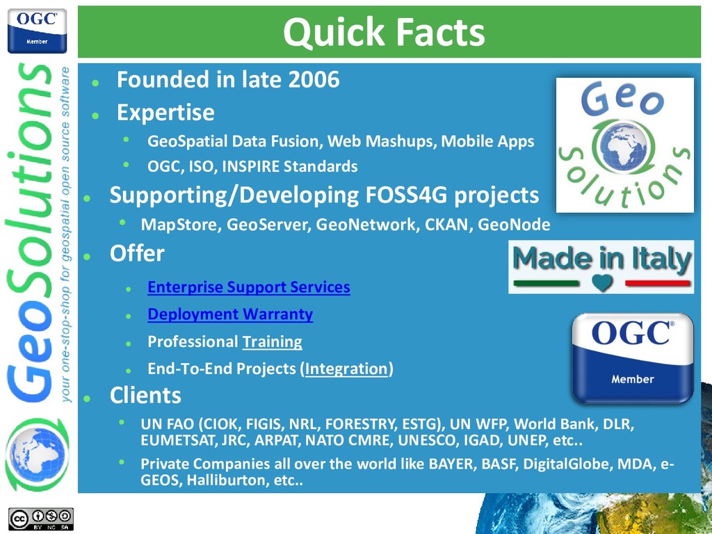
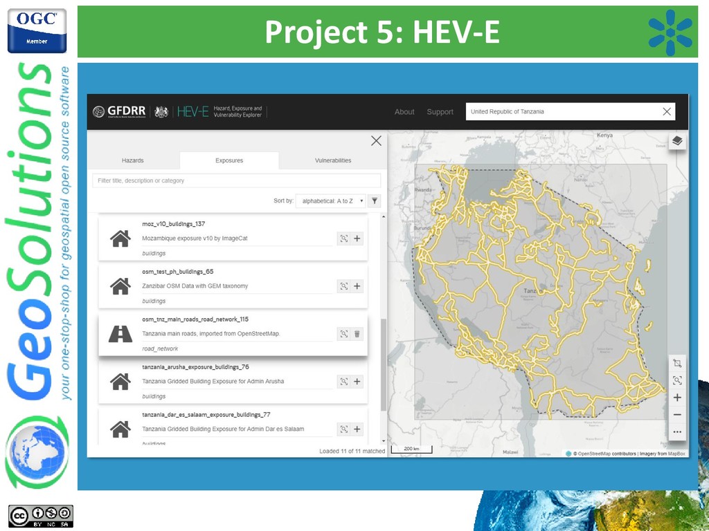
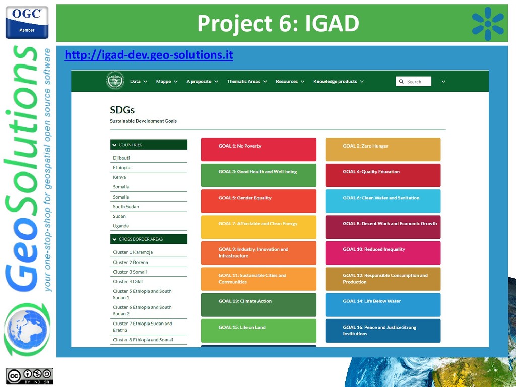
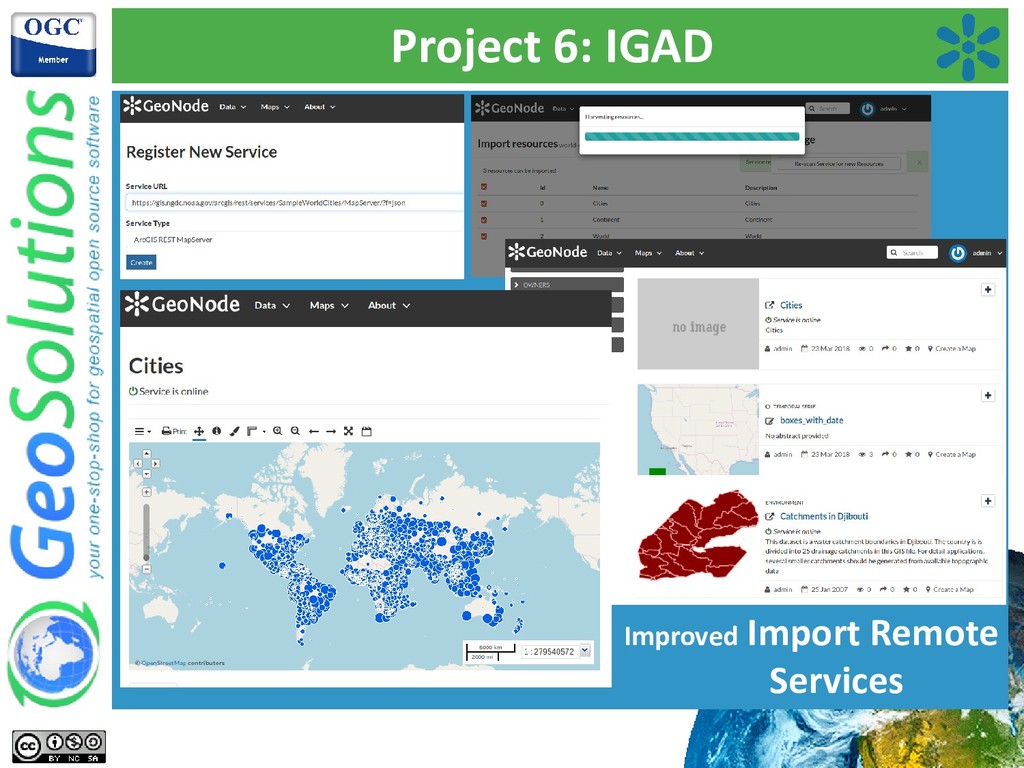
    GeoSpatial Data Fusion, Web Mashups, Mobile Apps • OGC, ISO, INSPIRE Standards ⚫ Supporting/Developing FOSS4G projects • MapStore, GeoServer, GeoNetwork, CKAN, GeoNode ⚫ Offer ⚫ Enterprise Support Services ⚫ Deployment Warranty ⚫ Professional Training ⚫ End-To-End Projects (Integration) ⚫ Clients • UN FAO (CIOK, FIGIS, NRL, FORESTRY, ESTG), UN WFP, World Bank, DLR, EUMETSAT, JRC, ARPAT, NATO CMRE, UNESCO, IGAD, UNEP, etc.. • Private Companies all over the world like BAYER, BASF, DigitalGlobe, MDA, e- GEOS, Halliburton, etc..
  2. Creating Downstream Applications • GeoNode cannot address all use cases

    • Avoid reinventing the wheel • Avoid implicit/explicit forks → Custom GeoNode Applications to the rescue! • A proper “GeoNode Project”: • Start from a template (geonode-project) • Generate a “materialized” Django project • It extends the “vanilla” GeoNode • It provides a custom Django app • It addresses specific use cases • You develop something of general interest? • Donate back to Core GeoNode!
  3. Creating Downstream Applications This approach offers several opportunities • Customize

    GeoNode look and feel • Extend its models without modifying GeoNode Core • Extend its functionalities without modifying GeoNode Core • Define a brand new end user interface This approach allows us to • make the most out of what GeoNode core offers • without sacrificing versatility • without sacrificing specific project needs It’s doable, we did it (or at least we tried to ☺ ) Hold tight, awesome examples next!
  4. Project 1: C-READ • Caribbean Community Climate Change Centre –

    C-READ (Regional Environment and Atmospheric Data) • Development and Installation of a Database Management System for a Regional Integrated Observing Network for Environmental Change in the Wider Caribbean • Ingest, to provide functionalities to preprocess, transform, load and refine the data that needs to be ingested into the system for later reuse • Discover, in order to allow external and internal players to search for data and information for later access and fusion • Access, to support the dissemination of data and information both in raw form as well as in more sophisticated forms like portrayals, reports and maps (superimpositions of multiple portrayals of raw data) • Fuse, to provide advanced geoprocessing functionalities to extract higher level information from the data and information managed by the data warehouse • http://c-read.net
  5. Project 2: Risk Analysis Tools • WB-GFDRR Project - Design

    and Implementation of Risk Management Modules to the Afghanistan Disaster Risk GeoNode • Risk Management and Cost Benfit Analysis Modules • Fill Afg gvt information gap on hazards by a multi-peril risk assessment and cost-benefit analysis covering the entire country • Extend GeoNode with modules able to easy the access to all this amount of analysis in a way that people can easily recognize • Create flexible/extensible modules to present different types of Cost Benefit Analysis • http://disasterrisk.af
  6. Project 3: UNESCO IHP-WINS • UNESCO Project - Water Information

    Network System by the International Hydrological Programme of UNESCO • Enable a publishing workflow for spatial Layers • Give real powers to Group Managers • Isolate GeoNode Groups private data • Each dataset must be approved by an editor before it can become public • Improve the contributors experience • Introduce the possibility of uploading KMZ and Temporal Series • Improve the integration with external Desktop GIS clients, and allow people to upload SLDs from external resources • http://ihp-wins.unesco.org
  7. Project 4: DECATASTROPHIZE • EU Project • “Towards Better Protection

    of Citizens against Disaster Risks: Strengthening Early Warning Systems in Europe” • 3 Phases Approach to Emergency Preparedness • Early Warning & Alert • Impact Assessment • Emergency Management • GeoNode Custom Application • Various GeoNode Enhancements • Various GeoNode Extensions • http://decat.geo-solutions.it
  8. DECATASTROPHIZE – Early Warning • Early Warning • Collect Alerts

    for potential disasters • Promote to disaster when confirmed • Early Warning Module (front-end and back-end) • Single Page Front-End (based on MapStore) • Custom Back-End
  9. DECATASTROPHIZE – Impact Assessment Early Warning Confirmed as Disaster Add

    Disaster Impact Model Run Create the COP as a GeoNode Map Share the COP with Emergency Managers • Impact Assessment • Upload of disaster models runs • Create Update COP for Emergency Managers
  10. DECATASTROPHIZE • Emergency Management → coordinate field interventions • Use

    Impact Assessment COP as back-end layers • Collaborative Map Annotations Module (front-end and back-end)
  11. Project 5: HEV-E • GFDRR and UK Department for International

    Development • “Hazards, Exposures and Vulnerabilities Explorer” • Explore, preview and download risk related global data • Hazards (British Geological Survey) • Exposures (GEM) • Vulnerabilities (University College London) • GeoNode Custom Application • Custom API + GeoNode API • Custom frontend (REST API)
  12. Project 6: IGAD • Intergovernmental Authority on Drought and Development

    and Biodiversity • “An integrated geoportal for IGAD’s and Biodiversity Development Program resources” • Thematic Data and Document catalog • Thematic areas categorization • Data management by country and cross border areas • Harvesting and remote services hub • GeoNode Custom Application • Custom template and models • Extended remote services (WMS, GeoNode, ArcGIS REST) • Metadata harvesting from GeoNode remote instances
  13. The Future: Docker Our current and future needs: • Development

    and Deployment of multiple different GeoNode projects. • On premise and on cloud instances management and monitoring • Continuous Delivery and Continuous Deployment requirements • HA and Failover
  14. The Future: Docker GeoNode’s stack containerization is helping in managing

    complex deployments and streamlining DevOps activities. We are testing Docker images and settings layout as defined in upstream GitHub repositories. Our use cases (e.g. World Bank GeoNode instances) are giving us the opportunity to • stress the Docker approach • improve it • bring back to the community. Rancher will be our next step
  15. The Future: Single Page Front-End We experienced that custom end

    user frontends and APIs are often required. We are seeking to: • design a replicable and versatile approach to implement custom frontends • extend and enhance GeoNode’s APIs, both as exposed methods and API architecture • enhance the geonode-project approach We think the next GeoNode should be a modular framework to easily adopt / adapt it within the most disparate custom projects.