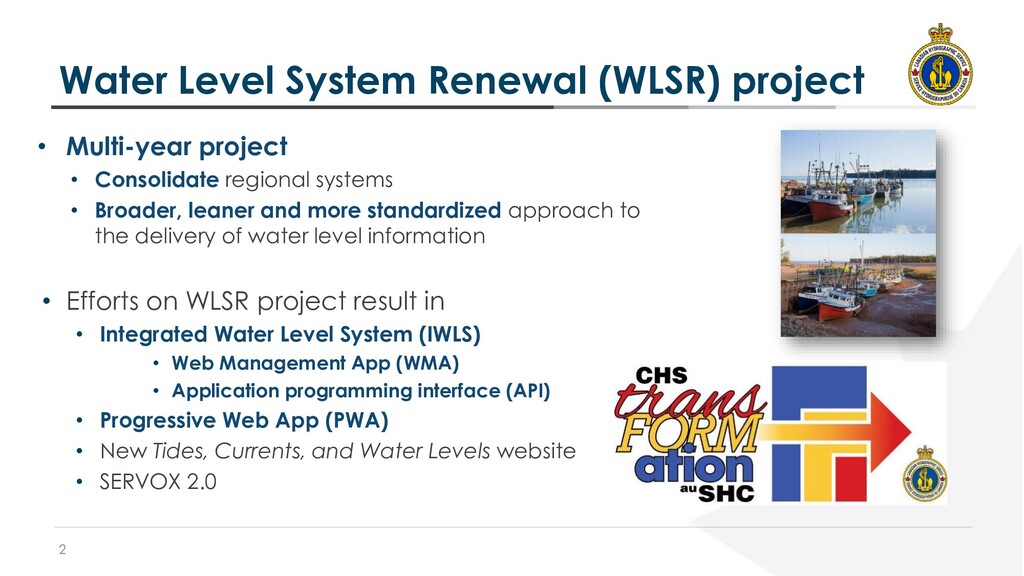
• Consolidate regional systems • Broader, leaner and more standardized approach to the delivery of water level information • Efforts on WLSR project result in • Integrated Water Level System (IWLS) • Web Management App (WMA) • Application programming interface (API) • Progressive Web App (PWA) • New Tides, Currents, and Water Levels website • SERVOX 2.0
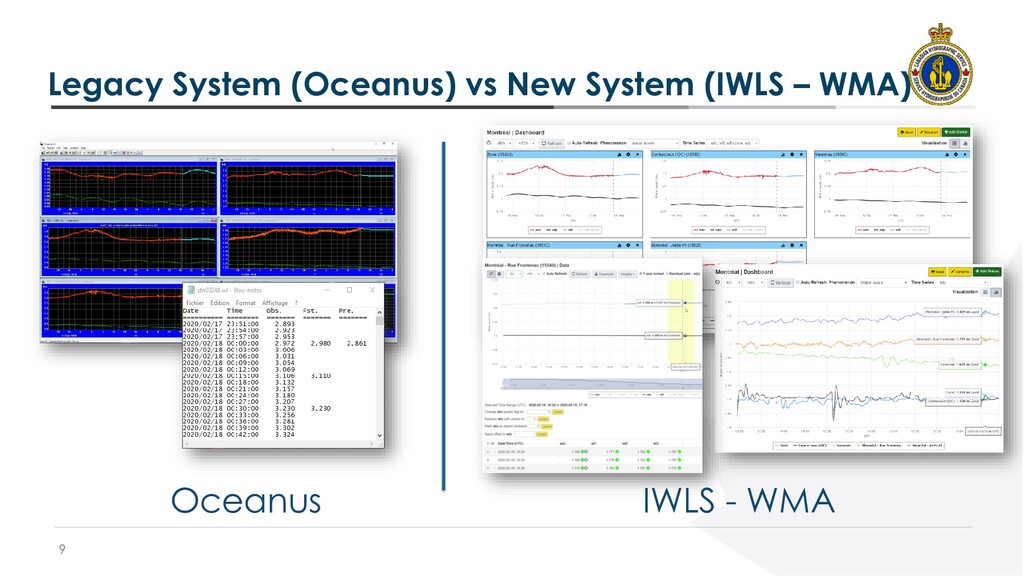
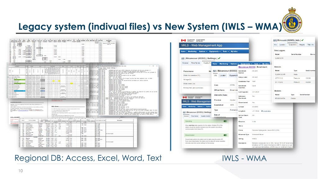
the way that Water Level data is managed across all CHS regions • Gather data and metadata in a central database to avoid data duplication • Enable efficient real-time quality control • Rationalize the number of applications related to Water Levels • Allow decommissioning of 15+ legacy applications + 6 regional databases
control parameters using the Web Management App (WMA). • Ease, Democratize and Promote the usage of official value through a single standardized Web API • Meet the demands of a modern navigational community
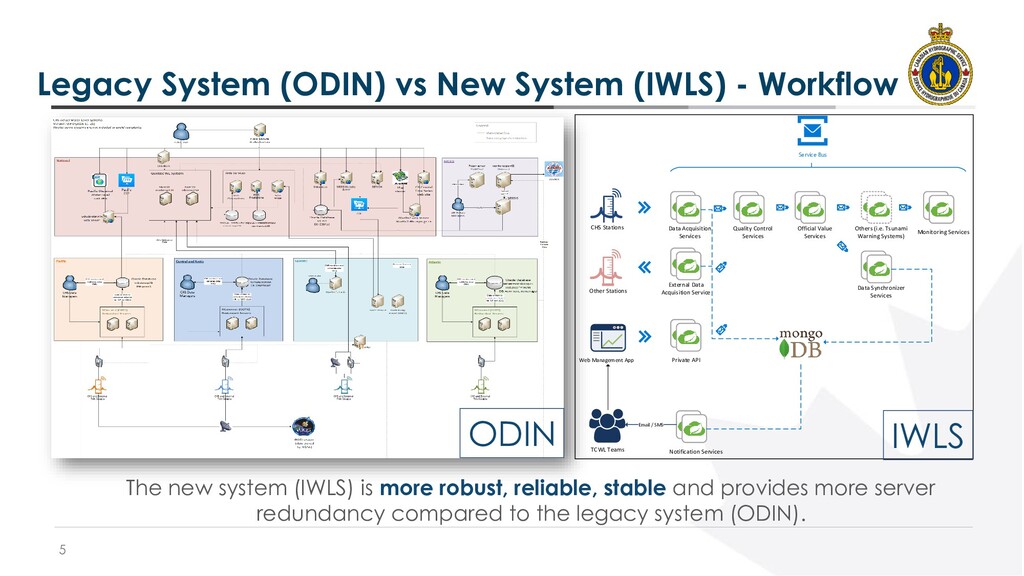
CHS Stations Quality Control Services Monitoring Services Official Value Services Data Synchronizer Services Others (i.e. Tsunami Warning Systems) Data Acquisition Services Web Management App Notification Services TCWL Teams Email / SMS External Data Acquisition Service Other Stations Service Bus Private API ODIN IWLS The new system (IWLS) is more robust, reliable, stable and provides more server redundancy compared to the legacy system (ODIN).
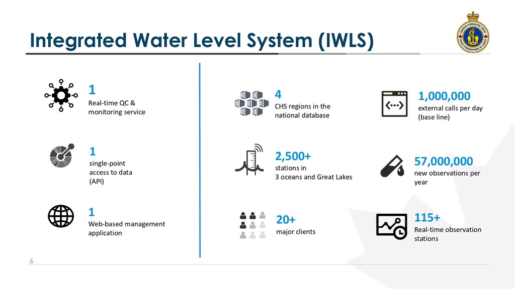
monitoring service 1 single-point access to data (API) 1 Web-based management application 57,000,000 new observations per year 1,000,000 external calls per day (base line) 20+ major clients 4 CHS regions in the national database 2,500+ stations in 3 oceans and Great Lakes 115+ Real-time observation stations
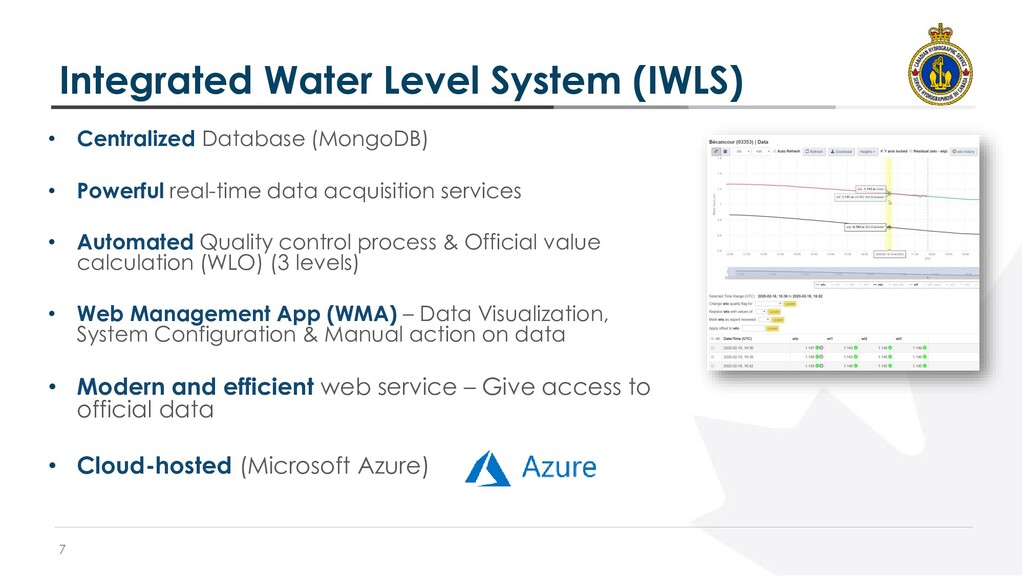
• Powerful real-time data acquisition services • Automated Quality control process & Official value calculation (WLO) (3 levels) • Web Management App (WMA) – Data Visualization, System Configuration & Manual action on data • Modern and efficient web service – Give access to official data • Cloud-hosted (Microsoft Azure)
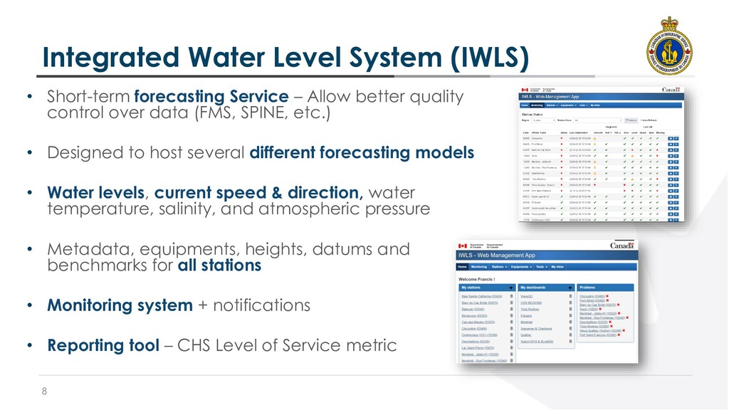
– Allow better quality control over data (FMS, SPINE, etc.) • Designed to host several different forecasting models • Water levels, current speed & direction, water temperature, salinity, and atmospheric pressure • Metadata, equipments, heights, datums and benchmarks for all stations • Monitoring system + notifications • Reporting tool – CHS Level of Service metric
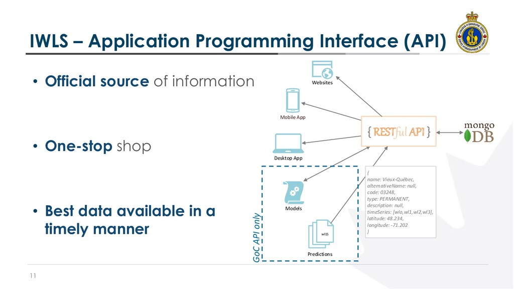
Mobile App { RESTful API } Websites Predictions wl15 { name: Vieux-Québec, alternativeName: null, code: 03248, type: PERMANENT, description: null, timeSeries: [wlo,wl1,wl2,wl3], latitude: 48.234, longitude: -71.202 } GoC API only • Official source of information • One-stop shop • Best data available in a timely manner
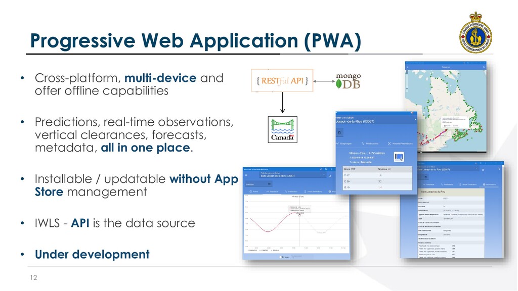
offline capabilities • Predictions, real-time observations, vertical clearances, forecasts, metadata, all in one place. • Installable / updatable without App Store management • IWLS - API is the data source • Under development
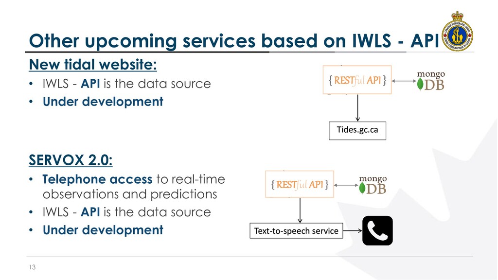
tidal website: • IWLS - API is the data source • Under development SERVOX 2.0: • Telephone access to real-time observations and predictions • IWLS - API is the data source • Under development Tides.gc.ca Text-to-speech service
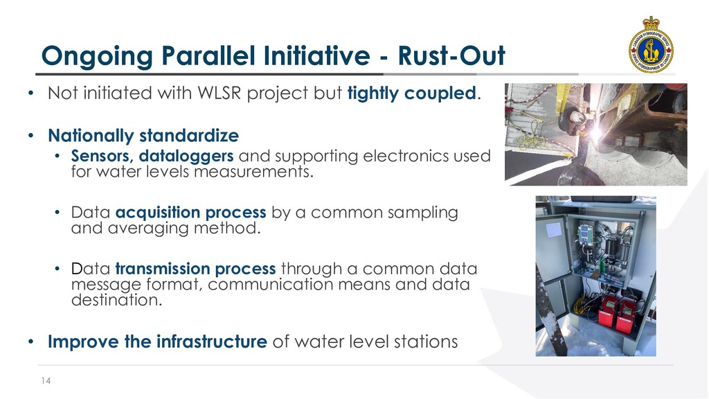
WLSR project but tightly coupled. • Nationally standardize • Sensors, dataloggers and supporting electronics used for water levels measurements. • Data acquisition process by a common sampling and averaging method. • Data transmission process through a common data message format, communication means and data destination. • Improve the infrastructure of water level stations
Dynamic prediction calculations • Public dissemination of the API to end-users • New PWA for field visit and elevation data management • Datum conversion (on the fly) • Tsunami detection algorithm • And many more! • Continue development of PWA, Website and SERVOX 2.0 • Parallel operation of the old system (ODIN) and the new system (IWLS) • Gradually decommissioning obsolete applications


 maltzj
 lindahogenes
 tonyrice
 rasagy
 rkendrick25
 techseoconnect
 eileencodes
 mfonobong
 geoffreycrofte
 chriscoyier
 sabderemane
 aleyda