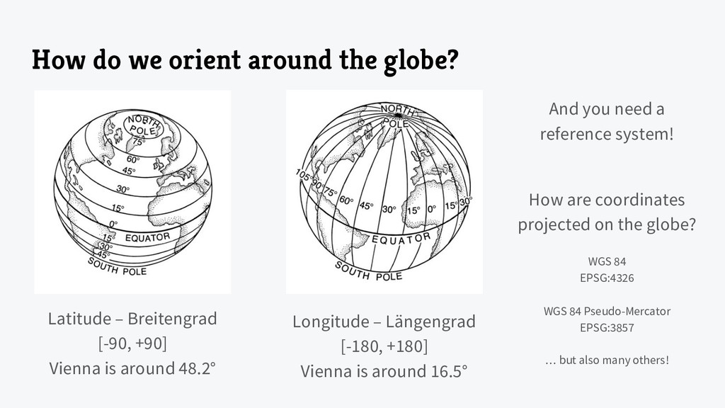
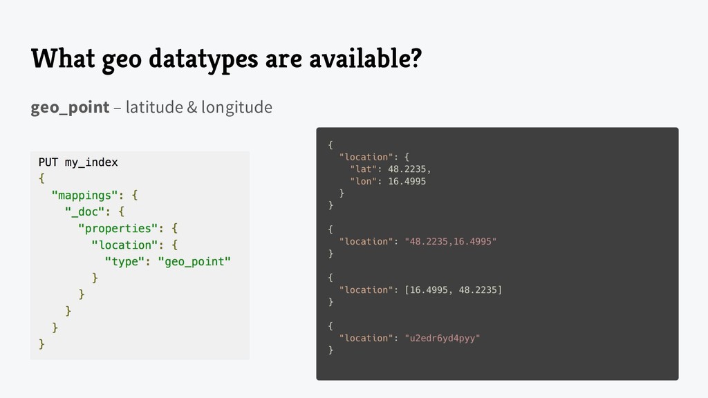
[-90, +90] Vienna is around 48.2° Longitude – Längengrad [-180, +180] Vienna is around 16.5° And you need a reference system! How are coordinates projected on the globe? WGS 84 EPSG:4326 WGS 84 Pseudo-Mercator EPSG:3857 … but also many others!
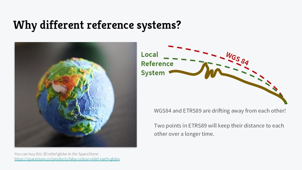
globe in the SpaceStore: https://spacestore.co/products/false-colour-relief-earth-globe WGS 84 Local Reference System WGS84 and ETRS89 are drifting away from each other! Two points in ETRS89 will keep their distance to each other over a longer time.
on a globe in WGS 84 • Point & Multi-Point LineString & Multi-LineString Polygon & Multi-Polygon (with support for holes) • Quite a lot of parameters for the mapping available, will be reduced to points_only in Elasticsearch 7 • Mostly used in queries to retrieve points inside a shape • But you might store shapes as bounding boxes ◦ If you store polygons from a GeoJSON object ◦ A shopping center must have a geo_point to map it, but also a polygon to query all shops inside
the underlying Lucene index can handle numeric datatypes ◦ Lucene 6.0 introduced geo-spatial data structures ◦ Indexing ▪ <= 2.x Term-based encoding of points ▪ >= 5.x in a far more efficient Bdk-Tree ◦ “The Evolution of Numeric Range Filters in Apache Lucene” https://www.elastic.co/blog/apache-lucene-numeric-filters ◦ “Numeric and Date Ranges in Elasticsearch: Just Another Brick in the Wall” https://www.elastic.co/blog/numeric-and-date-ranges-in-elasticsearch-just-another-brick-in-the-wall • 7.x will further optimize geo shape indexing ◦ Look at the “The State of Geo in Elasticsearch” Elastic{ON} talk https://www.elastic.co/elasticon/conf/2018/sf/the-state-of-geo-in-elasticsearch
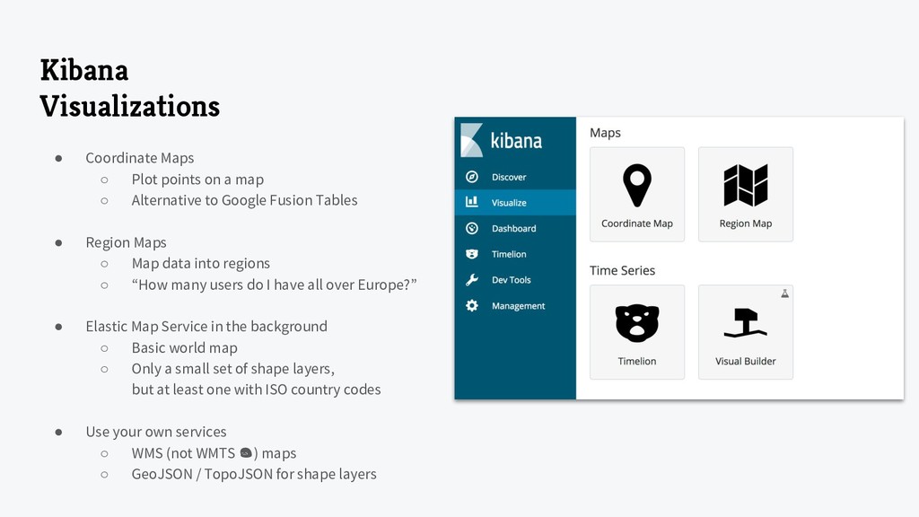
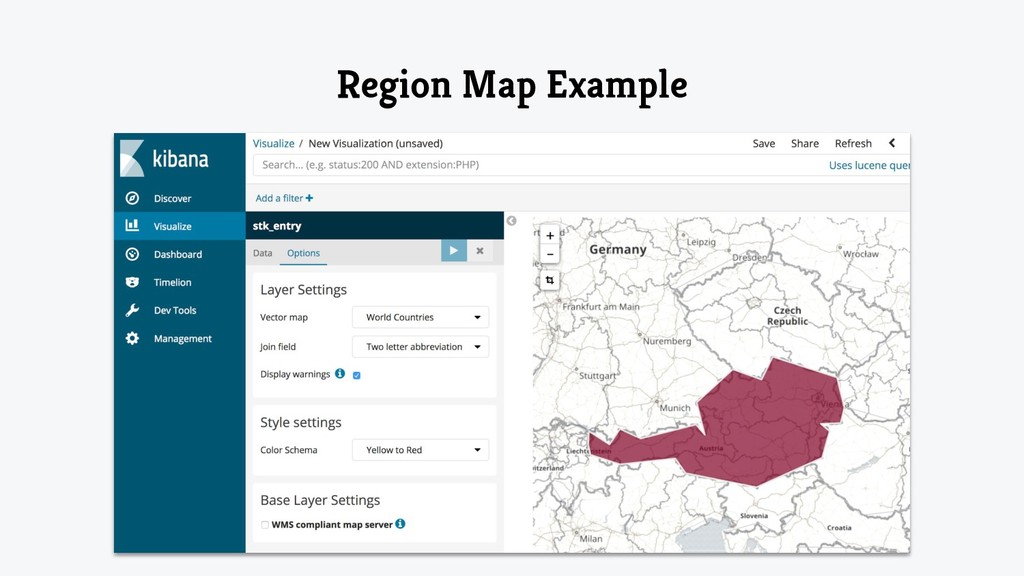
map ◦ Alternative to Google Fusion Tables • Region Maps ◦ Map data into regions ◦ “How many users do I have all over Europe?” • Elastic Map Service in the background ◦ Basic world map ◦ Only a small set of shape layers, but at least one with ISO country codes • Use your own services ◦ WMS (not WMTS ) maps ◦ GeoJSON / TopoJSON for shape layers
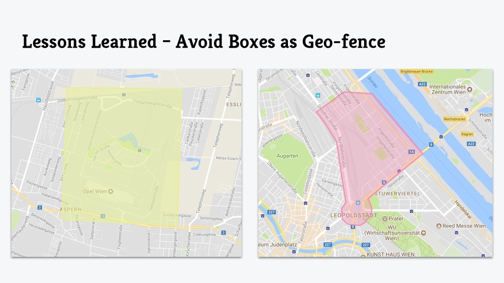
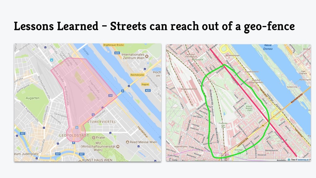
tool to limit visibility of geo-based data ◦ Seestadt-Admins should only see streets in the Seestadt geo-fence ◦ Users reporting incorrect data via the bot should only see suggestions from their neighborhood • Defined as geo_shape polygon ◦ You can even use holes (Vienna vs. Lower Austria) ◦ If the Seestadt grows, just increase the geo-fence to the new areas • Stick to one single definition standard ◦ Counterclockwise oriented definition of the polygon ◦ Closed polygon whose first and last point must match
valid and standardized addresses ◦ Währinger Straße – Währingerstrasse – Währingerstraße ◦ Autocomplete all address inputs • Addresses are managed by municipals (Gemeinden) ◦ Open Data: „Adressen Standorte Wien“ https://www.data.gv.at/katalog/dataset/1d5c2411-9719-4c8f-b99d-57a5f4a4ae41 ◦ Public Sector Infomation: BEV “Österreichisches Adressregister” http://www.bev.gv.at/portal/page?_pageid=713,2170374&_dad=portal&_schema=PORTAL • Enables you to geo-code existing data ◦ Used in the StadtKatalog crawler to import Spar / Libro / dm
has exactly one ◦ Street Name ◦ ONR – Orientierungsnummer ▪ Simple number 1 or a range 1–7 ▪ „Stiegen“ are not consistent and can be defined by the owner • Can be assigned clockwise or counterclockwise • A / B / C • 1 / 2 / 3 • A2/ A3 / C1 / C2 • But … Praterstern Bahnhof ◦ Did you know that all shops in the station “Praterstern” have no ONR? ◦ Their address is just “Praterstern” or “Bahnhof Praterstern”
Static vs. GTFS Realtime ◦ … but Wiener Linien provide you a realtime API • Standardized format to describe public transport ◦ CSV-based ◦ UTF-8 with or without BOM ◦ Raw data, you have to process everything … ◦ Well documented • Used by Google for Google Maps • There exist open source parsers and APIs
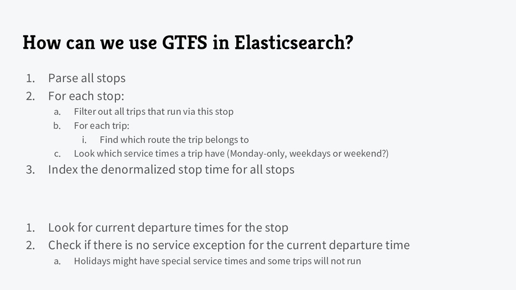
stops 2. For each stop: a. Filter out all trips that run via this stop b. For each trip: i. Find which route the trip belongs to c. Look which service times a trip have (Monday-only, weekdays or weekend?) 3. Index the denormalized stop time for all stops 1. Look for current departure times for the stop 2. Check if there is no service exception for the current departure time a. Holidays might have special service times and some trips will not run
![Merci. Philipp Naderer-Puiu [email protected]](https://files.speakerdeck.com/presentations/6a00ed2c56dd4a6cae26a635615fbb67/slide_34.jpg)