Upgrade to Pro
— share decks privately, control downloads, hide ads and more …
Speaker Deck
Features
Speaker Deck
PRO
Sign in
Sign up for free
Search
Search
空間情報システム入門Ⅰ#02 2016/06/20
Search
Daiki
June 20, 2016
0
45
空間情報システム入門Ⅰ#02 2016/06/20
Daiki
June 20, 2016
Tweet
Share
More Decks by Daiki
See All by Daiki
タイの車の売り方
daikitaniguchi
0
54
空間情報システム入門Ⅰ 7/14
daikitaniguchi
0
85
k
daikitaniguchi
0
43
Featured
See All Featured
WCS-LA-2024
lcolladotor
0
450
Product Roadmaps are Hard
iamctodd
PRO
55
12k
How to Think Like a Performance Engineer
csswizardry
28
2.4k
Designing for humans not robots
tammielis
254
26k
Efficient Content Optimization with Google Search Console & Apps Script
katarinadahlin
PRO
0
310
The Illustrated Children's Guide to Kubernetes
chrisshort
51
51k
I Don’t Have Time: Getting Over the Fear to Launch Your Podcast
jcasabona
34
2.6k
Color Theory Basics | Prateek | Gurzu
gurzu
0
190
Mobile First: as difficult as doing things right
swwweet
225
10k
Money Talks: Using Revenue to Get Sh*t Done
nikkihalliwell
0
150
Data-driven link building: lessons from a $708K investment (BrightonSEO talk)
szymonslowik
1
910
Practical Orchestrator
shlominoach
191
11k
Transcript
マッピング作業のマニュアル 1A116141 谷口 大輝
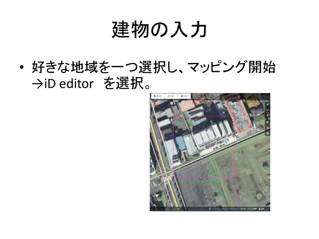
建物の入力 • 好きな地域を一つ選択し、マッピング開始 →iD editor を選択。
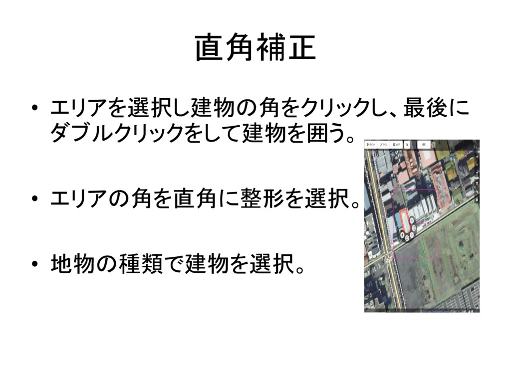
直角補正 • エリアを選択し建物の角をクリックし、最後に ダブルクリックをして建物を囲う。 • エリアの角を直角に整形を選択。 • 地物の種類で建物を選択。
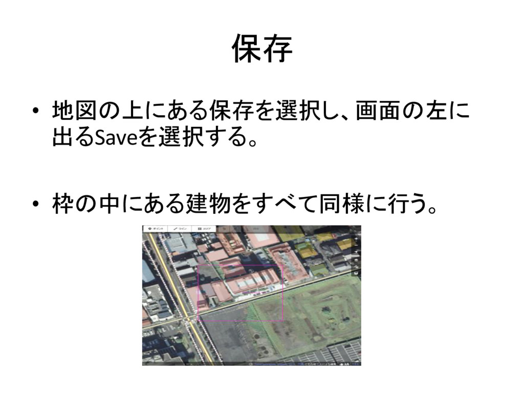
保存 • 地図の上にある保存を選択し、画面の左に 出るSaveを選択する。 • 枠の中にある建物をすべて同様に行う。
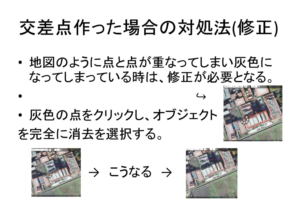
交差点作った場合の対処法(修正) • 地図のように点と点が重なってしまい灰色に なってしまっている時は、修正が必要となる。 • ↪ • 灰色の点をクリックし、オブジェクト を完全に消去を選択する。 →
こうなる →
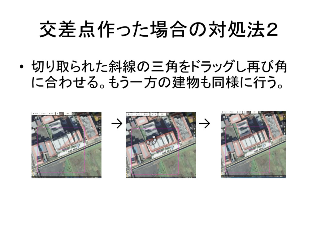
交差点作った場合の対処法2 • 切り取られた斜線の三角をドラッグし再び角 に合わせる。もう一方の建物も同様に行う。 → →
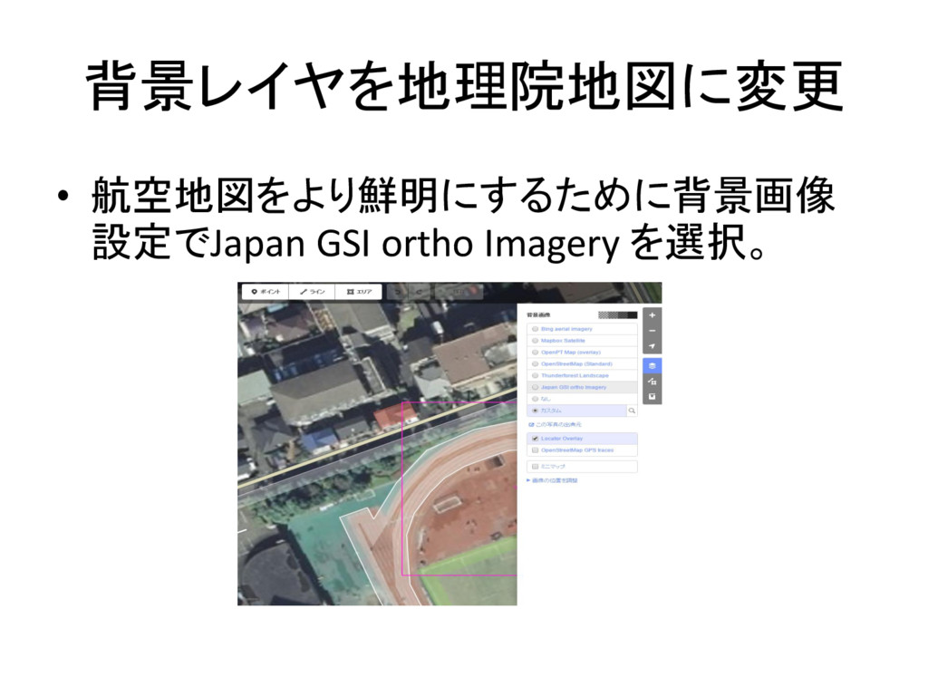
背景レイヤを地理院地図に変更 • 航空地図をより鮮明にするために背景画像 設定でJapan GSI ortho Imagery を選択。
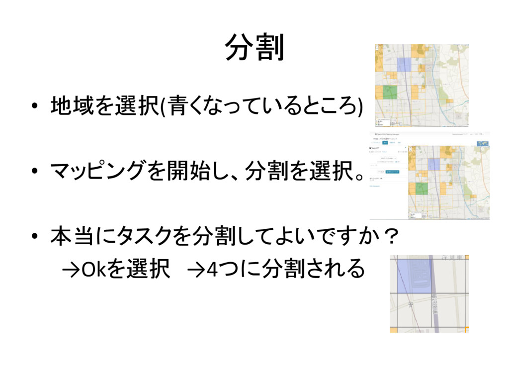
分割 • 地域を選択(青くなっているところ) • マッピングを開始し、分割を選択。 • 本当にタスクを分割してよいですか? →Okを選択 →4つに分割される
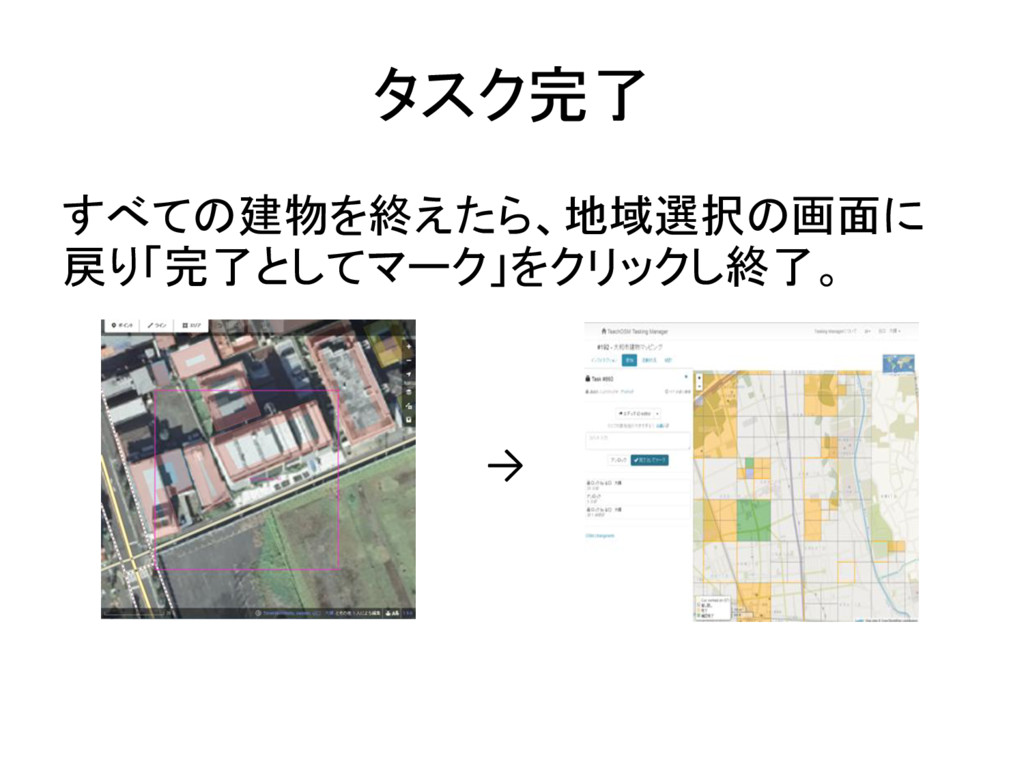
タスク完了 すべての建物を終えたら、地域選択の画面に 戻り「完了としてマーク」をクリックし終了。 →