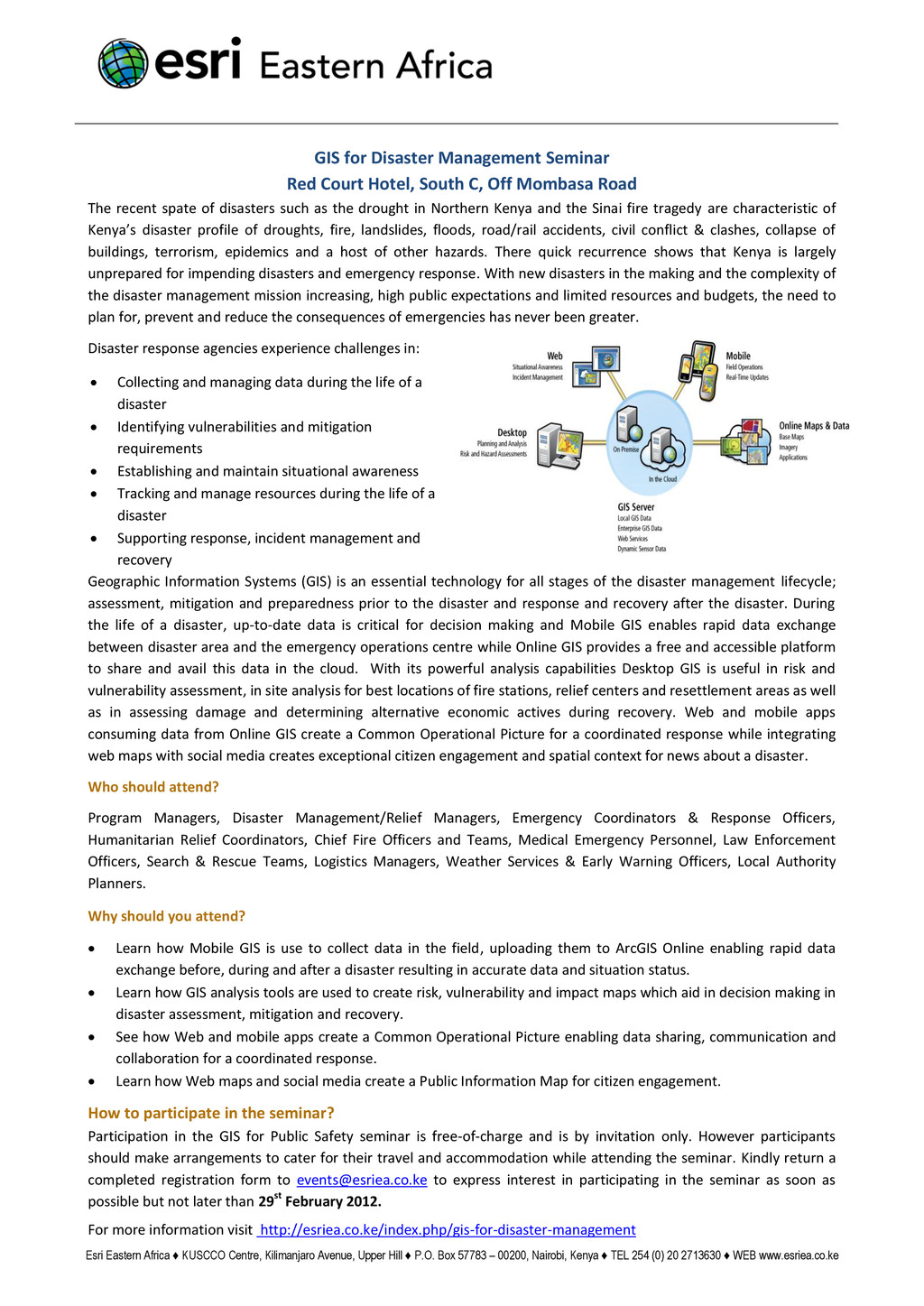
♦ P.O. Box 57783 – 00200, Nairobi, Kenya ♦ TEL 254 (0) 20 2713630 ♦ WEB www.esriea.co.ke GIS for Disaster Management Seminar Red Court Hotel, South C, Off Mombasa Road The recent spate of disasters such as the drought in Northern Kenya and the Sinai fire tragedy are characteristic of Kenya’s disaster profile of droughts, fire, landslides, floods, road/rail accidents, civil conflict & clashes, collapse of buildings, terrorism, epidemics and a host of other hazards. There quick recurrence shows that Kenya is largely unprepared for impending disasters and emergency response. With new disasters in the making and the complexity of the disaster management mission increasing, high public expectations and limited resources and budgets, the need to plan for, prevent and reduce the consequences of emergencies has never been greater. Disaster response agencies experience challenges in: Collecting and managing data during the life of a disaster Identifying vulnerabilities and mitigation requirements Establishing and maintain situational awareness Tracking and manage resources during the life of a disaster Supporting response, incident management and recovery Geographic Information Systems (GIS) is an essential technology for all stages of the disaster management lifecycle; assessment, mitigation and preparedness prior to the disaster and response and recovery after the disaster. During the life of a disaster, up-to-date data is critical for decision making and Mobile GIS enables rapid data exchange between disaster area and the emergency operations centre while Online GIS provides a free and accessible platform to share and avail this data in the cloud. With its powerful analysis capabilities Desktop GIS is useful in risk and vulnerability assessment, in site analysis for best locations of fire stations, relief centers and resettlement areas as well as in assessing damage and determining alternative economic actives during recovery. Web and mobile apps consuming data from Online GIS create a Common Operational Picture for a coordinated response while integrating web maps with social media creates exceptional citizen engagement and spatial context for news about a disaster. Who should attend? Program Managers, Disaster Management/Relief Managers, Emergency Coordinators & Response Officers, Humanitarian Relief Coordinators, Chief Fire Officers and Teams, Medical Emergency Personnel, Law Enforcement Officers, Search & Rescue Teams, Logistics Managers, Weather Services & Early Warning Officers, Local Authority Planners. Why should you attend? Learn how Mobile GIS is use to collect data in the field, uploading them to ArcGIS Online enabling rapid data exchange before, during and after a disaster resulting in accurate data and situation status. Learn how GIS analysis tools are used to create risk, vulnerability and impact maps which aid in decision making in disaster assessment, mitigation and recovery. See how Web and mobile apps create a Common Operational Picture enabling data sharing, communication and collaboration for a coordinated response. Learn how Web maps and social media create a Public Information Map for citizen engagement. How to participate in the seminar? Participation in the GIS for Public Safety seminar is free-of-charge and is by invitation only. However participants should make arrangements to cater for their travel and accommodation while attending the seminar. Kindly return a completed registration form to
[email protected] to express interest in participating in the seminar as soon as possible but not later than 29st February 2012. For more information visit http://esriea.co.ke/index.php/gis-for-disaster-management