Upgrade to Pro — share decks privately, control downloads, hide ads and more …

Leaflet Vector Tiles

Leaflet Vector Tiles

An introduction to vector tiles as and Leaflet.MapboxVectorTile

Nicholas Hallahan

October 15, 2014
Tweet

More Decks by Nicholas Hallahan

Other Decks in Technology

Transcript

  1. Leaflet.MapboxVectorTile
    Vector Tiles

    View Slide

  2. “Old School” PNG Raster Tiles
    • Just a grid of PNG images that you can slip
    around…
    Actual PNG Tile
    From OpenStreetMap Zoomed In…

    View Slide

  3. Raster Tile
    Discrete colors for each pixel.
    Need a data value for each pixel…

    View Slide

  4. 4
    Vector Tiles
    All of the relevant big players in mapping use this…

    View Slide

  5. Vector Tile
    No colors at all…
    It is a bunch of arrays in a 256 x 256 matrix.
    [ (x1,y1), (x2,y2), (x3,y3) …]

    View Slide

  6. Here’s what we would have !
    if there are two lines in a tile…
    [ (x1,y1), (x2,y2), (x3,y3) …], [ (x1,y1), (x2,y2), (x3,y3) …]

    View Slide

  7. Same Tile Schema as PNG
    • Same addressing scheme as PNG Tiles

    • ( Google / OpenStreetMap Schema )
    tileurl.com/4/2/5.png

    tileurl.com/4/2/5.pbf

    View Slide

  8. Specification
    • Decodes binary protocal buffer (Google)
    files that adhere to the Mapobox Vector
    Tile (Mapbox) Specification.
    https://github.com/mapbox/vector-tile-spec

    View Slide

  9. Why not GeoJSON?
    • A protocal buffer is a binary format that is
    very terse and compact, so it requires
    much less bandwidth than text-encoded
    JSON.

    • It automatically simplifies geometries
    appropriately to your given zoom level.

    • You cut out all of the extra data that the
    renderer never even uses…

    View Slide

  10. What do the values look like?
    • Data values are 
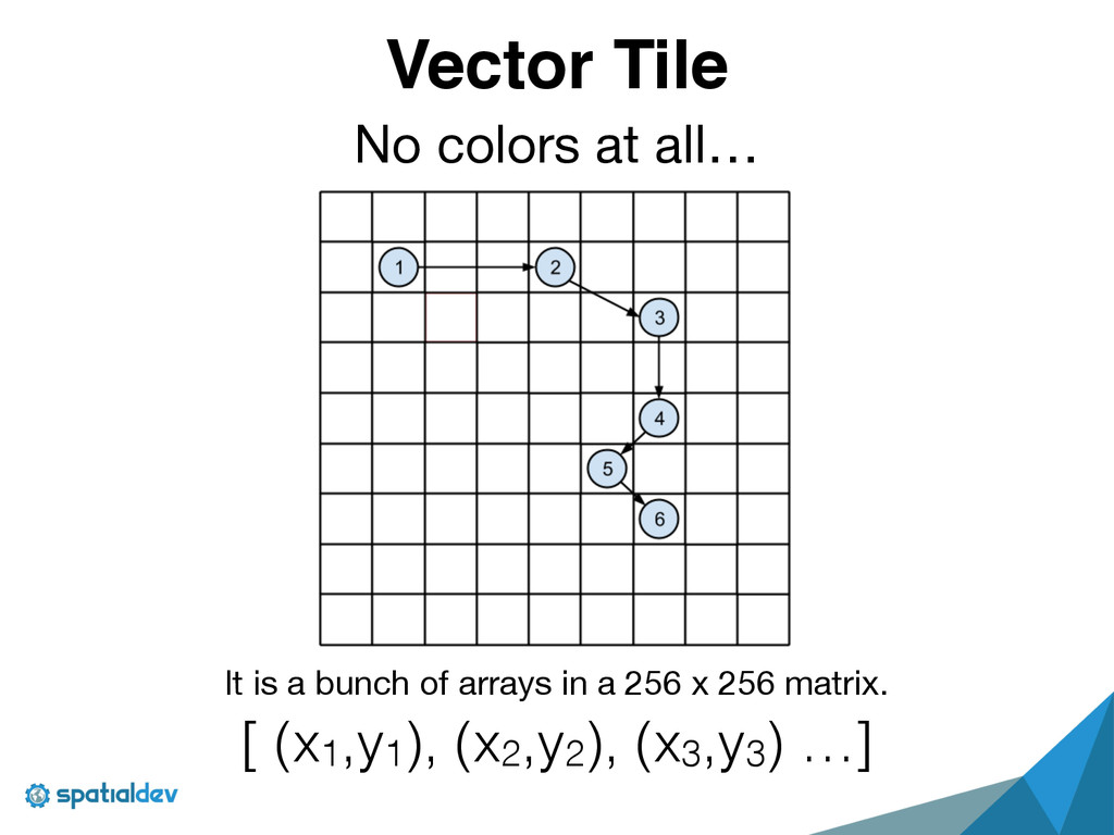
decoded into pixel
    coordinates relative to the origin of the tile.

    • If 2 points are in a pixel, it is
    automatically simplified into 1 point.

    • This is in a post-projection space. It is
    exactly in the correct form for your
    renderer…

    View Slide

  11. Each tile is a separate HTML5 Canvas.
    Polygon Framgent 1
    Polygon Framgent 2

    of the Democratic Republic of Congo

    Feature

    View Slide

  12. This means each tile is being rendered

    by your GPU in parallel.
    FAST!

    View Slide

  13. SpatialServer:

    Leaflet.MapboxVectorTile
    https://github.com/SpatialServer/Leaflet.MapboxVectorTile/

    !
    https://www.npmjs.org/package/leaflet-mapbox-vector-tile
    npm install leaflet-mapbox-vector-tile

    View Slide

  14. HTML5 Canvas Experiments

    View Slide

  15. View Slide

  16. How does this relate to MapboxGL?
    • Leaflet.MapboxVectorTile renders vector
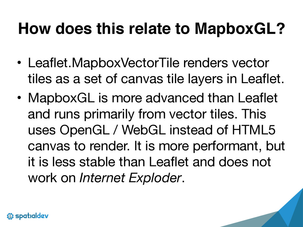
    tiles as a set of canvas tile layers in Leaflet.

    • MapboxGL is more advanced than Leaflet
    and runs primarily from vector tiles. This
    uses OpenGL / WebGL instead of HTML5
    canvas to render. It is more performant, but
    it is less stable than Leaflet and does not
    work on Internet Exploder.
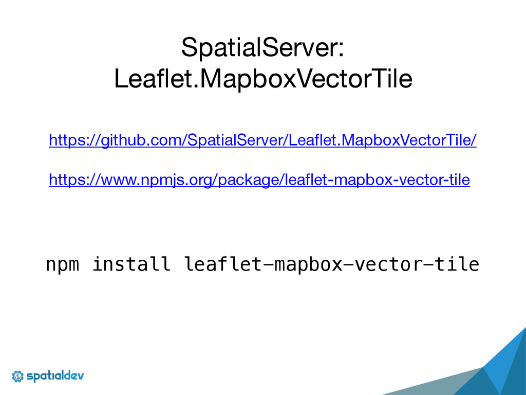
    View Slide

  17. How do I make

    Mapbox Vector Tiles?

    View Slide

  18. Option 1: Mapbox Studio

    View Slide

  19. View Slide

  20. View Slide

  21. View Slide

  22. View Slide

  23. View Slide

  24. View Slide

  25. What if I need / want

    to create these things

    dynamically???

    View Slide

  26. The Spatial Server

    (formally known as Chubbs)…
    If you want Mapbox to serve it,

    you need to pre-render your tiles

    into .mbtiles format…
    SpatialServer looks at PostGIS tables

    and cuts you tiles on the fly!

    View Slide

  27. View Slide