Piercing through the spatial scales: How finely can we predict wind damage to urban trees?
Supporting slides (complementary to the poster) prepared for the 2nd WWRP Weather & Society online conference. This material was presented in Session 2: Observations and Forecasting.
wind damage to urban trees? Irene Garcia-Marti Jouke de Baar Jan Willem Noteboom Fleur Groeneweg Supporting slides Session 2: Observations and forecasting 27th February 2024
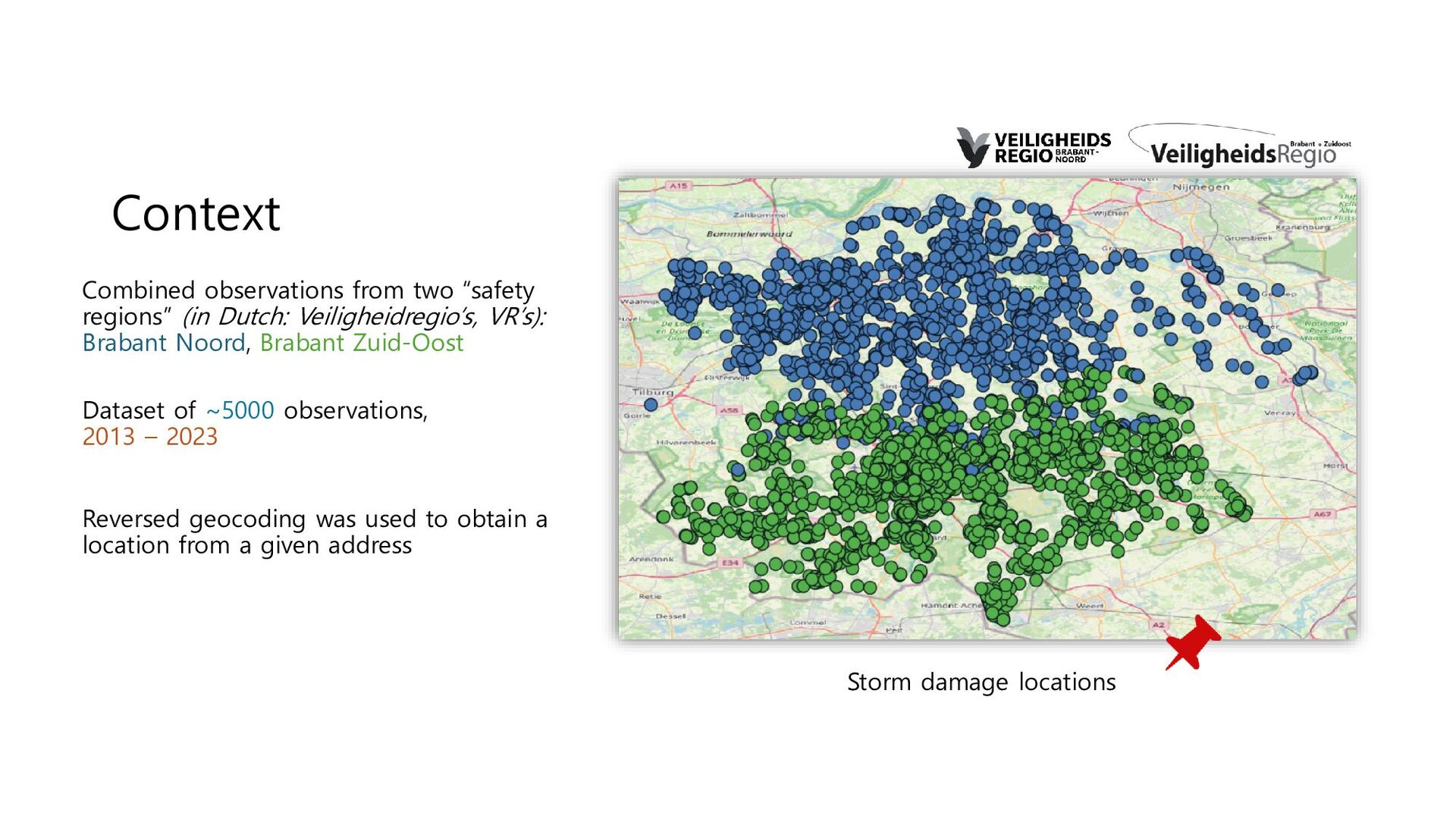
VR’s): Brabant Noord, Brabant Zuid-Oost Dataset of ~5000 observations, 2013 – 2023 Reversed geocoding was used to obtain a location from a given address Storm damage locations
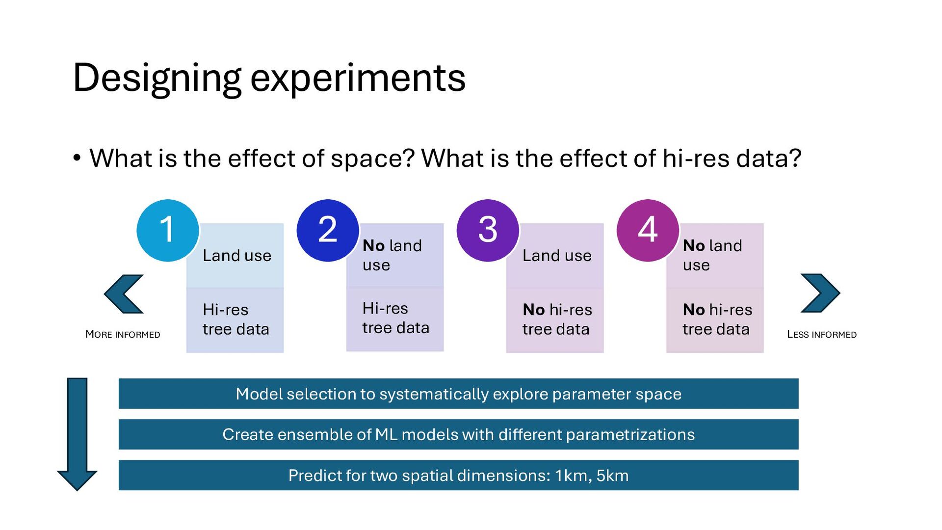
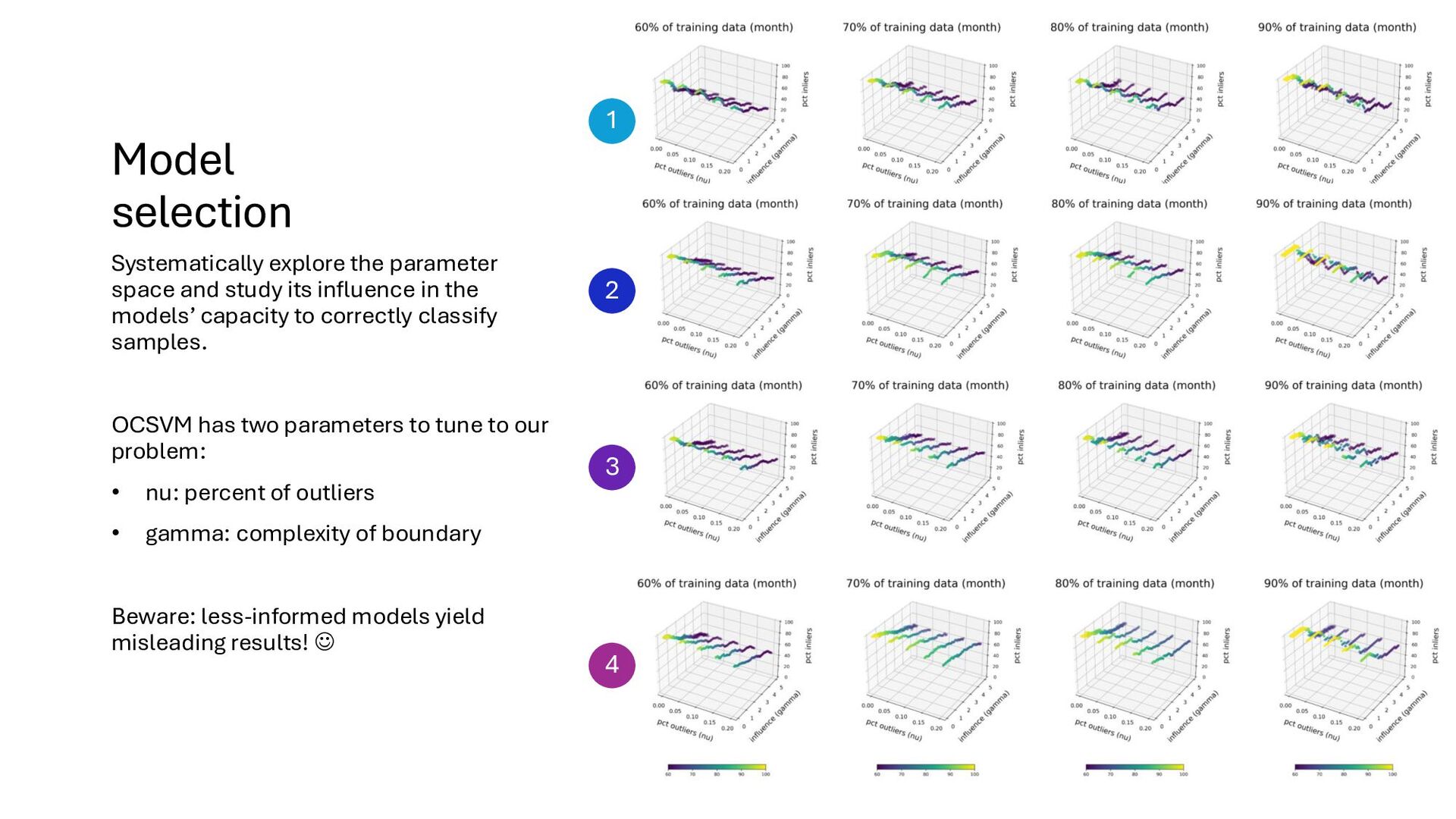
is the effect of hi-res data? Land use Hi-res tree data 1 No land use Hi-res tree data 2 Land use No hi-res tree data 3 No land use No hi-res tree data 4 Predict for two spatial dimensions: 1km, 5km Model selection to systematically explore parameter space Create ensemble of ML models with different parametrizations MORE INFORMED LESS INFORMED
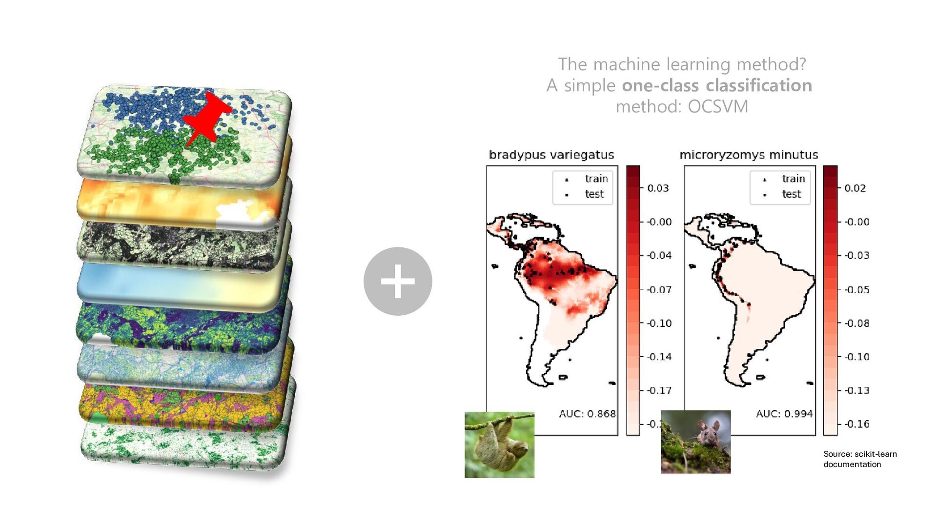
influence in the models’ capacity to correctly classify samples. OCSVM has two parameters to tune to our problem: • nu: percent of outliers • gamma: complexity of boundary Beware: less-informed models yield misleading results! ☺ 1 2 3 4
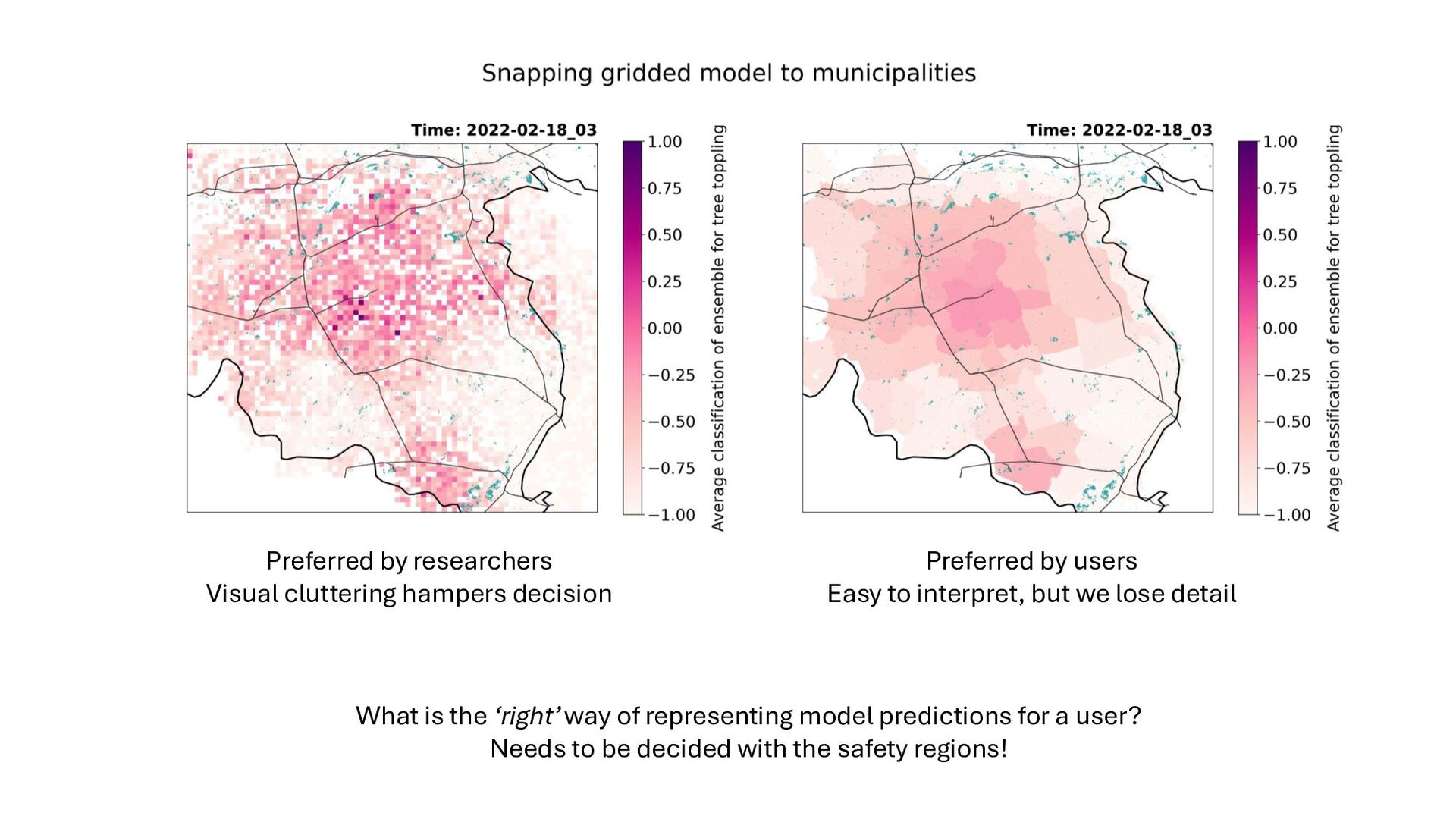
a user? Needs to be decided with the safety regions! Preferred by researchers Visual cluttering hampers decision Preferred by users Easy to interpret, but we lose detail
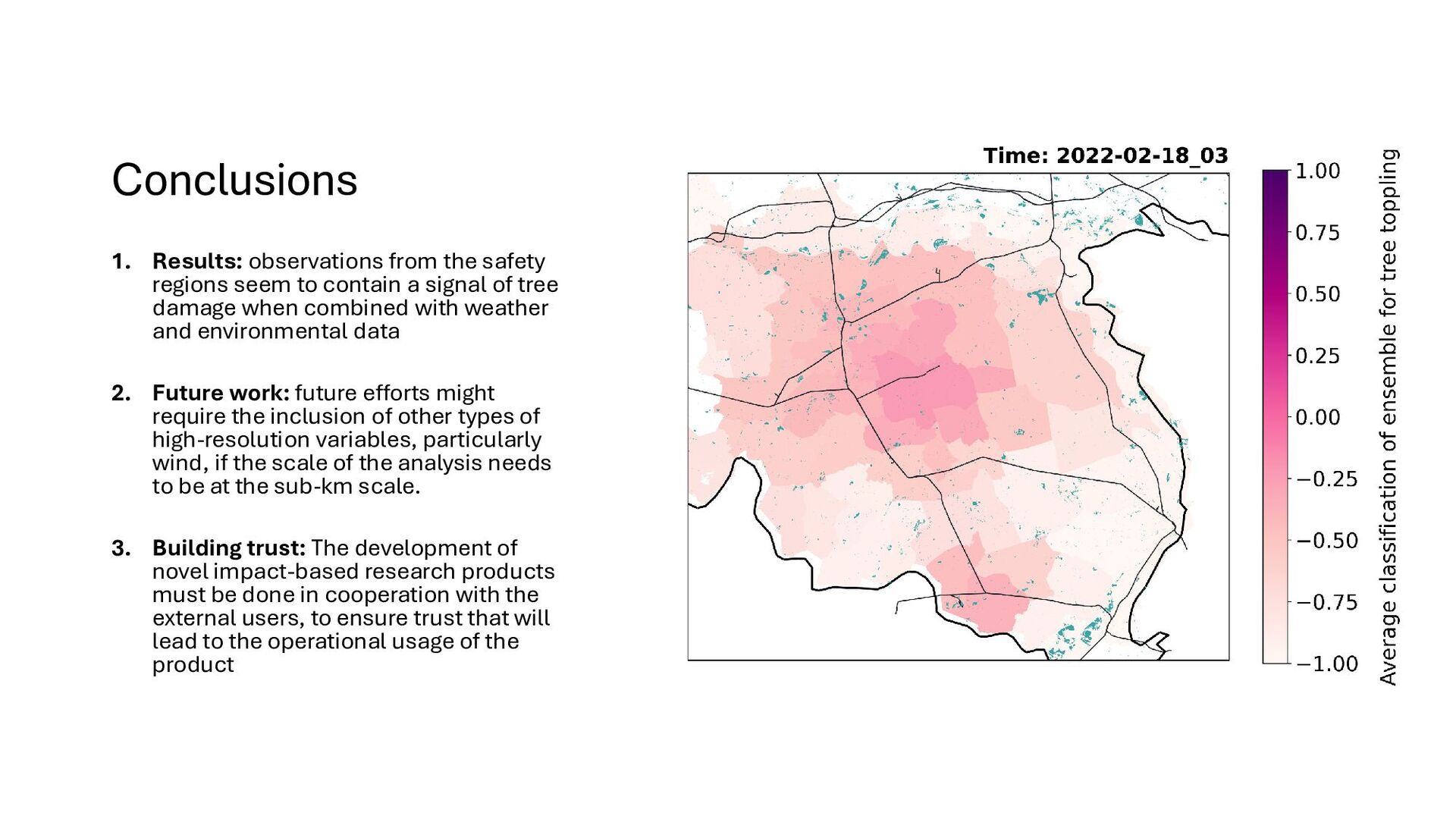
contain a signal of tree damage when combined with weather and environmental data 2. Future work: future efforts might require the inclusion of other types of high-resolution variables, particularly wind, if the scale of the analysis needs to be at the sub-km scale. 3. Building trust: The development of novel impact-based research products must be done in cooperation with the external users, to ensure trust that will lead to the operational usage of the product