Upgrade to Pro — share decks privately, control downloads, hide ads and more …

Styling Natural Earth with GeoServer CSS

Styling Natural Earth with GeoServer CSS

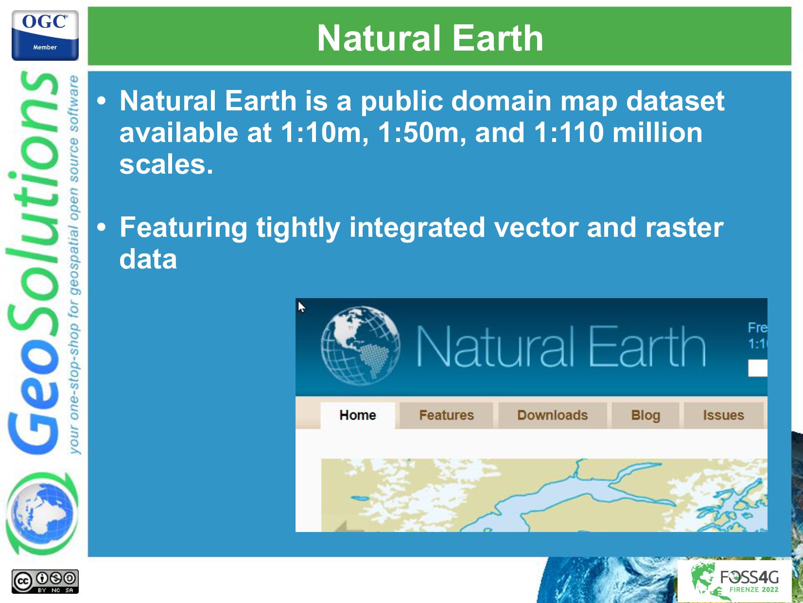
Natural Earth is a public domain map dataset available at 1:10m, 1:50m, and 1:110 million scales. Featuring tightly integrated vector and raster data, with Natural Earth one can build a variety of visually pleasing, well-crafted maps with cartography or GIS software.

GeoServer GeoCSS is a CSS inspired language allowing you to build maps without consuming fingertips in the process, while providing all the same abilities as SLD.

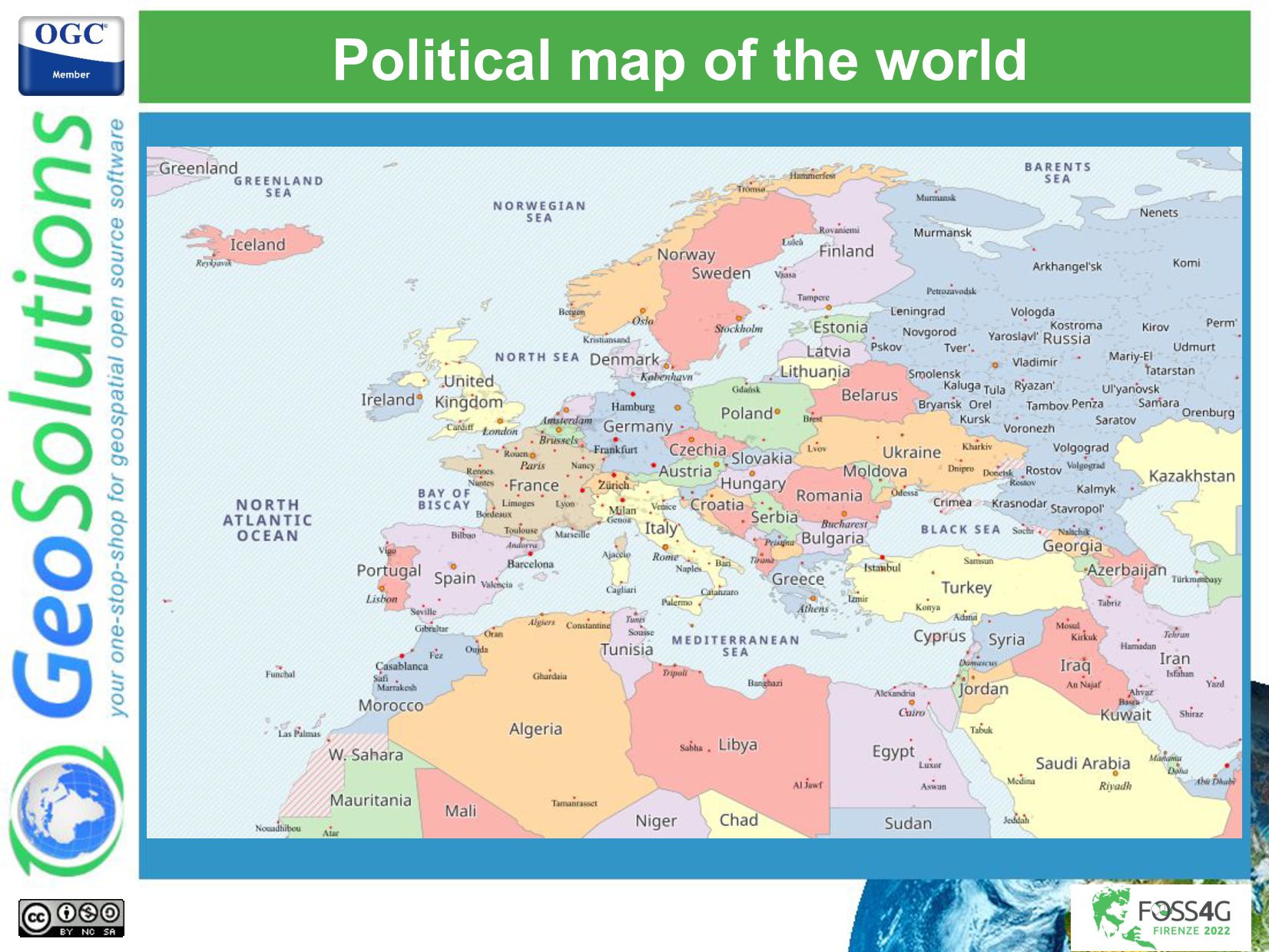
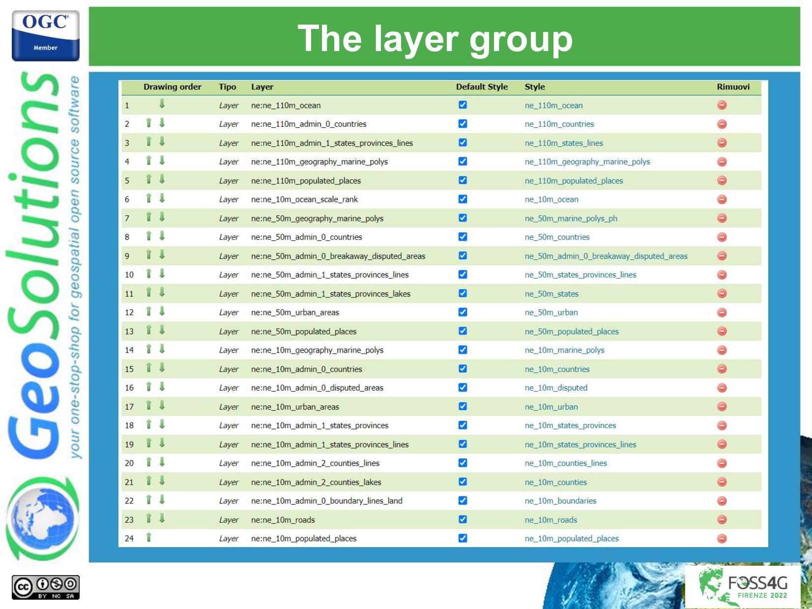
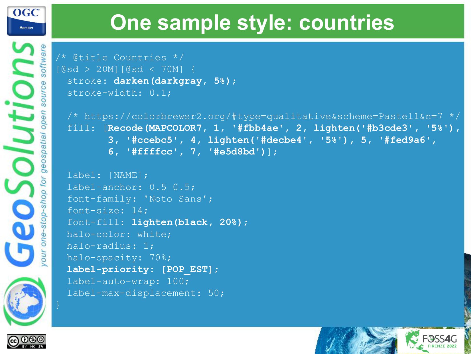
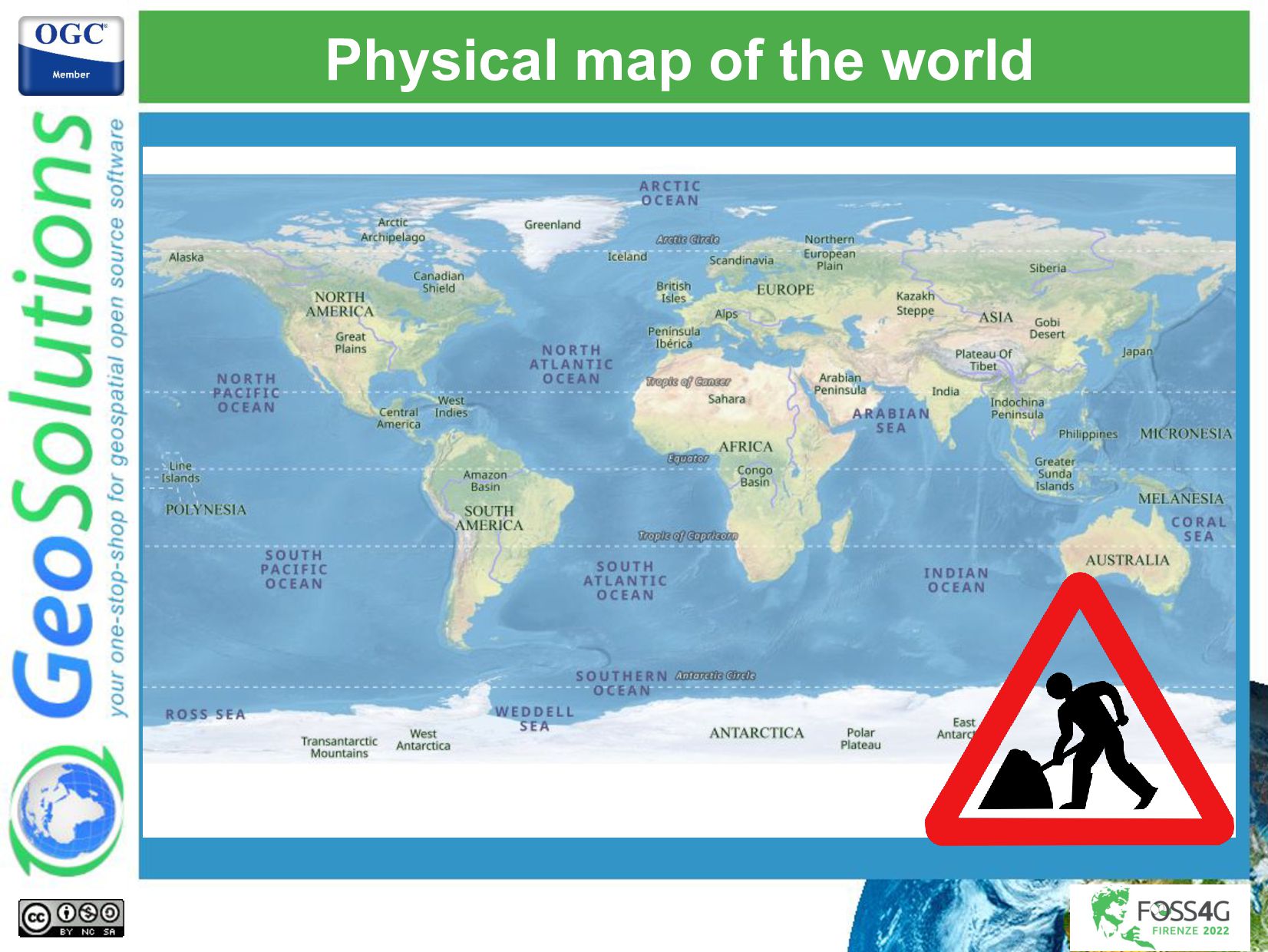
In this presentation we’ll show how we have built a world political map and a world geographic map based on Natural Earth, using CSS, and shared the results on GitHub. We’ll share with you how simple, compact styles can be used to prepare a multiscale map, including: * Leveraging CSS cascading. * Building styles that respond to scales in ways that go beyond simple scale dependencies. * Various types of labeling tricks (conflict resolution and label priority, controlling label density, label placement, typography, labels in various scripts, label shields and more). * Quickly controlling colors with LessCSS inspired functions. * Building symbology using GeoServer large set of well known marks.

Join this presentation for a relaxing introduction to simple and informative maps.

Simone Giannecchini
PRO

August 29, 2022
Tweet

More Decks by Simone Giannecchini

Other Decks in Technology

Transcript

  1. Andrea Aime
    GeoSolutions
    Styling Natural Earth
    with GeoServer CSS

    View Slide

  2. GeoSolutions
    Enterprise Support
    Services
    Deployment
    Subscription
    Professional
    Training
    Customized
    Solutions
    GeoNode
    • Offices in Italy & US, Global Clients/Team
    • 40+ collaborators, 30+ Engineers
    • Our products
    • Our Offer

    View Slide

  3. Affiliations
    We strongly support Open
    Source, it Is in our core
    We actively participate in
    OGC working groups and
    get funded to advance new
    open standards
    We support standards
    critical to GEOINT

    View Slide

  4. Intro: Natural Earth and GeoCSS

    View Slide

  5. Natural Earth
    • Natural Earth is a public domain map dataset
    available at 1:10m, 1:50m, and 1:110 million
    scales.
    • Featuring tightly integrated vector and raster
    data

    View Slide

  6. GeoServer CSS (GeoCSS)
    • CSS inspired language for map styling
    • Compact, powerful, human readable, human
    writable
    * {
    stroke: blue;
    fill: #7EB5D3;
    label: [name];
    label-anchor: 0.5 0.5;
    font-fill: black;
    font-family: "Arial";
    font-size: 14;
    halo-radius: 2;
    halo-color: #7EB5D3;
    halo-opacity:0.8;
    }

    View Slide

  7. The challenge
    • Wanted to have a significant, yet not too
    complicated, base map, in CSS, for our training
    package
    • What about osm-styles?
    • Nice, but too
    complicated!

    View Slide

  8. The political map

    View Slide

  9. Political map of the world

    View Slide

  10. Political map of the world

    View Slide

  11. Political map of the world

    View Slide

  12. Political map of the world

    View Slide

  13. The layer group

    View Slide

  14. One sample style: countries
    /* @title Countries */
    [@sd > 20M][@sd < 70M] {
    stroke: darken(darkgray, 5%);
    stroke-width: 0.1;
    /* https://colorbrewer2.org/#type=qualitative&scheme=Pastel1&n=7 */
    fill: [Recode(MAPCOLOR7, 1, '#fbb4ae', 2, lighten('#b3cde3', '5%'),
    3, '#ccebc5', 4, lighten('#decbe4', '5%'), 5, '#fed9a6',
    6, '#ffffcc', 7, '#e5d8bd')];
    label: [NAME];
    label-anchor: 0.5 0.5;
    font-family: 'Noto Sans';
    font-size: 14;
    font-fill: lighten(black, 20%);
    halo-color: white;
    halo-radius: 1;
    halo-opacity: 70%;
    label-priority: [POP_EST];
    label-auto-wrap: 100;
    label-max-displacement: 50;
    }

    View Slide

  15. How about a physical map?

    View Slide

  16. Physical map of the world

    View Slide

  17. Physical map of the world

    View Slide

  18. Ok, how can I get it?

    View Slide

  19. But on GitHub, of course!
    • GeoSolution’s Natural Earth styles repository
    • https://github.com/geosolutions-it/ne-styles
    • The physical map is in a branch right now:
    • https://github.com/geosolutions-it/ne-styles/tree
    /physical

    View Slide

  20. That’s all folks!
    Questions?
    [email protected]
    [email protected]

    View Slide