Upgrade to Pro — share decks privately, control downloads, hide ads and more …

Create tiled map using Global map (2016)

Create tiled map using Global map (2016)

For JICA seminar 2016.

Taro Matsuzawa aka. btm

October 18, 2016
Tweet

More Decks by Taro Matsuzawa aka. btm

Other Decks in Education

Transcript

  1. Topics •  Introduc'on of web map and 'led map • 

    Introduc'on of so<ware and global map •  Create 'les from vector files •  Create 'les from raster files •  Create web map applica'on with created 'les •  Introduc'on of Vector 'les and other
  2. Clickable Map •  PaGern 1: Using HTML ‘map’ and ‘area’

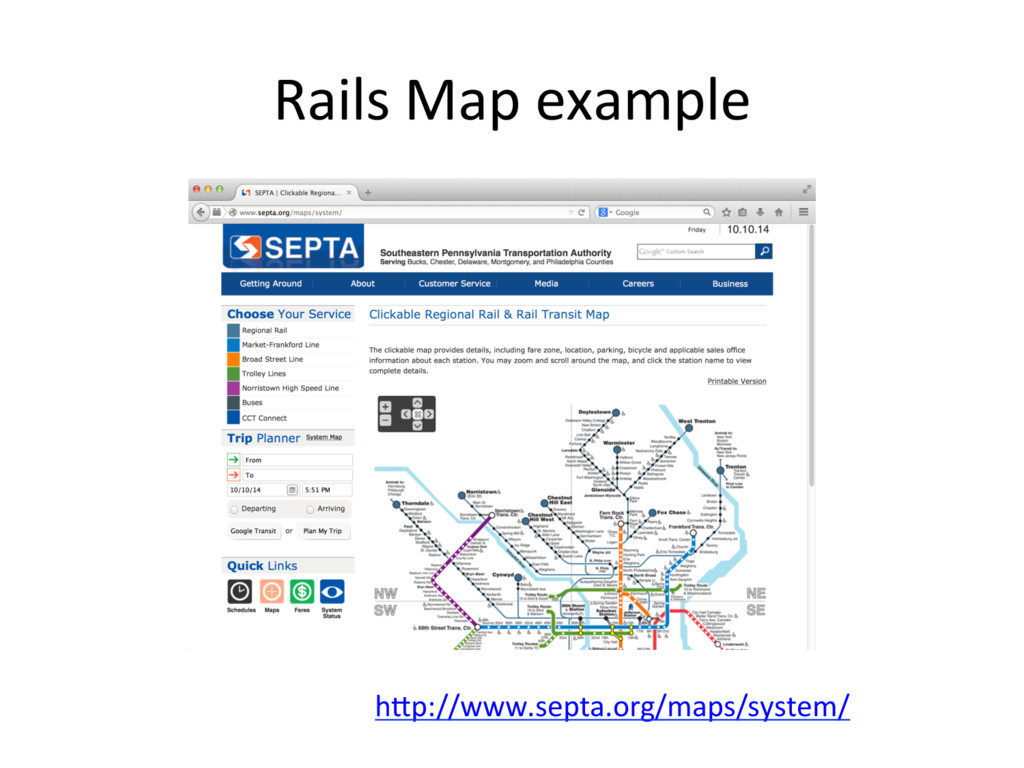
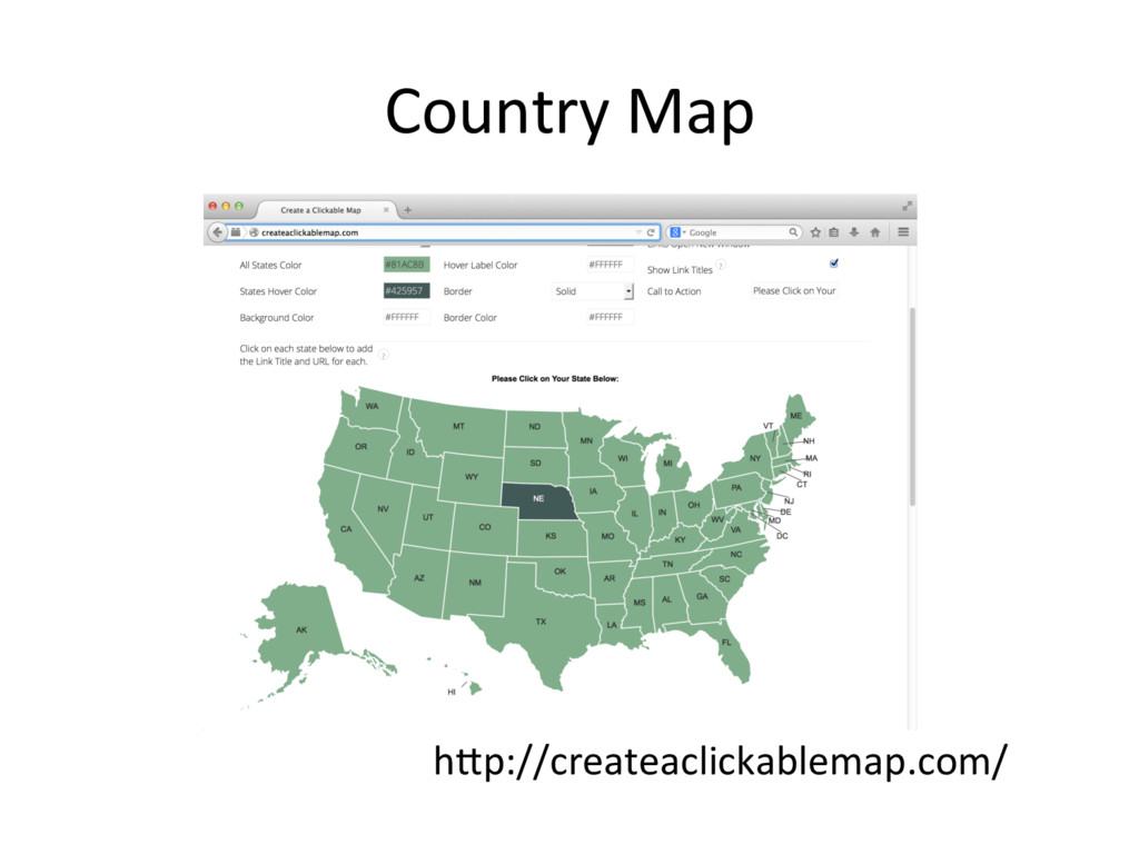
    tag – Many rails and bus route map – Old style (from Netscape Navigator 2.0) •  PaGern 2: HTML5 – Country map – Modern style •  Using canvas or CSS func'on
  3. Georeferenced map images •  Server create images by response using

    data from GIS databases or other storage. – Server side so<ware may process request include bounding box and etc. •  Web Map Service (WMS) Protocol is famous.
  4. Tiled web map •  Provide map images over the internet.

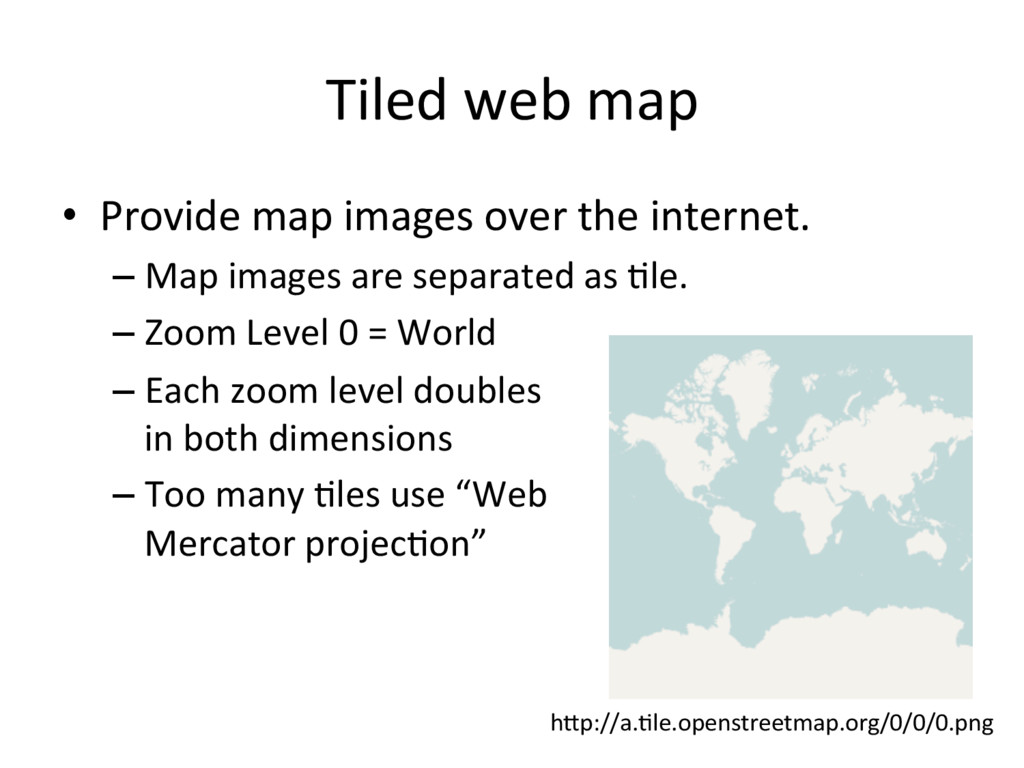
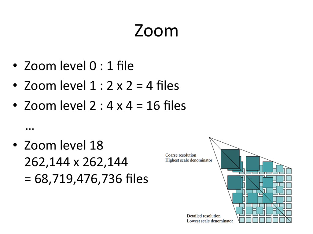
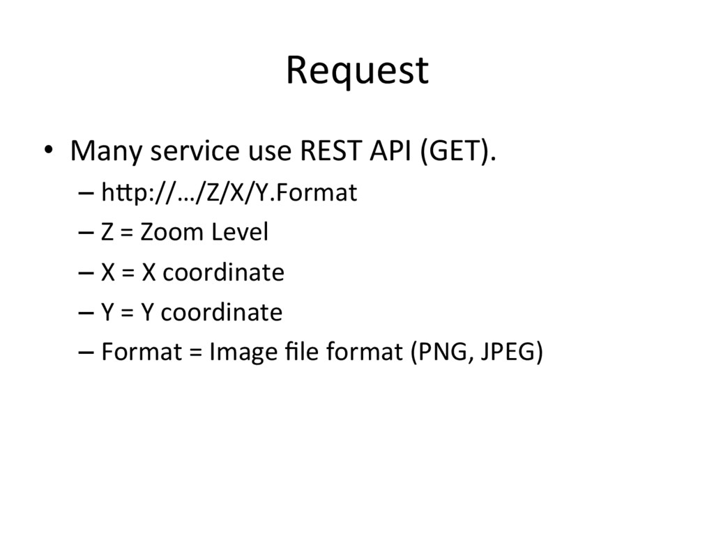
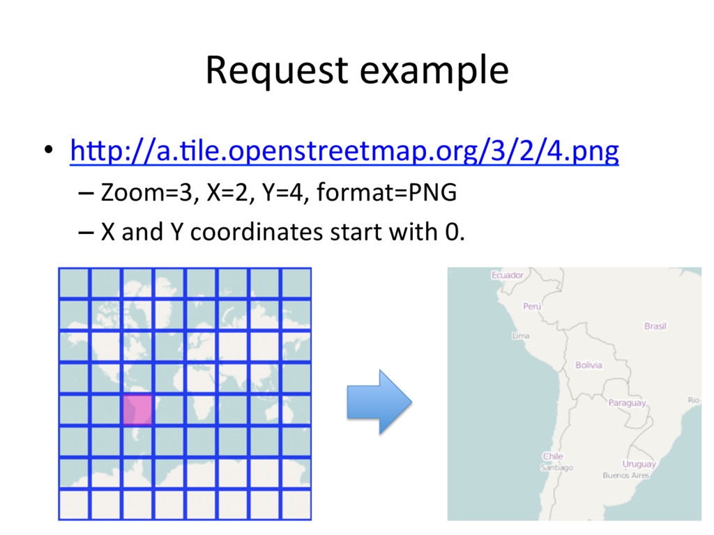
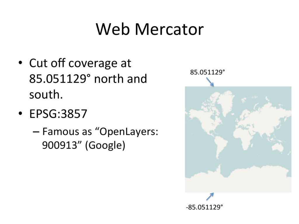
    – Map images are separated as 'le. – Zoom Level 0 = World – Each zoom level doubles in both dimensions – Too many 'les use “Web Mercator projec'on” hGp://a.'le.openstreetmap.org/0/0/0.png
  5. Tile •  Tile images are “sta'c contents”. – Tile images can

    provide with sta'c web server. – Also you can use in local machine with file URL schema (file:///).
  6. Zoom •  Zoom level 0 : 1 file •  Zoom

    level 1 : 2 x 2 = 4 files •  Zoom level 2 : 4 x 4 = 16 files … •  Zoom level 18 262,144 x 262,144 = 68,719,476,736 files
  7. Request •  Many service use REST API (GET). – hGp://…/Z/X/Y.Format – Z

    = Zoom Level – X = X coordinate – Y = Y coordinate – Format = Image file format (PNG, JPEG)
  8. Web Mercator •  Cut off coverage at 85.051129° north and

    south. •  EPSG:3857 – Famous as “OpenLayers: 900913” (Google) 85.051129° -85.051129°
  9. Tile Service Specifica'on •  Two 'le service specifica'on – Tile Map

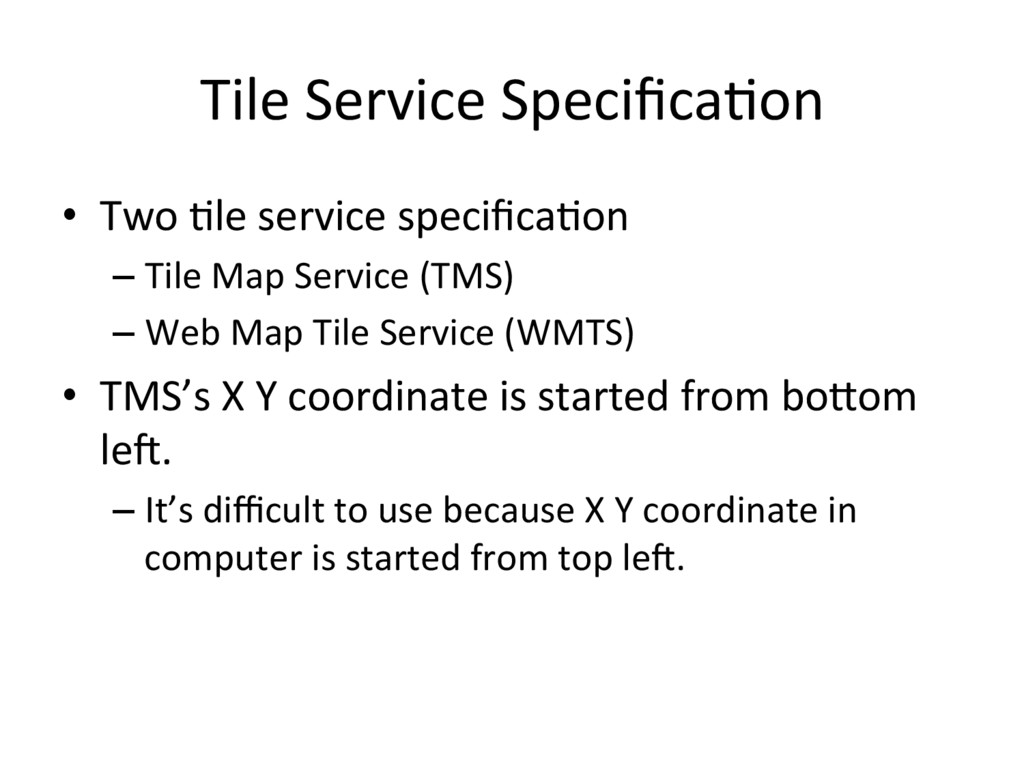
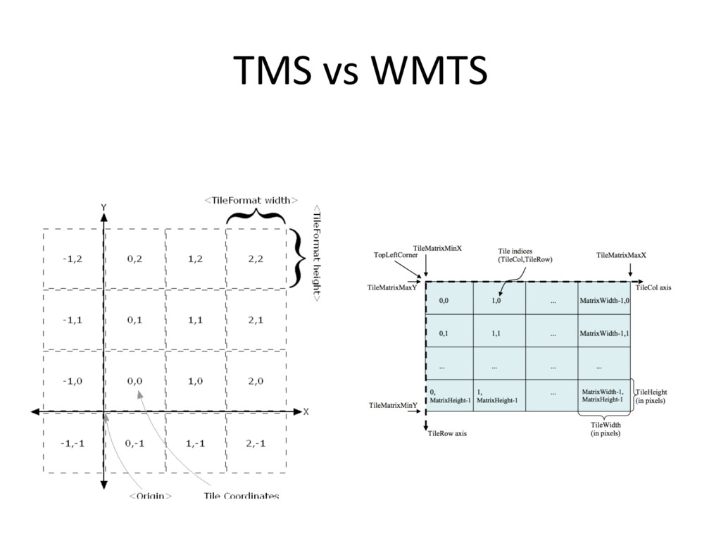
    Service (TMS) – Web Map Tile Service (WMTS) •  TMS’s X Y coordinate is started from boGom le<. – It’s difficult to use because X Y coordinate in computer is started from top le<.
  10. The Y coordinate flipped •  OpenStreetMap use TMS like protocol

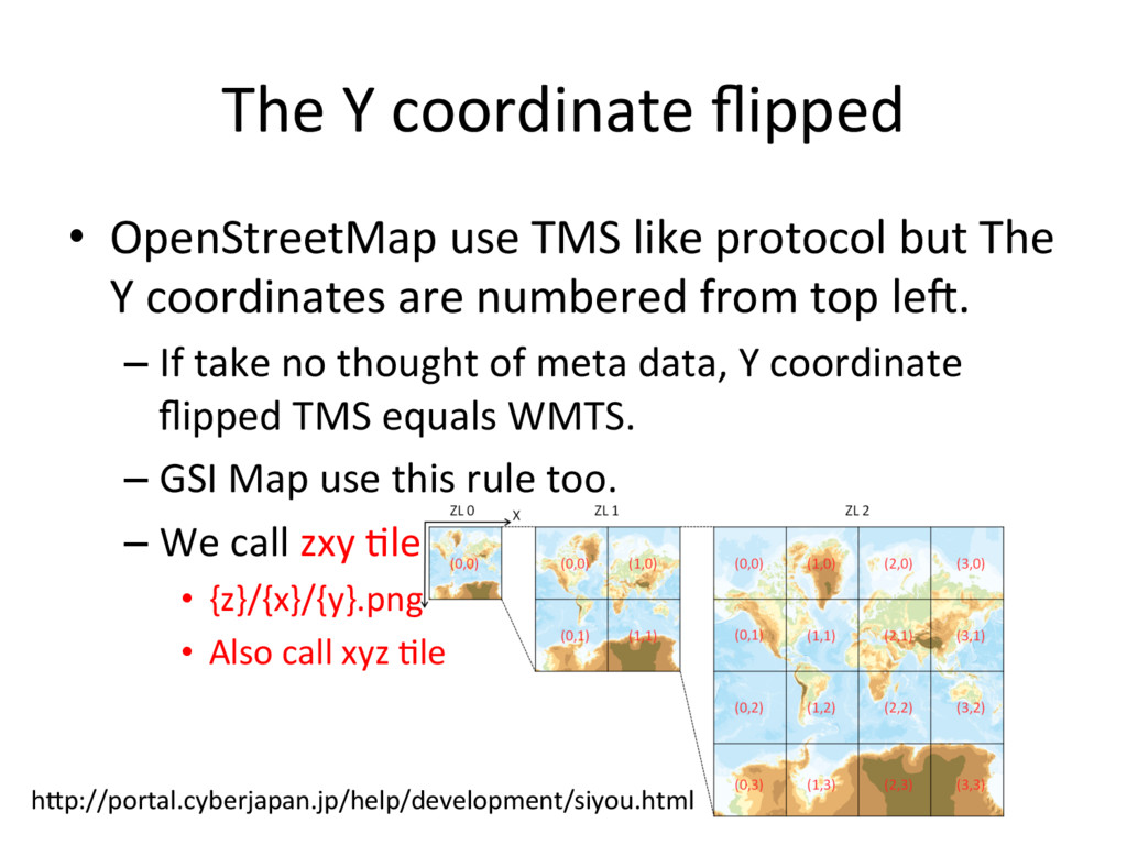
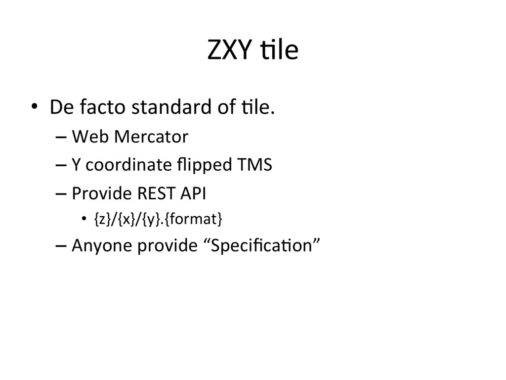
    but The Y coordinates are numbered from top le<. – If take no thought of meta data, Y coordinate flipped TMS equals WMTS. – GSI Map use this rule too. – We call zxy 'le •  {z}/{x}/{y}.png •  Also call xyz 'le hGp://portal.cyberjapan.jp/help/development/siyou.html
  11. ZXY 'le •  De facto standard of 'le. – Web Mercator

    – Y coordinate flipped TMS – Provide REST API •  {z}/{x}/{y}.{format} – Anyone provide “Specifica'on”
  12. JavaScript Libraries for display map •  OpenLayers –  Full stack

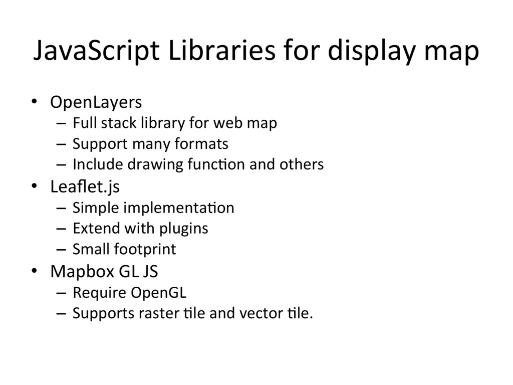
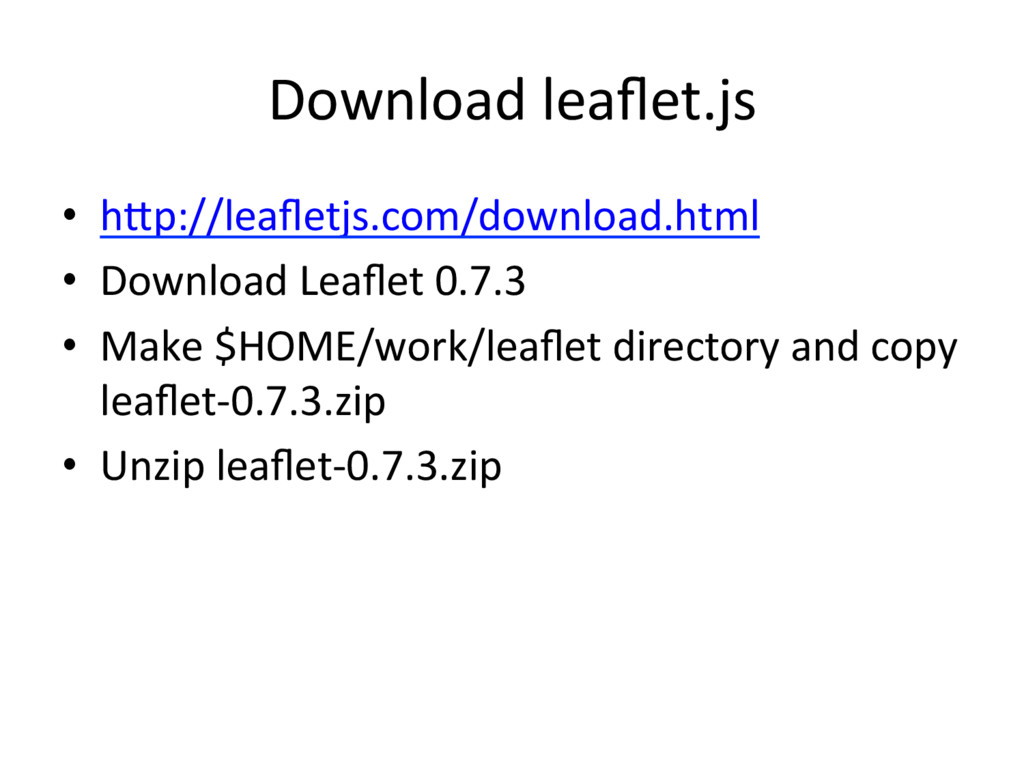
    library for web map –  Support many formats –  Include drawing func'on and others •  Leaflet.js –  Simple implementa'on –  Extend with plugins –  Small footprint •  Mapbox GL JS –  Require OpenGL –  Supports raster 'le and vector 'le.
  13. Leaflet example <body> <div id="map"> <script> var map = L.map('map');

    L.'leLayer('hGp://cyberjapandata.gsi.go.jp/xyz/std/{z}/{x}/{y}.png', { aGribu'on: "<a href='hGp://portal.cyberjapan.jp/ help/termsofuse.html' target='_blank'>国土地理院</a>" }).addTo(map); map.setView([35.3622222, 138.7313889], 5); </script> hGp://portal.cyberjapan.jp/help/development/sample.html#sample-ll
  14. Libraries for Smartphone •  Mapbox iOS SDK / Mapbox Android

    SDK – using C++ and OpenGL – Supports vector 'le •  OSMDroid – Android Library •  Leaflet / OpenLayers / Mapbox GL JS – Use JavaScript Library in WebView.
  15. Other format: MBTiles •  MBTiles is container of 'le – MBTiles

    is single Database (SQLite) – Tilemill can output MBTiles – TMS schema (not zxy) X Y Z blob 0 0 0 (binary) … … … … 241 362 9 (binary)
  16. The Goal for this workshop •  Create “your country” 'led

    map using Global Map. – Customize map design. •  Create simple web site.
  17. Steps for this workshop 1.  Make sense about So<ware and

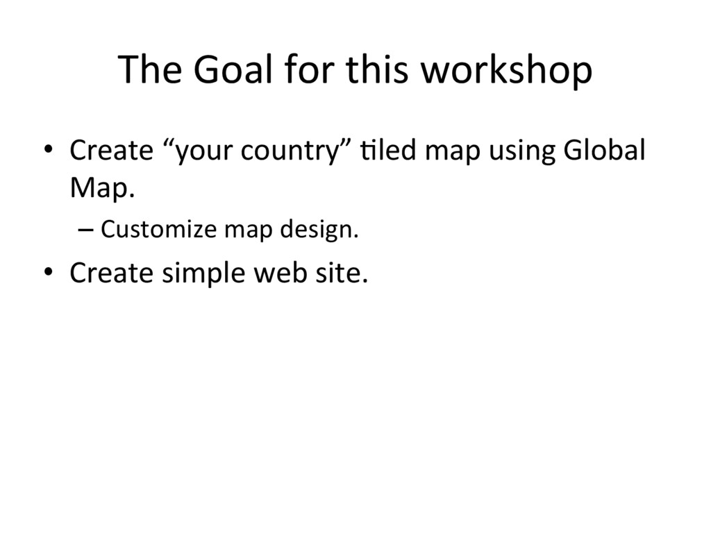
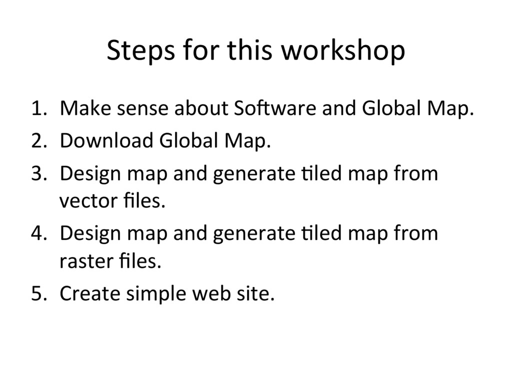
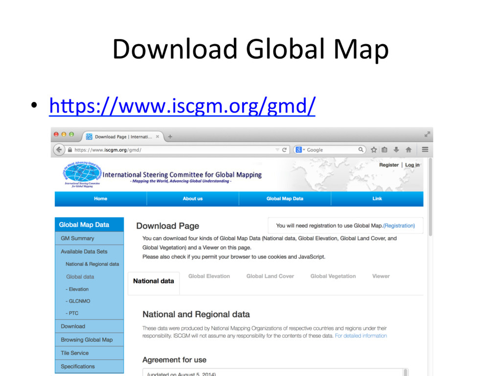
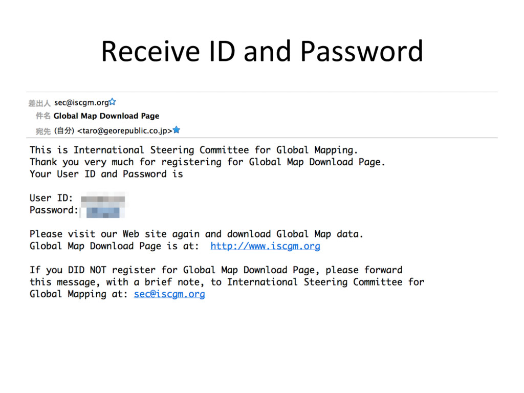
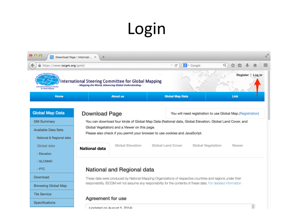
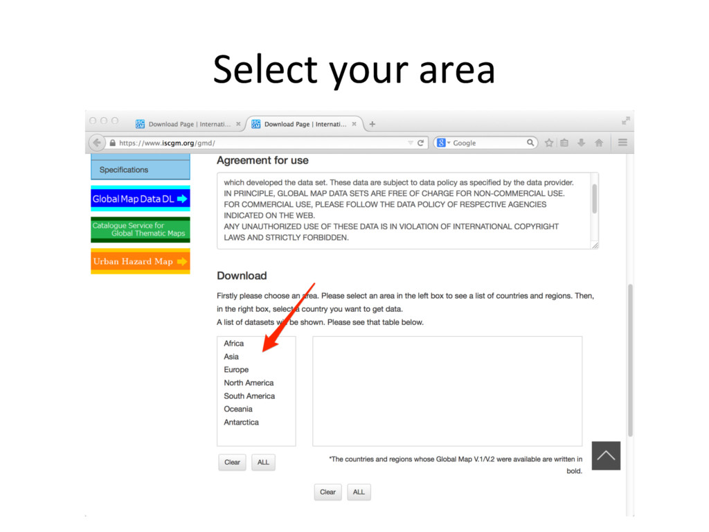
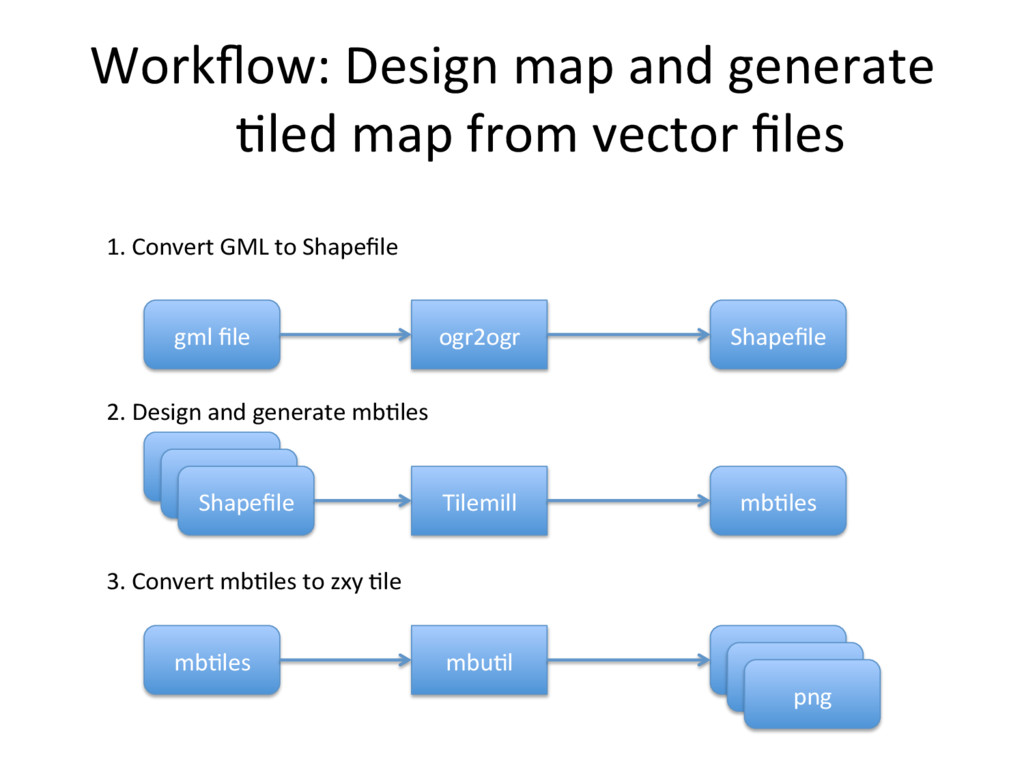
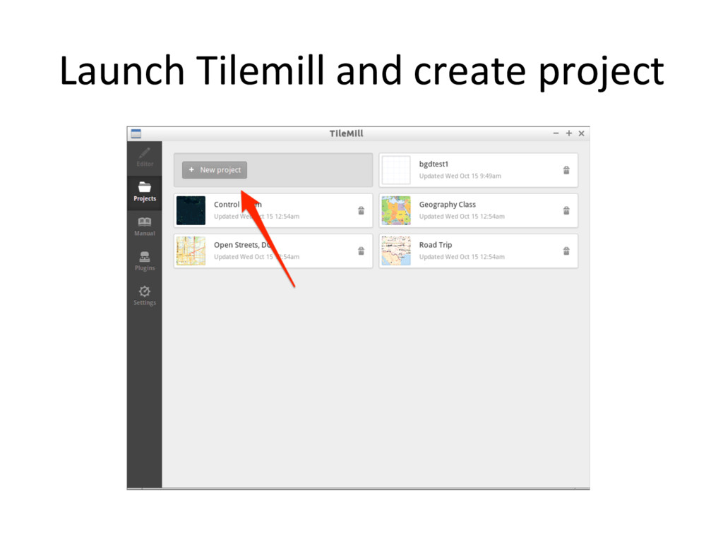
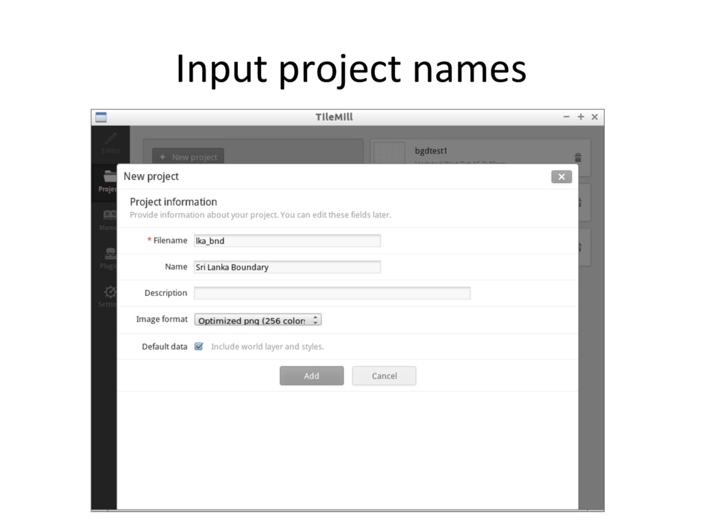
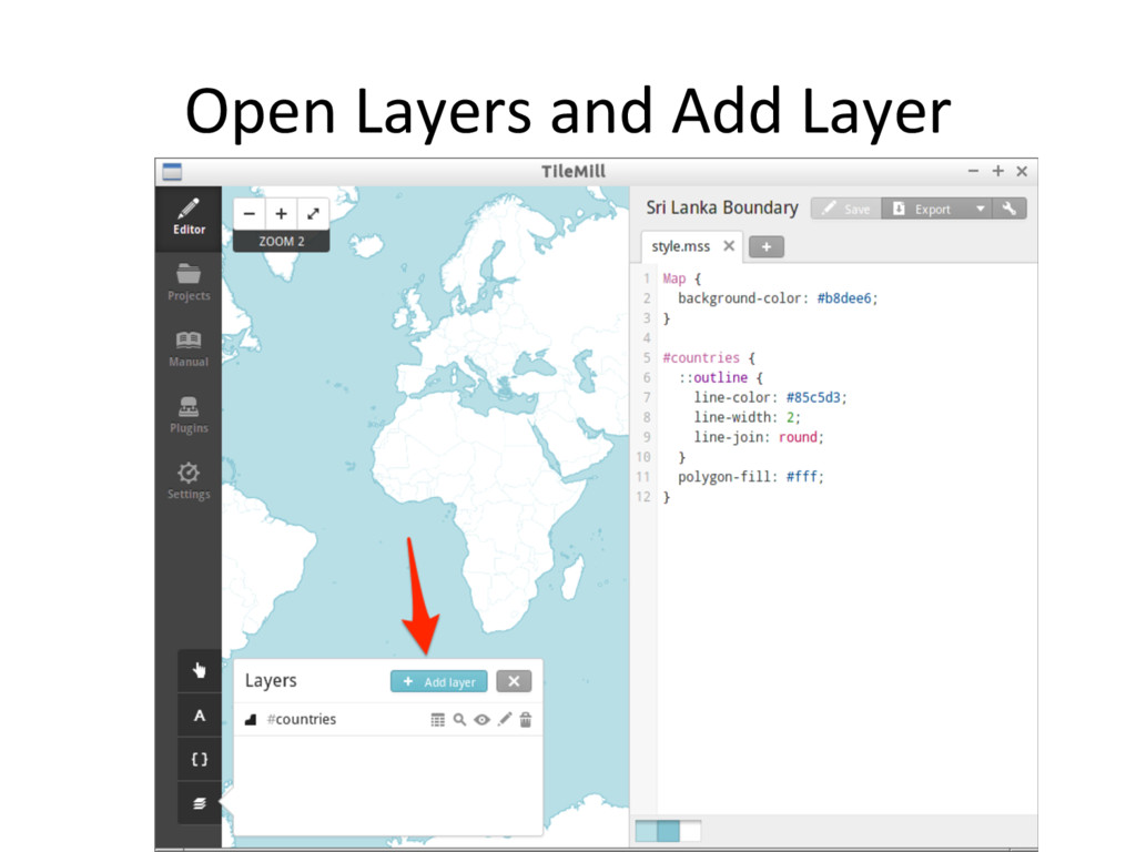
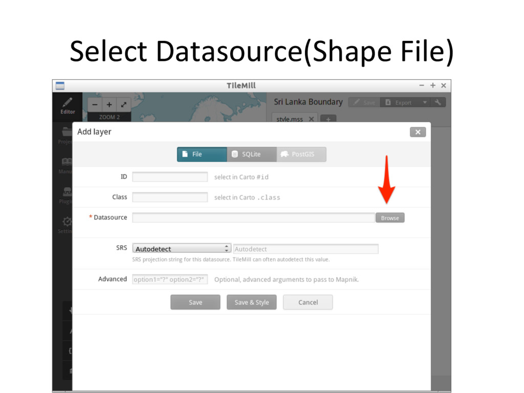
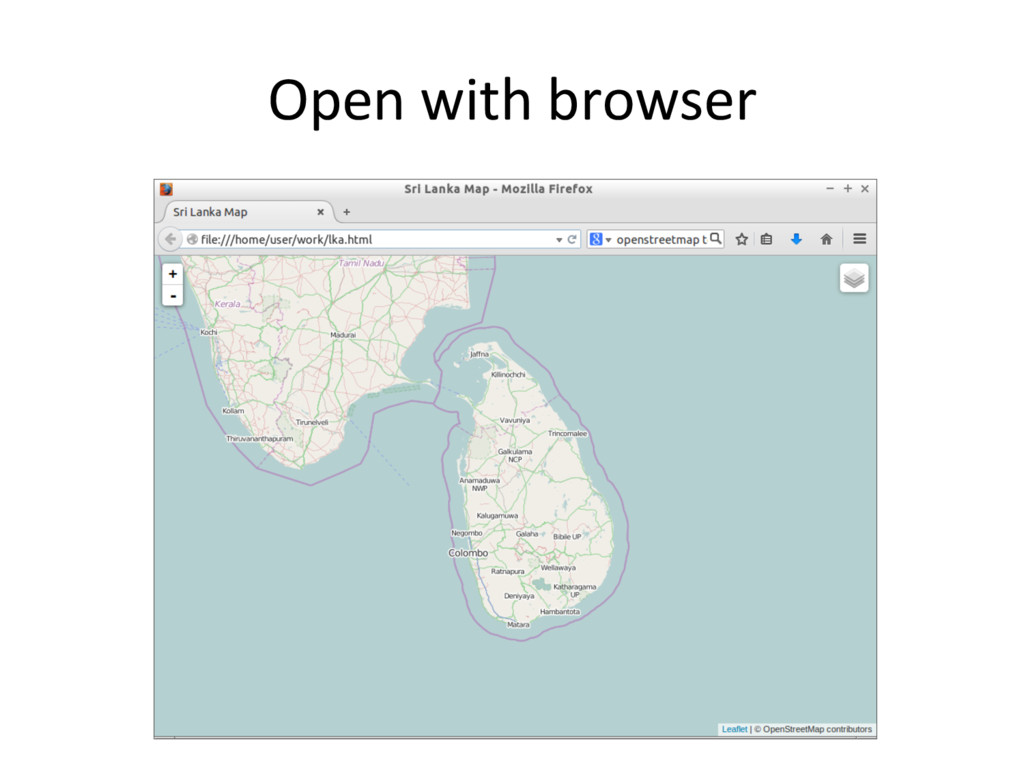
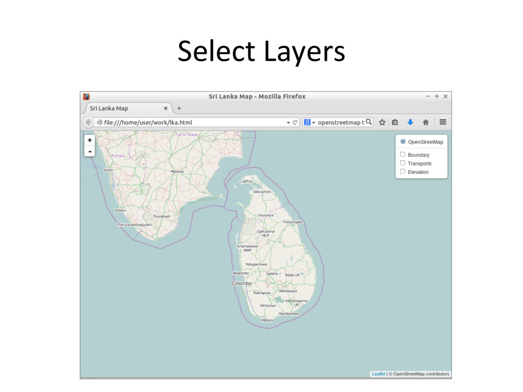
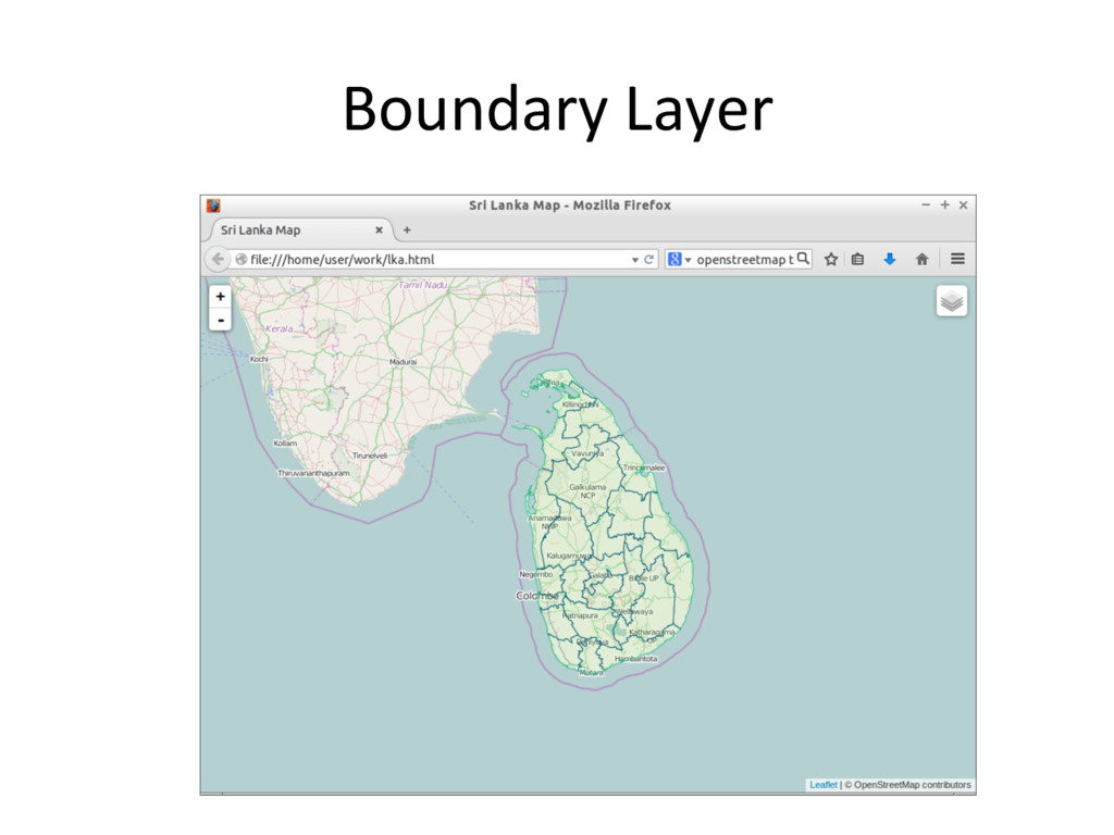
    Global Map. 2.  Download Global Map. 3.  Design map and generate 'led map from vector files. 4.  Design map and generate 'led map from raster files. 5.  Create simple web site.
  18. OS / So<ware •  OS: OSGeo-Live 10.0 or Windows 7

    •  GDAL/OGR •  QGIS •  Tilemill (or TileOven) – Mapnik – Carto / CartoCSS •  Leaflet.js
  19. OSGeoLive 10.0 •  OSGeo-Live is Linux distribu'on includes too many

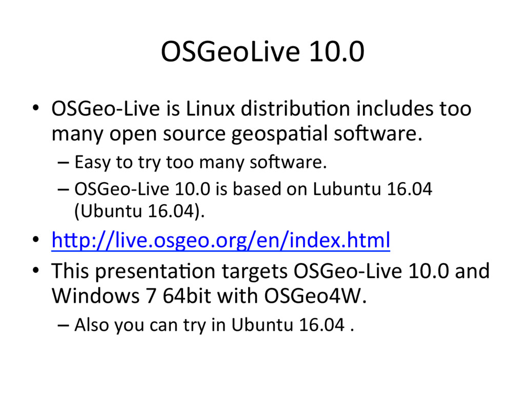
    open source geospa'al so<ware. – Easy to try too many so<ware. – OSGeo-Live 10.0 is based on Lubuntu 16.04 (Ubuntu 16.04). •  hGp://live.osgeo.org/en/index.html •  This presenta'on targets OSGeo-Live 10.0 and Windows 7 64bit with OSGeo4W. – Also you can try in Ubuntu 16.04 .
  20. GDAL/OGR •  hGp://gdal.org/ •  GDAL/OGR is translator library for raster

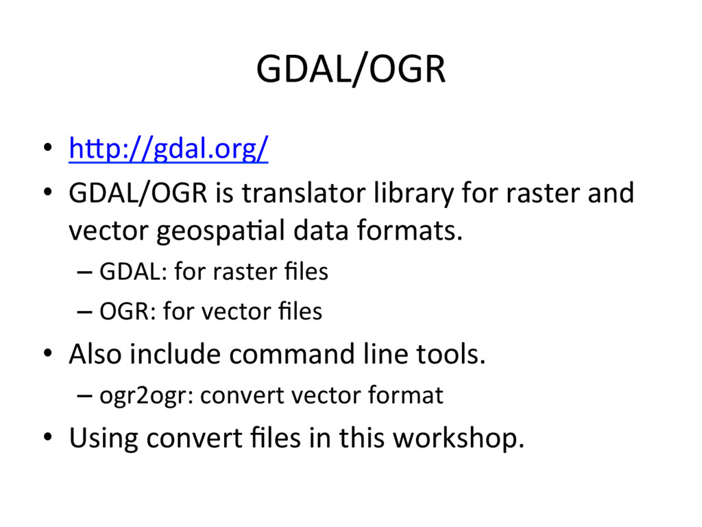
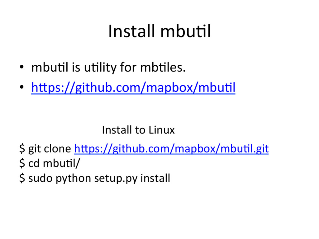
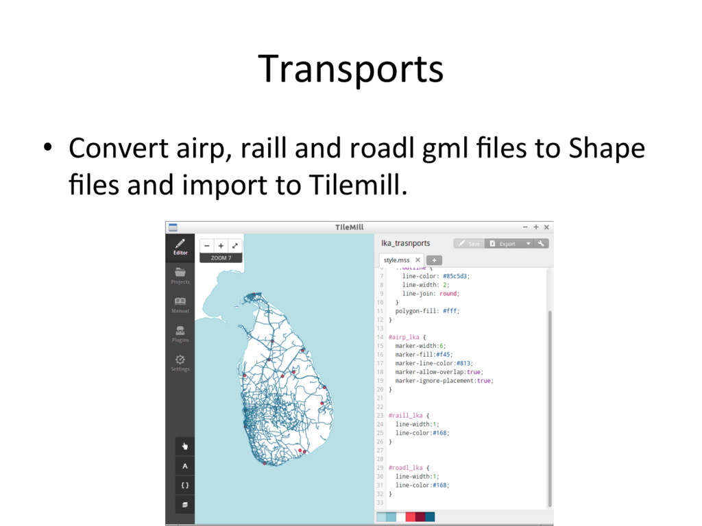
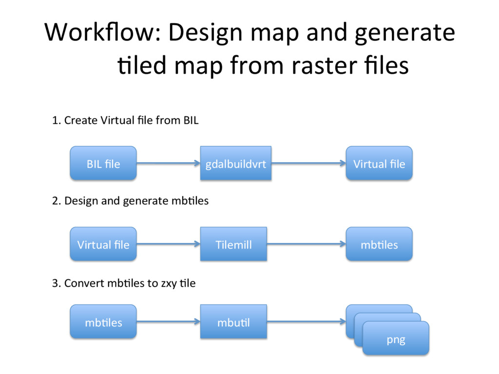
    and vector geospa'al data formats. – GDAL: for raster files – OGR: for vector files •  Also include command line tools. – ogr2ogr: convert vector format •  Using convert files in this workshop.
  21. QGIS •  Open Source Geographic Informa'on System •  Some GDAL/OGR

    u'li'es can run from QGIS. •  hGp://www.qgis.org
  22. No'ce •  Tilemill supports Windows, macOS, and Linux but Tilemill

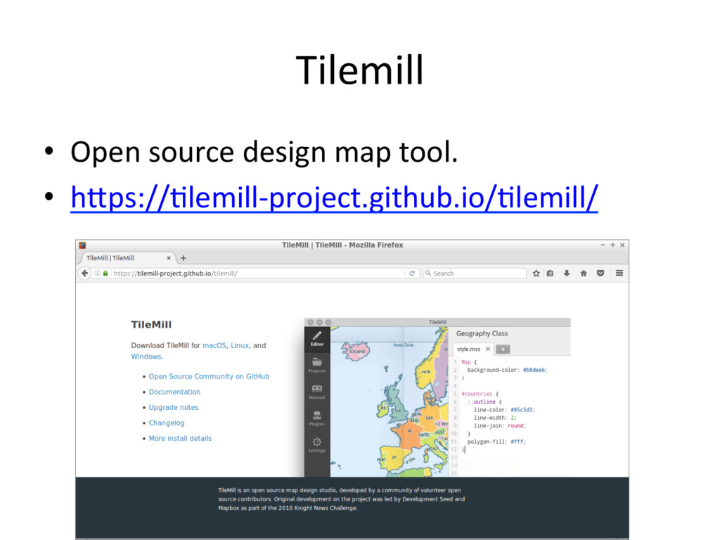
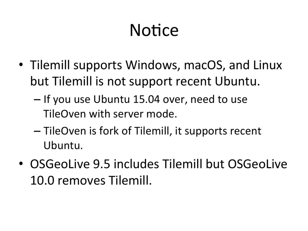
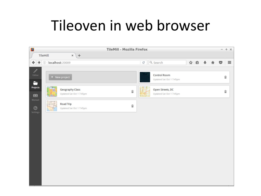
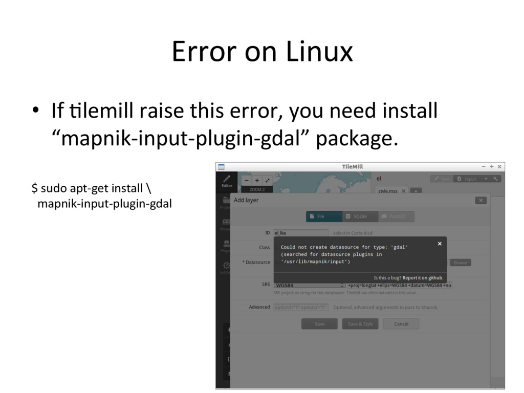
    is not support recent Ubuntu. – If you use Ubuntu 15.04 over, need to use TileOven with server mode. – TileOven is fork of Tilemill, it supports recent Ubuntu. •  OSGeoLive 9.5 includes Tilemill but OSGeoLive 10.0 removes Tilemill.
  23. Install TileOven in OSGeo-Live 10.0 •  Install some package at

    first. •  Fetch source code and build node libraries. •  Run index.js and open hGp://localhost:20009 # apt-get install nodejs nodejs-legacy nodejs-dev $ git clone hGps://github.com/florianf/'leoven.git $ cd 'leoven $ npm install $ node index.js
  24. mapnik •  Open source mapping toolkit for map rendering. • 

    OpenStreetMap use this so<ware. •  Tilemill can export mapnik xml from style. •  hGp://mapnik.org/
  25. Carto / CartoCSS •  CSS-like stylesheet for map. •  Tilemill

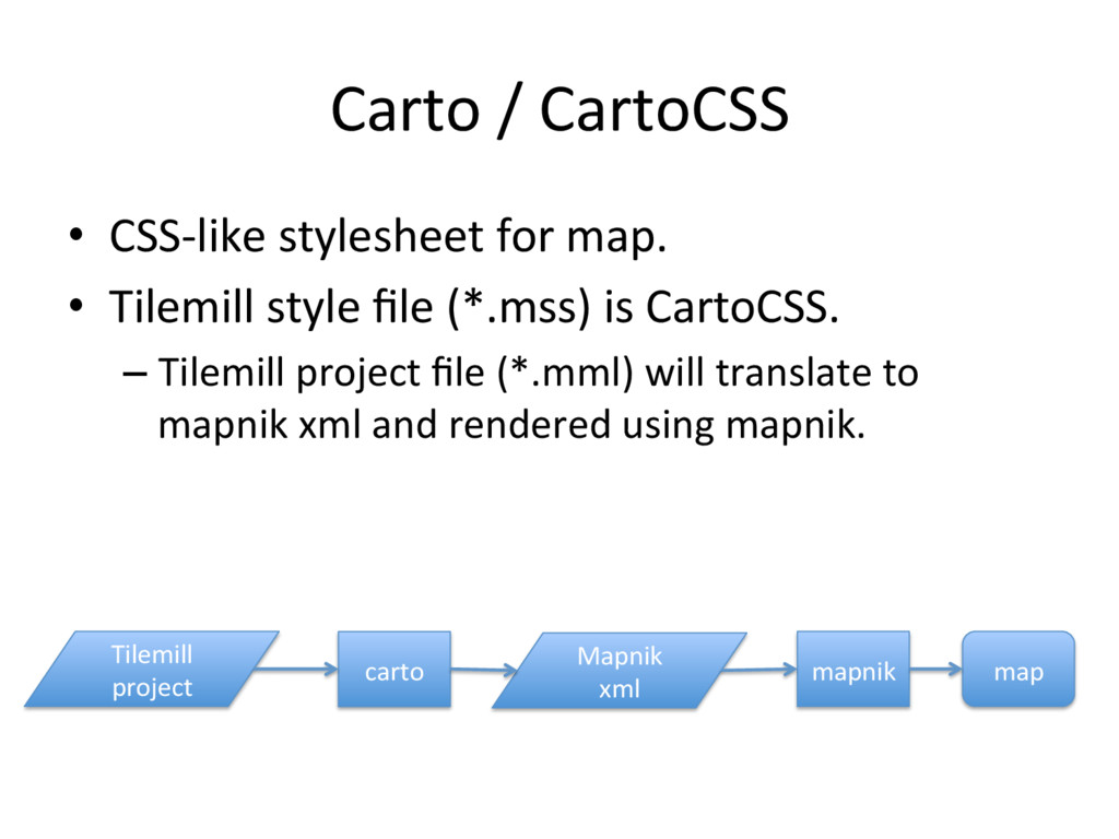
    style file (*.mss) is CartoCSS. – Tilemill project file (*.mml) will translate to mapnik xml and rendered using mapnik. carto Mapnik xml Tilemill project mapnik map
  26. Global Map •  Digital geographic informa'on – Provided by Interna'onal Steering

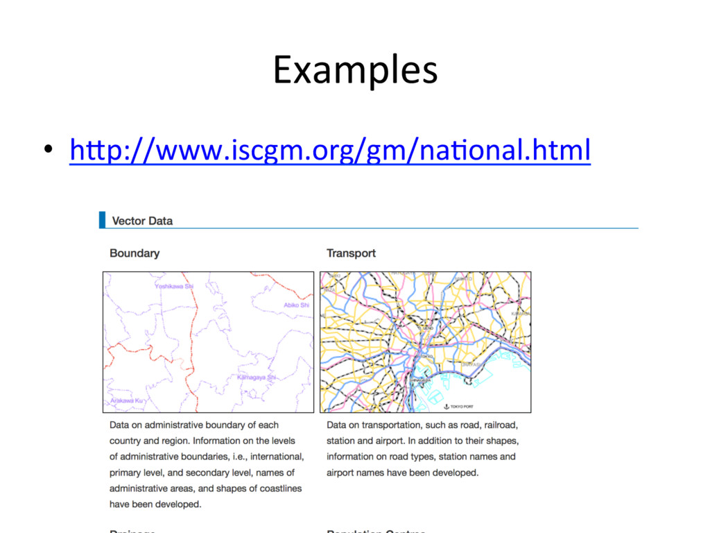
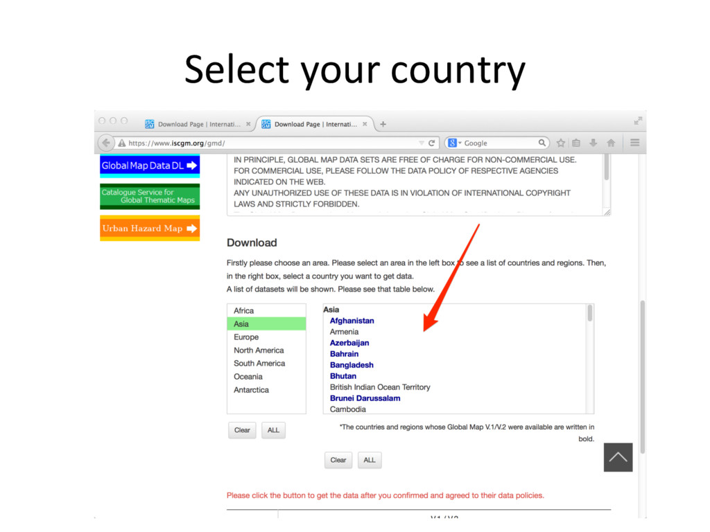
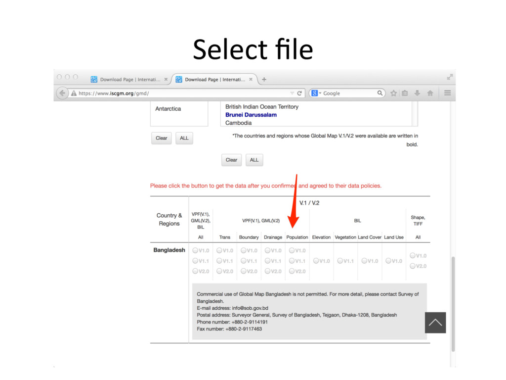
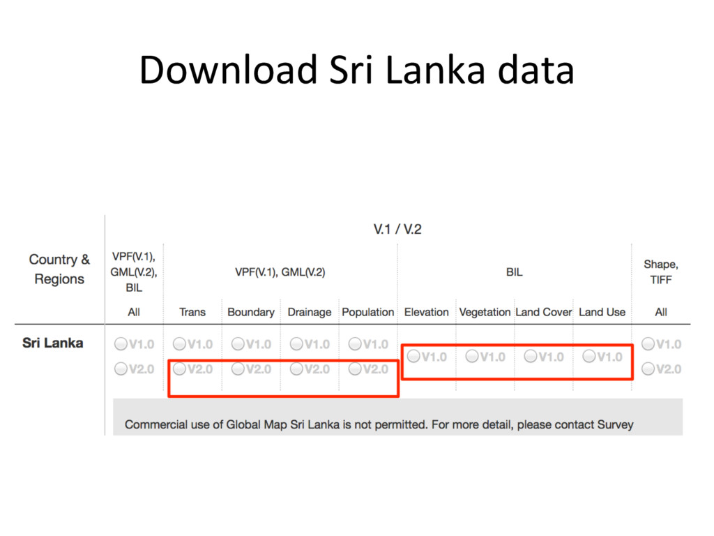
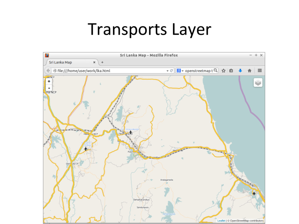
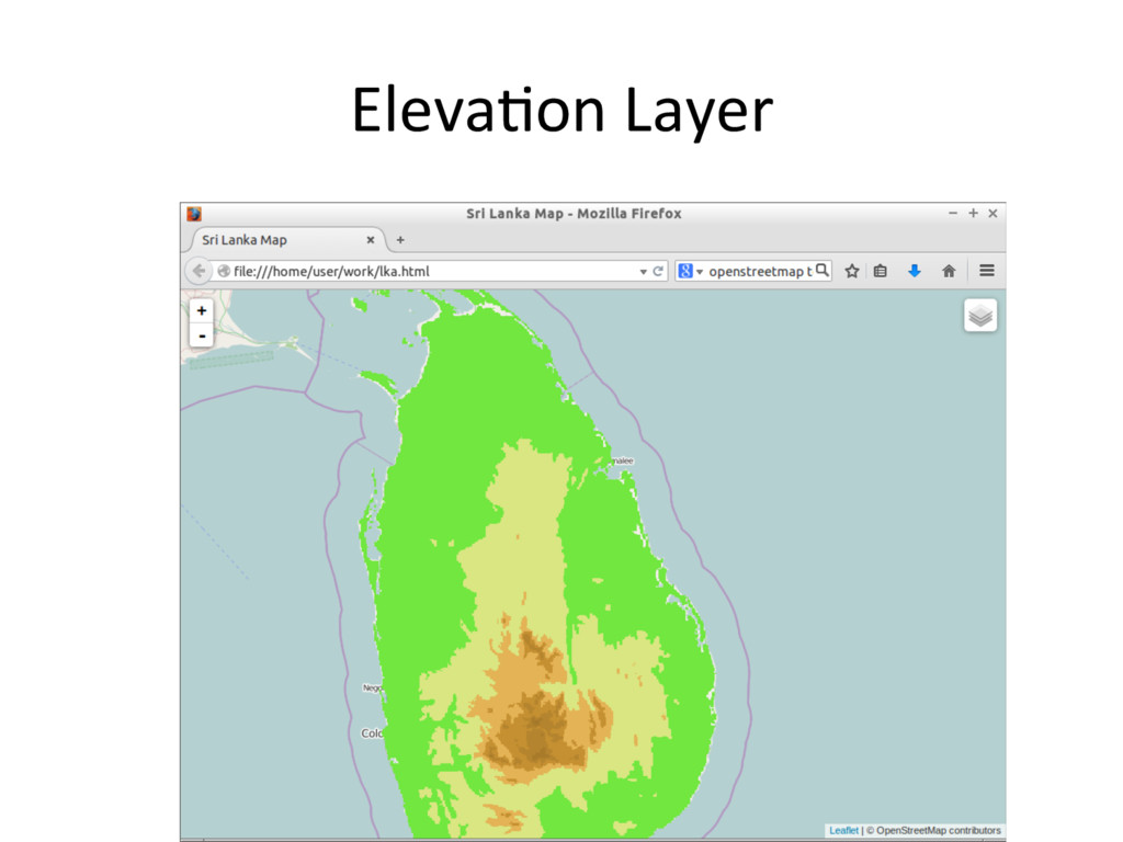
    CommiGee for Global Mapping (ISCGM) – Composed of 8 Data Sets •  Vector Data (Transporta'on, Boundaries, Drainage, Popula'on Centres) •  Raster Data (Eleva'on, Vegeta'on, Land Cover, Land Use) – Free for non-commercial use.
  27. Formats •  Vector data provide as Geography Markup Language (GML)

    format. – Also available ESRI Shape File format as friendly format. •  Raster data provide as Band interleaved by line (BIL) format. – Also available Geo'ff format as friendly format.
  28. No'ce •  Shape file and TIFF file is contain only

    same versions. – In this case, V1.0 contains Shape and TIFF files but V2.0 contains only Shape file.
  29. If you can’t download data. •  You can use github

    mirror. – hGps://github.com/globalmaps •  This server uploads only User Friendly Data only. – BIL -> GeoTiff – GML -> ESRI Shapefile
  30. Workflow: Design map and generate 'led map from vector files

    ogr2ogr Tilemill mbu'l gml file Shapefile Shape file Shape file Shapefile mb'les mb'les png png png 1. Convert GML to Shapefile 2. Design and generate mb'les 3. Convert mb'les to zxy 'le
  31. Convert GML to Shape file •  Use ogr2ogr command • 

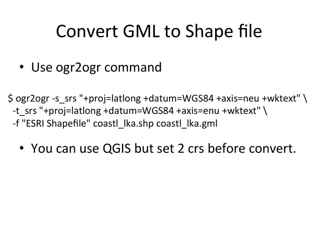
    You can use QGIS but set 2 crs before convert. $ ogr2ogr -s_srs "+proj=latlong +datum=WGS84 +axis=neu +wktext" \ -t_srs "+proj=latlong +datum=WGS84 +axis=enu +wktext" \ -f "ESRI Shapefile" coastl_lka.shp coastl_lka.gml
  32. ID and Class •  ID and Class are used in

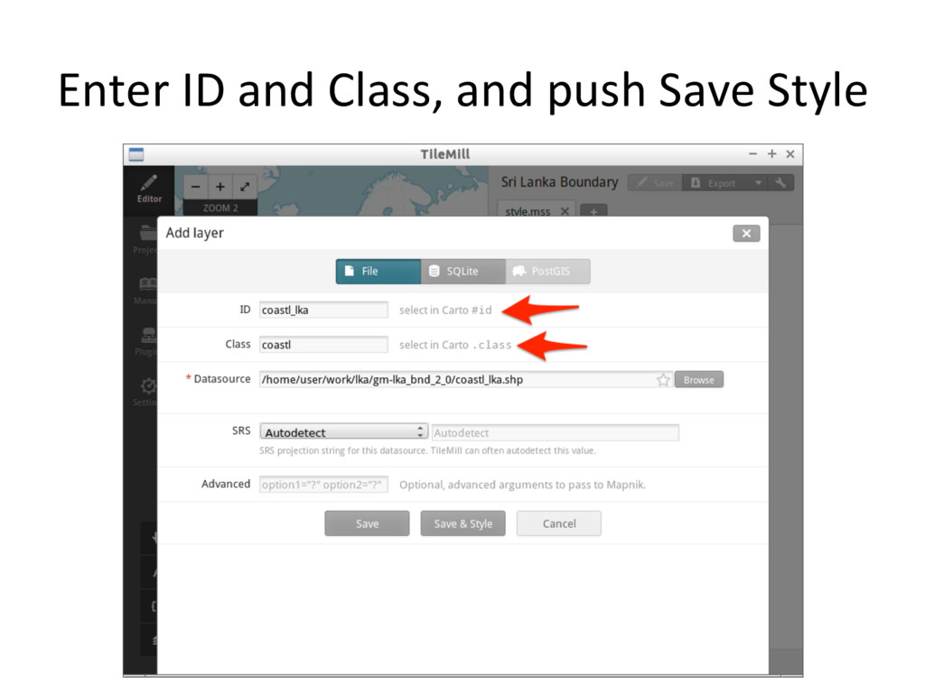
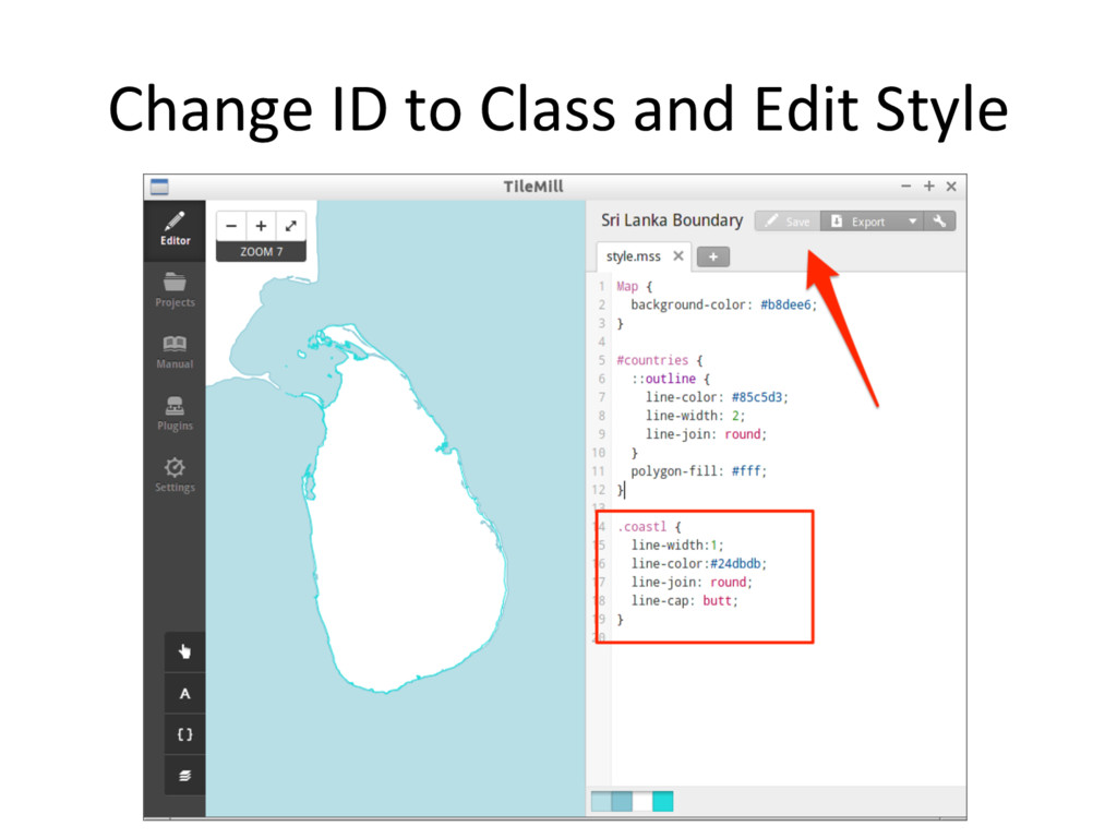
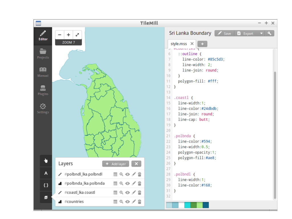
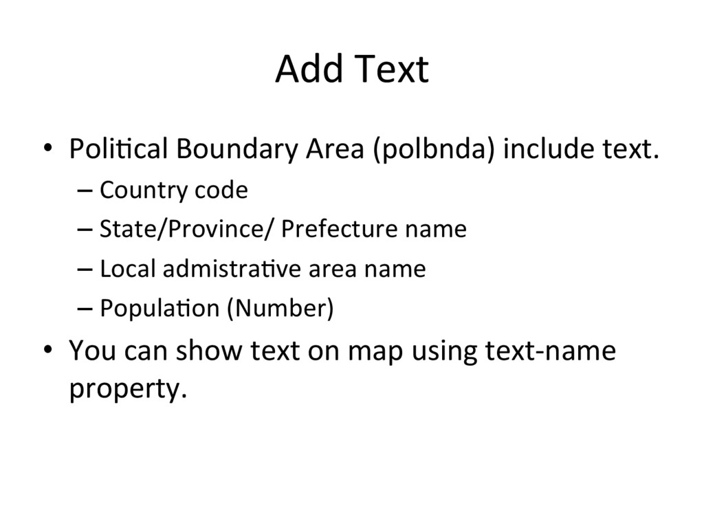
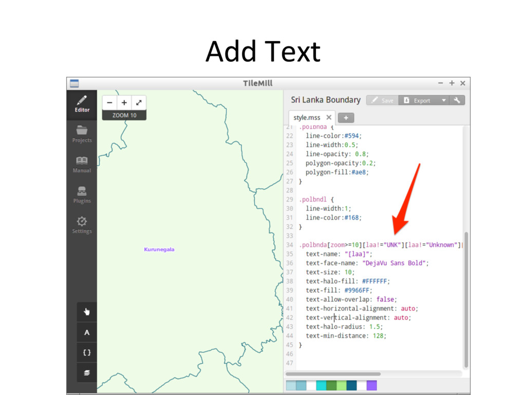
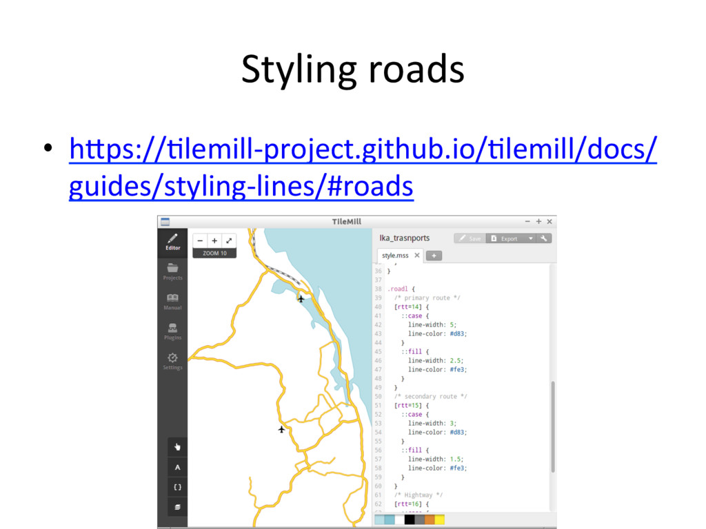
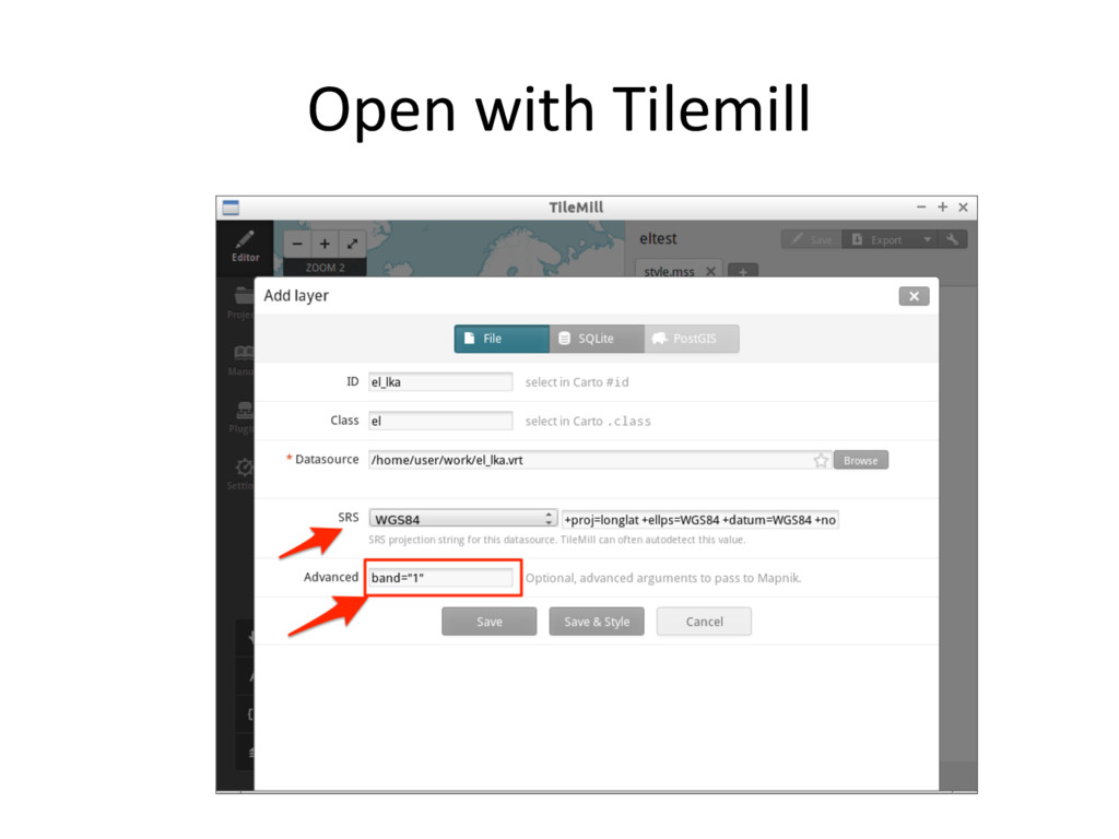
    Carto CSS. – Like CSS •  ID set datasource file name. •  Class set datasource file name exclude country name. •  ex. coastl_lka.shp – ID: coastl_lka – Class: coastl
  33. Import others •  Convert polbnda_lka.gml and polbndl_lka.gml to shape files.

    •  Import them into Tilemill. •  Change styles.
  34. No'ce •  All styles are available in support files and

    you can copy and paste from github. – hGps://github.com/smellman/ crea'ng_'les_with_global_map_support_files/ tree/master/2015/vector_cartocss – hGps://github.com/smellman/ crea'ng_'les_with_global_map_support_files/ tree/master/2015/raster_cartocss
  35. Add Text •  Poli'cal Boundary Area (polbnda) include text. – Country

    code – State/Province/ Prefecture name – Local admistra've area name – Popula'on (Number) •  You can show text on map using text-name property.
  36. Install mbu'l •  mbu'l is u'lity for mb'les. •  hGps://github.com/mapbox/mbu'l

    $ git clone hGps://github.com/mapbox/mbu'l.git $ cd mbu'l/ $ sudo python setup.py install Install to Linux
  37. Install mbu'l (for OSGeo4W) •  Download ZIP in mbu'l web

    page. •  Unzip it. •  “cd” to Unzipped directory and – python setup.py install •  Copy “mb-u'l.bat” from support file to C:\OSGeo4W\bin
  38. Convert mb'les to xyz 'les •  Usage: – mb-u'l <MBTiles path>

    <output path> $ cd ~/work/lka $ mkdir 'les $ mb-u'l mb'les/lka_bnd.mb'les 'les/lka_bnd
  39. Point •  airp(Airport) is Point. – Points enable to put icon

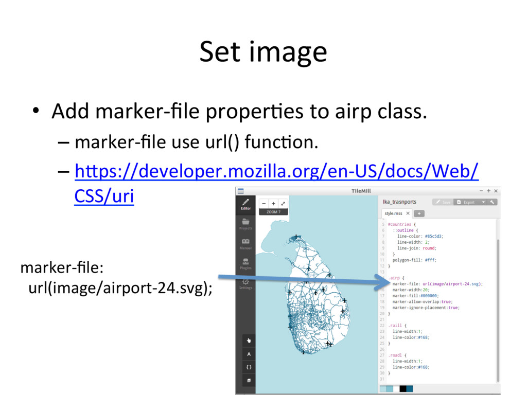
    images. – You can design icon but normally search icon images in internet. •  Maki – A clean point of interest icon set from MapBox – hGps://www.mapbox.com/maki-icons/
  40. Import image to Tilemill Project •  Open your 'lemill project

    directory – Windows: (Home Directory)\My Documents \MapBox\project\(project file name) – Linux: (Home Directory)/Documents/MapBox/ project/(project file name) •  Make image directory and copy file.
  41. Set image •  Add marker-file proper'es to airp class. – marker-file

    use url() func'on. – hGps://developer.mozilla.org/en-US/docs/Web/ CSS/uri marker-file: url(image/airport-24.svg);
  42. Generate 'les 1.  Comment out Map and countries styles. 2. 

    Export to mb'les 3.  Convert 'les from mb'les
  43. Making 4 'les from raster files 1.  Eleva'on 2.  Land

    Use 3.  Land Cover 4.  Vegeta'on
  44. Workflow: Design map and generate 'led map from raster files

    gdalbuildvrt Tilemill mbu'l BIL file Virtual file Virtual file mb'les mb'les png png png 1. Create Virtual file from BIL 2. Design and generate mb'les 3. Convert mb'les to zxy 'le
  45. Raster files •  Global maps raster files are distributed bil

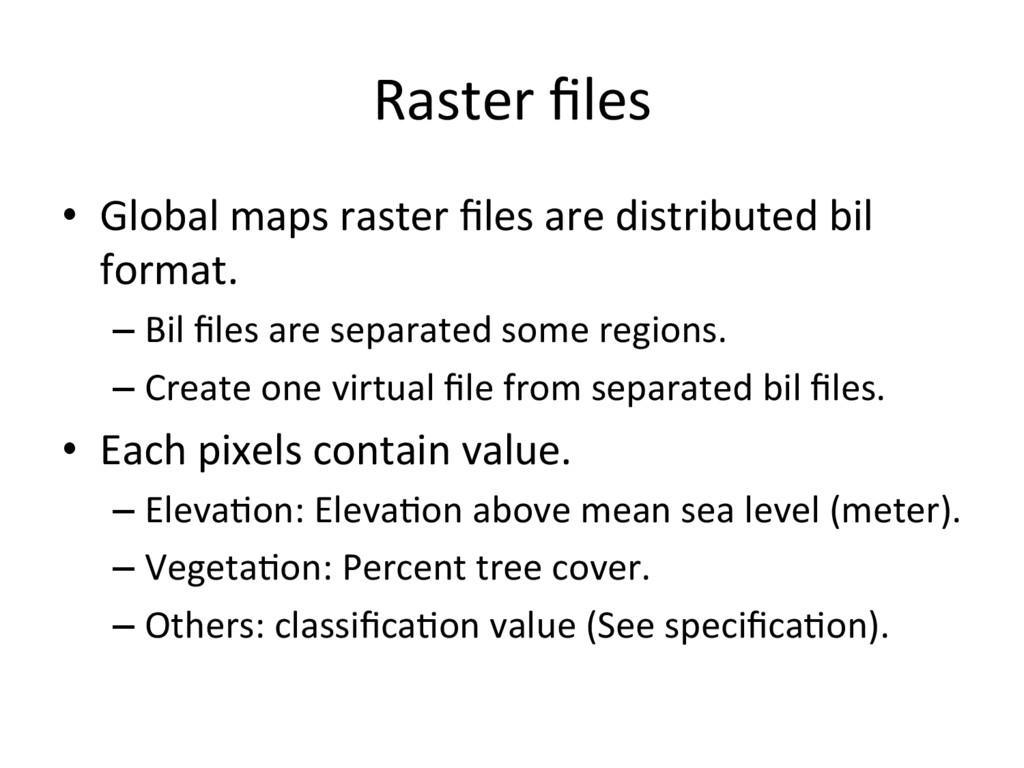
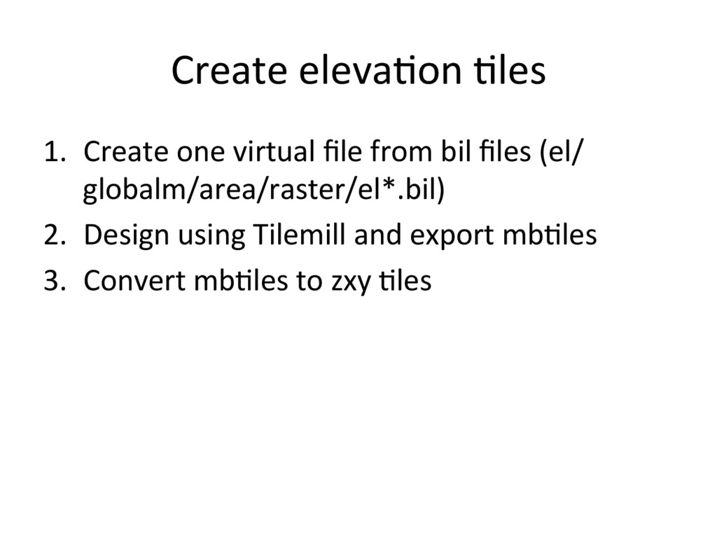
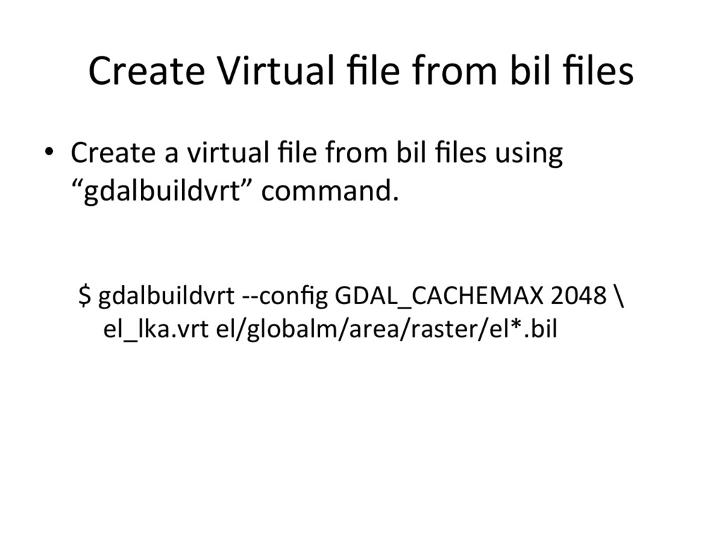
    format. – Bil files are separated some regions. – Create one virtual file from separated bil files. •  Each pixels contain value. – Eleva'on: Eleva'on above mean sea level (meter). – Vegeta'on: Percent tree cover. – Others: classifica'on value (See specifica'on).
  46. Land Use example •  Global Map Specifica'ons Version 2.2 -

    APPENDIX D Global Map Data Dic'onary – hGp://www.iscgm.org/gm/spec/gmspec-2.2.pdf • 
  47. Create eleva'on 'les 1.  Create one virtual file from bil

    files (el/ globalm/area/raster/el*.bil) 2.  Design using Tilemill and export mb'les 3.  Convert mb'les to zxy 'les
  48. Create Virtual file from bil files •  Create a virtual

    file from bil files using “gdalbuildvrt” command. $ gdalbuildvrt --config GDAL_CACHEMAX 2048 \ el_lka.vrt el/globalm/area/raster/el*.bil
  49. Open with Tilemill •  Select datasource (*.vrt) and input ID

    and class. •  Choose “WGS84” in SRS. •  Input ‘band=“1”’ in Advanced text field. •  Push “Save & Style”
  50. Error on Linux •  If 'lemill raise this error, you

    need install “mapnik-input-plugin-gdal” package. $ sudo apt-get install \ mapnik-input-plugin-gdal
  51. Raster style •  raster-scaling: scaling algorithm •  raster-colorize-default-mode: –  “liner”:

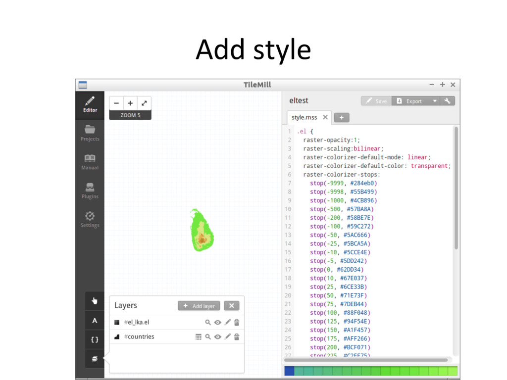
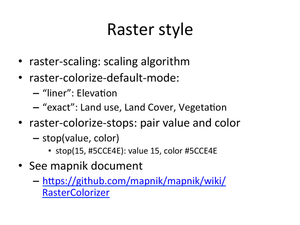
    Eleva'on –  “exact”: Land use, Land Cover, Vegeta'on •  raster-colorize-stops: pair value and color –  stop(value, color) •  stop(15, #5CCE4E): value 15, color #5CCE4E •  See mapnik document –  hGps://github.com/mapnik/mapnik/wiki/ RasterColorizer
  52. Download leaflet.js •  hGp://leafletjs.com/download.html •  Download Leaflet 0.7.3 •  Make

    $HOME/work/leaflet directory and copy leaflet-0.7.3.zip •  Unzip leaflet-0.7.3.zip
  53. Code <!DOCTYPE html> <html> <head> <meta charset="UTF-8"> <'tle>Sri Lanka Map</'tle>

    <link rel="stylesheet" href="./leaflet/leaflet.css" /> <script src="./leaflet/leaflet.js"></script> <style> body {padding: 0; margin: 0} html, body, #map {height: 100%; width: 100%;} .leaflet-container {background: #fff;} </style> </head>
  54. Code <body> <div id="map"> <script> var basemap = L.'leLayer('hGp://{s}.'le.openstreetmap.org/{z}/{x}/{y}.png', {

    aGribu'on: "© OpenStreetMap contributors" }); var map = L.map('map', { center: [7.7110,80.5078], zoom: 7, layers: [basemap] }); var base_layers = { "OpenStreetMap": basemap };
  55. Code var bnd_layer = L.'leLayer('./lka/'les/lka_bnd/{z}/{x}/{y}.png'); var transports_layer = L.'leLayer('./lka/'les/lka_transports/{z}/{x}/{y}.png'); var

    eleva'on_layer = L.'leLayer('./lka/'les/el_lka/{z}/{x}/{y}.png'); var overlay_layers = { "Boundary": bnd_layer, "Transports": transports_layer, "Eleva'on": eleva'on_layer }; L.control.layers(base_layers, overlay_layers).addTo(map); </script> </body> </html>
  56. Tile without “raster image” •  Tile can provide without “raster

    image”. – {z}/{x}/{y}.{format} – You can use many formats. •  Text data, GeoJSON/TopoJSON data, other binary data
  57. GSI’s DEM 'le •  10m mesh data. – Provides only japan

    area. – hGp://cyberjapandata.gsi.go.jp/xyz/dem/{z}/{x}/ {y}.txt
  58. quan'zed-mesh •  Terrain 'leset using Cesium. – Using TMS schema and

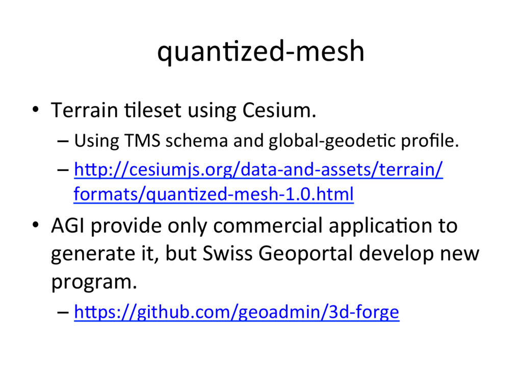
    global-geode'c profile. – hGp://cesiumjs.org/data-and-assets/terrain/ formats/quan'zed-mesh-1.0.html •  AGI provide only commercial applica'on to generate it, but Swiss Geoportal develop new program. – hGps://github.com/geoadmin/3d-forge
  59. Cesium 3D Tiles •  AGI develop new specifica'on for Cesium.

    – hGps://cesiumjs.org/2015/08/10/Introducing-3D- Tiles/
  60. GeoJSON Tiles •  Provide GeoJSON file with zxy 'le. • 

    GSI provide experimental demo. – hGp://gsi-cyberjapan.github.io/experimental_fgd/
  61. Mapbox Vector Tile •  Mapbox develop vector 'le specifica'on. – Vector

    'le provide using Protocol Buffers. •  Smaller than GeoJSON file – Provide too many layers. •  Mapbox GL Style define rendering layers and styles.
  62. Mapbox Vector Tile demo •  Suppor'ng file for this workshop

    includes Mapbox Vector Tile demo. – 2015/mapbox_vector_'le_demo directory •  'lelive-bridge is support to generate mapbox vector 'le from mapnik xml.
  63. File system limit •  When you create map covered world,

    be careful about max number of files. – Ext4 on Linux: 4 billion files (specified at filesystem crea'on 'me) – Zoom Level 18 on world: 68 billion files. •  Also be careful about file usage.
  64. Rendering server •  Too many rendering server use mapnik. – 

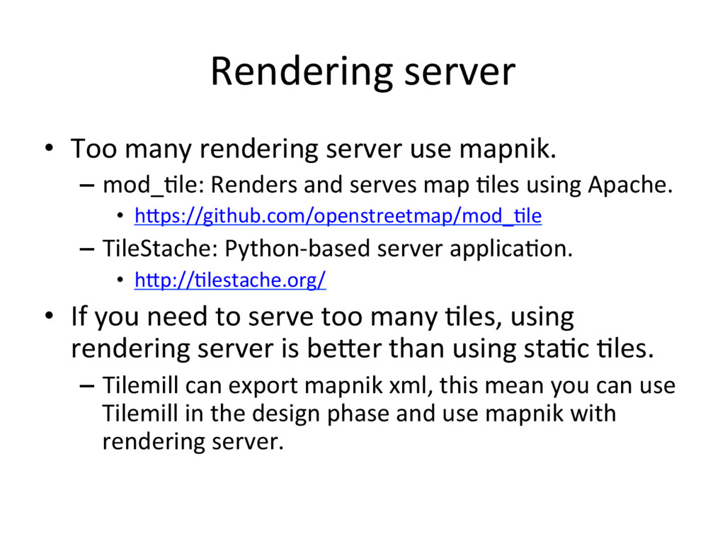
    mod_'le: Renders and serves map 'les using Apache. •  hGps://github.com/openstreetmap/mod_'le –  TileStache: Python-based server applica'on. •  hGp://'lestache.org/ •  If you need to serve too many 'les, using rendering server is beGer than using sta'c 'les. –  Tilemill can export mapnik xml, this mean you can use Tilemill in the design phase and use mapnik with rendering server.