Upgrade to Pro
— share decks privately, control downloads, hide ads and more …
Speaker Deck
Features
Speaker Deck
PRO
Sign in
Sign up for free
Search
Search
Exploring Nautical Mapping with Open Data
Search
Sponsored
·
Your Podcast. Everywhere. Effortlessly.
Share. Educate. Inspire. Entertain. You do you. We'll handle the rest.
→
Zac McCormick
February 11, 2012
How-to & DIY
2.4k
1
Share
Embed
Copy iframe code
Copy JS code
Copy link
Start on current slide
Exploring Nautical Mapping with Open Data
Exploring Nautical Mapping with Open Data from WhereCampTB 2012 by @zacmcc
Zac McCormick
February 11, 2012
More Decks by Zac McCormick
See All by Zac McCormick
Pushpin OSM - State of the Map US
zac
1
770
Other Decks in How-to & DIY
See All in How-to & DIY
EmbeddingGemmaをDifyから使いたいけどAPI経由はつまらん #iotlt #gemma #dify
n0bisuke2
0
210
キャリア科目では教えてくれない、就活を生き抜く法則
logica0419
2
310
なぜISPでオリジナルカードゲームを作ったのか?制作者と対談 - NIFTY Tech Talk #25
niftycorp
PRO
0
110
ボードゲーム × 専用収納 〜3Dプリントで埋めるニッチな隙間〜 / Board Games × Custom Storage
handlename
0
320
JAWS/AWS Community Updates - JAWS-UG新潟 #29
awsjcpm
1
140
餃子コミュニティの活性化/TechGYOZA
nishiuma
2
370
[電子工作]クリップモーターをつくろう
oriontakemura
1
870
エッジで動くNode-REDを作る実験 #noderedjp #noderedcon
n0bisuke2
0
620
What's the difference in taste between expensive and cheap mills? Measuring coffee particle size distribution using ImageJ
dogrunjp
0
860
JAWS-UG と AWS - JAWS-UG 沖縄 Cloud on the Beach 2025
awsjcpm
0
180
個人制作コンテンツの多言語展開のノウハウを全公開! 〜世界に自分を発信しよう!〜
syotasasaki593876
0
200
ROSAというLLM使ったROSエージェントをおもちゃに実装してみた話
takeofuture
0
250
Featured
See All Featured
Templates, Plugins, & Blocks: Oh My! Creating the theme that thinks of everything
marktimemedia
31
2.8k
Accessibility Awareness
sabderemane
1
160
Building the Perfect Custom Keyboard
takai
2
820
Leveraging Curiosity to Care for An Aging Population
cassininazir
1
430
Ten Tips & Tricks for a 🌱 transition
stuffmc
0
160
Designing Powerful Visuals for Engaging Learning
tmiket
1
460
The Organizational Zoo: Understanding Human Behavior Agility Through Metaphoric Constructive Conversations (based on the works of Arthur Shelley, Ph.D)
kimpetersen
PRO
0
390
Distributed Sagas: A Protocol for Coordinating Microservices
caitiem20
333
23k
How to build an LLM SEO readiness audit: a practical framework
nmsamuel
1
810
16th Malabo Montpellier Forum Presentation
akademiya2063
PRO
0
300
sira's awesome portfolio website redesign presentation
elsirapls
0
310
How to Talk to Developers About Accessibility
jct
2
450
Transcript
exploring nautical mapping with open data @zacmcc
None
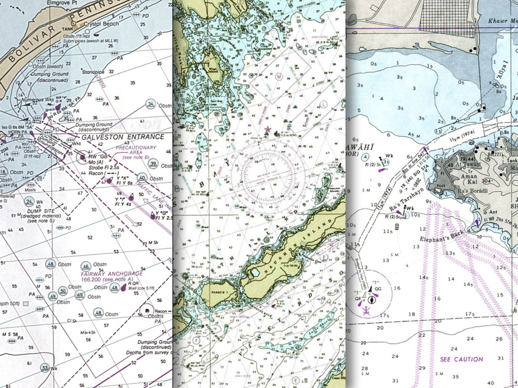
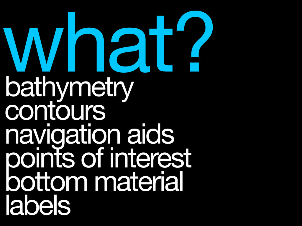
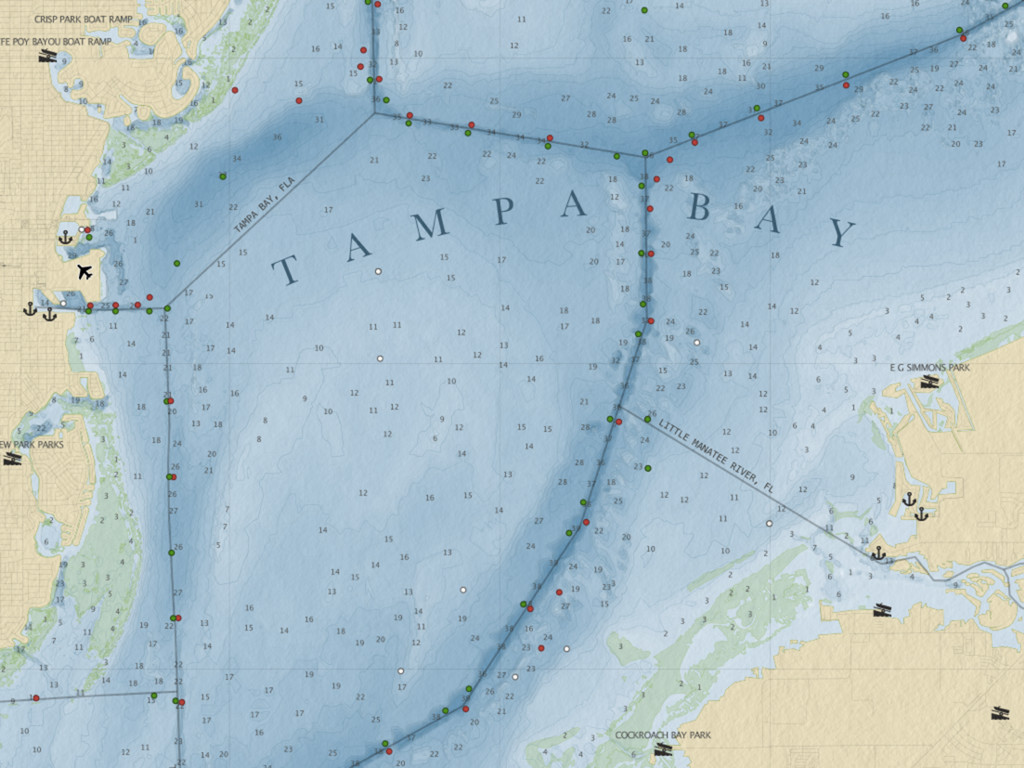
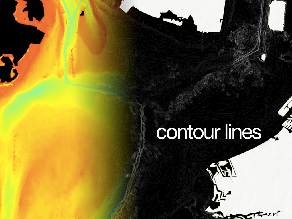
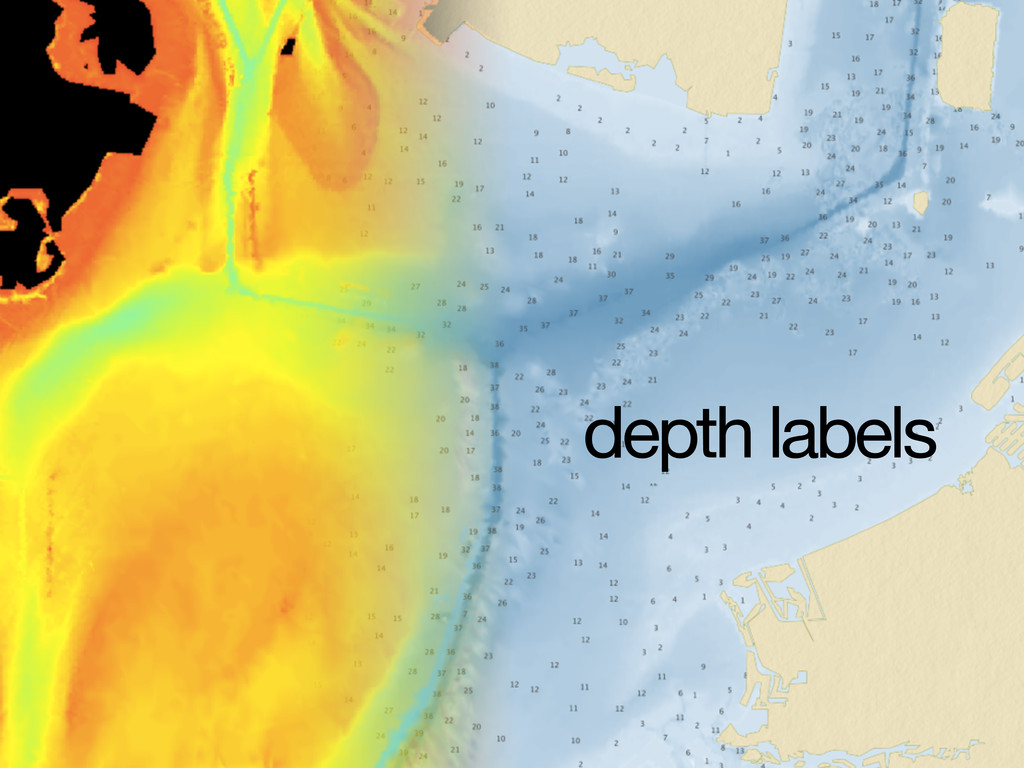
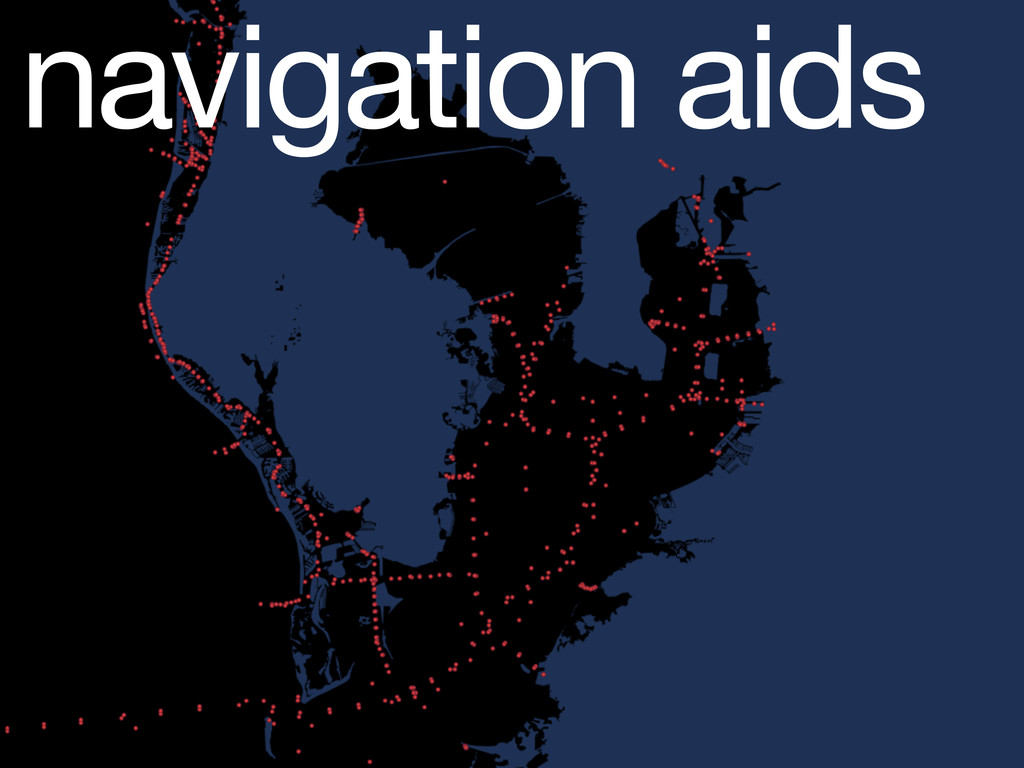
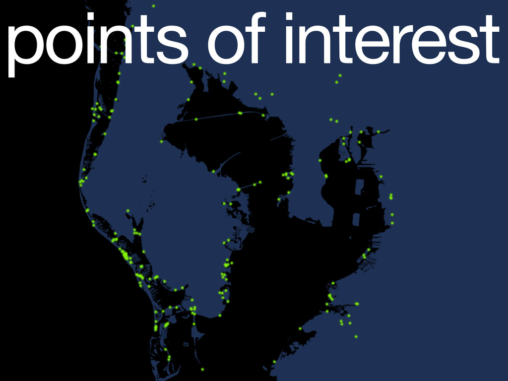
what? bathymetry contours navigation aids points of interest bottom material
labels
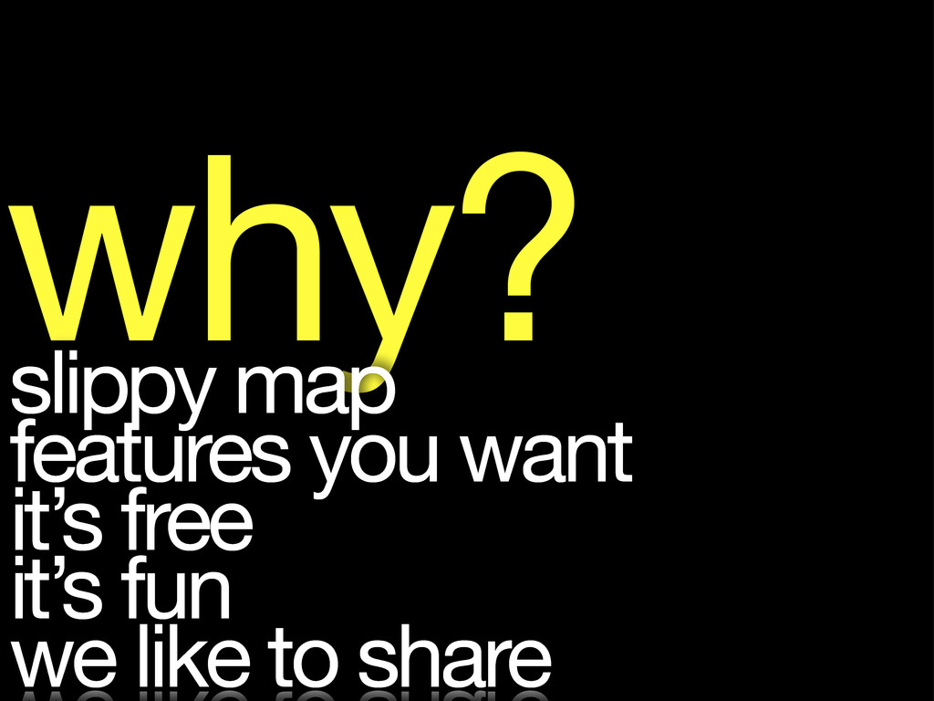
why? slippy map features you want it’s free it’s fun
we like to share
None
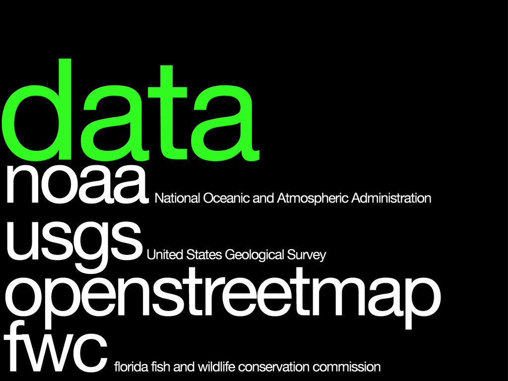
data noaa National Oceanic and Atmospheric Administration usgs United States
Geological Survey openstreetmap fwc florida fish and wildlife conservation commission
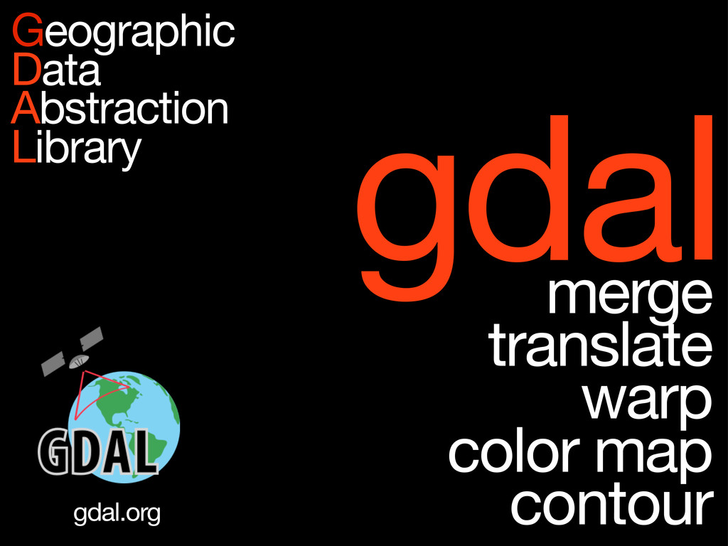
gdal merge translate warp color map contour Geographic Data Abstraction
Library gdal.org
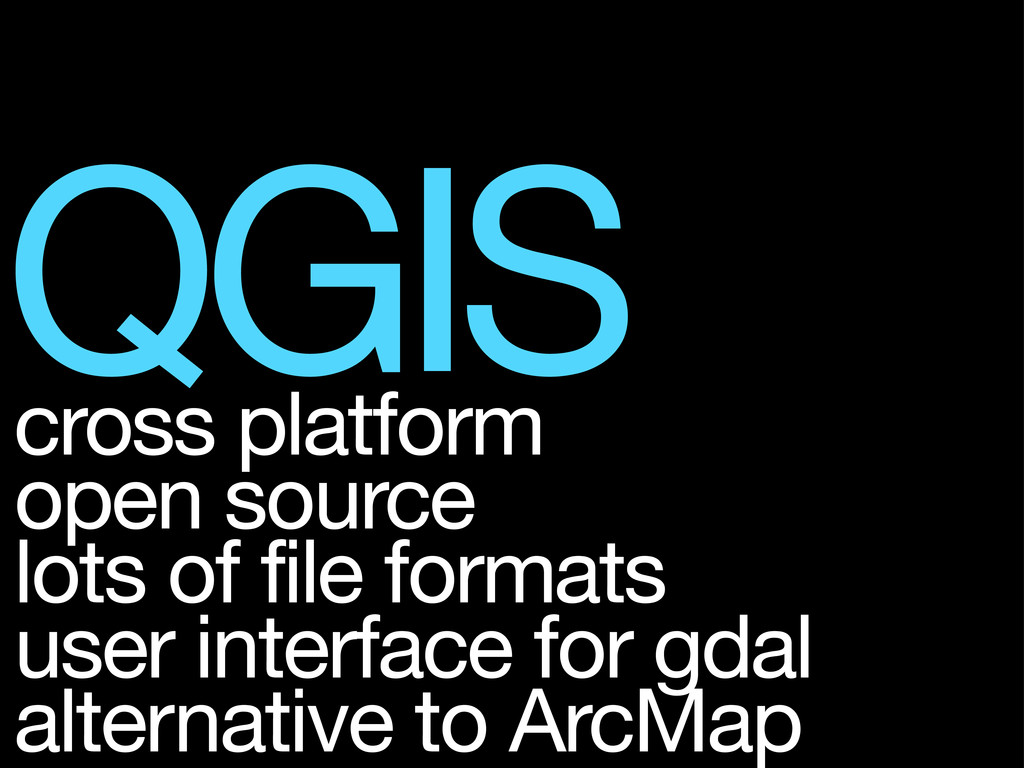
QGIS cross platform open source lots of file formats user
interface for gdal alternative to ArcMap
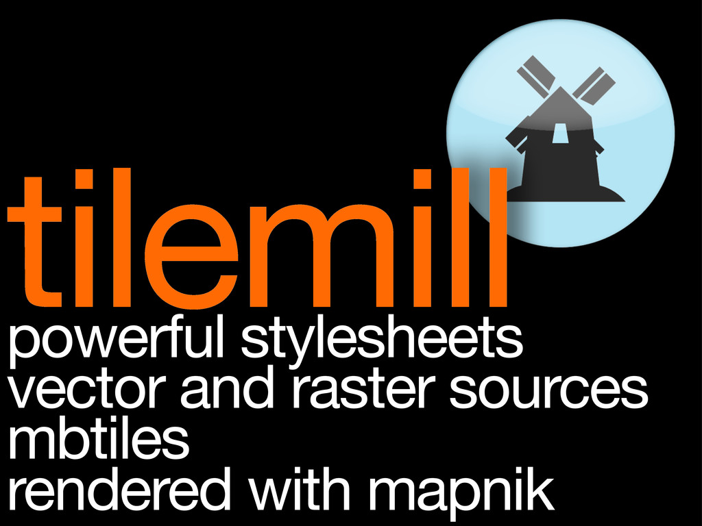
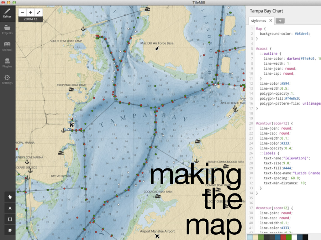
tilemill powerful stylesheets vector and raster sources mbtiles rendered with
mapnik
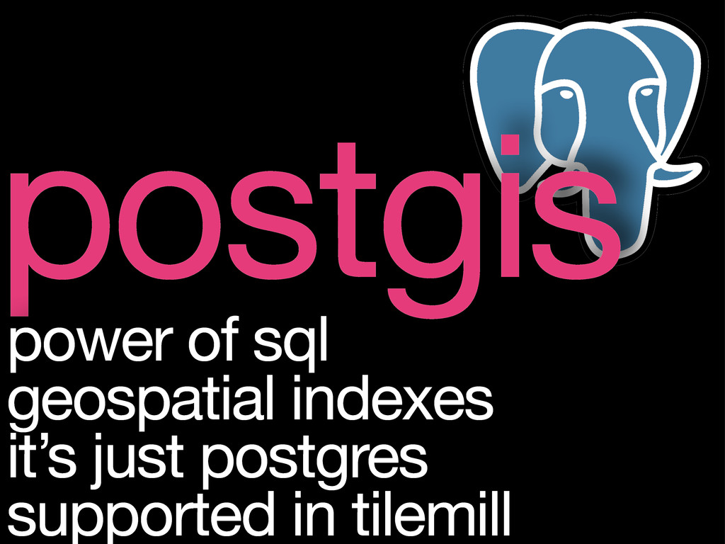
postgis power of sql geospatial indexes it’s just postgres supported
in tilemill
contour lines
depth labels
navigation aids
points of interest
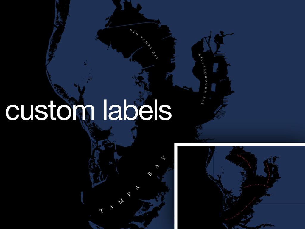
custom labels
making the map
#navigation_aids["aid_color"="R"] { marker-‐width: 3; marker-‐fill: #c81f1f; marker-‐line-‐color:
darken(#c81f1f, 20%); marker-‐line-‐width: 1; marker-‐allow-‐overlap: true; } #navigation_aids["aid_color"="G"] { marker-‐width: 3; marker-‐fill: #119511; marker-‐line-‐color: darken(#119511, 20%); marker-‐line-‐width: 1; marker-‐allow-‐overlap: true; } carto styles
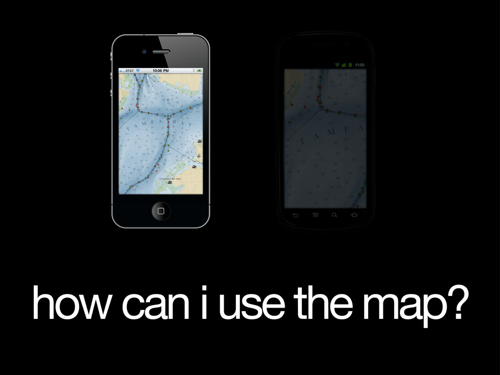
how can i use the map?
what’s missing?
check it out tiles.mapbox.com/zac :)
![#navigation_aids["aid_color"="R"] { marker-‐width: 3; marker-‐fill: #c81f1f; marker-‐line-‐color:](https://files.speakerdeck.com/presentations/4f3716e9cbeee8001f004401/slide_16.jpg)