Upgrade to Pro — share decks privately, control downloads, hide ads and more …

Overview 3D4EM project

3D4EM
January 14, 2015
580

Overview 3D4EM project

3D4EM

January 14, 2015
Tweet

Transcript

  1. ! • 3D    is  ad  hoc  en  project  gebaseerd

    • Onnodig  duur • Potenties  worden  niet  benut
  2. !

  3. 3D SDI voor omgevingsmodellering ! 3D4EM Design and implementation of

    a 3D GII for integrated 3D environmental modelling ! ! ! ! ! Delft University of Technology (GIS technology) VU University Amsterdam (Spatial Economics) University of Twente (3D geo-information extraction) 3D4EM
  4. 3D4EM Domain model 3D data requirements Water flooding • Terrain

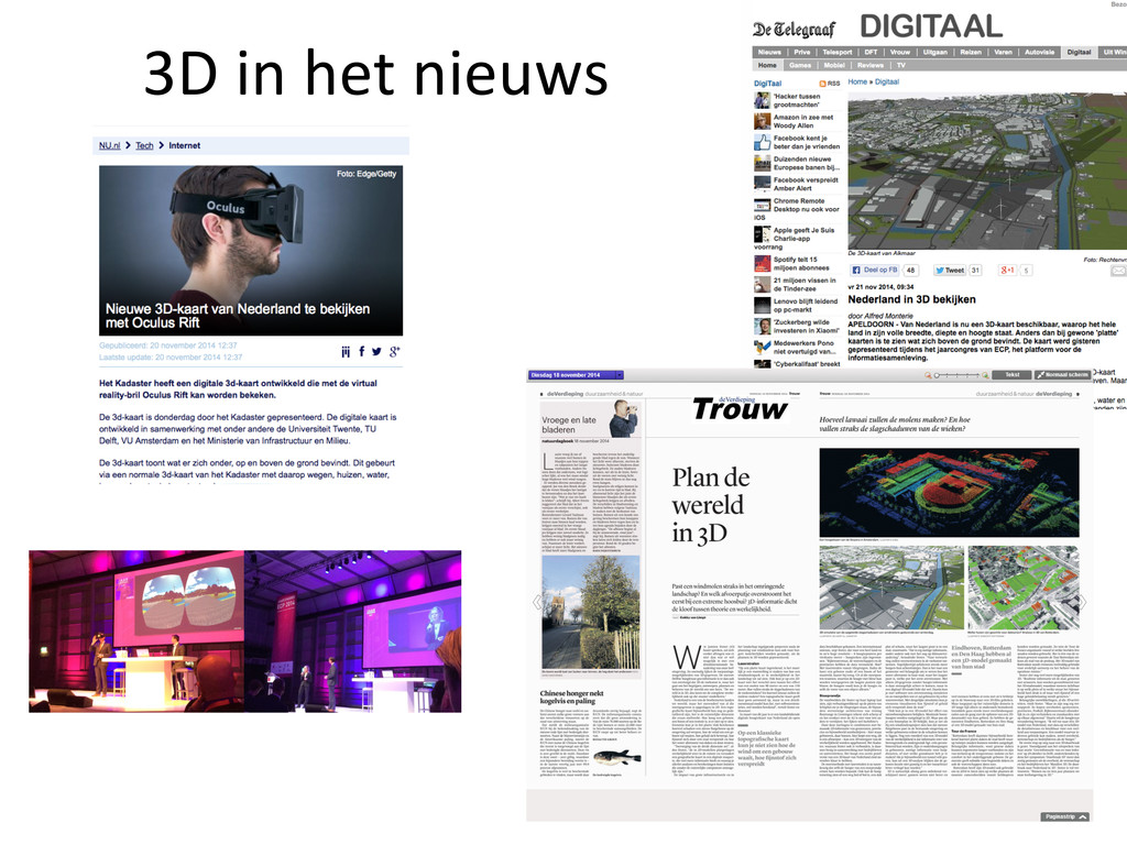
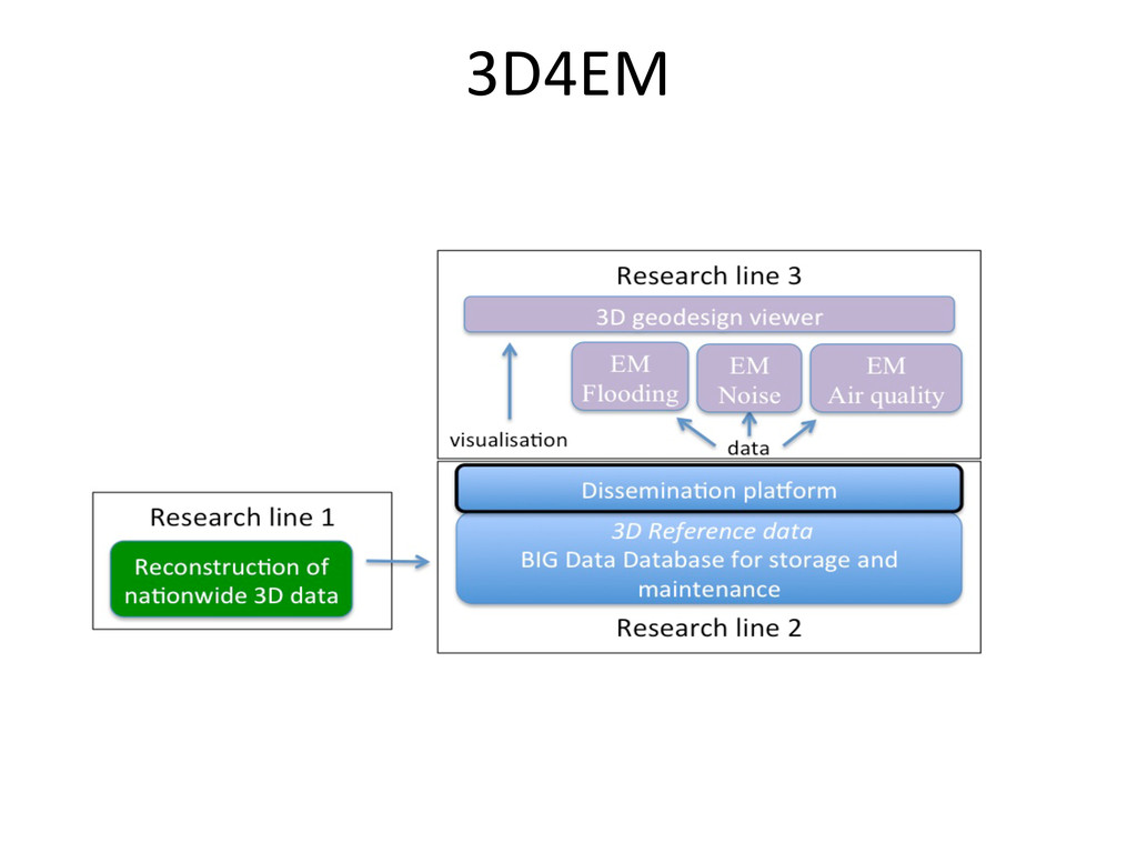
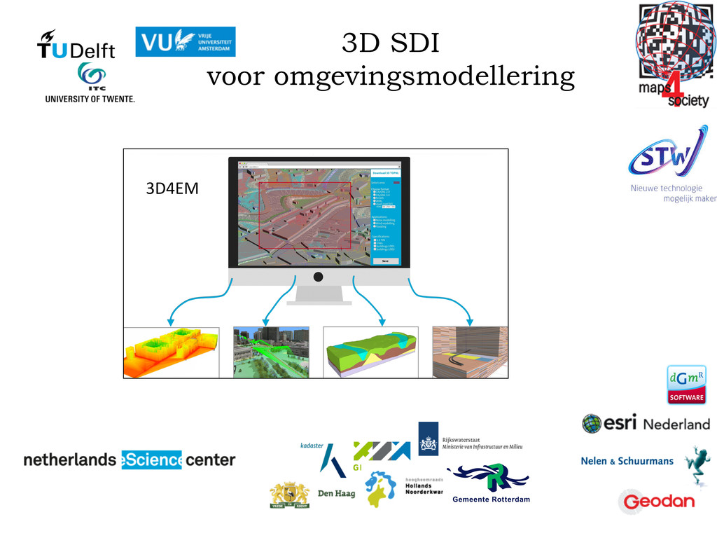
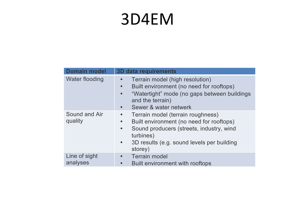
    model (high resolution) • Built environment (no need for rooftops) • “Watertight” mode (no gaps between buildings and the terrain) • Sewer & water netwerk Sound and Air quality • Terrain model (terrain roughness) • Built environment (no need for rooftops) • Sound producers (streets, industry, wind turbines) • 3D results (e.g. sound levels per building storey) Line of sight analyses • Terrain model • Built environment with rooftops
  5. Doel  van  vandaag • 1)  kennismaking  met  elkaar • 2)

     nadere  kennismaking  met  het  project • 3)  afstemmen  verwachtingen  mbt de   resultaten  en  inzet  van  een  ieder
  6. Agenda 13:00 Kennismaking 13:15 Toelichting  van  3D4EM  project  door  wetenschappelijke

     partners: -­‐ Jantien:  overall  (kort  inhoudelijk;  met  name  organisatorisch) -­‐ Sander:  Part  1:  Automated reconstruction and update  of  a  countrywide 3D  reference dataset -­‐ Hugo:  Part  2:  Developing the  storage,  maintenance  and dissemination platform -­‐ Henk:  Part  3:  Apply 3D  GII  to integrated 3D  environmental modelling 14:00 Per  partner,  10  minuten  presentatie  over: 1)  wensen/verwachtingen  mbt tot  resultaten 2)  eigen  geplande  inzet  in  het  project 15:00 Afspraken  maken  over  vervolg